The Mighty Five: Road tripping through Utah's national parks
April was the month of Utah! This was one of our most anticipated parts of our southwest travels this spring, and it did not disappoint.
Southern Utah is home to the Mighty Five national parks – from west to east: Zion, Bryce Canyon, Capitol Reef, Canyonlands, and Arches. Each one is only a couple hours away from the next, the scenery in and between them is incredible, and there are some cool little towns along the way (Springdale, Escalante, Torrey, Moab) making this probably one of the best road trips you can take in the US.
We experienced some of our favorite campsites ever in Utah, a few amazing hikes, some adventurous drives, and a whole lot of colorful canyons and desert sunsets. Fair warning – this is going to be a long post. Here's how we spent April in Utah!

Zion
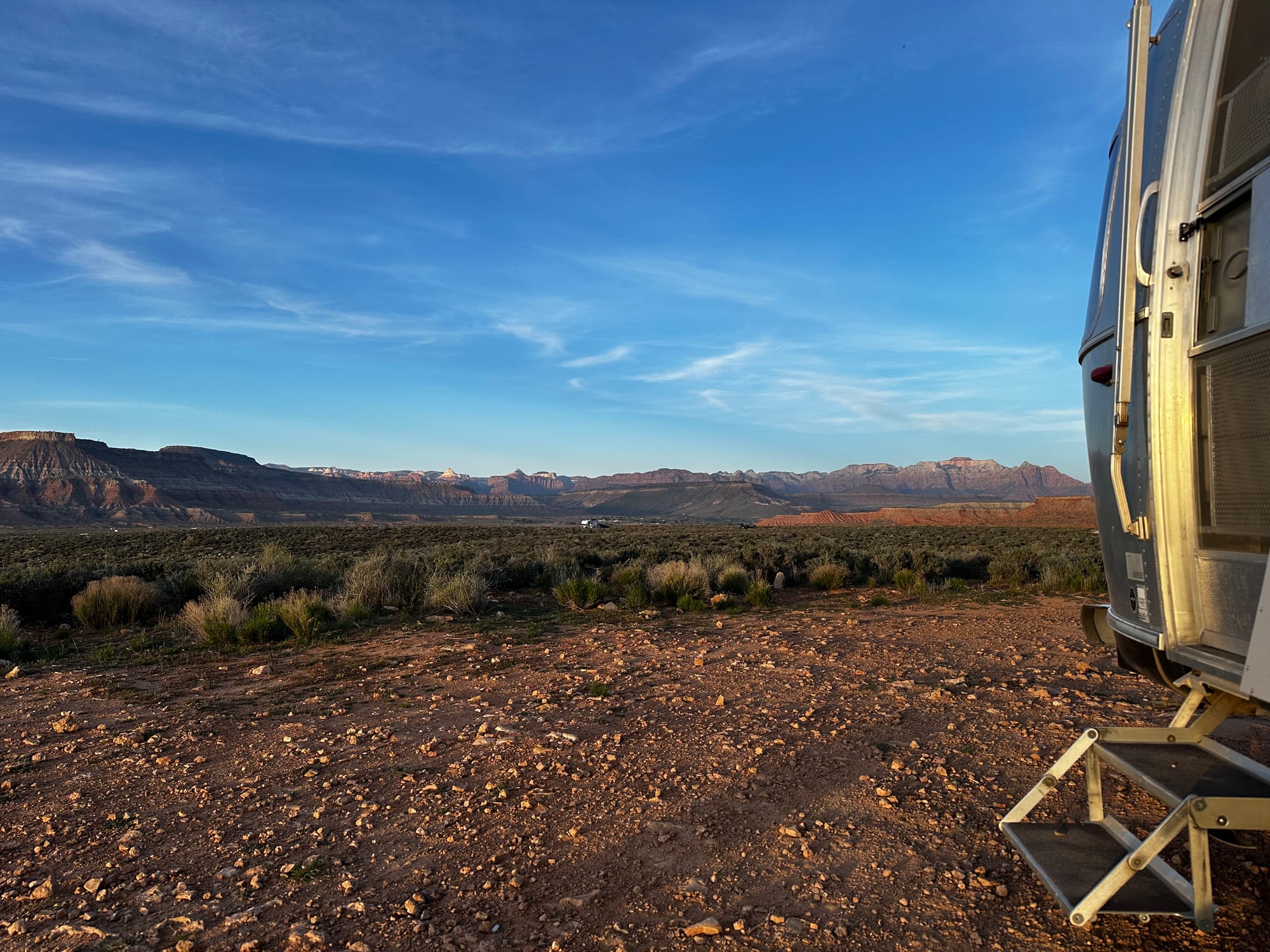
Hurricane Cliffs dispersed camping
First up on the road trip: Zion National Park.
It's funny because this is the area we spent the longest in, but it doesn't feel like we actually did a whole lot in Zion itself. We did one big hike and a couple smaller hikes/drives in the park, but overall we just spent two weeks working and hanging out at the same campsite – the longest we've spent in one place in a long time.
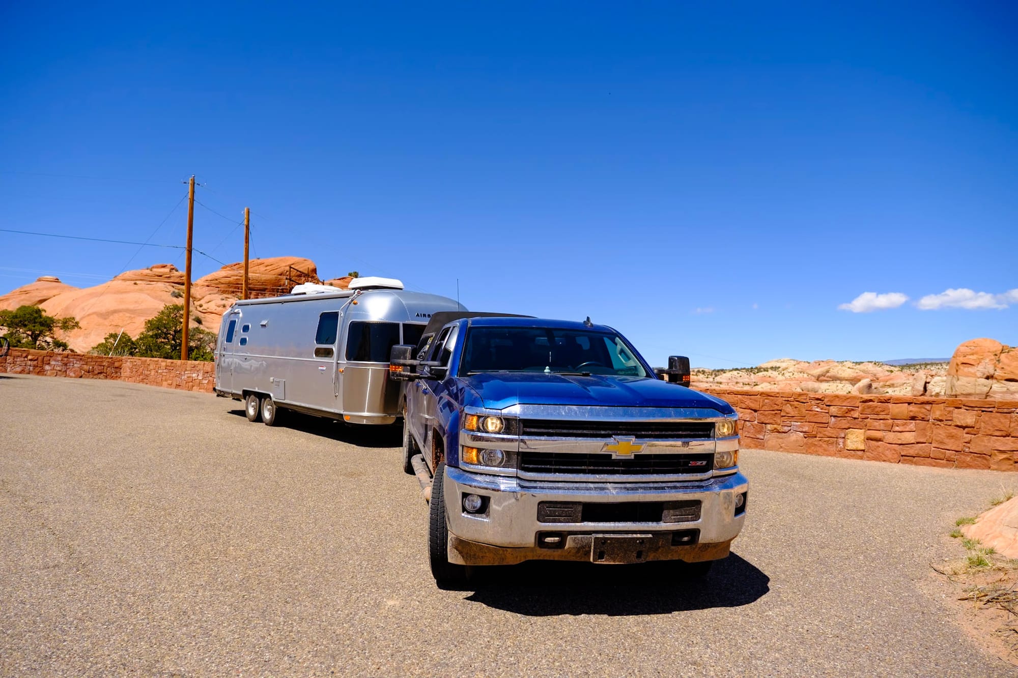
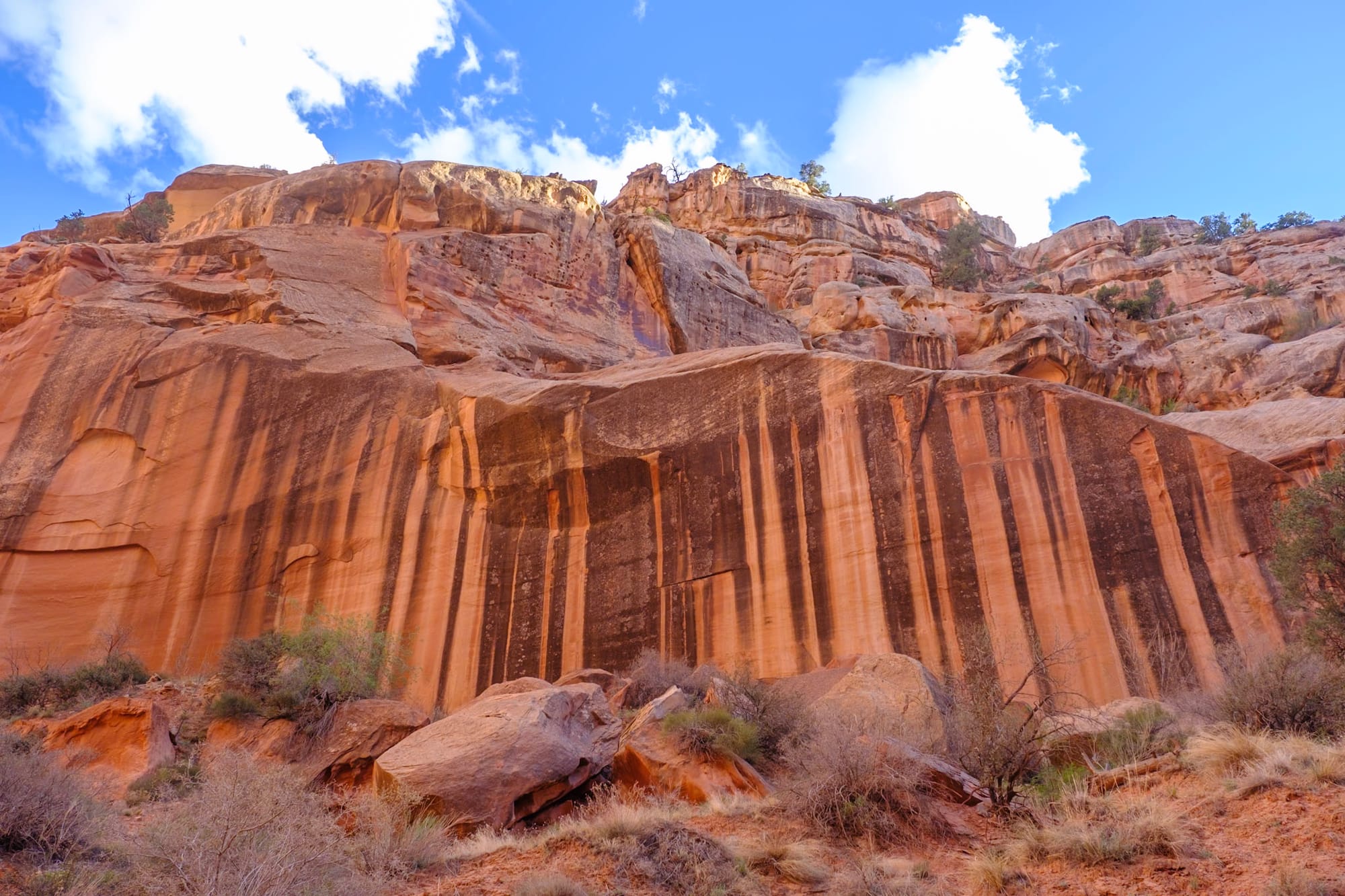
Hurricane Cliffs is BLM land high above the town of Hurricane, Utah, about 30 minutes outside the main Zion entrance. It's not true dispersed camping (there are actual numbered sites to occupy) but it's free and first-come, first-served. The main road through this area was gravel and well-maintained, but the dirt roads leading to the campsites were pretty rough and rutted in places – but we got our RV through okay.
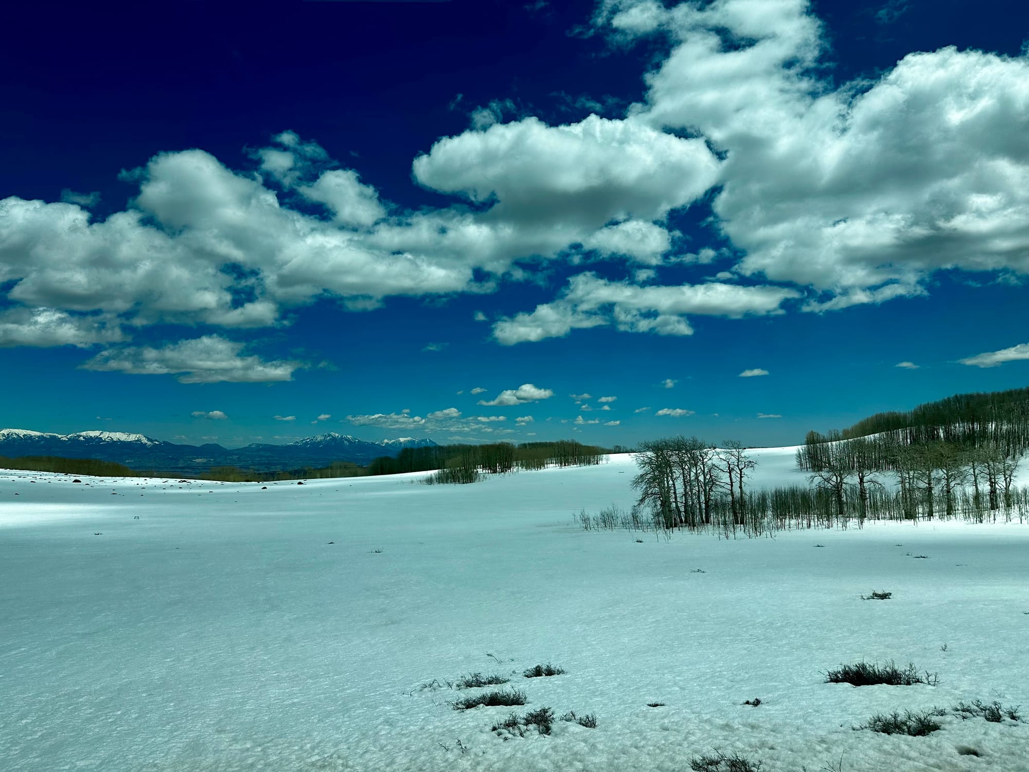
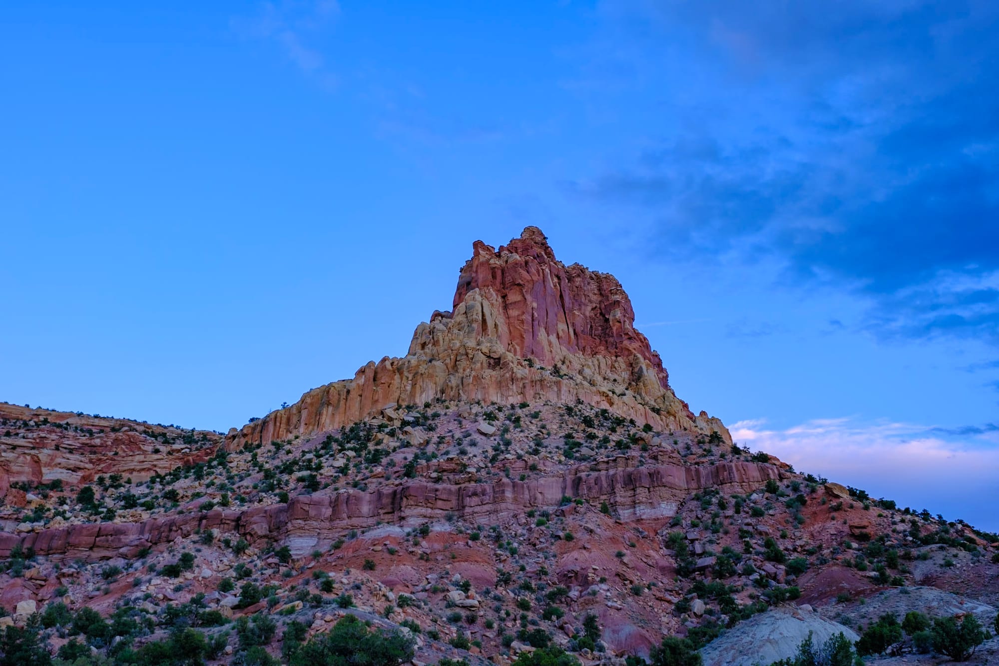
We ended up finding an awesome spot here, which is why we stayed for two weeks. It was high on a hill, off on its own separate road apart from the other campsites, so that people weren't driving by all the time. We had amazing views overlooking the whole area – snowy mountains to the north, red rocky buttes behind us to the south, and the colorful cliffs of Zion visible to the east.
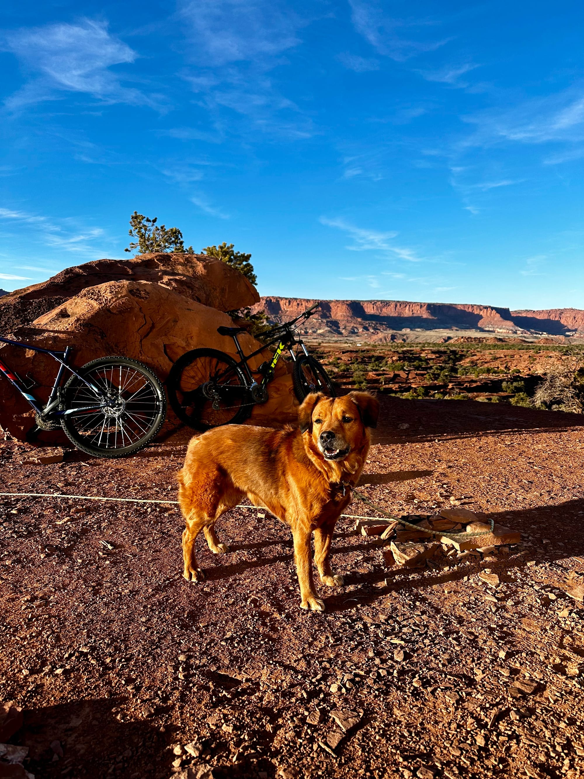
This was a popular mountain biking spot as well, with lots of trails running near our campsite. There was a race one weekend, and we watched mountain bikers ride by all day. Cows also wandered around the whole place (another common sight on BLM land) – fortunately they didn't usually get too close to us; Hollie HATES cows.
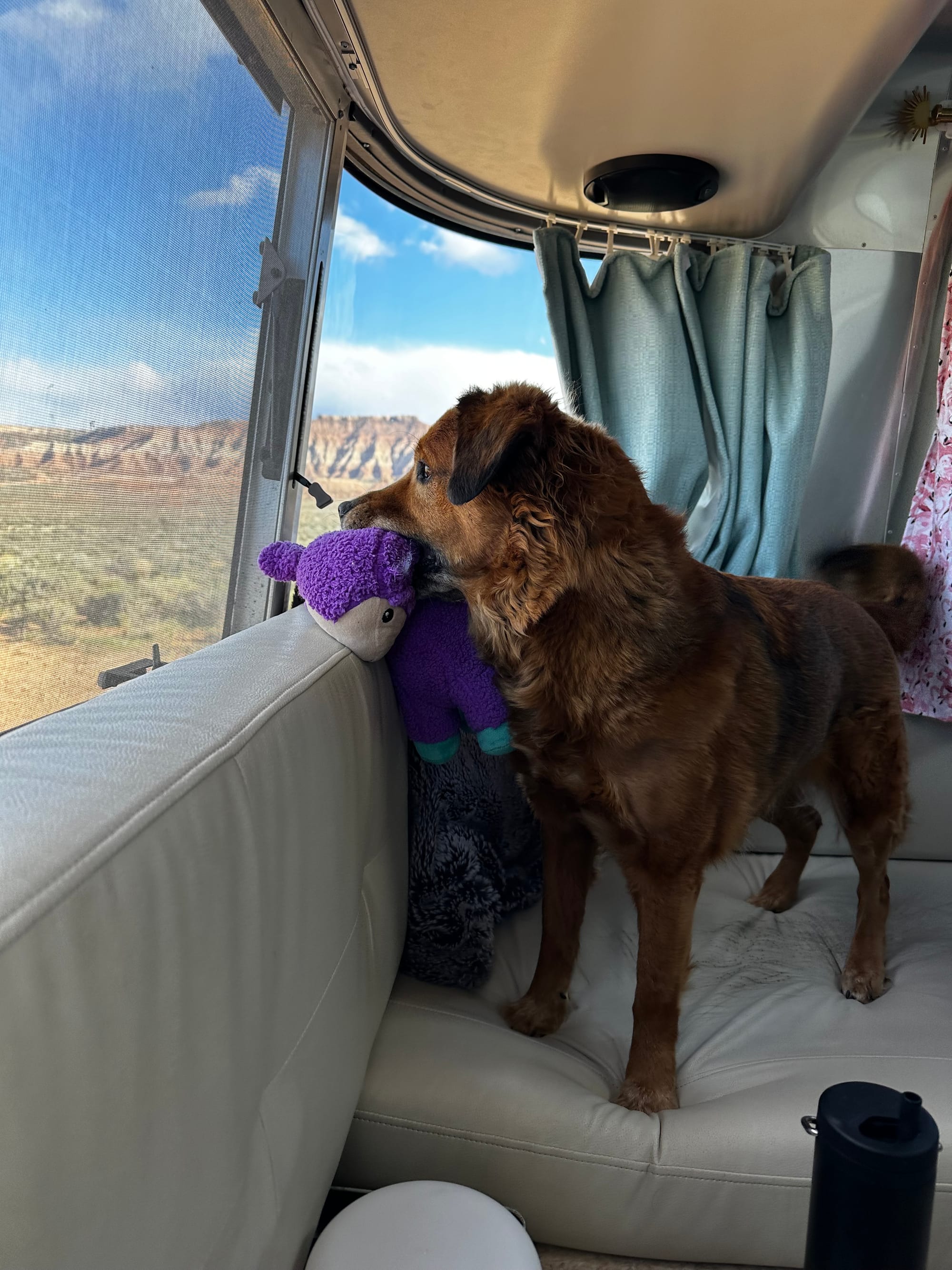
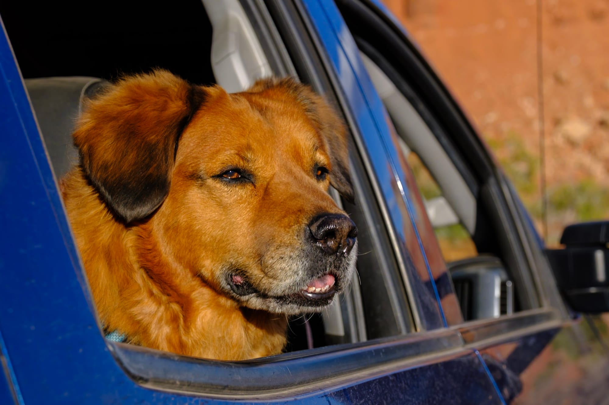
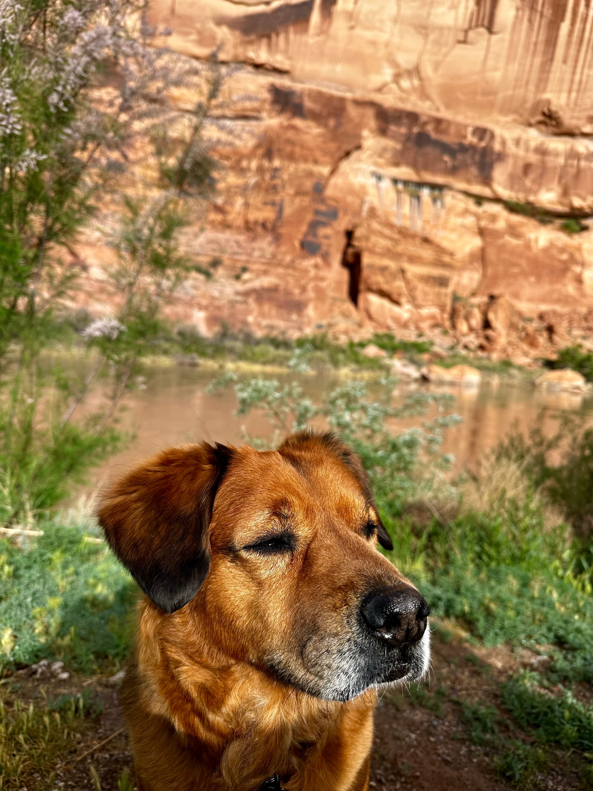
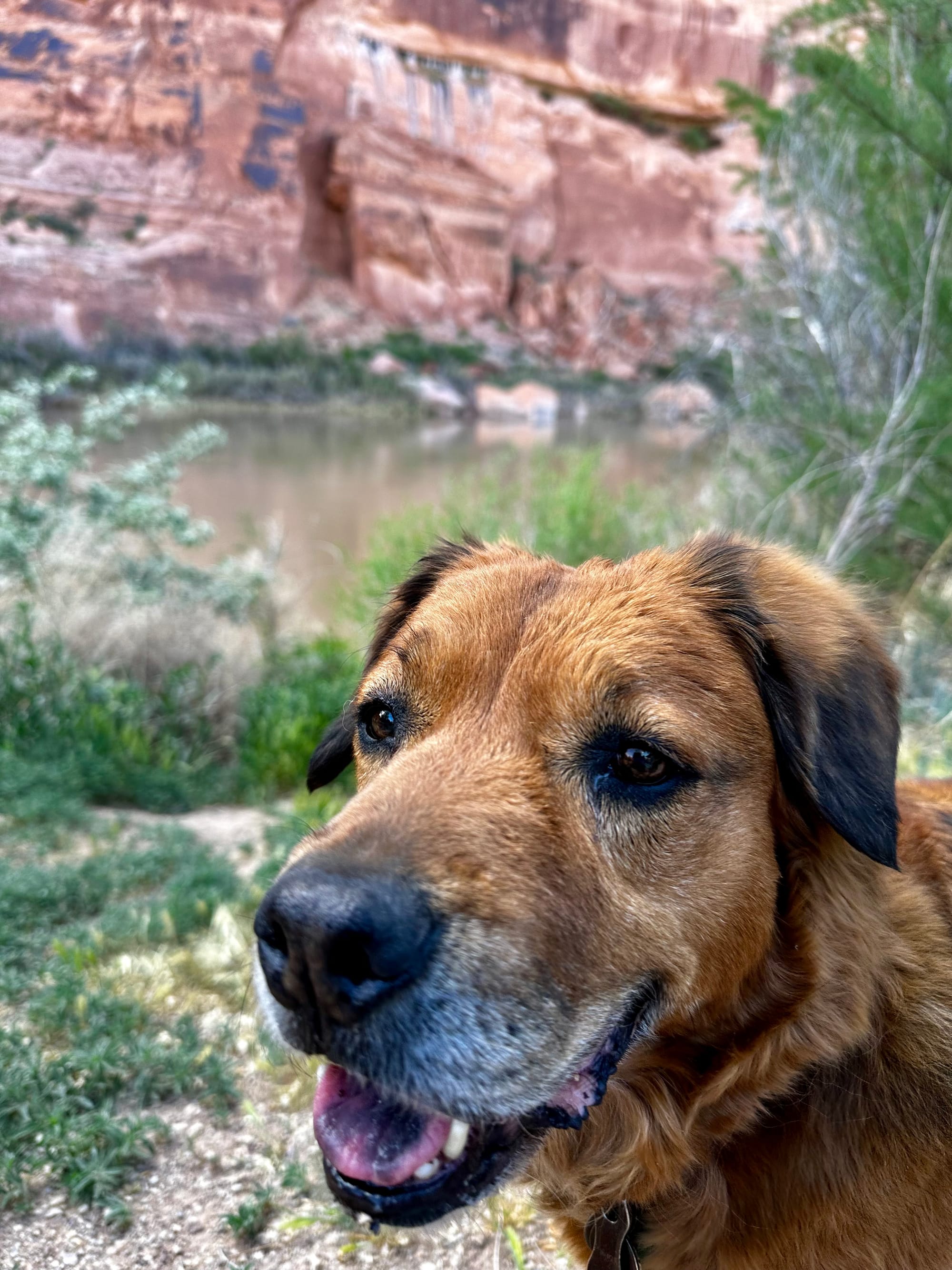
Hollie says hello!
The main downside of this spot was the wind. It was pretty windy most of the time – something we got used to in the desert, but probably our least favorite part about the wide-open southwest. The extreme wind makes being outside not fun.
The first couple days were drizzly and cold, but after that we had dry weather. It was pretty warm during the day but cold at night (another common theme in the desert). We had beautiful sunrises and sunsets almost every day.
About a week into our stay here, Joey took the RV to town to dump our tanks and fill our fresh water while I stayed at the campsite, holding down our spot with our chairs and outdoor stuff. Our battery held up pretty well for two weeks, but we did have to run the generator pretty often toward the end of our stay – running the heat at night and charging laptops during the day takes a good amount of power.
We didn't do much in town, but after running errands in St George (a bigger town down the road from Hurricane) one day, we ate a late lunch at a cute place called George's Corner Restaurant. Otherwise, we mostly cooked at the campsite. On Easter Sunday, it was rainy and cold – we made breakfast biscuits with eggs and bacon in the morning and watched basketball in the afternoon. On a nicer evening, we made a charcuterie platter and had a campfire at sunset. But usually we just make simple things like salad, rice bowls with chicken and broccoli, etc.
Anyway, all this to say – it was a pretty normal, low-key couple weeks here overall, albeit with stunning views and a couple adventures along the way.
Angels Landing
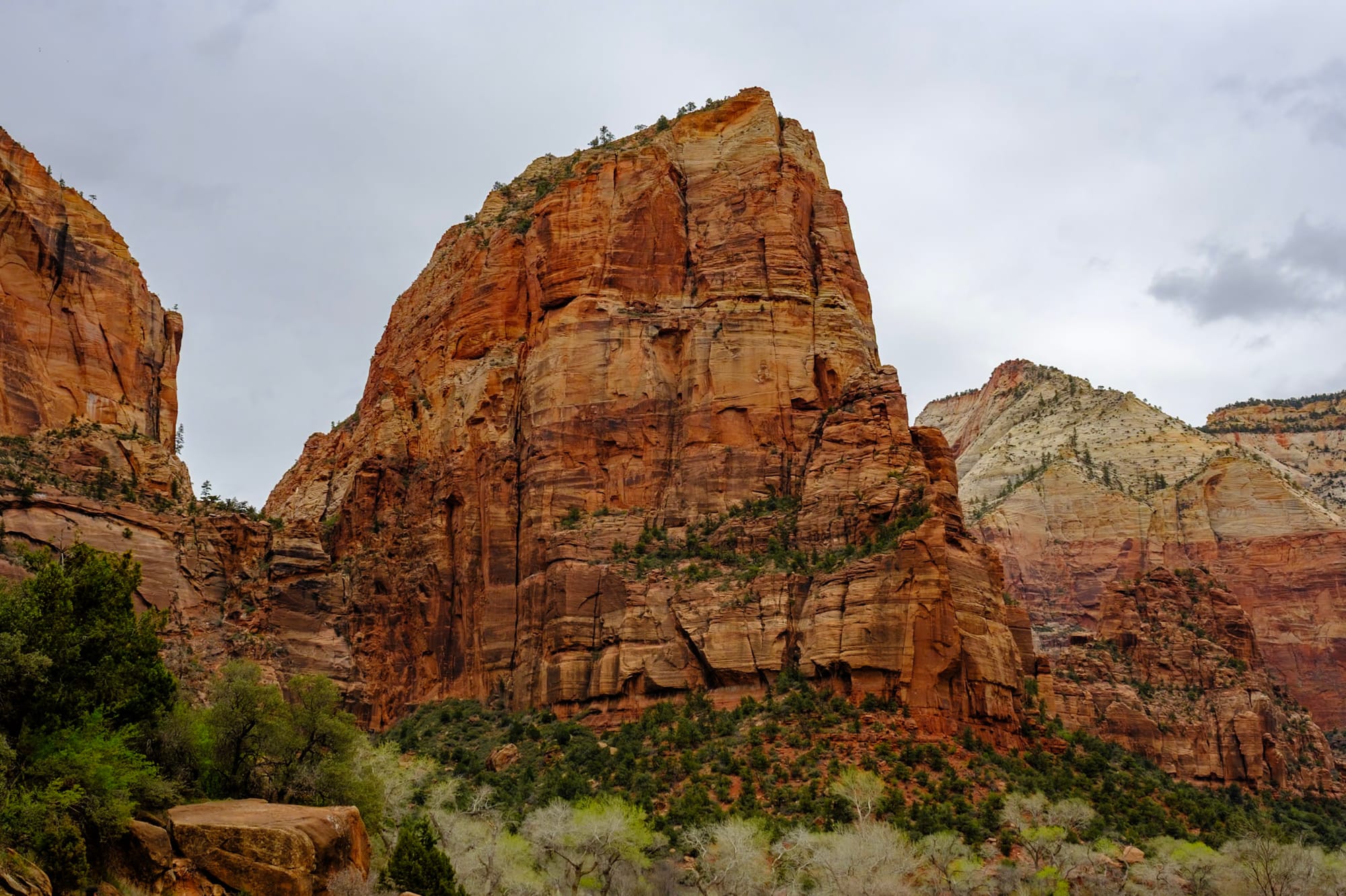
The big thing we did in Zion was... hike Angels Landing!
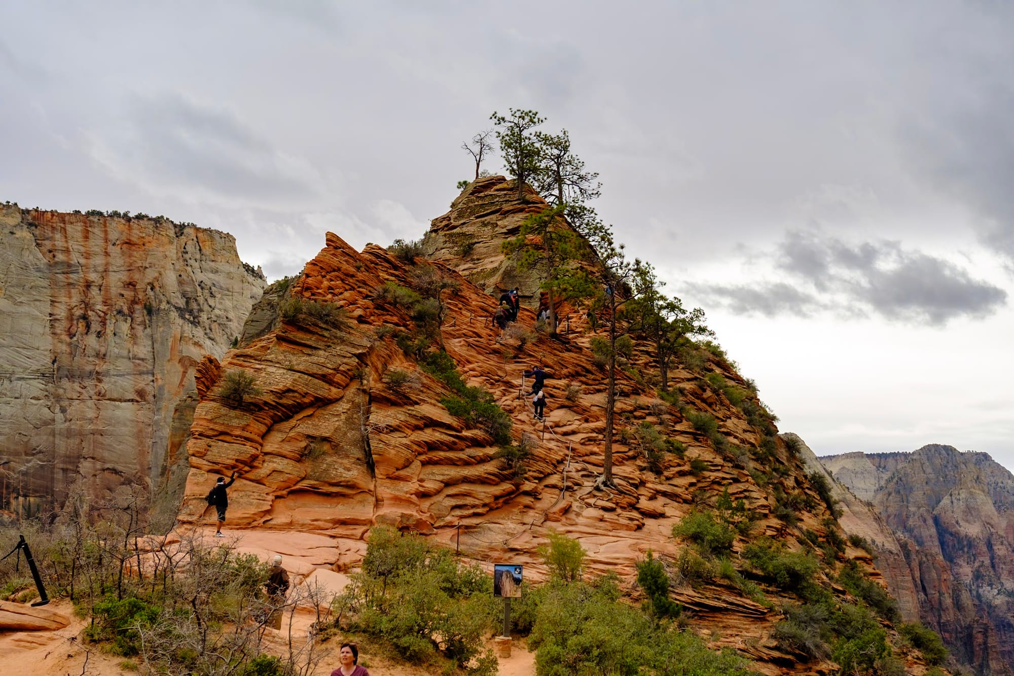
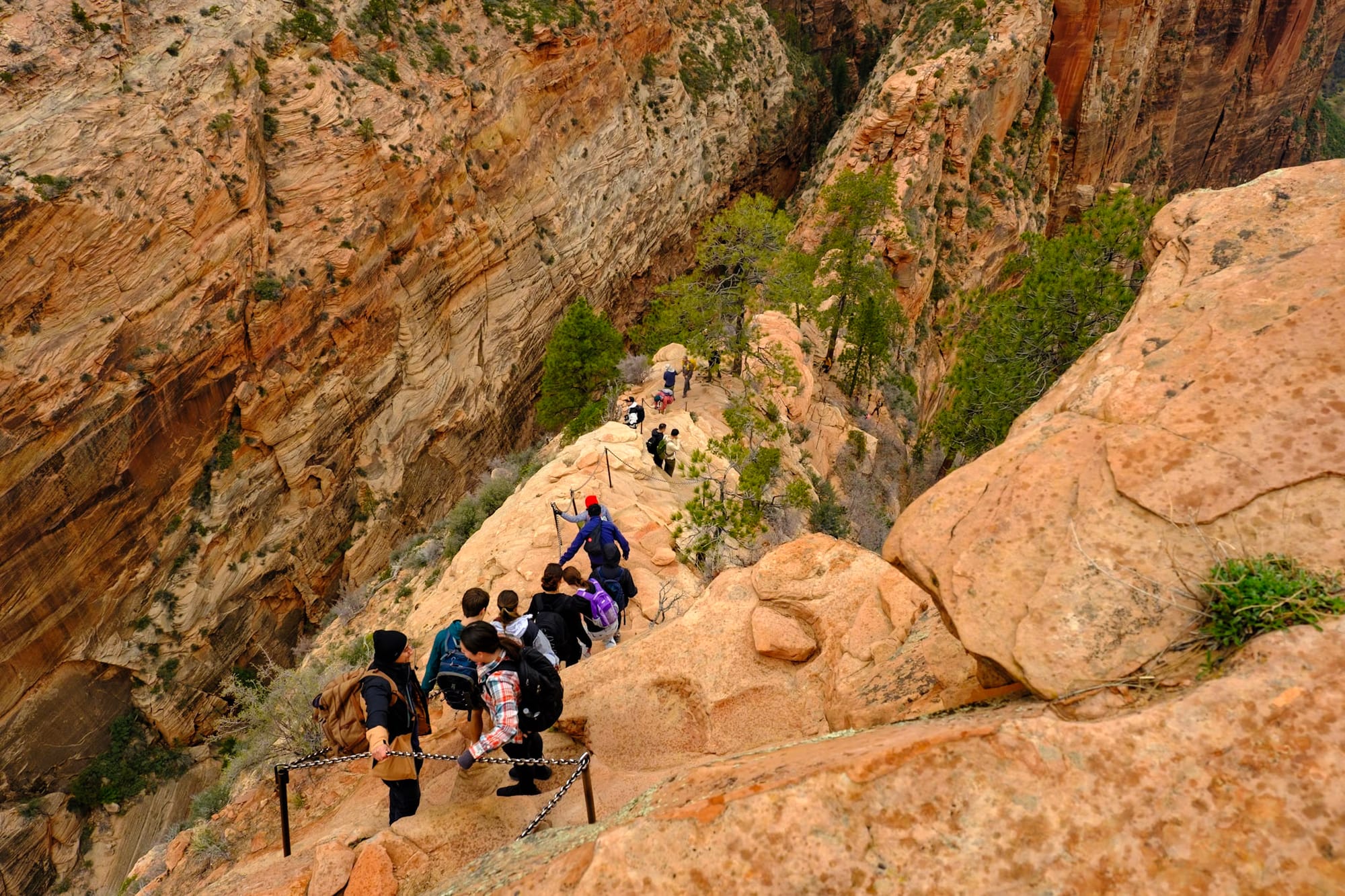
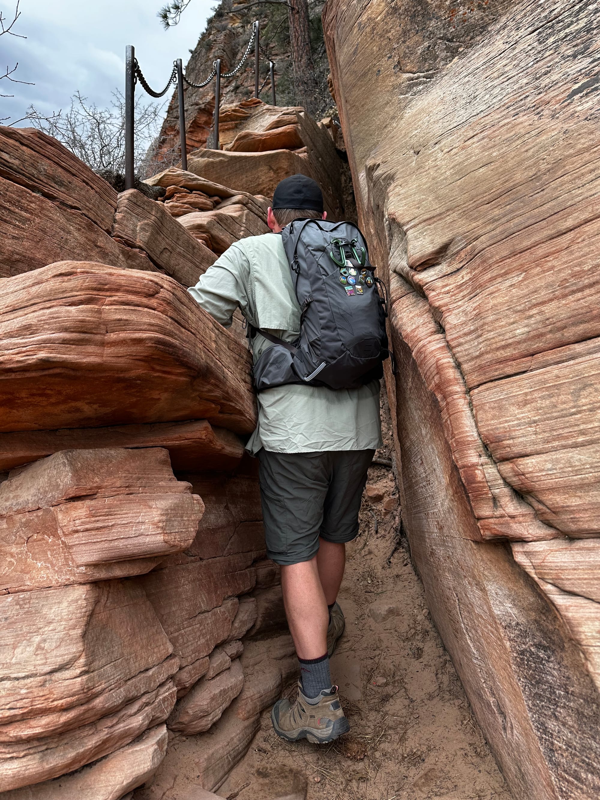
If you're not familiar, Angels Landing is one of the most famous hikes in the country, and has been on my bucket list for a long time. It's a huge, towering cliff/rock formation in the heart of Zion National Park. You hike up on the West Rim Trail, climbing over 1,500 feet in about 2 miles.
Then, you have to get a permit to hike the last half mile along a narrow ridgeline to Angels Landing itself – this is the most famous part of the trail. It follows the rocky ridgeline, climbing up even higher, with a few pretty narrow and nerve-wracking sections where you scramble up rocks or hold onto chains while the cliffs on either side of you drop all the way down to the valley. A ton of people want to do this hike (which is why there's a permit system to control the crowds) and several people have died (16 according to Wikipedia).
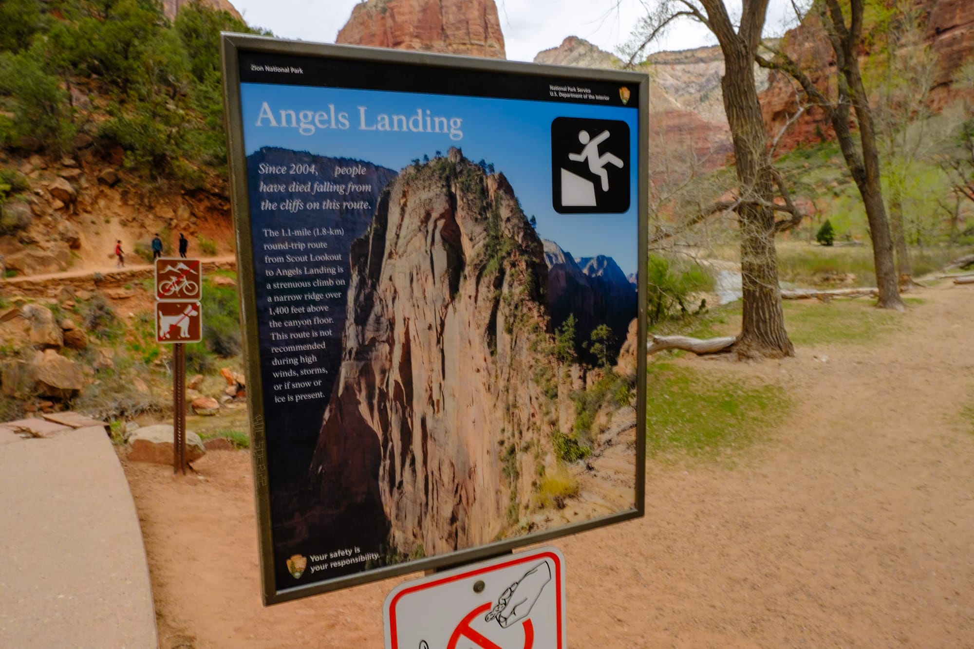
Anyway, since we hadn't entered the advance lottery for this hike several months earlier, we had to apply for a day-before permit (they reserve a certain amount of spots for day-before applicants). We applied on Friday, March 29, the day we got to Hurricane Cliffs, and found out that afternoon that we'd won the hiking lottery – we had an early morning start to hike Angels Landing the next day!!
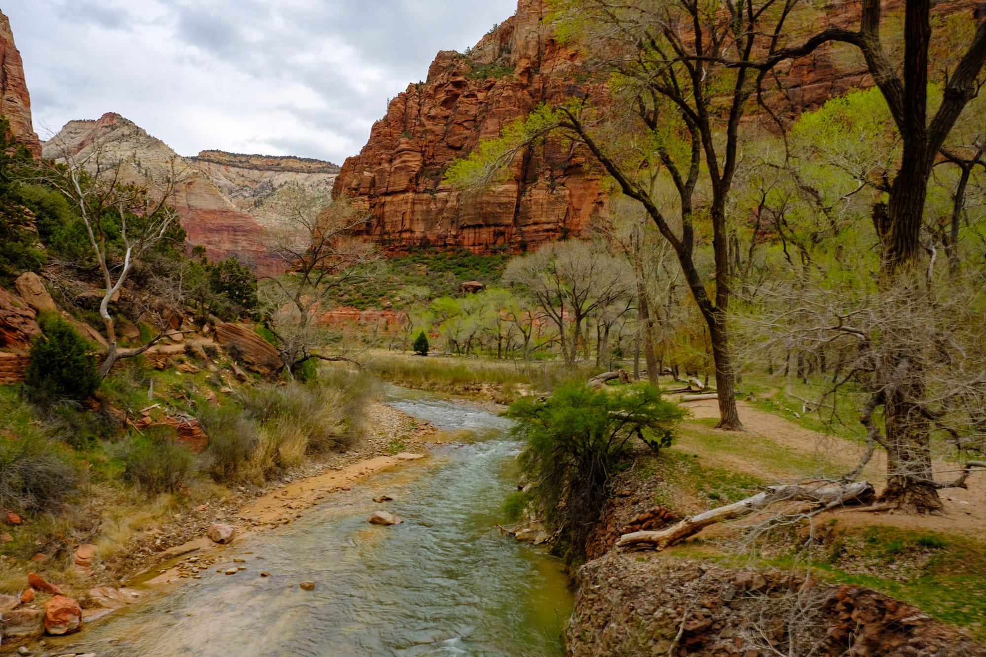
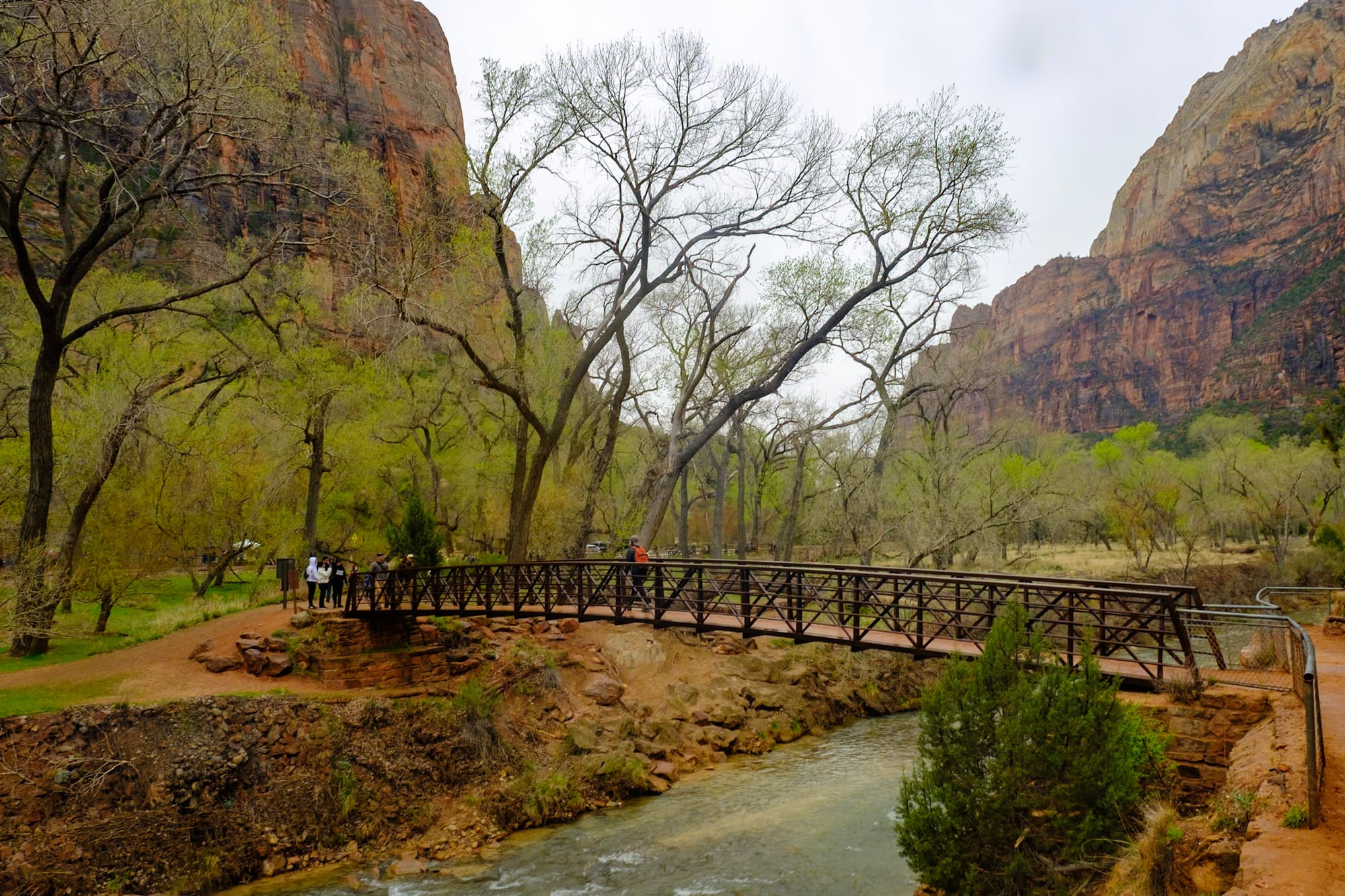
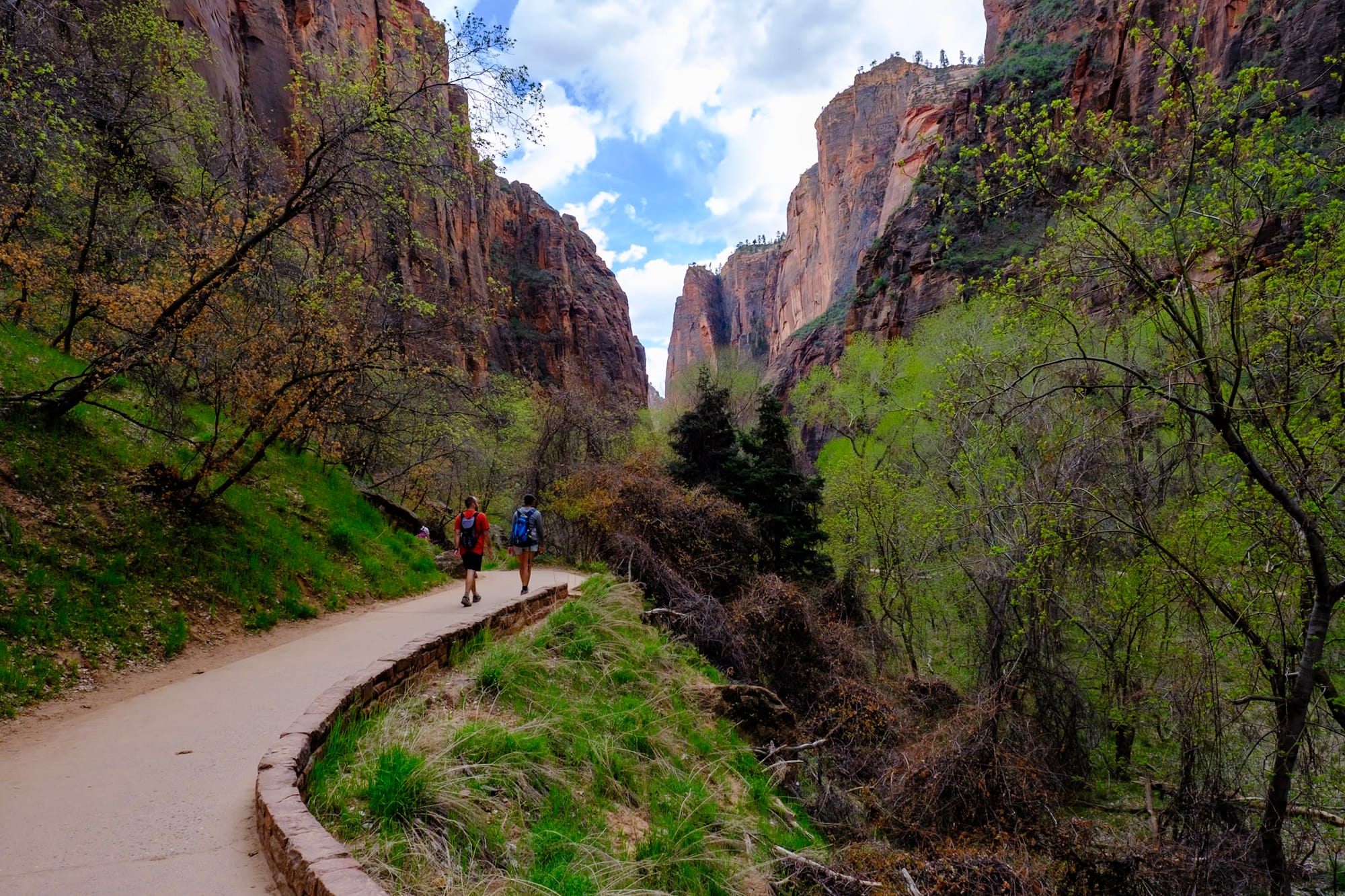
So on Saturday we got up at dawn, packed our backpacks, and left for Zion around 6:30am. It was a 30-minute drive, and we wanted to grab one of the first shuttles. (You have to take a shuttle through most of the main area of the park). We parked at the Zion Canyon Visitor Center and got in line for the shuttle; there were already a lot of people there, but the Zion shuttle system is dialed in and we got on one soon enough.
By 8am, we had gotten off the Grotto shuttle stop, crossed the Virgin River, and started the West Rim trail. We could see Angels Landing from the trail in the valley – it looked SO high above us. It was a cool, cloudy day, but we warmed up as we hiked. A bunch of people were hiking already too, but it didn't feel too crowed. We kept pace with the same few groups of people and kept passing each other on the way up.
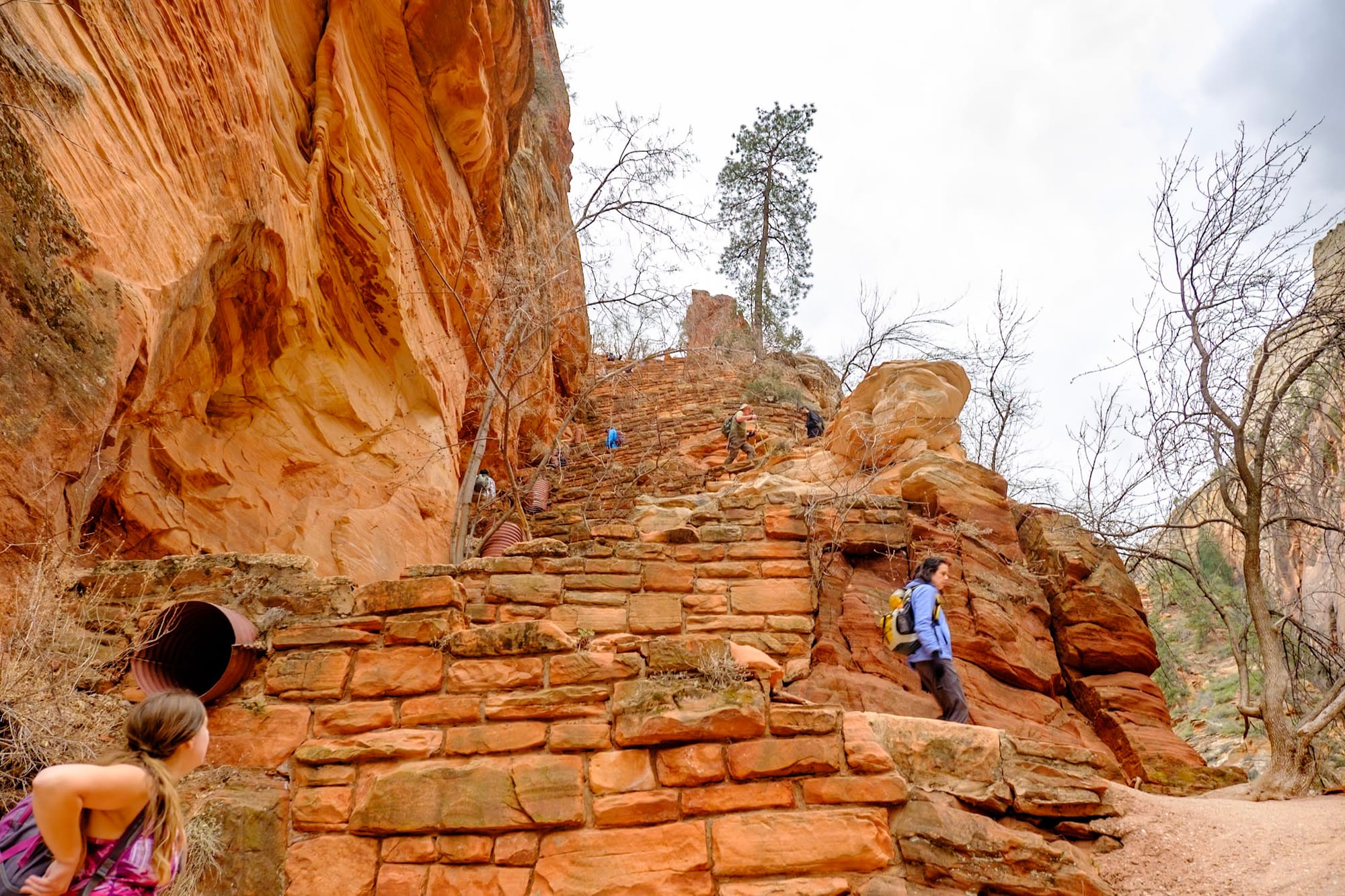
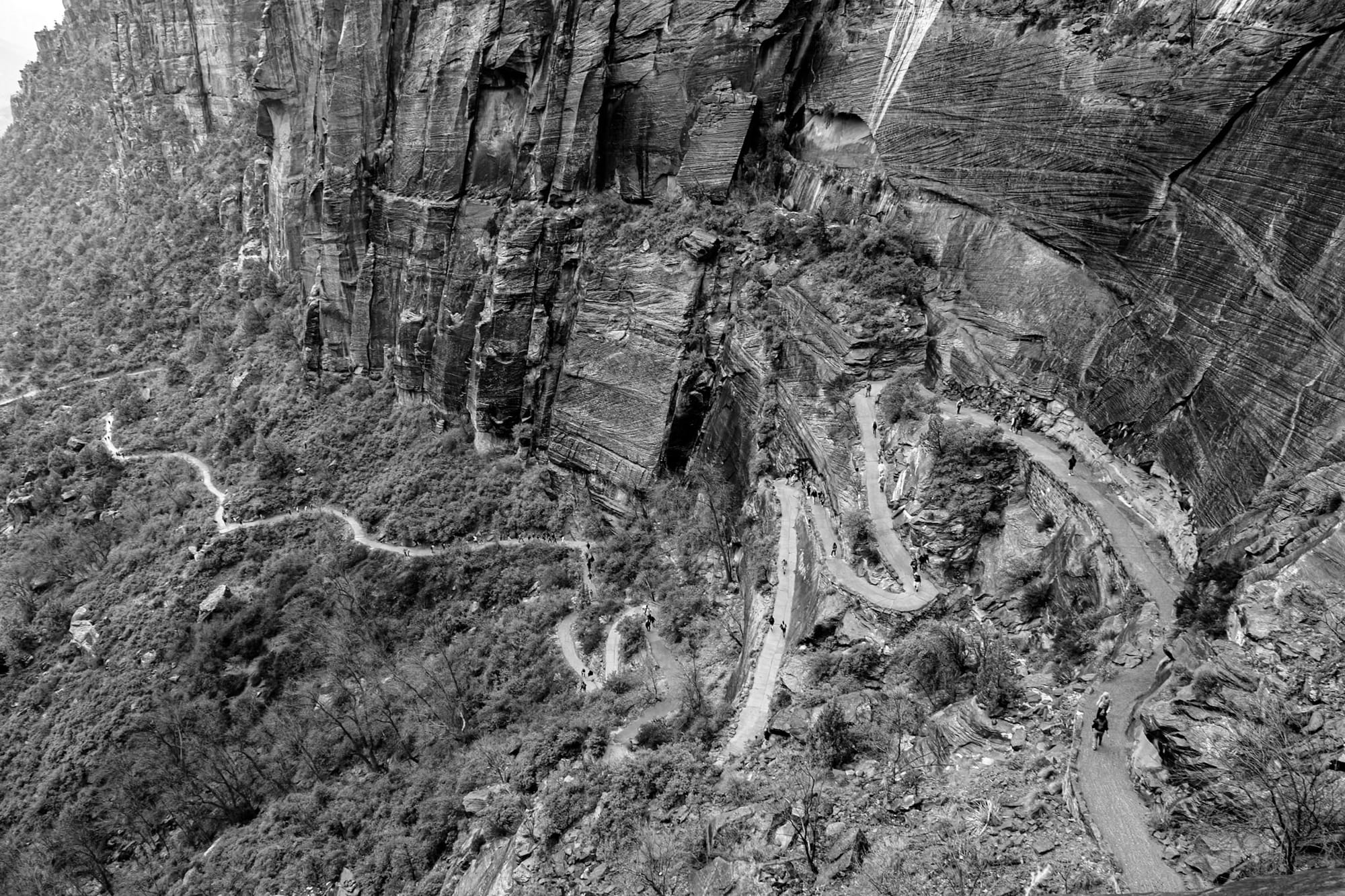
The trail starts off gentle, and it's paved almost the entire way up, but soon enough you have to tackle these long, steep, killer switchbacks up the cliff. They were brutal, especially first thing in the morning before we'd eaten anything. Luckily, the view over the valley was beautiful, so there were a lot of nice spots to take breaks and catch our breath.
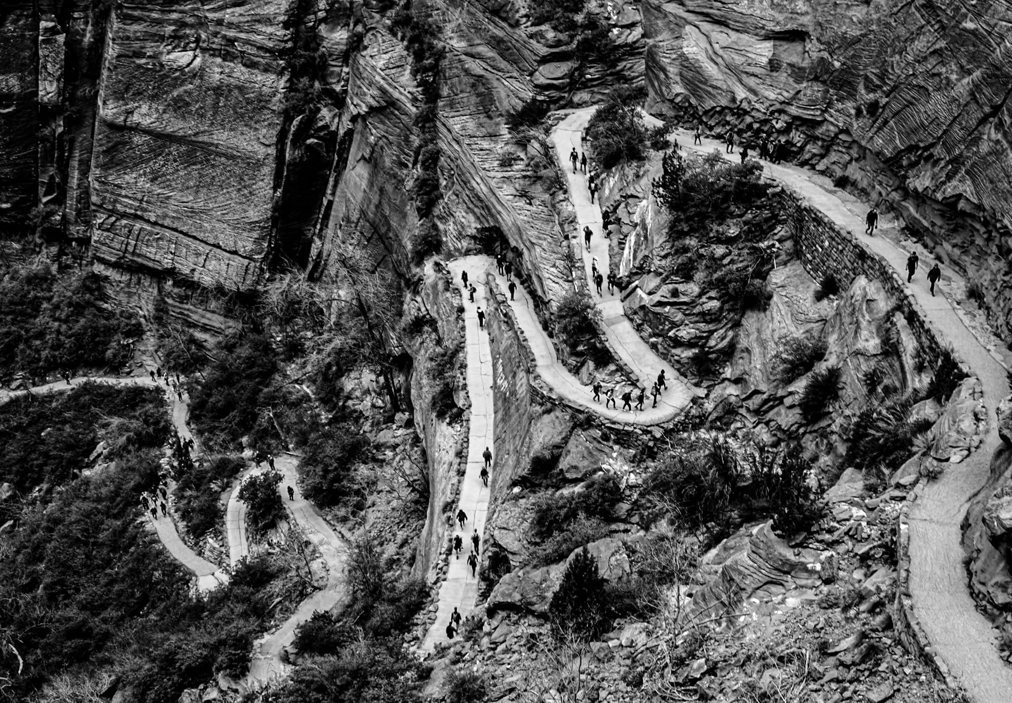
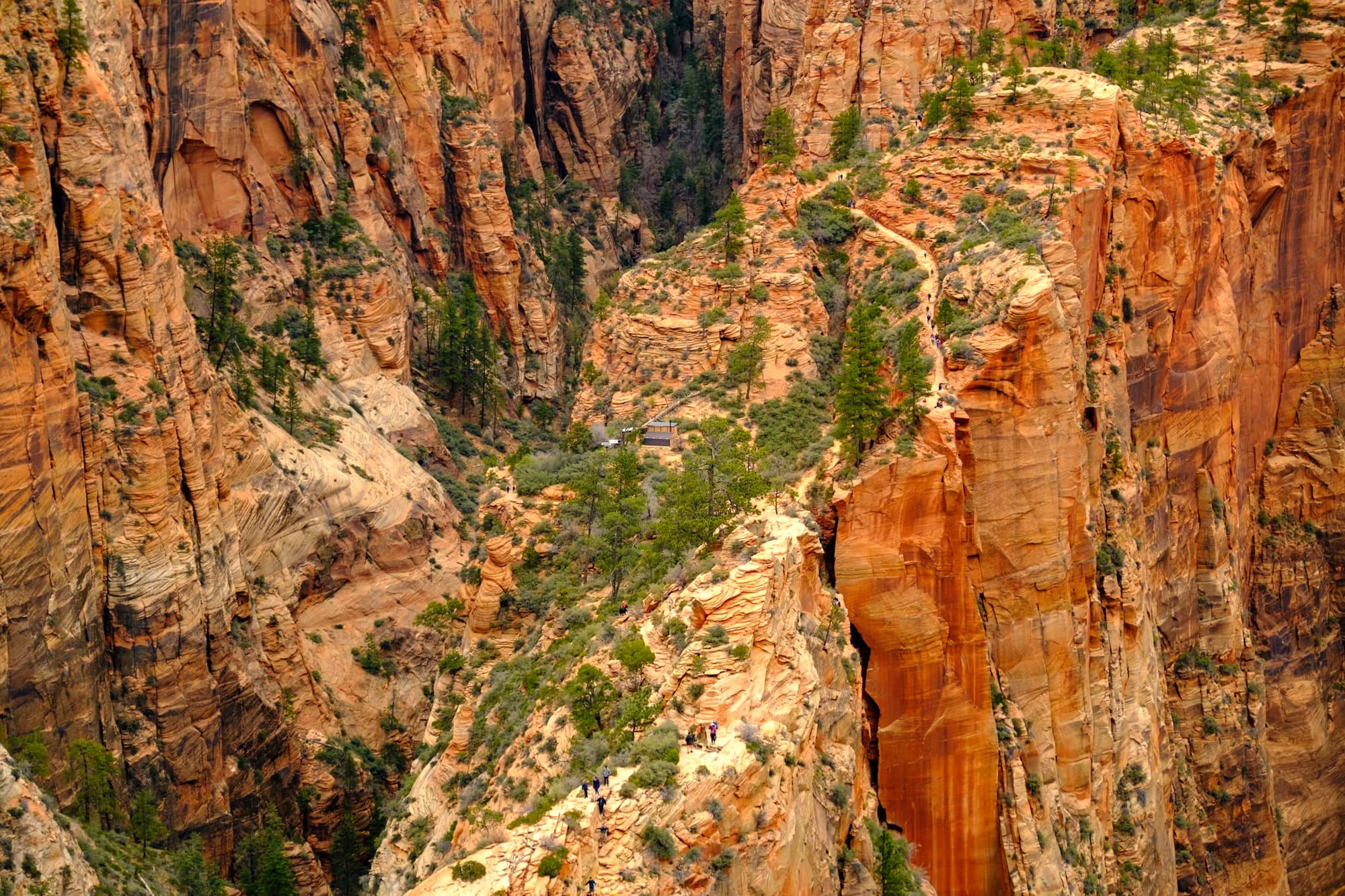
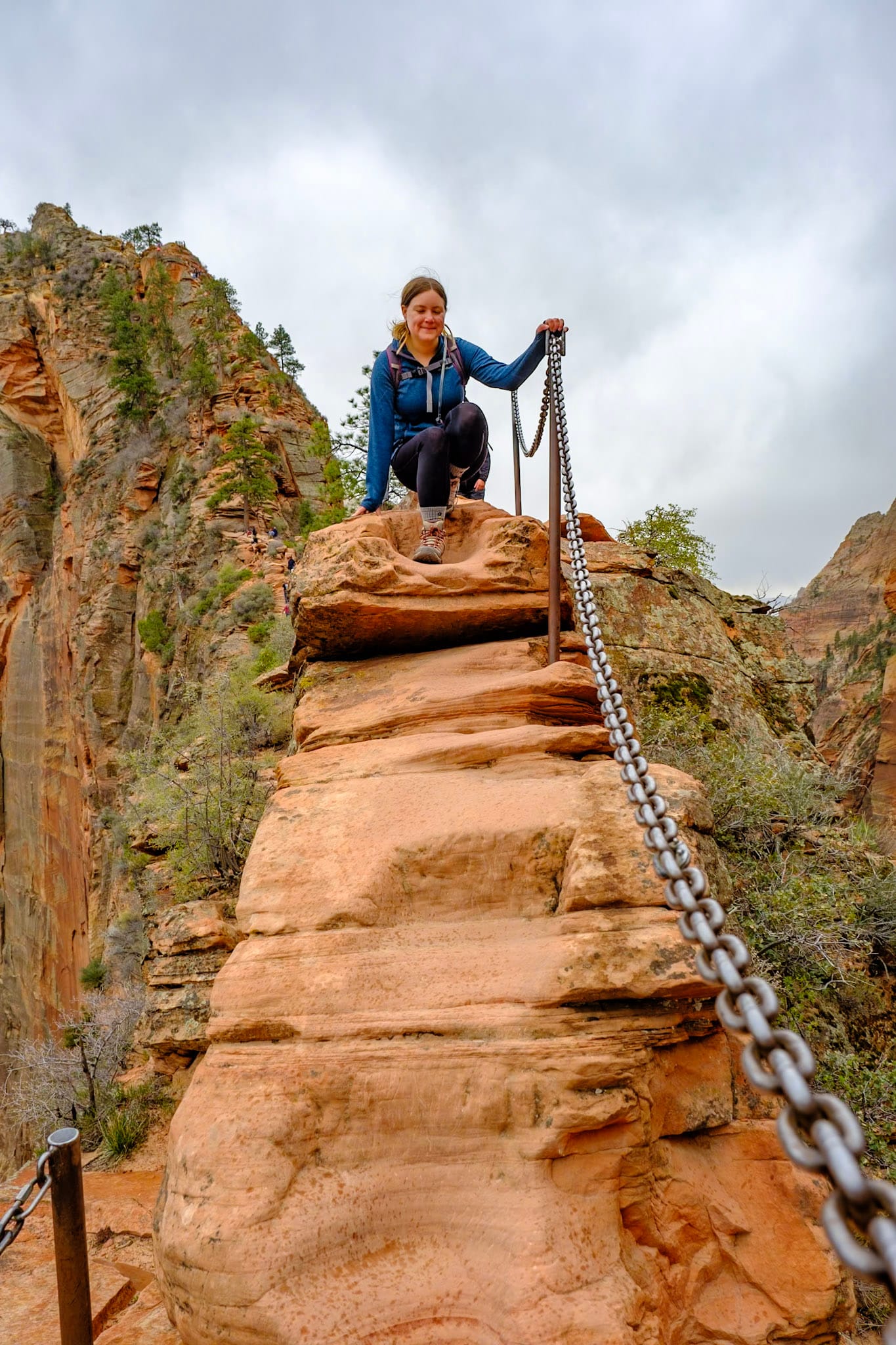
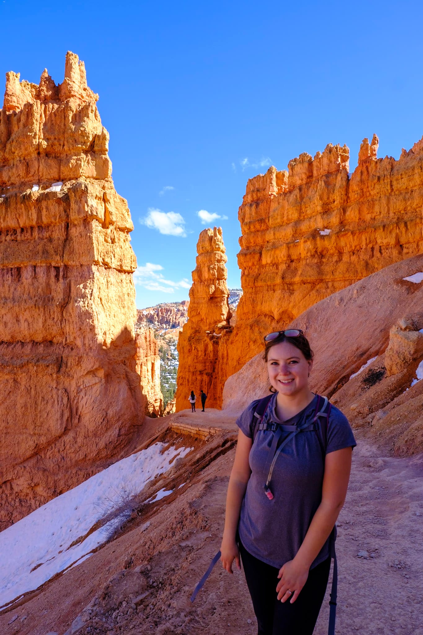
After a while you enter Refrigerator Canyon, a flatter, more shaded part of the trail in between canyon walls. Then, you get to Walter's Wiggles! These are a series of 21 short, steep switchbacks that climb the last few hundred feet up to Scout's Landing – the viewpoint right before the final Angels Landing climb.
Walter's Wiggles was a cool section of the hike, especially looking down from the top at all the people climbing the wiggly switchbacks. I had been dreading it a little, but actually found this part easier than the longer switchbacks at the beginning.
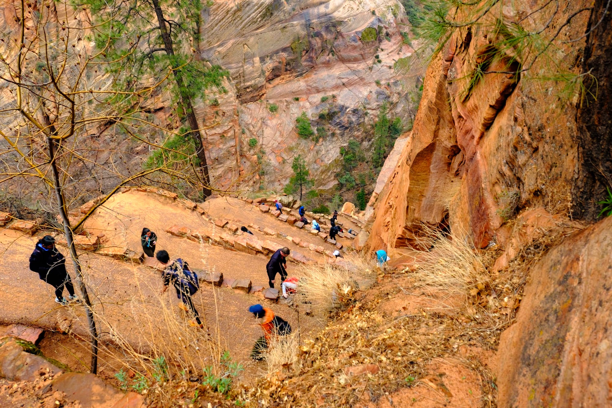
Walter's Wiggles from below and above
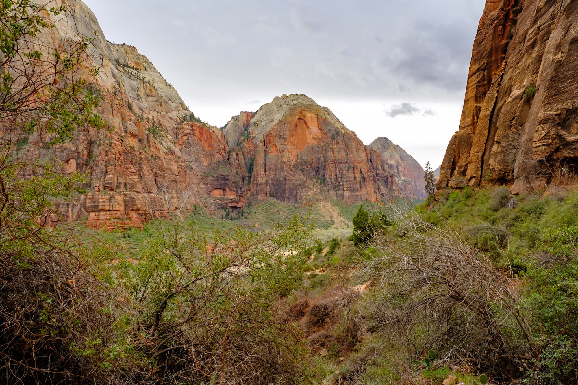
Finally, we were at Scout's Landing, with Angels Landing just ahead of us! We were already pretty high up, so the view of Zion Canyon all around was incredible. A bunch of people were hanging out and taking pictures here – many just hike up to this point or keep following the West Rim Trail, especially if they didn't get a permit. We rested here for a while to gear ourselves up for the final climb.
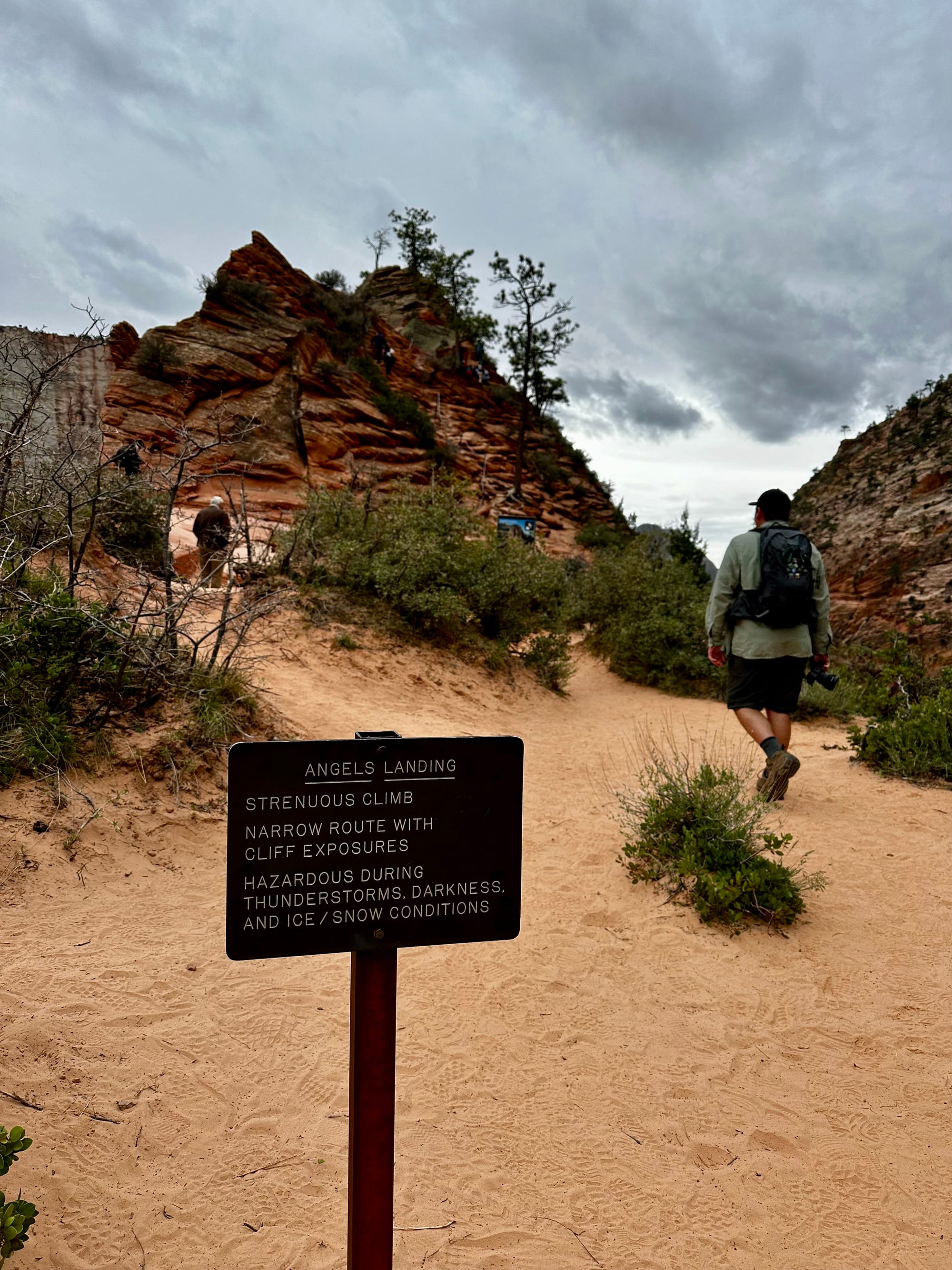
There was a ranger checking permits at the start of the Angels Landing trail. We passed him and were off! Side note – I'm so glad they have the permit system now there. I don't have a personal reference point for how it was before, but according to a few people we talked to, it could get pretty bad. A lot of the trail only has room for one-way traffic, so there would be lines of people waiting for ages to get by. I can see how it would get really frustrating – not to mention dangerous – waiting for slower hikers, or people trying to rush by and being reckless.
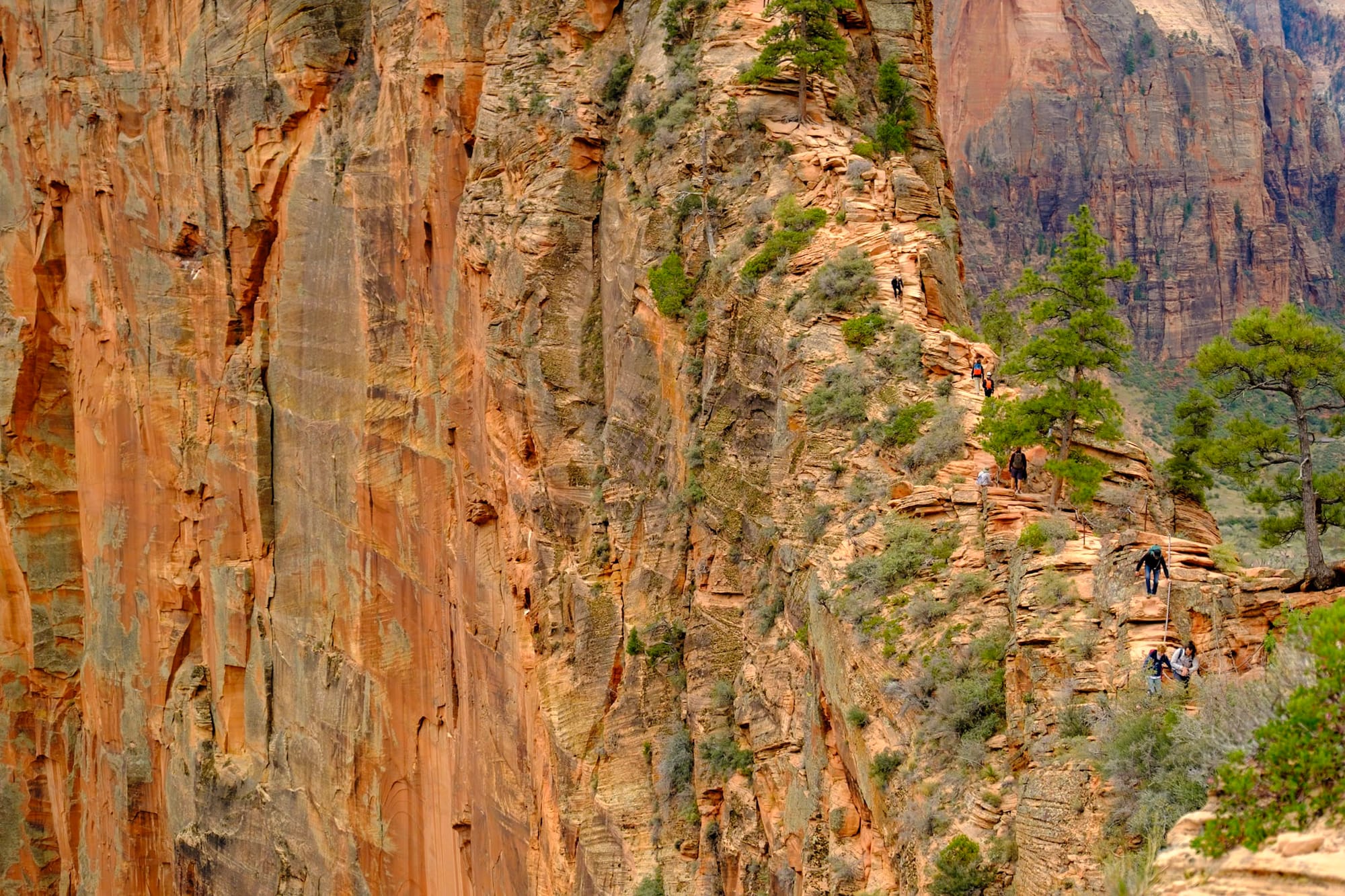
Although there were a decent amount of people on our Angels Landing hike, we only had to wait a few times for people to pass in the narrow sections, and in some places we were mostly by ourselves. It made the hike much calmer and nicer; we felt like we could take our time.
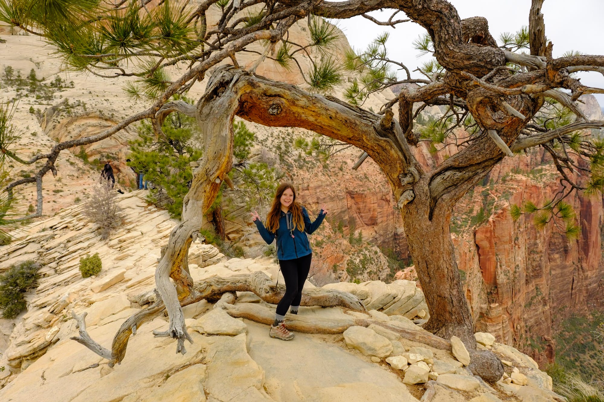
Anyway, we started the half mile hike to Angels Landing, and almost immediately hit one of the sections of the trail with chains attached to the rocks – intended to guide you along the trail, help you feel safer, and give you something to hold onto so you don't fall far into the valley below.
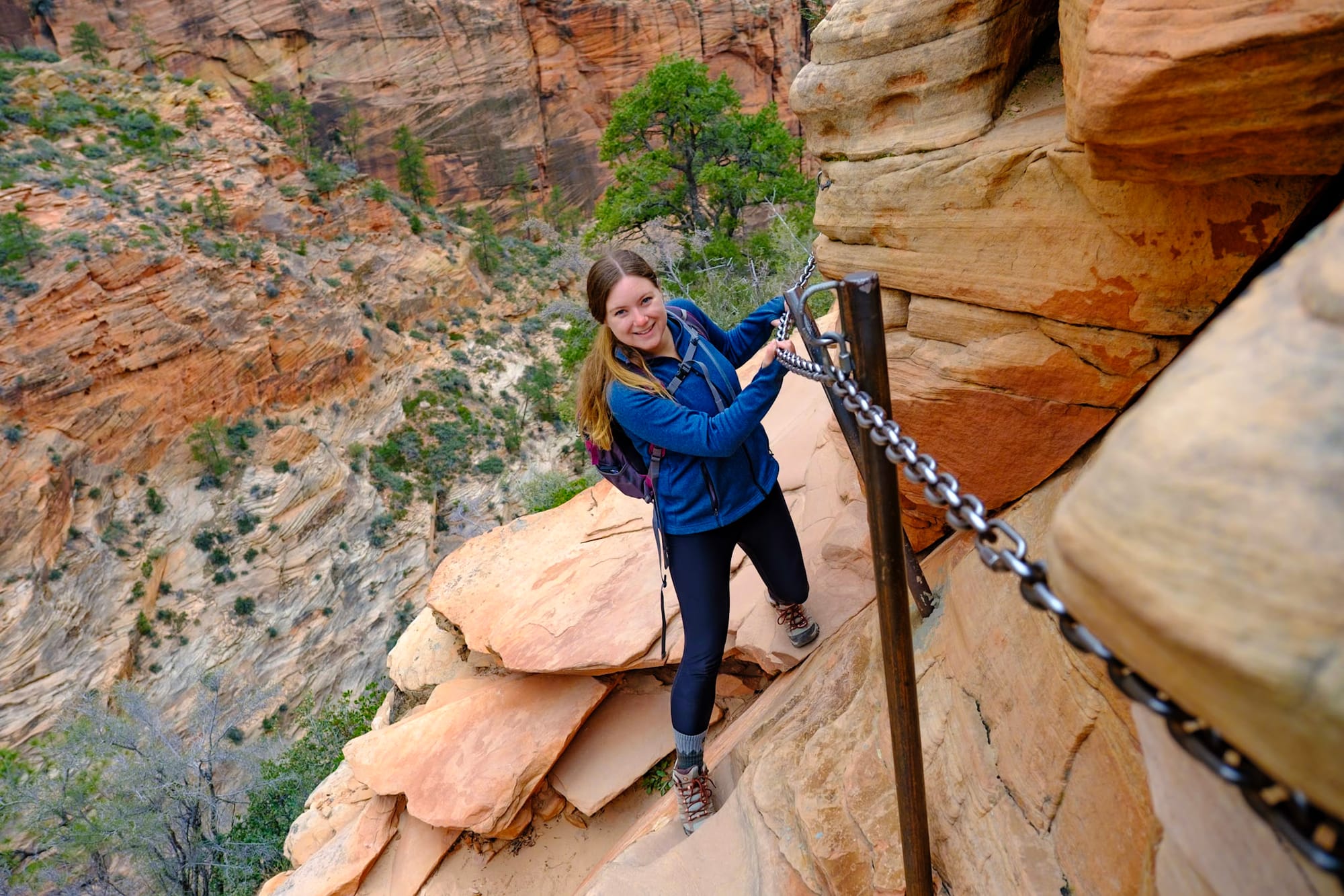
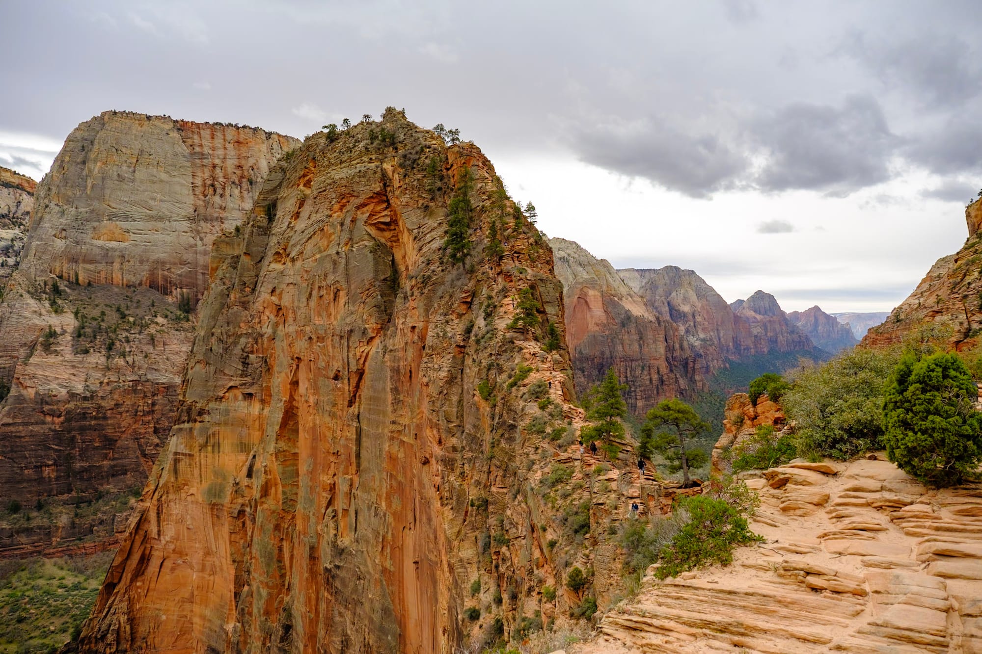
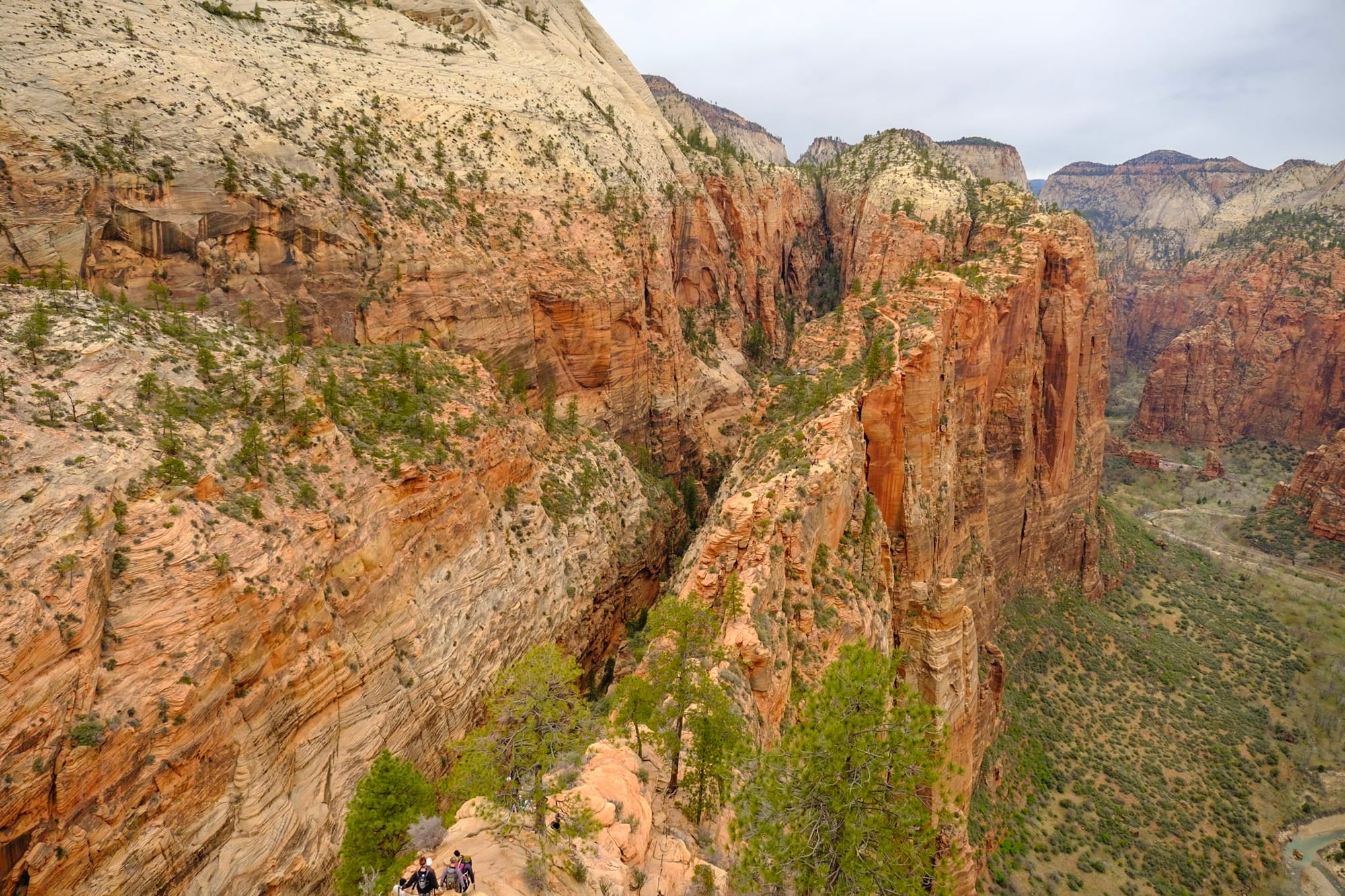
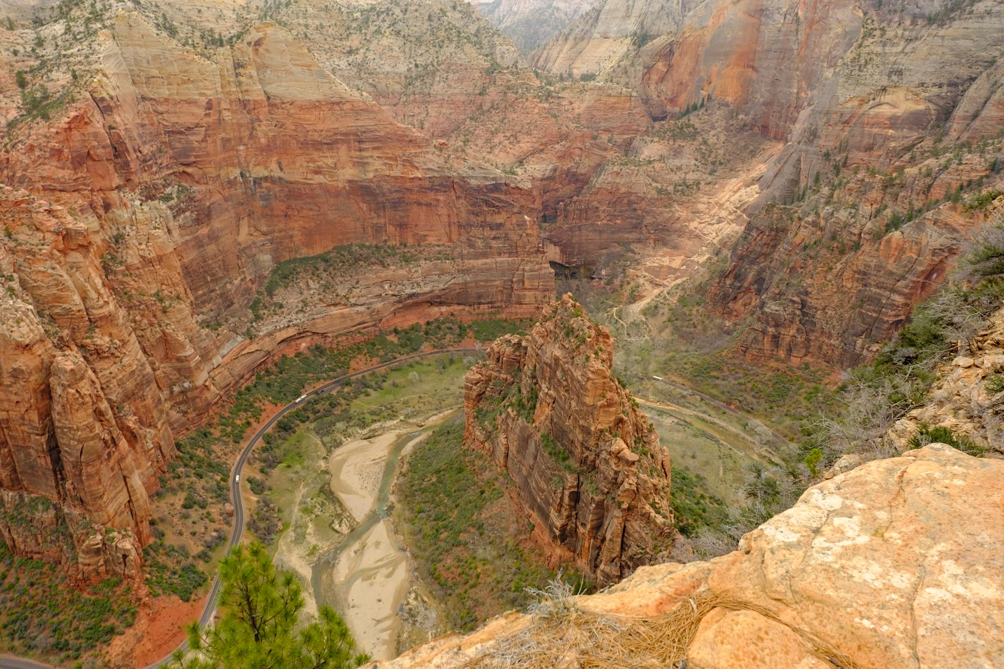
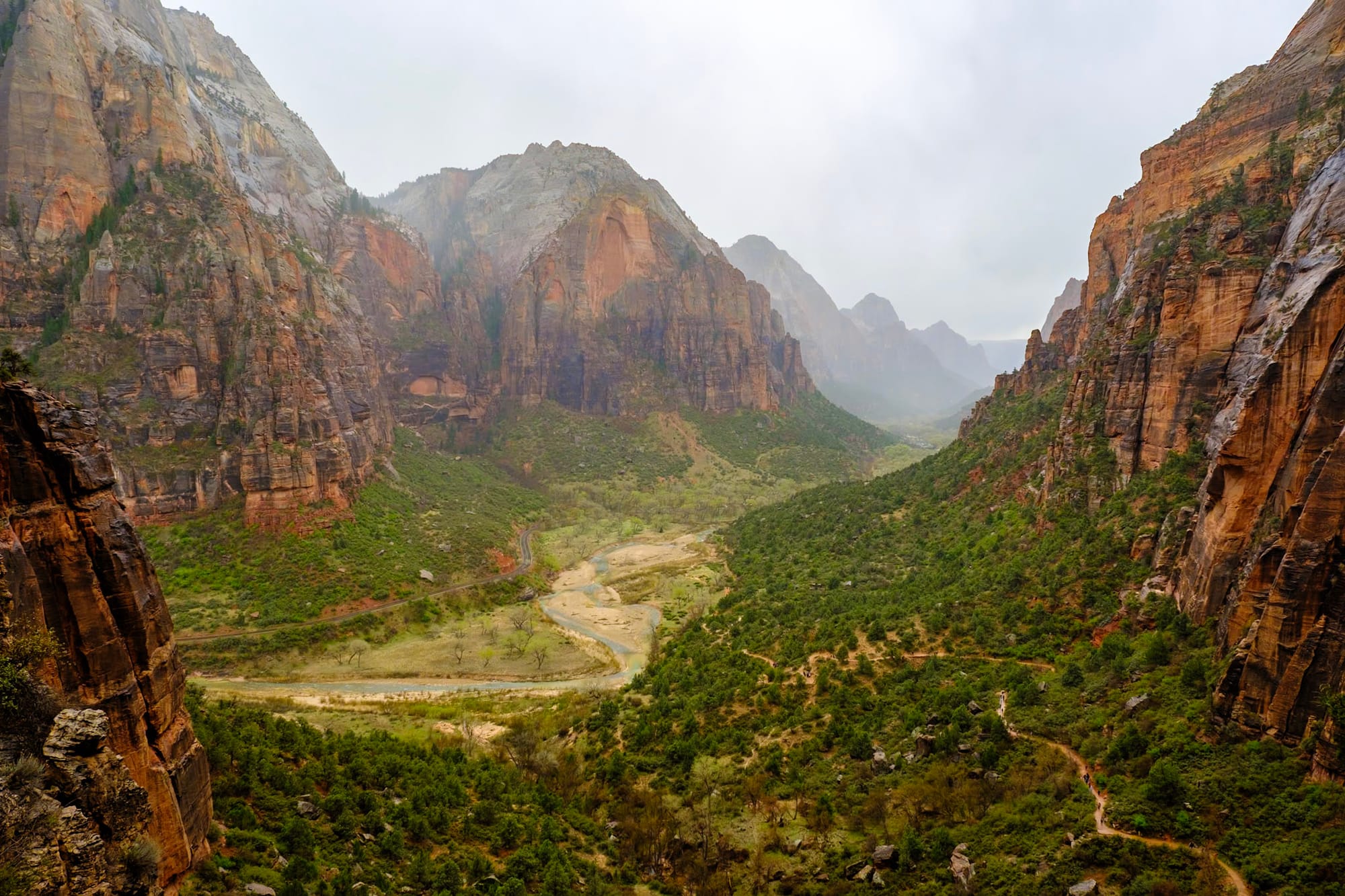
Needless to say, the views are stunning (and dizzying) the whole way. The road, buses, and river at the canyon floor looked tiny from up there. Colorful red and orange cliffs surround you on both sides and drop away in a sheer rock face below you as you make your way along the ridgeline. Even in cloudy weather, it was absolutely beautiful.
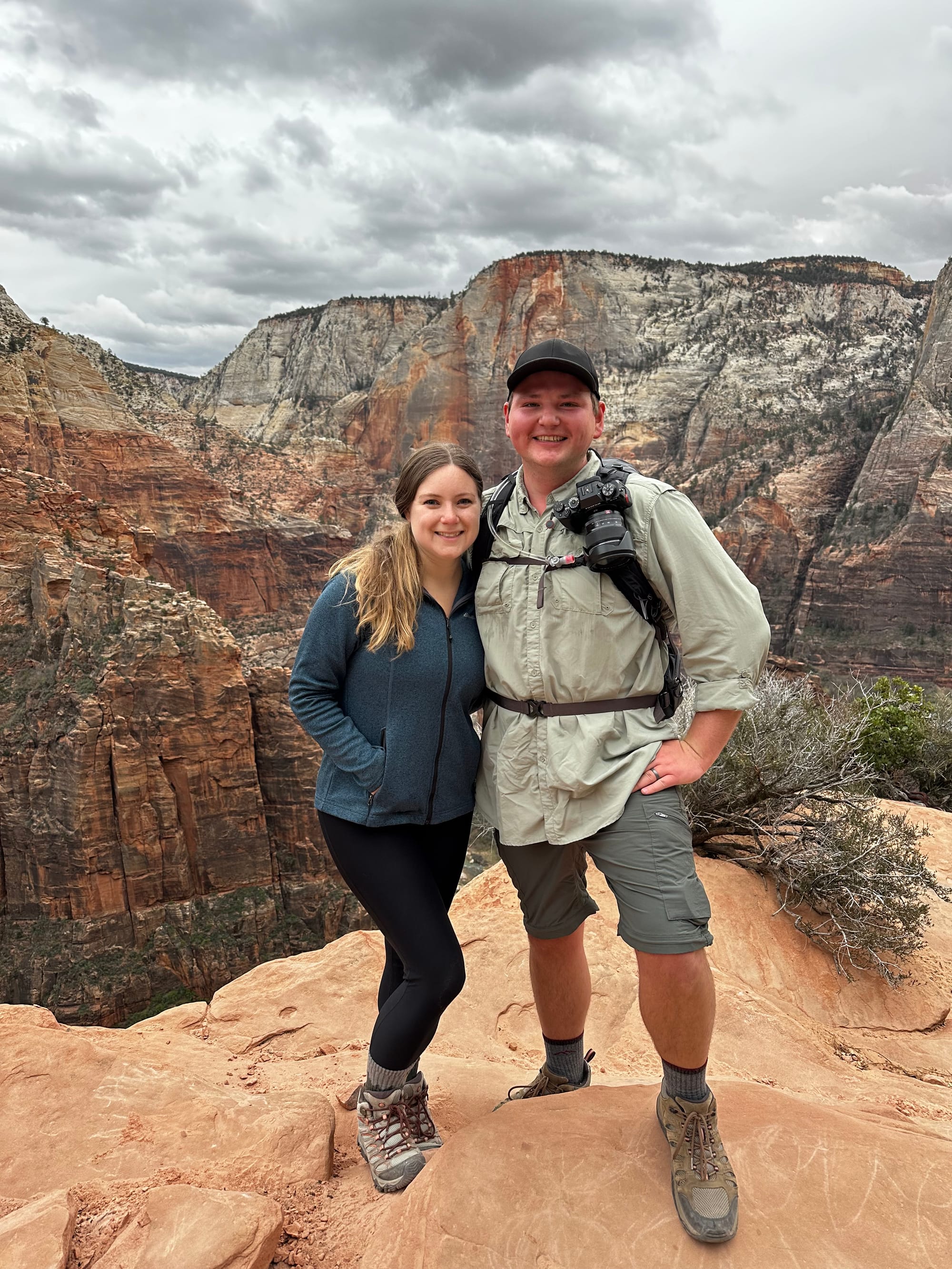
Once you get past the first part of the Angels Landing trail, you have a stunning view of the rest of it: the final steep climb up to the landing. This part is pretty much a rock scramble straight to the top, climbing with your hands and feet. Finally, we made it – we were on top!
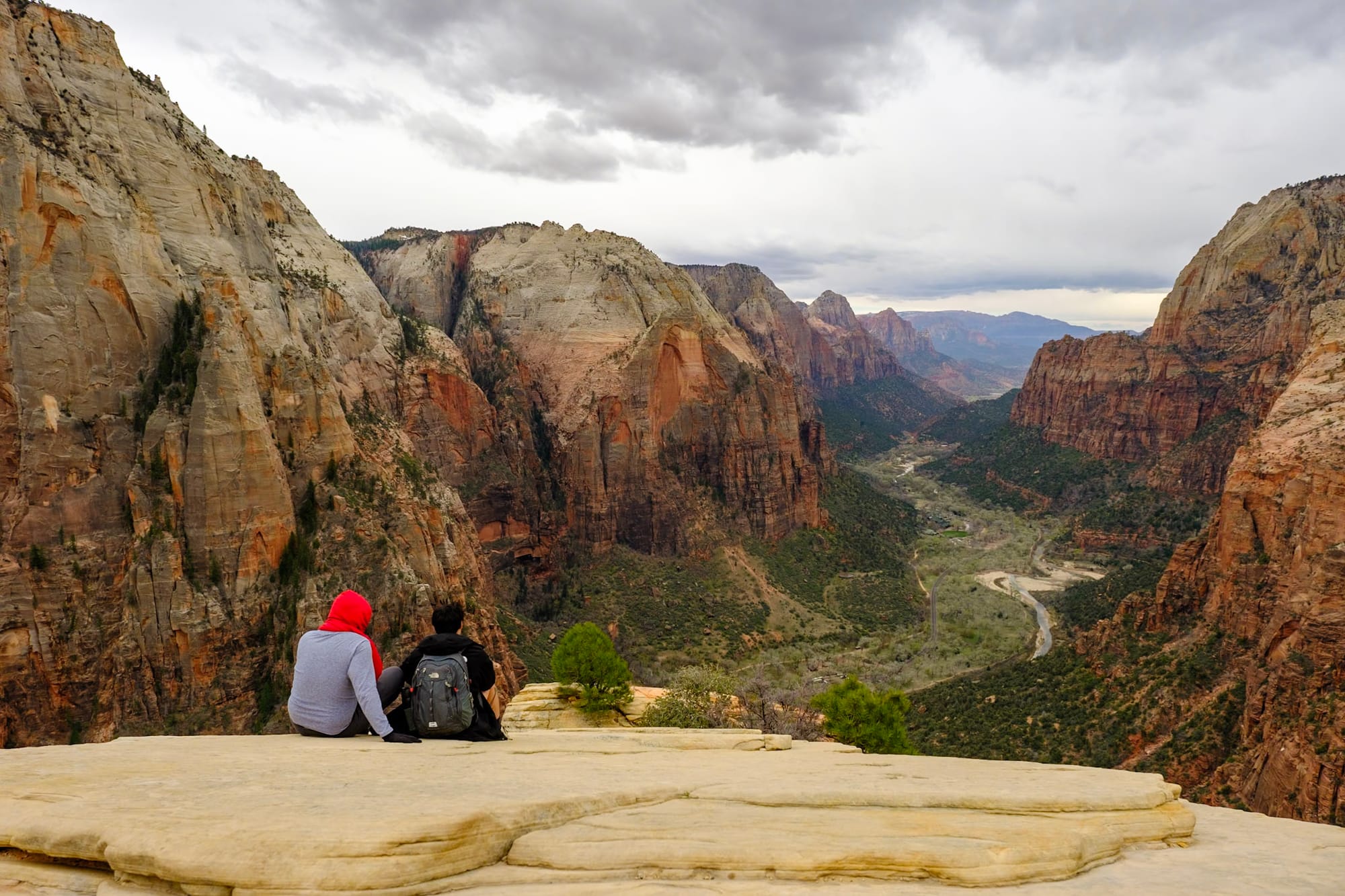
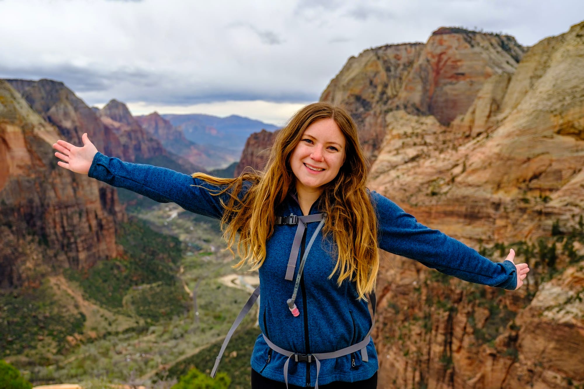
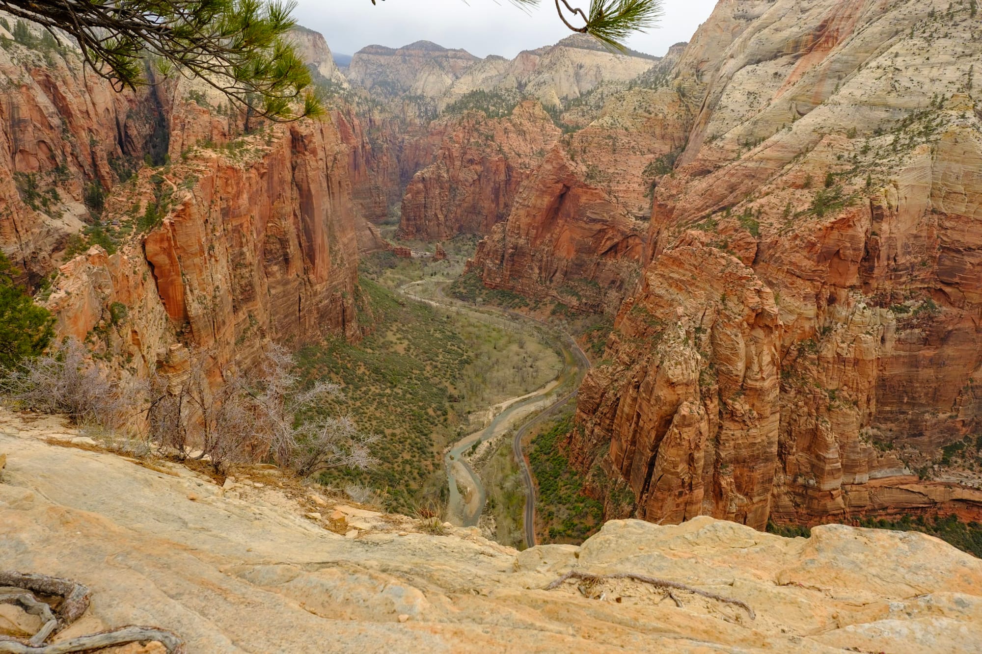
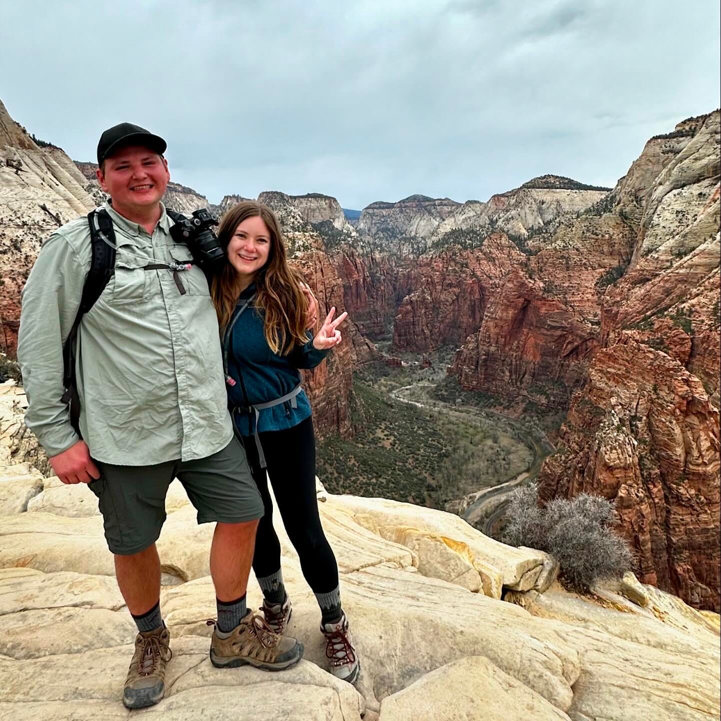
Even though the hike was short, it had been tough, steep, and mentally demanding almost the whole way, and reaching the top was a rush – SUCH a good feeling. The 360-degree views were incredible, of course. We took a bunch of pictures and spent a long time hanging out at the top, soaking in the views of Zion Canyon, before heading back down. Climbing down the Angels Landing trail was a bit slow as we watched our footing on the slick rocks, but the rest of the West Rim trail was much easier.
After doing the hike, I think a lot of videos of Angels Landing make it look scarier than it actually is. Most of the time, I felt we had enough room on either side that we weren't in danger of actually falling. Holding onto the chains was pretty optional in a lot of places. We were able to step aside the vast majority of the time to let people pass, and as long as you're careful and watch your footing, you'll be totally fine. I mean, if you're afraid of heights, you will be scared – and even if you're not, there are definitely some nerve-wracking sections; it's still a crazy hike! But a ton of people do it every day, and it's totally worth it.
The caveat is that you should absolutely not do this in rainy or bad weather – the rocks can get really slippery when wet. It started raining on our way back down, and they were starting to get pretty slick, but fortunately we made it to the main trail before it got too wet.
Sorry for the very long story about this one hike, but it was a really cool one that we're so happy we got the chance to do. If you're visiting Zion and able to hike it, highly recommend trying to get an Angels Landing permit!
Other Zion stuff
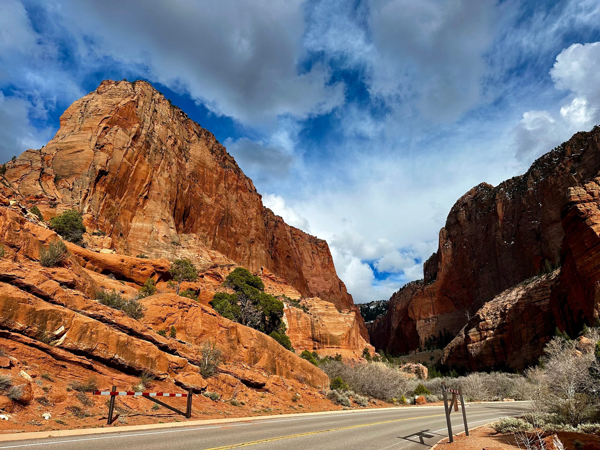
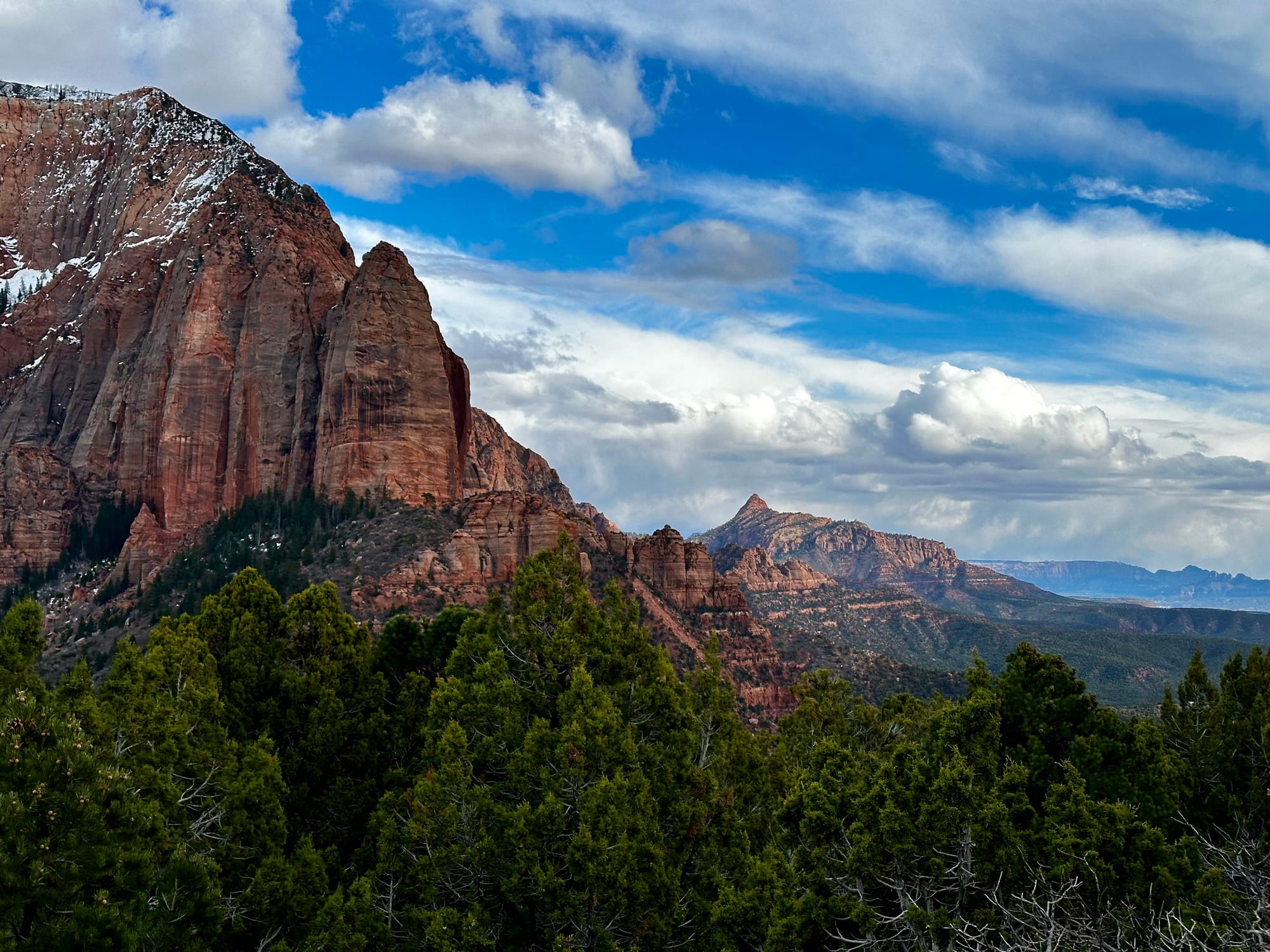
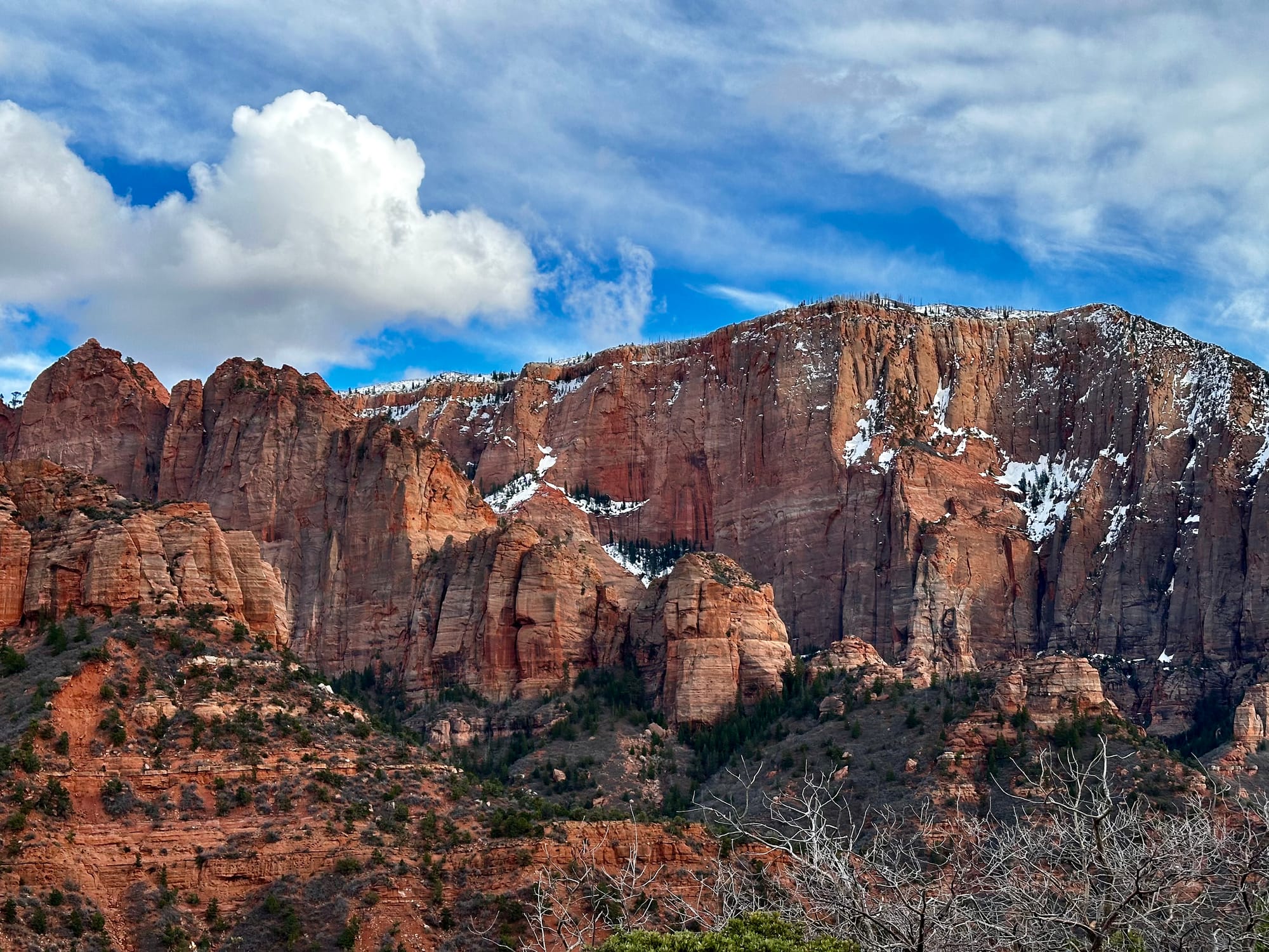
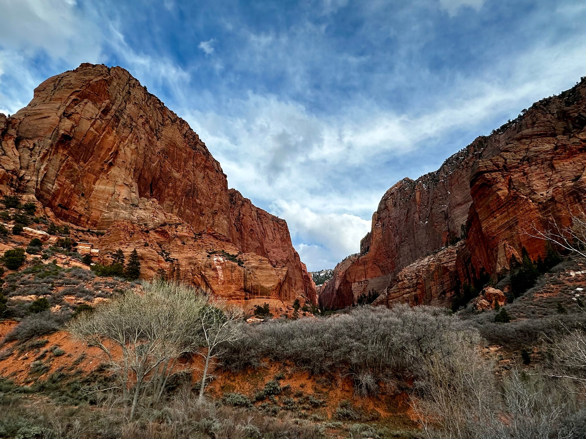
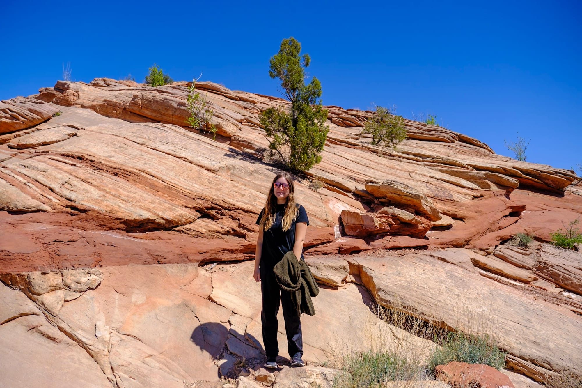
We didn't do much else in Zion, honestly. One evening we drove over to the Kolob Canyons section of the park, which is a separate, much quieter area to the east. There's a visitor center and a short scenic drive with some overlooks and trailheads. And there's no shuttle required – it's always nice to be able to drive your own car through these scenic views.
We didn't do any hiking here; just drove the scenic drive and stopped at the overlooks along the way. It was beautiful and calm, with huge red rocks and great valley views from the top of the road.
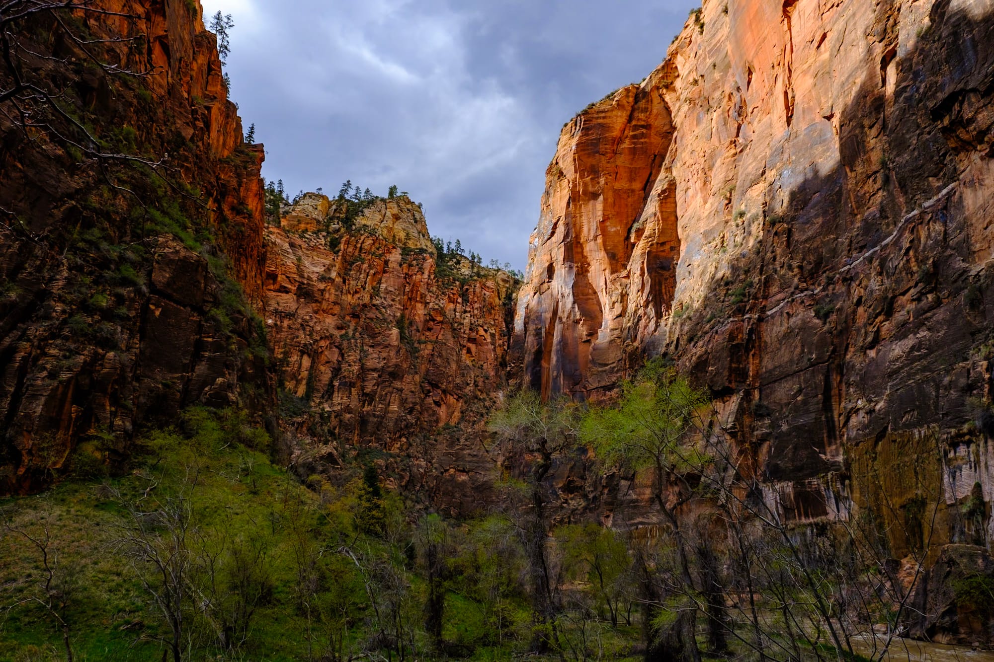
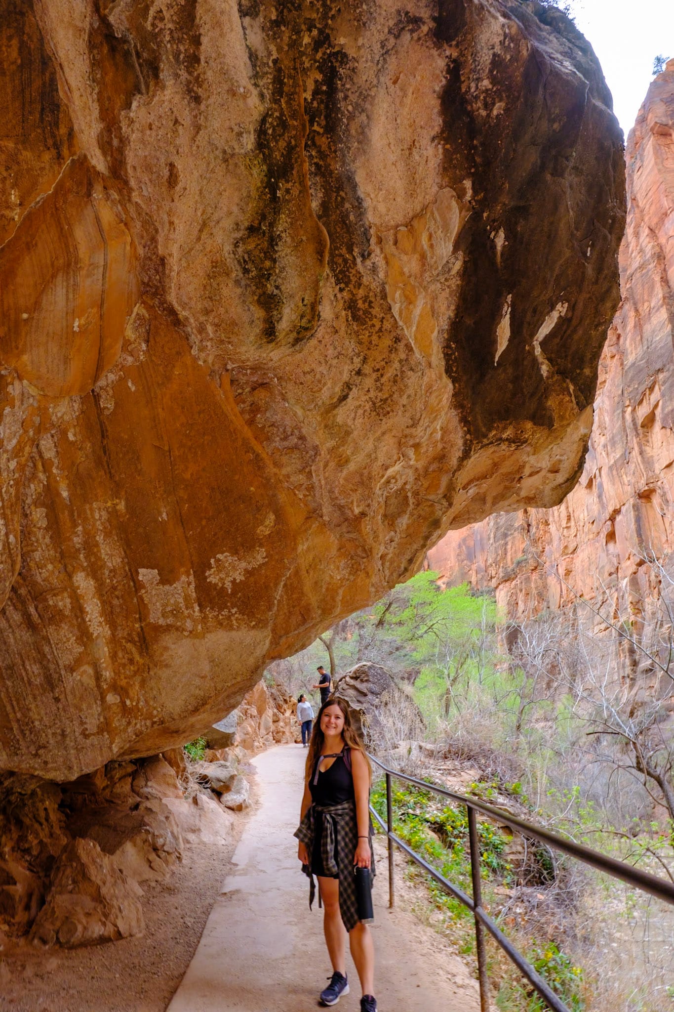
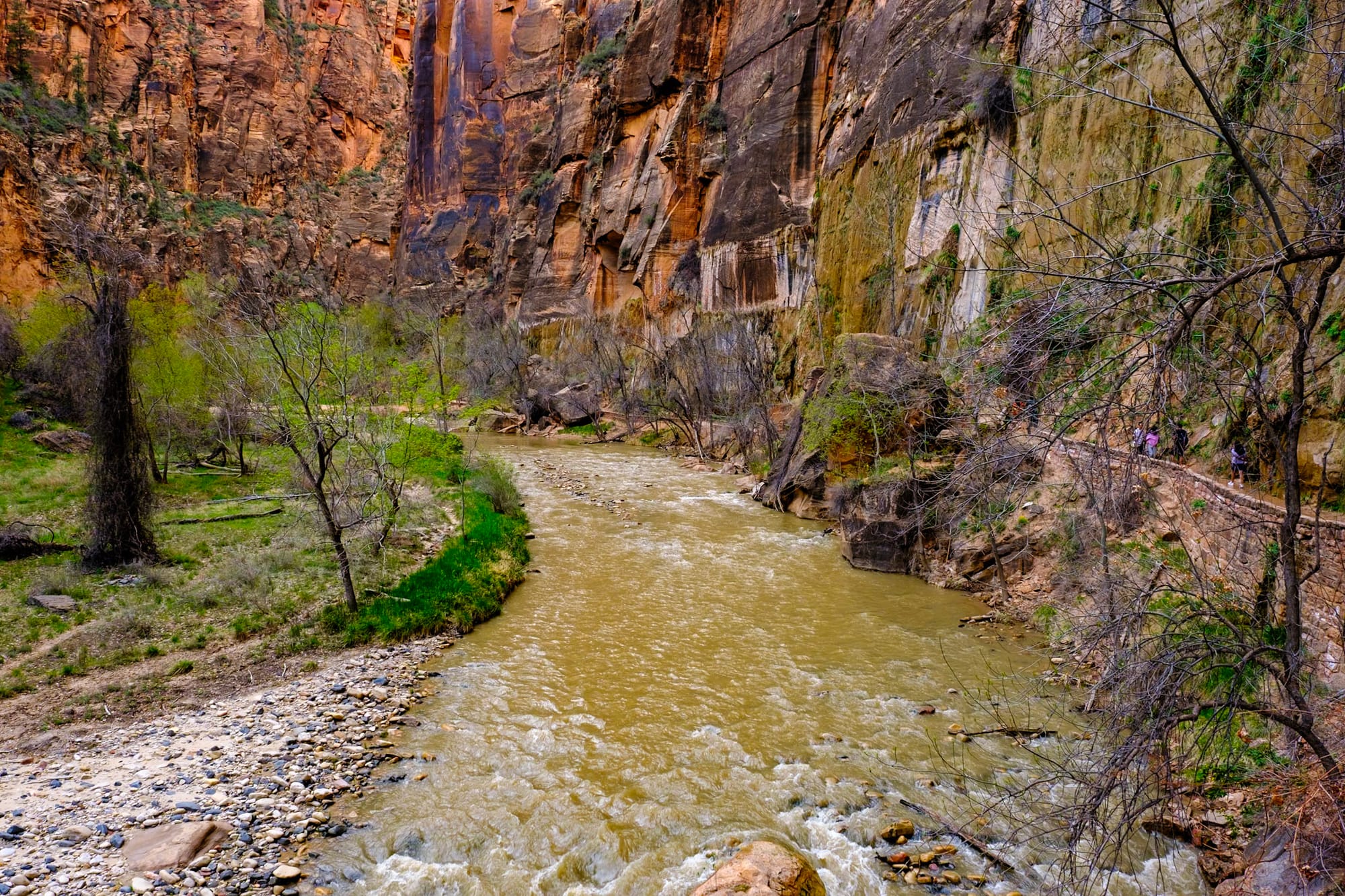
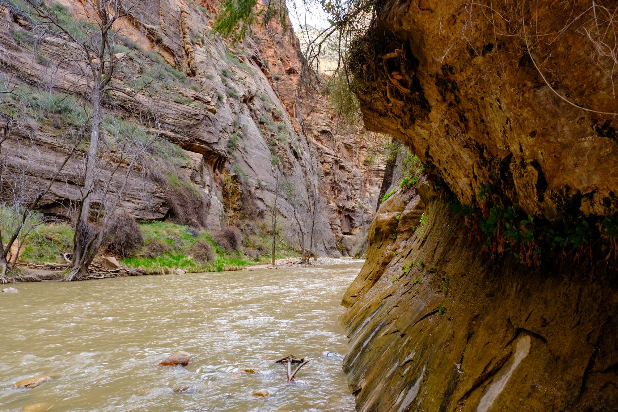
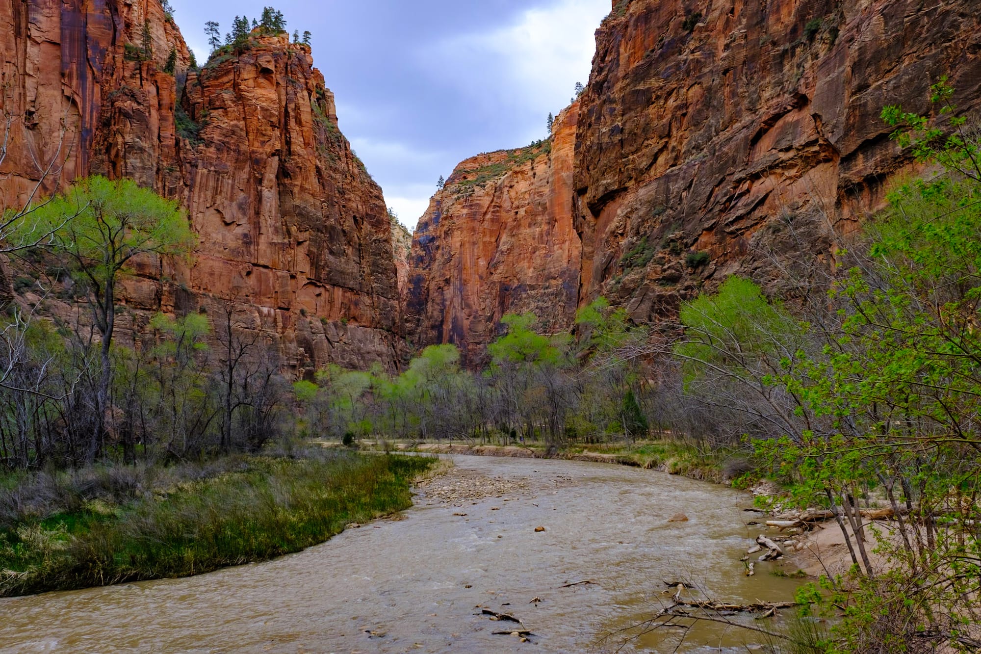
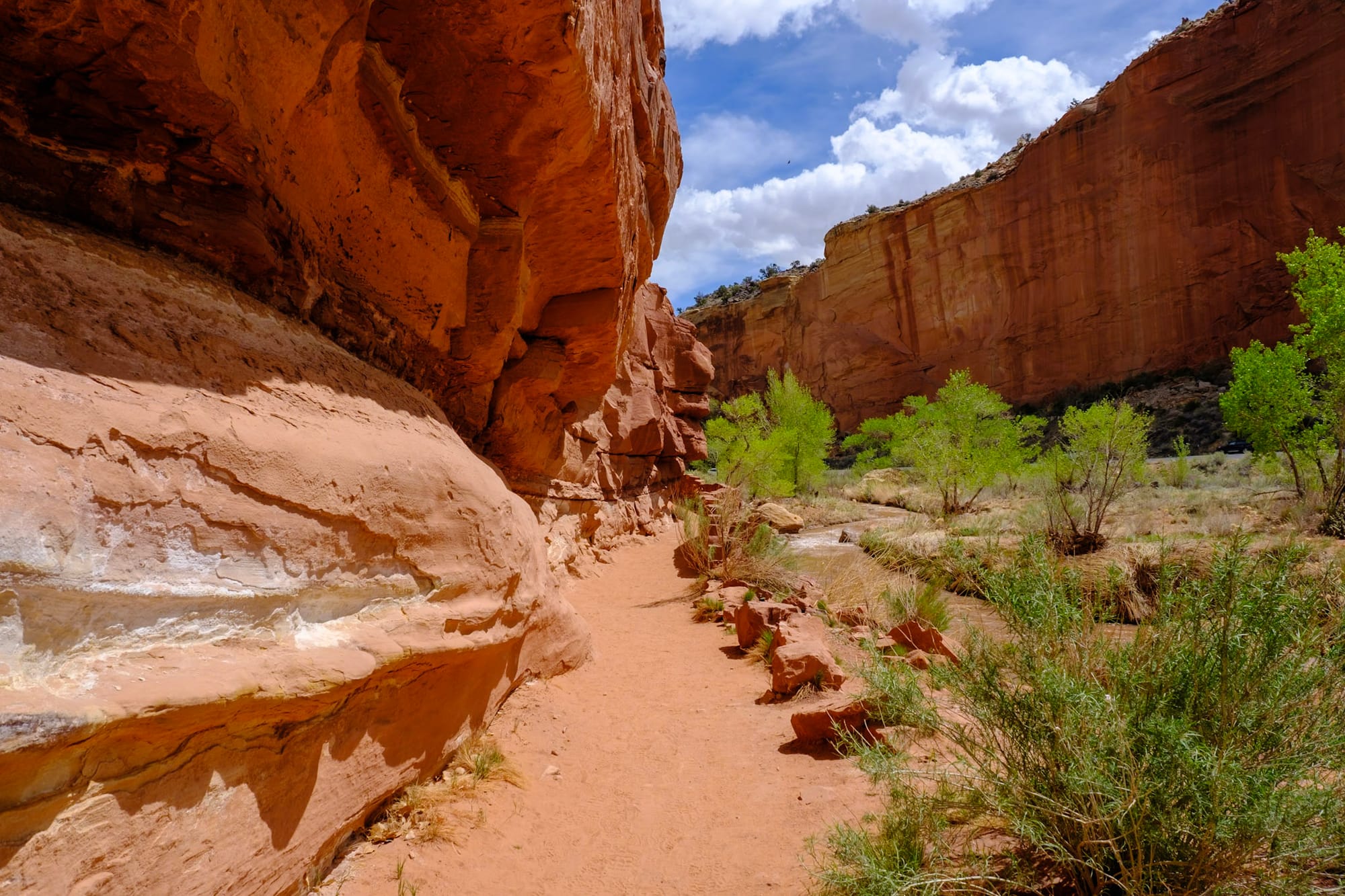
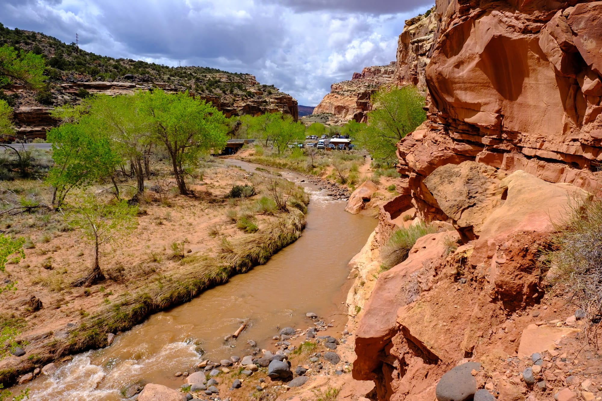
Another afternoon, we took the shuttle in the main area of the park to the very end of the line to hike the Riverside Walk – a 2-mile, mostly flat trail along the river. This is how you get to the other famous hike in Zion, the Narrows, where you hike in the river through the canyons. We didn't do the Narrows (it's not always recommended in spring due to flash floods – also the water was super cold) so we just did the easy, peaceful Riverside Walk instead. As always, the views overlooking the river and up the steep canyon walls were beautiful.
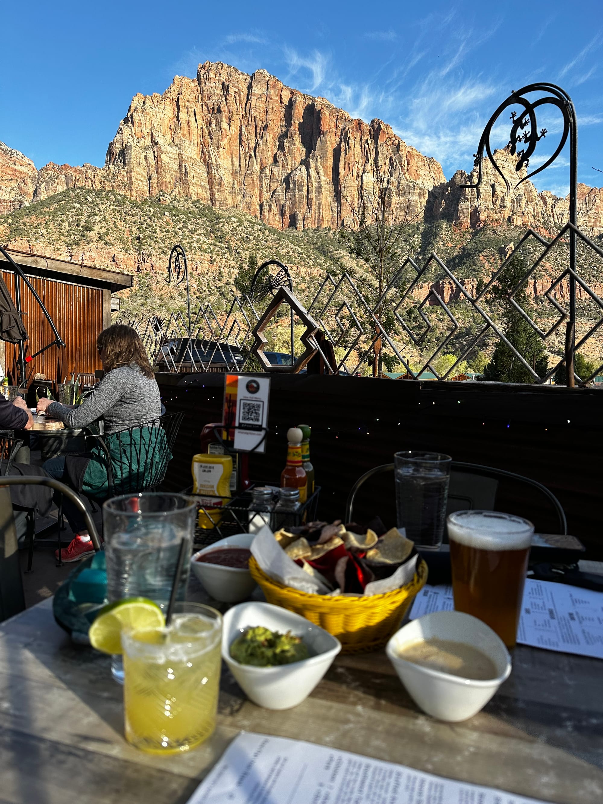
After the Riverside Walk, we went out to eat in Springdale (the cute little town right outside the park) at Whiptail Grill. We got a table on their patio with awesome mountain views. It was super nice eating Mexican food and drinking margaritas in the gorgeous weather at golden hour. All in all, a very good way to end our time in Zion.
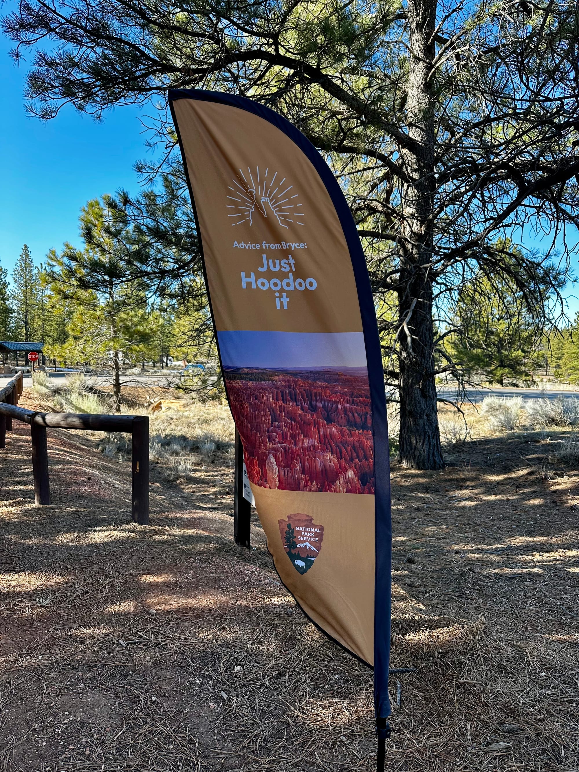
Bryce Canyon
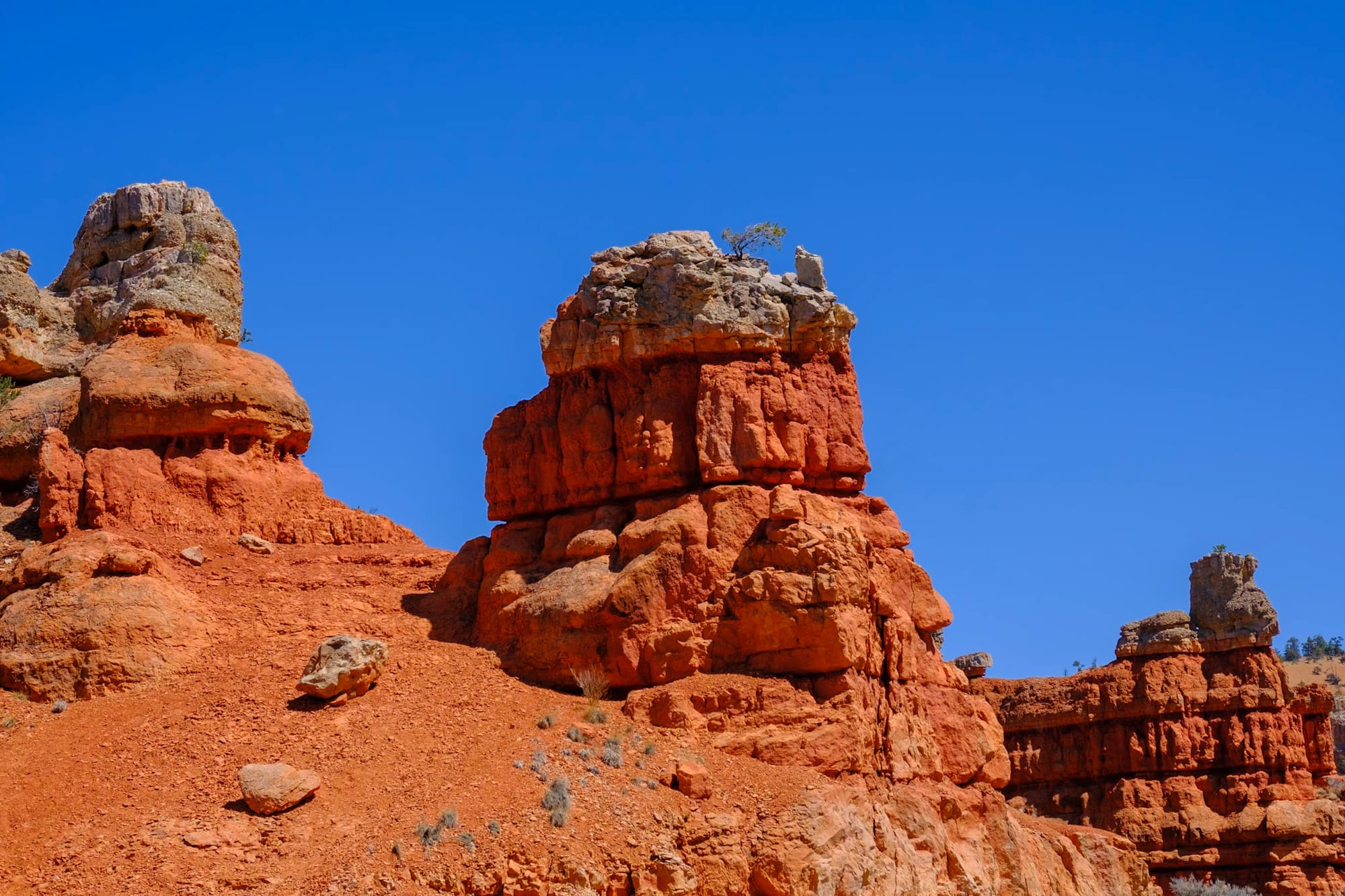
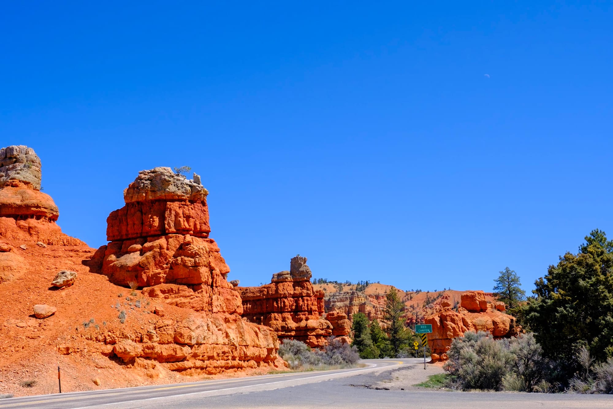
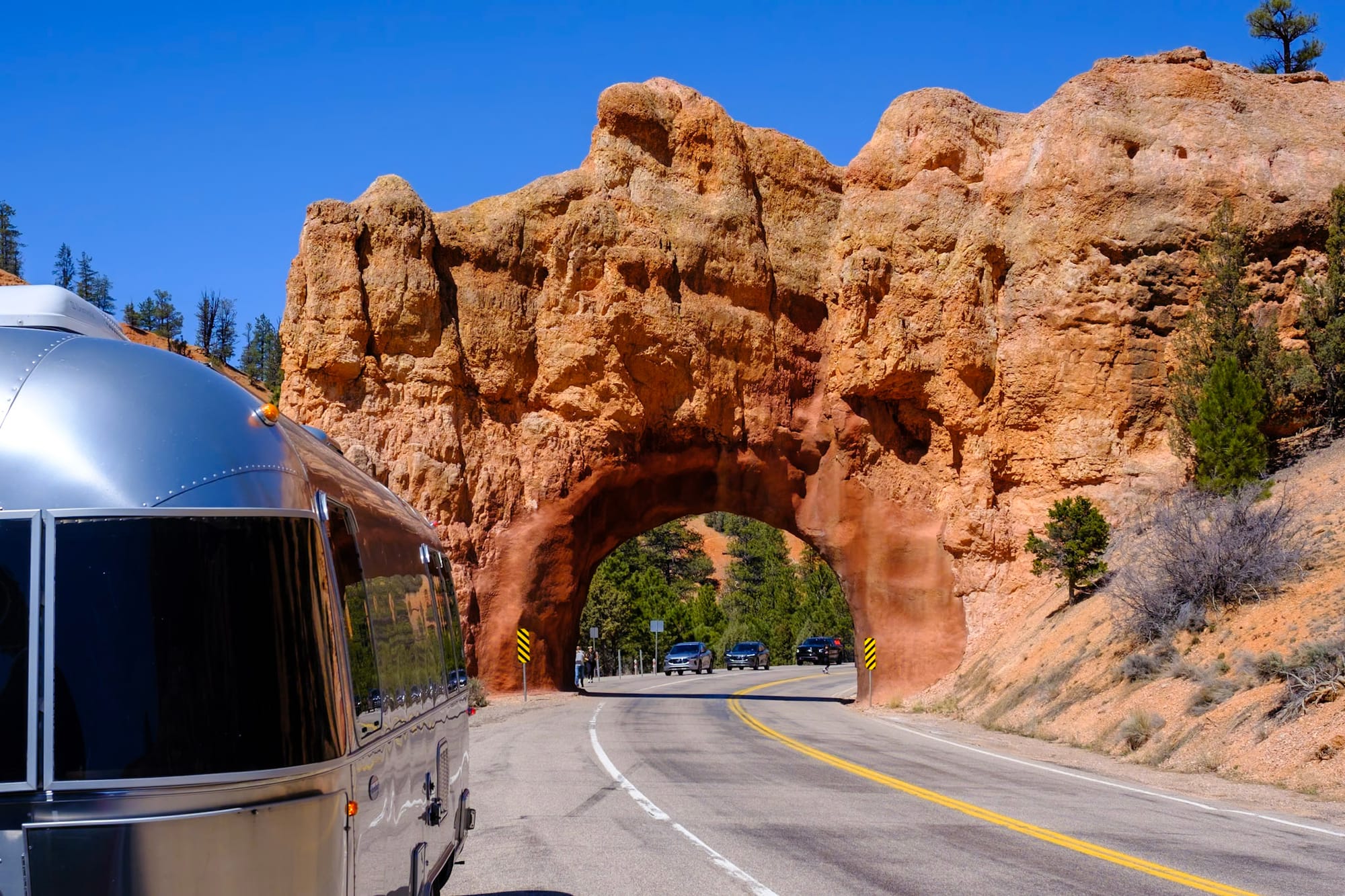
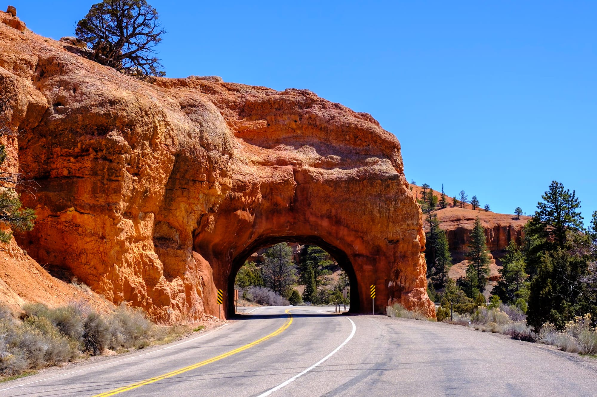
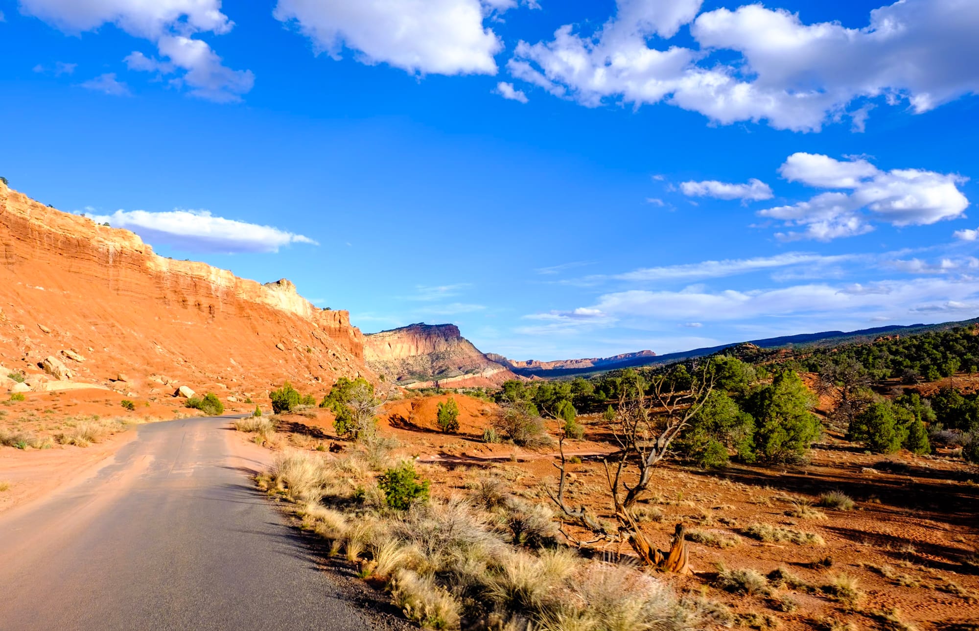
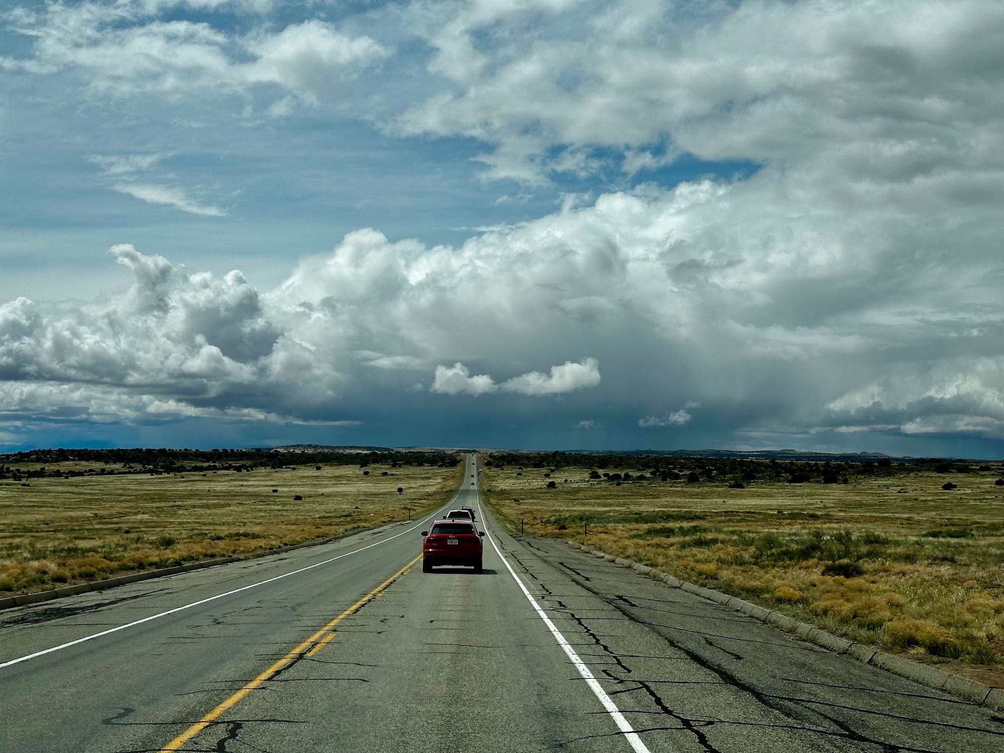
On Saturday, April 13, we said goodbye to our Hurricane Cliffs spot – where we'd been camping for the full 2-week limit – and made the 2-hour drive up to Bryce Canyon National Park. When we were almost there, we made the turn onto Scenic Byway 12, a gorgeous scenic drive through southern Utah from Bryce Canyon to Capitol Reef. There were vivid orange rocks and arches over the road.
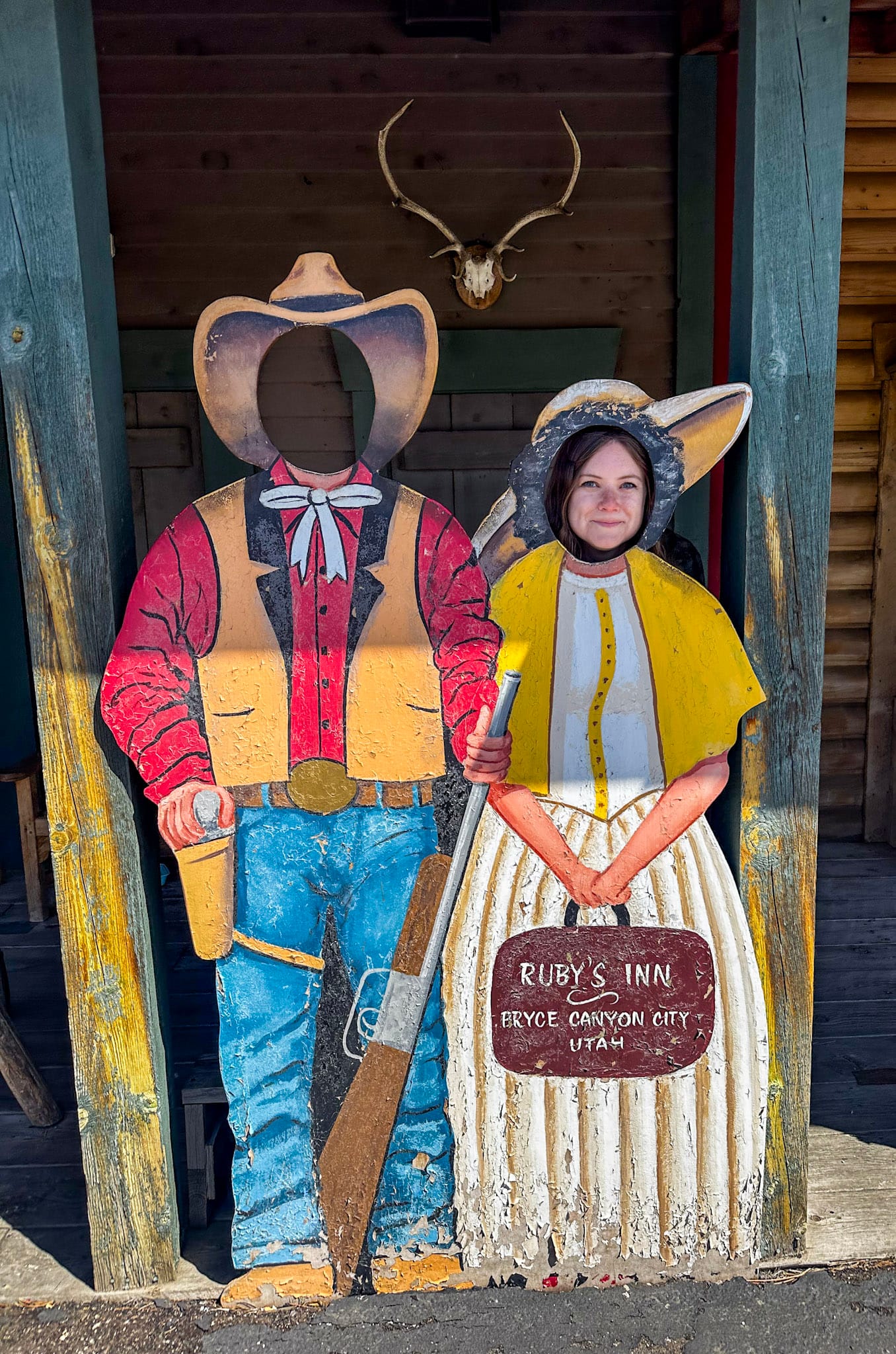
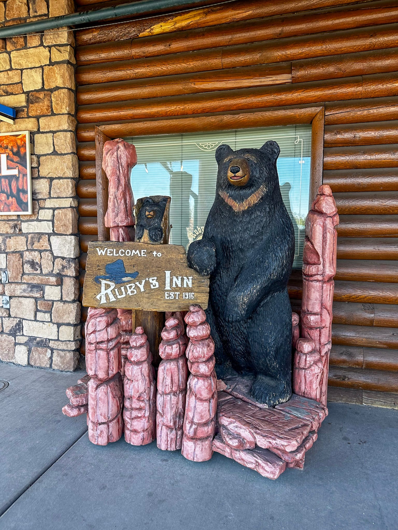
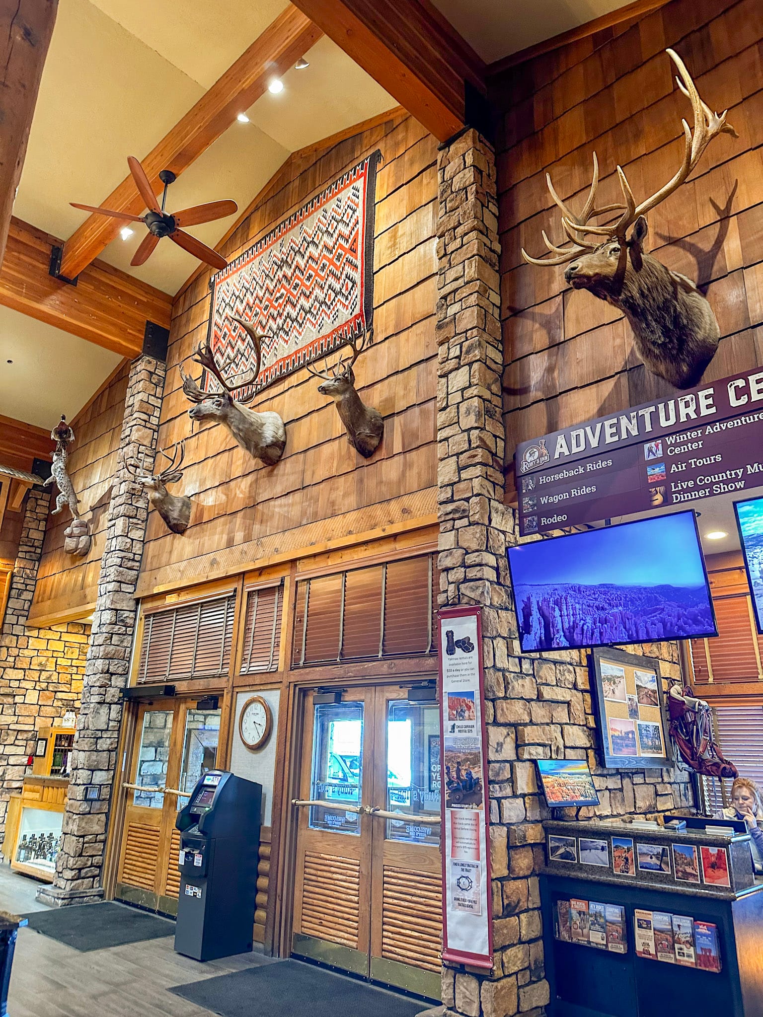
We'd booked a spot at Ruby's RV Park & Campground, which is right next to the historic Ruby's Inn in Bryce Canyon City. Ruby's Inn was started back in 1919, just before Bryce Canyon was established as a protected park, by a rancher who wanted to host people visiting the beautiful area. It's obviously grown a lot over the years, but it still has that old-west charm. Bryce Canyon City, the tiny "town" next to the national park, is almost all Ruby's – the big lodge hotel and attached general store/gift shop and restaurant and the campground next door take up one side of the street. Then on the other side, there's a small strip of old western-themed shops, another hotel/restaurant, and a gas station.
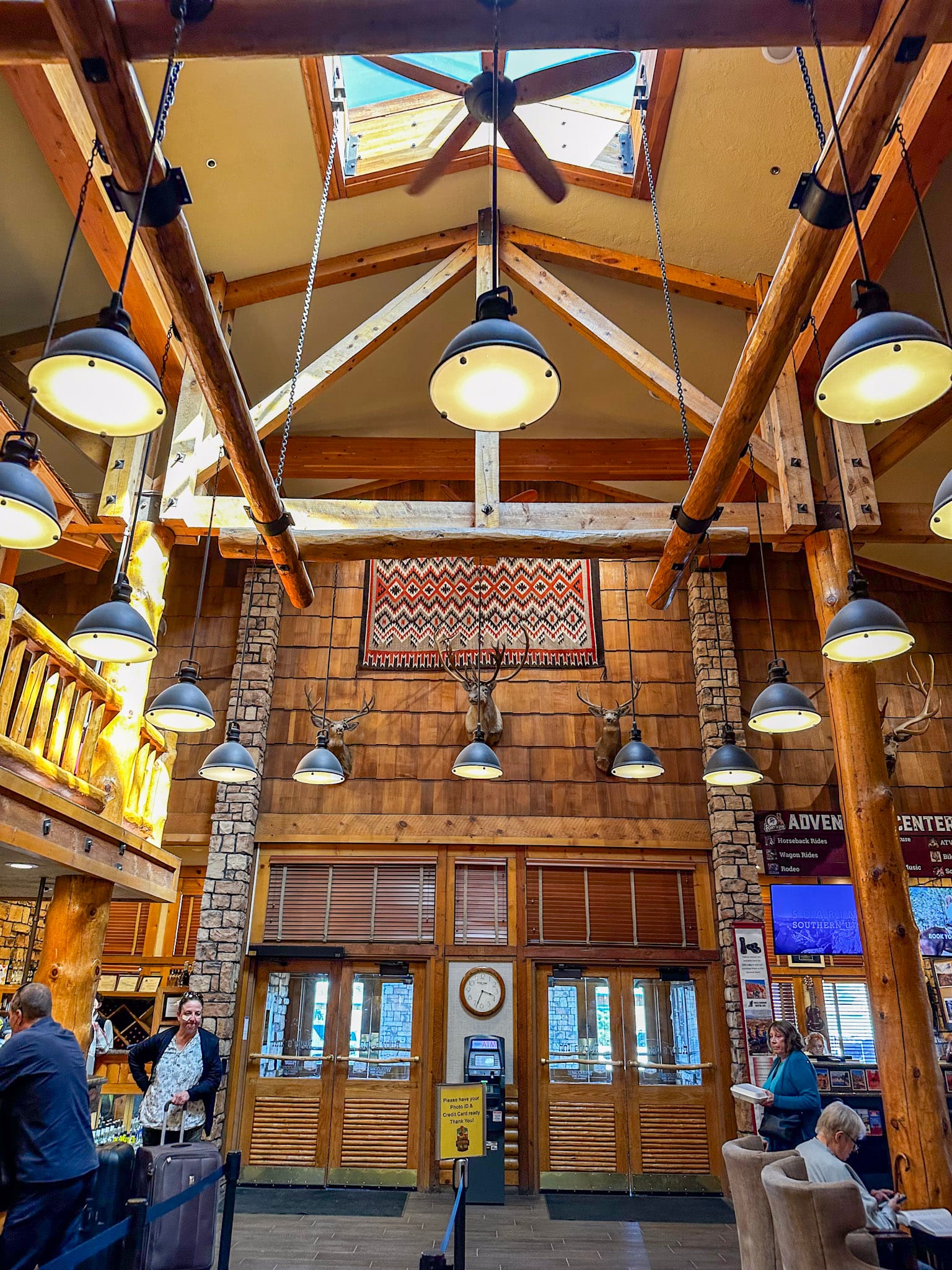
The area is easily walkable and bikeable, and the Bryce Canyon park shuttle stops in multiple places. We biked to get groceries at the general store and shop around. Our campground was big, with a variety of both tent sites and RV hookup sites. We had a water/electric spot near the front among the trees. It was only a 10-minute drive down the road into the park.
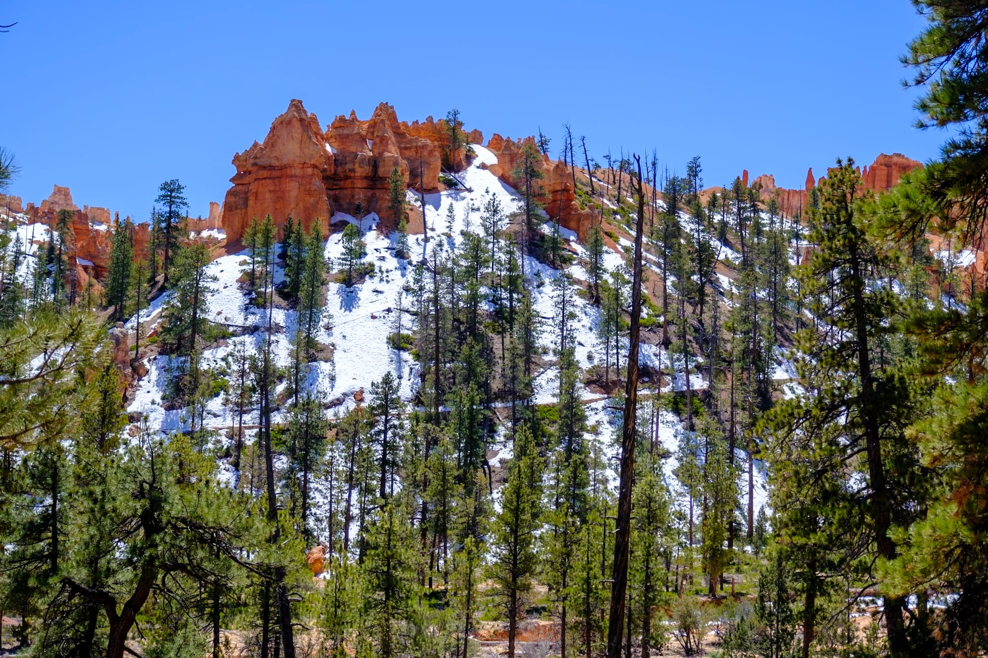
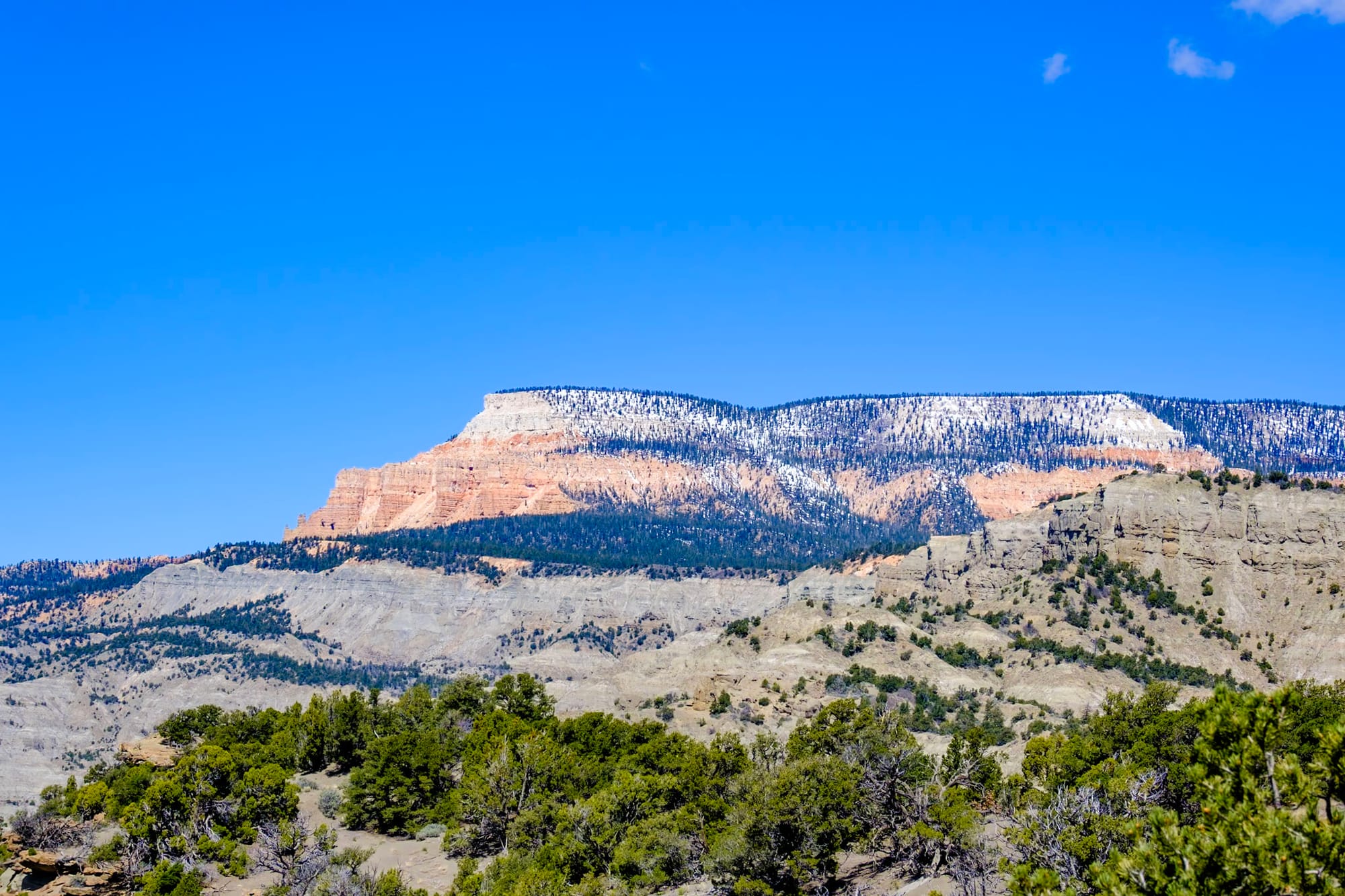
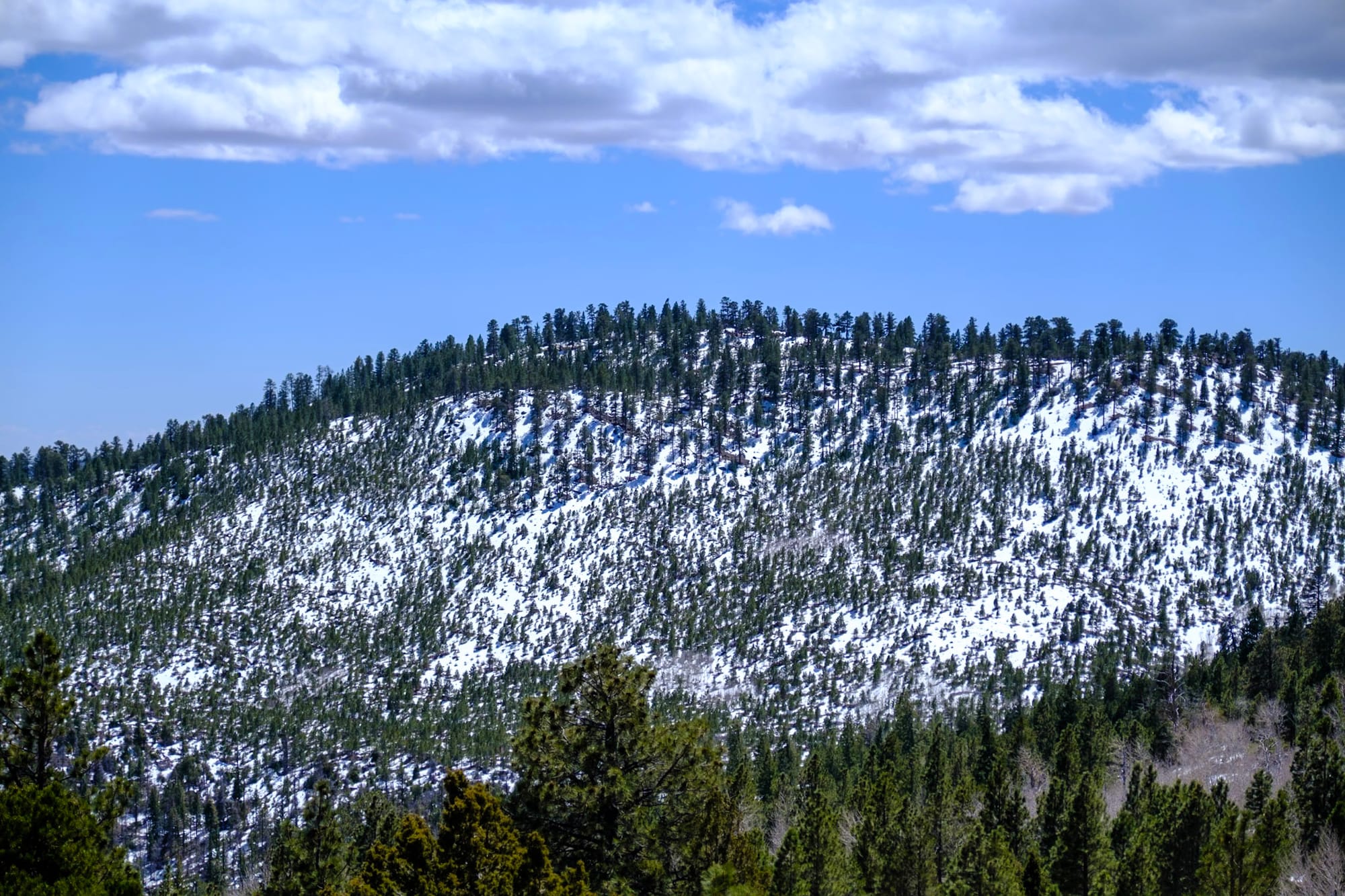
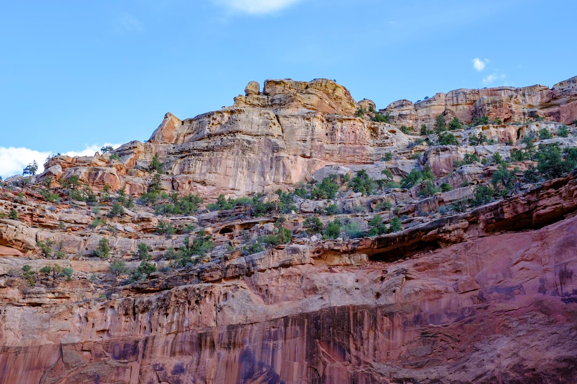
We were surprised at how much colder it was in Bryce Canyon. The average elevation in the park is about 8,000 feet – double what it was in Zion.
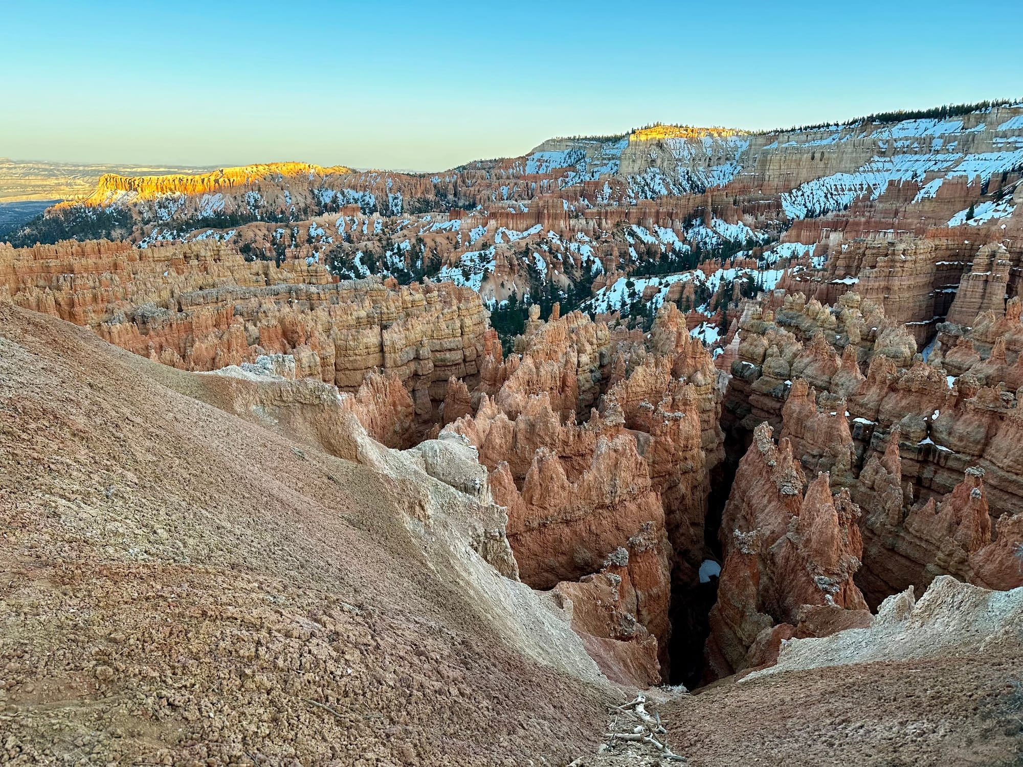
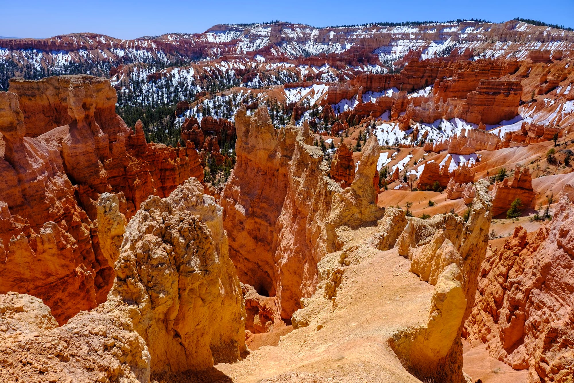
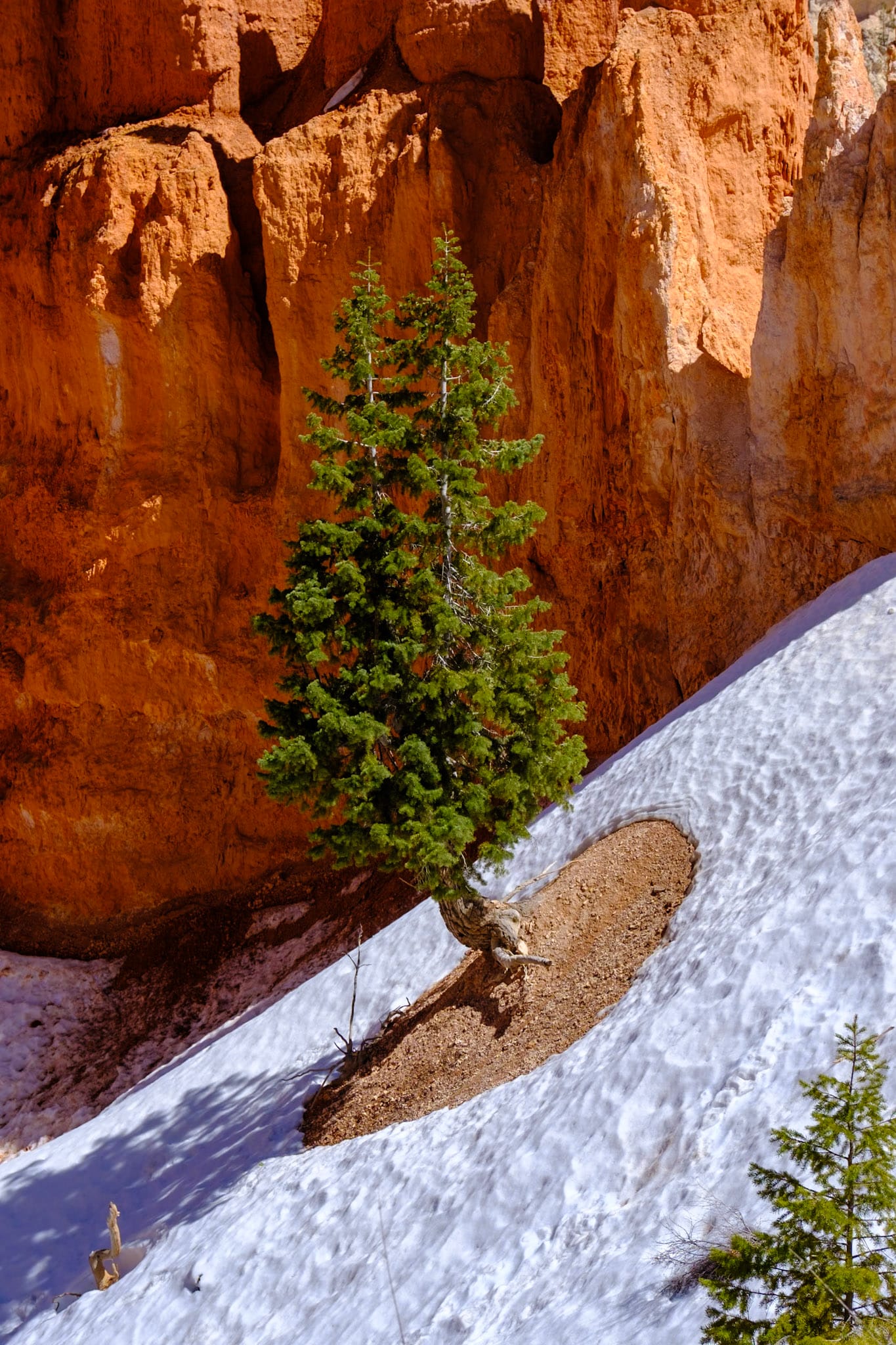
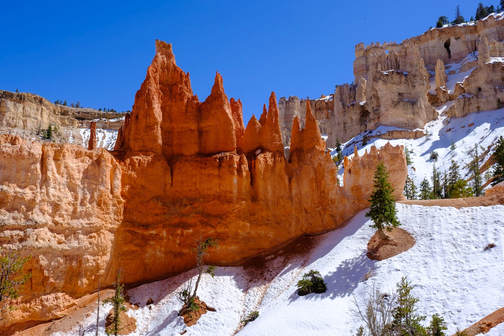
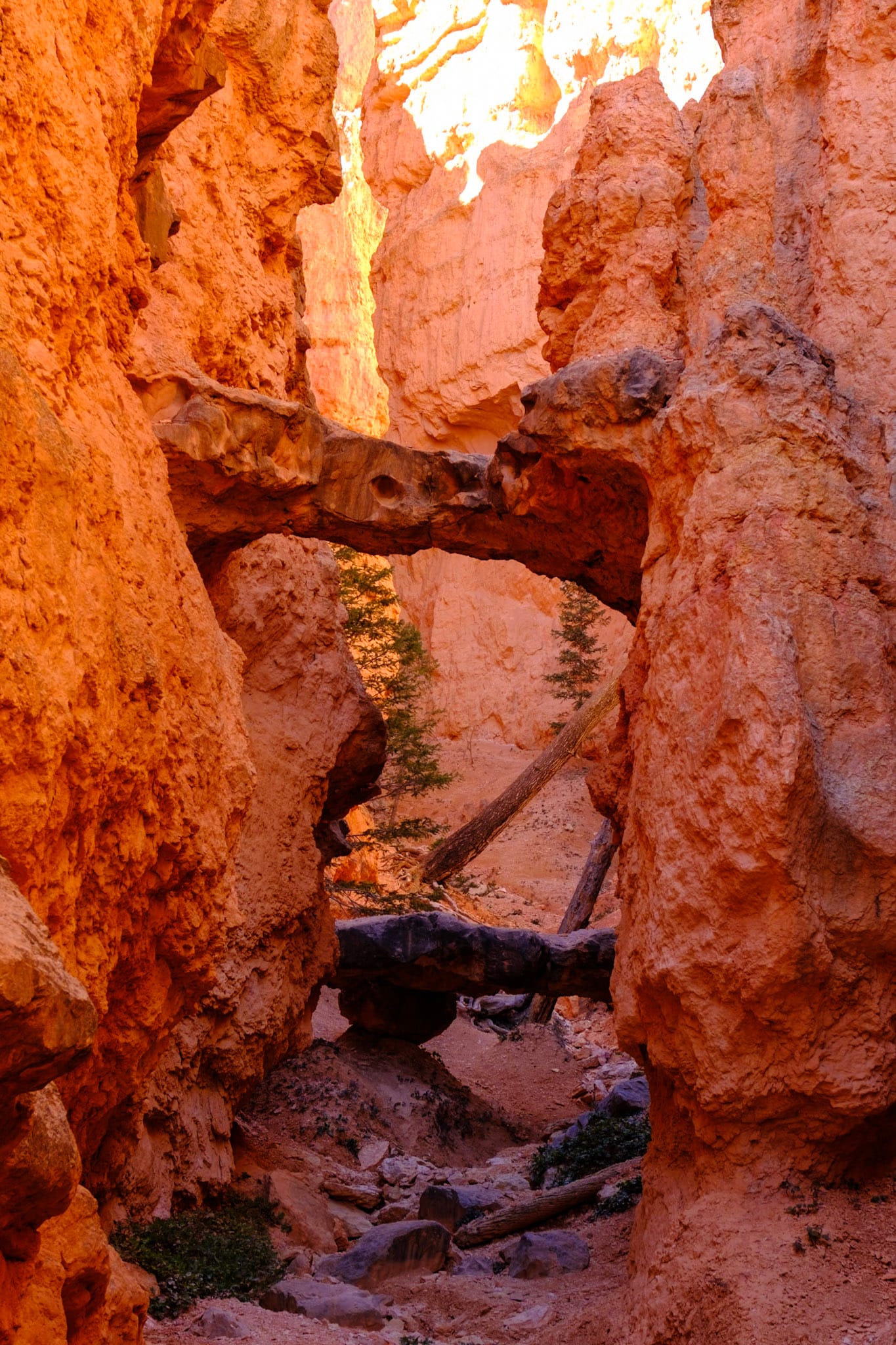
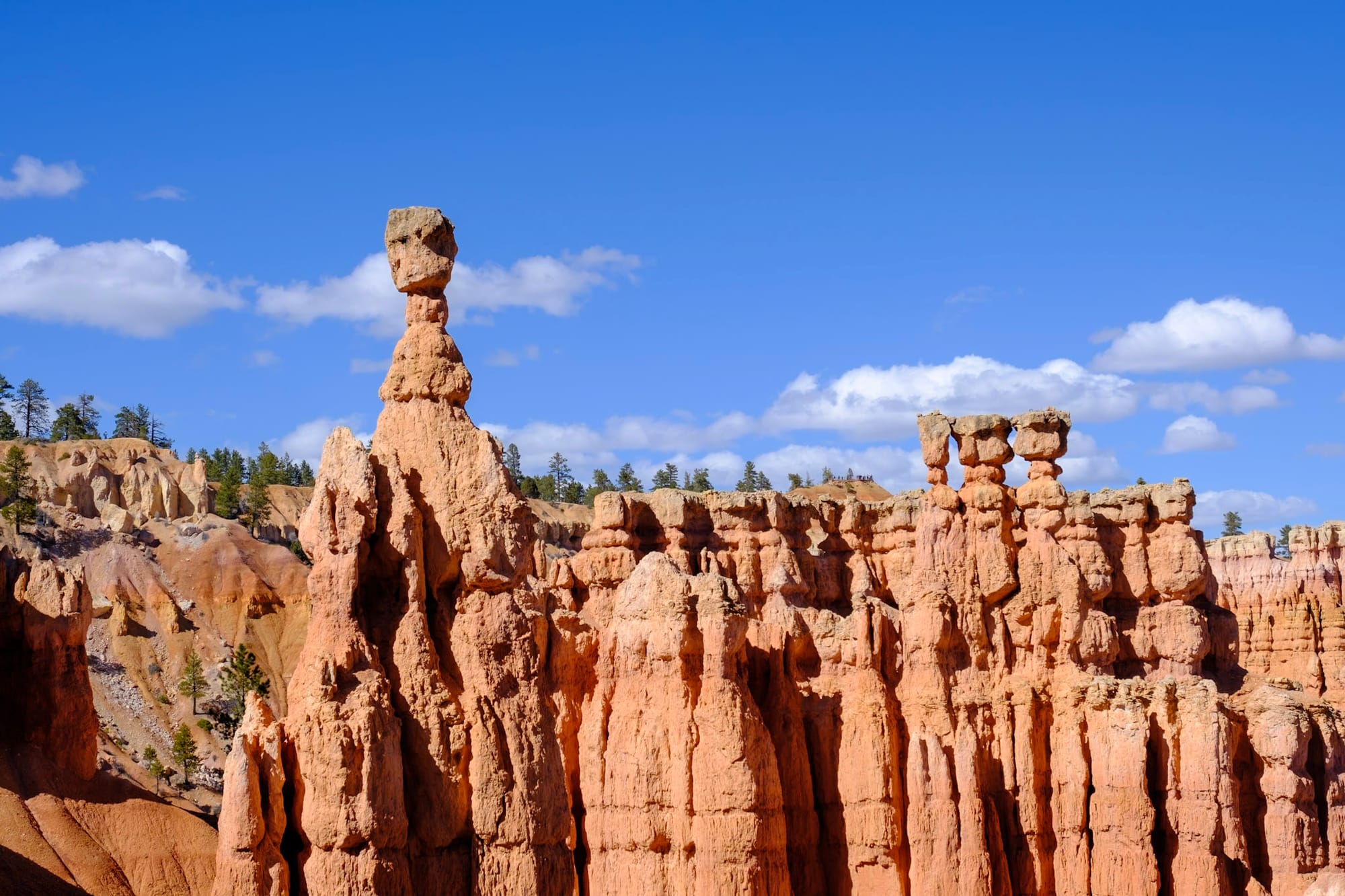
The first night after we arrived, we drove into the park to watch the sunset, and it was COLD. But it was so beautiful, with a light dusting of snow over the hoodoos, which were still so bright orange even in the fading light. Bryce Canyon is such an odd, otherwordly place. It's one of the prettiest parks.
We'd heard on a podcast that Bryce Canyon is a good place to see the Earth's penumbra, which is the Earth's shadow, at sunset. You can sometimes see a dark, bluish-purple band across the horizon. We weren't 100% sure what we were looking for, and it actually just looks like part of the sunset colors, but we did end up seeing it, apparently. It was a beautiful and quiet sunset in the park, but I was not used to being that cold again, haha.
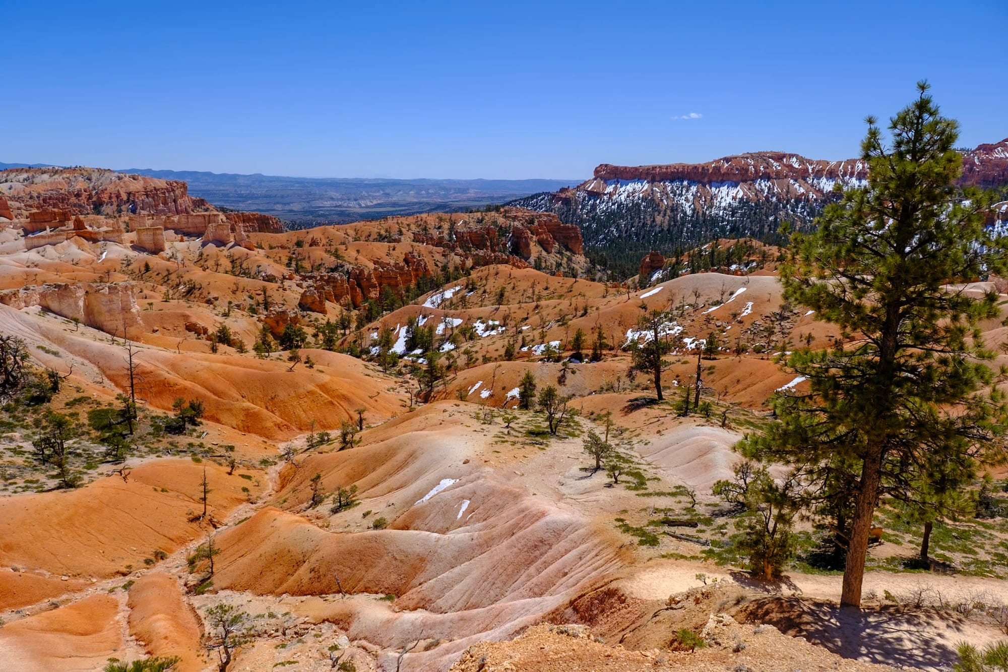
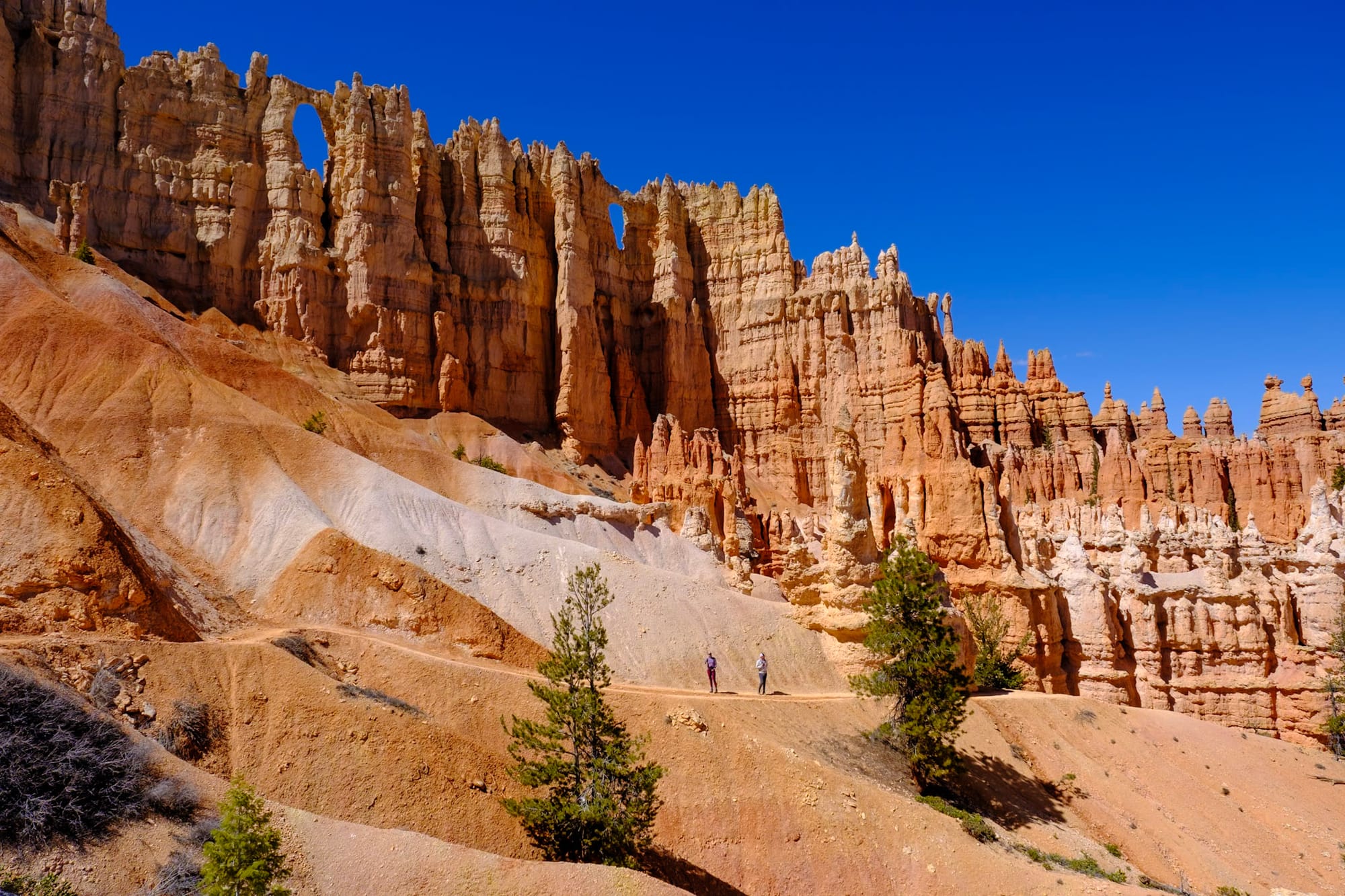
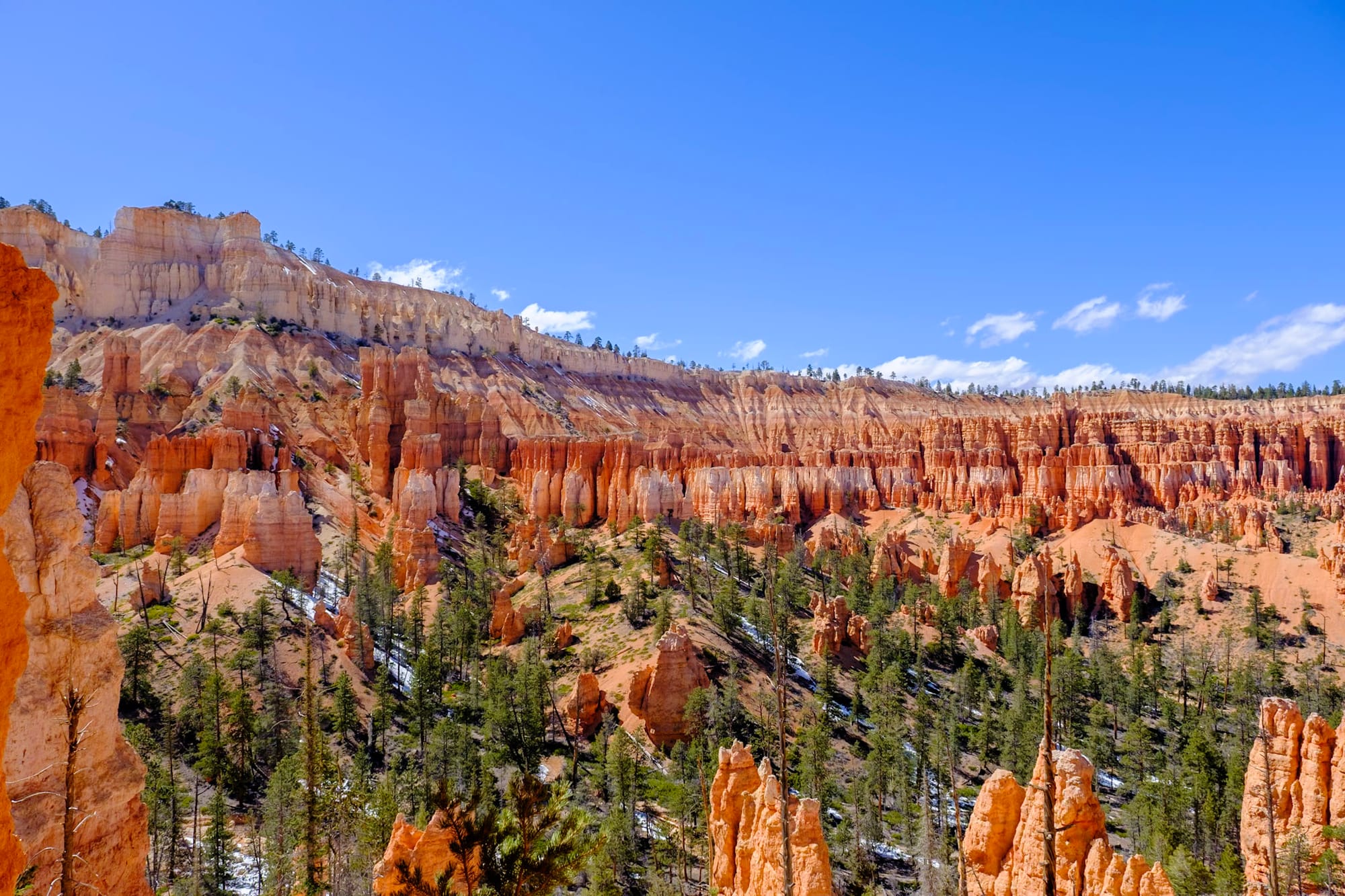
Bryce Canyon is a pretty small, easy to see park. If you wanted to, you could just drive or take the shuttle to the four most popular overlooks along the main "amphitheater" section of the park – Sunrise Point, Sunset Point, Inspiration Point, and Bryce Point – or you can walk the Rim Trail along the top between them. Then you could drive along the rest of the scenic road, which gets you to some less-popular overlooks and trailheads. There are several trails that descend down into the canyon, with a good variety of shorter and longer hikes.
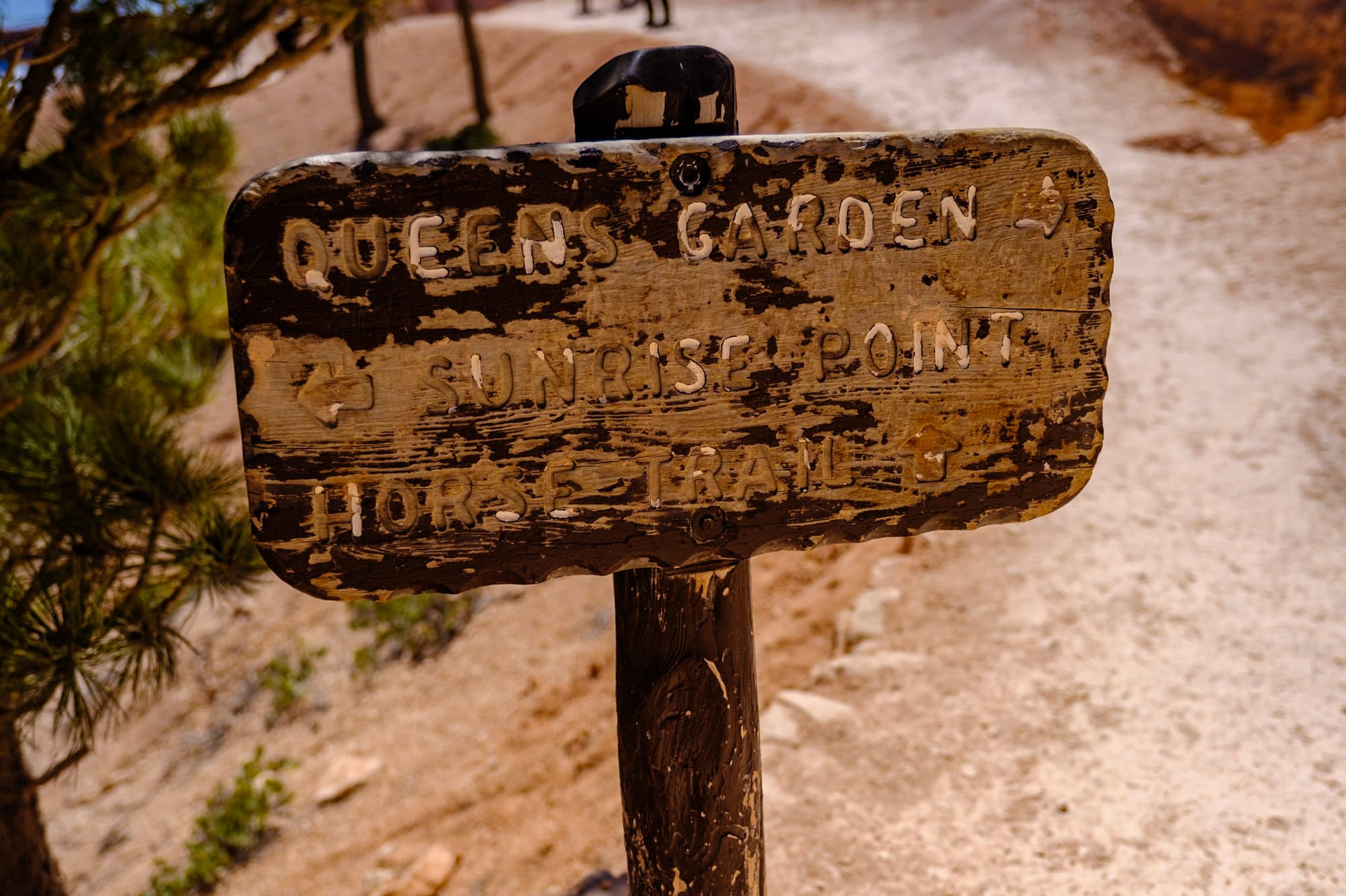
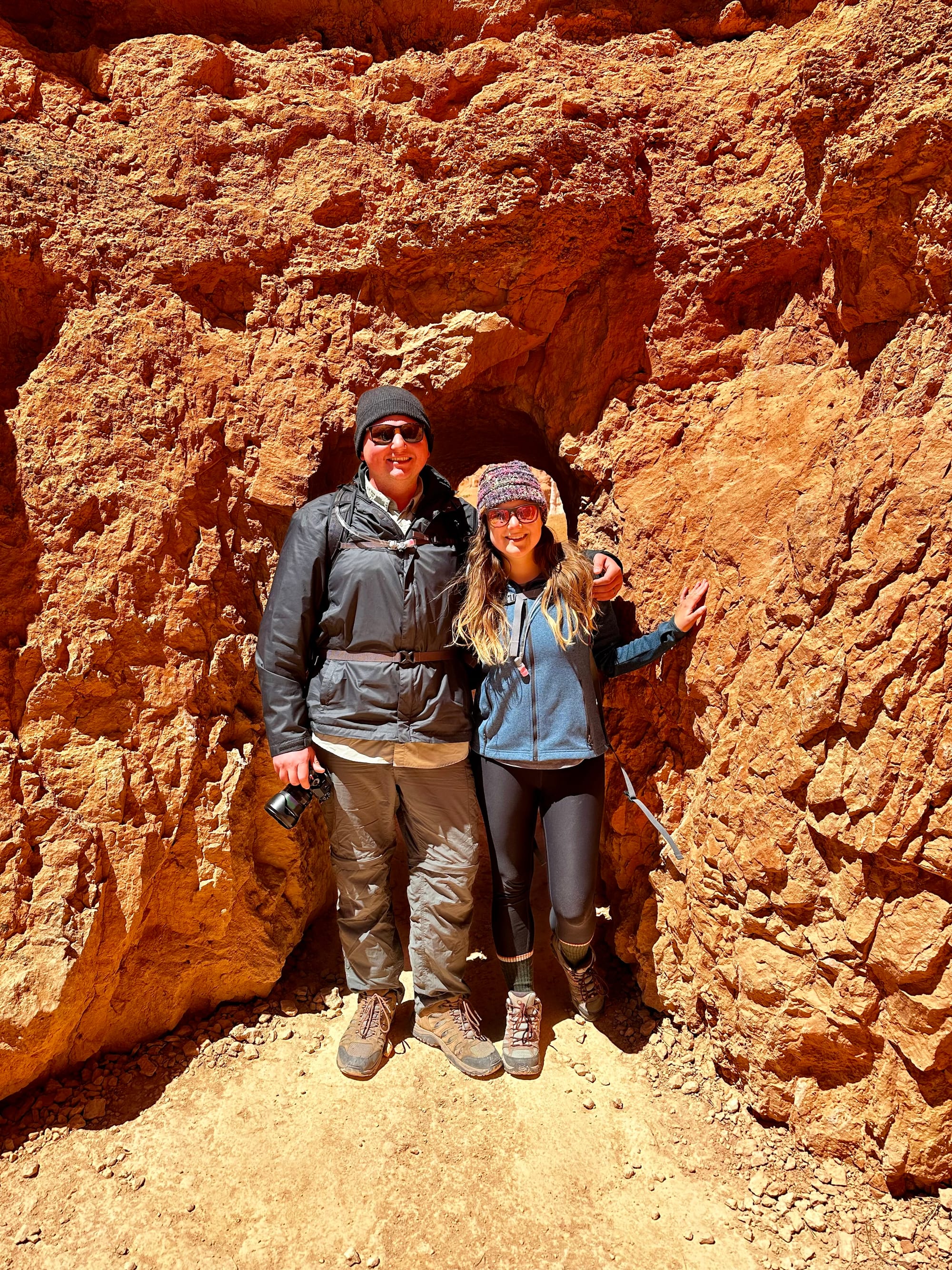
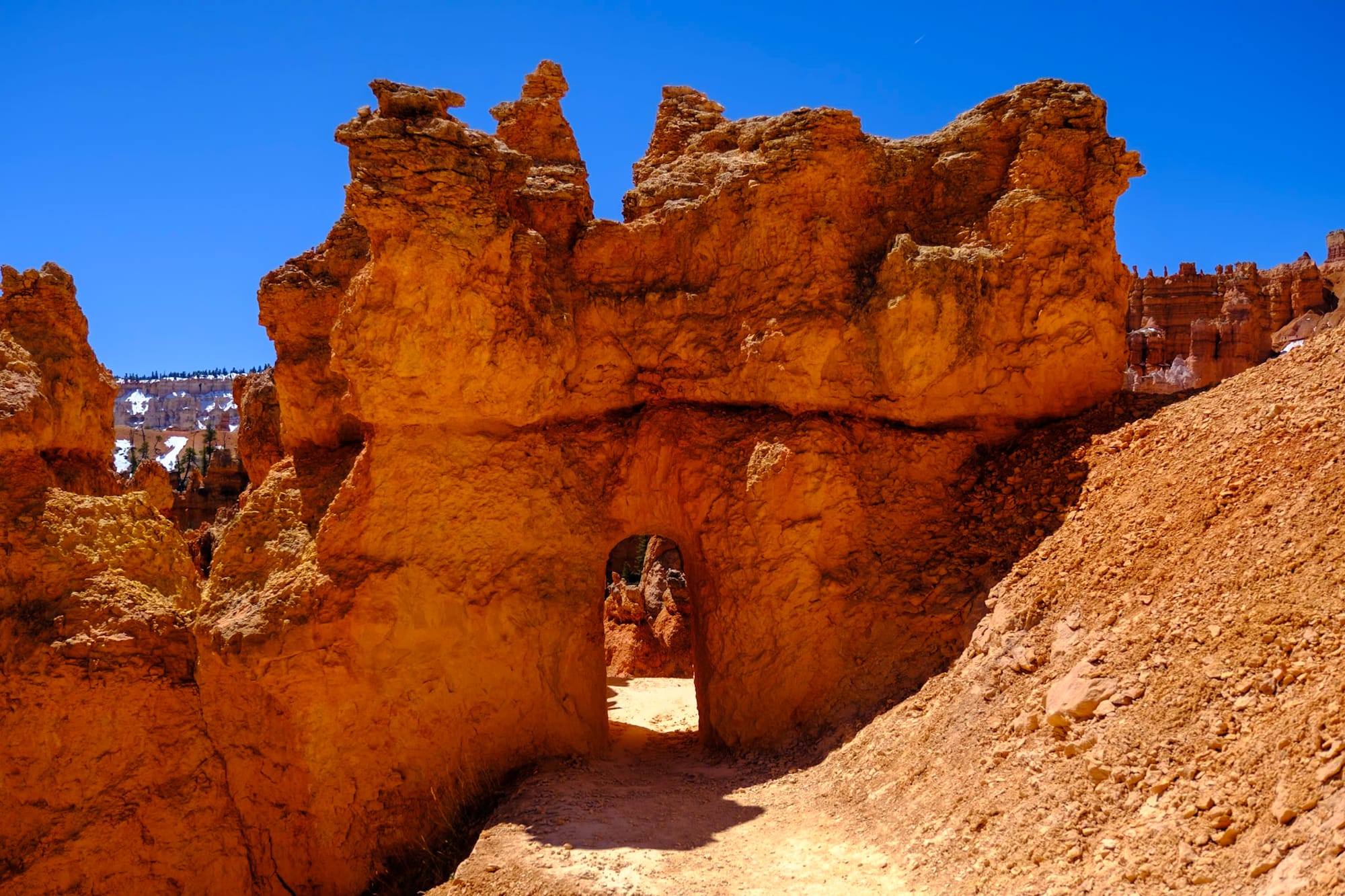
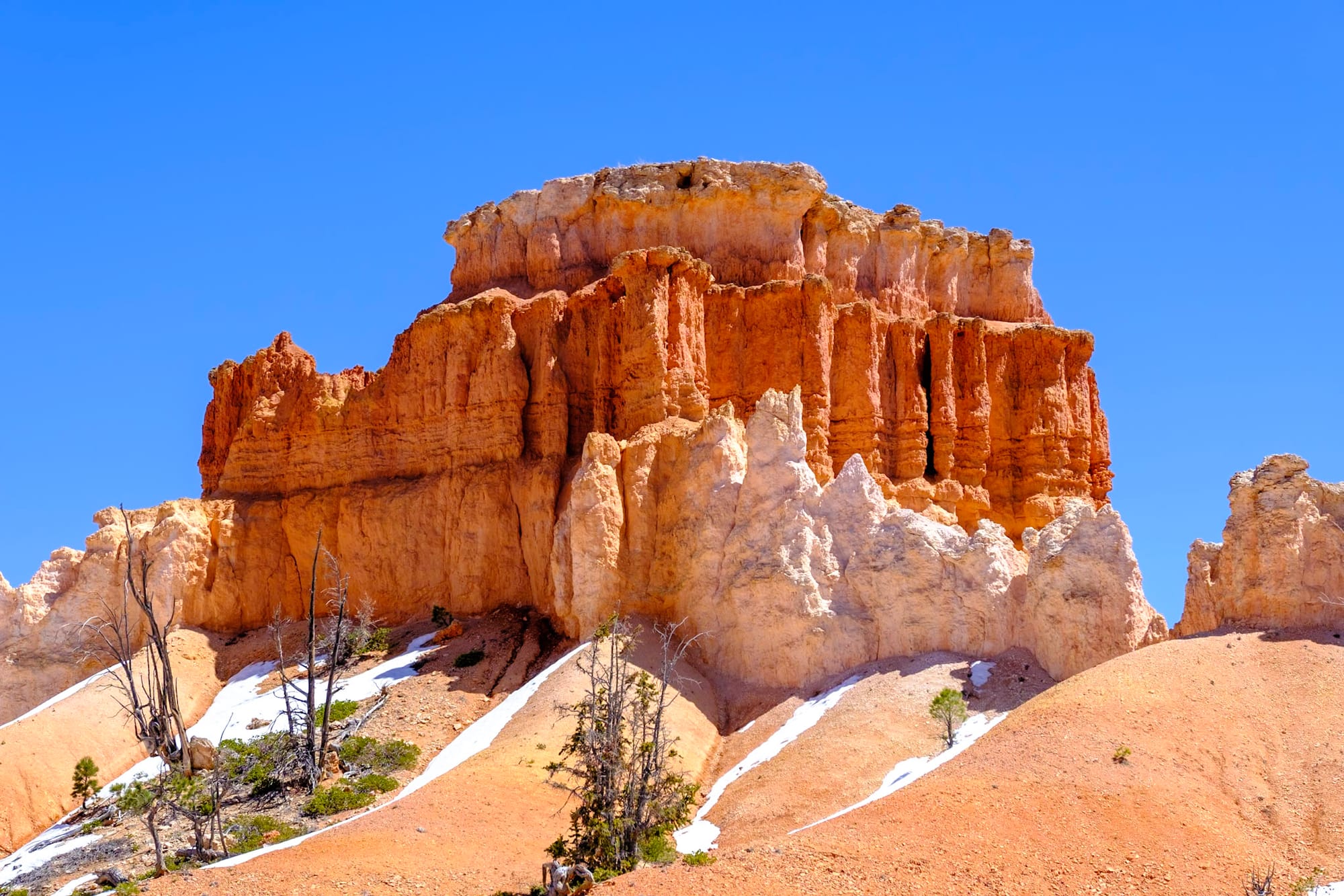
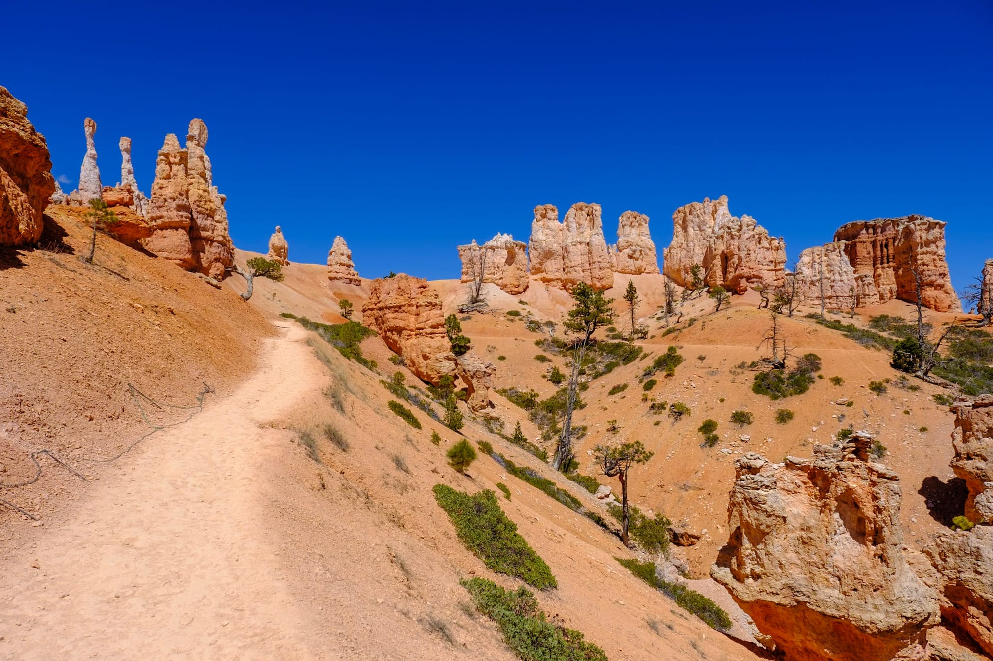
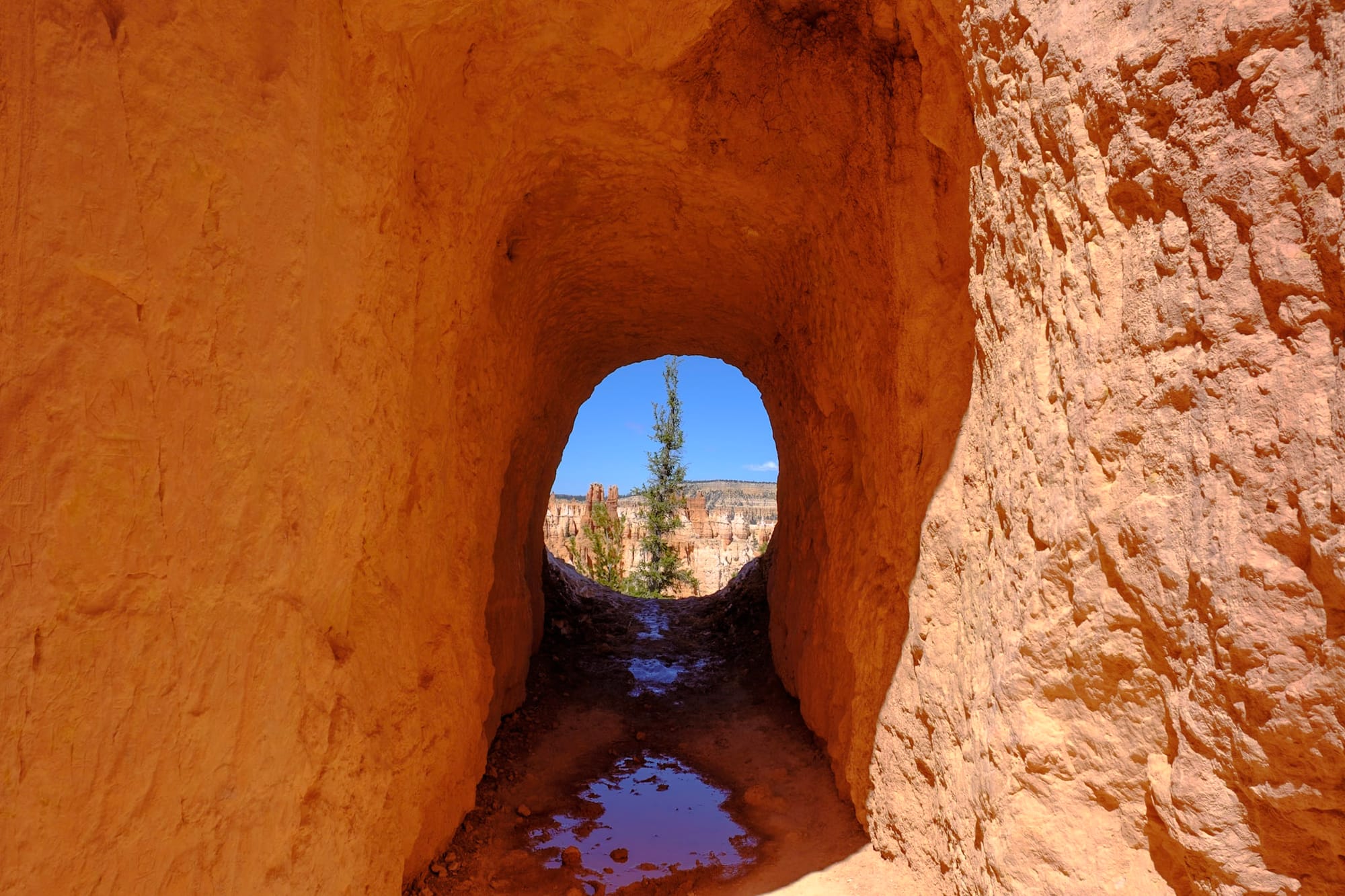
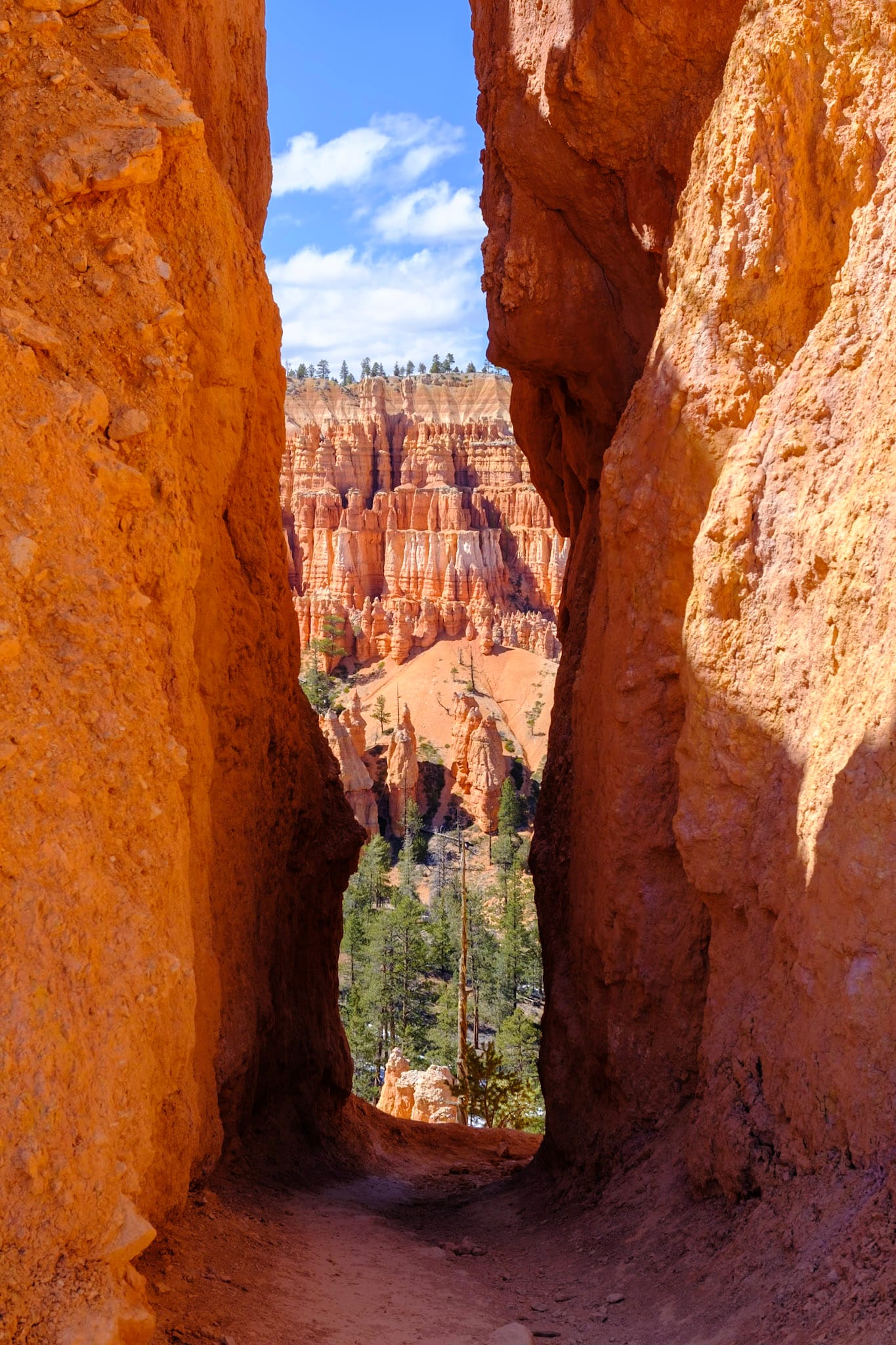
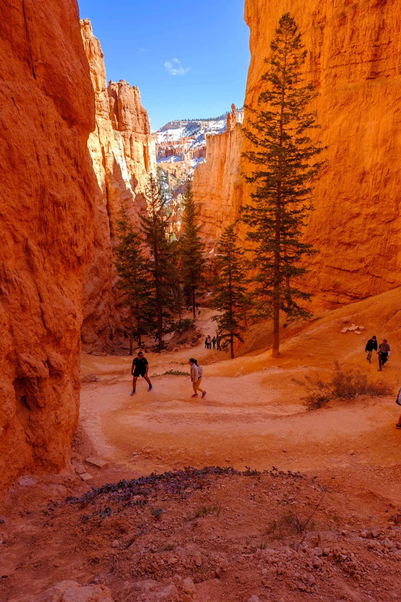
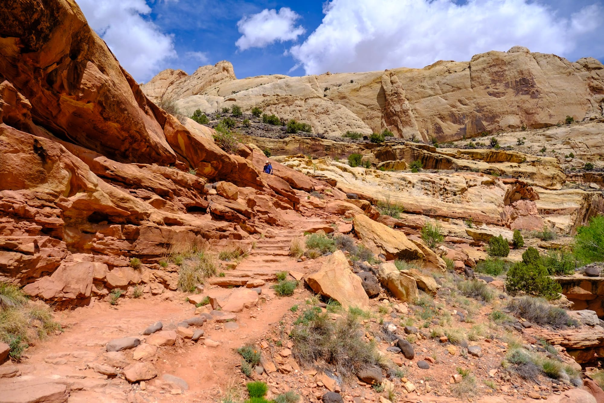
On Sunday, we wanted to do a good hike down into the canyon. We chose the Figure 8 Loop, which is a combination of the Queens Garden, Peekaboo Loop and Navajo trails. Each of them is a good and popular trail on its own, but combining them (about 6 miles total) gave us an ultimate tour of Bryce Canyon. This was definitely a contender for our favorite hike we did in Utah and one of my favorite hikes ever. (SO many pictures below lol).
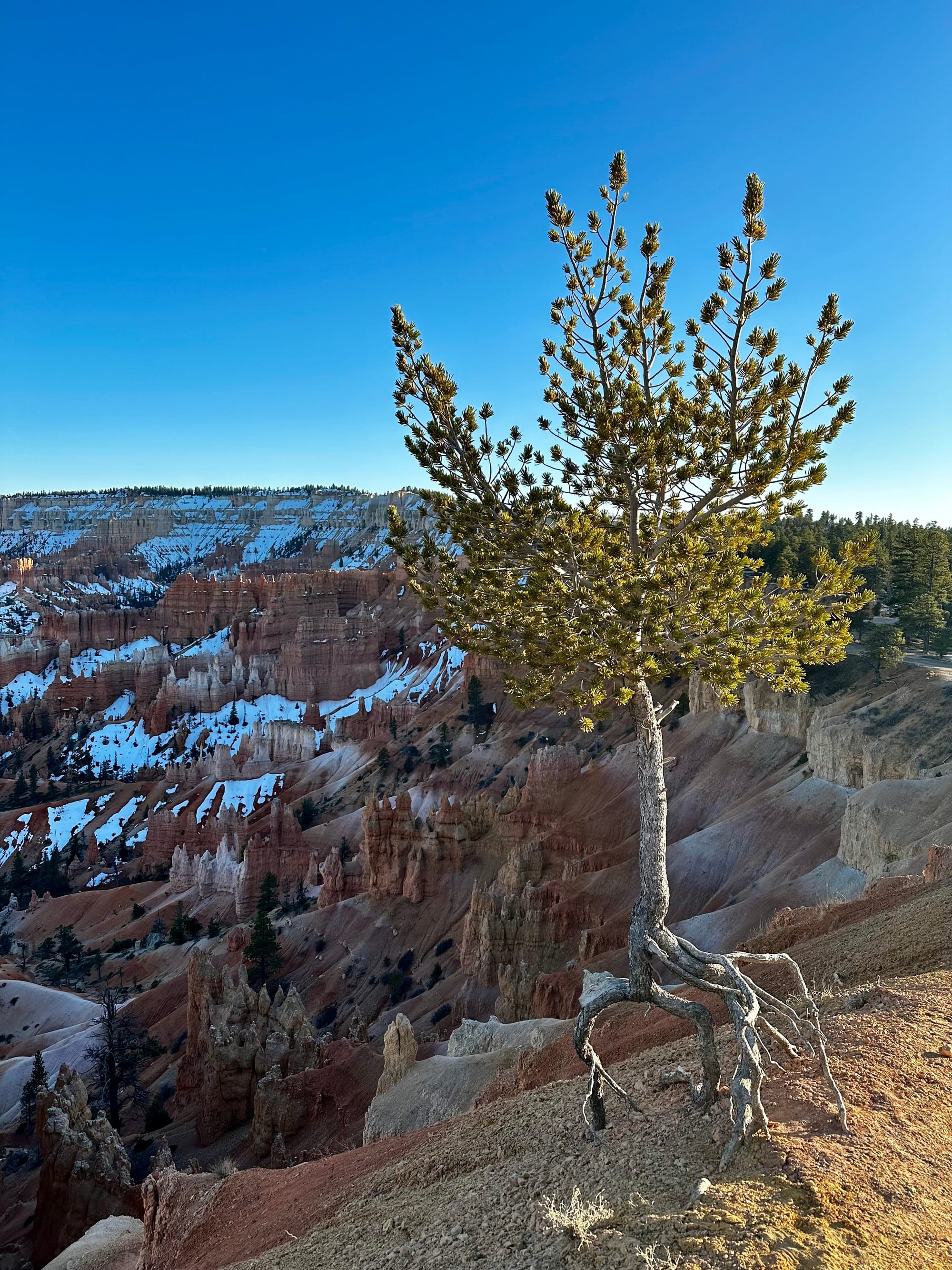
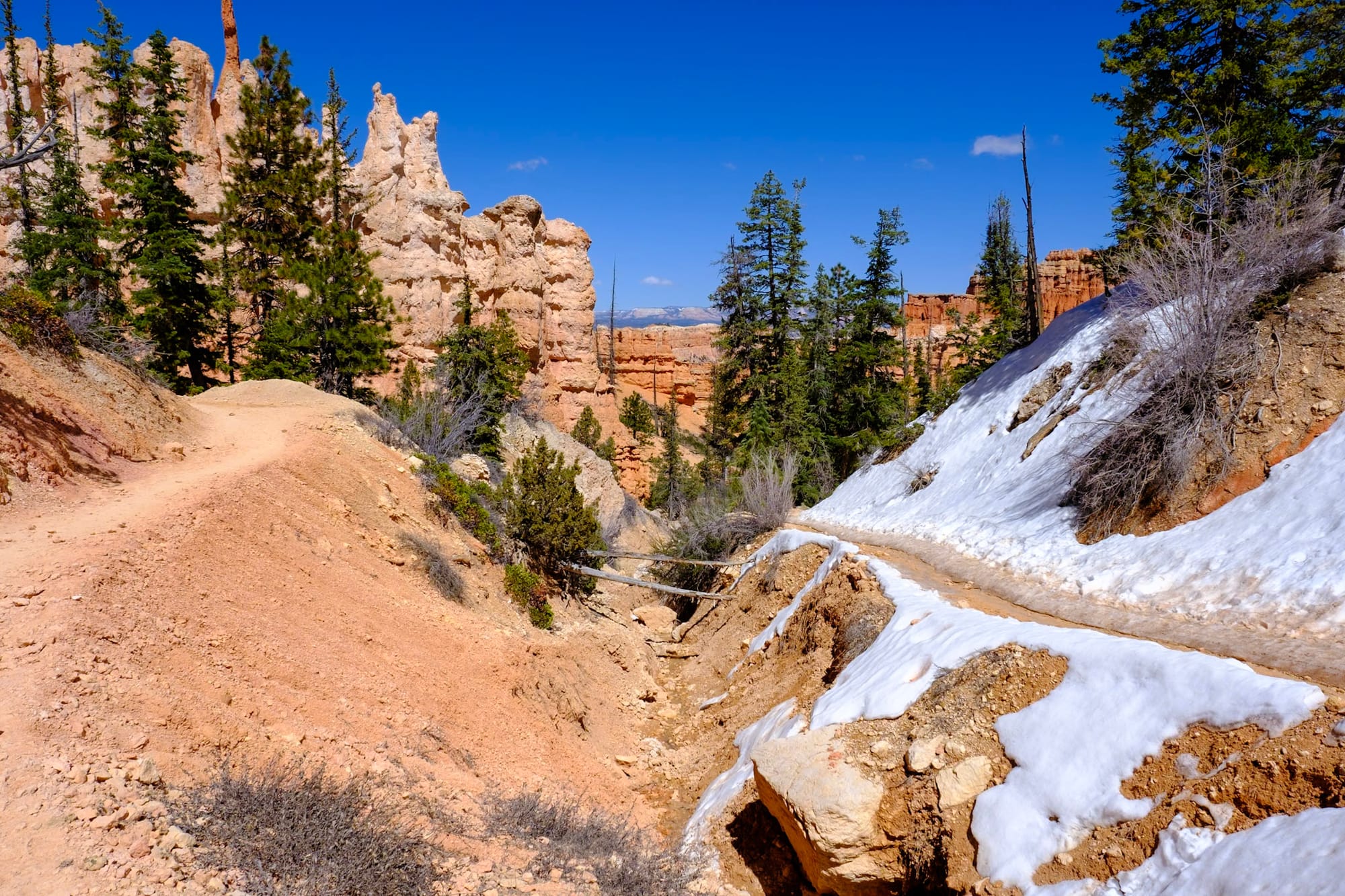
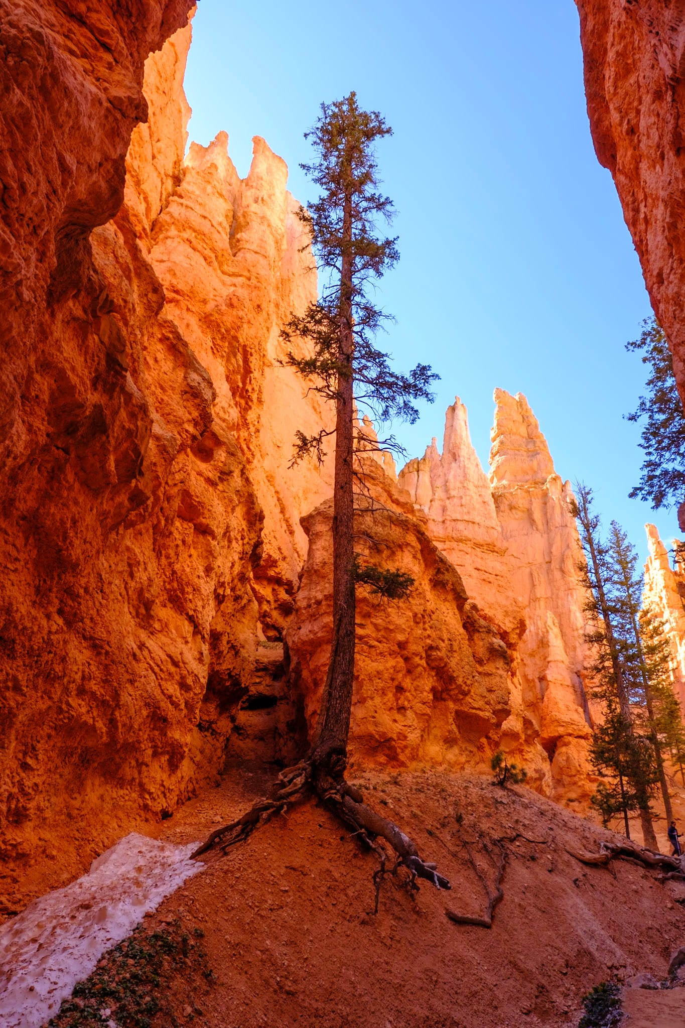
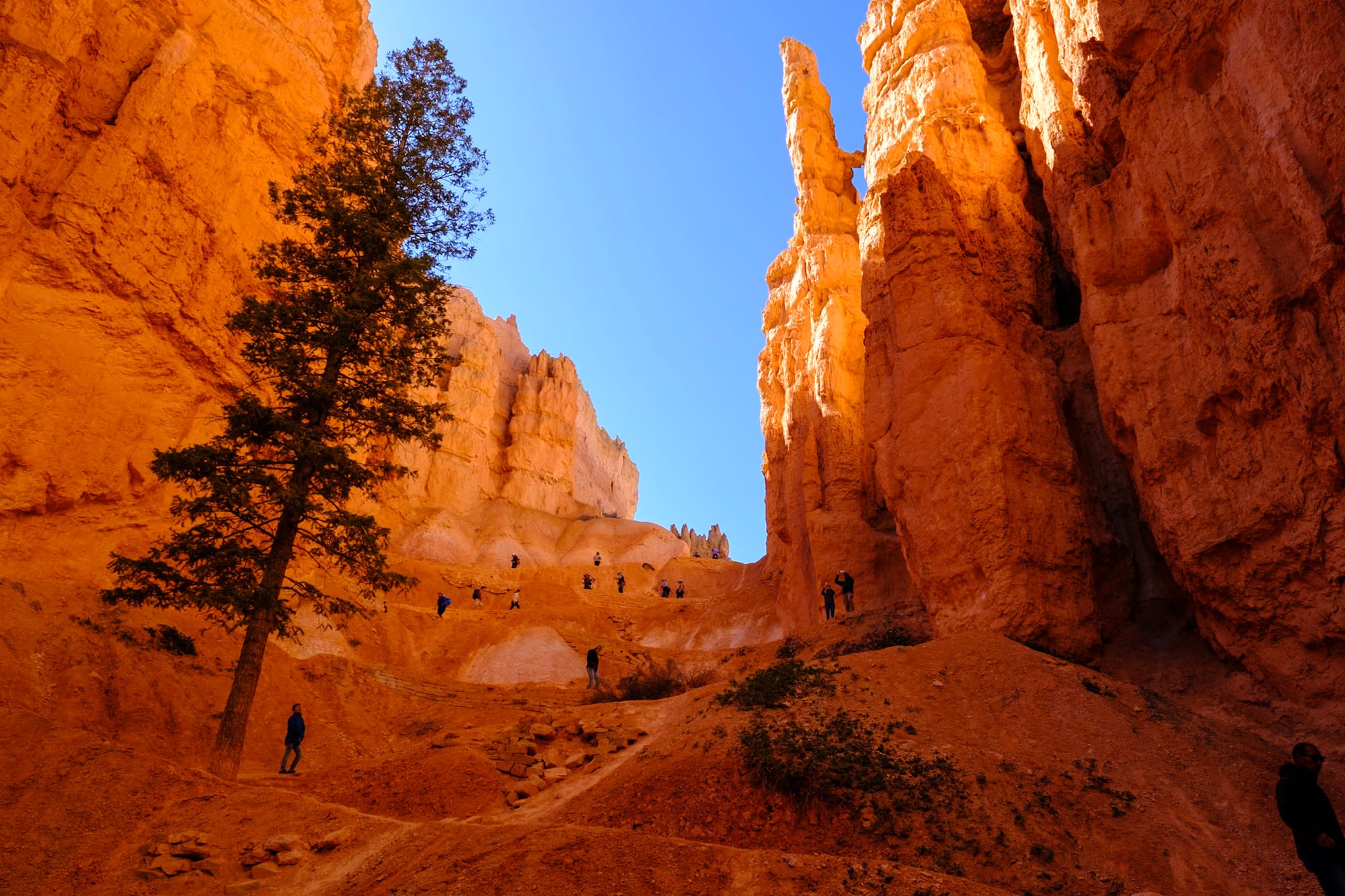
We started at Sunrise Point around lunchtime after taking the shuttle in, descending down into the canyon on the Queens Garden trail. The views are almost immediately captivating – you get such a different perspective on the hoodoos and rock formations when you go down into the canyon! There were all these cool tunnels along the trail, so many unique hoodoo shapes and windows through the rocks, and at the bottom, a forest of pines and snow on the ground.
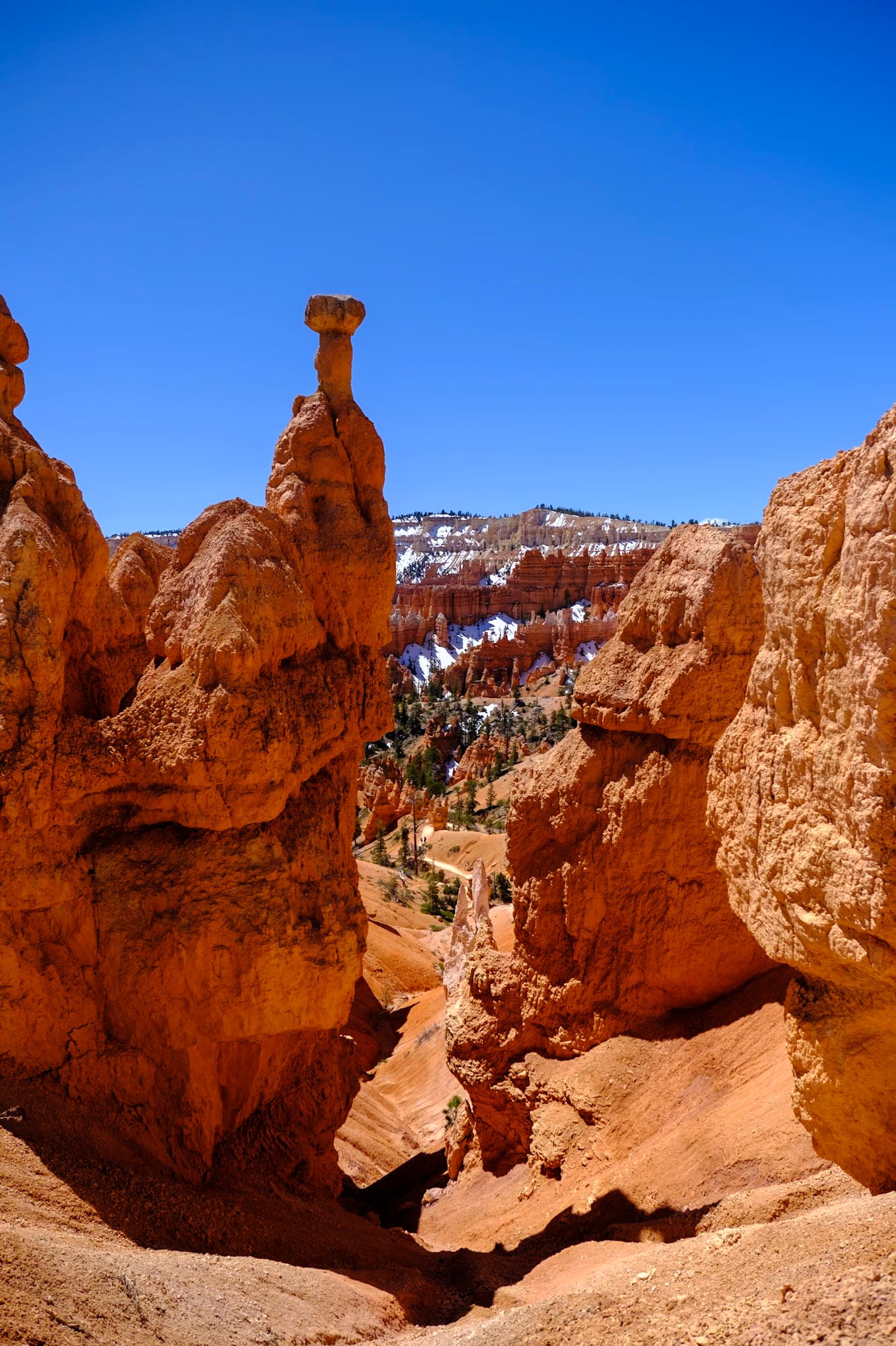
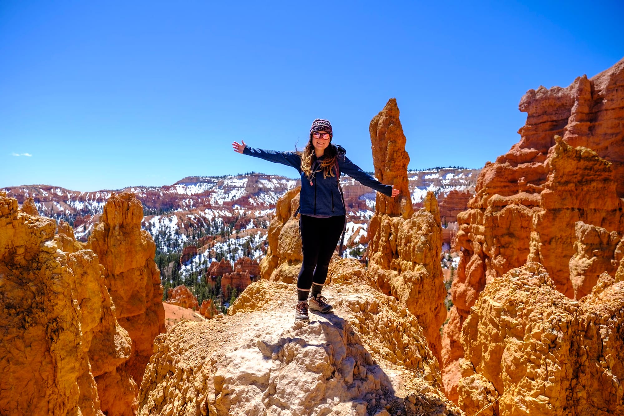
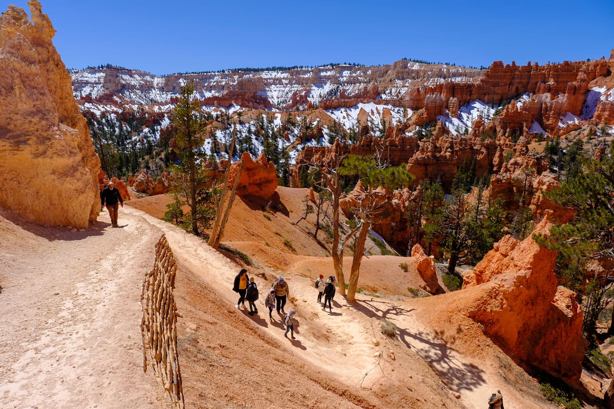
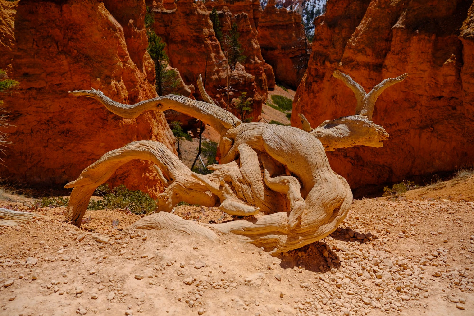
The Peekaboo Loop was the hardest part of the trail, with lots of ups and downs, but definitely the coolest. It was quieter here, and the views were amazing basically the entire time. This trail felt like an adventure through the wild west. It was just a lot of fun.
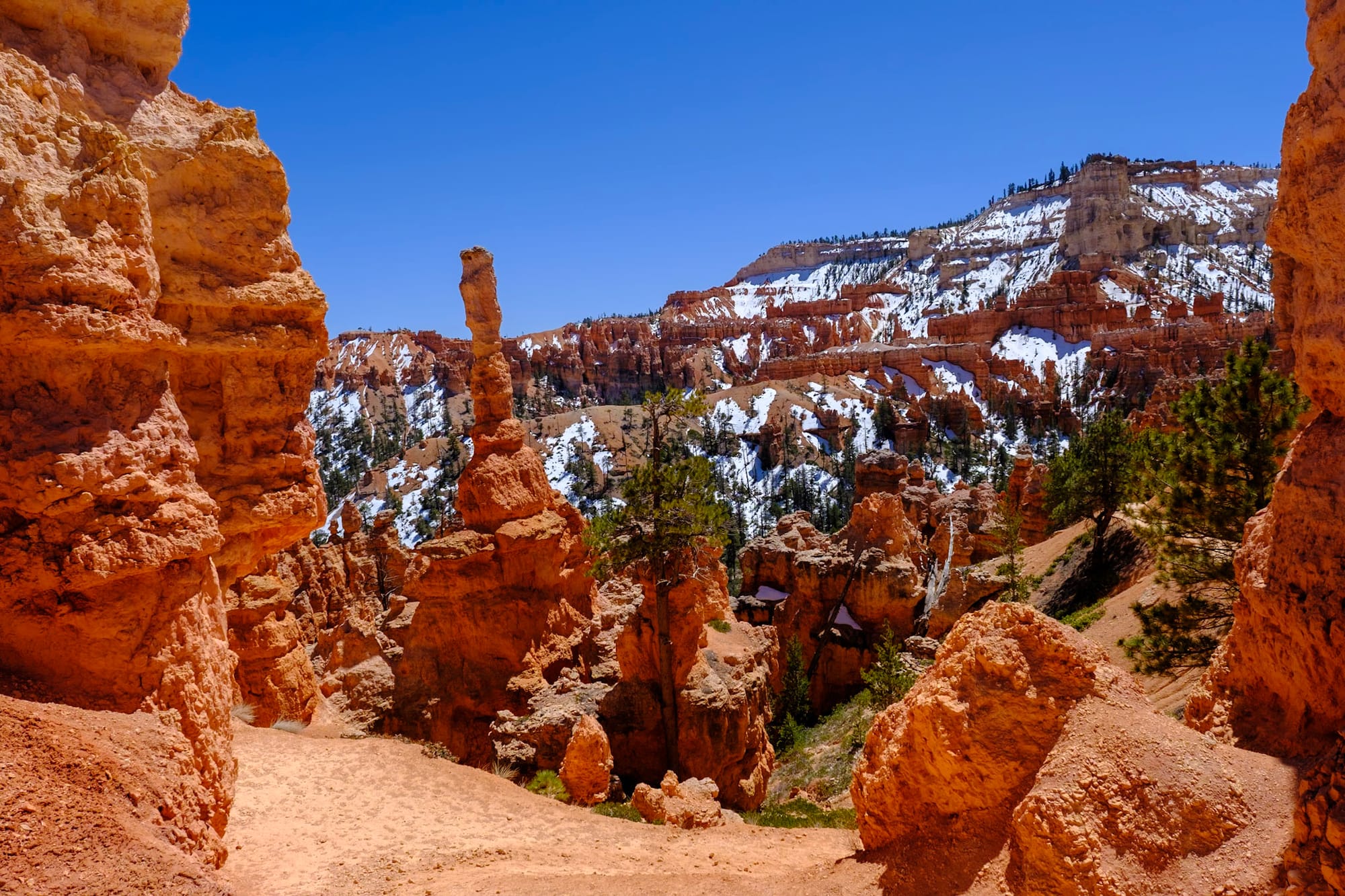
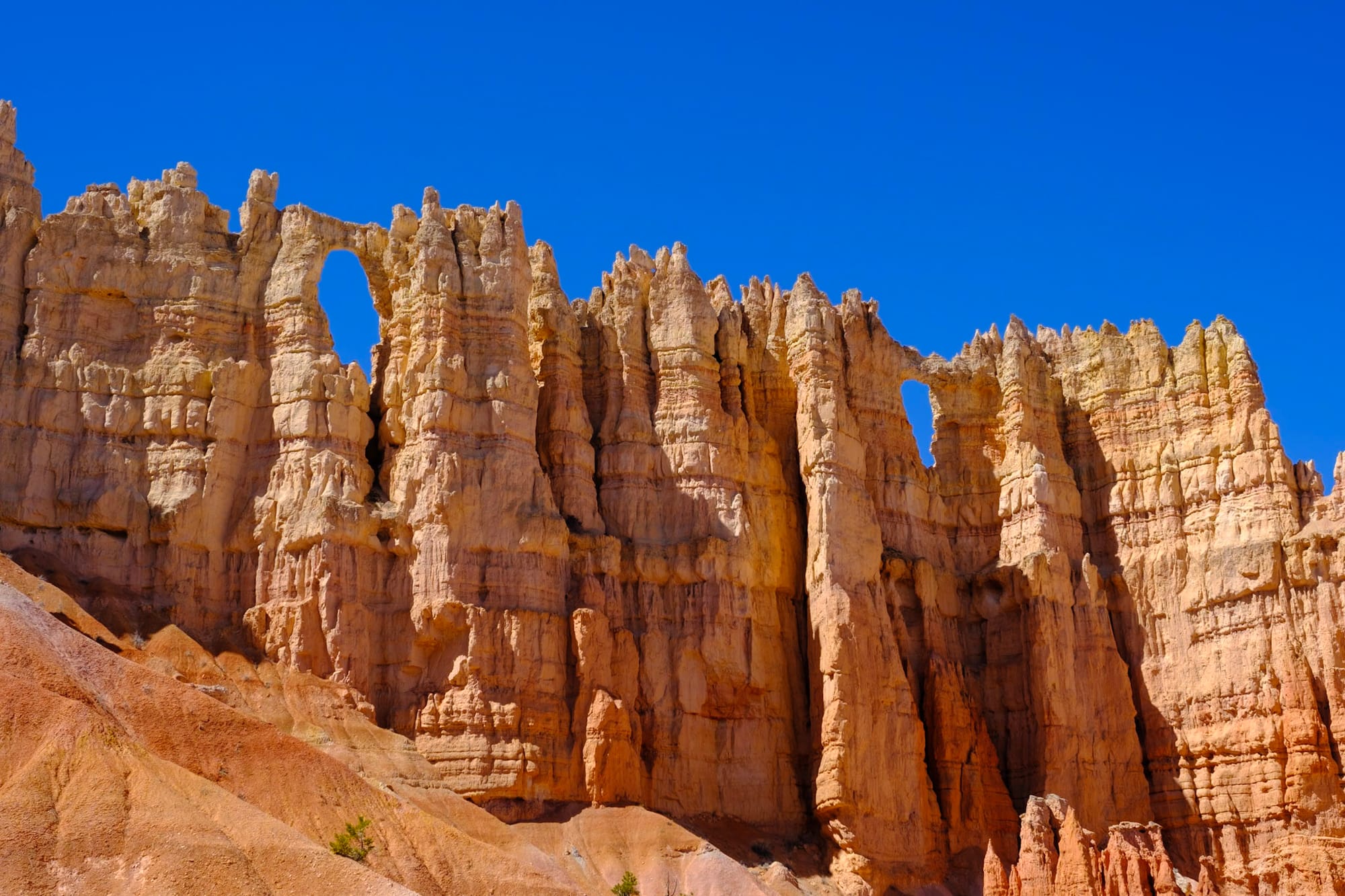
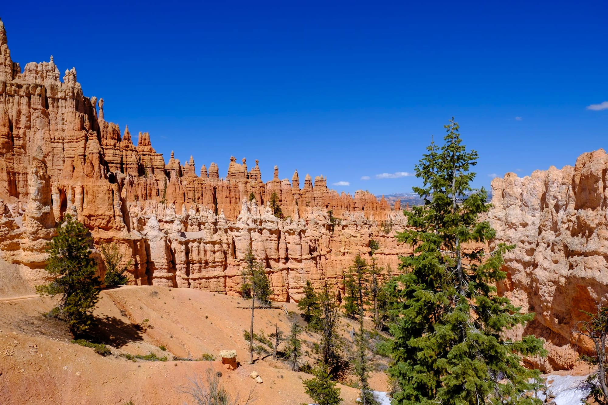
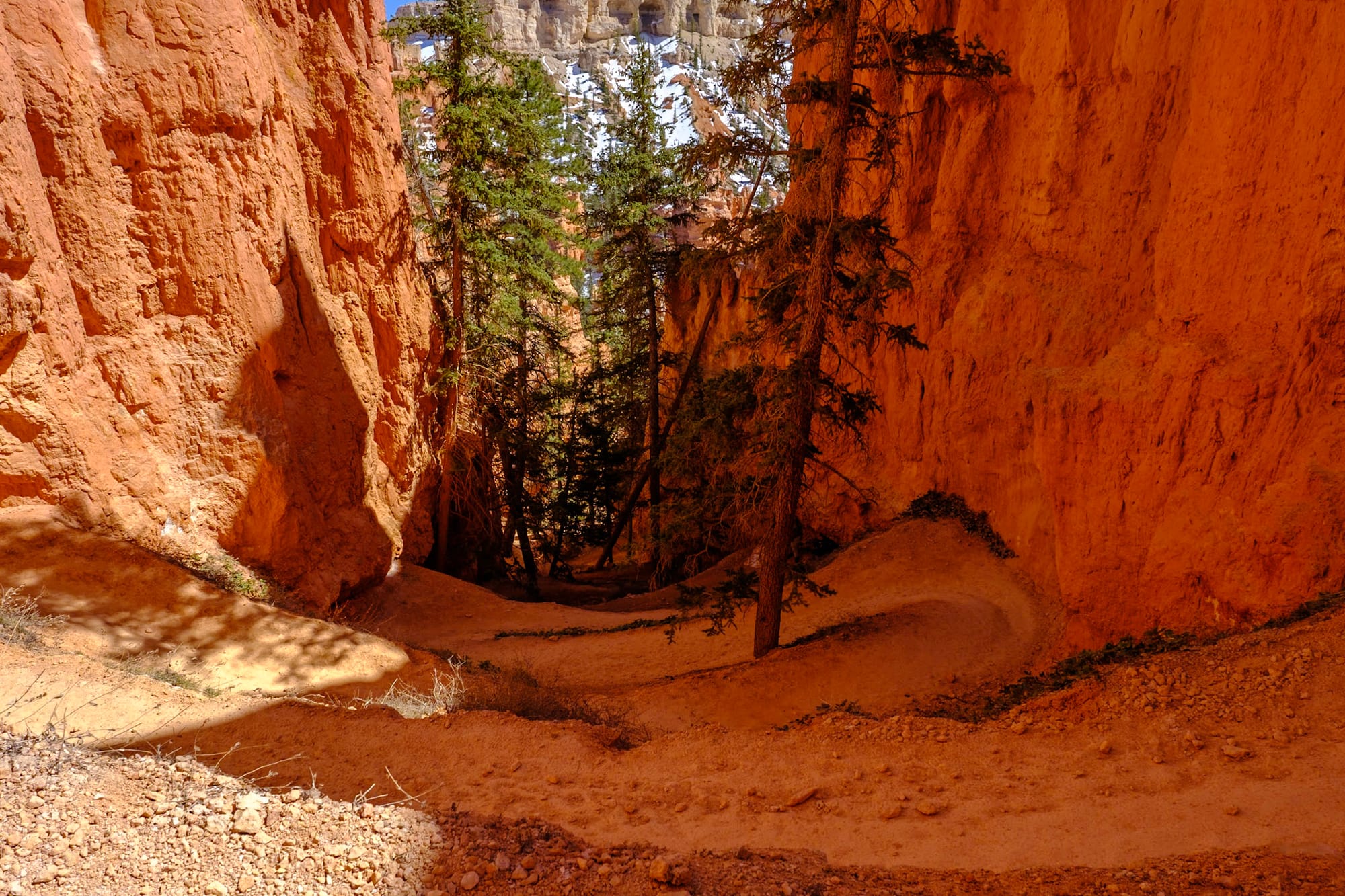
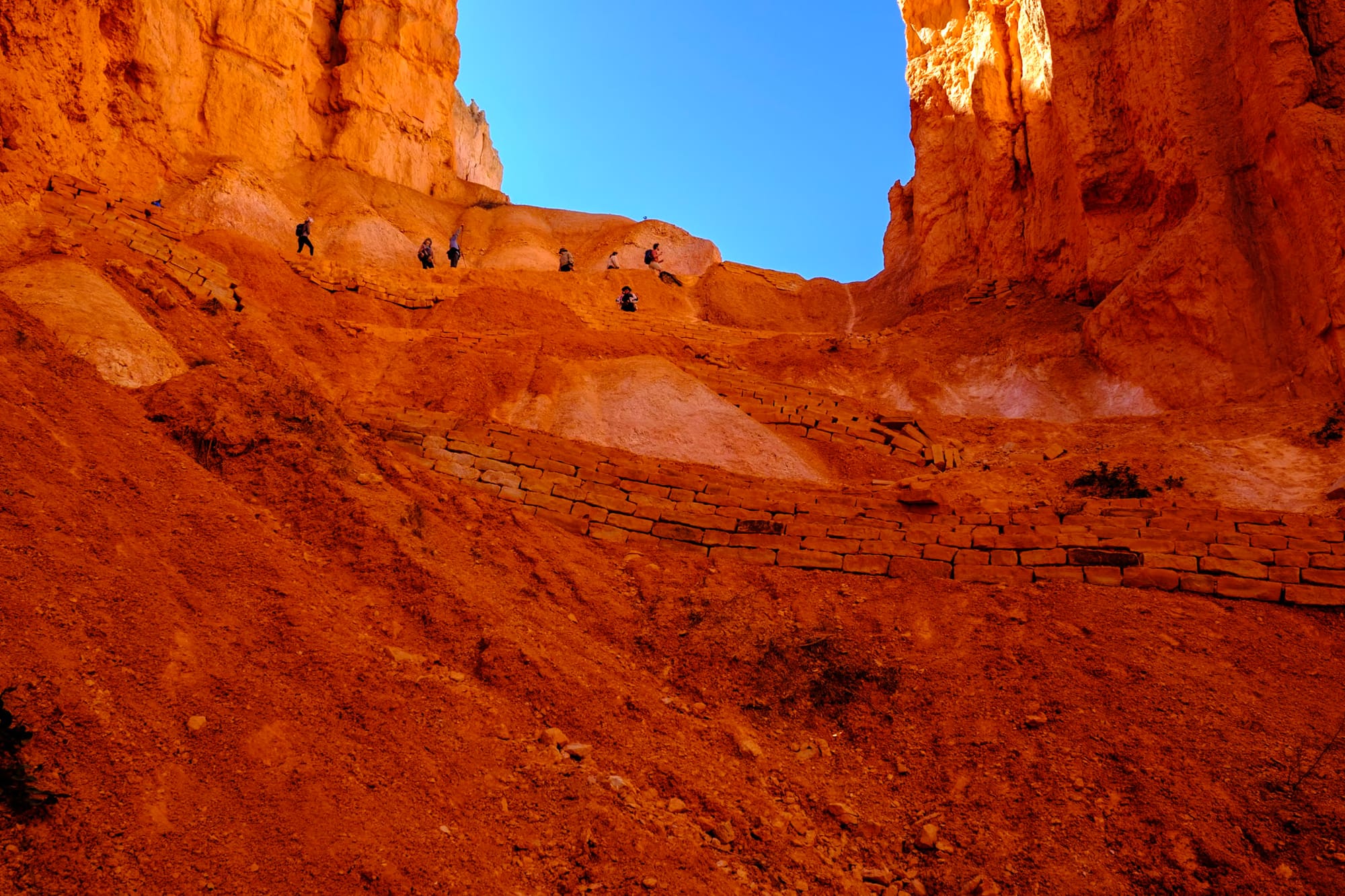
The last part of the hike was ascending back up the canyon on the Navajo Trail. It was short – only about a half mile – but very steep, with lots of switchbacks through this narrow, bright orange, echo-y canyon. Getting back to the top at Sunset Point was rewarding. We stayed a while soaking in the canyon views from above, and then grabbed the shuttle back to the campground.
The next day was Monday – back to work. But it was a good day to stay inside; it snowed softly at the campground almost all day, which was peaceful to watch.
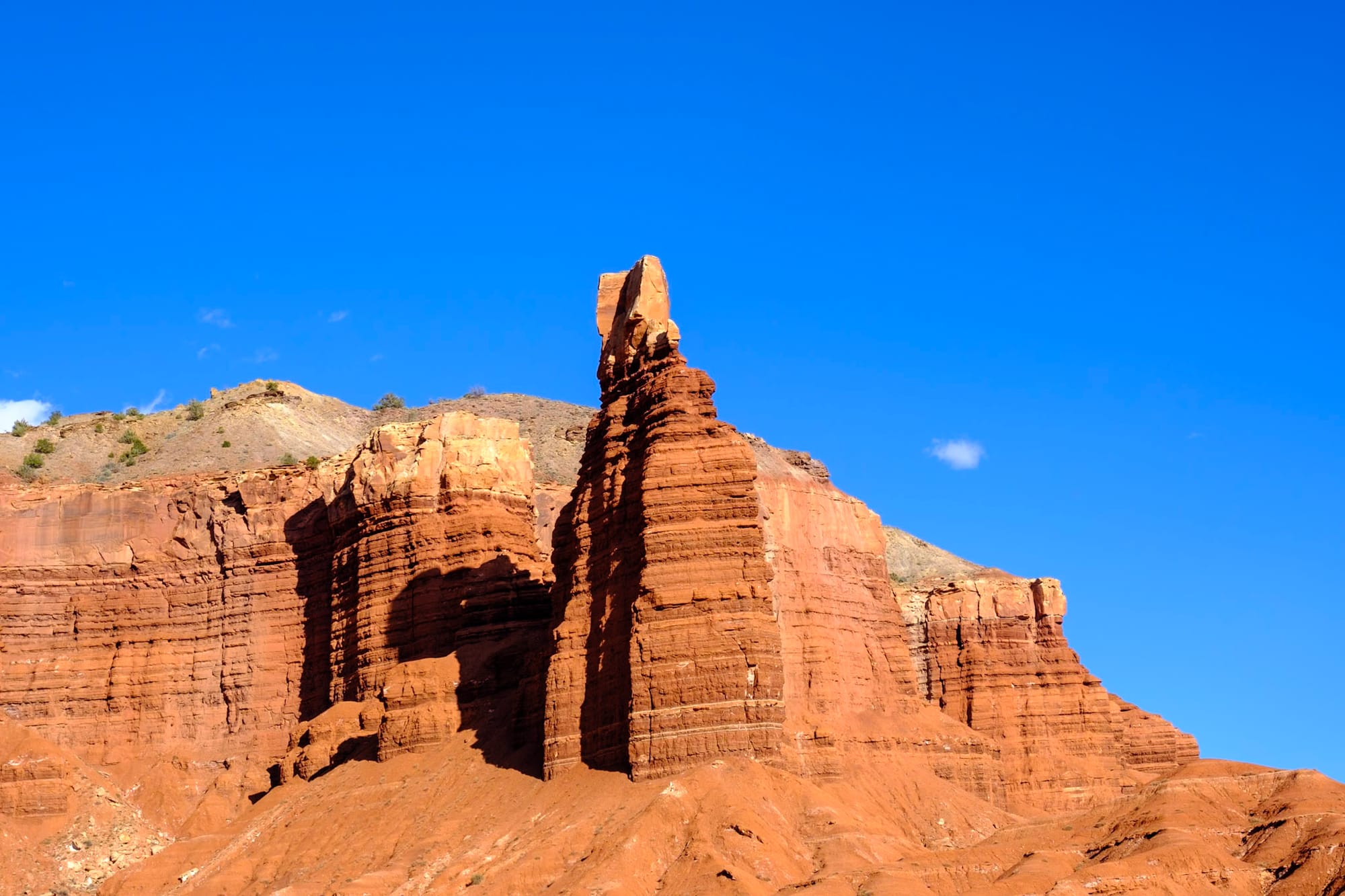
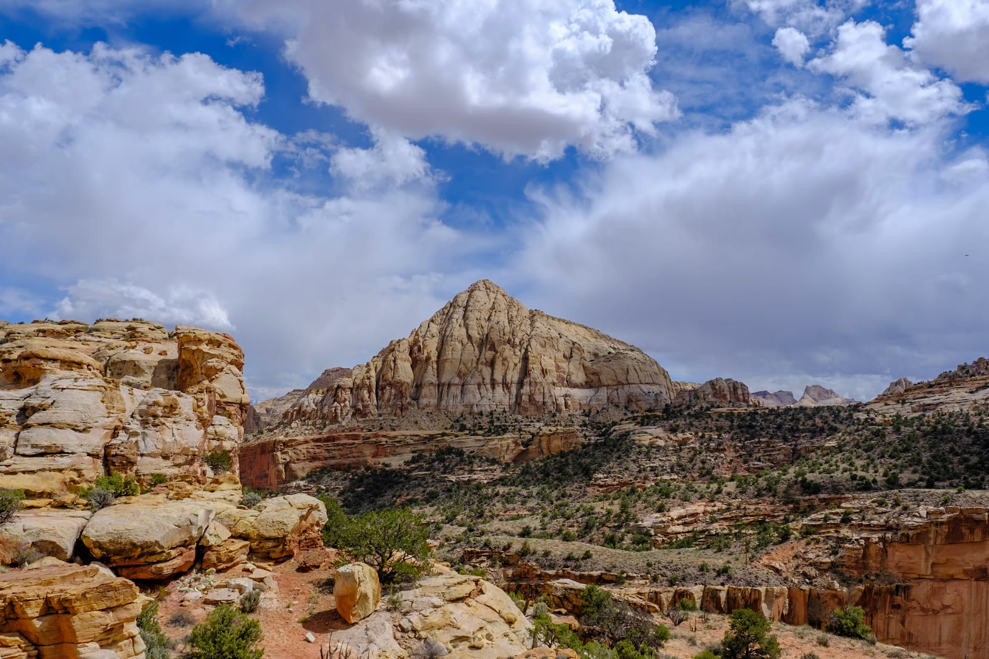
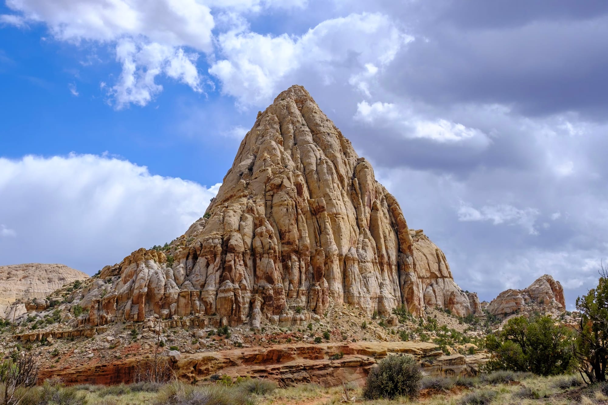
Capitol Reef
On Tuesday, we took a day off work (which we hadn't done for a while) to drive the rest of Scenic Byway 12 to Capitol Reef National Park!
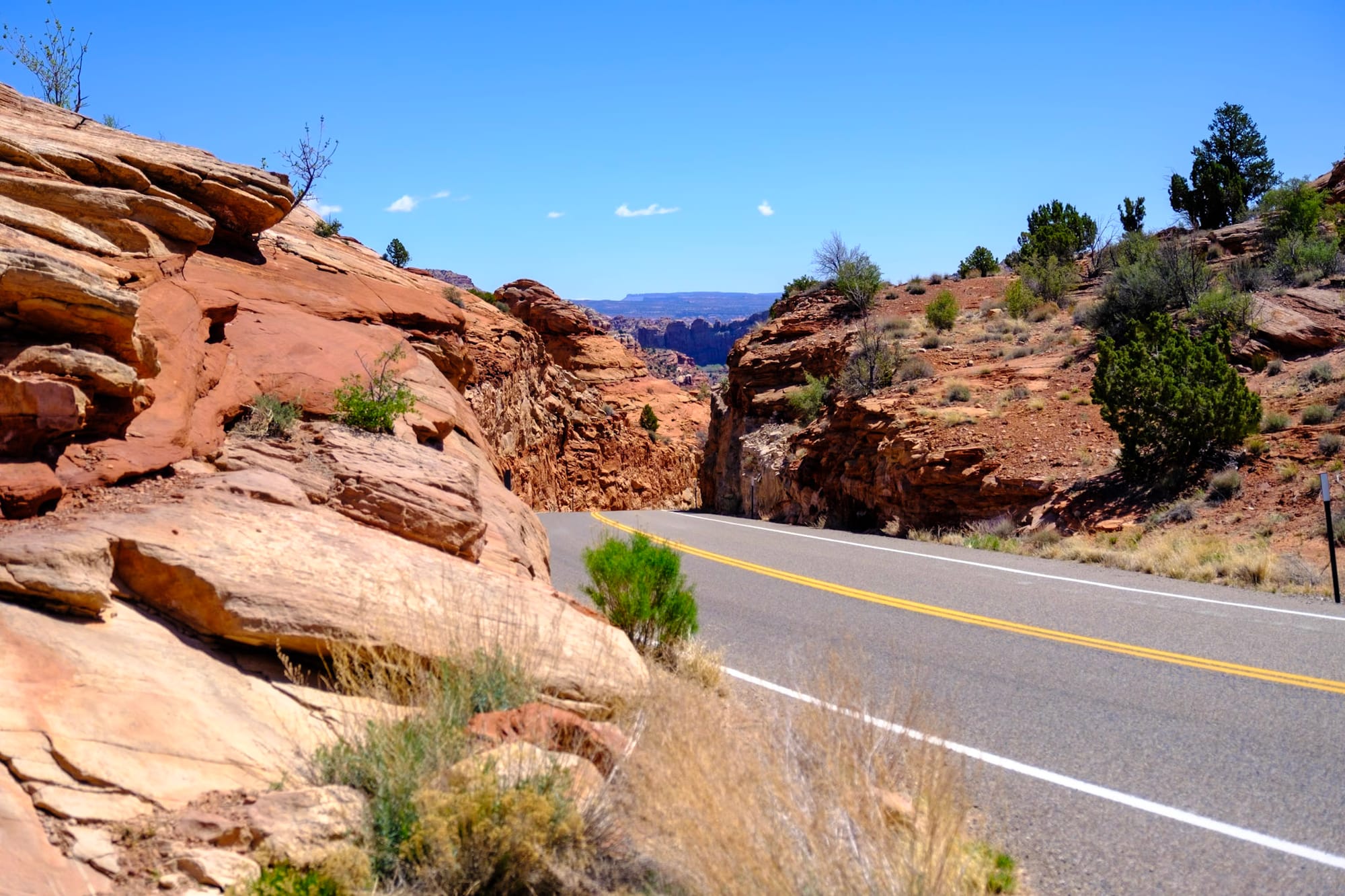
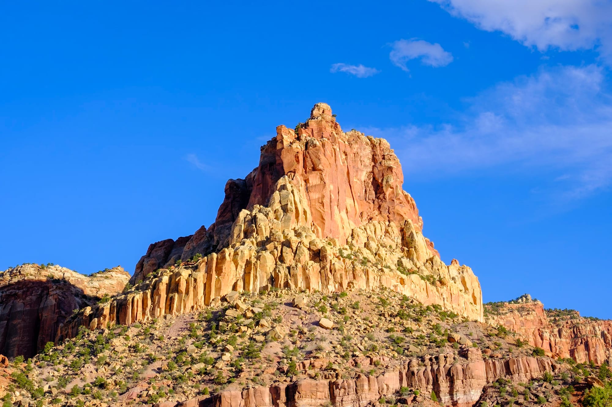
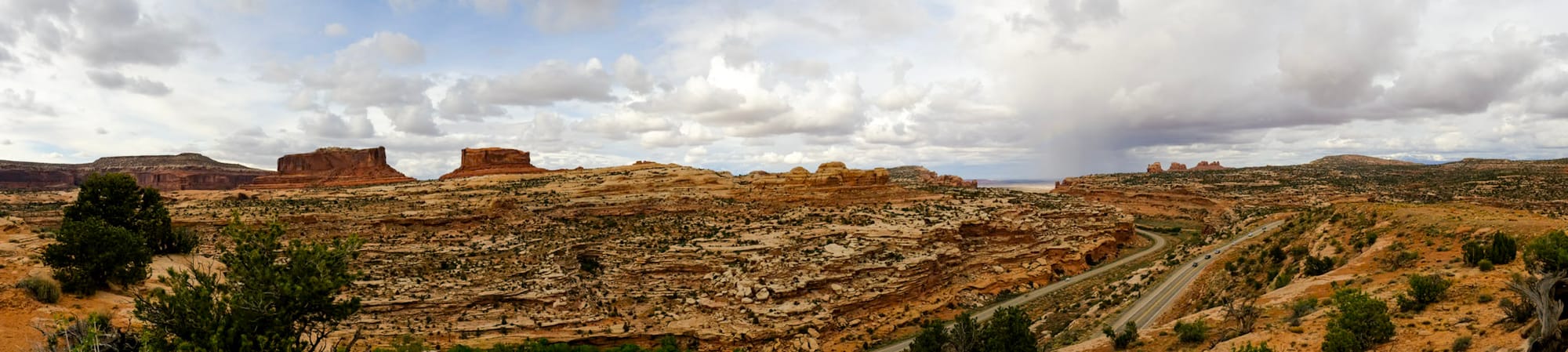
This is an absolutely stunning drive and a must-do if you're vacationing or road-tripping through southern Utah. The scenery is amazing and diverse. After leaving Bryce Canyon, you start driving through mostly open, sparse desert and little towns like Tropic and Escalante (we didn't stop there, but Escalante looked like a cool little town).
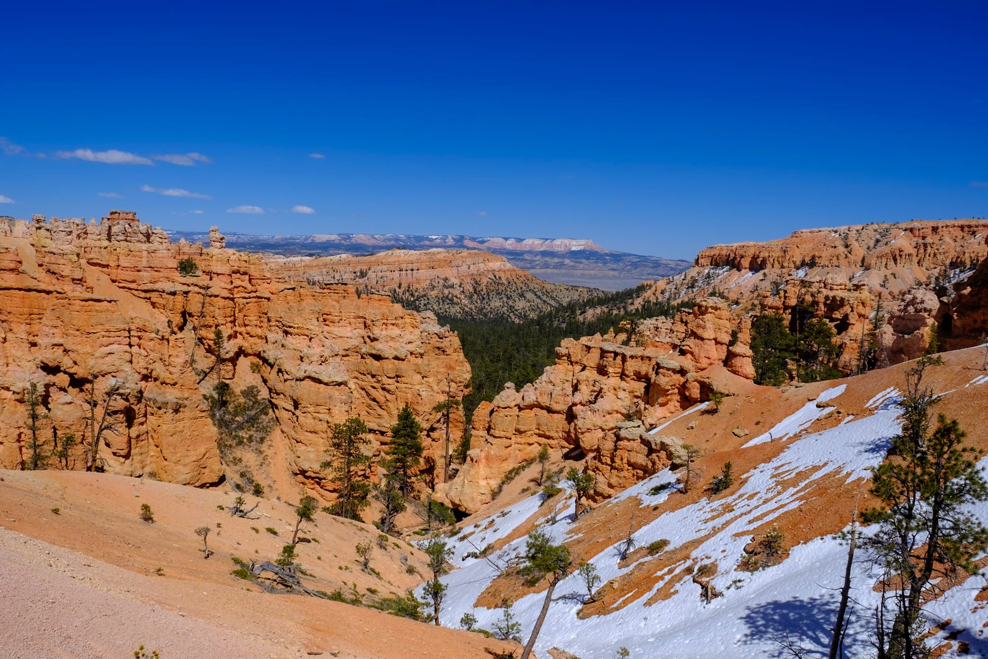
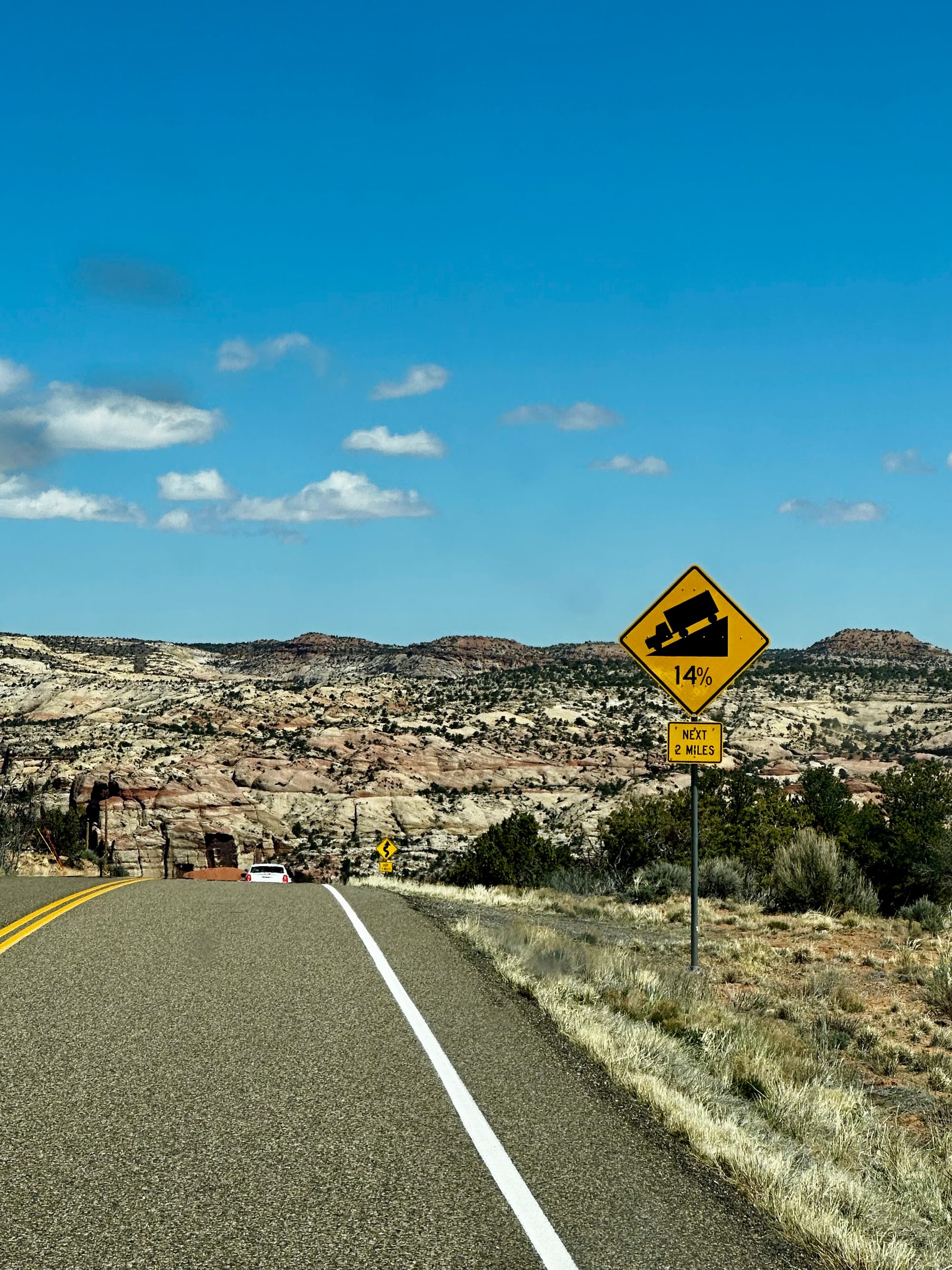
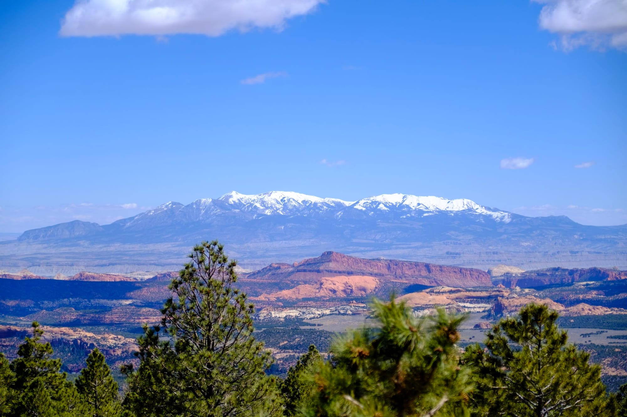
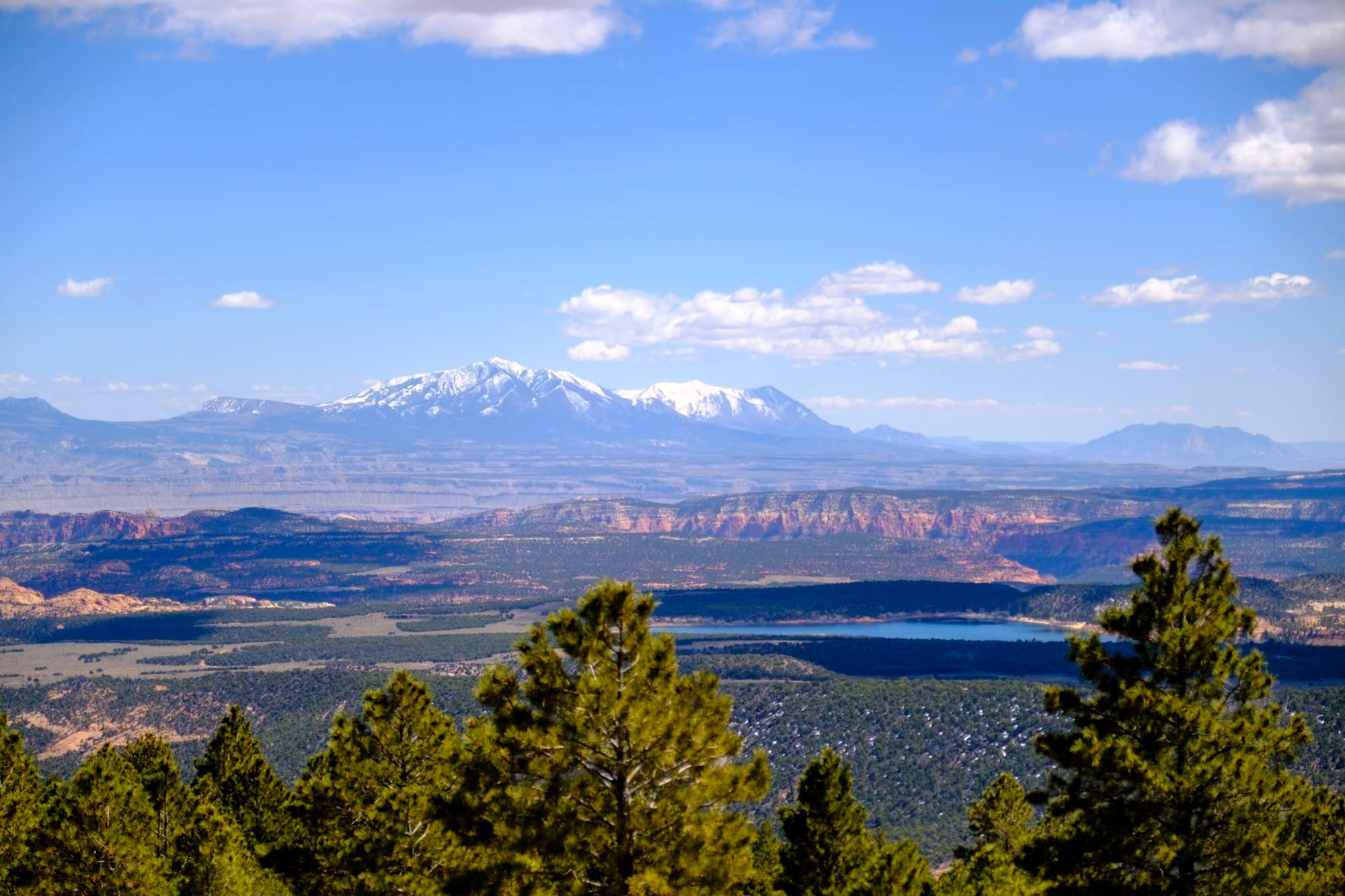
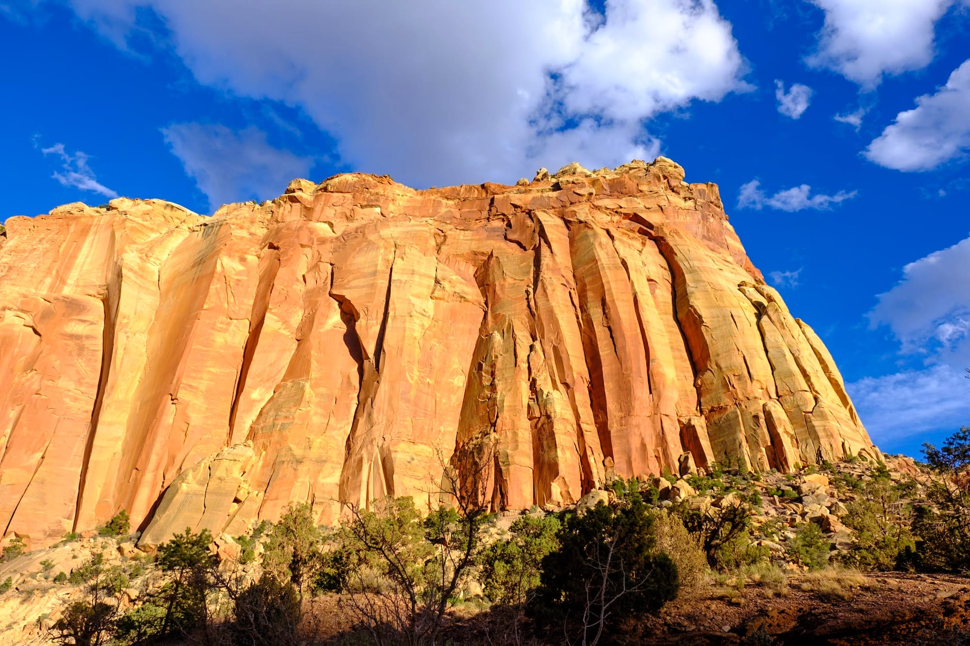
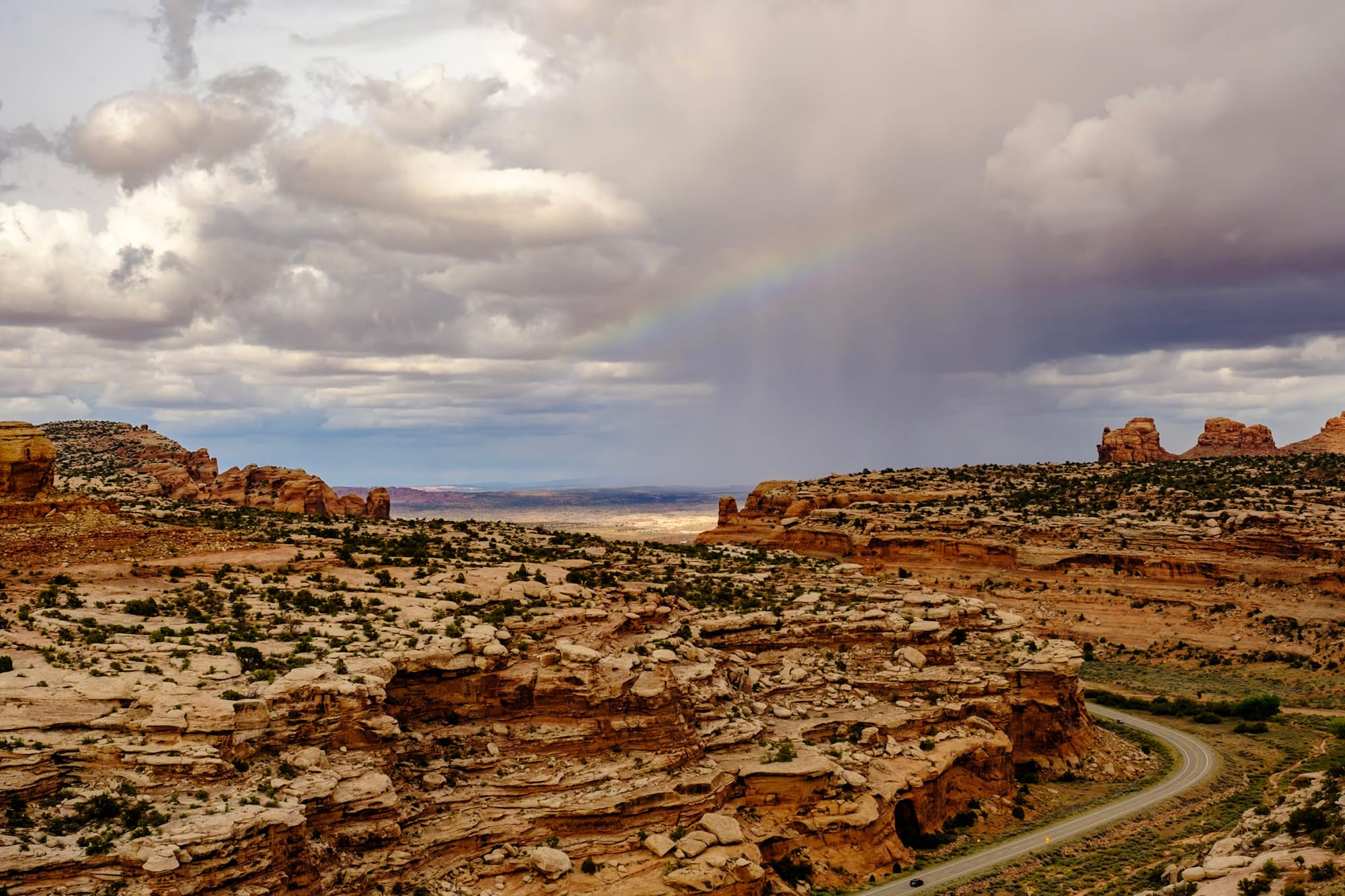
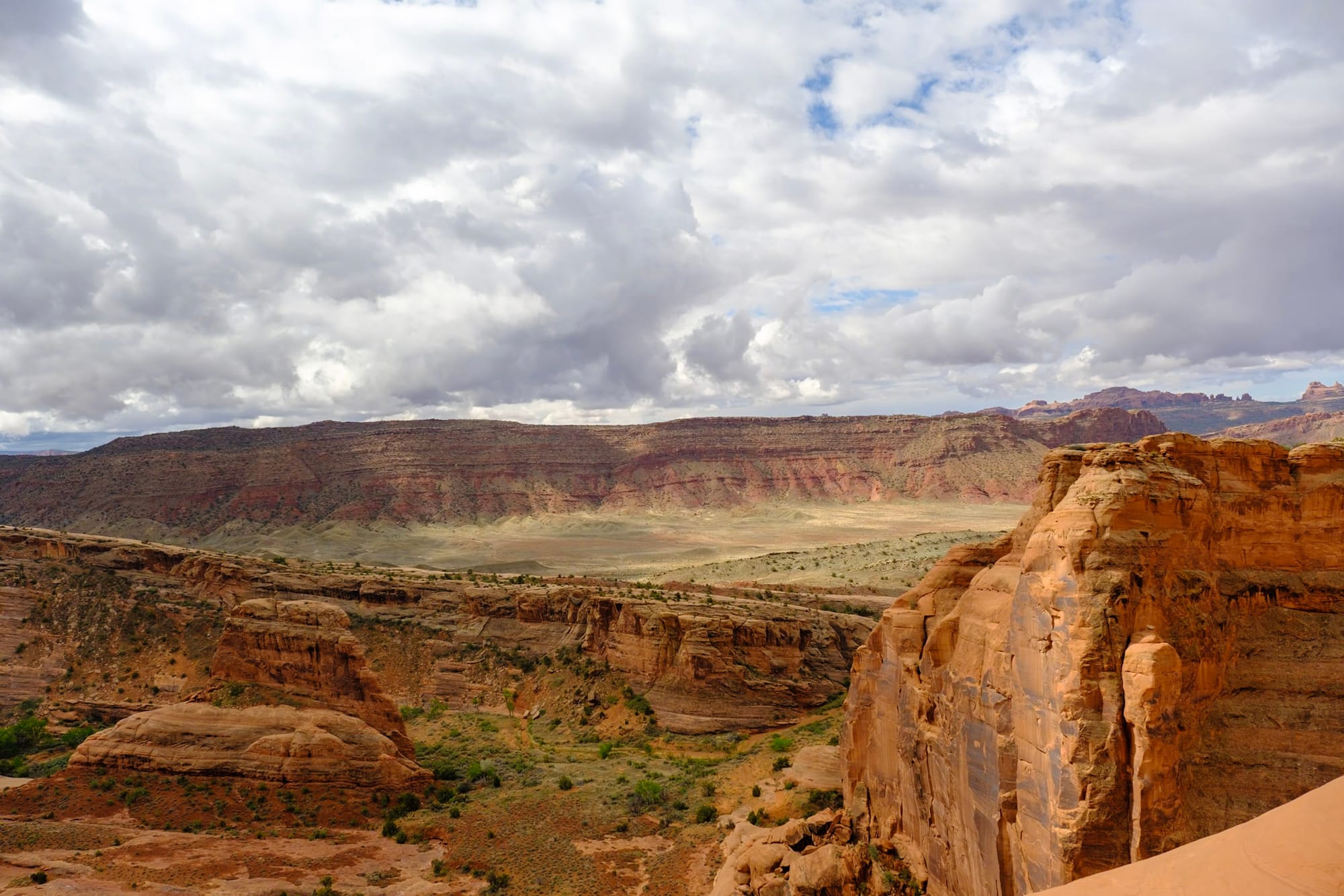
After that, it gets really spectacular between Escalante and Boulder, Utah. Still in the desert, the road rises high above a land of colorful canyons and rocks spread out for miles below. Then you descend down into these canyons on a steep section of the road (at one point it's a 14% grade!) stopping at overlooks along the way. It feels like the area should be a national park; it's gorgeous driving through and over the cliffs.
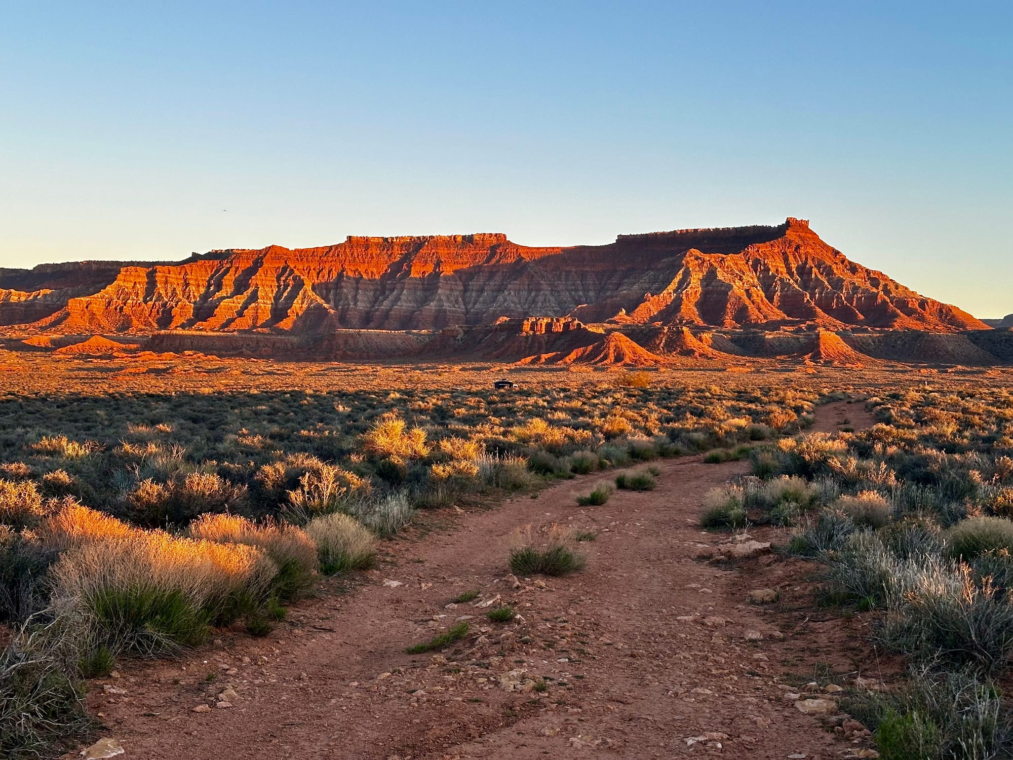
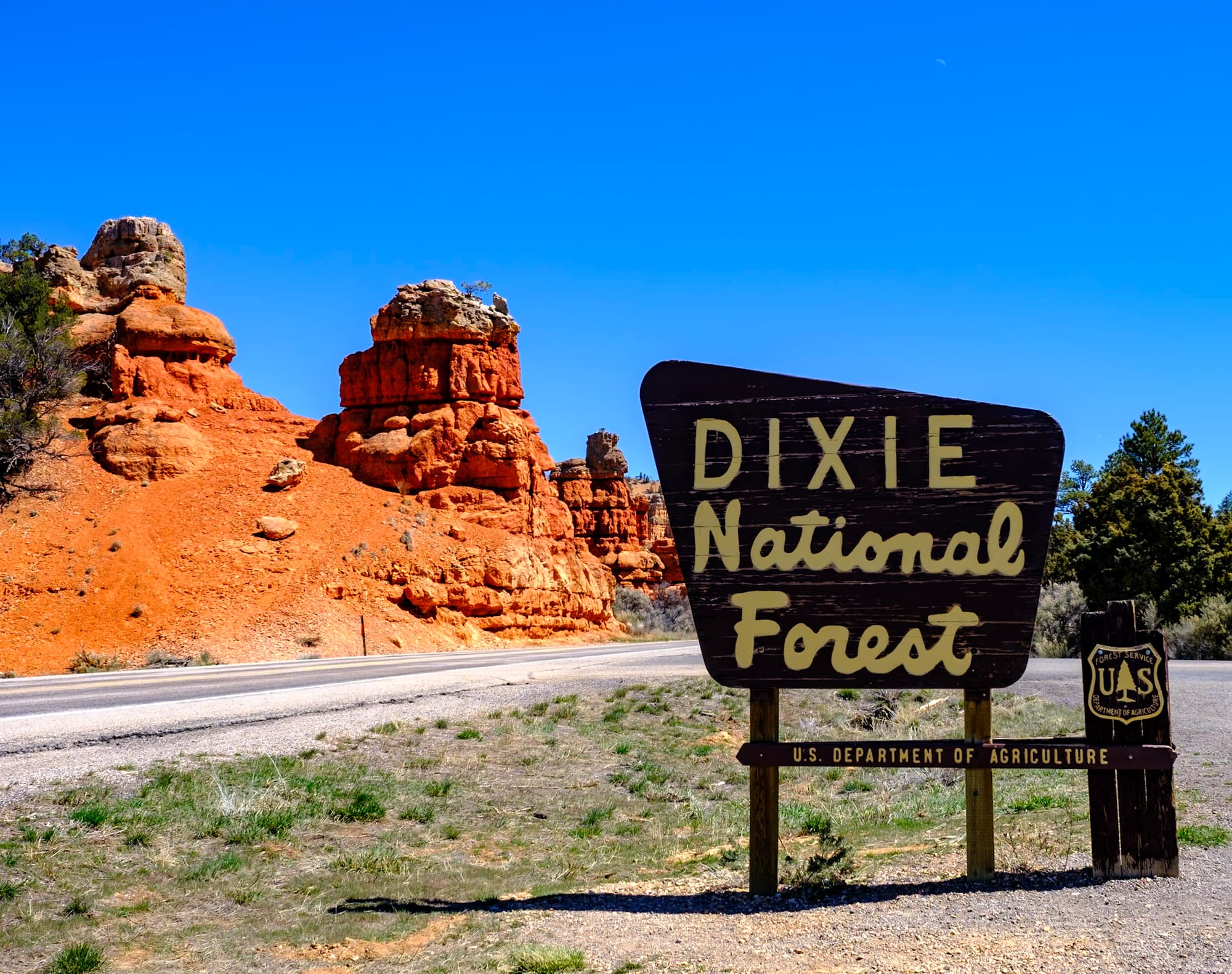
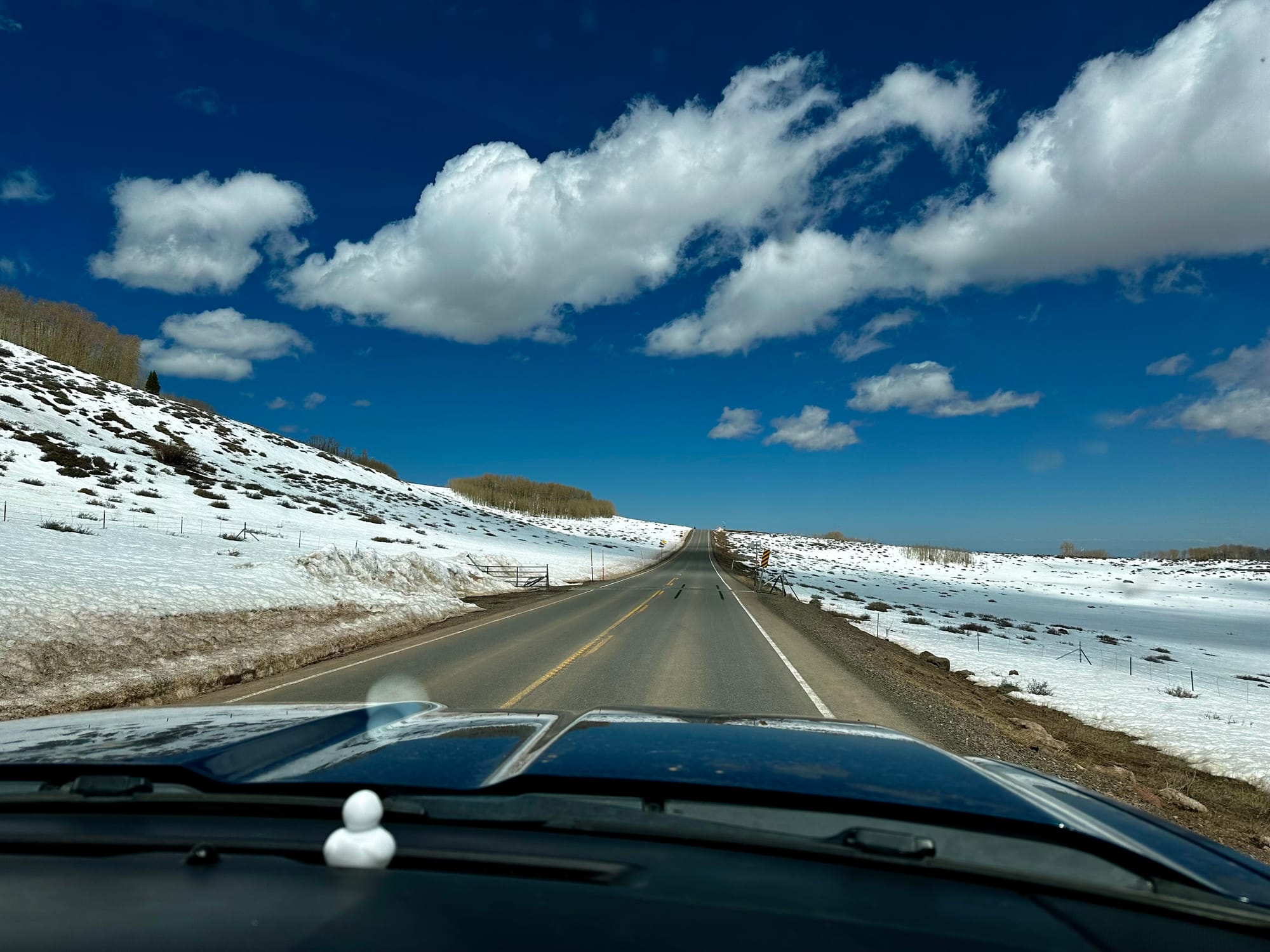
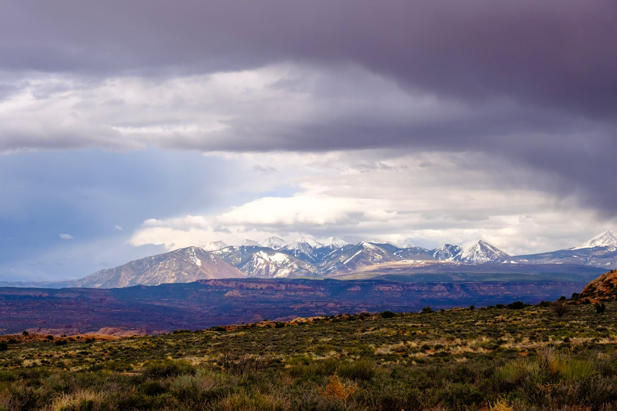
Then the landscape shifts as you drive north through Dixie National Forest, climbing higher and higher through pine forests up the mountains. The ground was still covered in snow up here, and all the greenery and shrubs in the forest hadn't grown in yet, so it was pretty open in places – we had some great views down the mountains, where we could see the deep red and bright orange canyons of the Capitol Reef area far below. We reached 9,600 feet in elevation at the highest point, Boulder Mountain Pass, and then started descending again back into the desert.
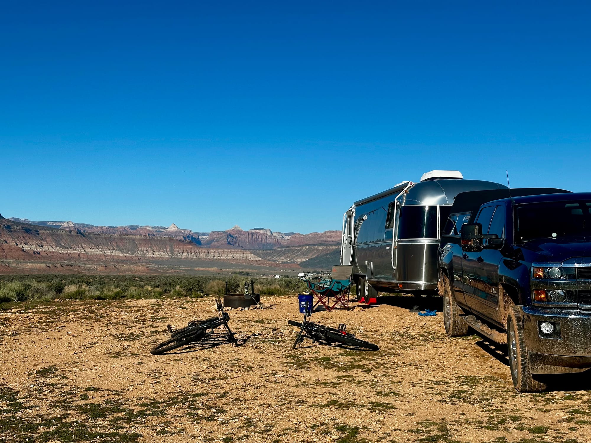
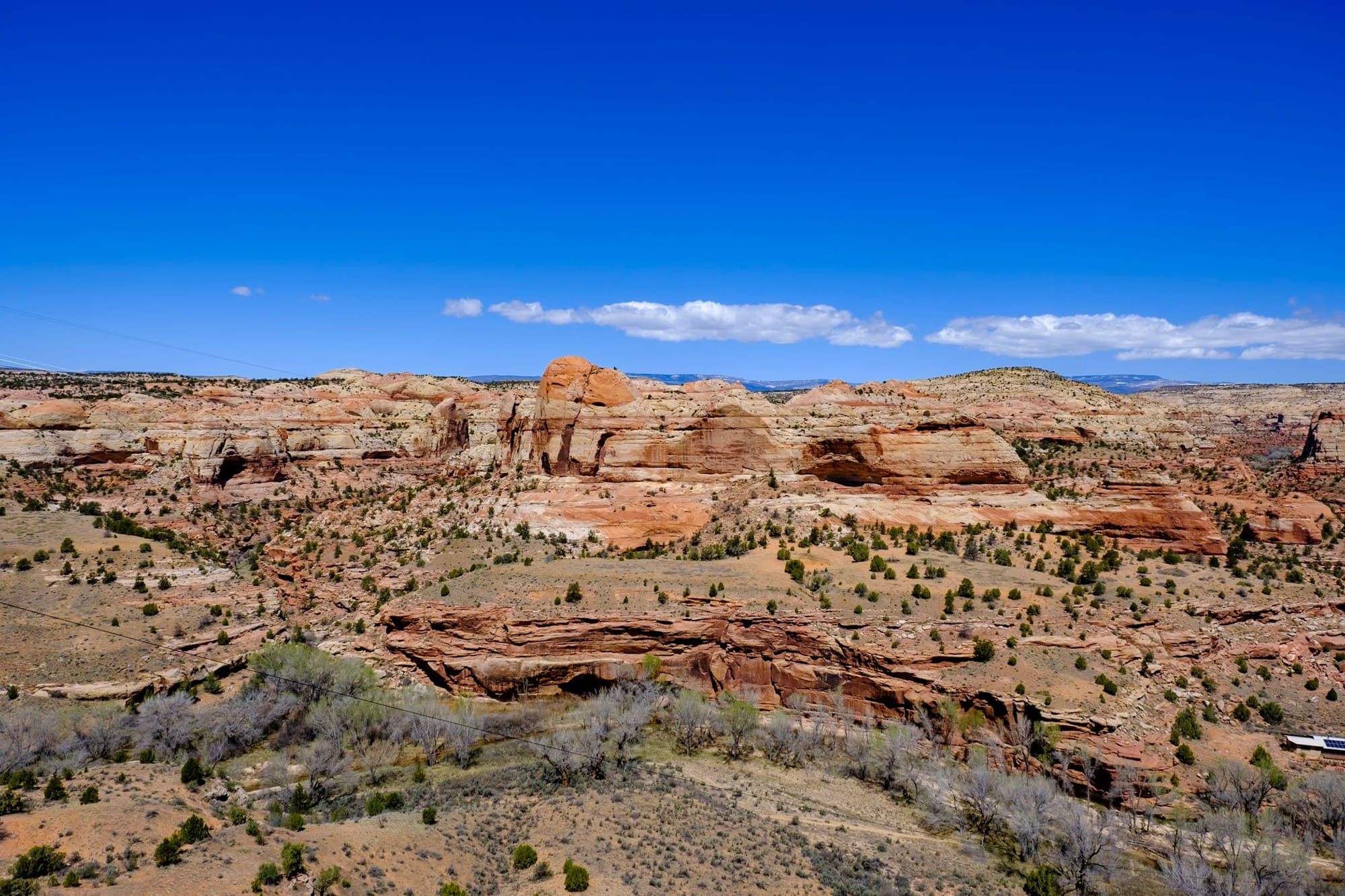
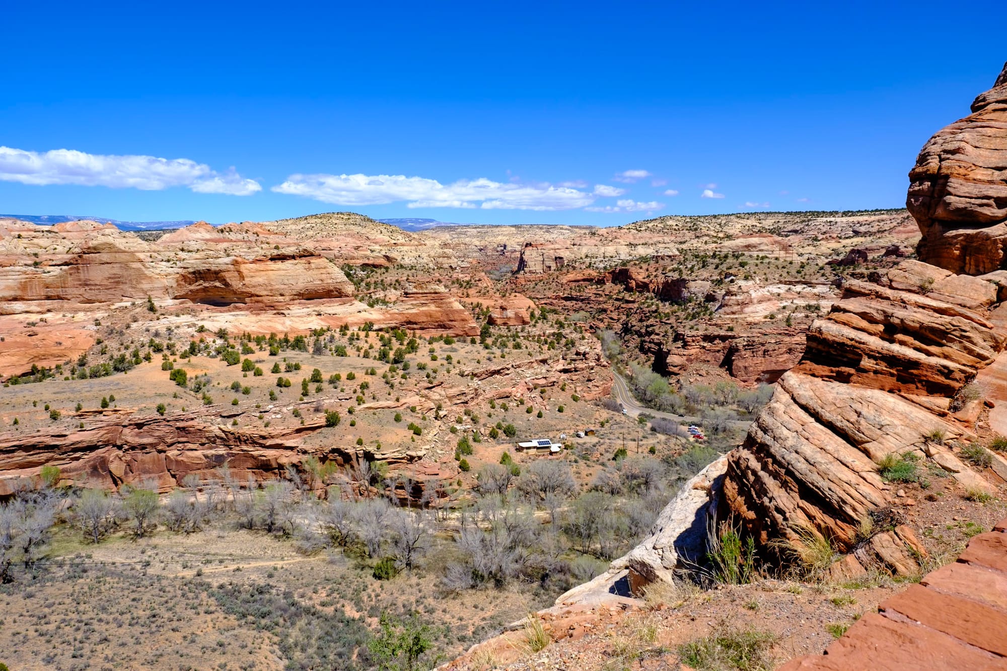
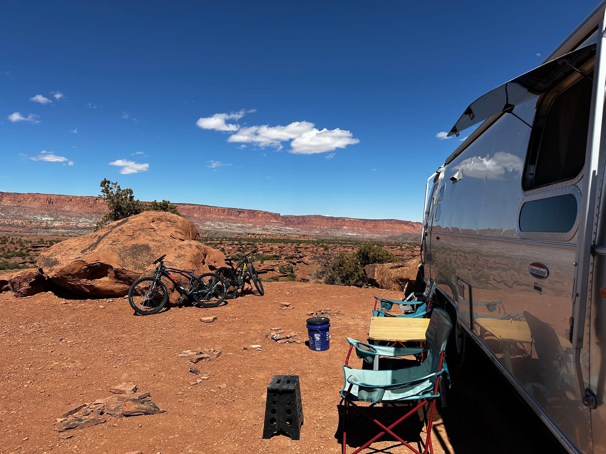
After a while, we reached Torrey, a little town right outside Capitol Reef, and turned down the Beas Lewis Flat dirt road (called Overlook Point Camping on Google) where we planned to find a dispersed camping spot for the week.
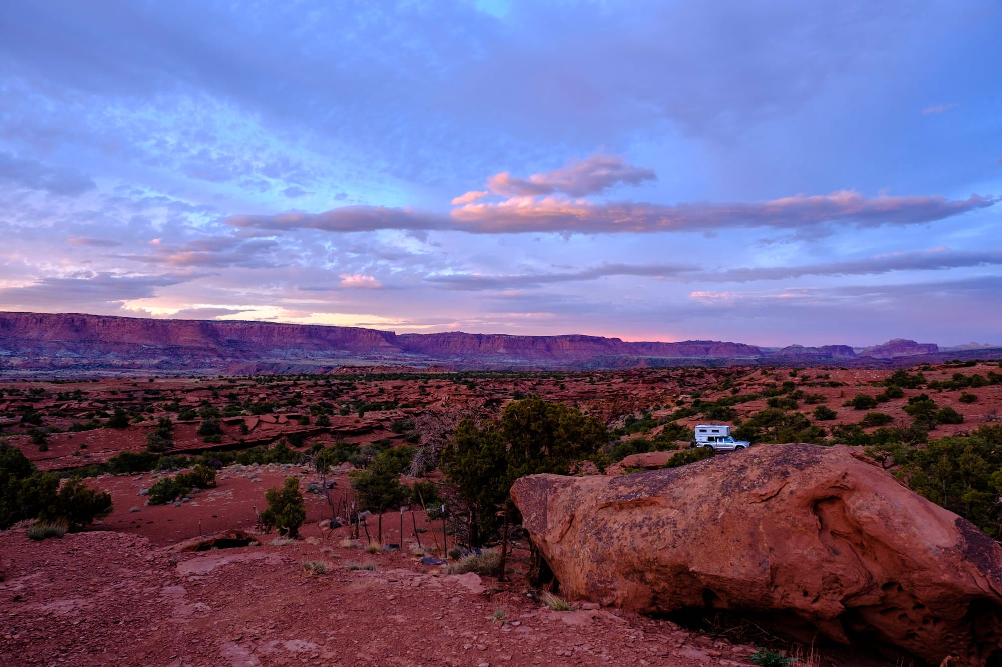
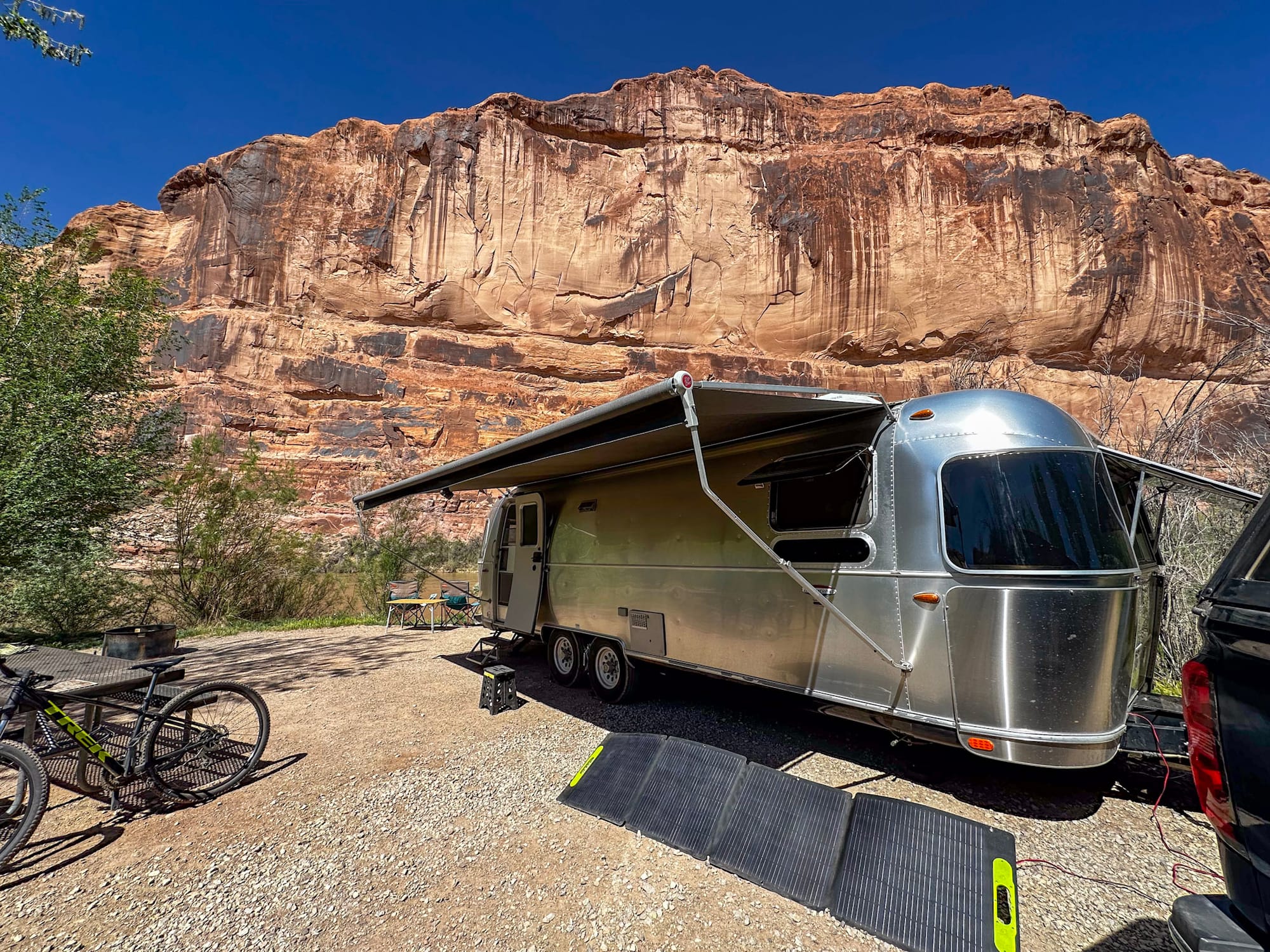
We ended up finding probably our favorite dispersed site ever here. It was just a short drive down the dirt road, and then up a small hill to a big flat area off to the left. There was already a big fifth-wheel trailer set up on one side here, so we parked a little ways down from them.
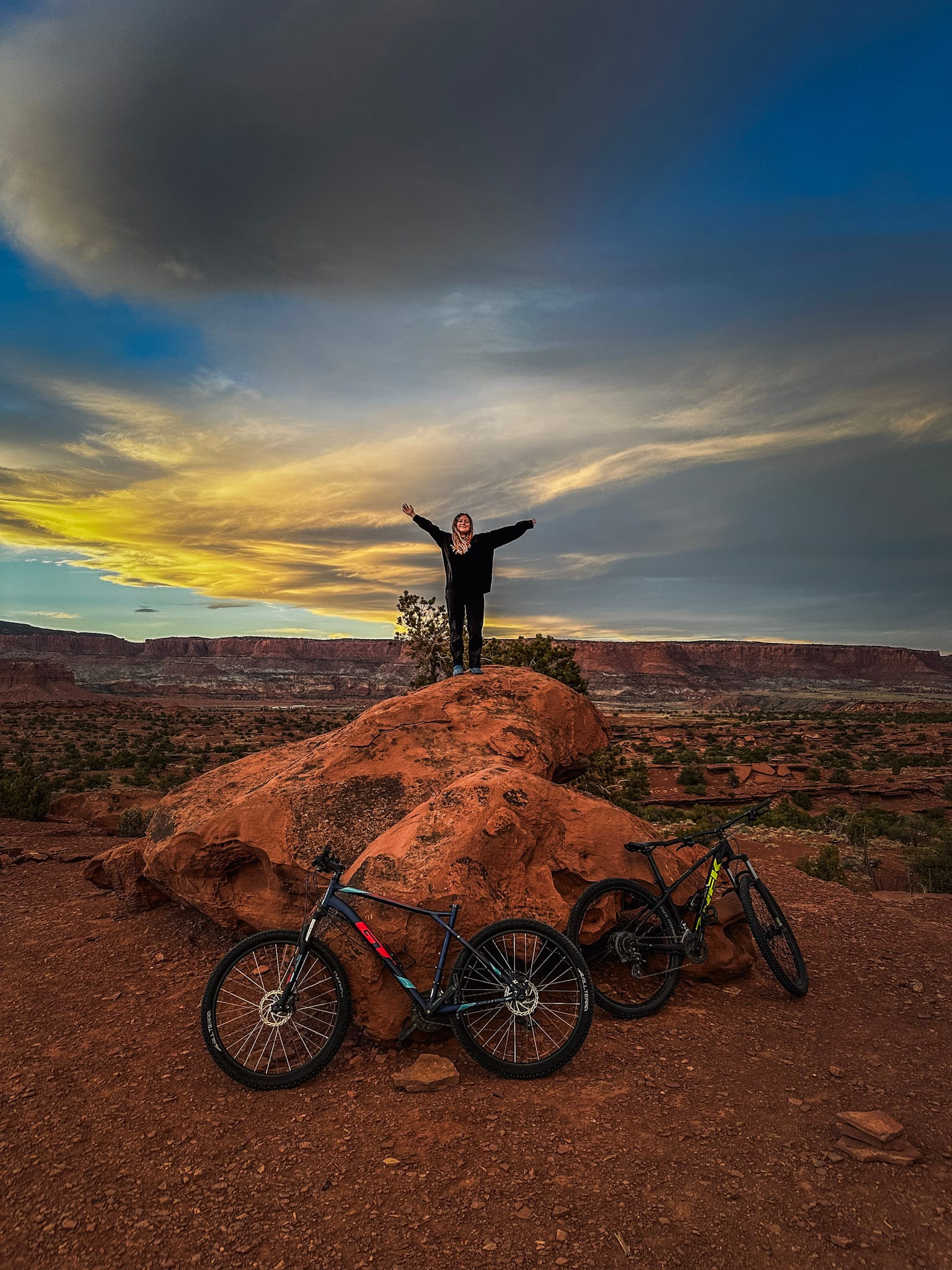
This spot was PERFECT – it was like it was made for camping. The area behind the Airstream was huge and full of big red rocks that you could climb and wander through. There was a huge red rock hill kind of between our site and our neighbor's, so that we couldn't really see each other, and then a bunch of smaller rocks and cave-like areas spread all around behind our spot. And we were on top of a hill that overlooked the Captiol Reef cliffs. The sunsets were gorgeous. We were only a short drive from both the park and the cute town of Torrey, which had a tiny grocery store where we picked up food for the week. It was great.
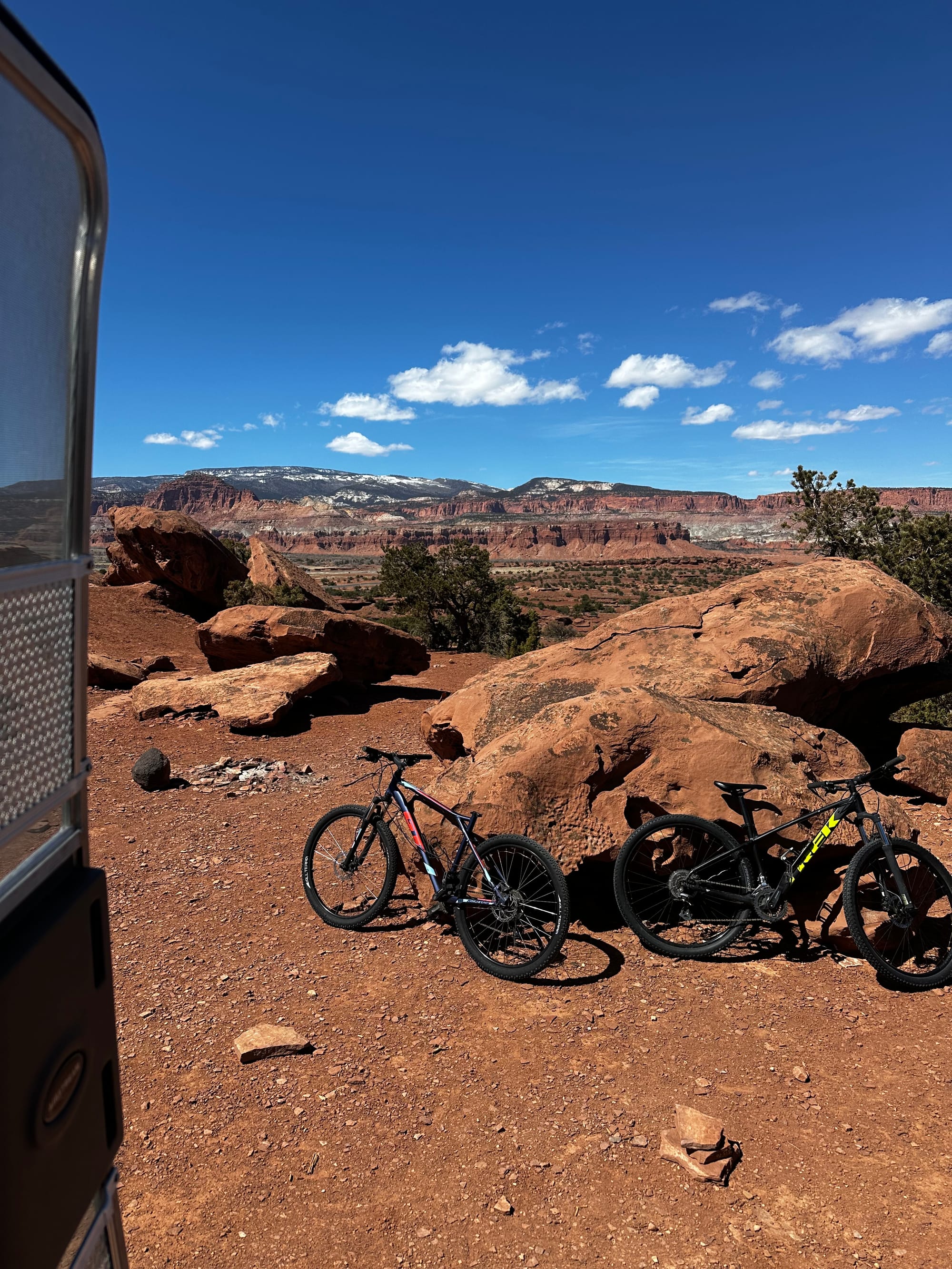
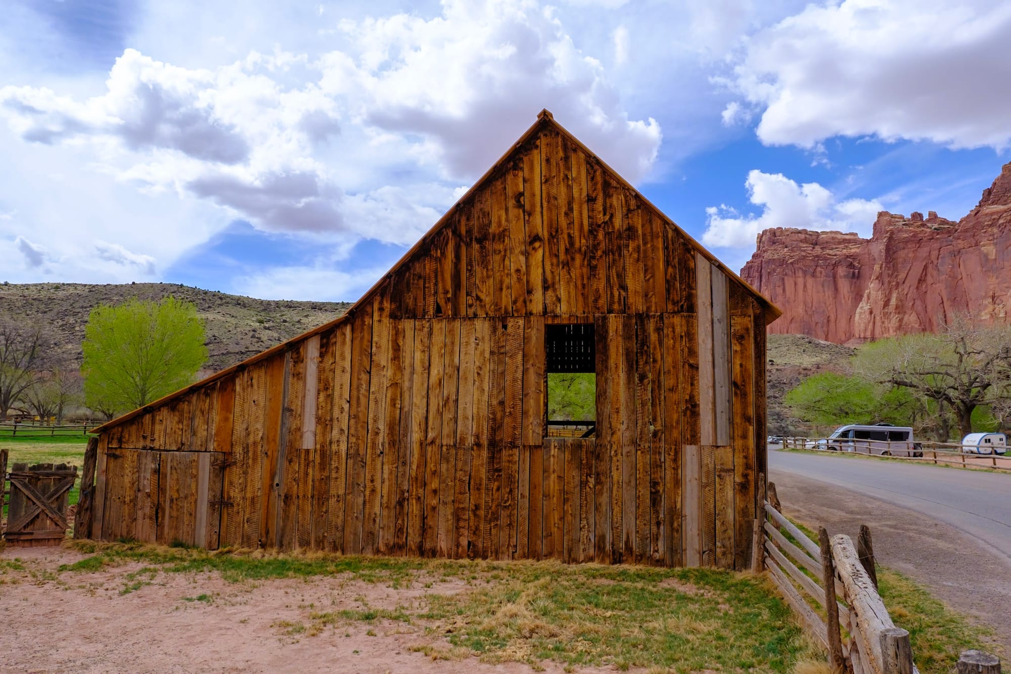
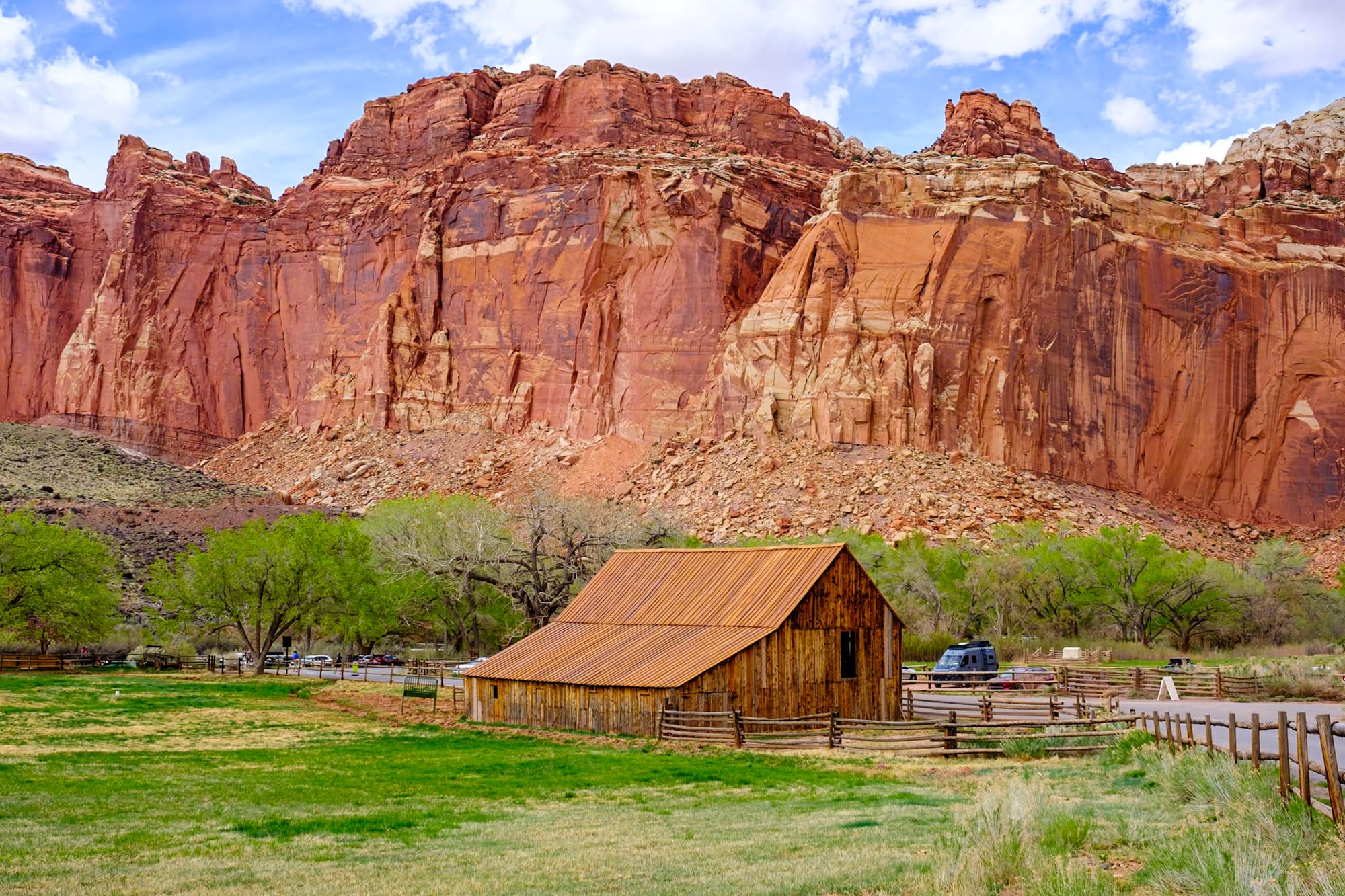
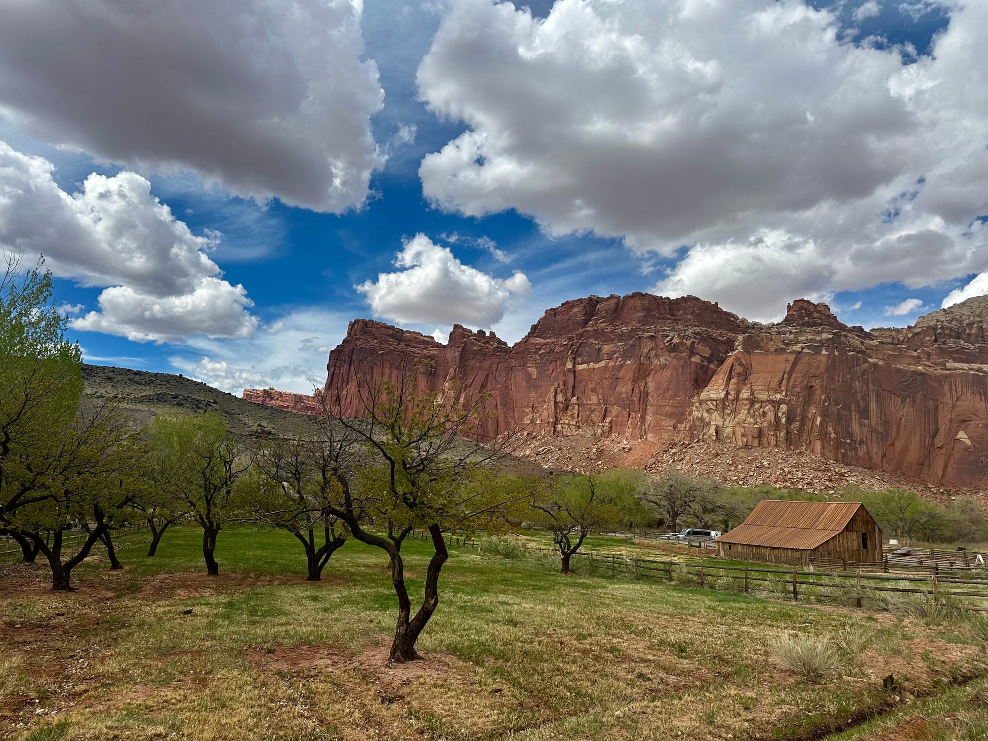
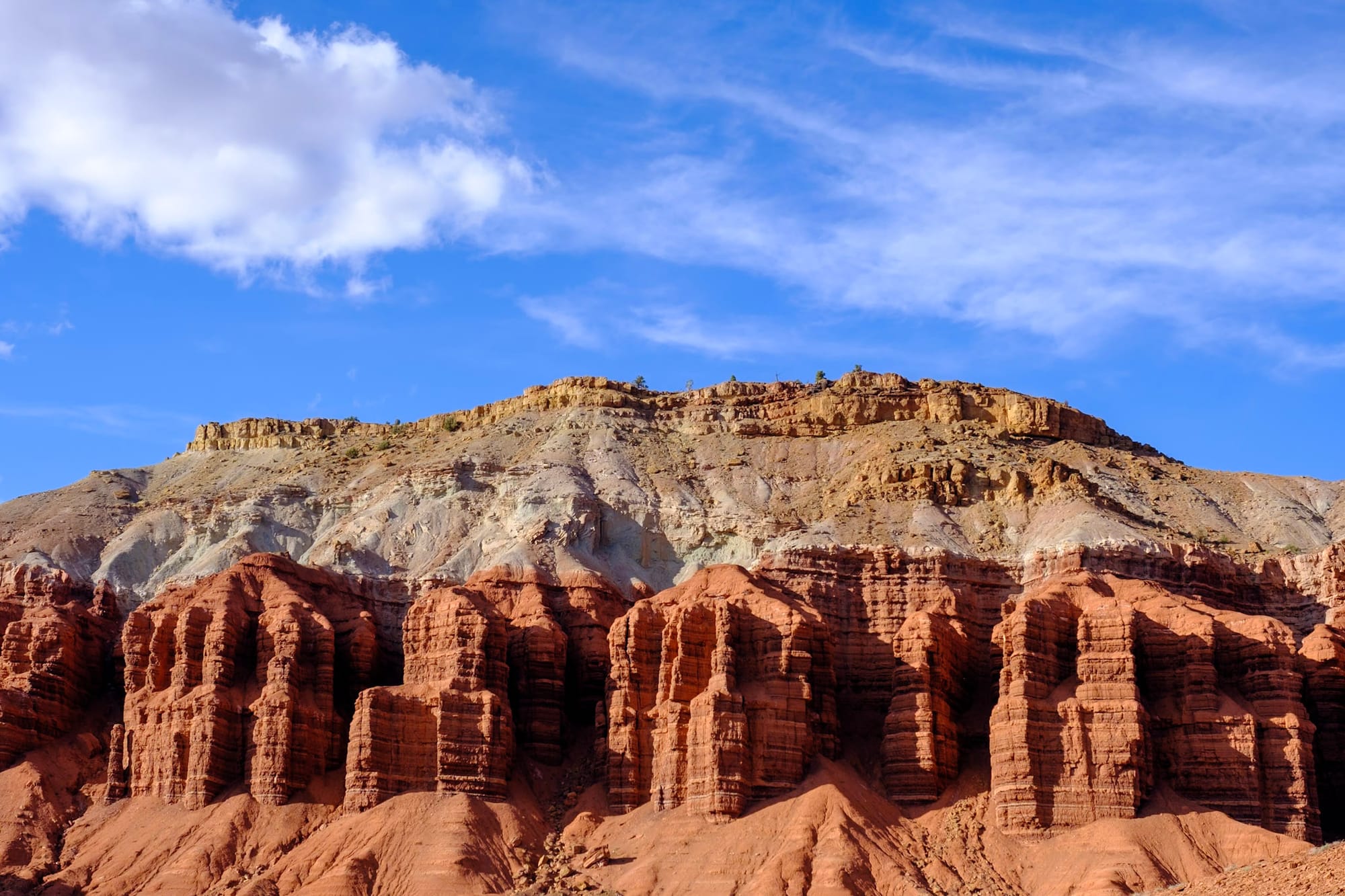
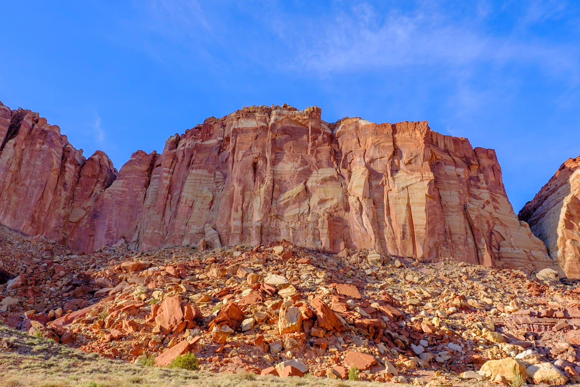
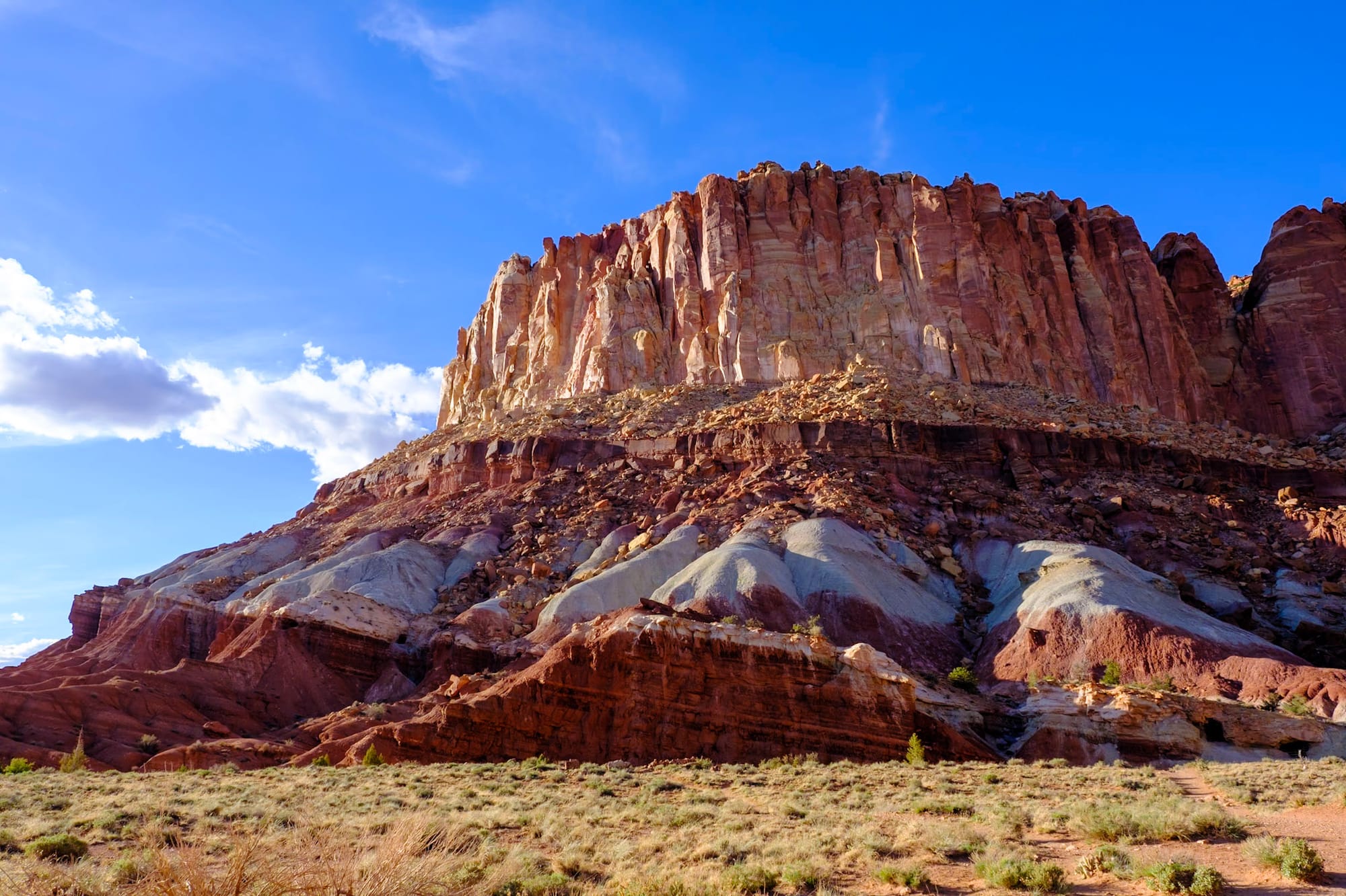
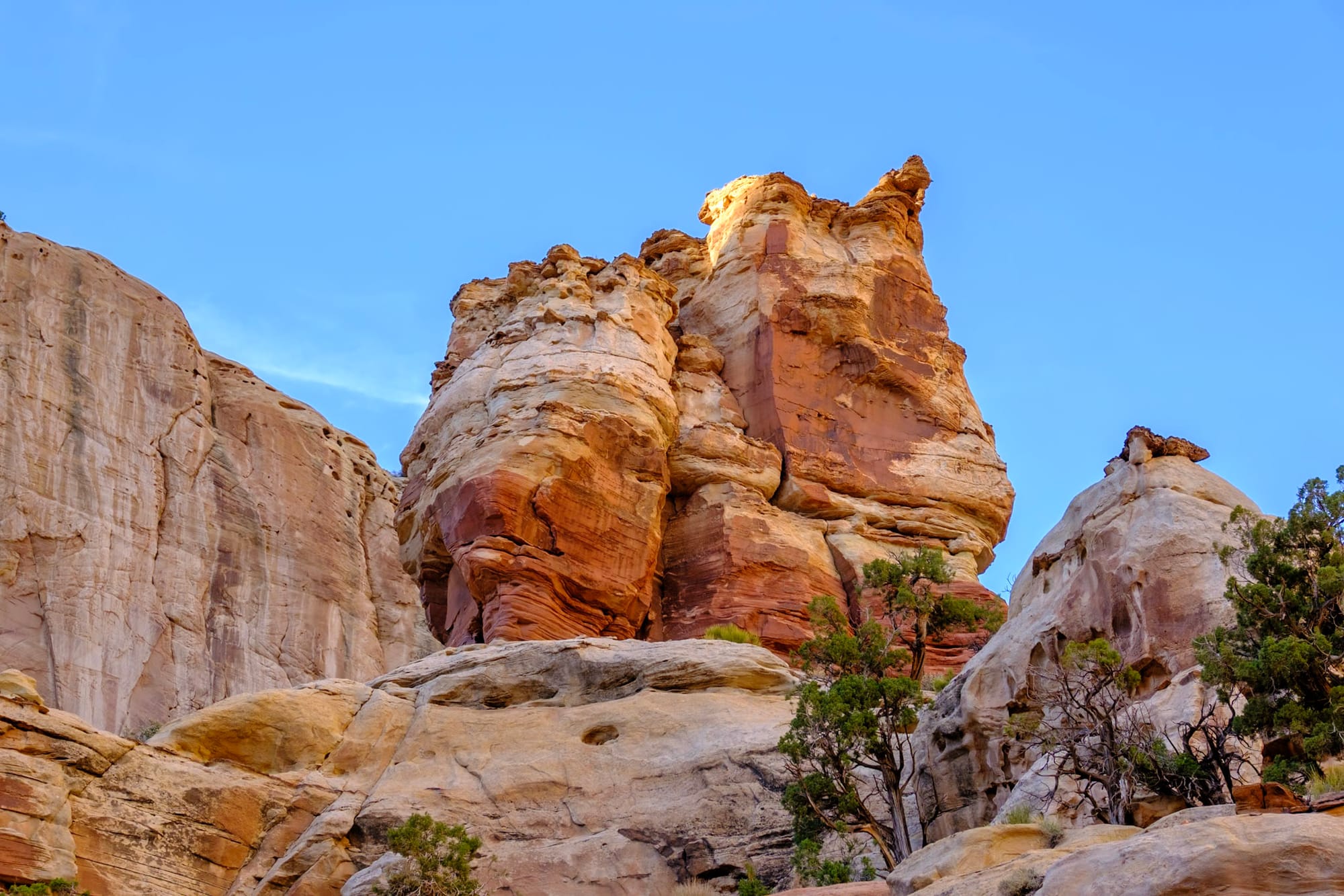
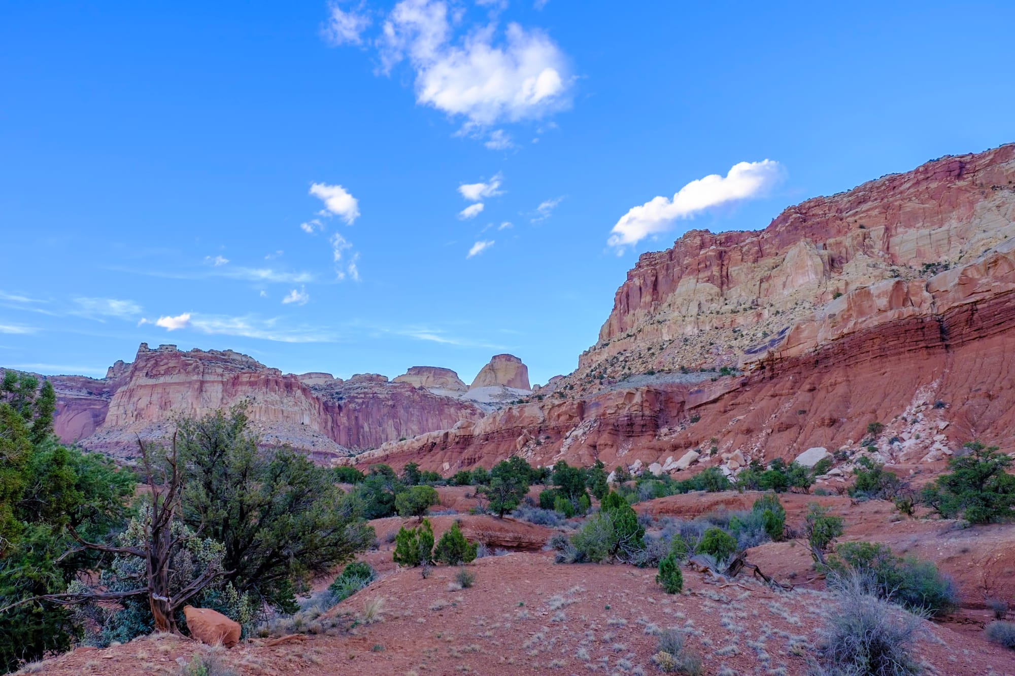
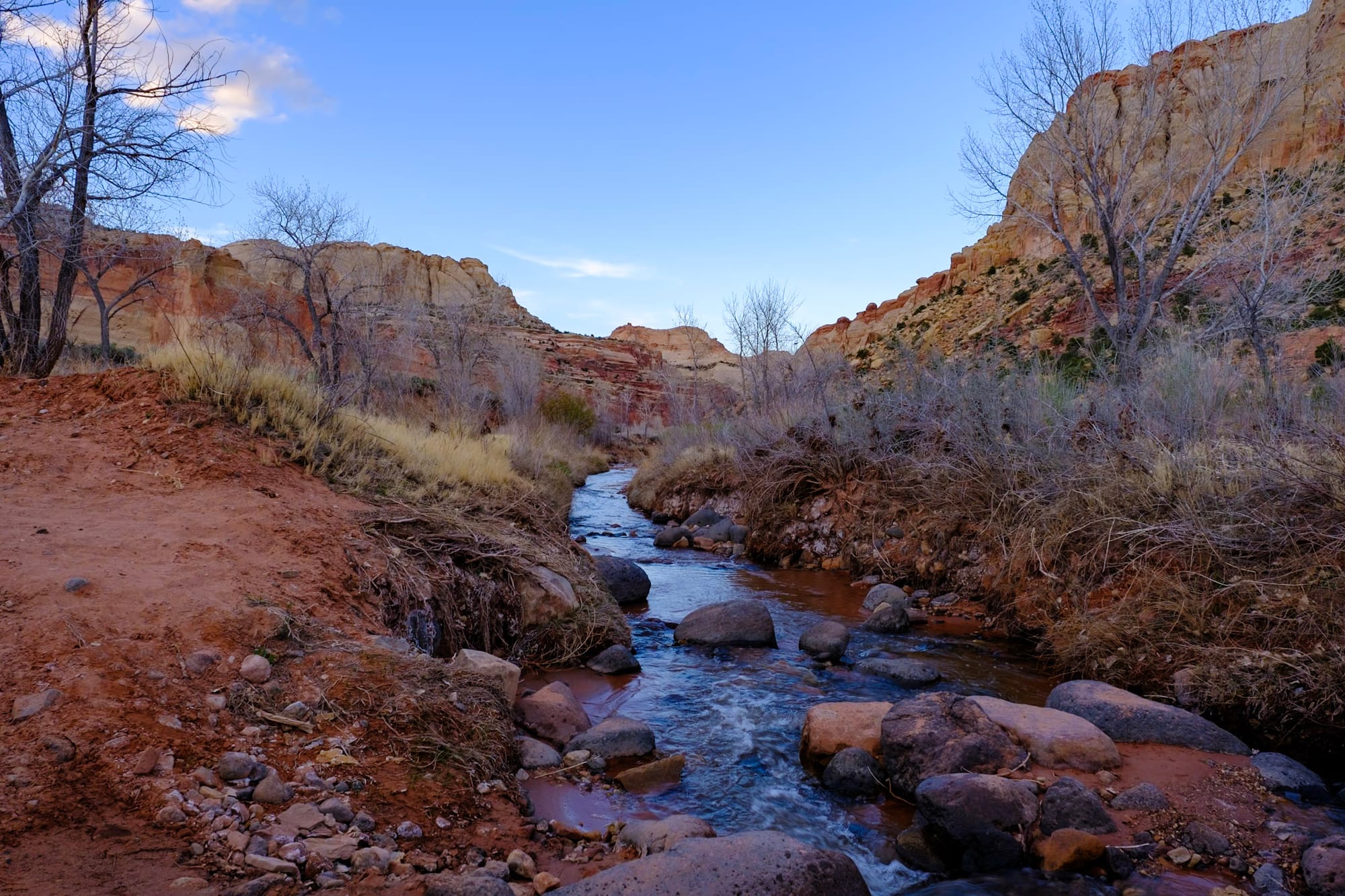
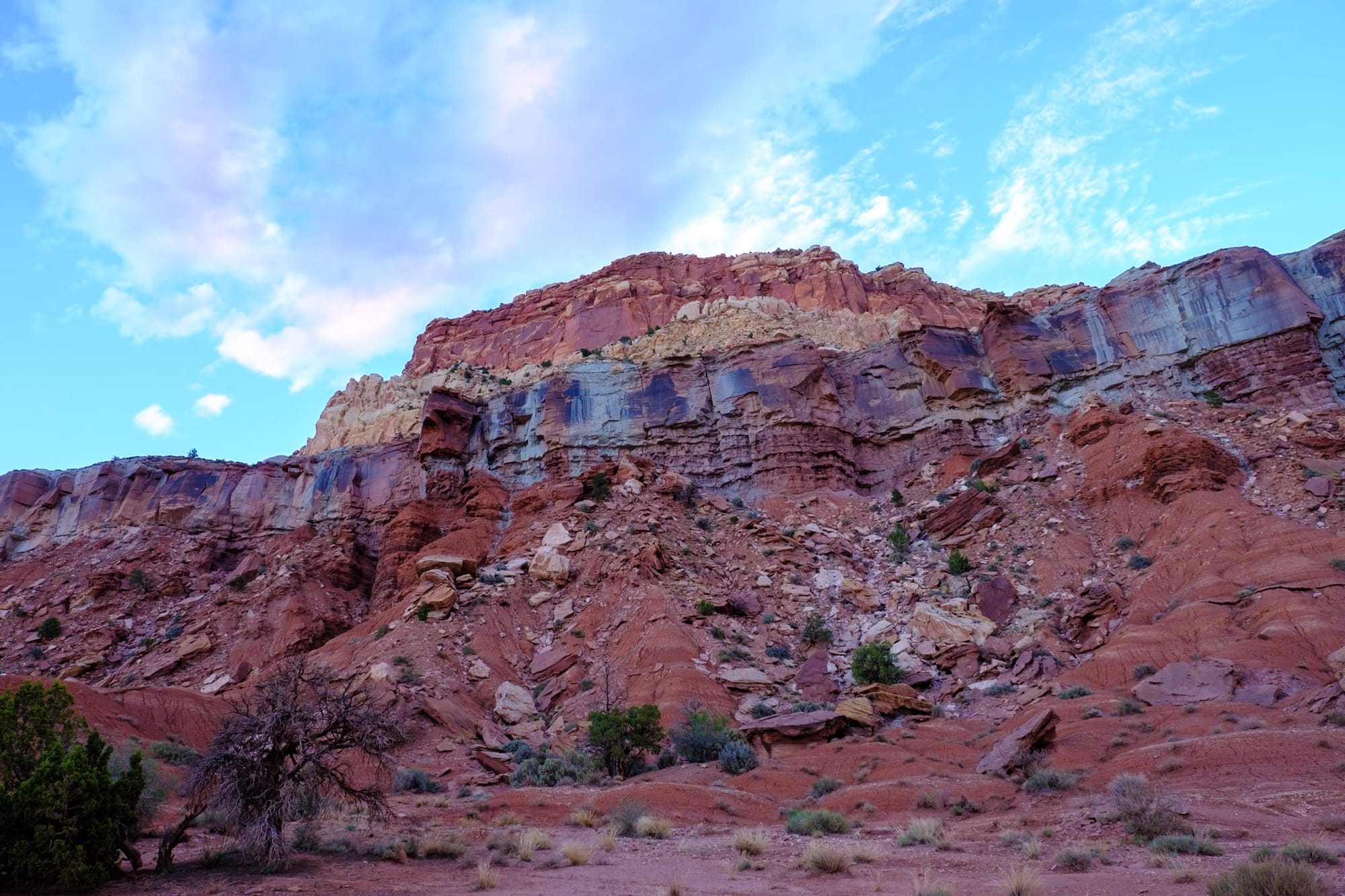
This area of Utah is absolutely beautiful. A lot of the land around the town is relatively flat, lots of farmland with little creeks and bright spring-green trees, but surrounded by huge, colorful, rocky cliffs. In the historic settlement of Fruita inside the national park, they have orchards, which were blooming – you can pick fruit from them later in the season. Capitol Reef is a lot quieter than the other Utah parks, and it feels like a peaceful oasis in the desert. It was one of our favorites.
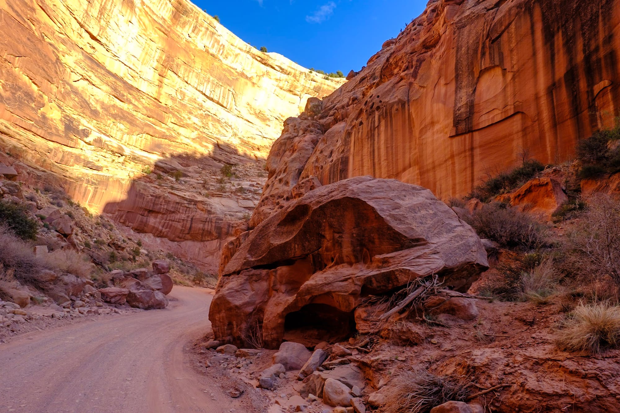
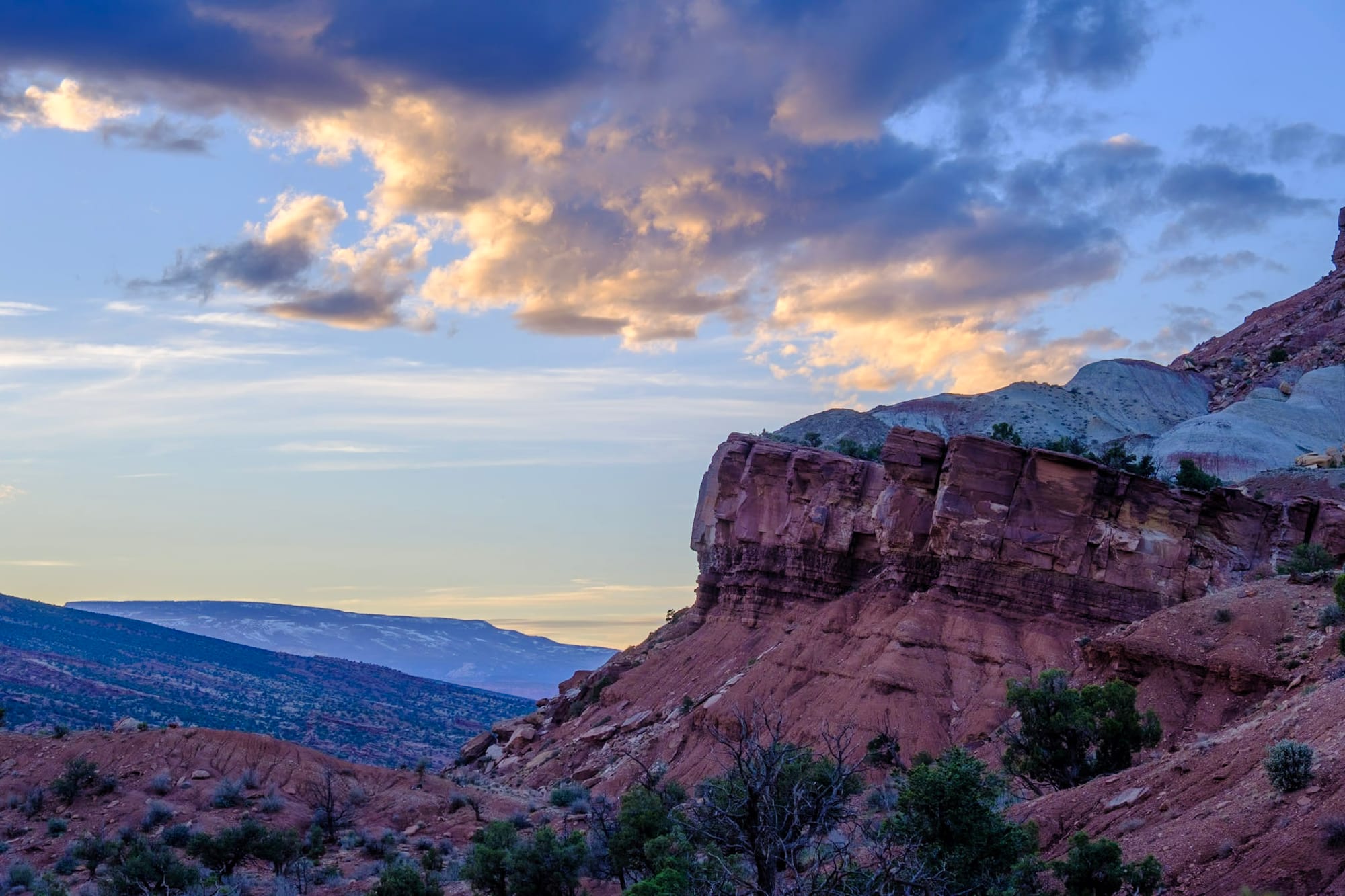
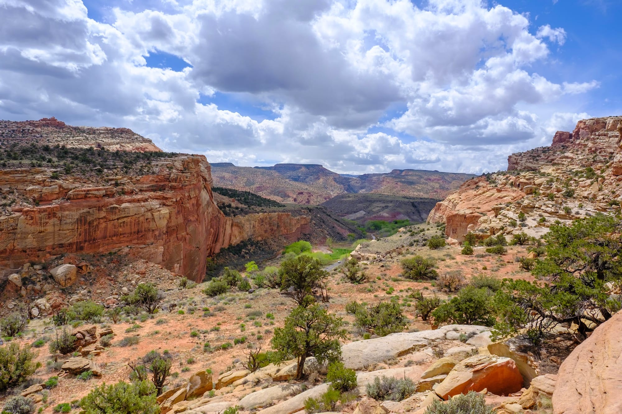
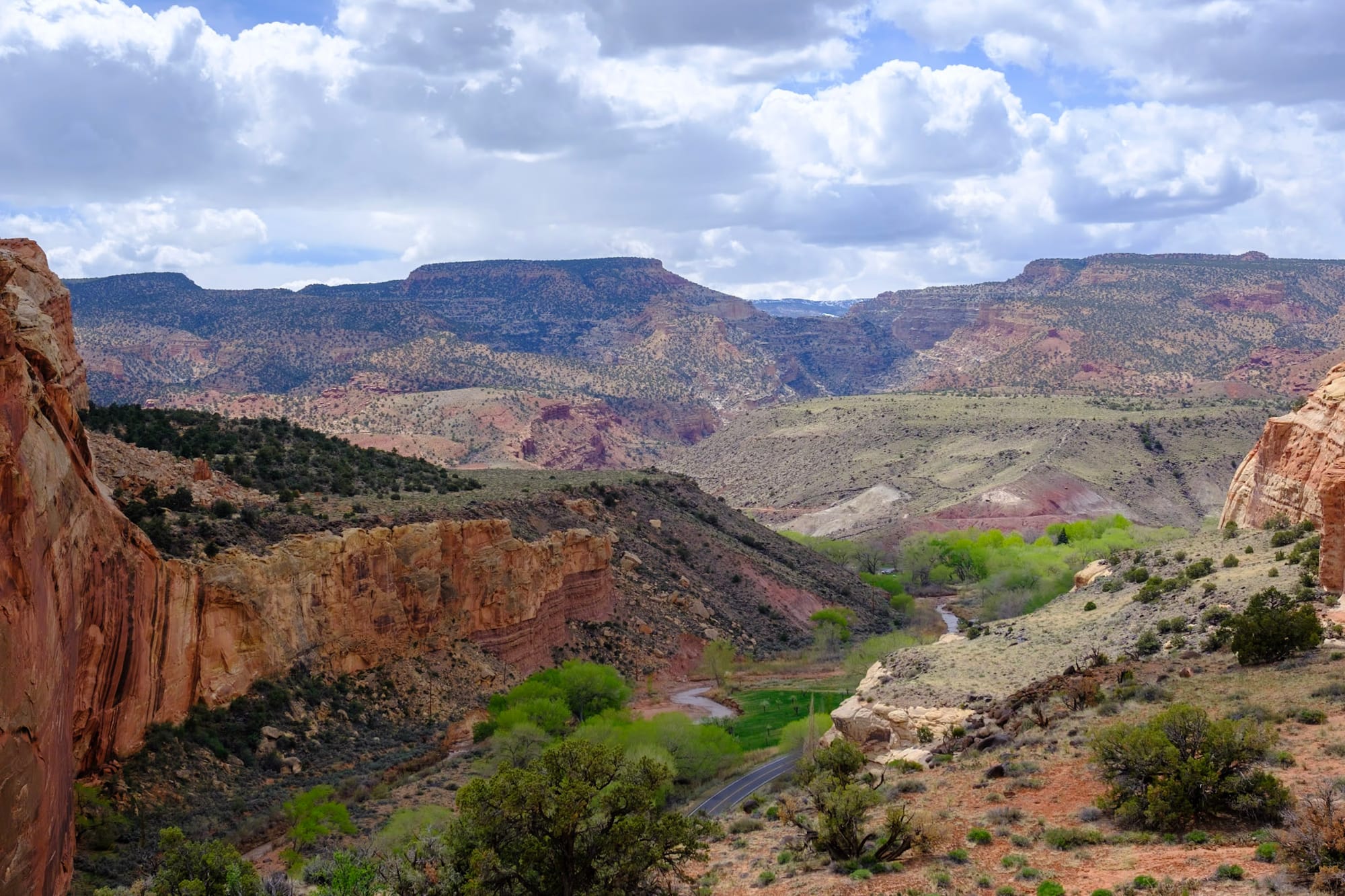
But it still has plenty of desert adventures. We did the scenic drive through the park one evening, which is one main paved road and a few other optional dirt/gravel spur roads that go deeper into the canyons. These roads were so cool – getting narrower and narrower until you're squeezing right in between the canyon walls, hoping another car isn't just around the corner. The almost-sunset light was beautiful on the colorful, patterned rocks.
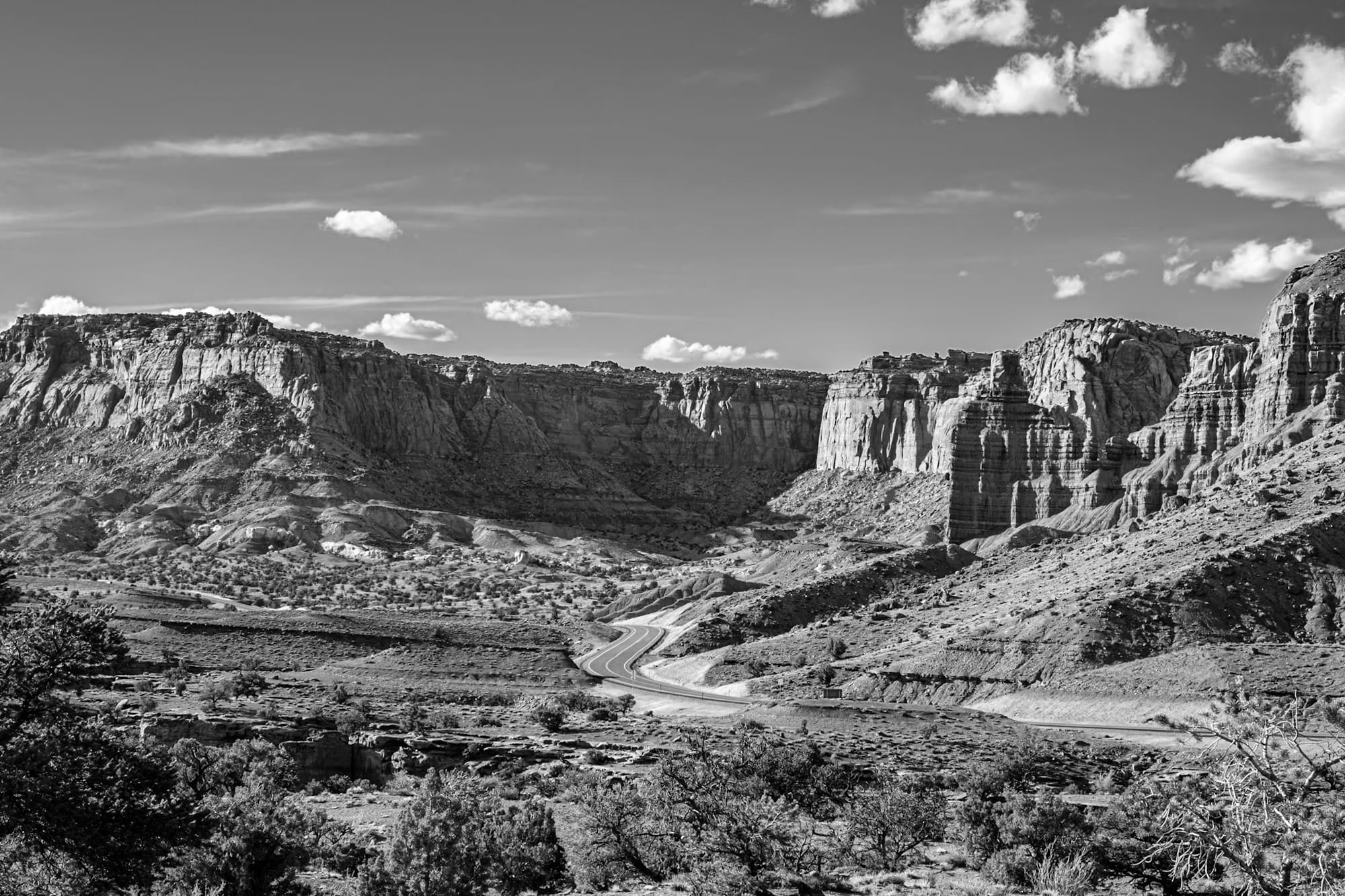
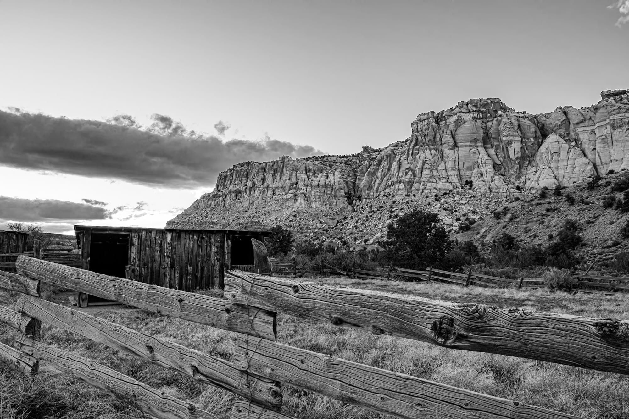
At the end of two of the dirt roads, there were trailheads and small parking lots to turn around in. But on the last one, which was the most remote-feeling road we drove, we came across old farm building remains at Pleasant Creek. The road kept going through and past the creek, but it looked like potentially more intense off-roading than we (or at least I) wanted to do since it was getting dark, so we turned around.
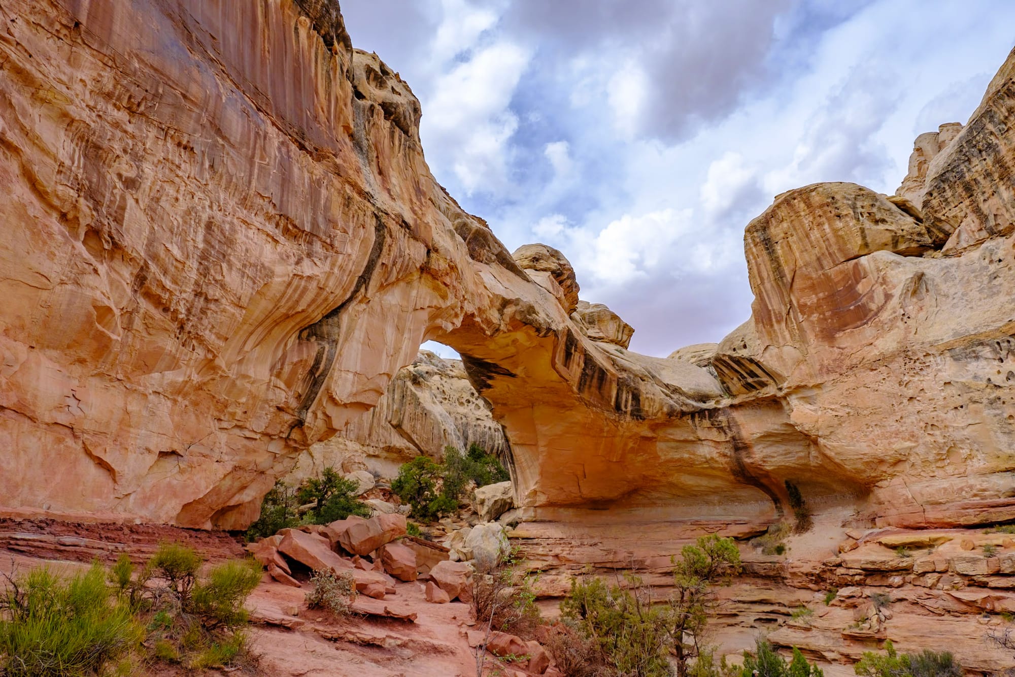
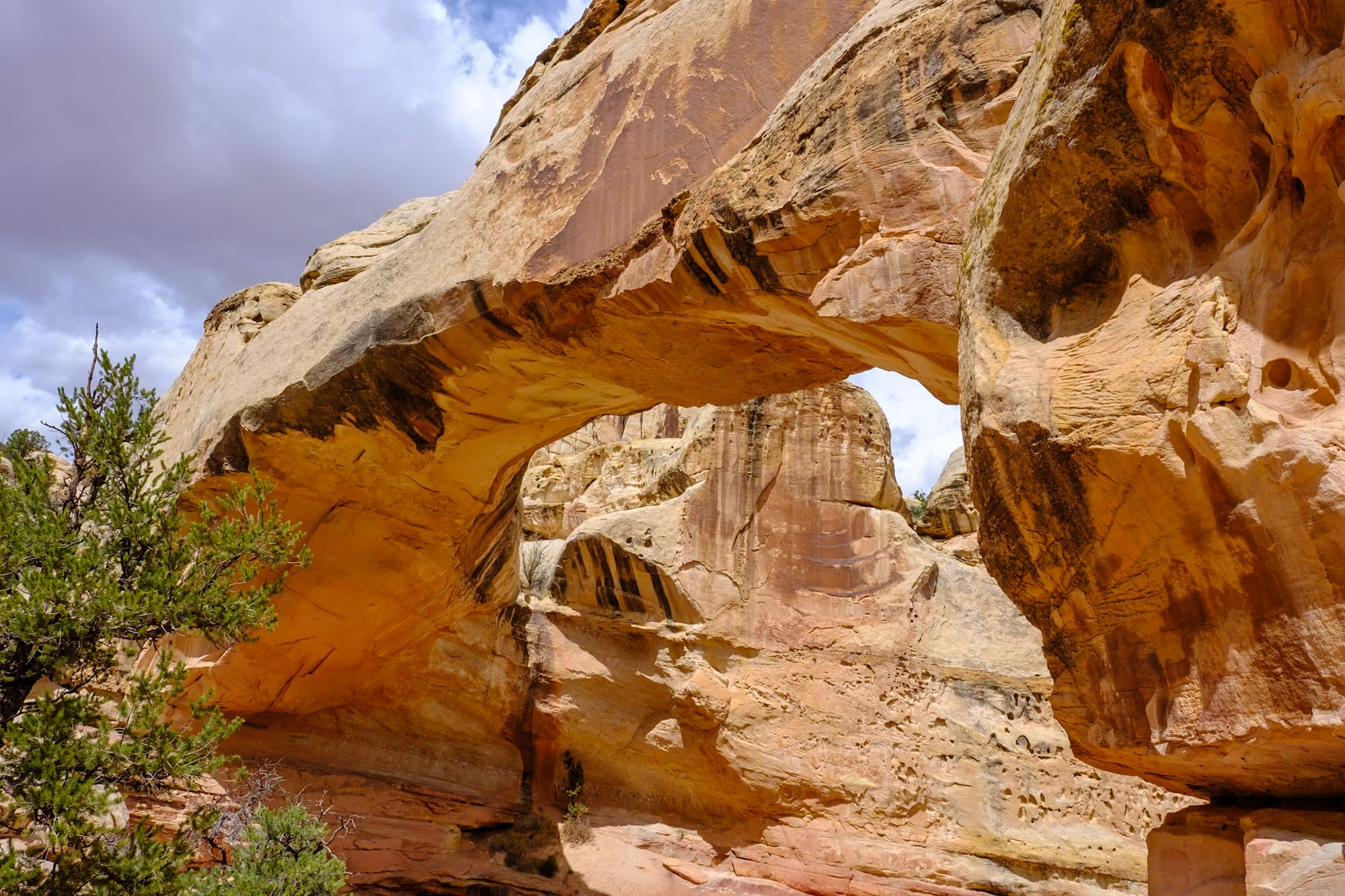
We didn't do much hiking in Capitol Reef, actually, but the scenic drive and narrow roads through the canyons felt like it gave us a nice tour of the park. On a hot weekend day, we did a short hike – Hickman Bridge, a ~3 mile roundtrip hike to a huge stone arch. The views (as always) were super cool along the way, and we spent a while hanging out below the arch before heading back.

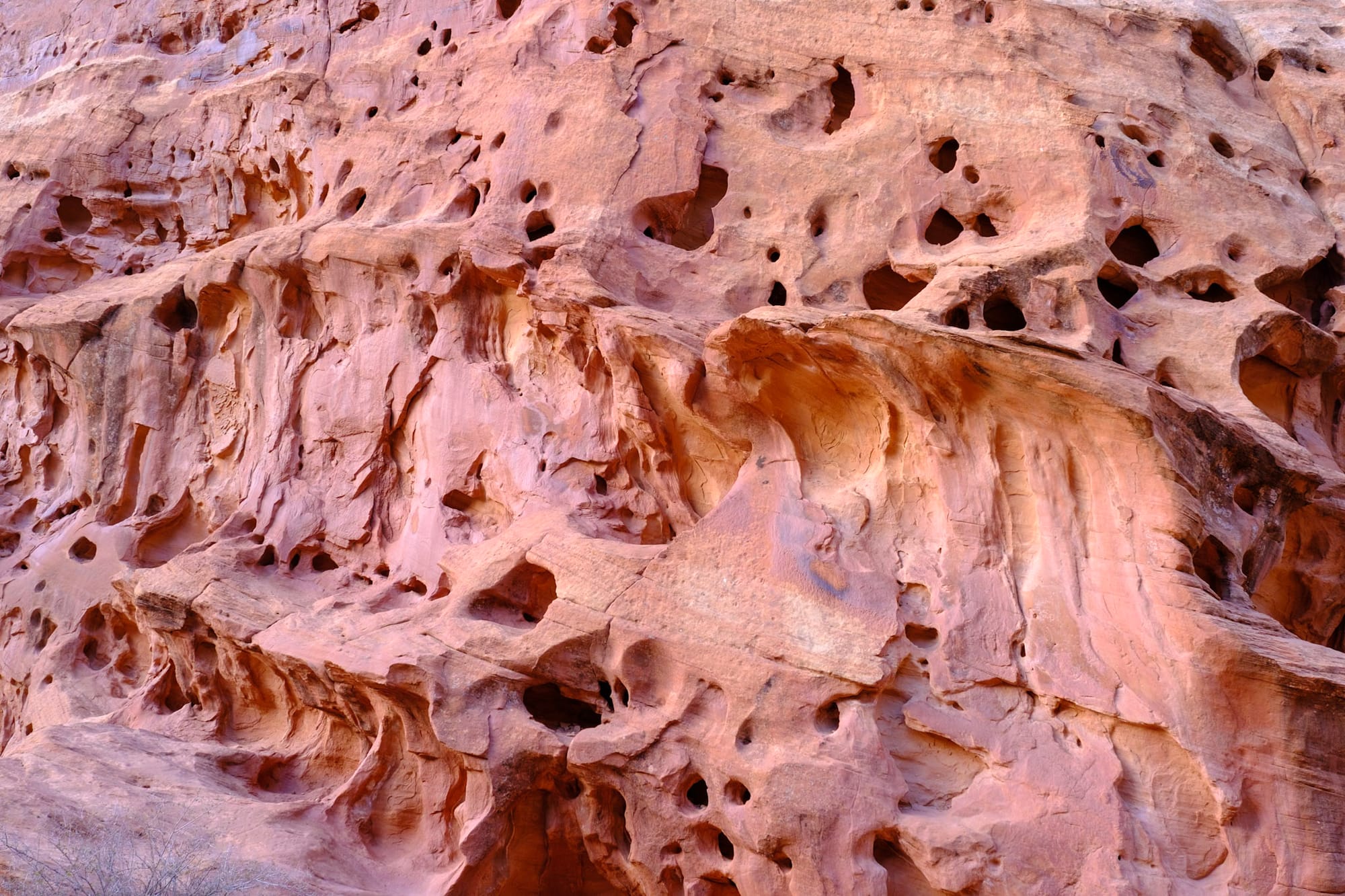
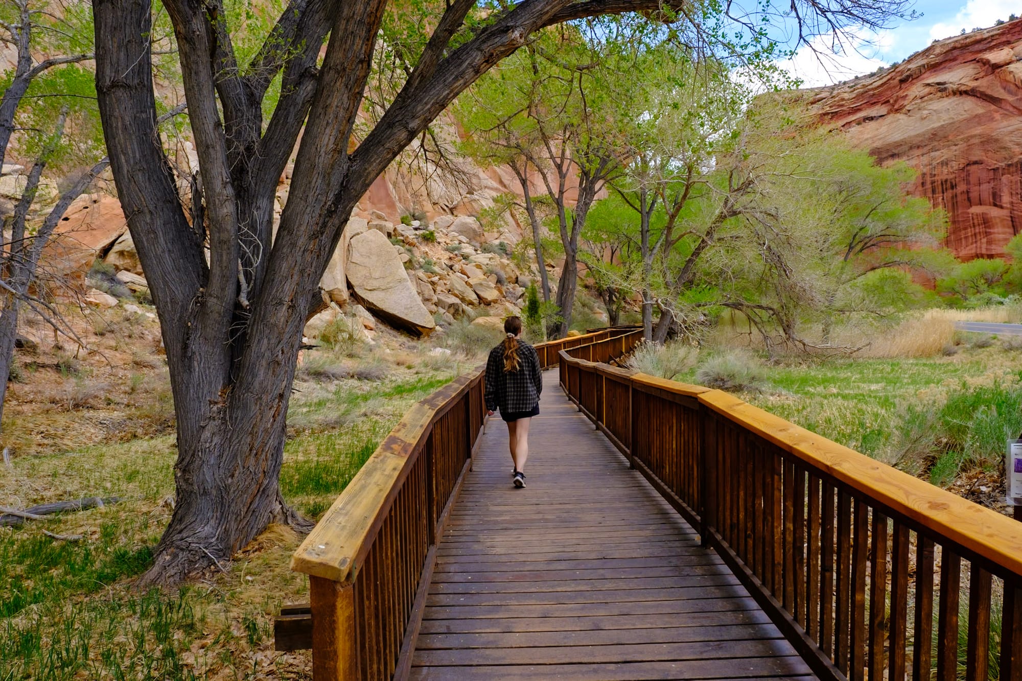
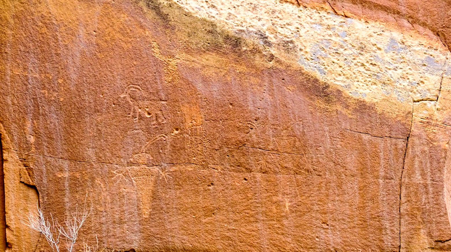
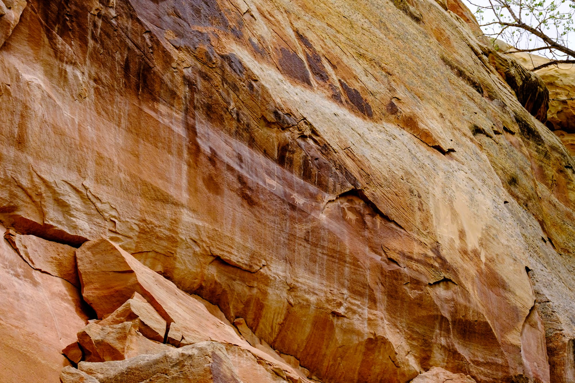
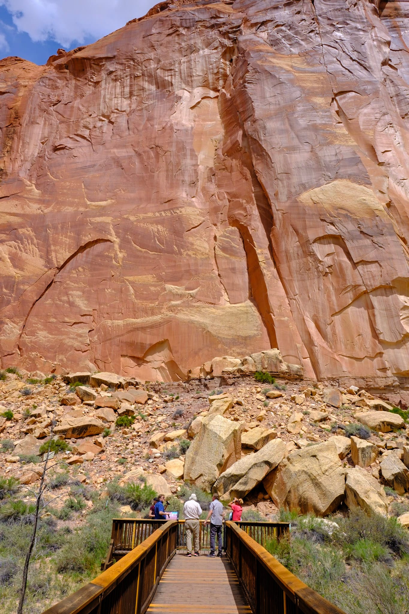
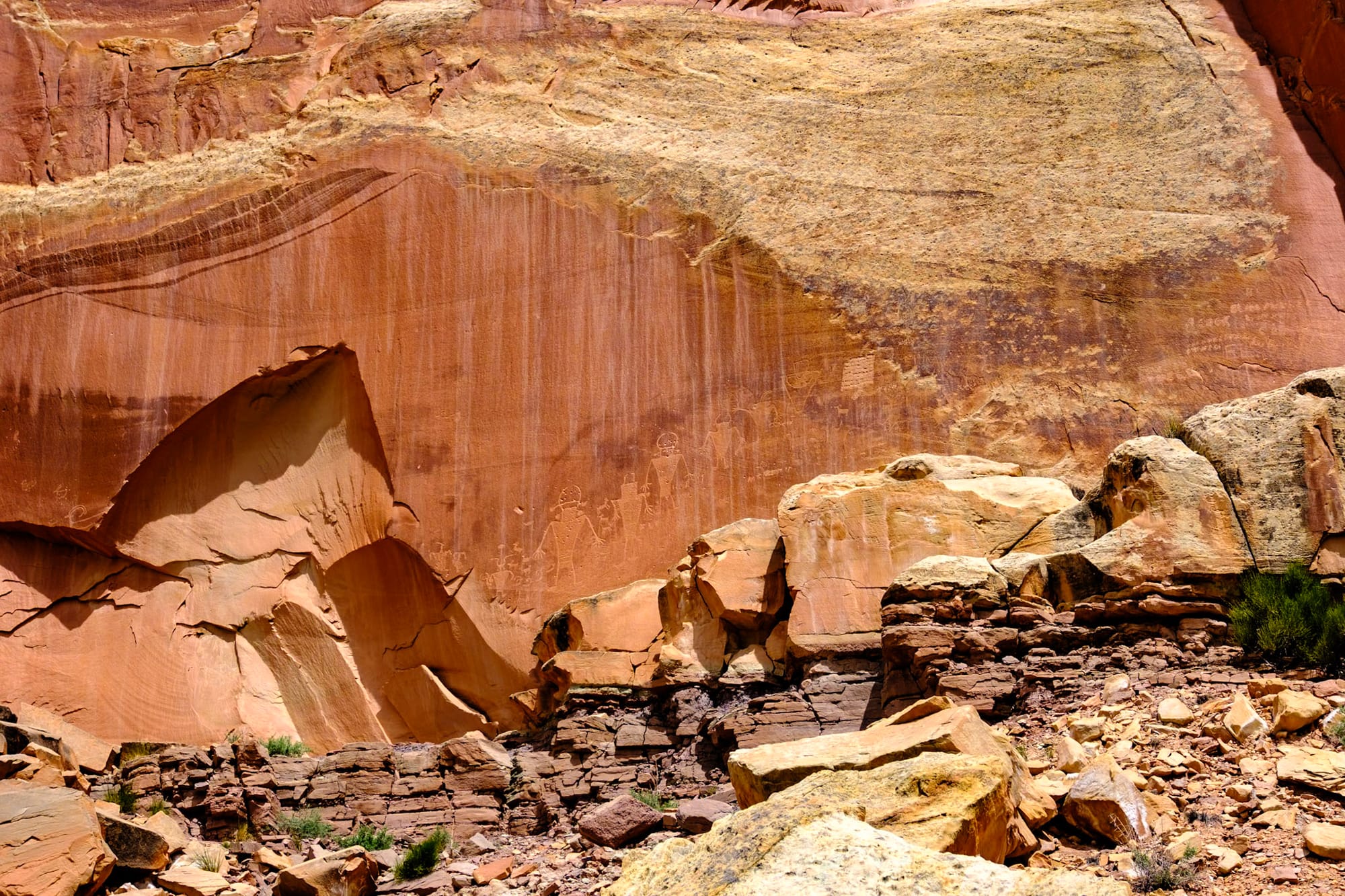
We also stopped at the short petroglyph boardwalk trail, which takes you through some bright green trees on the side of the road right up to the cliff wall, where you can see petroglyphs of people and goats/deer and handprints from long ago.
After the hike, we were hot and hungry, and decided to stop at this Mexican restaurant on the way back to the campground – it was attached to a gas station, but it randomly had really good food and margaritas. We got guacamole and quesadillas to share and both were delicious. We ended up taking more quesadillas home for later. Shoutout to La Cueva!
While I'm talking about food, later that weekend we got burgers from Capitol Burger food truck in Torrey, which were also delicious.
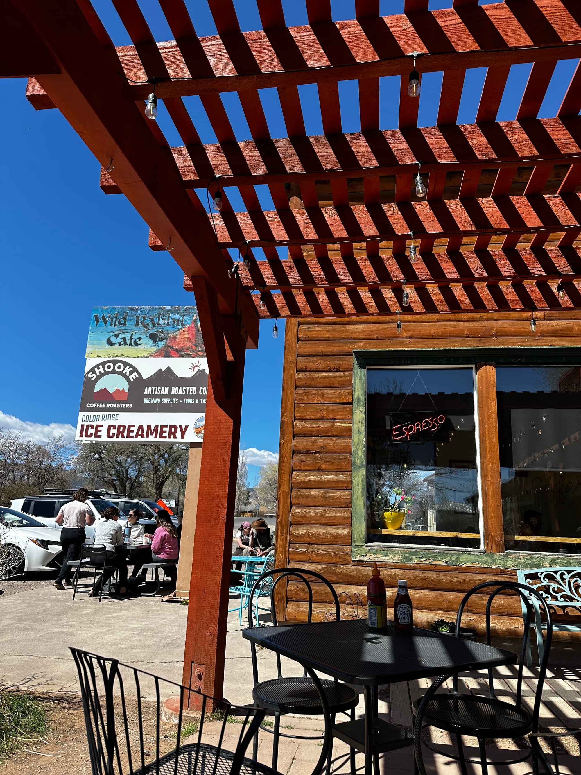
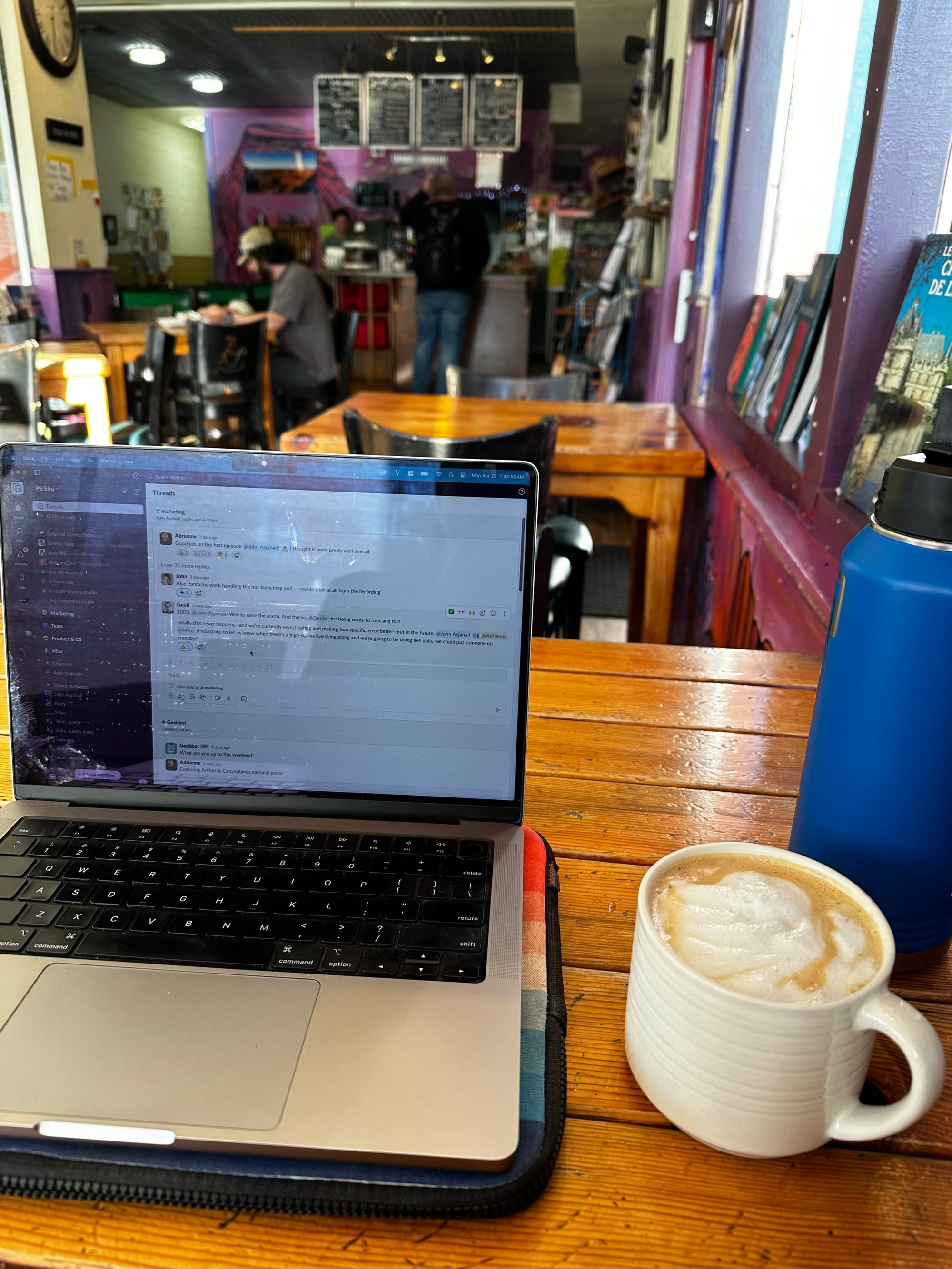
We were originally going to leave for Moab on Sunday, but we really weren't ready to leave Capitol Reef yet and were feeling lazy on Sunday – so we decided to stay one more day. Since we'd be spending part of the afternoon driving the next day, I caught up on work for a couple hours that morning in Torrey at the Wild Rabbit Cafe, sitting outside on their shady patio in the nice weather. Then I went back to relax, read, and enjoy our beautiful campsite for one last night.
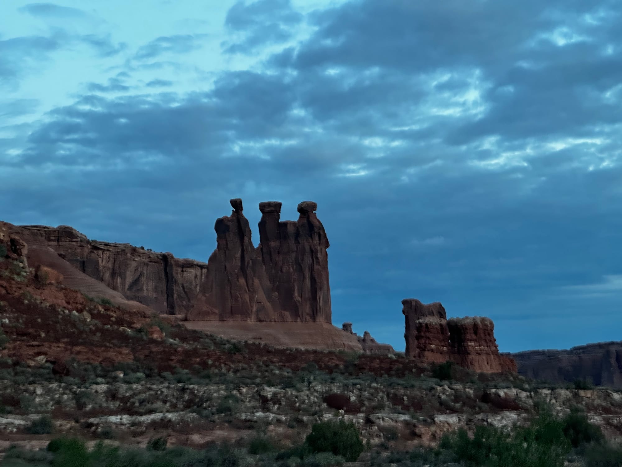
Arches & Canyonlands
The hunt for the perfect Moab campsite
I'm combining the final two Utah national parks into one section since we stayed in the same town (Moab) for both.
Arches is small and easy to visit, and we got to see a lot of the park. But Canyonlands is HUGE and has four separate "districts" which are at least a couple hours from each other. The most accessible district is called Island in the Sky, which is the shortest drive from Moab. That's the only area we were able to see on this trip – the next closest district, the Needles, was an hour and a half away, and we just didn't want to drive that far since we were only in Moab for about a week.
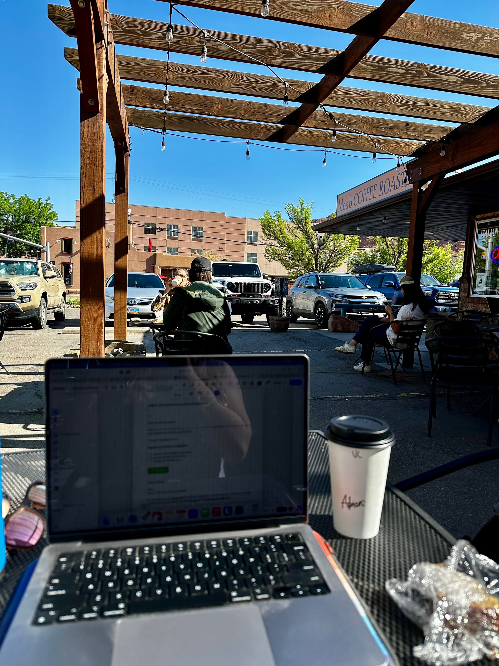
Anyway, both national parks are beautiful and totally worth the visit, of course. And Moab is just really fun, even if it is super popular and busy. It's an outdoor adventure mecca for hikers, rock climbers, mountain bikers, rafters, paddlers, and off-roaders/Jeepers. And it's full of cool stores, restaurants, and coffee shops (the latter I spent a lot of time working in because our campsites didn't have great cell or internet service).
The camping situation in and around Moab is a bit unique. Since it's so busy, there are a lot of regular campgrounds/RV parks like KOAs and Sun Outdoors, but they're expensive, packed, and not our jam. Then there are several "BLM" owned campgrounds close to town that are first-come, first-served, but have designated dry campsites that you pay for ($20/night). These spots are competitive, as I expected and we learned firsthand. As you go further outside Moab, there's more of the normal dispersed desert camping we were used to.
Monday. Anticipating that it would be a bit competitive, I wrote down several campground options. When we got to Moab, we tried our top choices first – a couple campgrounds along UT-128 right outside town. The road follows the Colorado River, with towering red rock walls on either side, and it's beautiful.
We arrived around mid-afternoon, and all the spots we could fit in at Goose Island Campground and Big Bend Campground were taken. We especially loved Goose Island, so we decided to try to come back later in the week to grab a spot. The camp host (who also had an Airstream, so we chatted with him for a while) told us to look at people's reservation tags on their campsite signs to see what day they were leaving, and talk to them if possible to see what time – then to get there early to snag the spot when they left. It's that competitive.
Anyway, we were more successful over at Williams Bottom Campground on Potash Road, which also follows the river and has some good canyon views. There were a few spots open at this campground, but only one could fit the Airstream, and it was kind of an awkward site right against the canyon wall and on the side of the road. We decided to take it rather than drive around to more campgrounds – it was a decent spot – and try for Goose Island the next day.
After getting settled in, we drove into Moab so I could wrap up work for the day (there wasn't any service at the campground) and picked up pizza from Moab Canyon Pizza Co. We took it back to the campsite and sat outside at sunset while we ate – it was peaceful and really warm outside.
Tuesday. We got up early and Joey dropped me off at Moab Coffee Roasters just after 7am so I could take some meetings. I spent a lot of time here over the week; it was a cute and popular coffee shop with a nice outdoor patio. Then he went back to Goose Island to try to get a spot we knew someone was vacating that day – but just before Joey got there, someone else had already pulled in and claimed it. There weren't any other open spots, but he scoped out the options for tomorrow and found someone who was planning to leave around 6am. We decided to just get up super early and try to get that spot – it would be worth it.
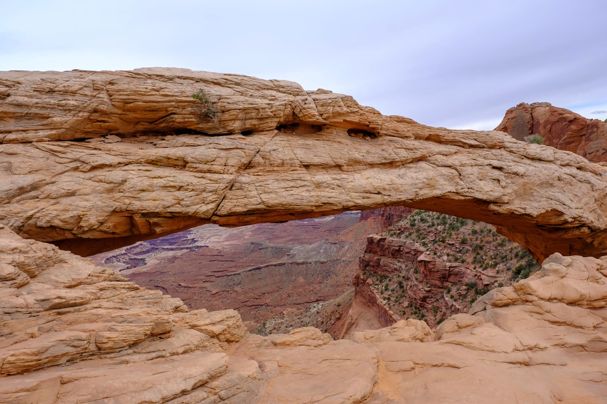
After work, we drove the main road through Arches National Park. You need a vehicle reservation to enter the park between 7am-4pm, but it's generally better to go early or later and we had to work anyway, so we didn't worry about getting a reservation. The Arches scenic drive is gorgeous, with lots of overlooks and short, easy trails to the most popular arches in the park.
Wednesday. We got up at 5am, made coffee, packed our work stuff, and drove back over to Goose Island to grab our coveted campsite. We hung out in the dark, lurking by this guy's campground and drinking coffee, while we waited for him to get ready and leave. He left around 6:30am (shoutout to this super nice guy) and we moved the truck in, paid for it, and claimed it. The campsite was ours!
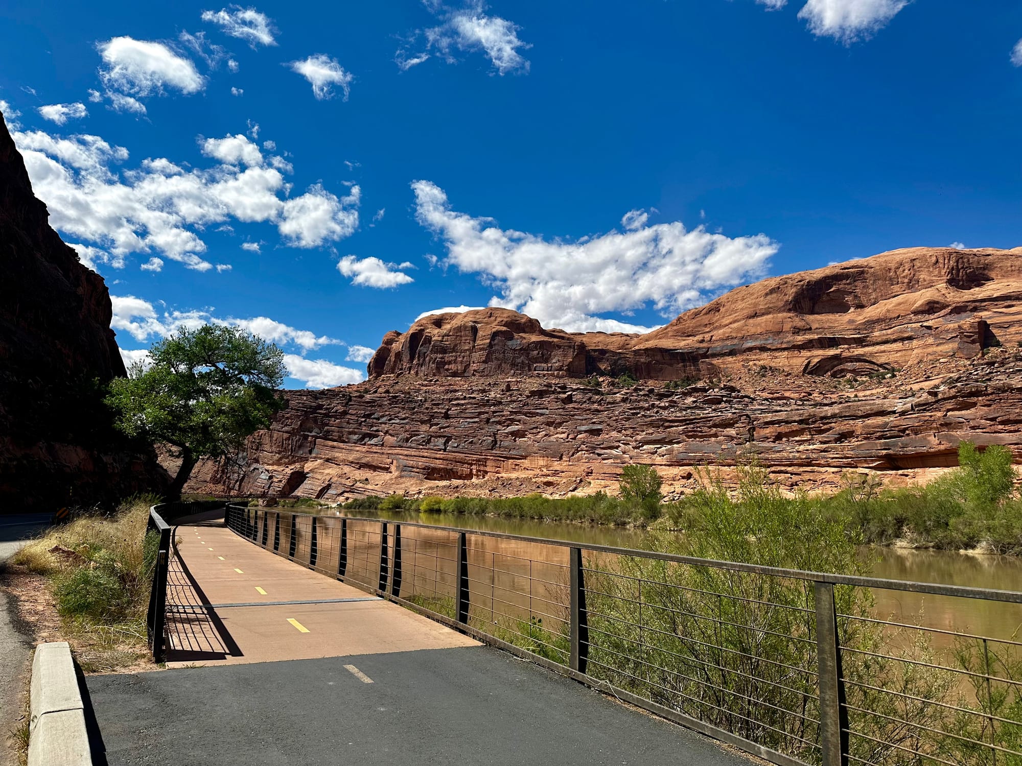
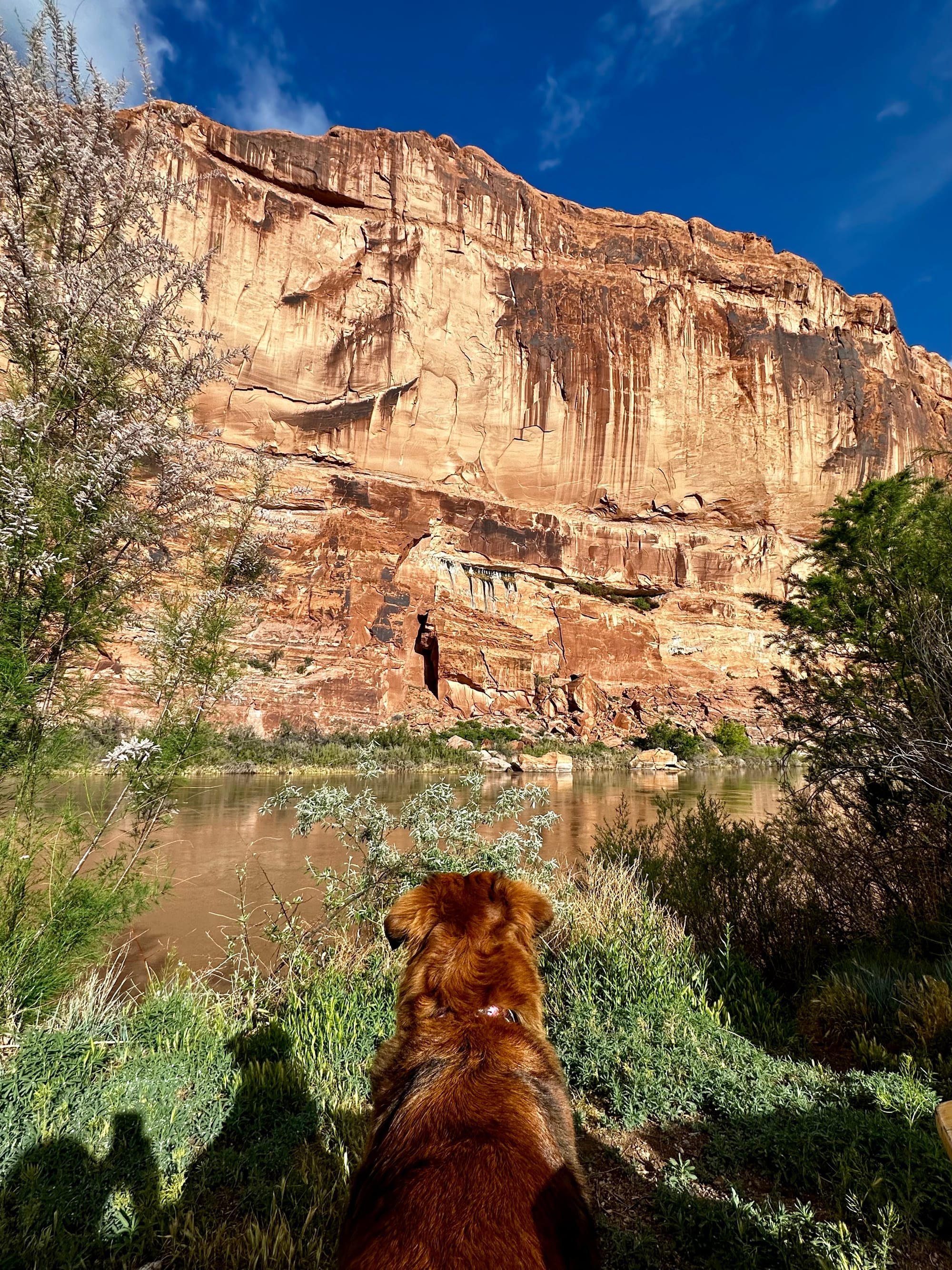
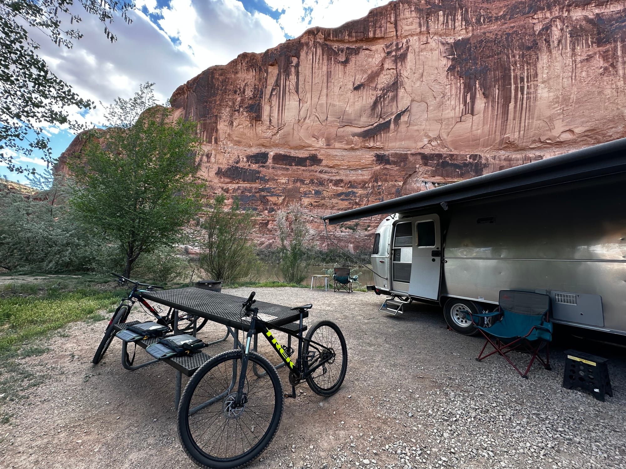
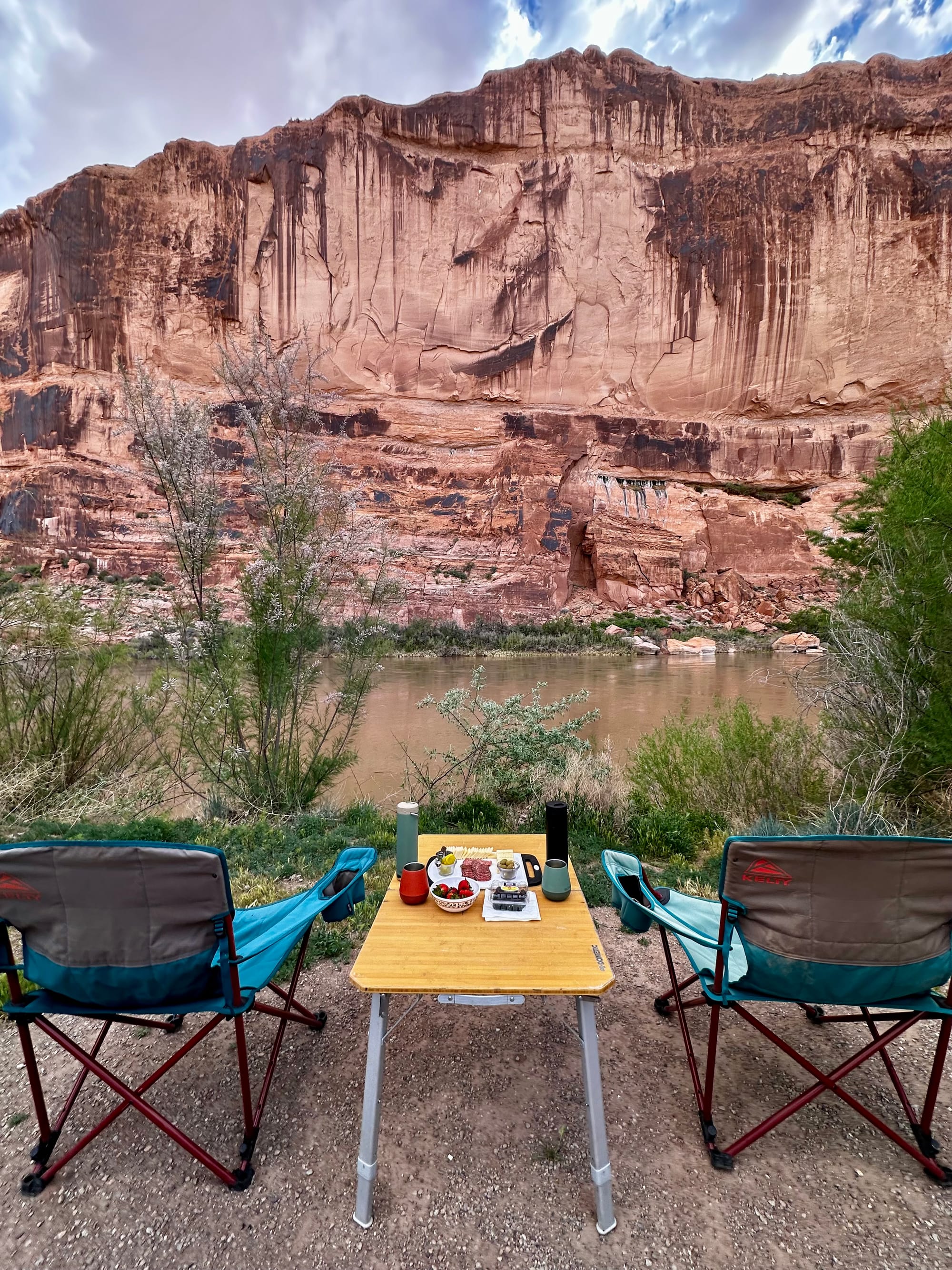
You might be wondering why we would go to all this effort, but a great campsite can make a huge difference in your experience. Sure, we would've been fine with our other site for the week. But the Goose Island site was gorgeous, peaceful, and in a great location. Did I mention we were right on the Colorado River? And on the other side, the huge canyon wall towered over us. The sites were big and relatively private, with a picnic table, fire ring, and trees and bushes partially blocking the neighbors. Sitting in the warm sun and watching kayakers paddle by on the river was so nice and peaceful. Also, we were getting just enough internet service to get work done if we didn't have to take Zoom calls (still had to go into town for those). So yes, to us it was totally worth it.
After we claimed the site, Joey dropped me off at the coffee shop again for my morning meetings while he moved the RV to our new spot. When I got back that afternoon, we took Hollie for a long walk up the greenway to the main road, where a bridge crossed the river. It was hot outside, and she was worn out by the time we get back. One cool thing we came across was a natural spring, with the water steadily streaming out of a hole in the canyon wall across the street. We filled our water bottles there and it tasted good! That evening, we had a charcuterie and wine night sitting by the river, which was lovely.
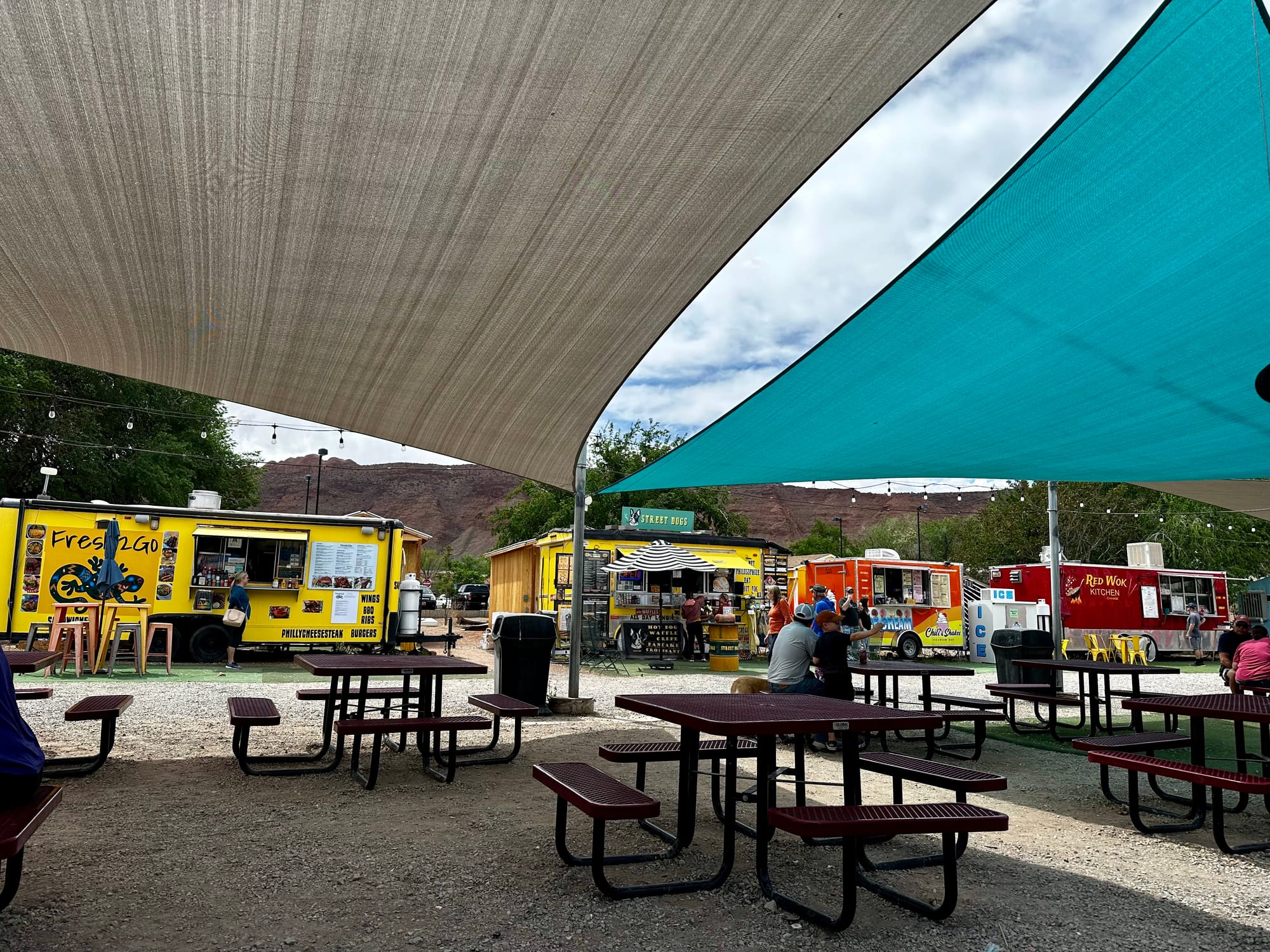
Thursday. We worked in town again to take meetings – this time moving over to Red Rock Bakery & Cafe, which had delicious coffee, smoothies, breakfast sandwiches and baked goods. The staff was super friendly and the inside had lots of cool local art. Me and Joey got lunch at the Moab Food Truck Park, a shaded area with a bunch of tables surrounded by more than a dozen food trucks. Joey got a London Broil sandwich (missing Mitch's in Raleigh) and I got sushi. We did laundry in town that afternoon, finished work, and had a chill night back at the campground.
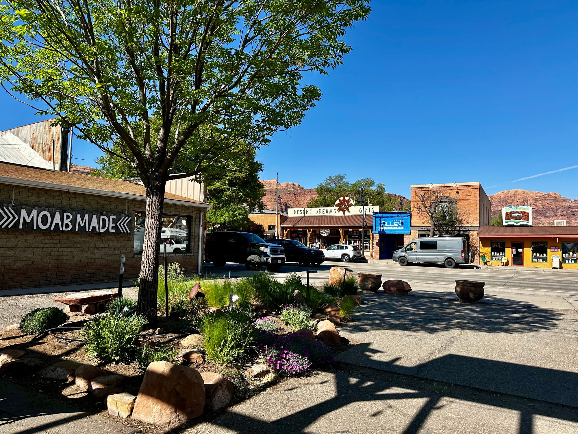
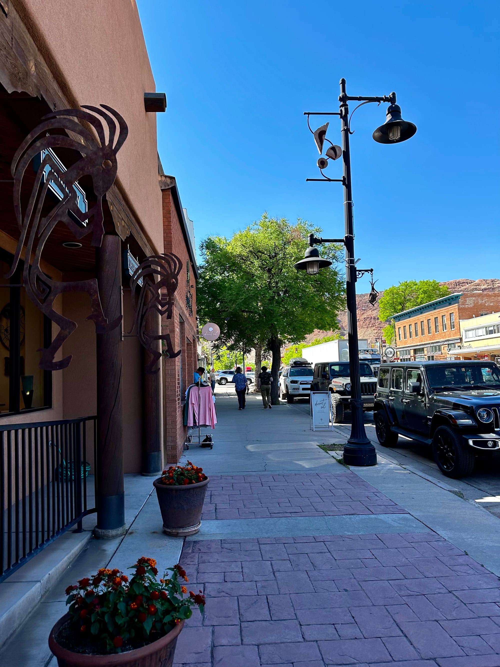
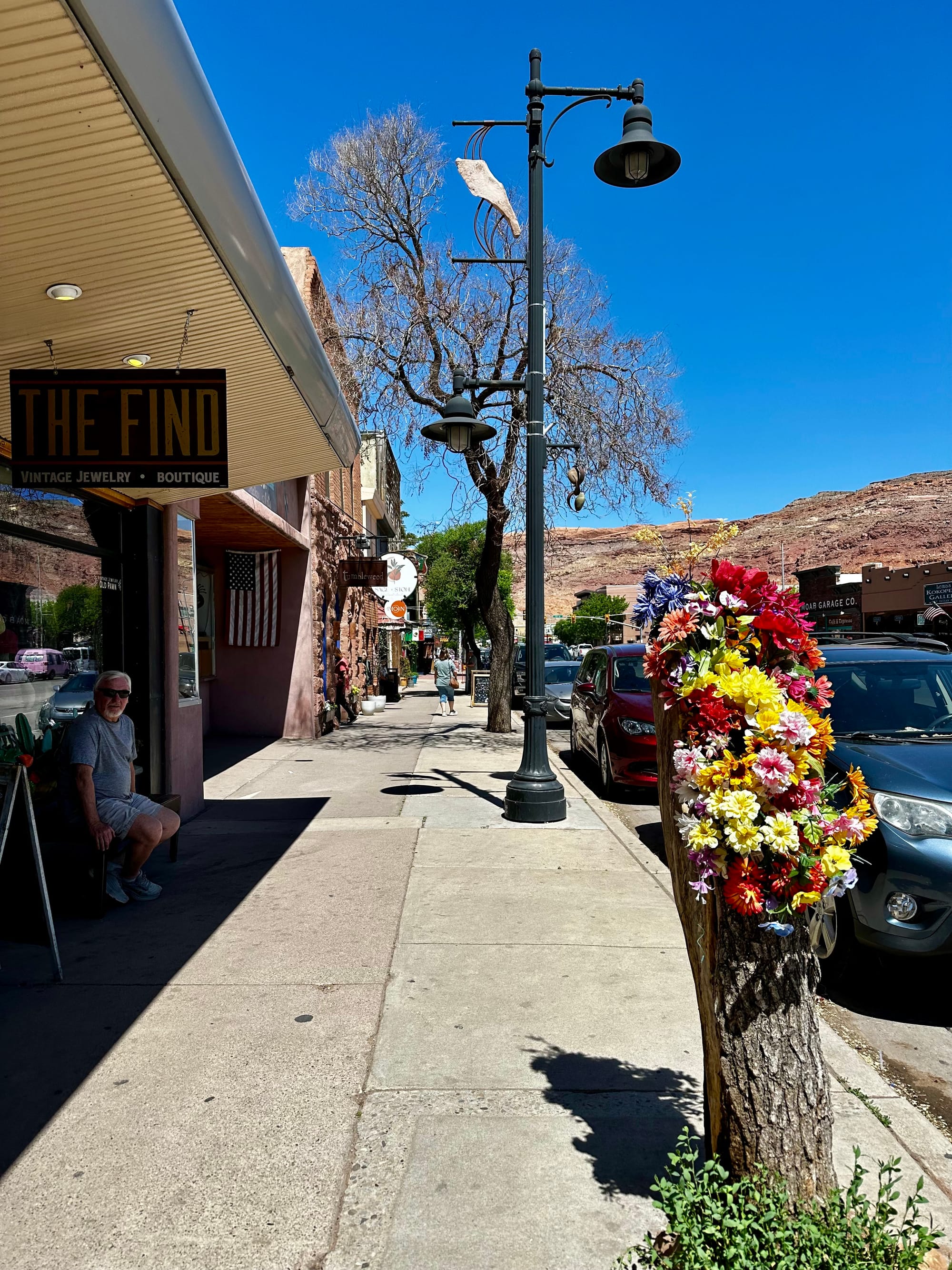
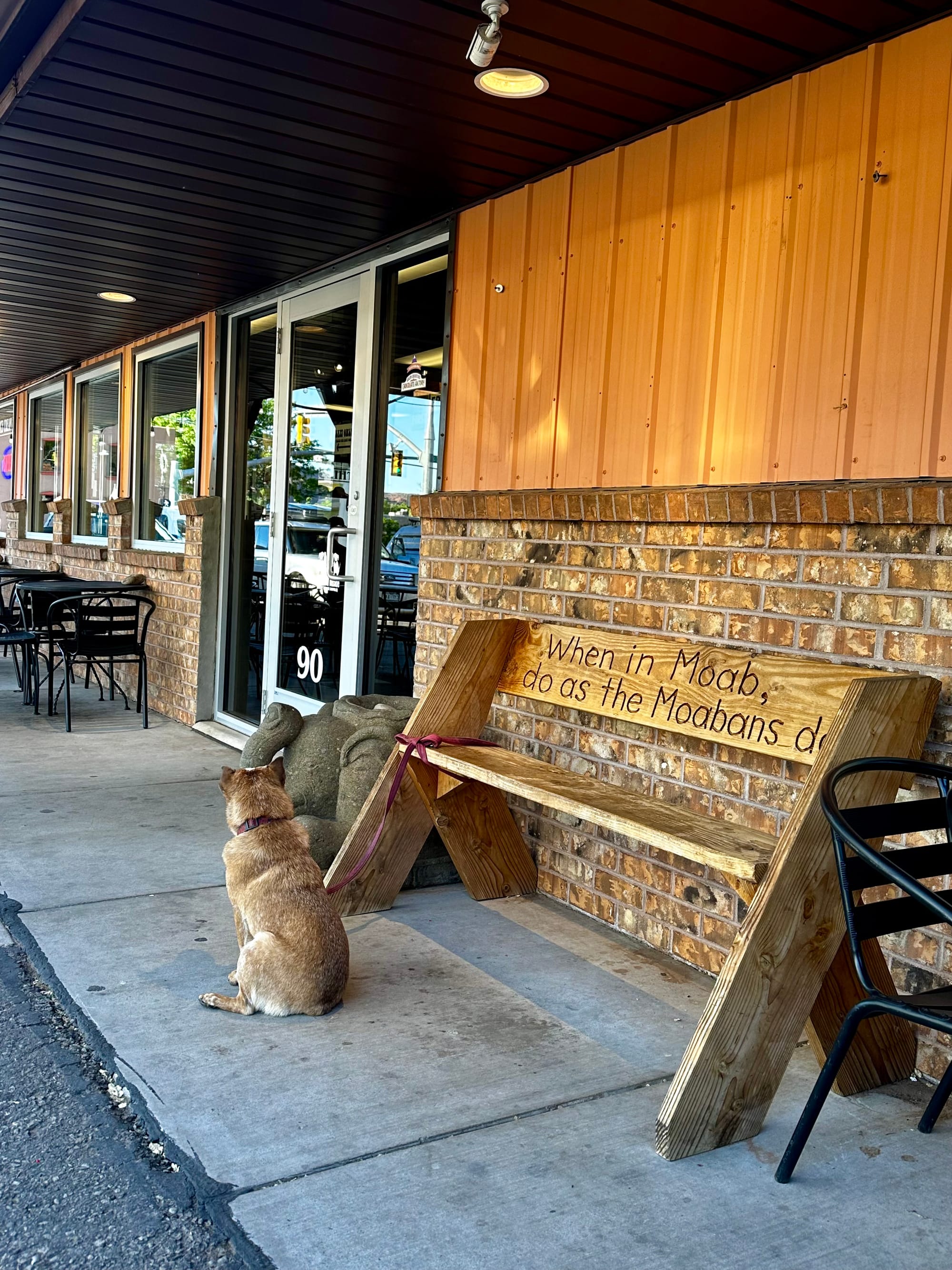
Pics from downtown Moab
Exploring Arches and Canyonlands
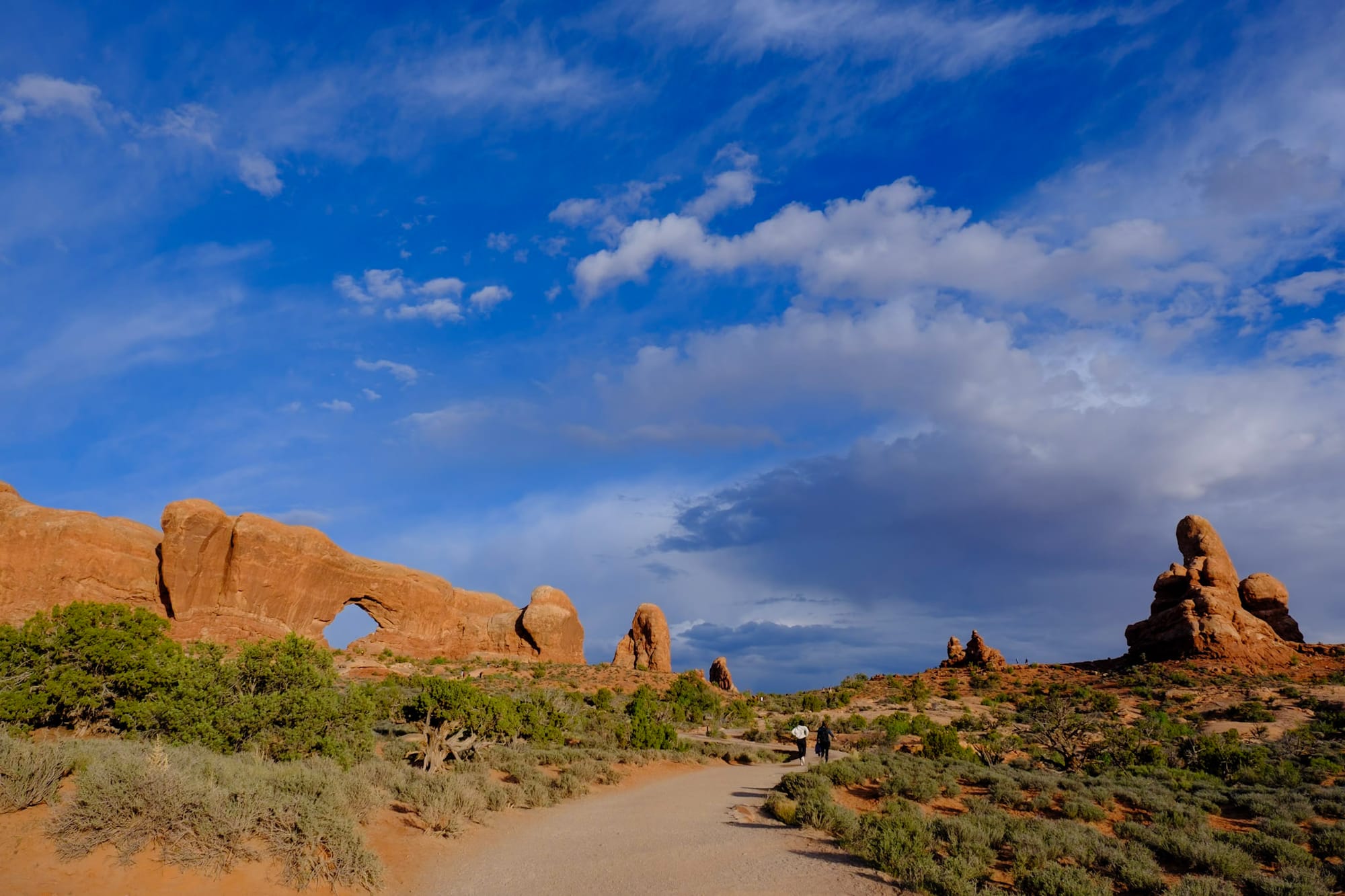
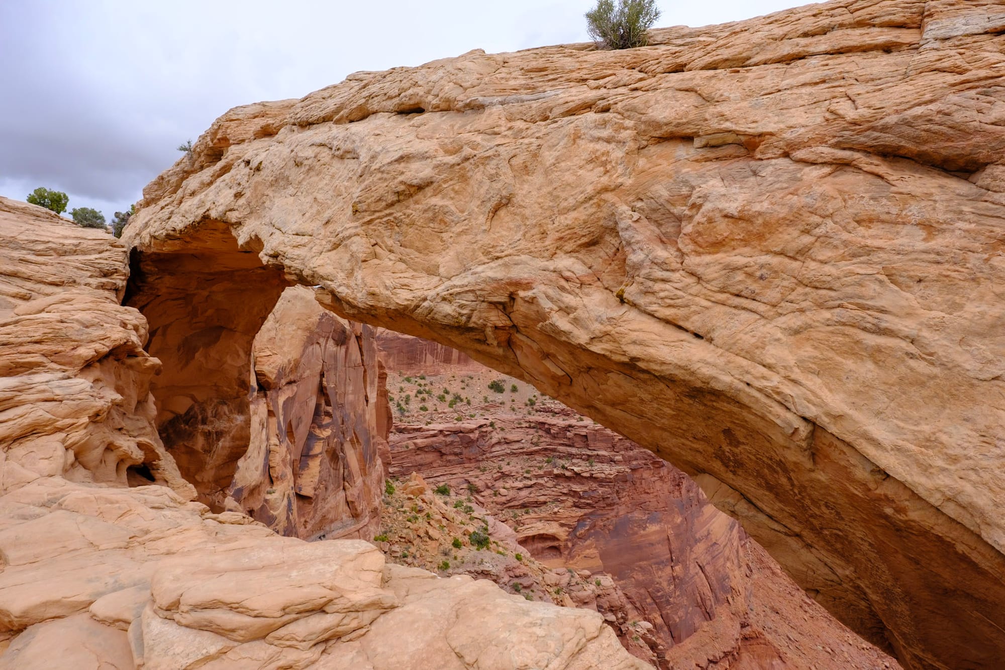
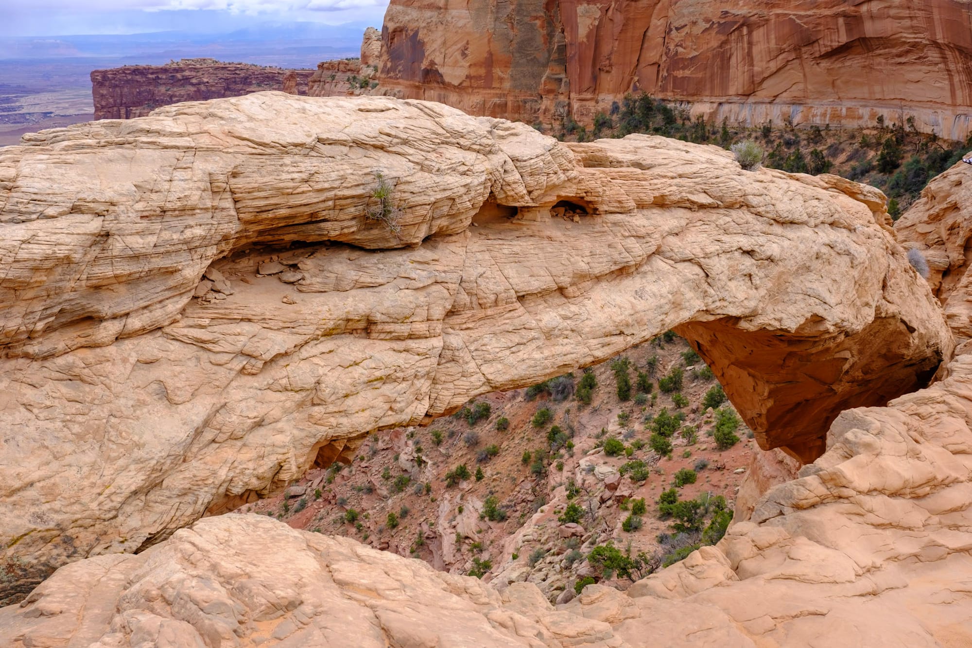
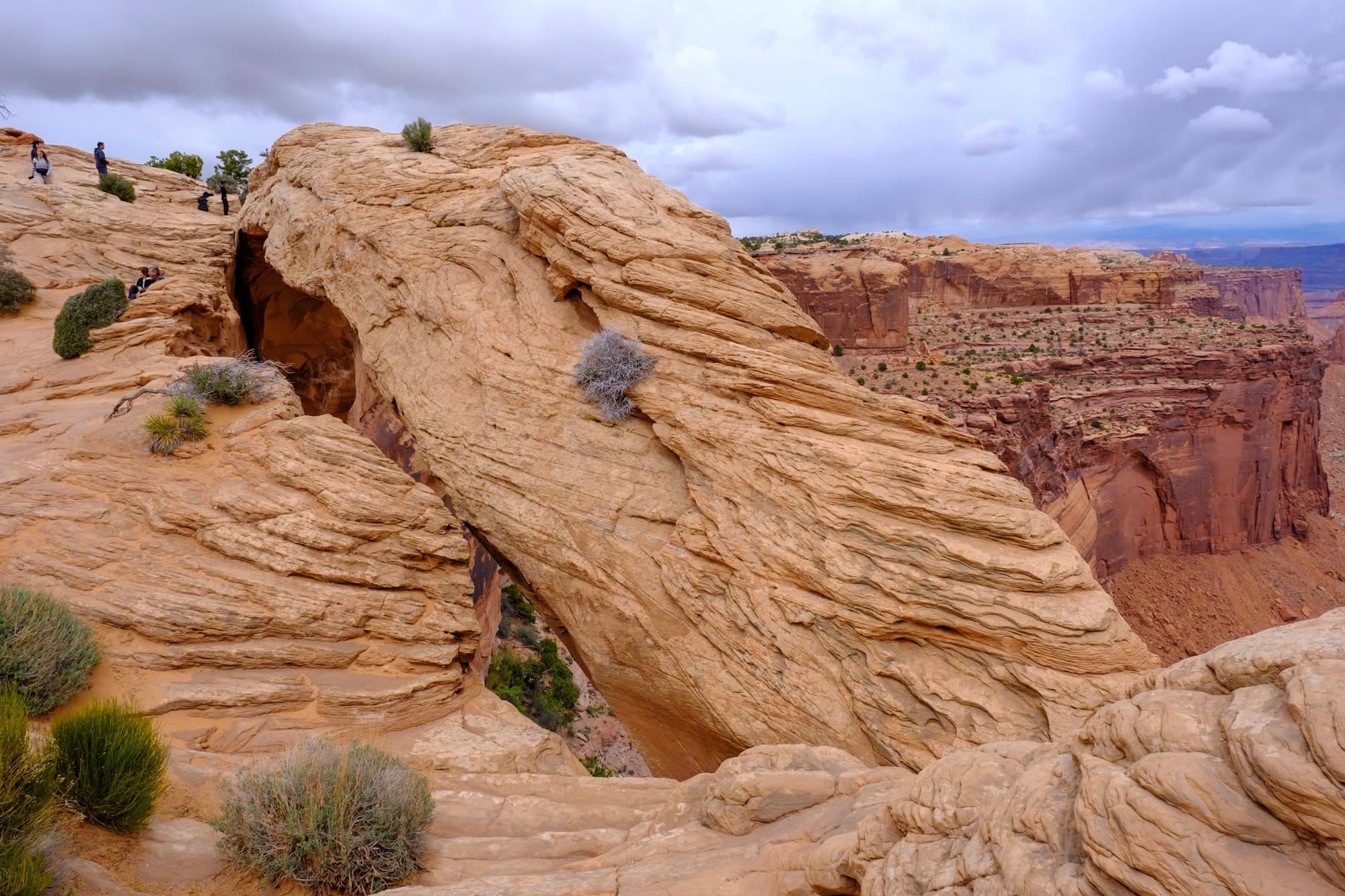
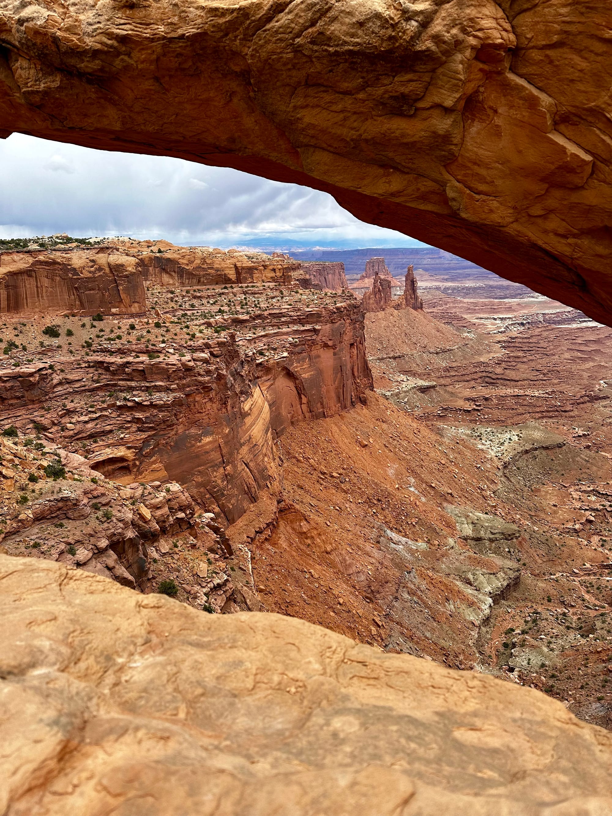
Friday. We didn't have any meetings, so we got to work from the campground. Late afternoon, we went to the Arches visitor center to get our souvenirs, then drove up into the park. The entrance to Arches is pretty cool because the road winds up high along the canyon wall – at the top, you're way above the visitor center parking lot overlooking Moab Canyon.
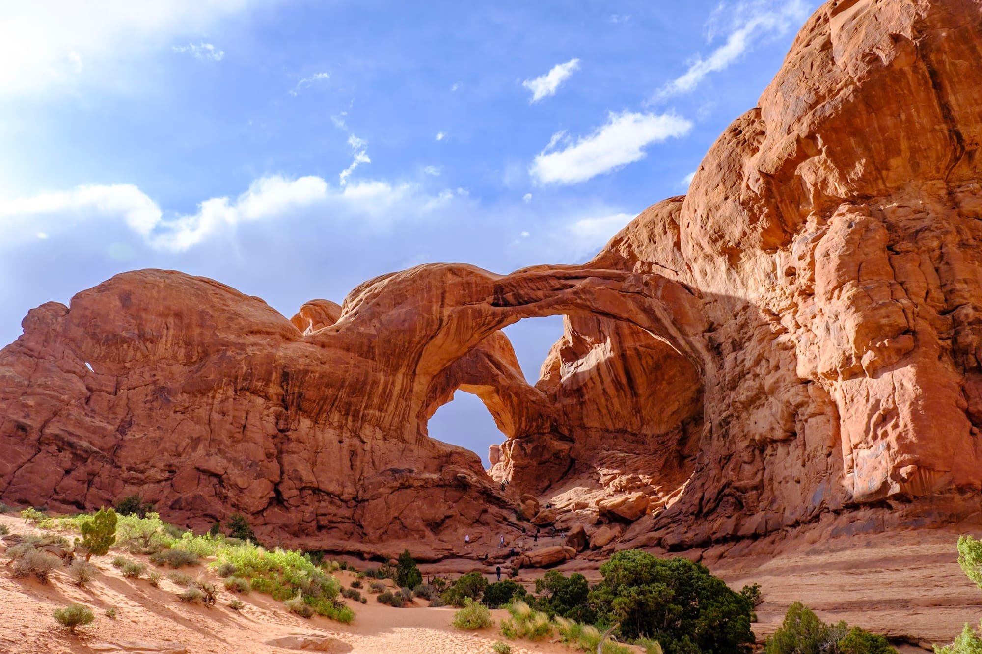
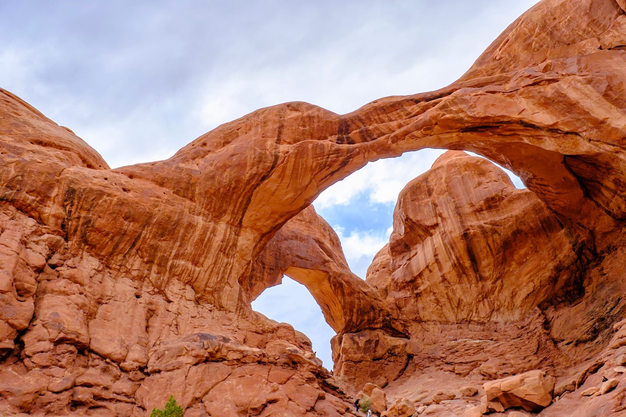
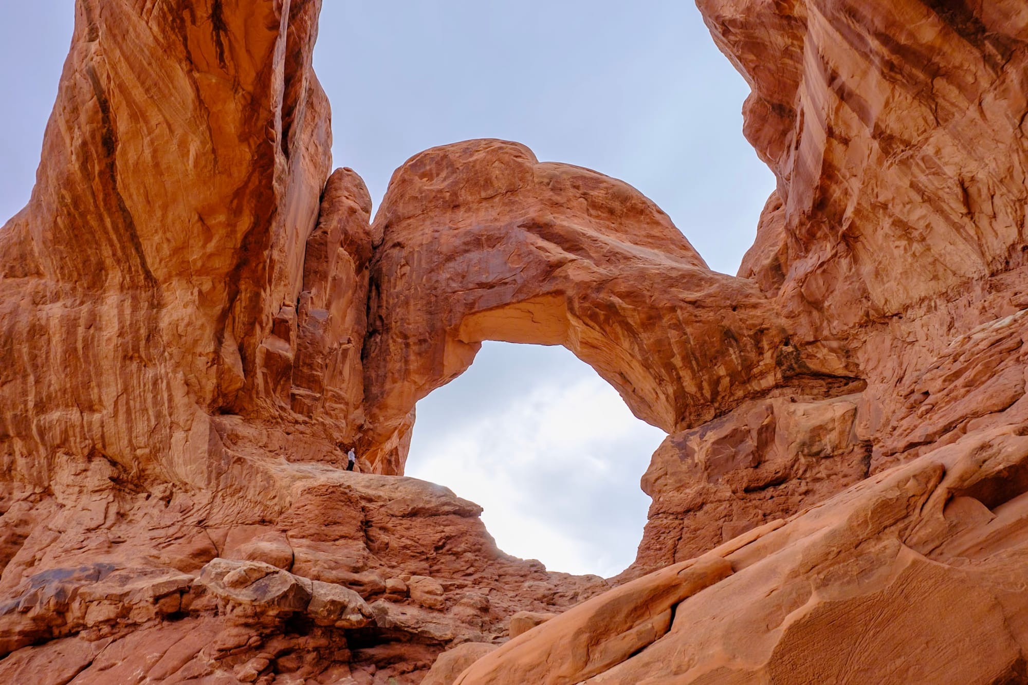
We decided to do a couple of the short hikes that evening – Double Arch and the Windows. I remember being totally in awe of Double Arch the first time I visited on a family trip when I was 14. It's a short, flat quarter-mile walk up to the arches as they get bigger and bigger, and then suddenly you're right below them, and then you go up in the rock amphitheater in them, and it's so huge and cavernous.
(By the way – Joey took this hyperlapse by taking one step at a time on this trail to Double Arch, taking one photo with each step. It took him maybe half an hour, but it was totally worth it – it turned out so good!! I don't give him enough credit in these posts, but seriously, shoutout to Joey for all the amazing photos and timelapses you see here).
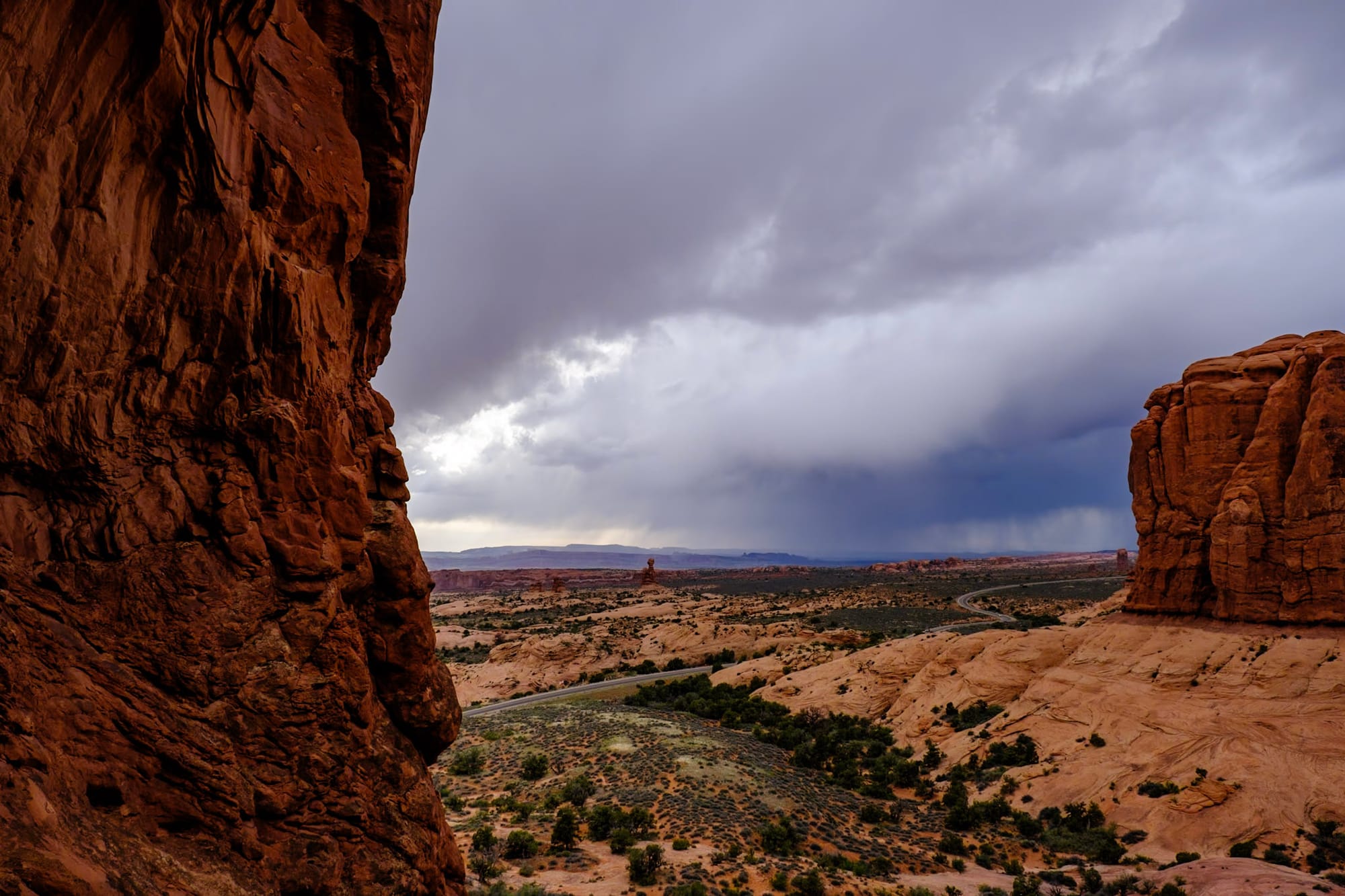
You can climb way up into one of the arch holes to look out at an awesome desert view. We spent a long time just sitting and soaking it in. The weather couldn't make up its mind – dark clouds would sometimes part to reveal the golden setting sun, which would light everything up before hiding behind the clouds again – and it was gorgeous.
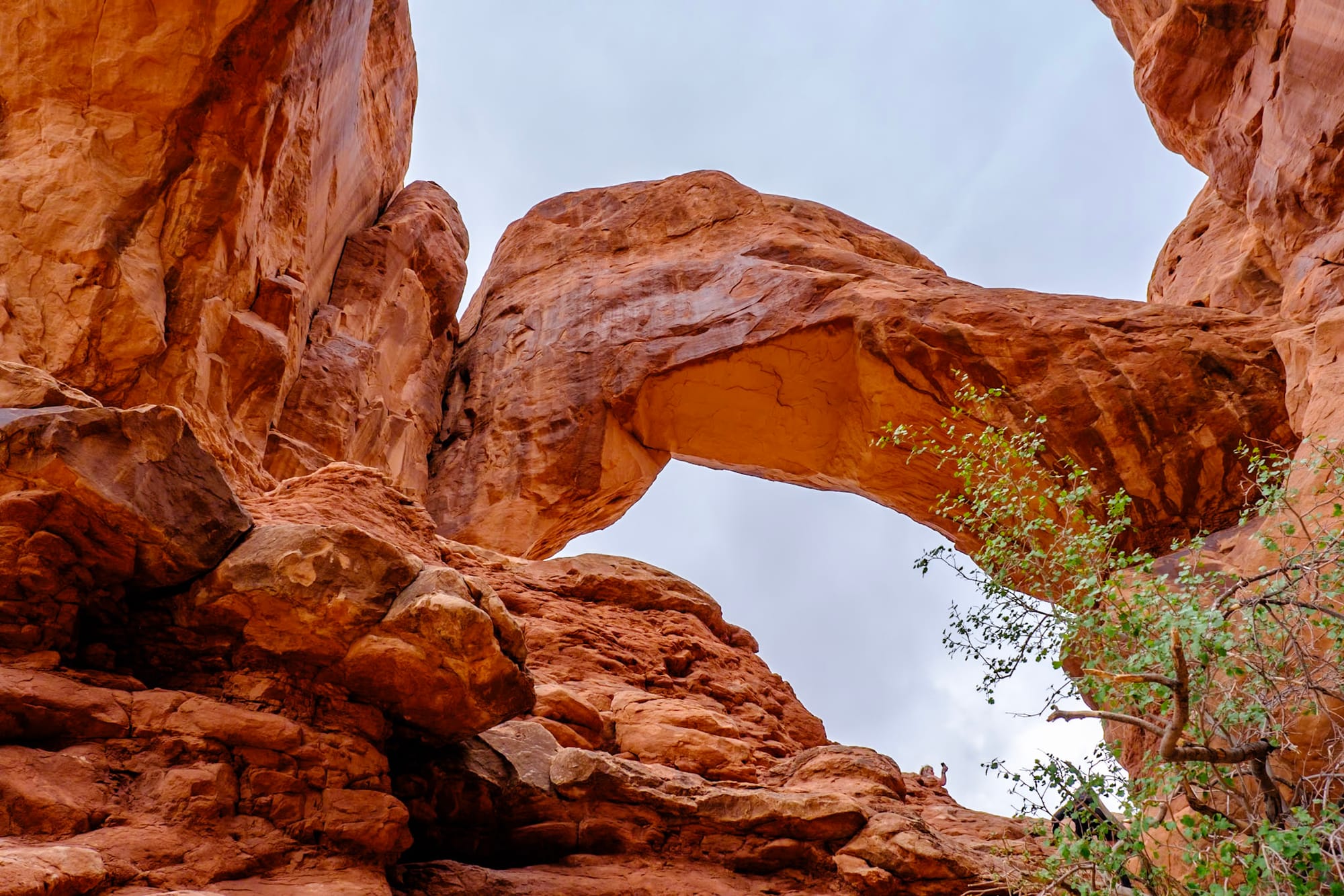
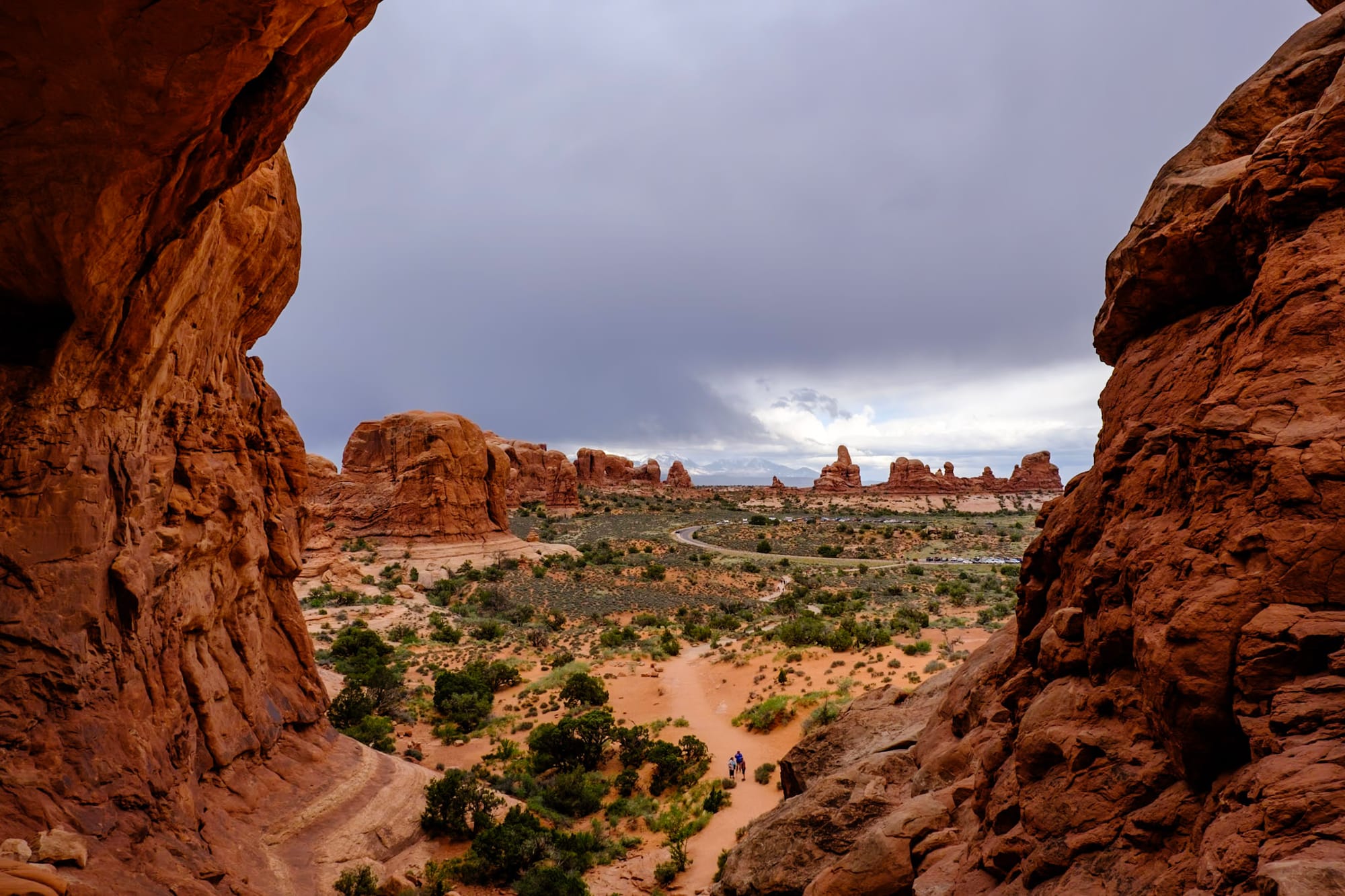
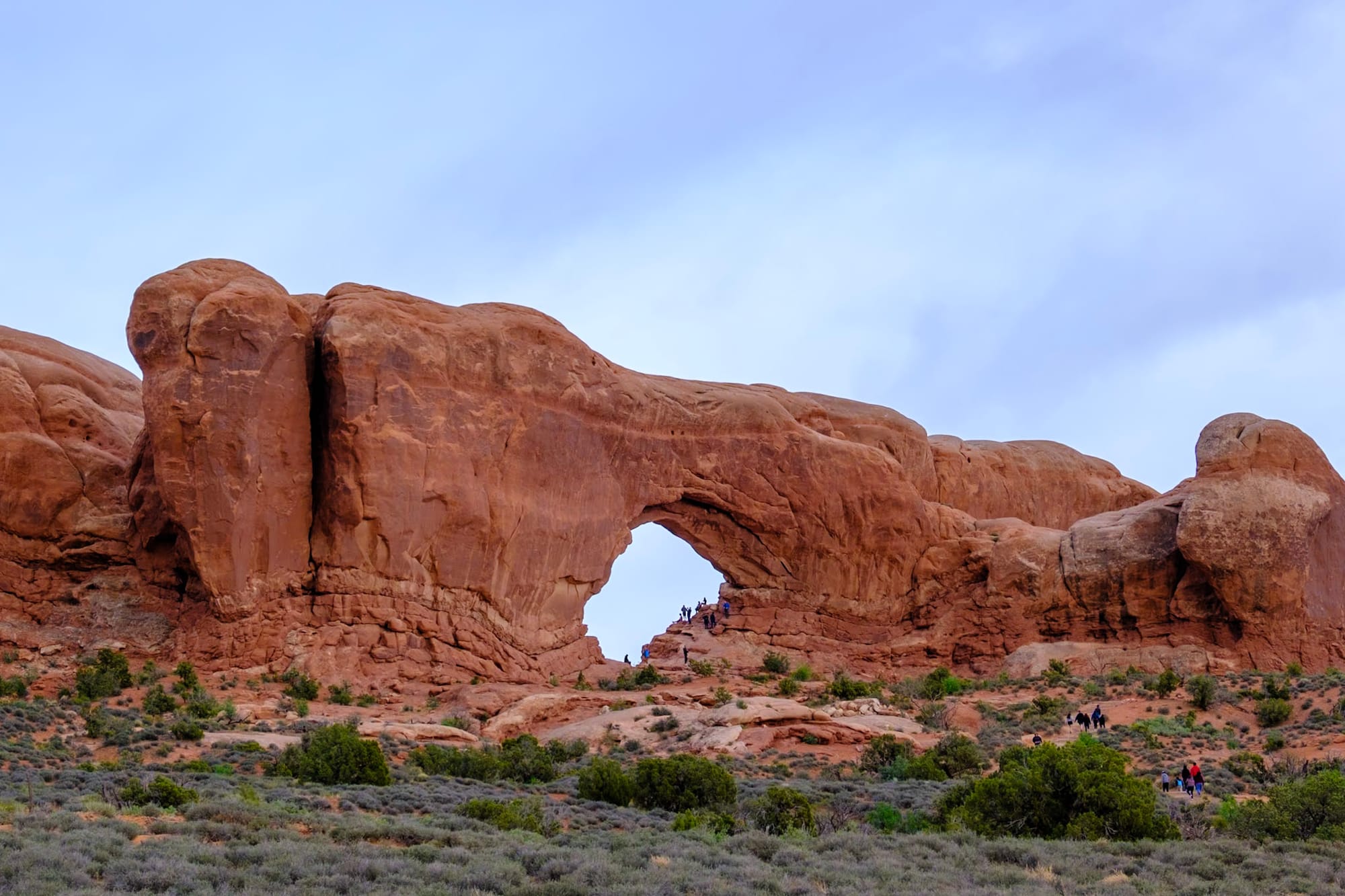
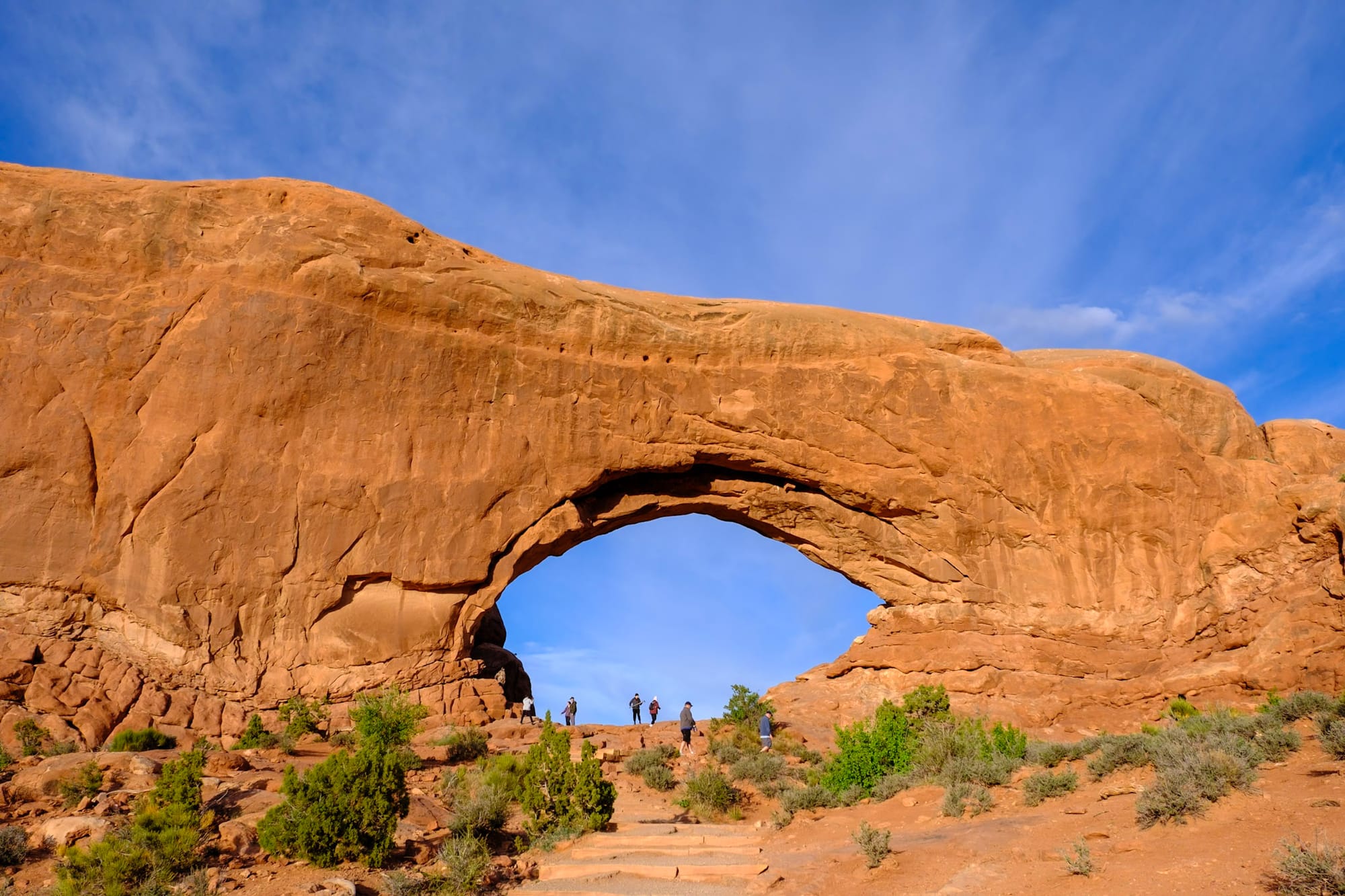
After that, we walked across the parking lot to do a short uphill hike to one of the Windows arches. (There are two of them; we only did the first one). This was also a really cool view if you climb up on the rocks along the side of the Window, looking out into the desert on the other side.
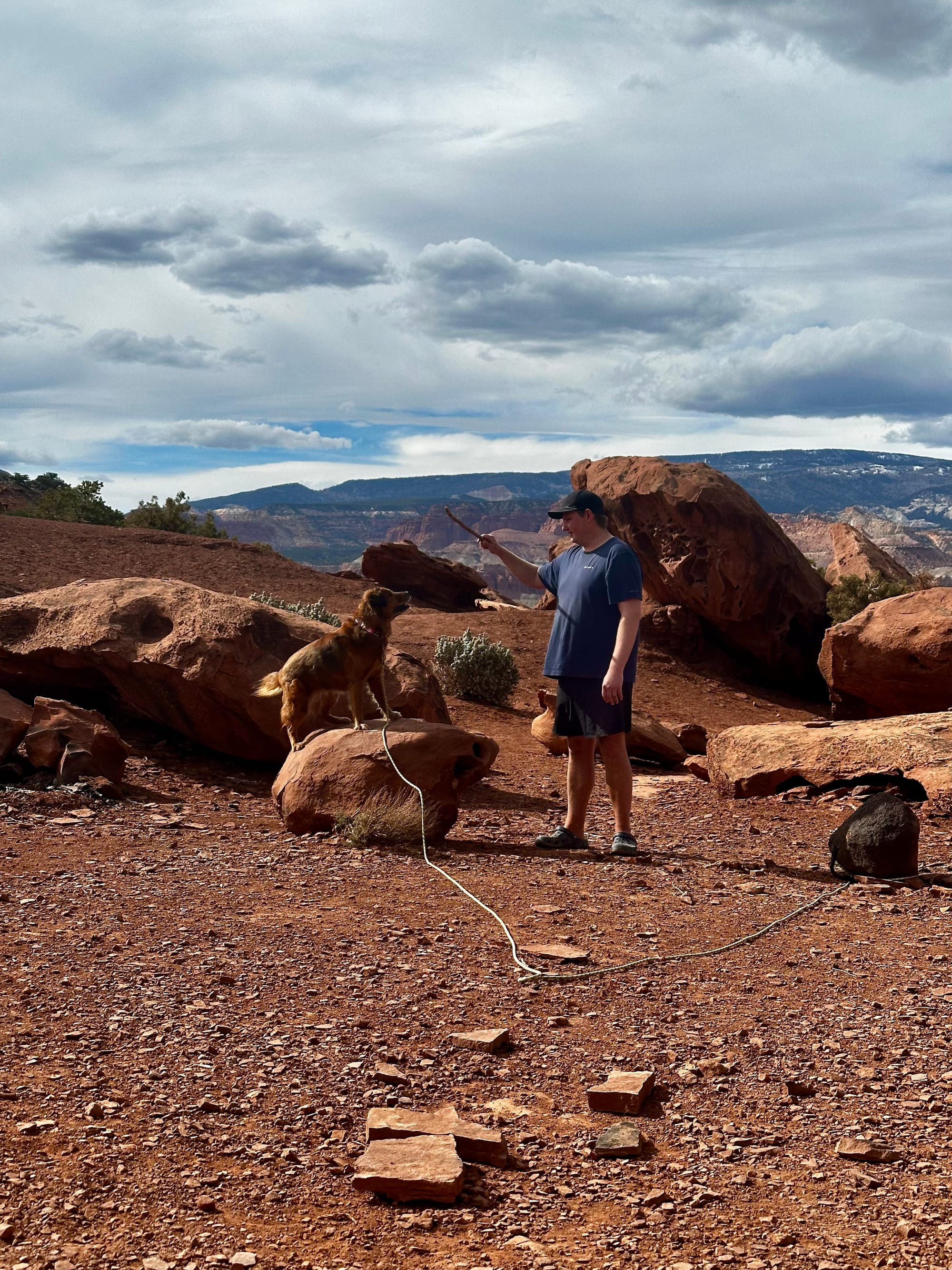
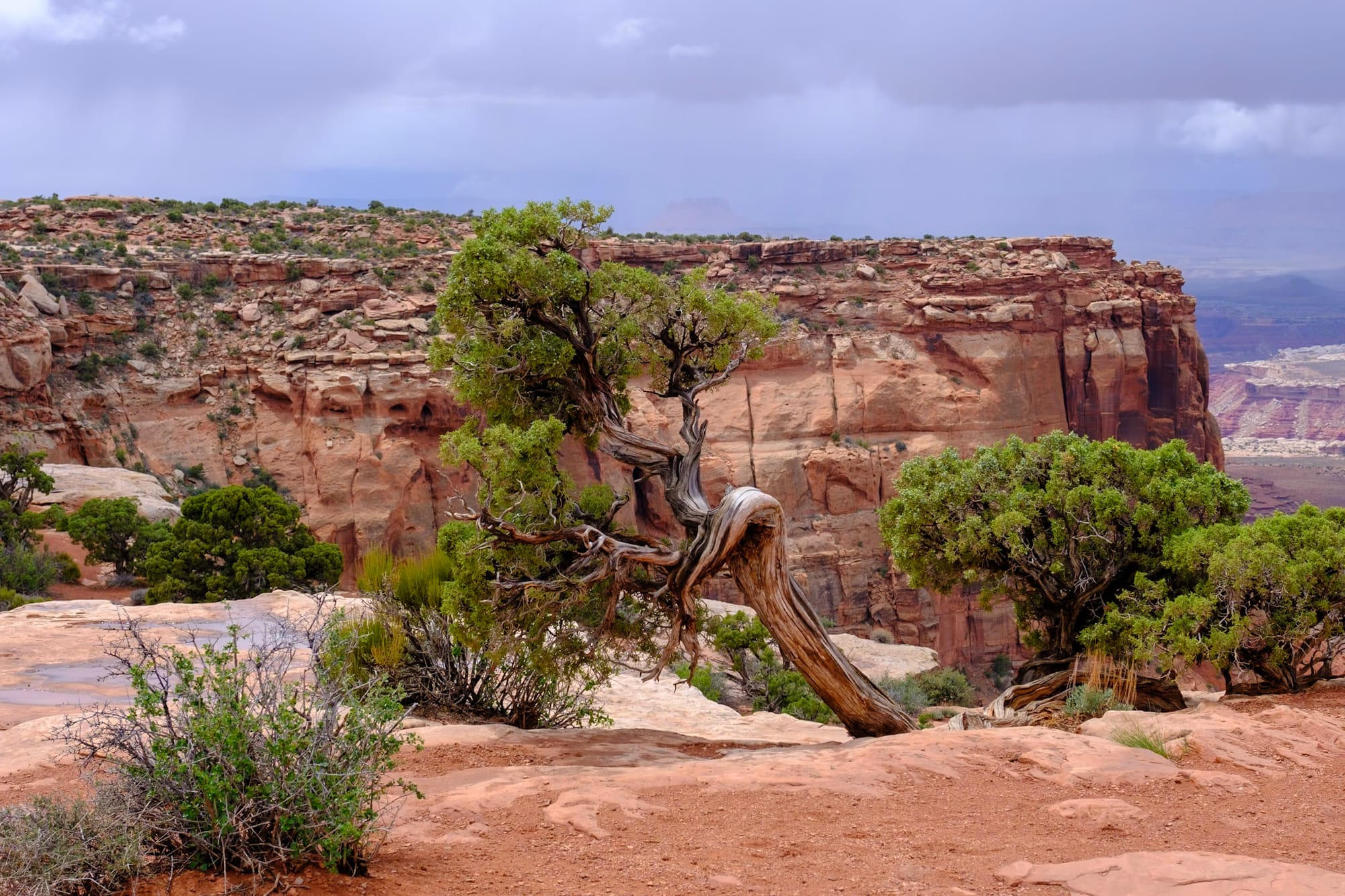
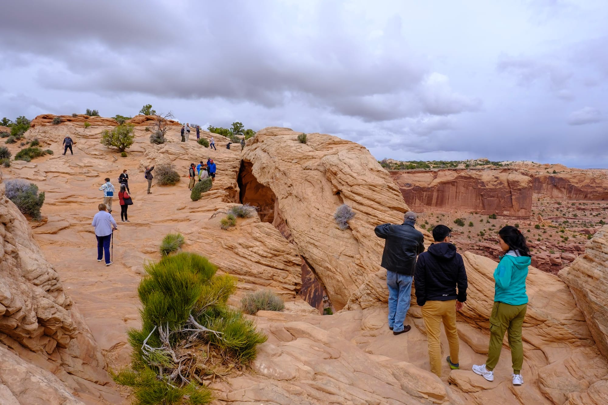
Saturday. It was a cool, cloudy day, and we decided to make this our Canyonlands day. We slept in and relaxed at the campground in the morning, then took Hollie and drove the ~40 minutes to Island in the Sky. (Dogs aren't allowed on trails, but we only planned on doing overlooks and a couple of very short hikes, so we knew she'd enjoy riding along and waiting in the car on a cooler day).
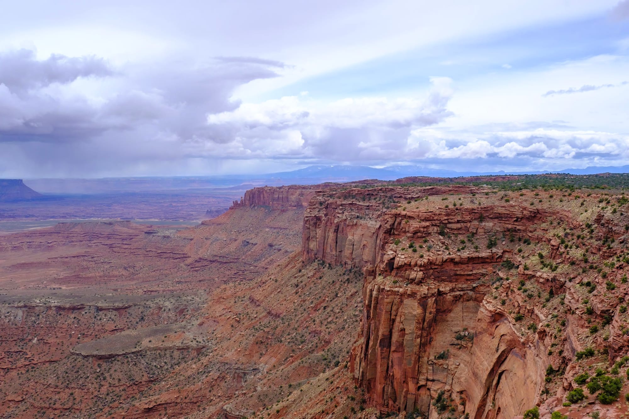
As we got closer to Canyonlands, the road climbed up higher and higher above the desert, until suddenly we were on a huge, grassy mesa where cows were grazing. It was like a different world, and we suddenly understood the name "Island in the Sky." Then traffic stopped, and it took us about 45 minutes to get past the single entrance station into the park – not sure why I thought it would be less busy at noon on a Saturday. But we eventually got through and though the rest of the park was busy, it didn't feel too crowded and we didn't have trouble finding parking.
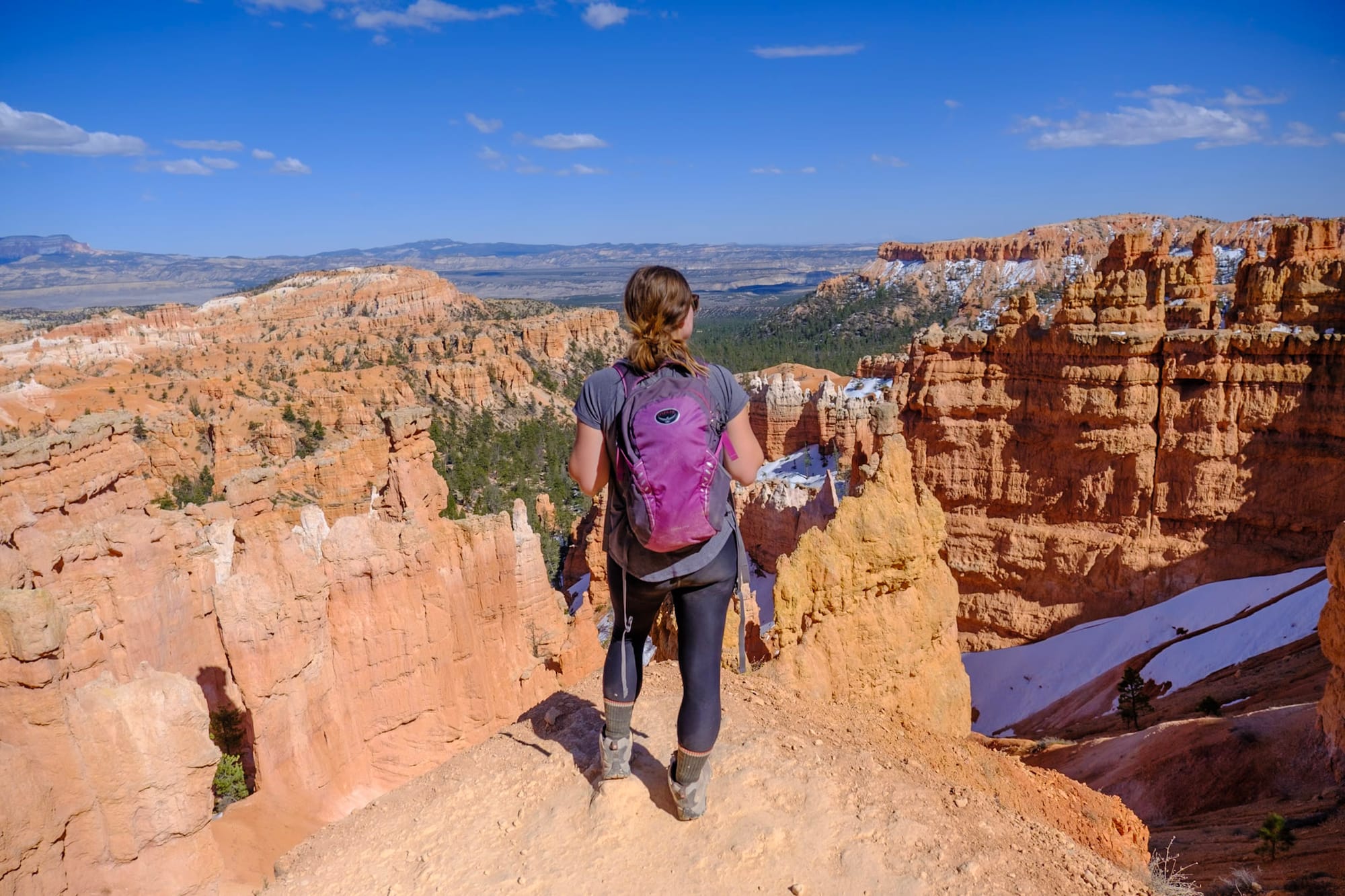
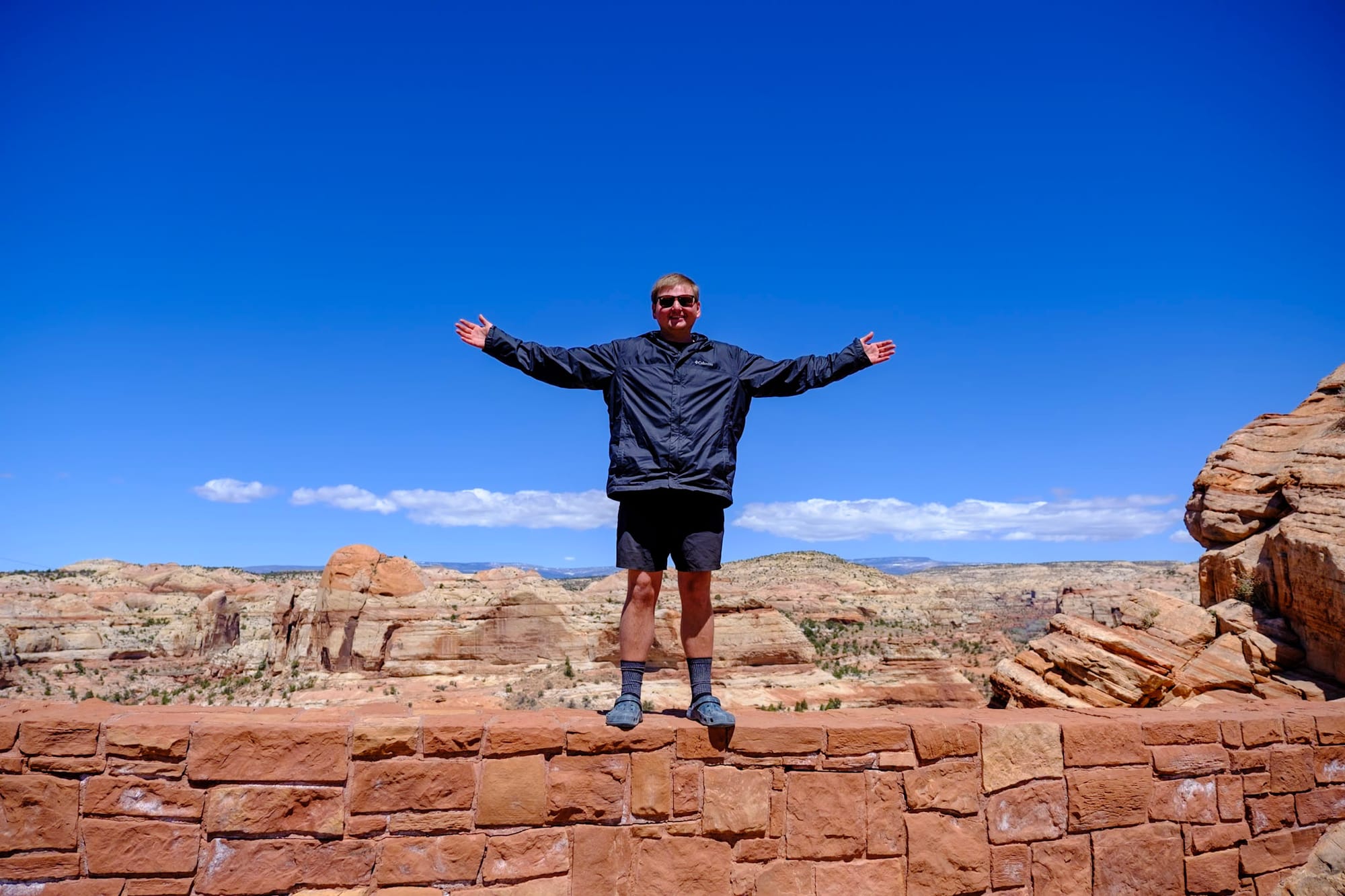
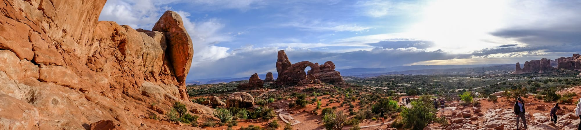
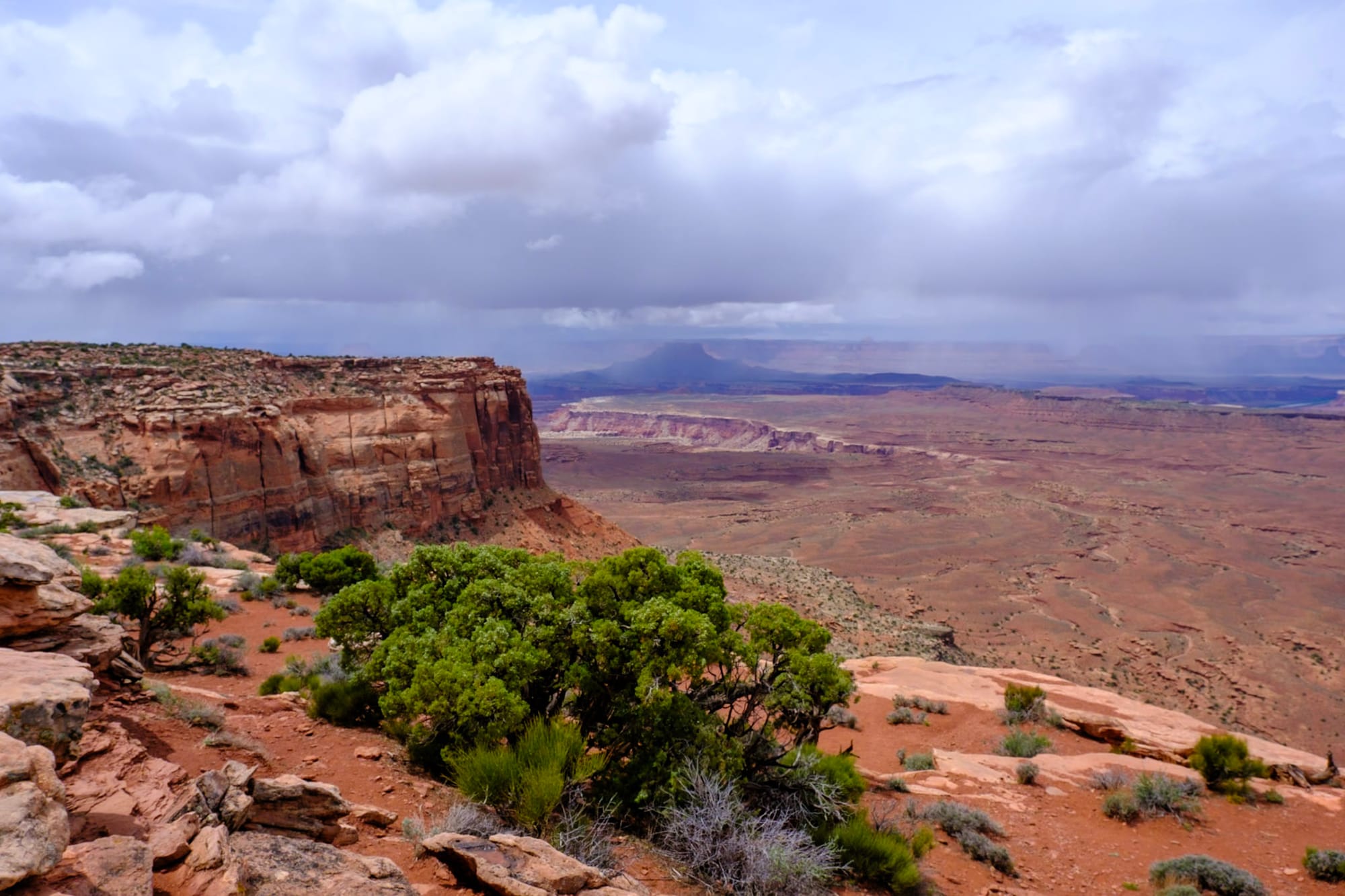
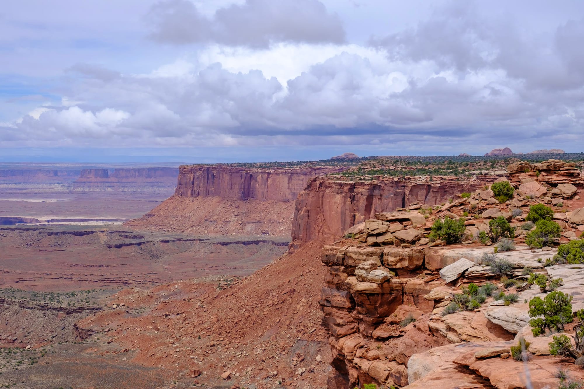
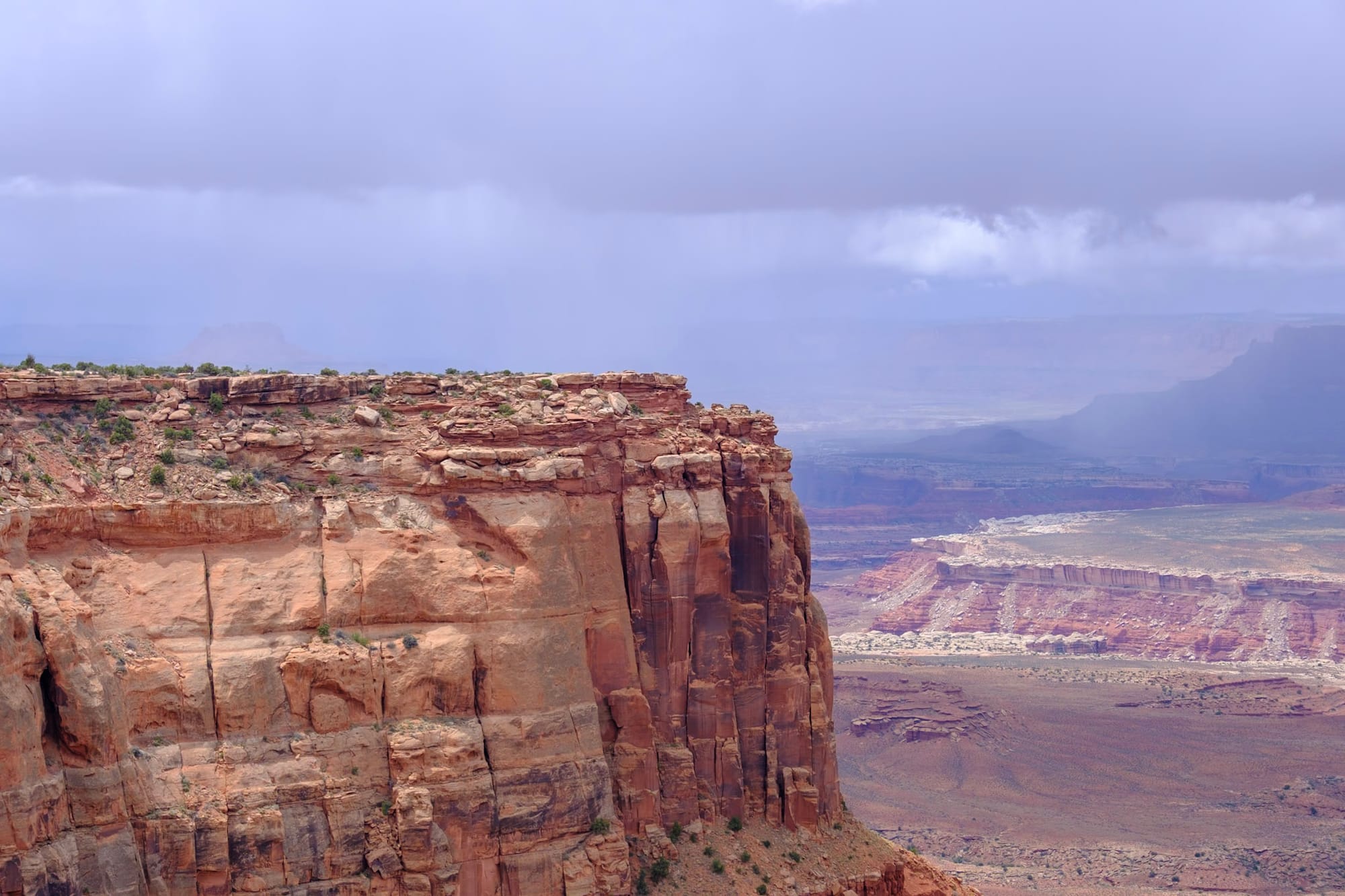
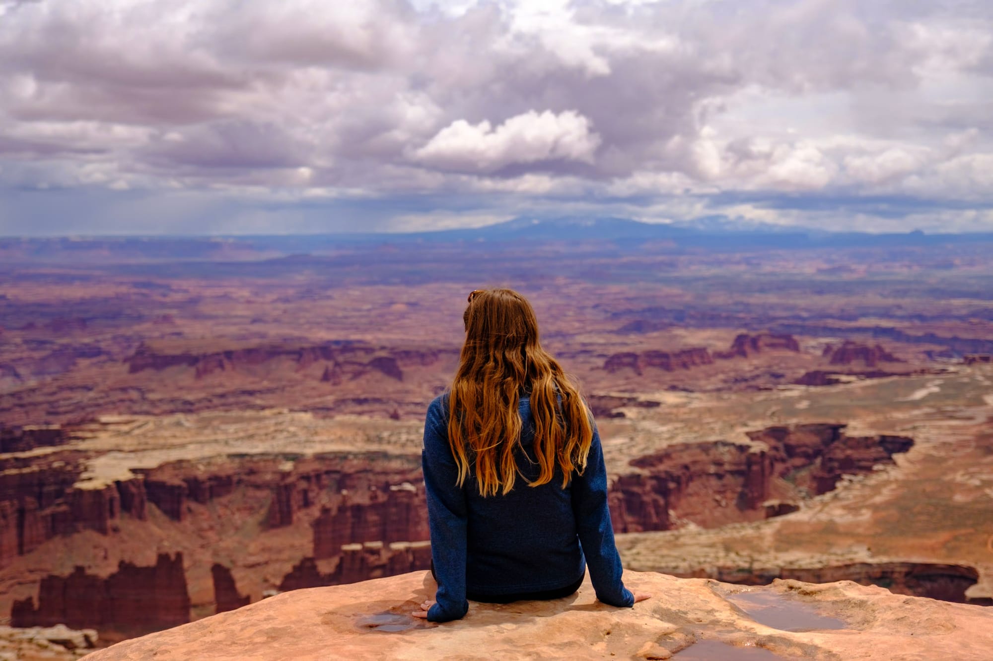
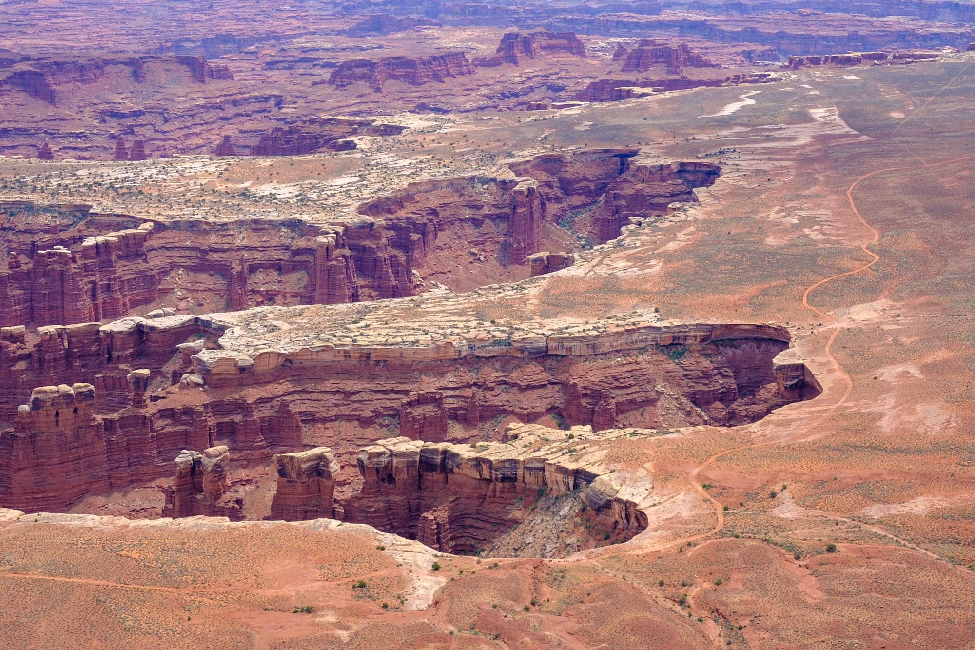
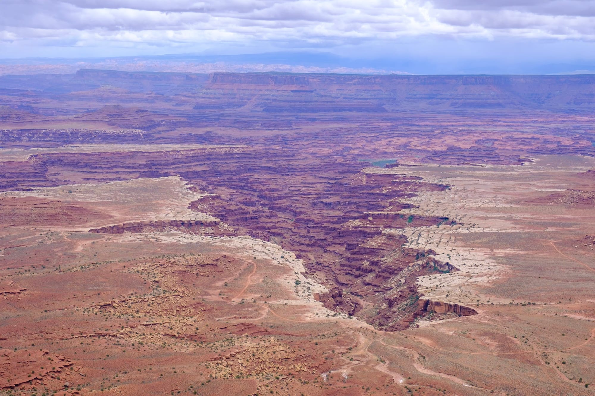
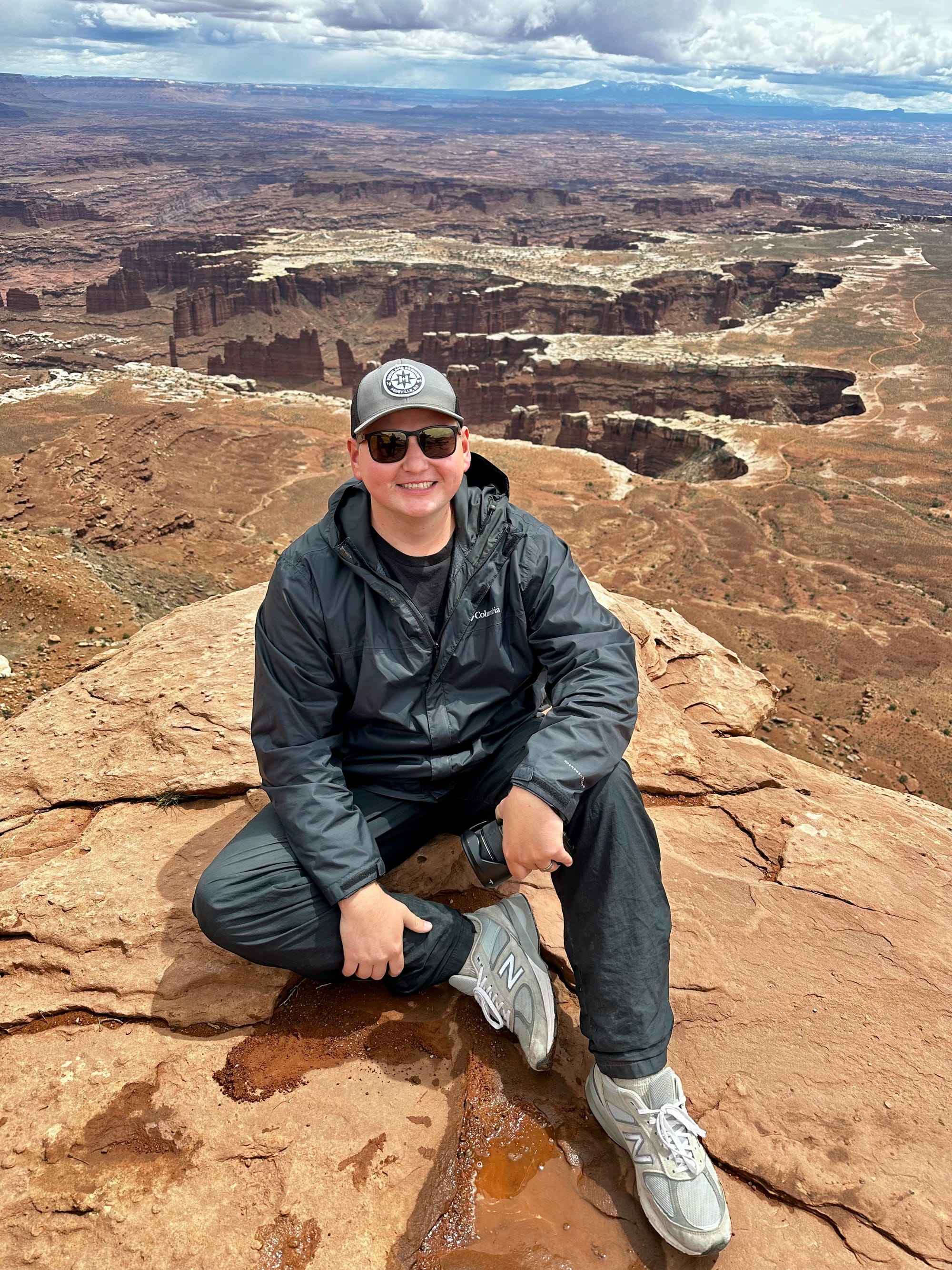
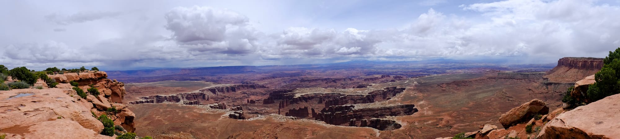
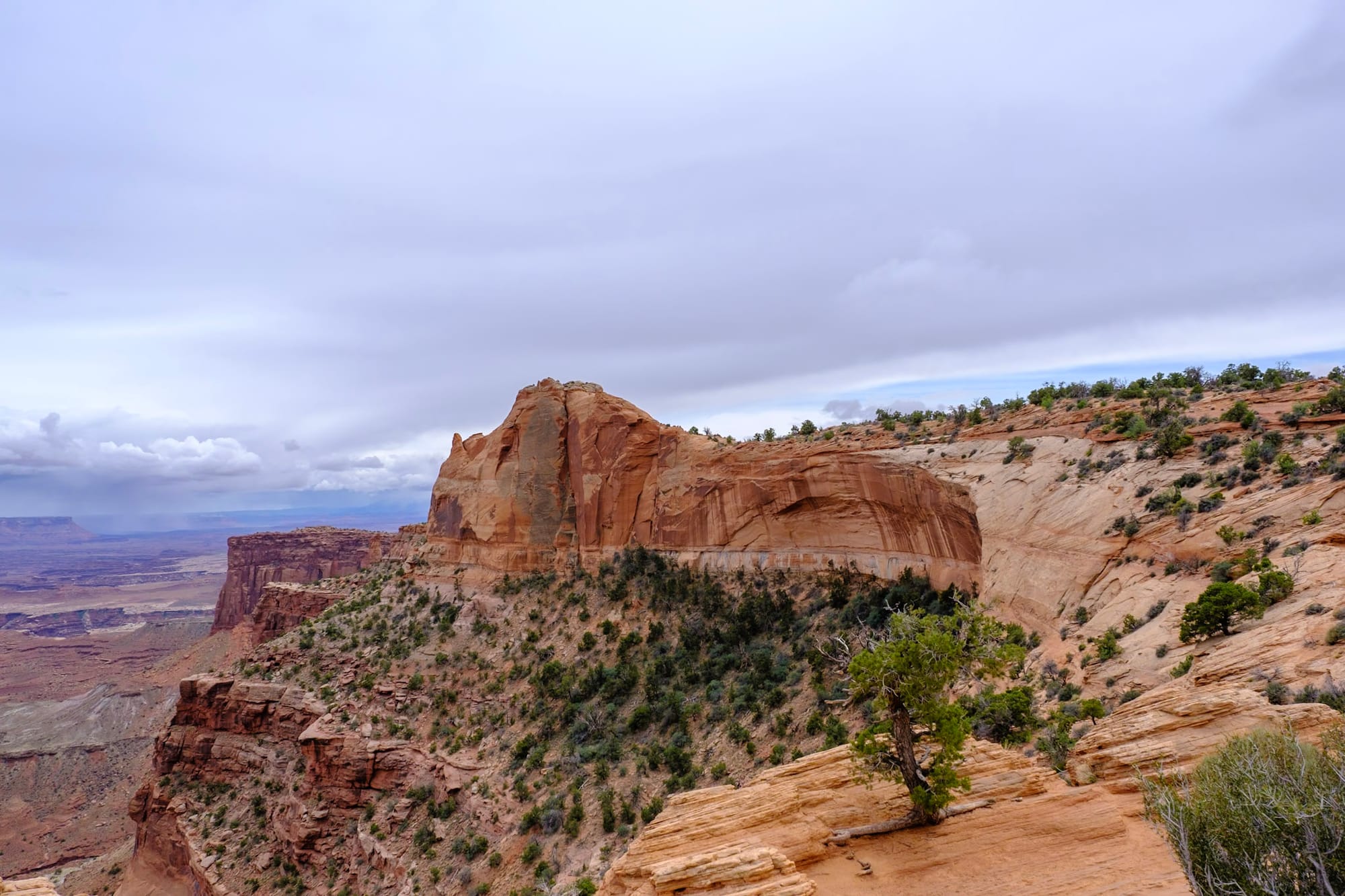
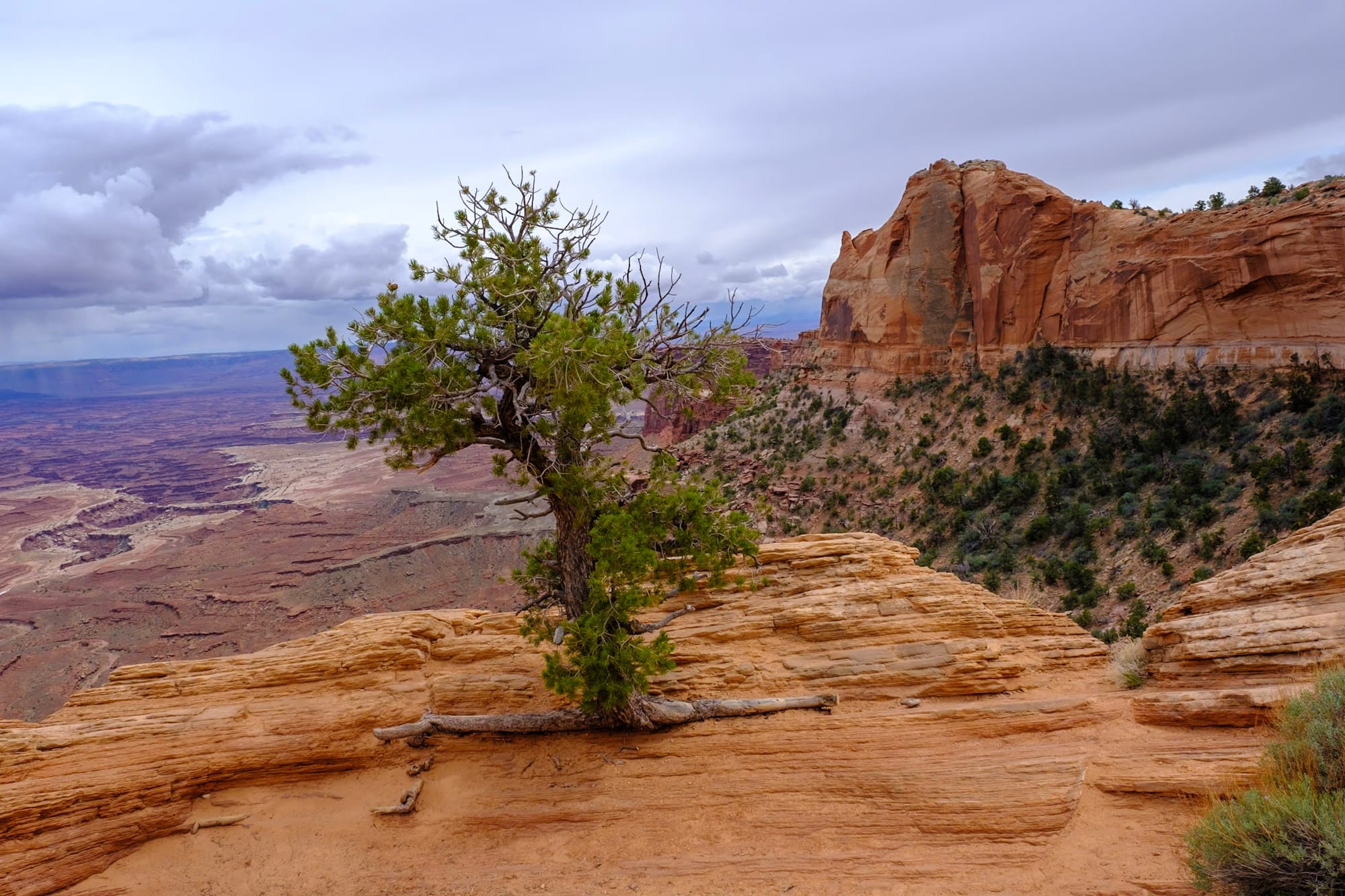
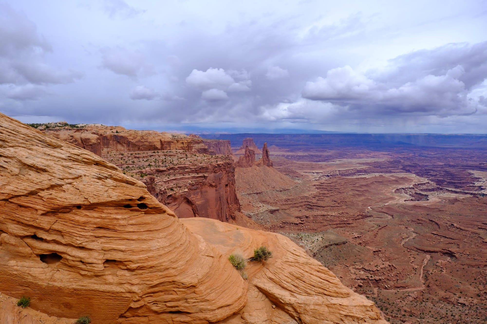
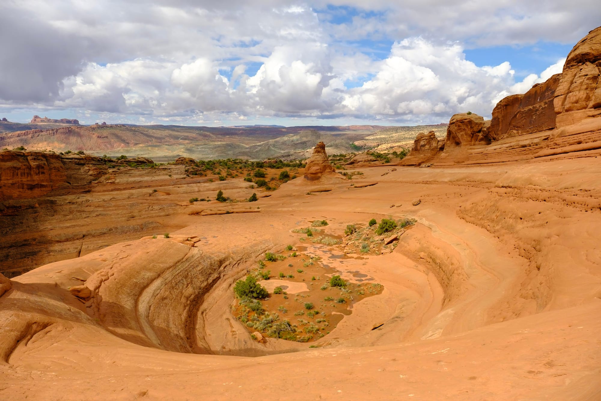
We stopped at the visitor center first to grab our magnet and sticker. Then we drove the Grand View Point scenic road, stopping at overlooks along the way, until we reached the end – Grand View Point itself. It was beautiful, almost like the Grand Canyon. We were so high up, looking deep down into multiple layers of rocks and cliffs and odd formations below. We could see a dirt road way down there where tiny cars and offroad vehicles were driving. And you could get right up to the edge of the cliff, which was dizzying.
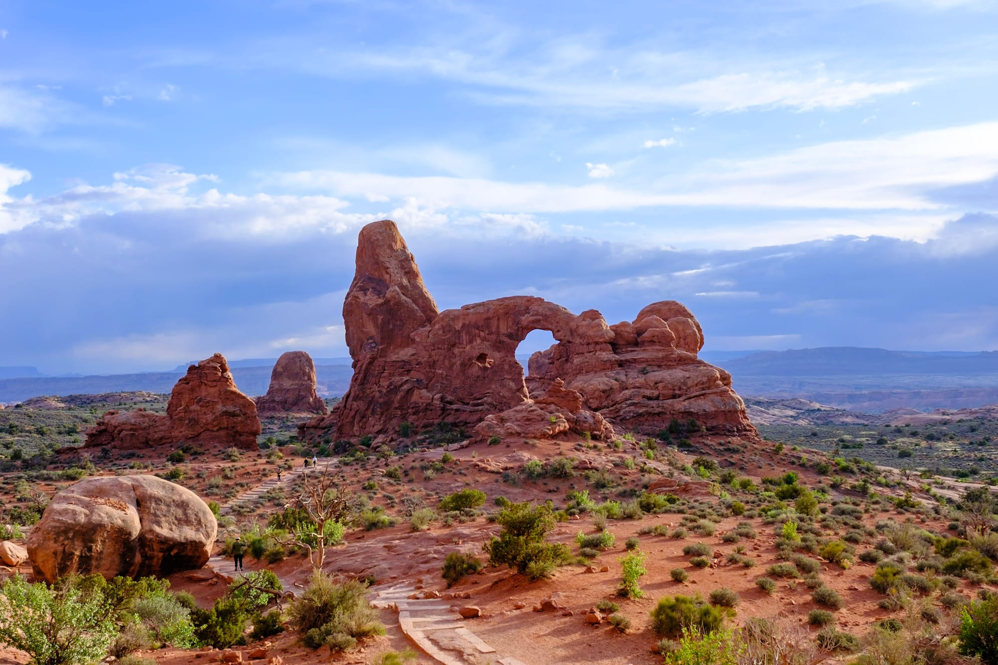
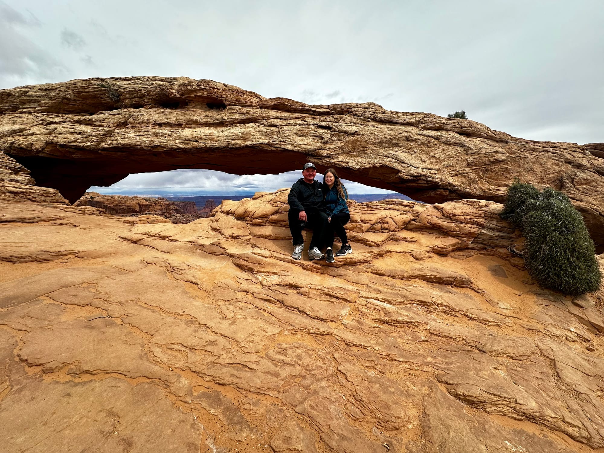
On the way back along the scenic drive, we did the short hike to Mesa Arch, probably the most popular trail in all of Canyonlands. Mesa Arch was so cool – it's an arch right on the side of a cliff. You can look right through it for spectacular views on the other side. It was a busy spot, but everyone was just having fun running around, climbing on the rocks, and taking pictures.
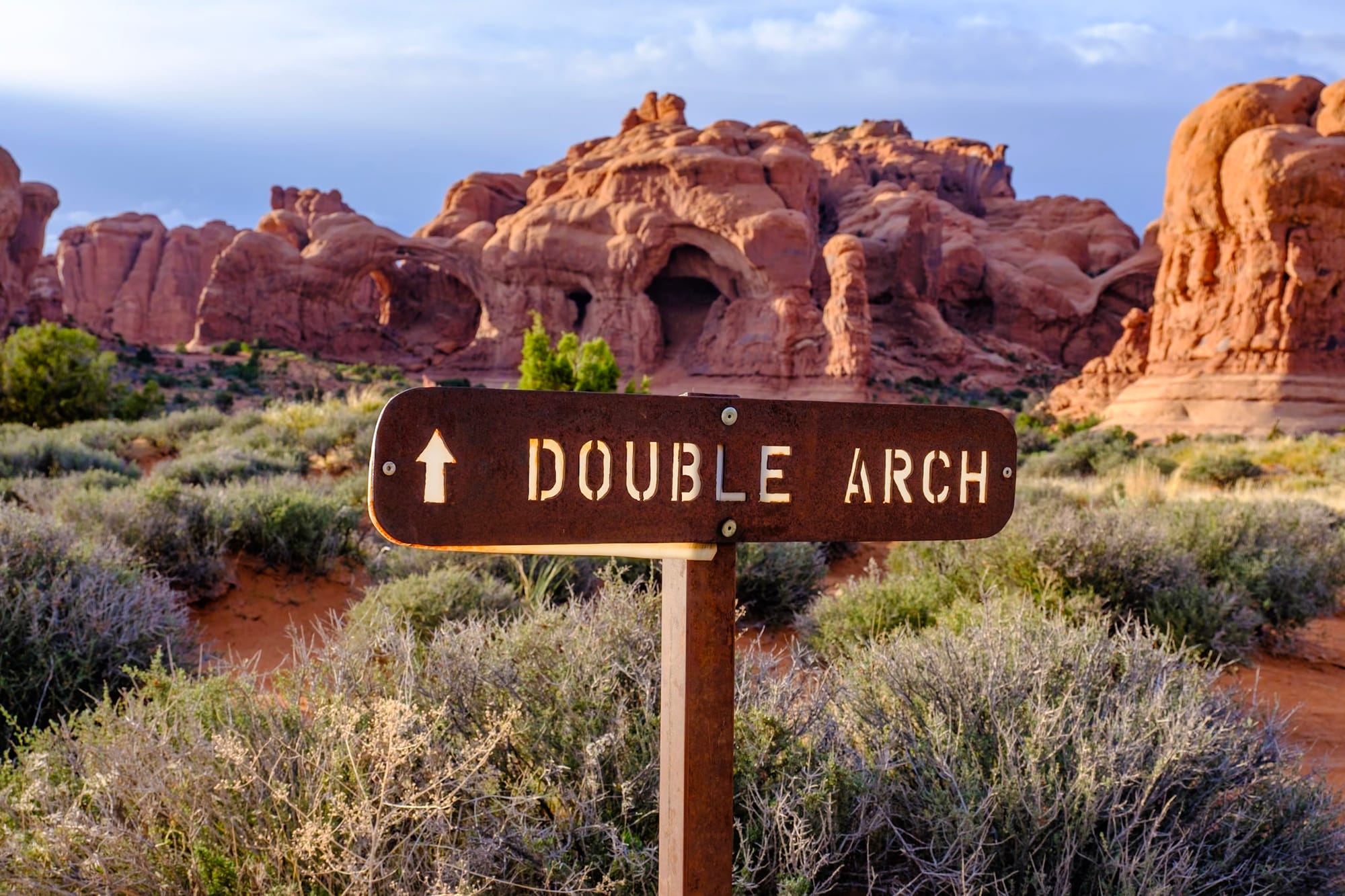
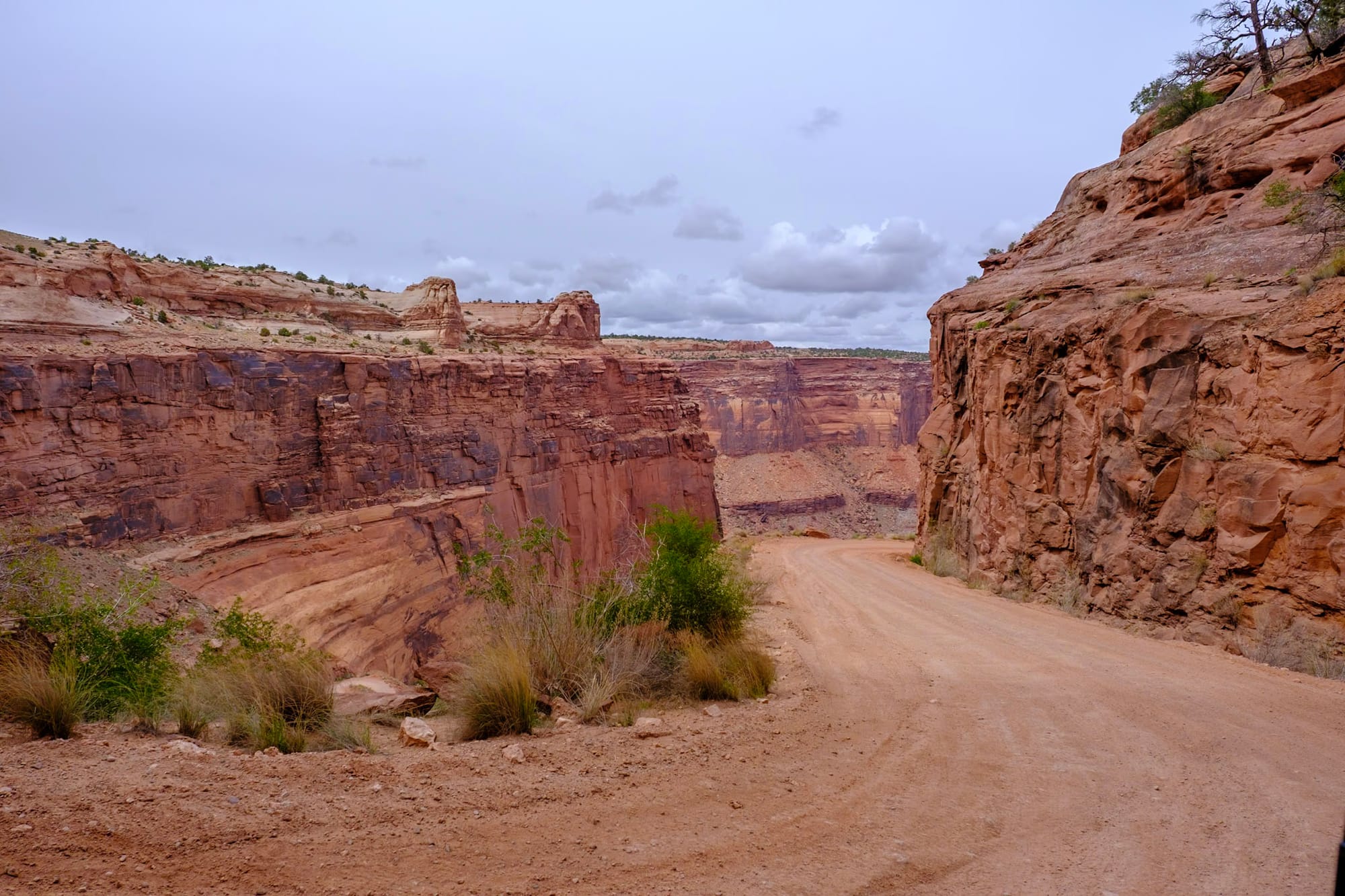
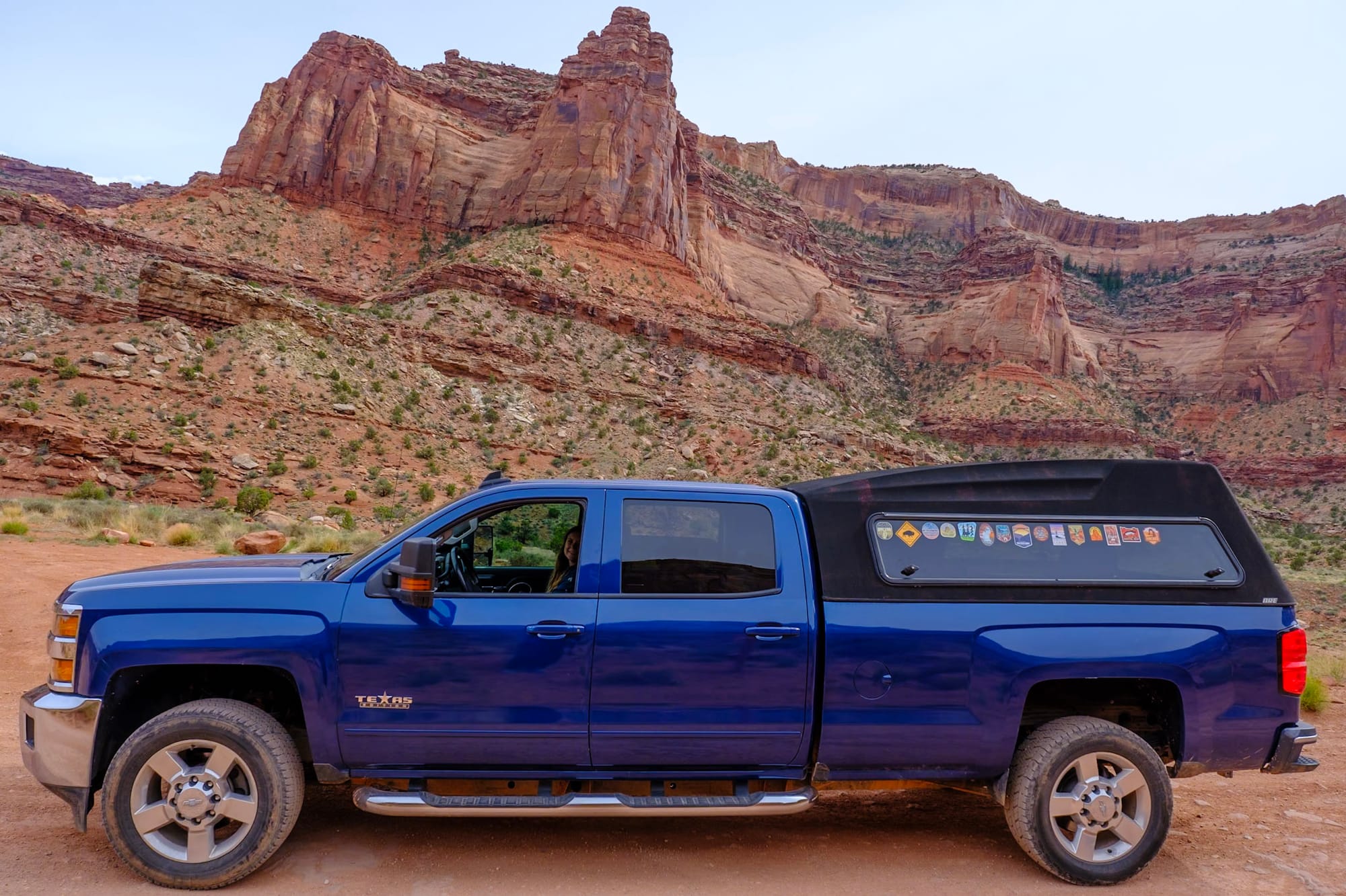
But the best thing we did in Canyonlands was a last-minute adventure: the Shafer Trail, a dirt/gravel road that descends 1,500 feet all the way to the bottom of the canyon. 4WD/high-clearance vehicles are highly recommended. Tex meets those requirements, and we saw other trucks doing it, so we decided to go for it.
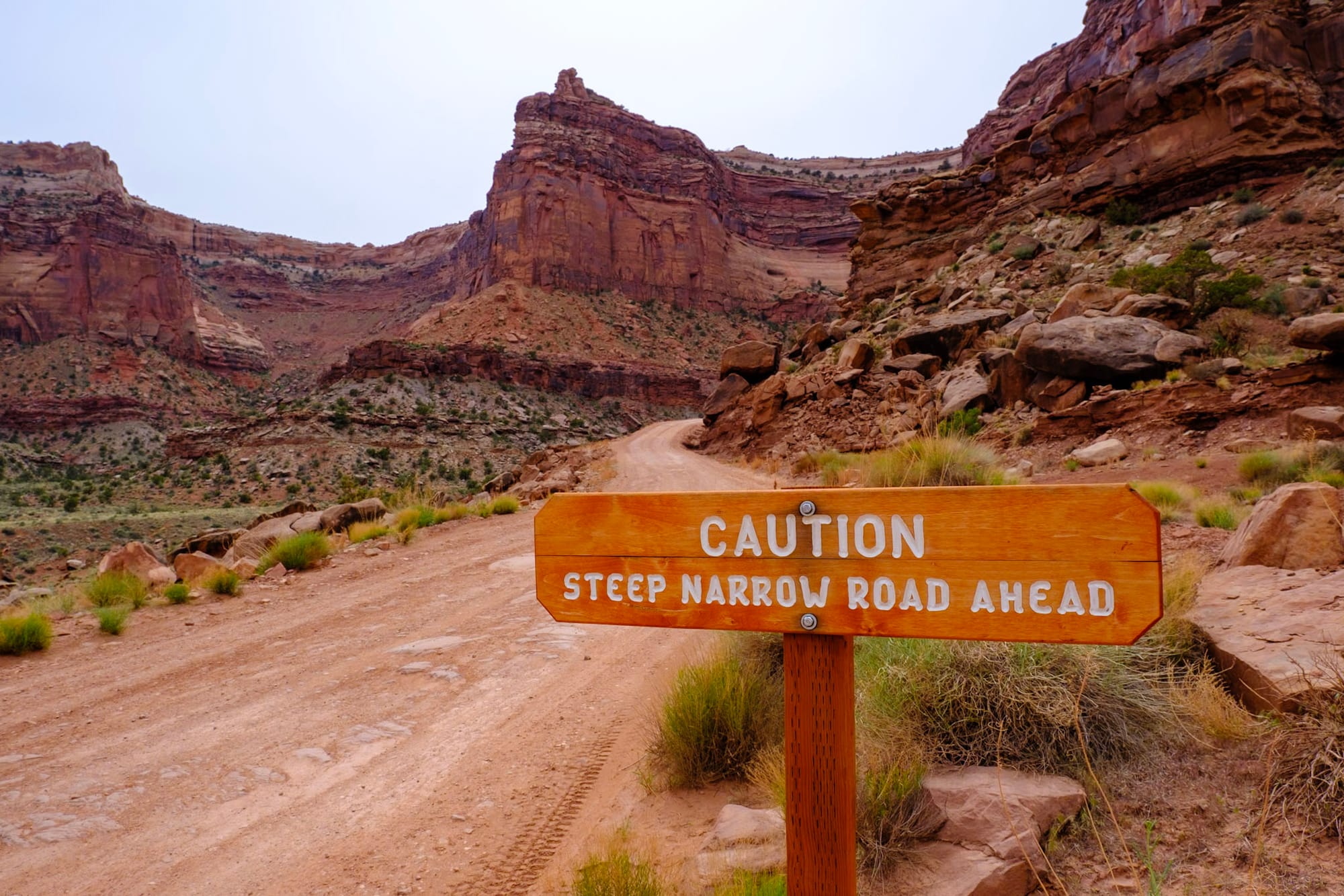
This road was CRAZY. It's narrow – in most places, you have enough space to squeeze past other cars, but in some spots you have to take turns. You're literally following the canyon wall and switchbacking down the cliff, so one side of the road just drops off a thousand feet below you. A few places are pretty steep with tight turns, which is even more nerve-wracking when you're basically hanging off a cliff edge. But the road was pretty well maintained and not too rough. I was nervous the whole time, but never truly afraid anything was going to happen – we saw a wide variety of cars from trucks to Jeeps to Subarus driving by, and everyone was friendly and patient, just having fun driving this wild road.
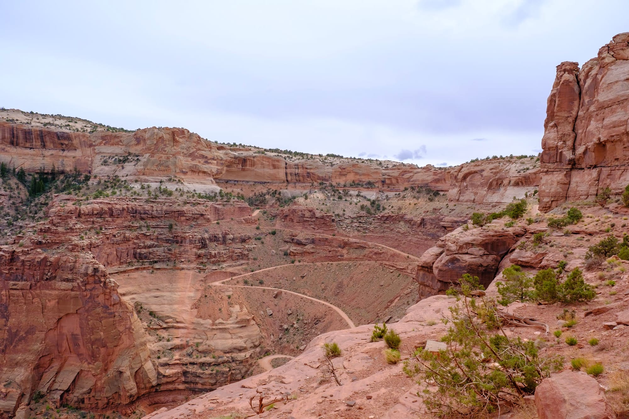
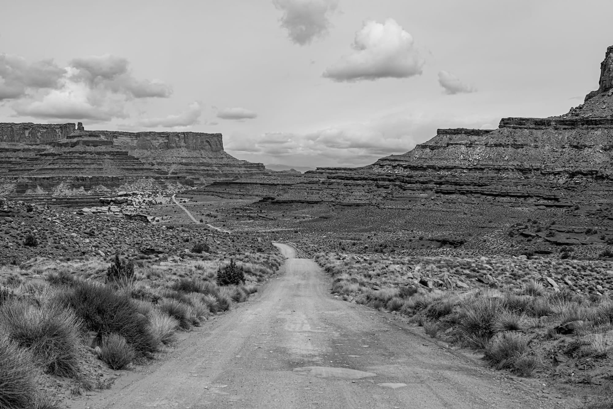
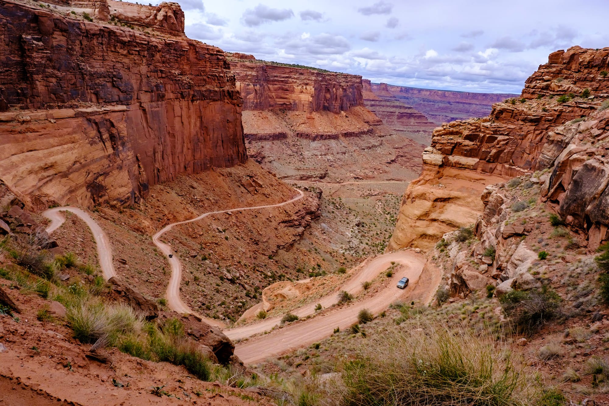
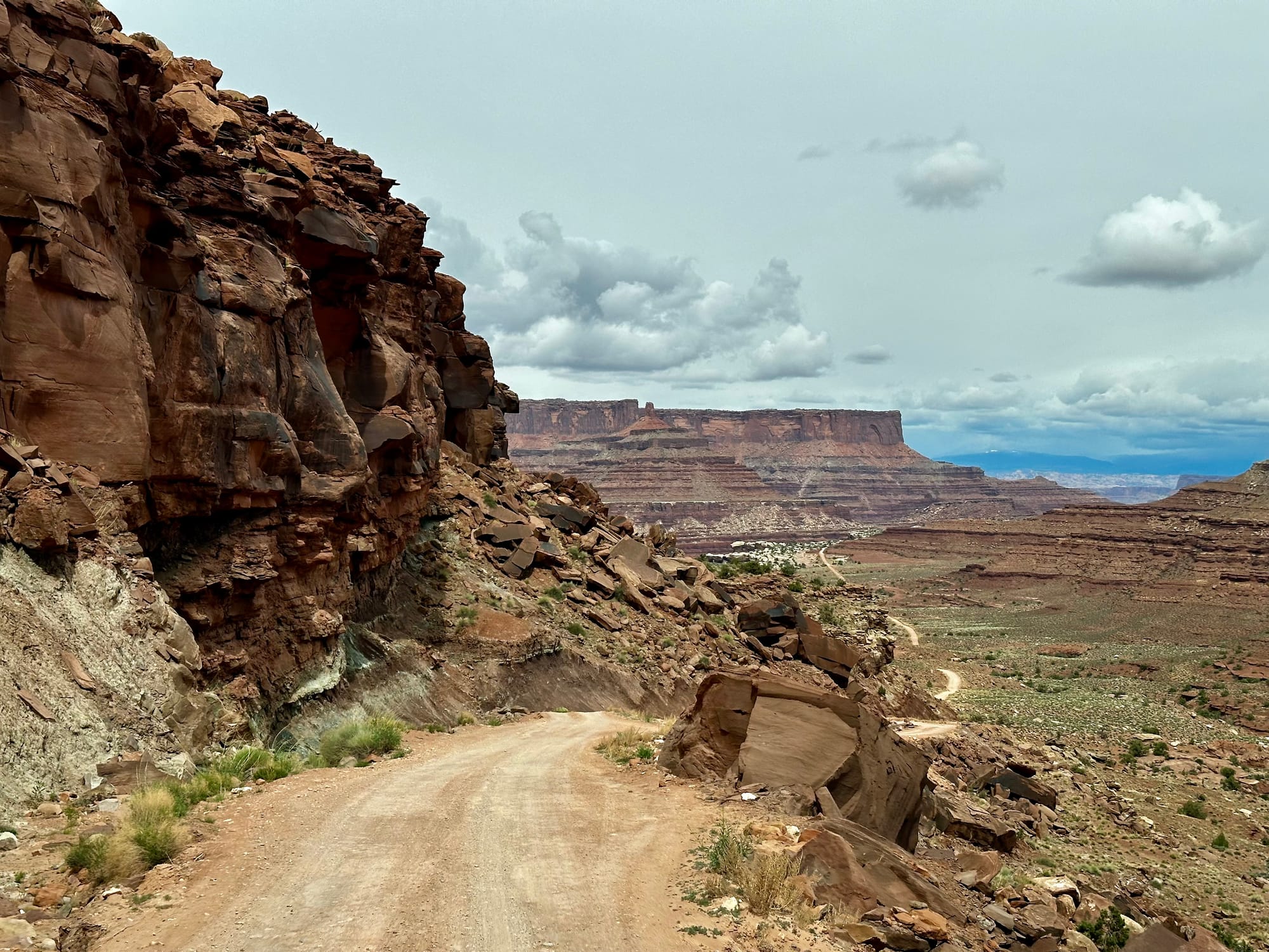
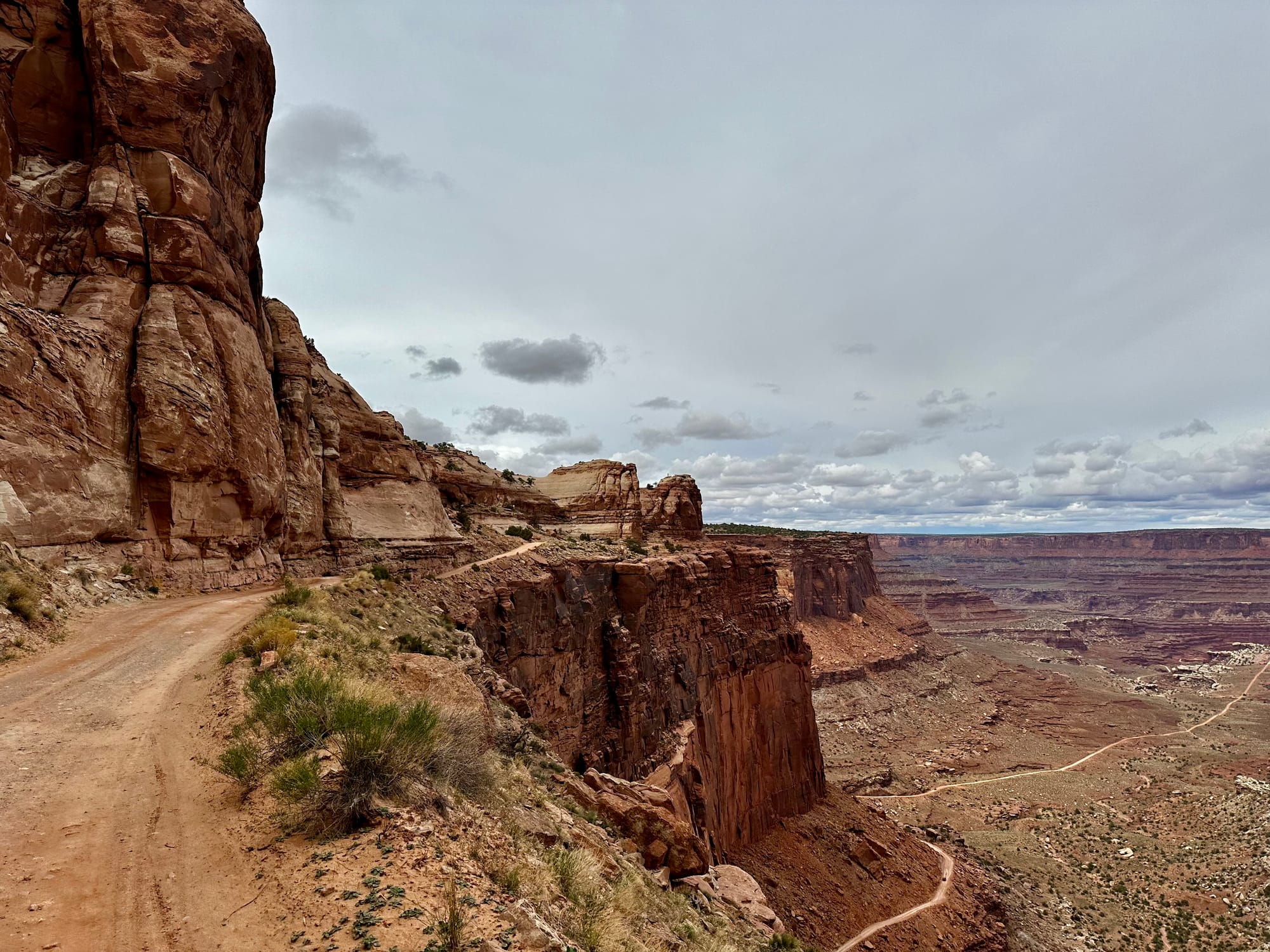
And it probably goes without saying, but the views are incredible. We didn't get to experience going down into the Grand Canyon, so this felt like the next best thing. When we finally got down to the bottom, it was crazy to look way back up to the top and know that we just came from there. We drove until we got to Shafer Campground at the bottom (which was empty and beautiful) and then turned around to start the climb back up. The road keeps going deeper into Canyonlands (turning into the White Rim Road) but you need a permit past the campground. There are more backcountry camprounds along the White Rim Road, which would be a super cool multi-day offroading/camping trip someday.
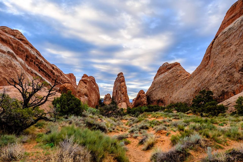
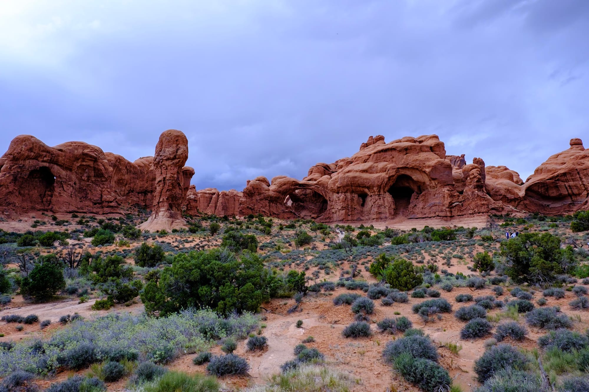
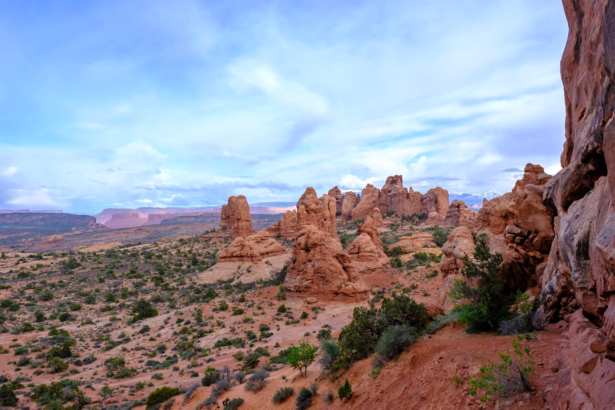
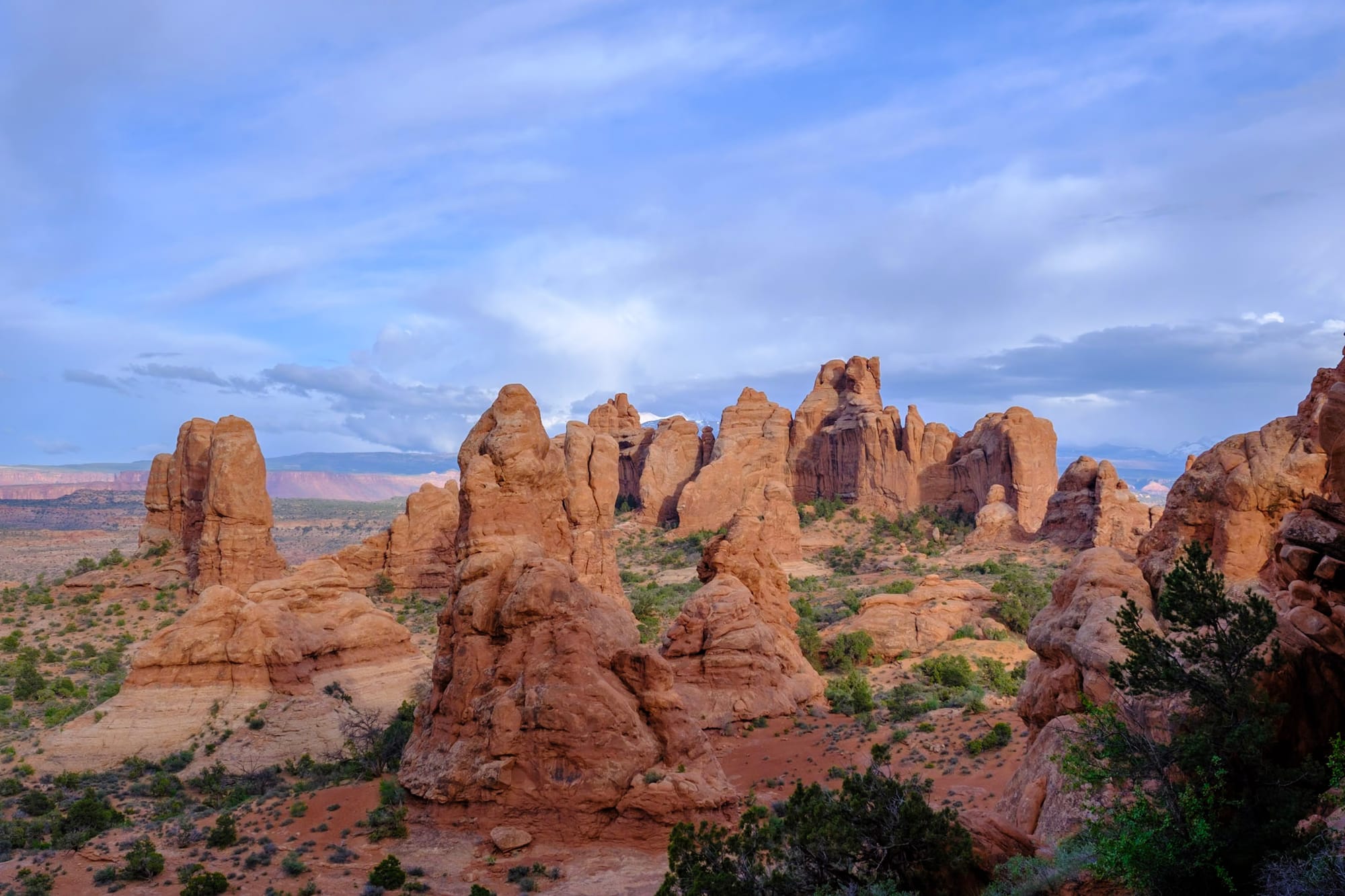
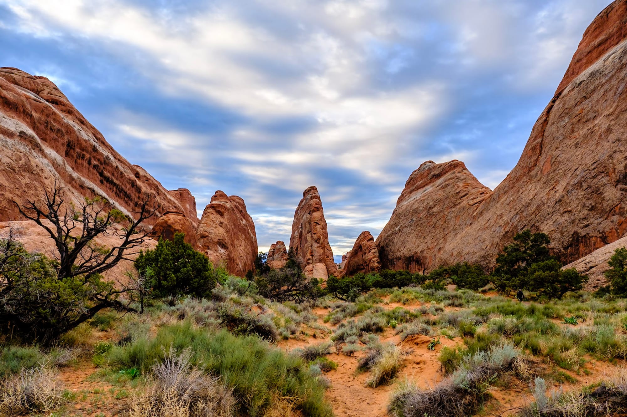
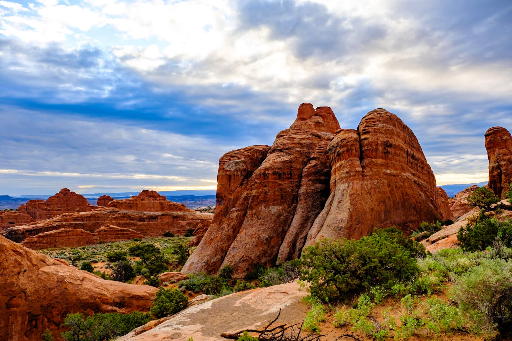
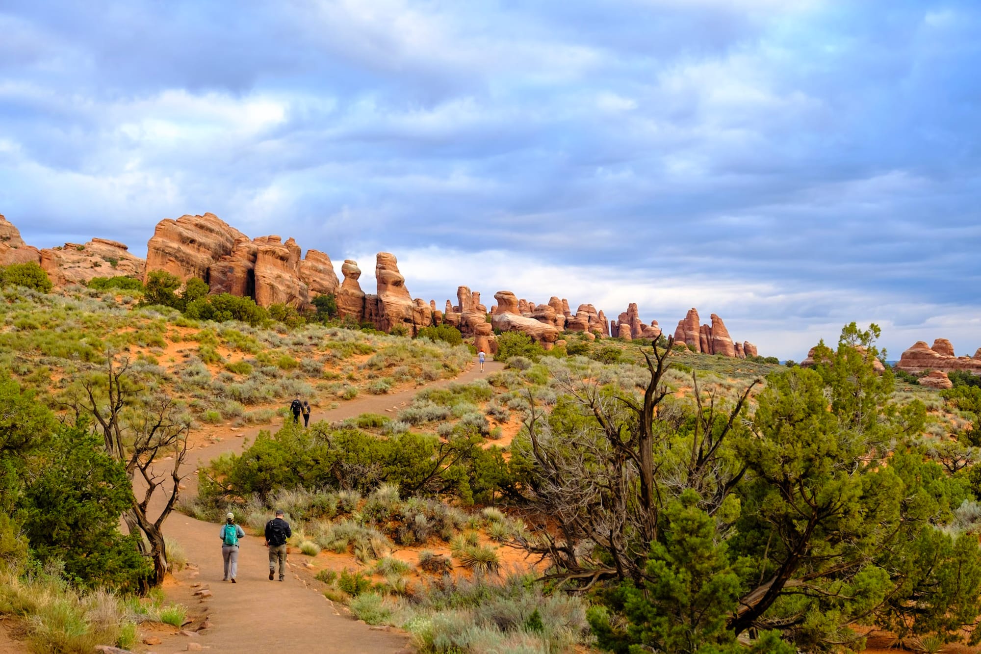
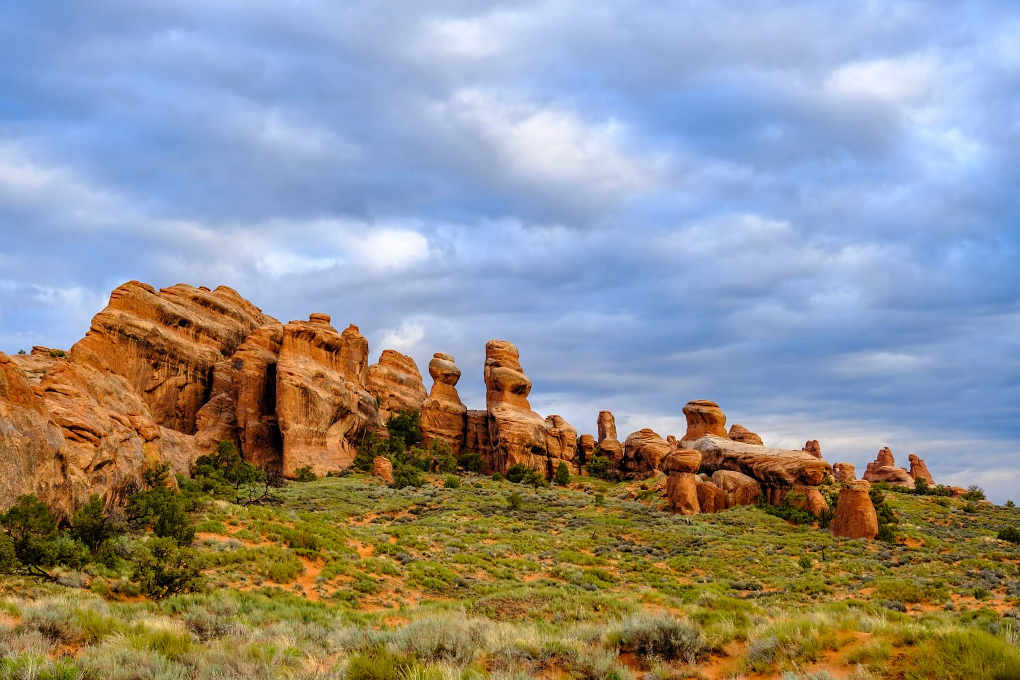
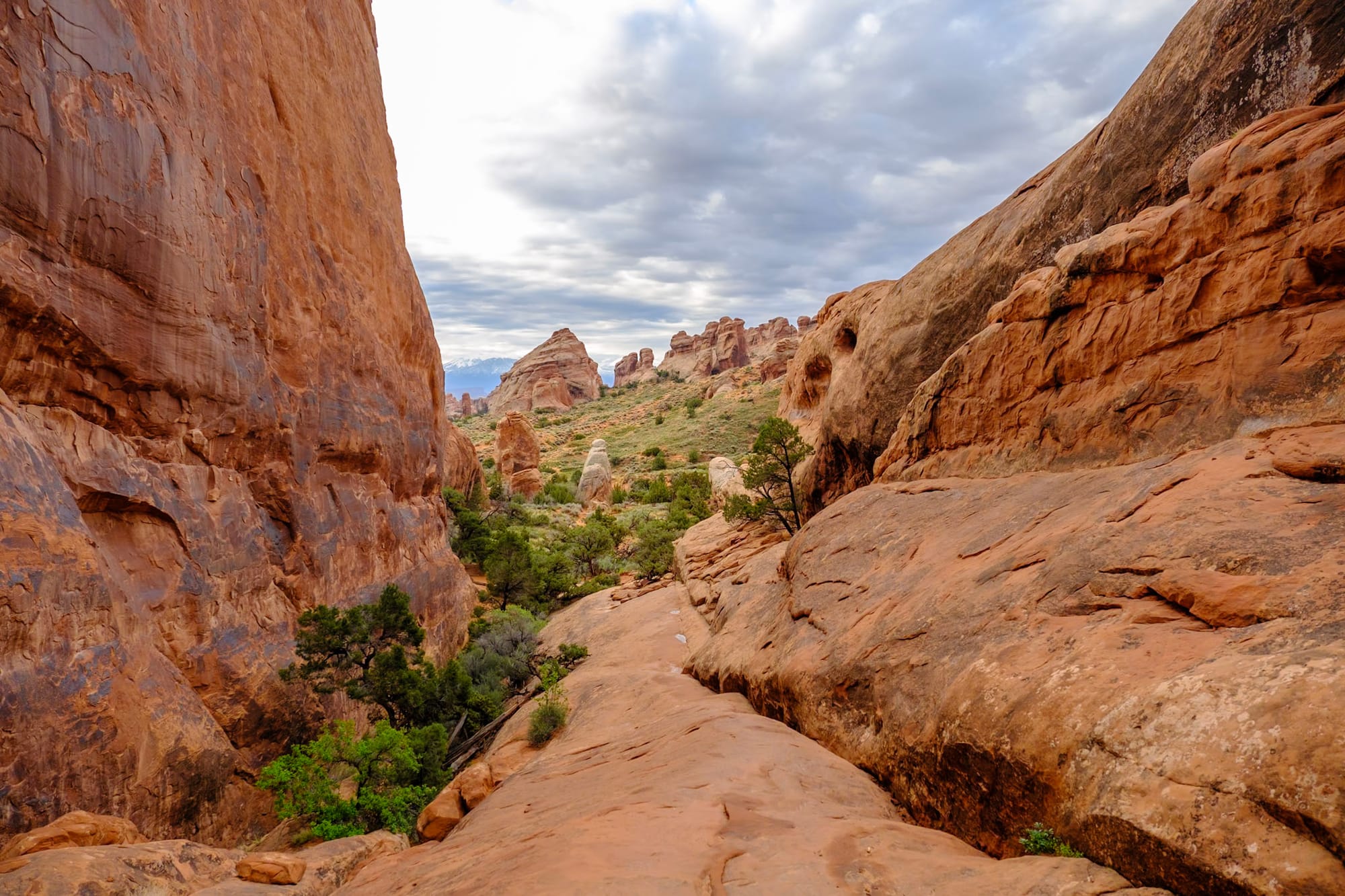
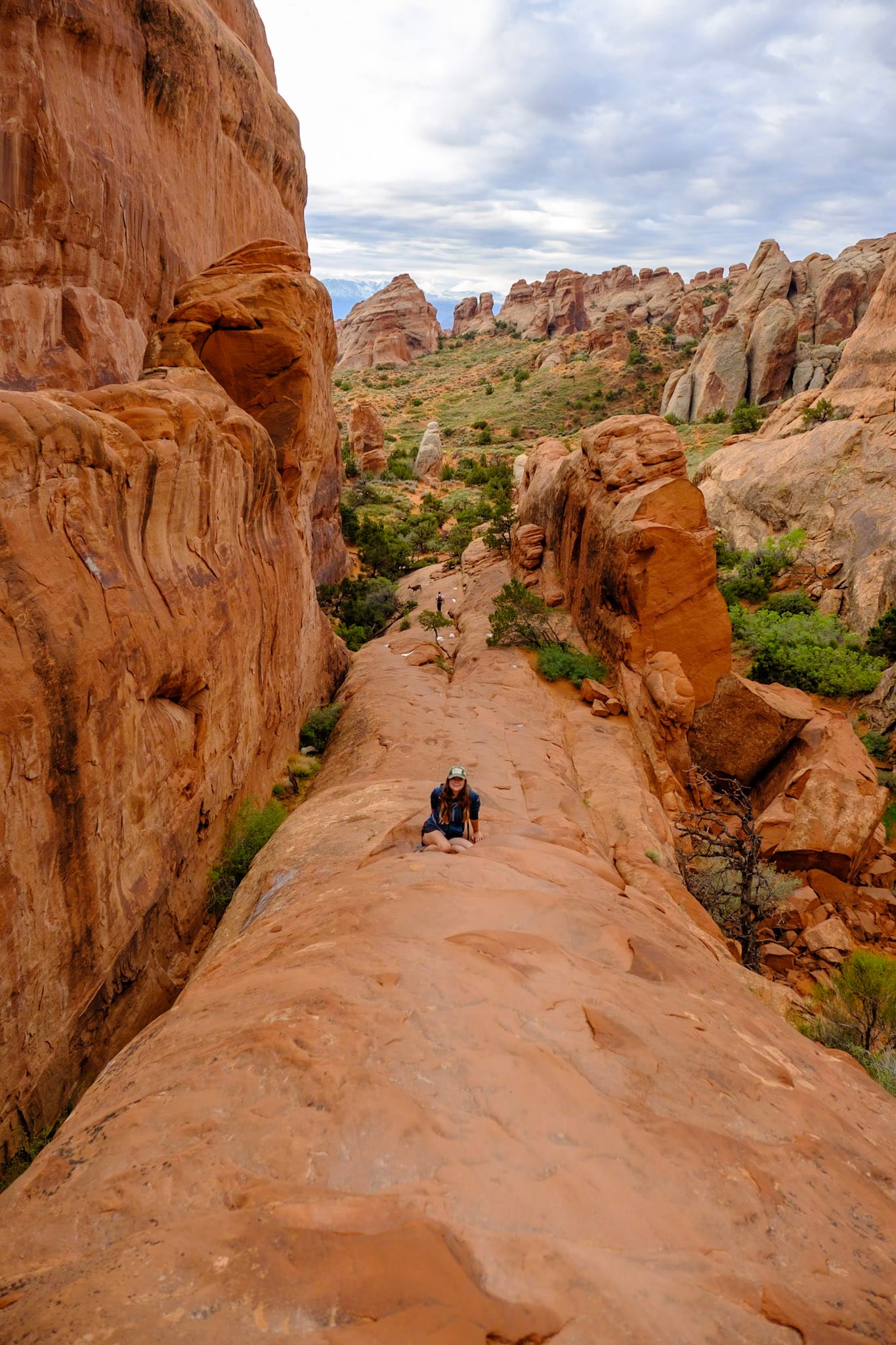
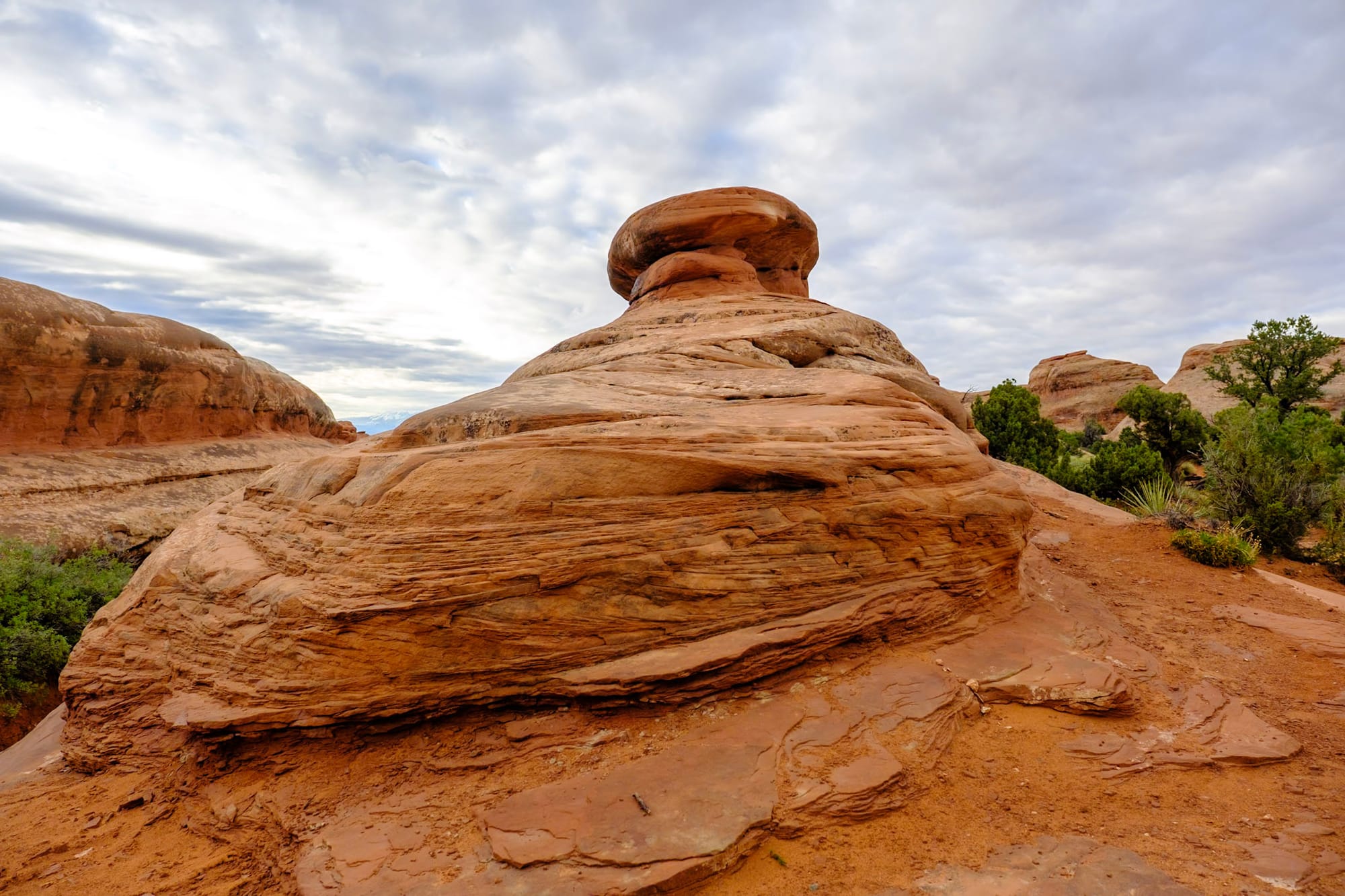
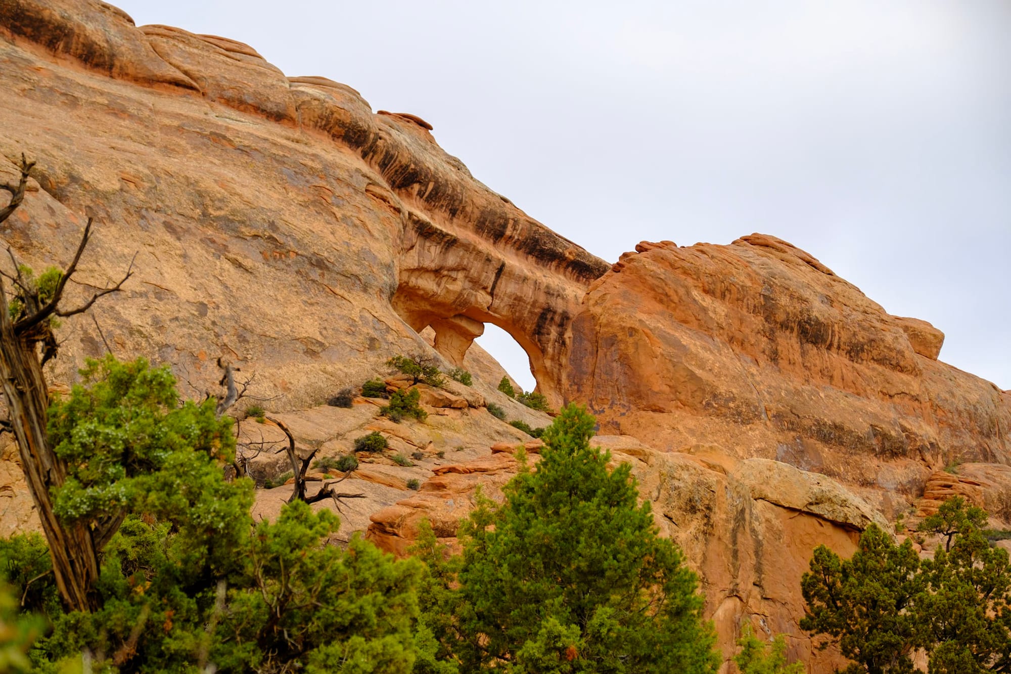
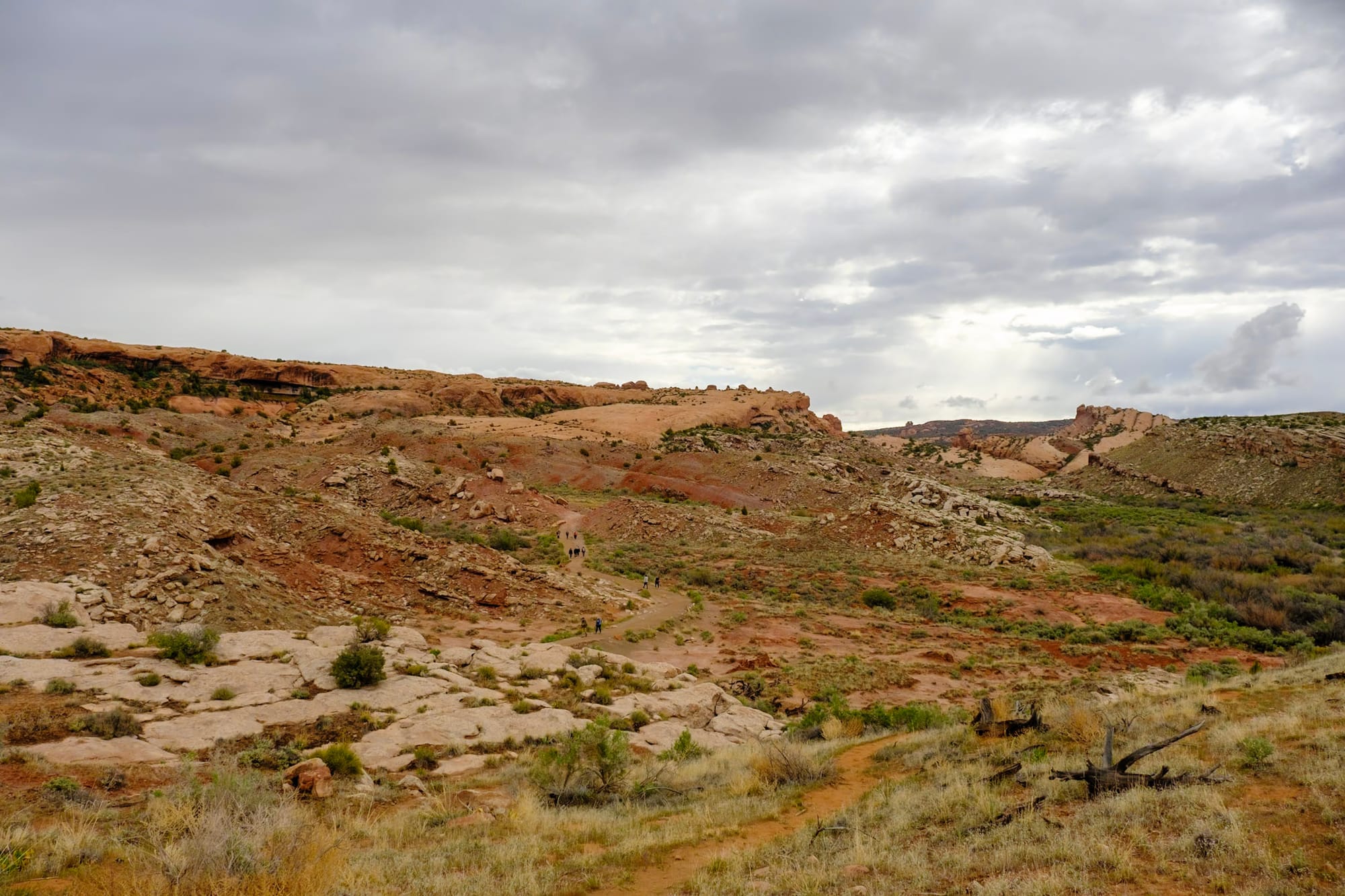
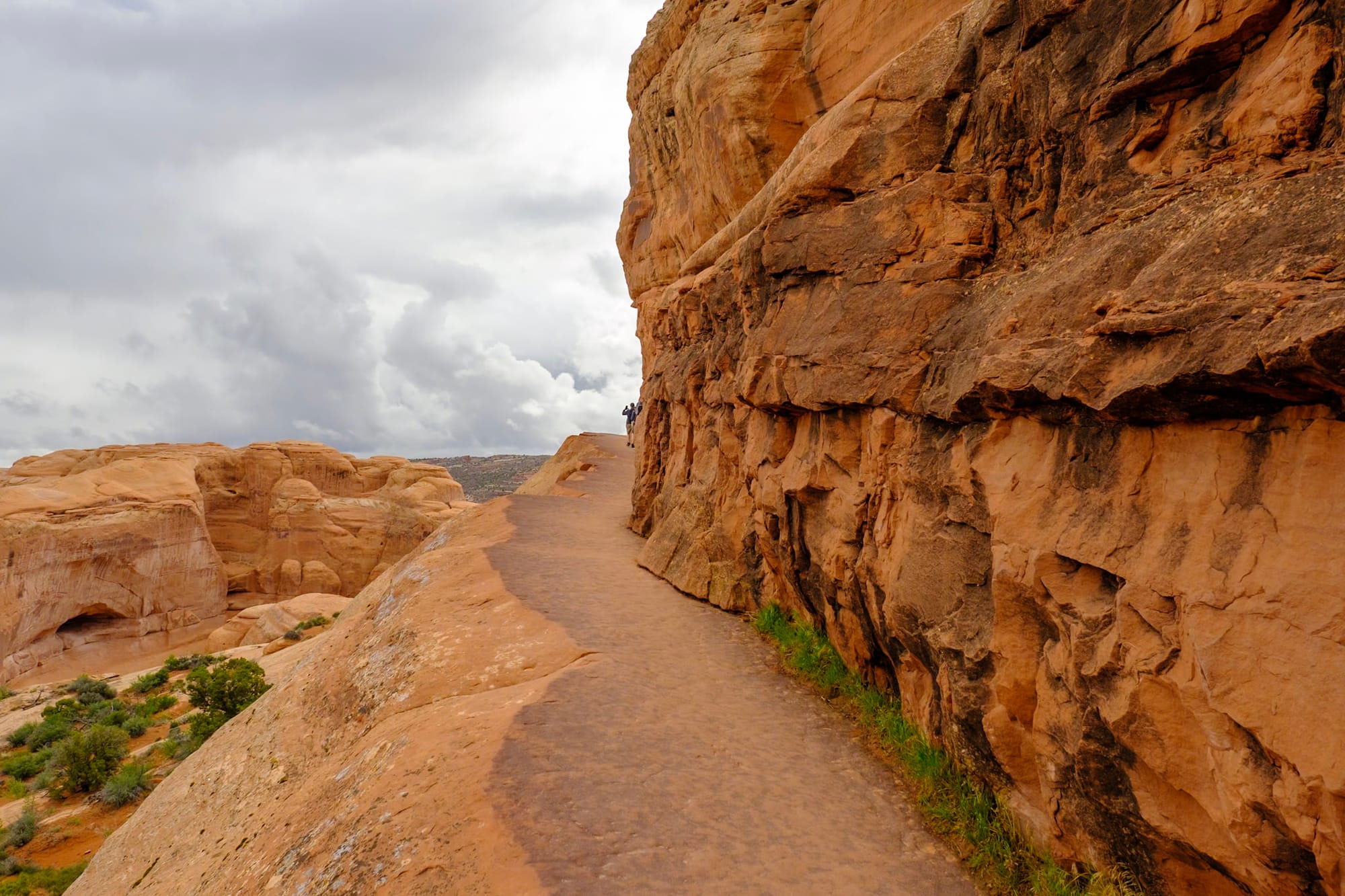
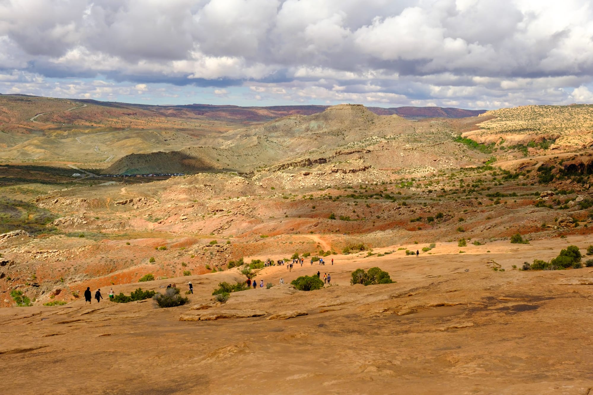
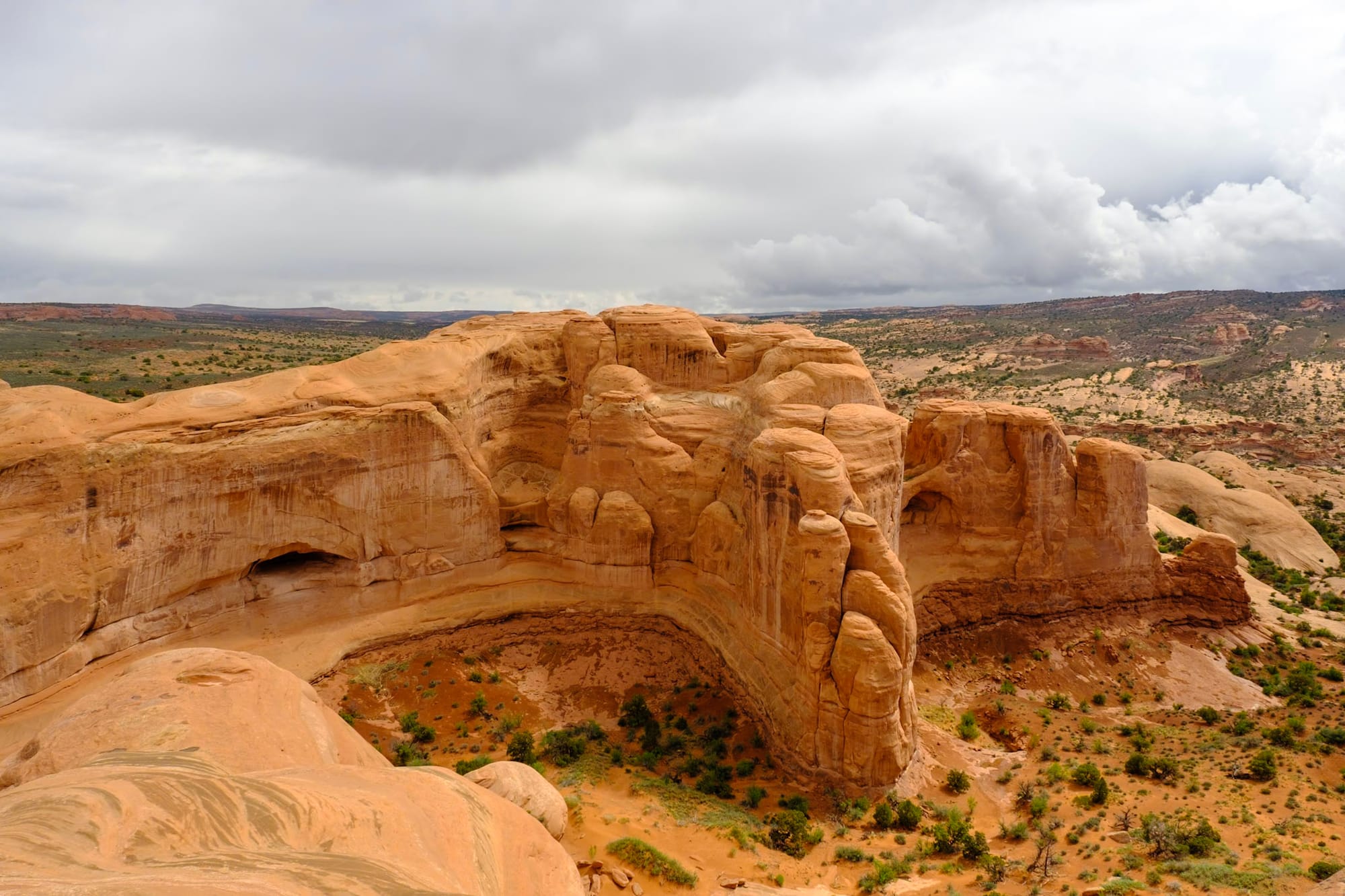
Sunday. We got up early to get into Arches before the permit requirement started at 7am. It was another gray, drizzly, and chilly morning, but we saw a beautiful sunrise trying to peek through the clouds on our drive in. We drove to the very end of the main Arches road to hike the Devils Garden trail.
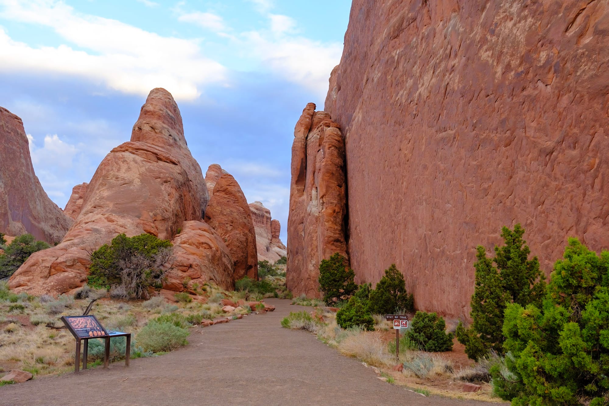
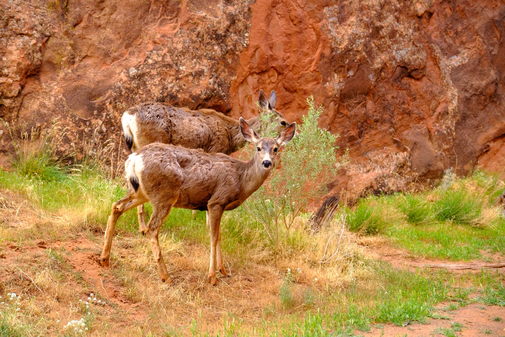
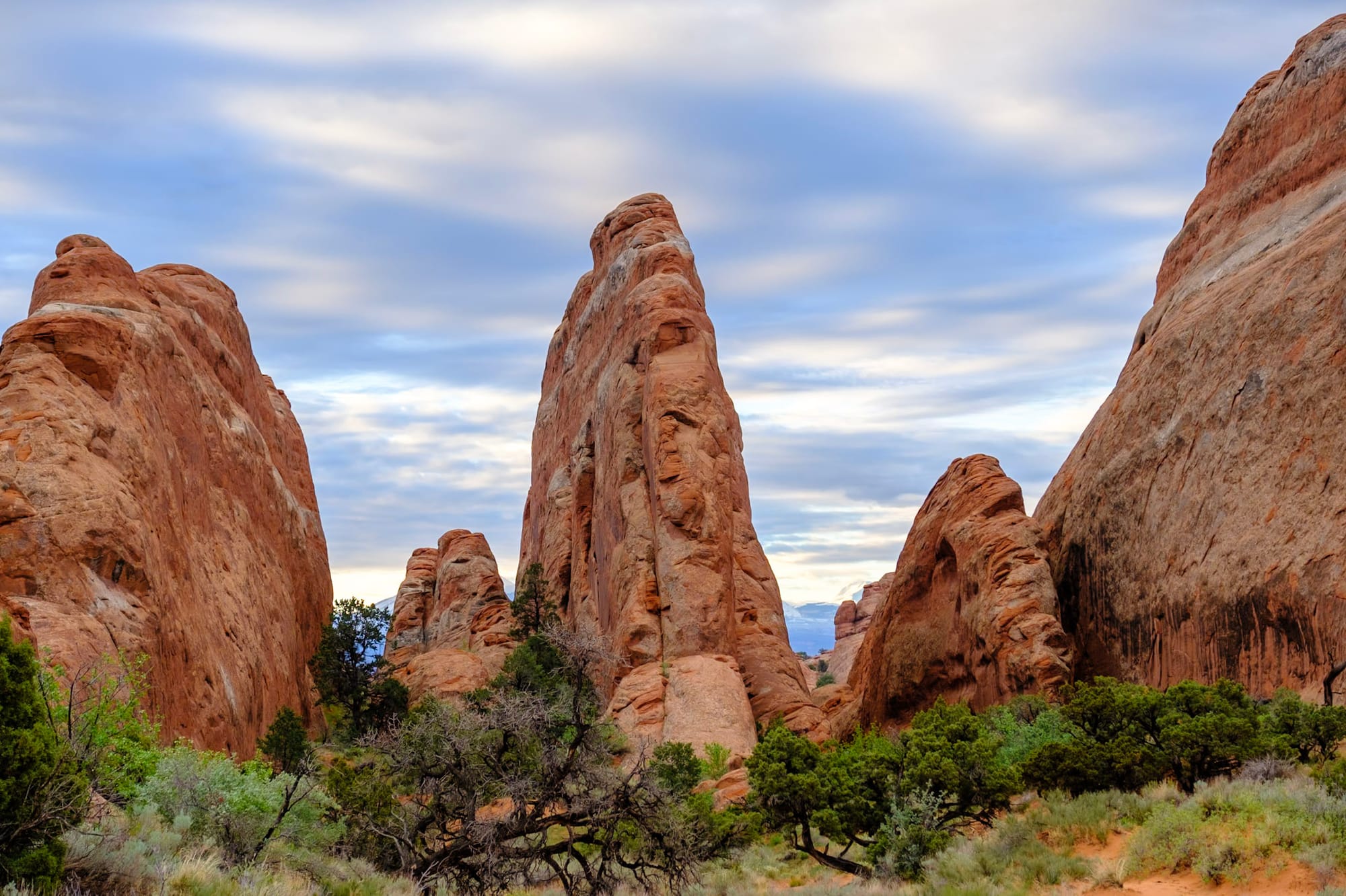
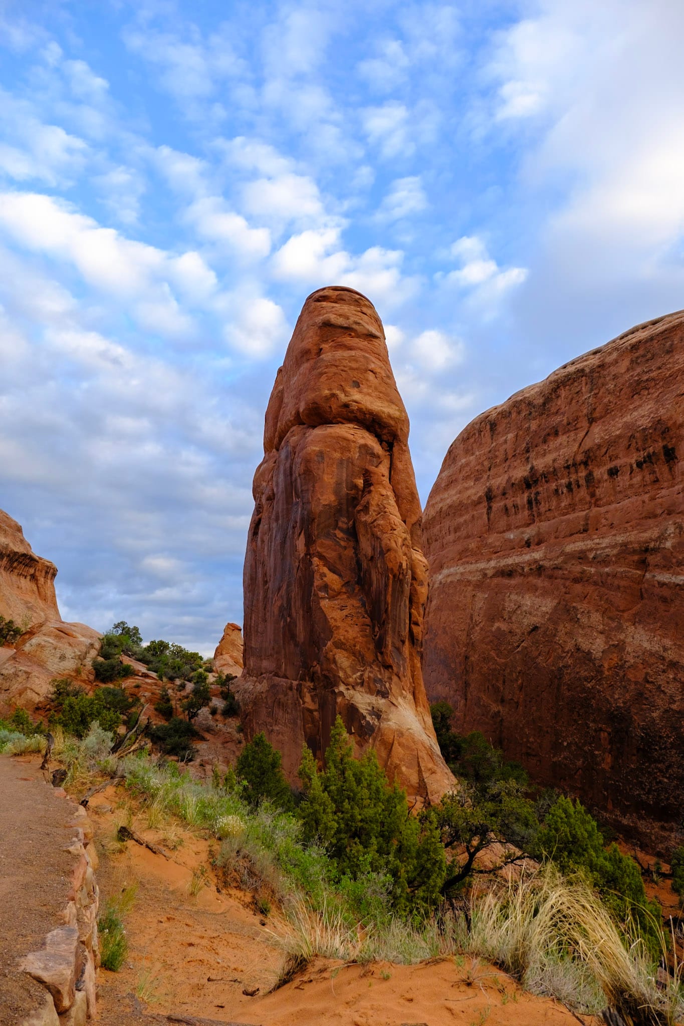
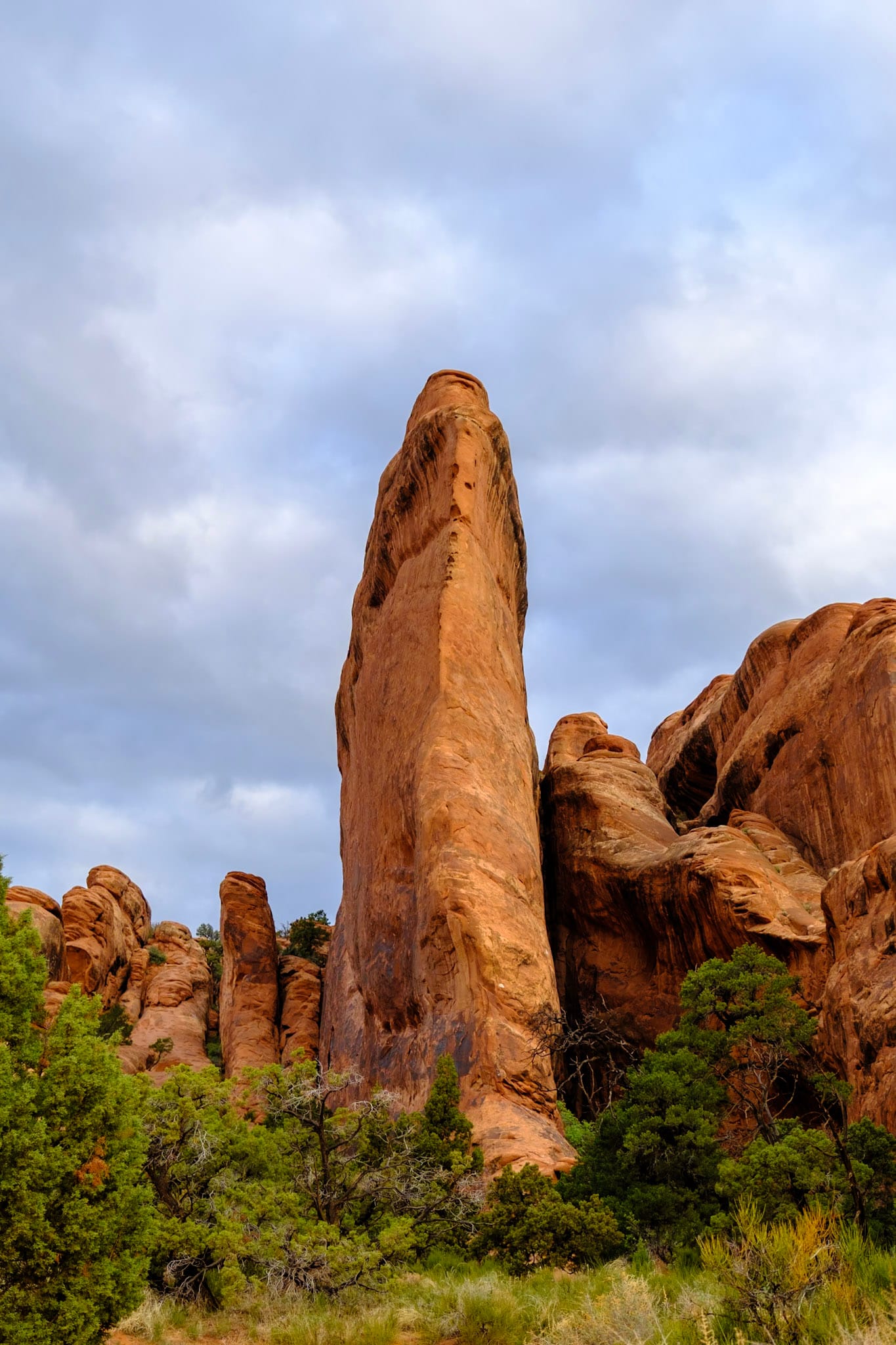
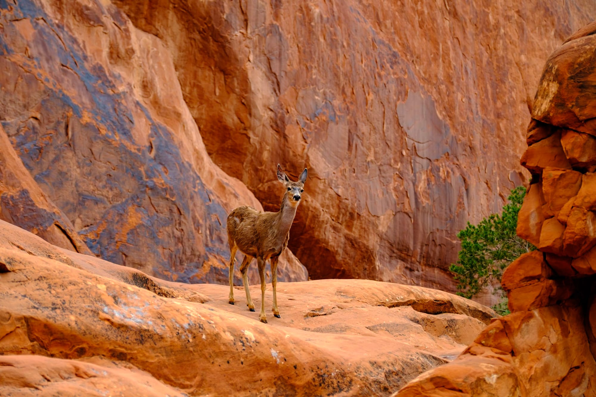
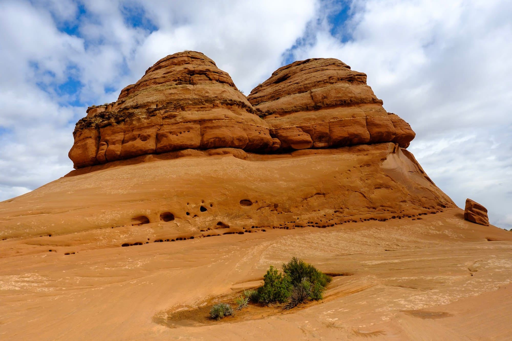
There were several people parked already when we got there, but it was pretty quiet when we started the hike. Devils Garden is a beautiful area of Arches full of these big red rock "fins" – thin and tall formations that will likely, very far in the future, turn into arches. As we walked in between two of these huge fins right at the trail entrance, we passed a few deer who stood and watched us, not afraid at all. It smelled amazing on this trail, the recent rain bringing out all the fresh green scents of the juniper trees.

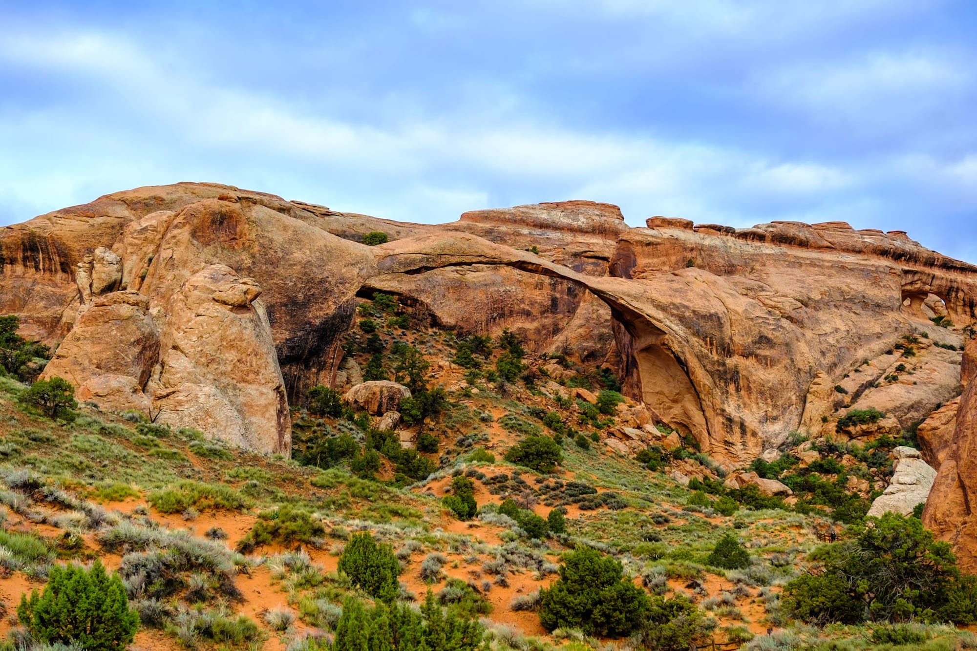
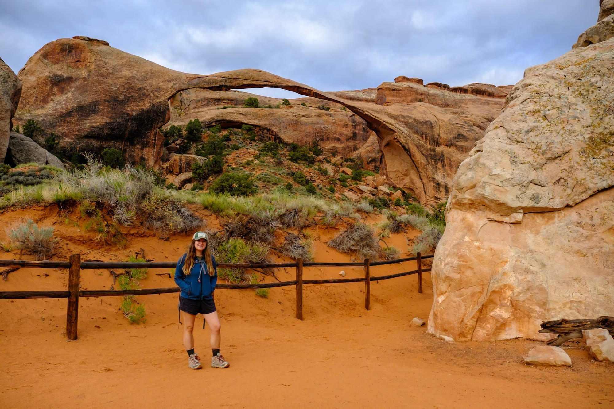
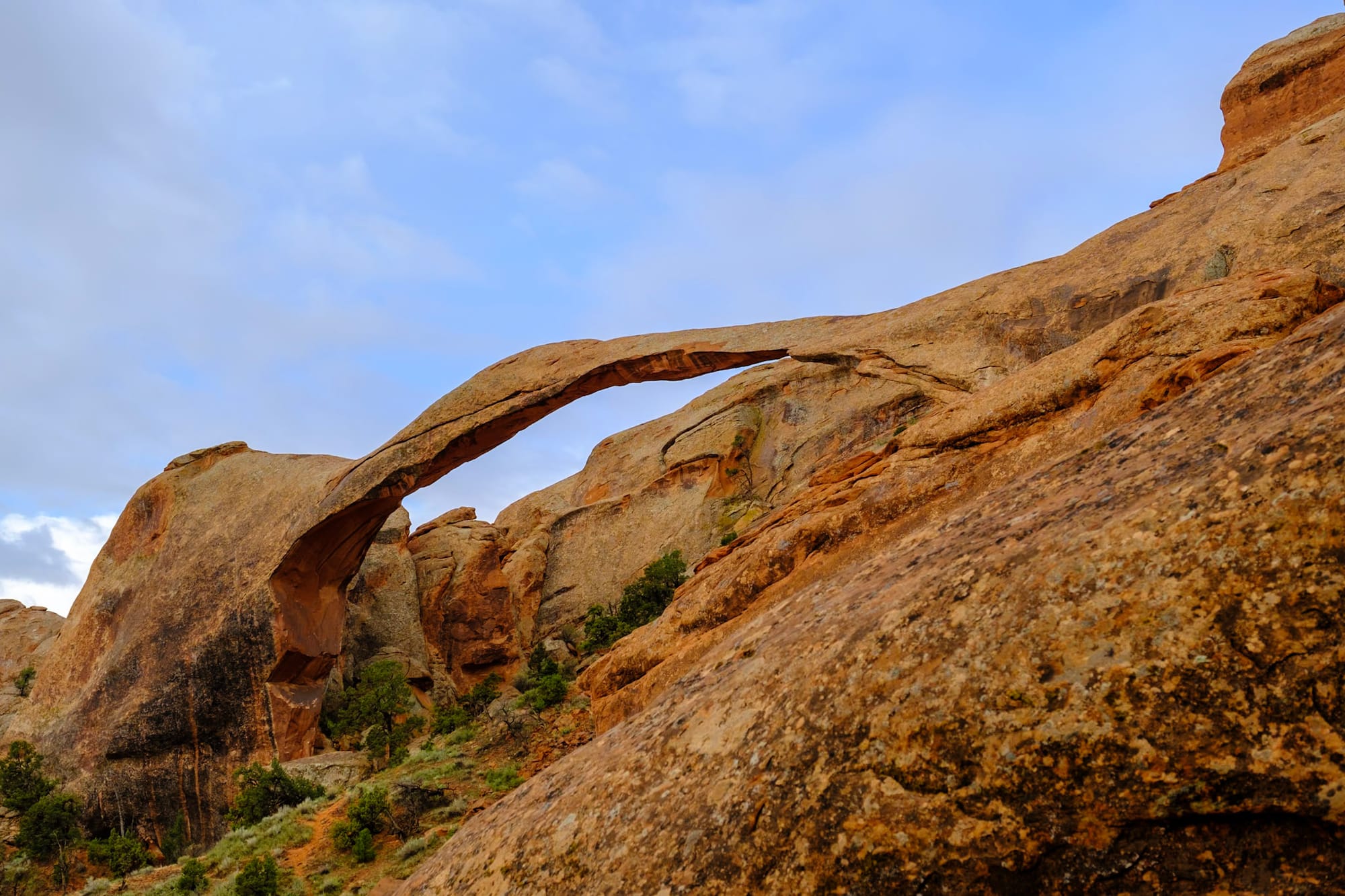
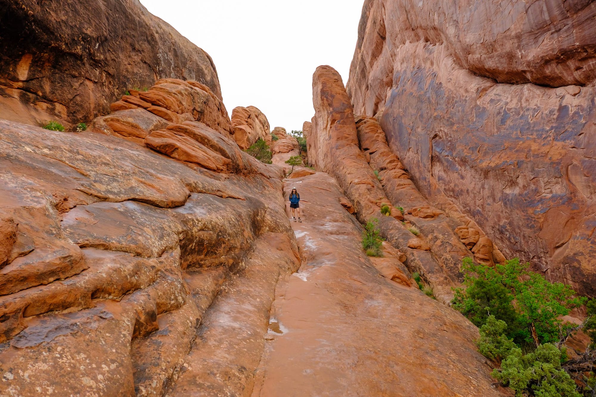
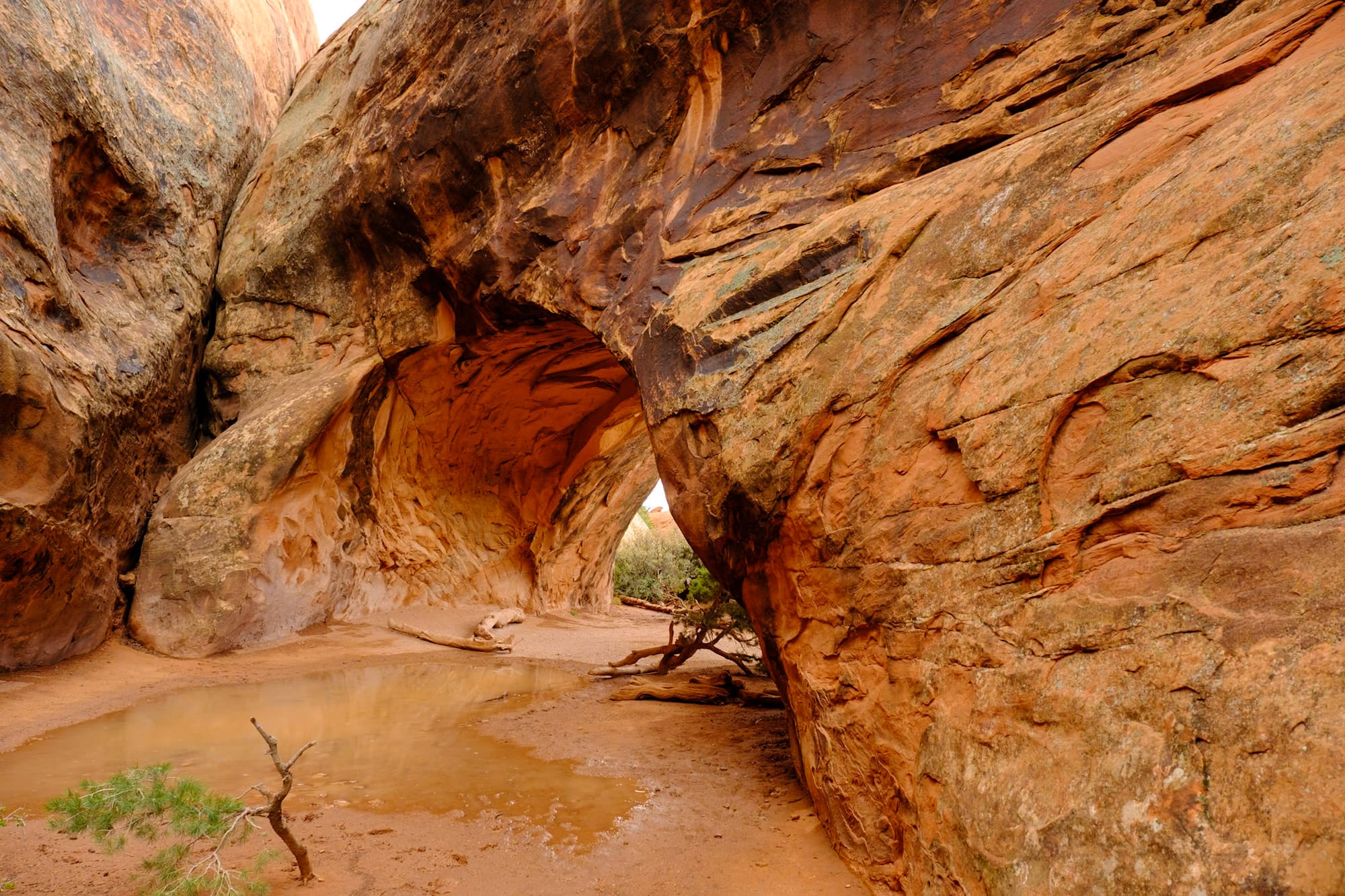
You can do a longer 8-mile loop through Devils Garden, which includes several miles on the harder to navigate Primitive Trail, or you can just hike part of it to see a few arches – Landscape Arch is the easiest and most popular, which you reach after about a mile. Landscape Arch is one of the longest arches in the world at over 300 feet, and looks super thin and delicate – part of the side came crashing down in the 90s, and who knows when part of it will collapse again. (You can't go under it anymore; just look from a distance).
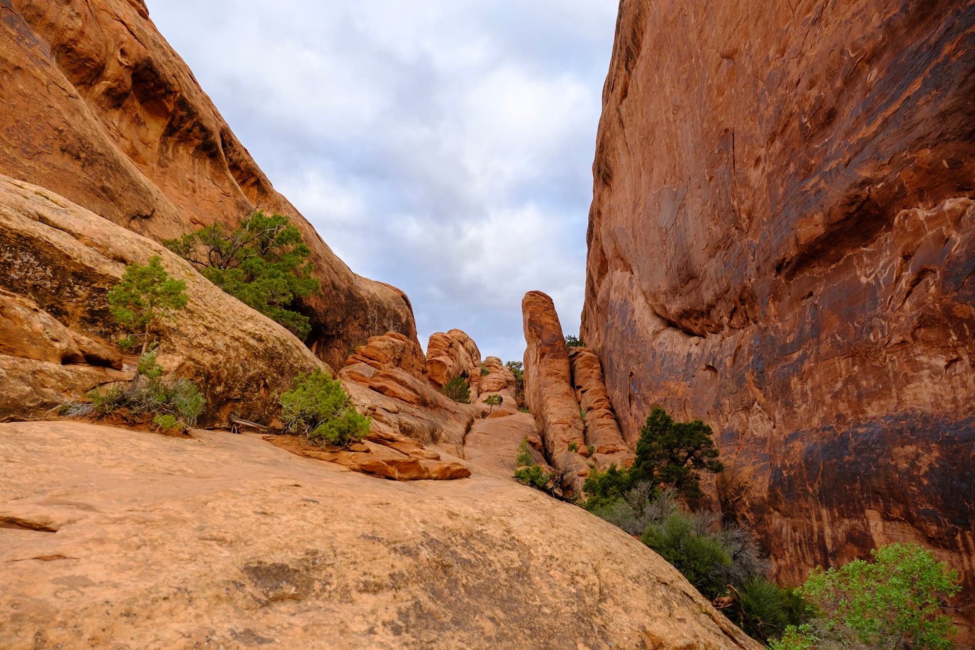
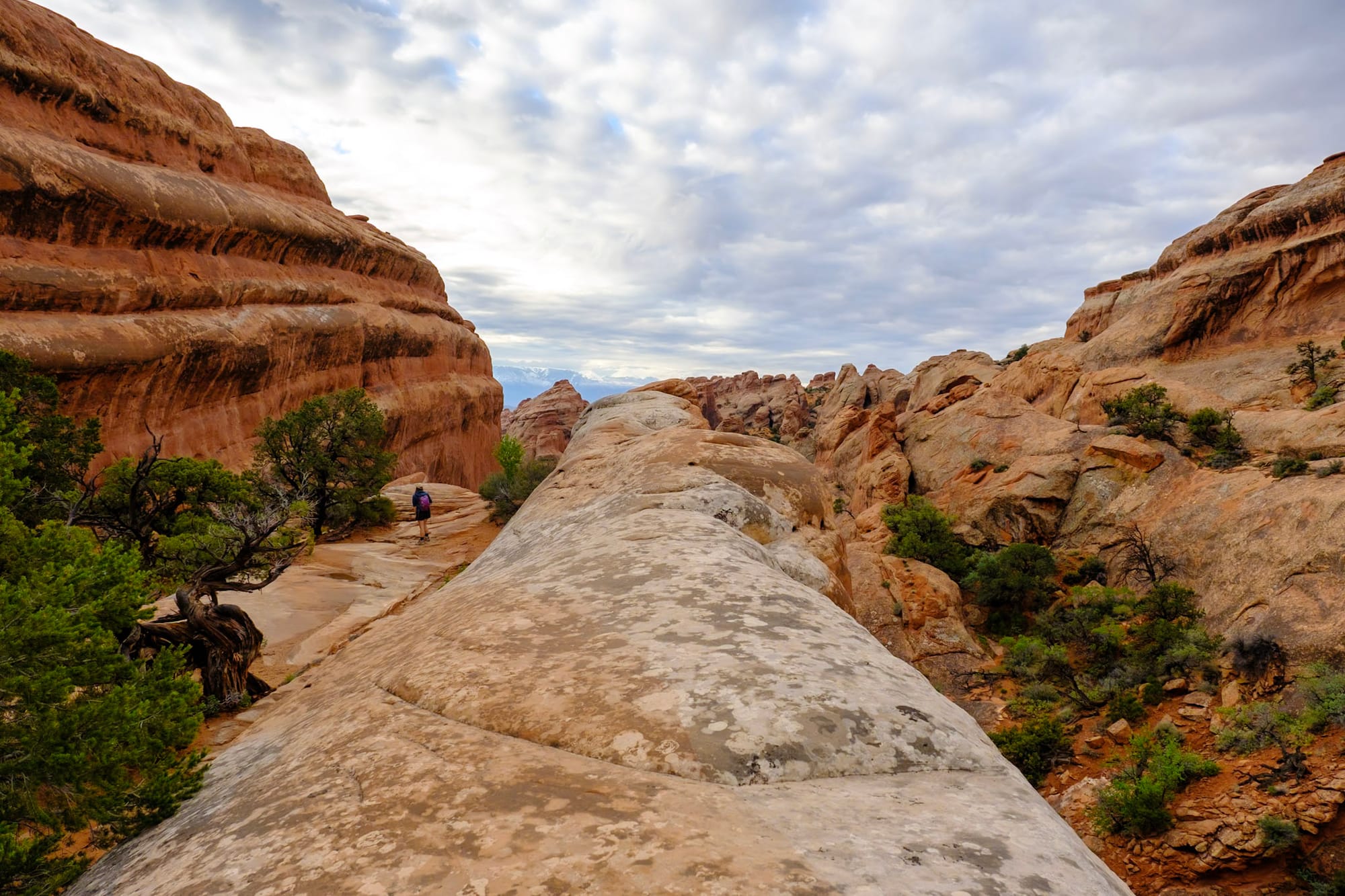
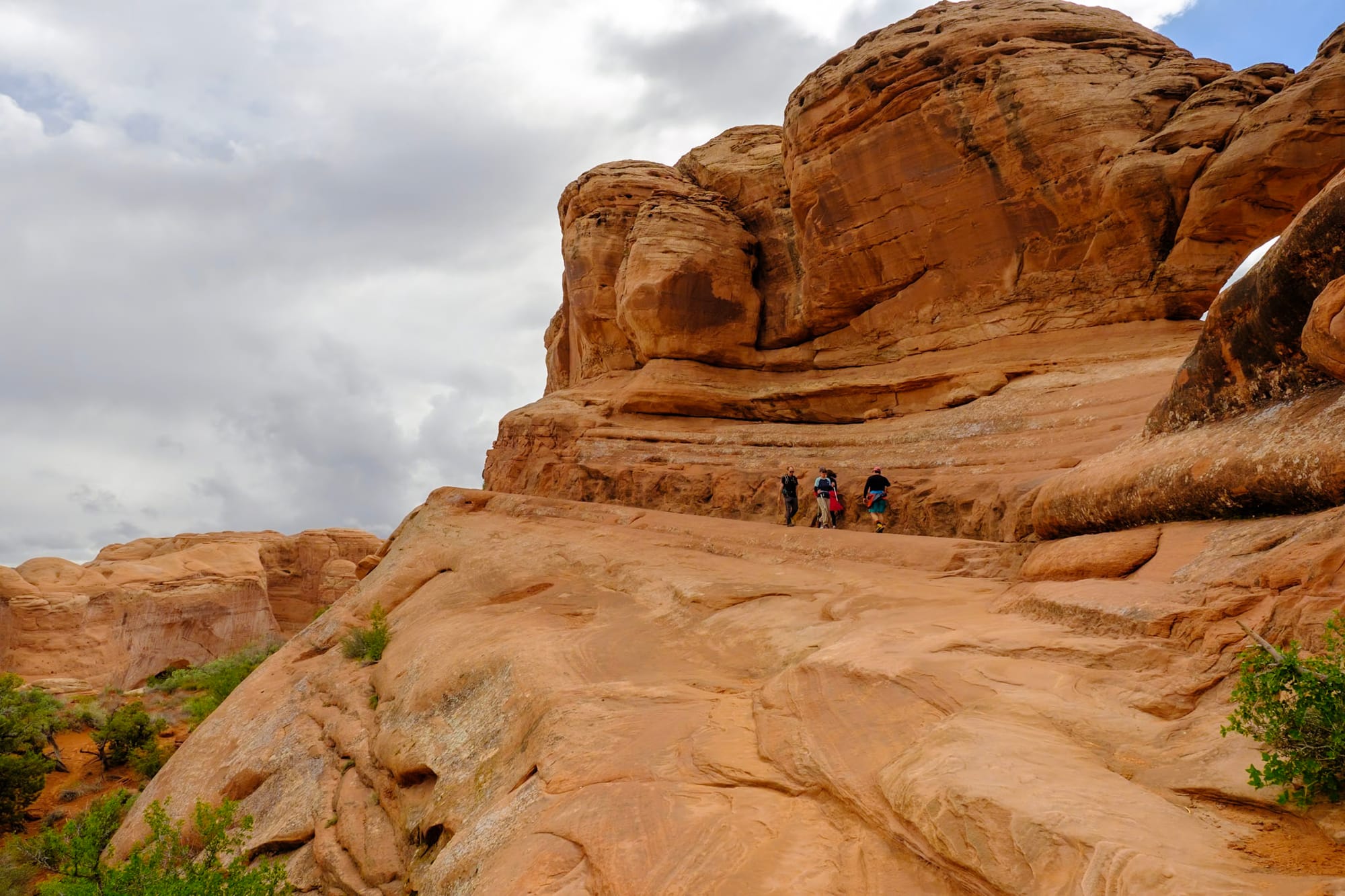
We kept hiking past Landscape Arch to go find two more: Navajo and Partition arches. Past Landscape, the Primitive Trail begins, which is less well-marked and obvious. You have to actually scramble up some steep rock fins, which was super fun but a little slick in the light rain. Another couple we met hiking were unclear where to go – they chose one path lower in the canyon, and after we followed for a bit, we realized it wasn't the way we were supposed to go, so we climbed up those fins til we saw a trail marker that let us know we were on the right path.
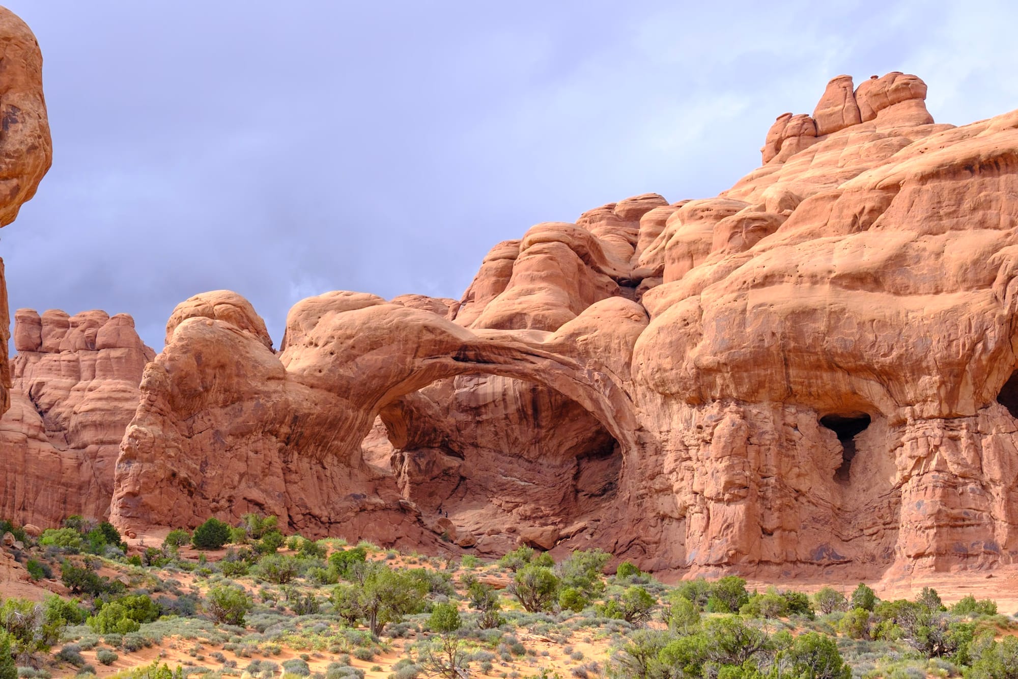
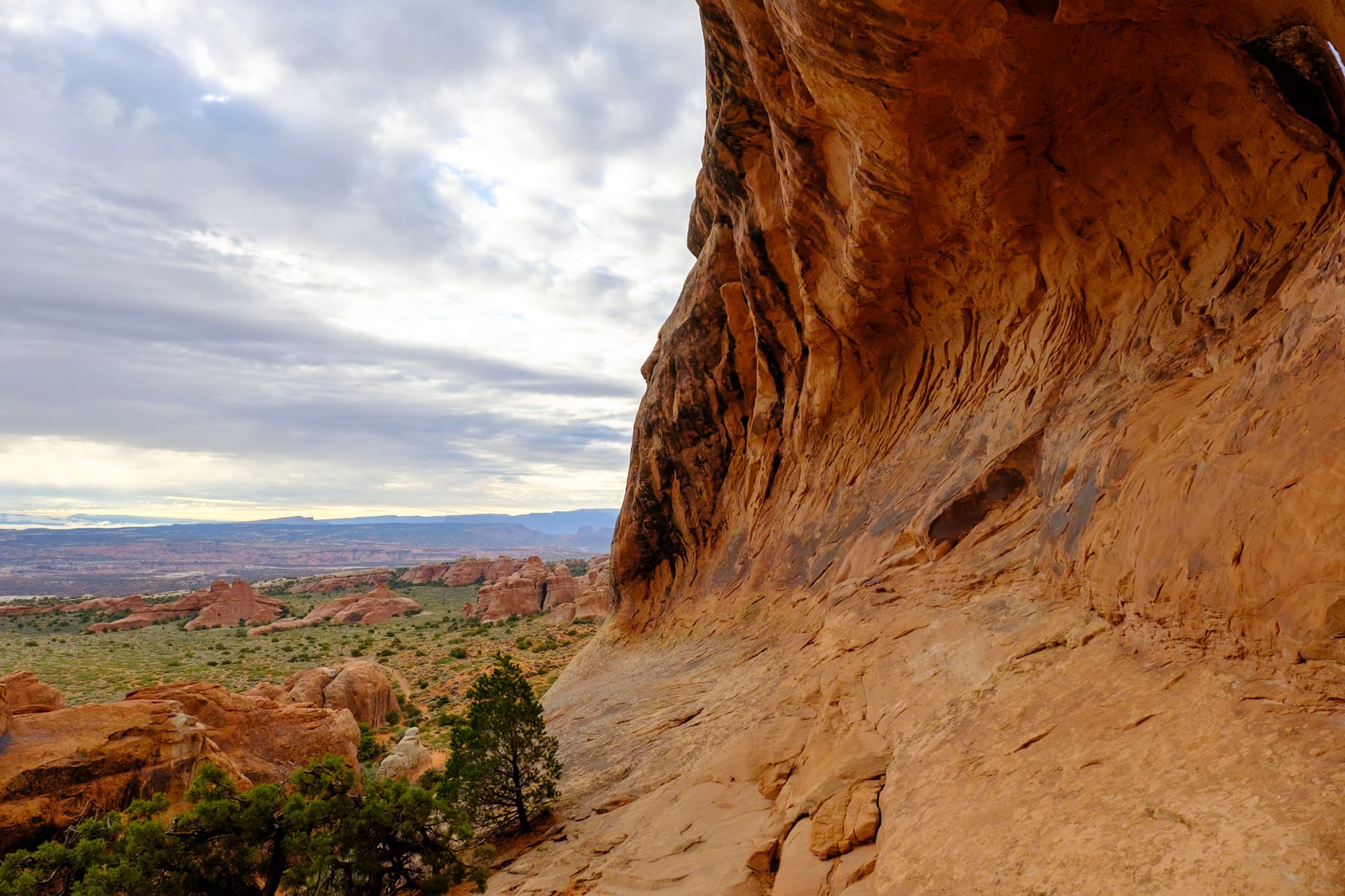
After a bit, we reached Partition Arch, which was awesome. It's high up, off to the side of Landscape, and you can sit beneath it with a great view of Devils Garden below. We took a break there for a while, enjoying the quiet. The other couple eventually made it there too; we were glad they hadn't gotten lost.
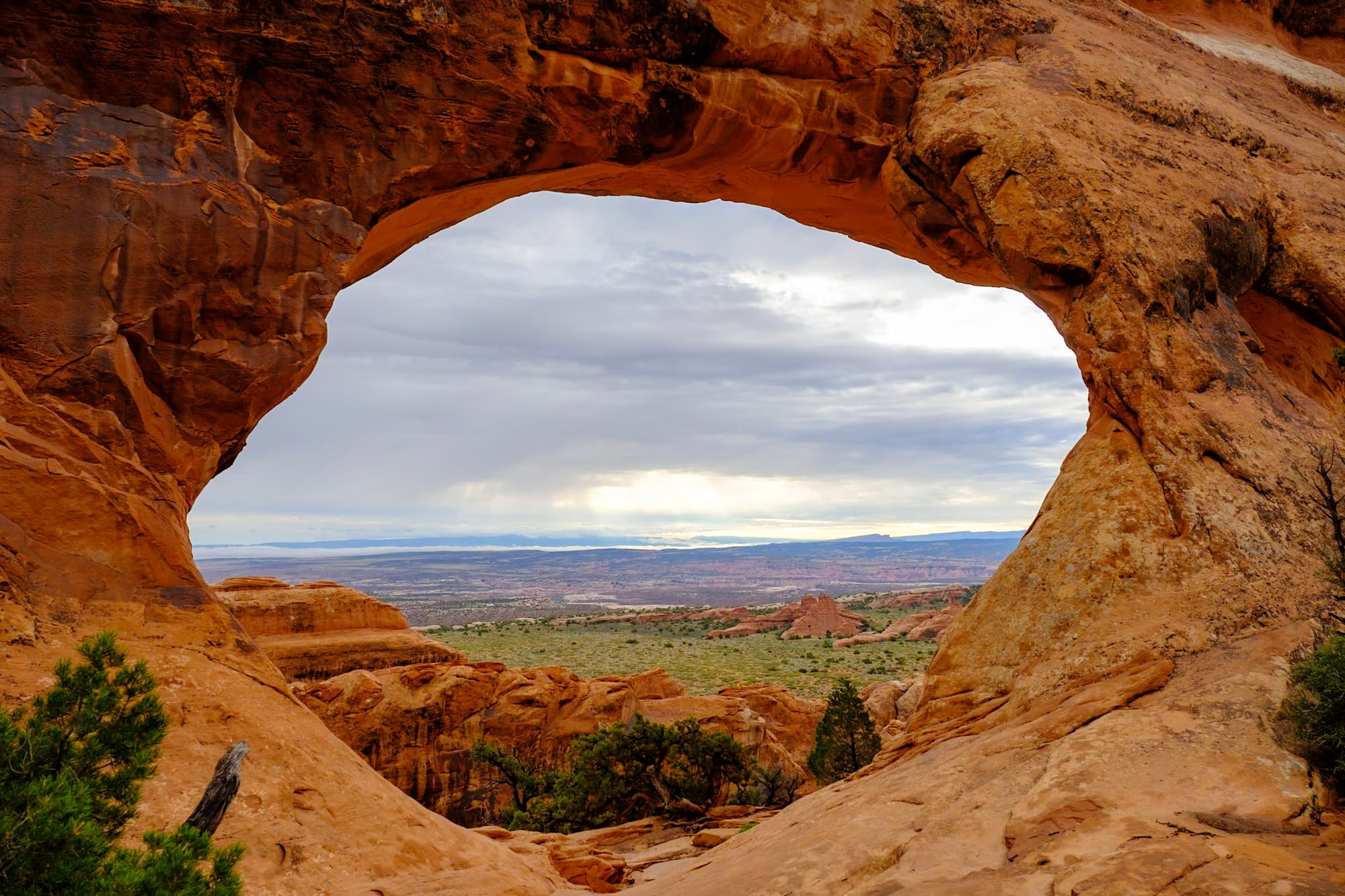
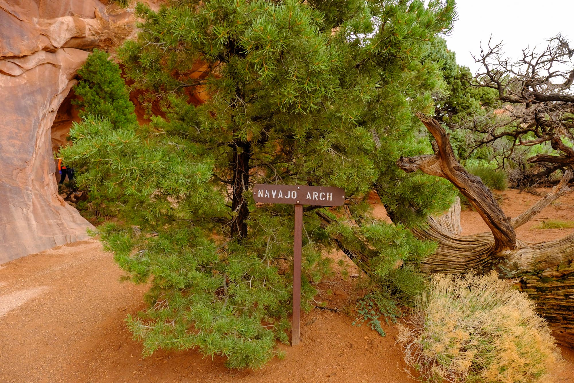
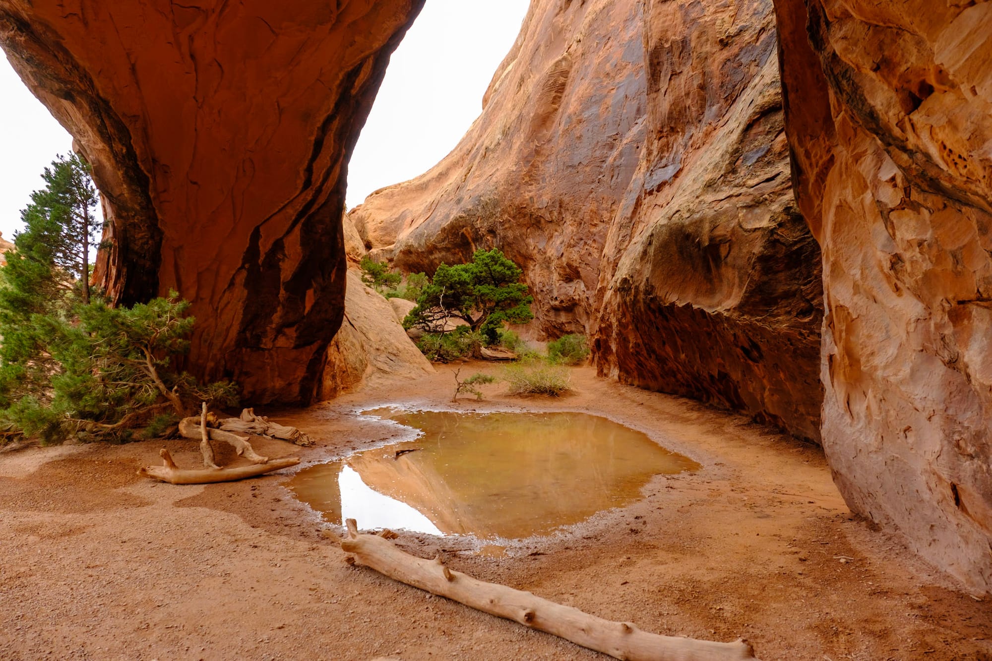
When we left Partition, it was just a short walk to Navajo Arch. This was a very different kind of arch – it was more like a cave, an arched entrance into a semi-hidden nook in the canyon.
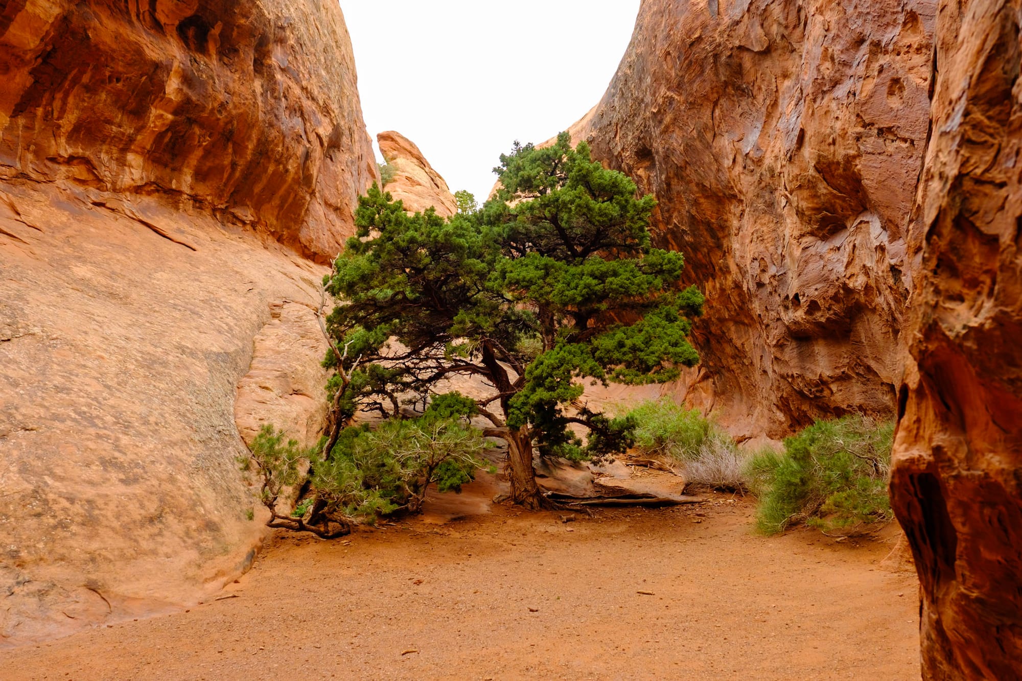
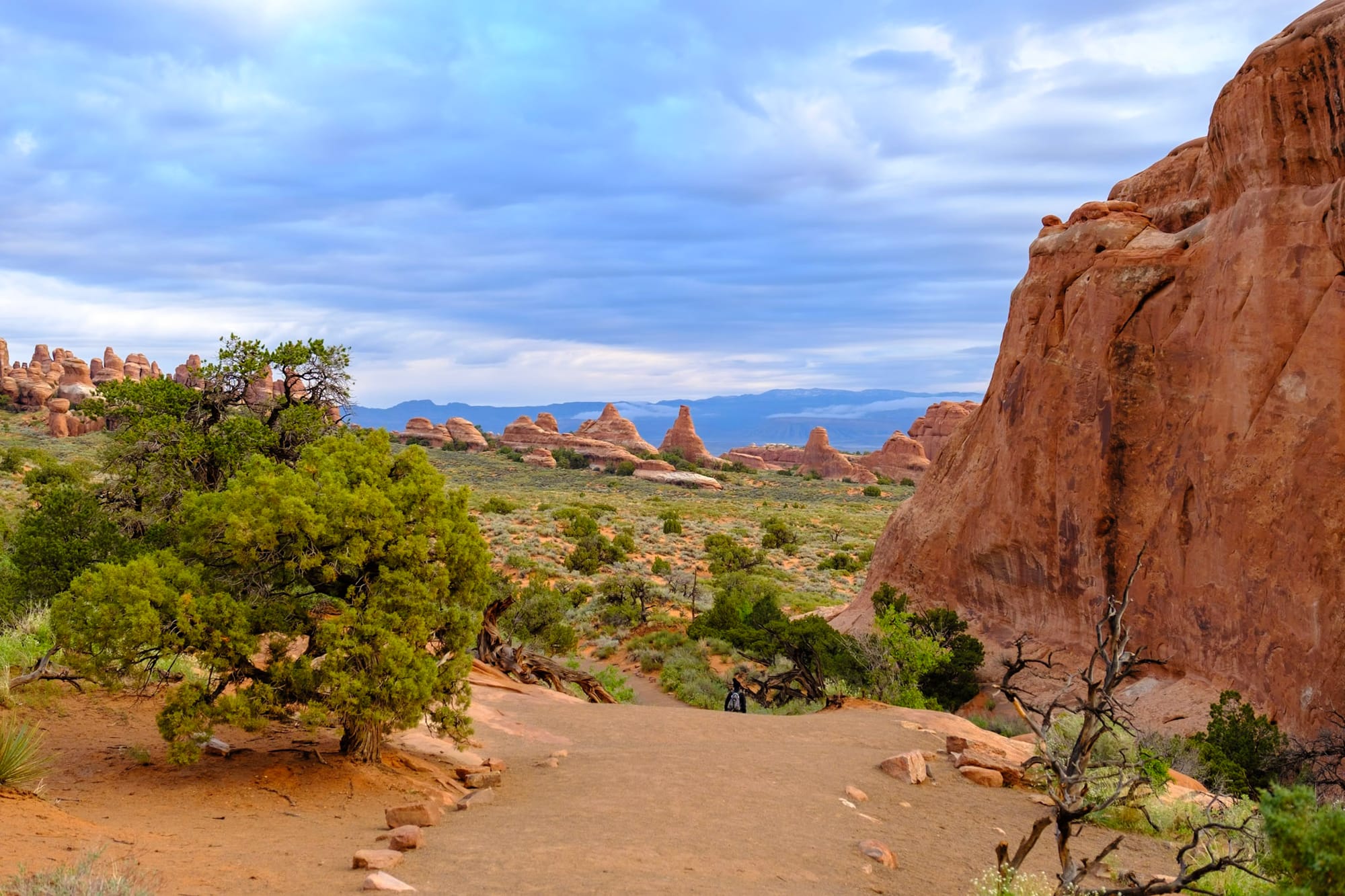
Then we climbed back down the rock fins and walked back to the trail entrance. It was mid-morning now and getting a lot busier. Someday I'd love to do the entire Devils Garden loop; I think it gets a lot quieter as you go further back, and it's such a beautiful area. This was a really nice morning hike, though – we probably did about 4 miles total.
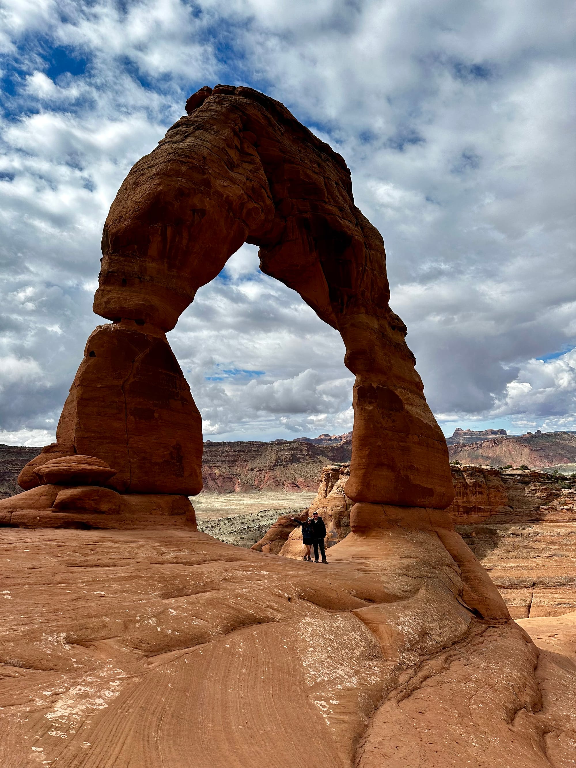
But we had another hike on our list for the day – the iconic Delicate Arch!
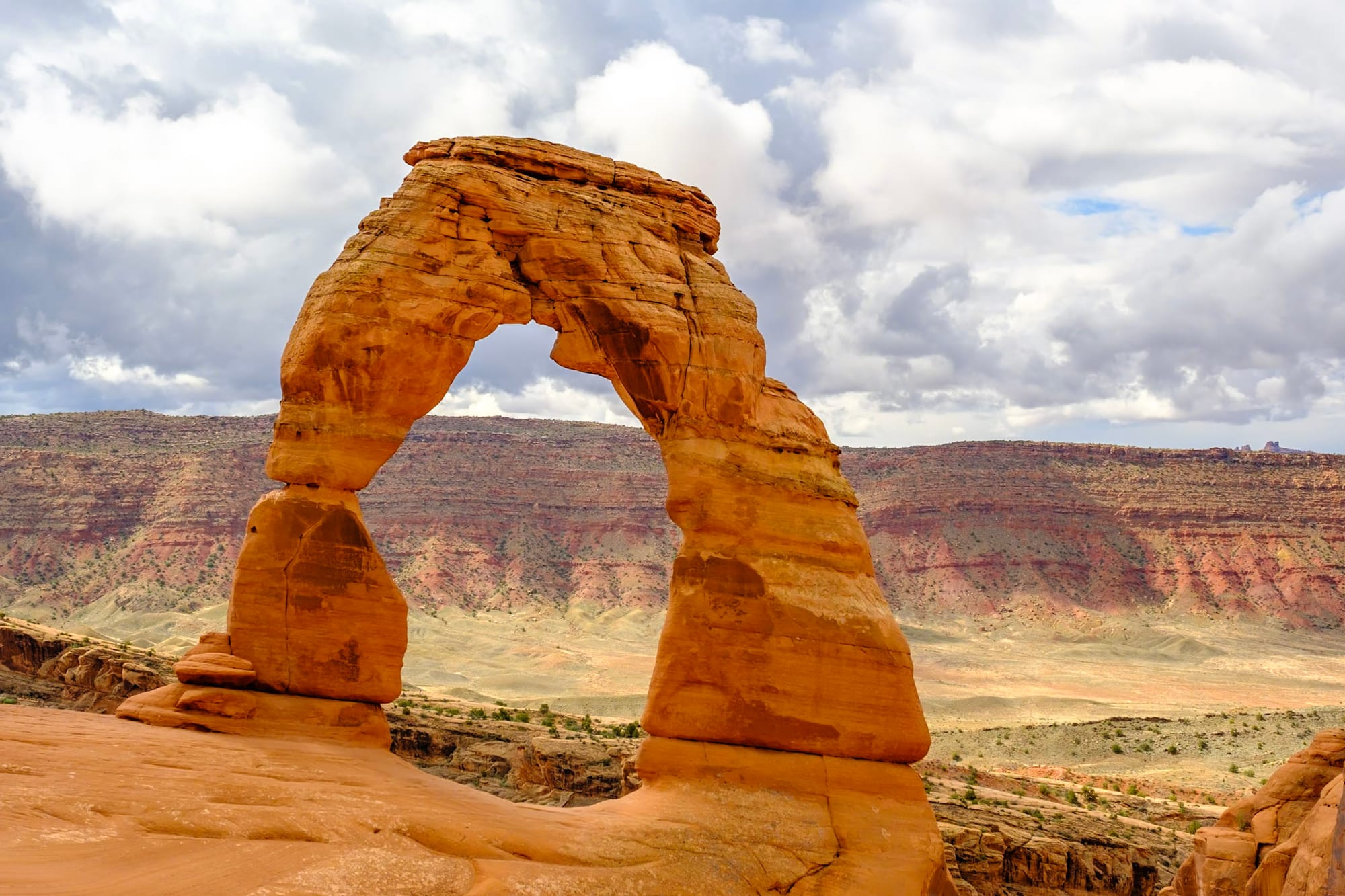
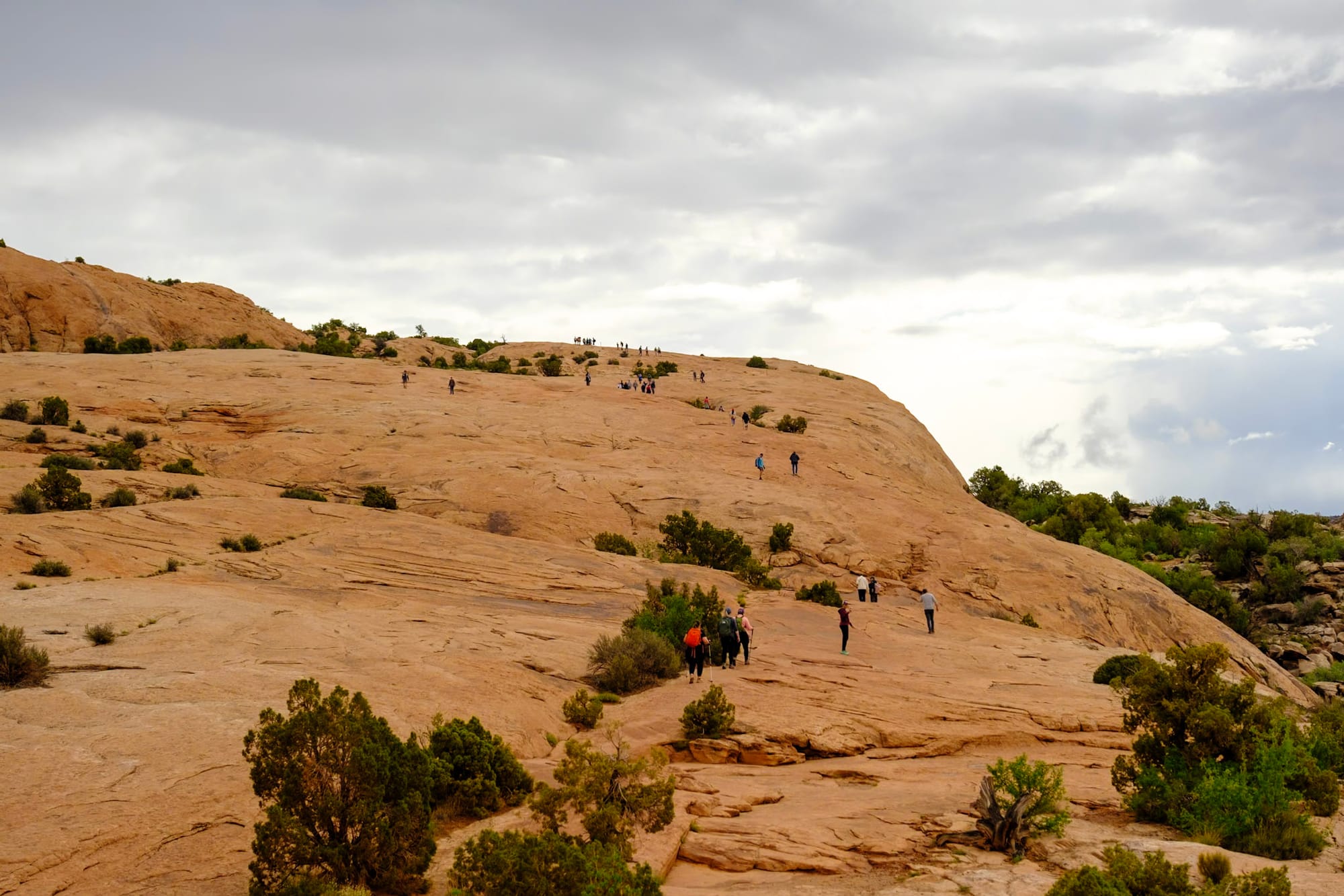
This is the arch that's on Utah's license plate. You can see it without hiking from a roadside overlook, but it's very tiny in the distance and not impressive. Now, having done the hike to it, it's totally worth it if you're able. It's only about 3 miles roundtrip, but harder than a lot of people expect – it's over 600 feet elevation gain in a relatively short distance, steep for a good stretch, and very exposed, so there are lots of warnings against hiking it in the heat of summer. We hadn't eaten a lot that day, and were a bit tired from our first morning hike, so it wore us out more than we expected. This definitely isn't a quiet hike – it was busy with lots of people, young and old, on the way up with us.
But like I said, it was totally worth it. Once you make it past the steep, exposed stretch of rock toward the beginning, you pass through a bowl-like area surrounded by curving rock walls, then walk up a very narrow stretch of trail on the side of a cliff, and then around the corner – Delicate Arch!
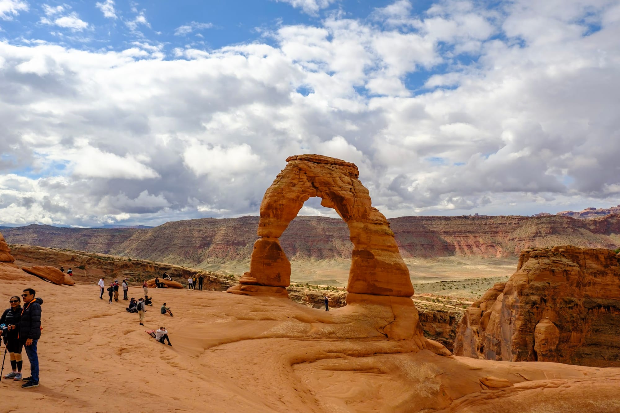
It was stunning up close – huge, beautiful, and sturdy-looking (not delicate at all, I don't know where they got that name from). It sits at the edge of this amphiteater-like area, one side surrounded by more curving rock walls, one side open to the vast desert below. Dozens of people were sitting up here, snacking and taking breaks and standing in line to take photos beneath the arch (everyone was very polite about taking turns for the iconic pic).
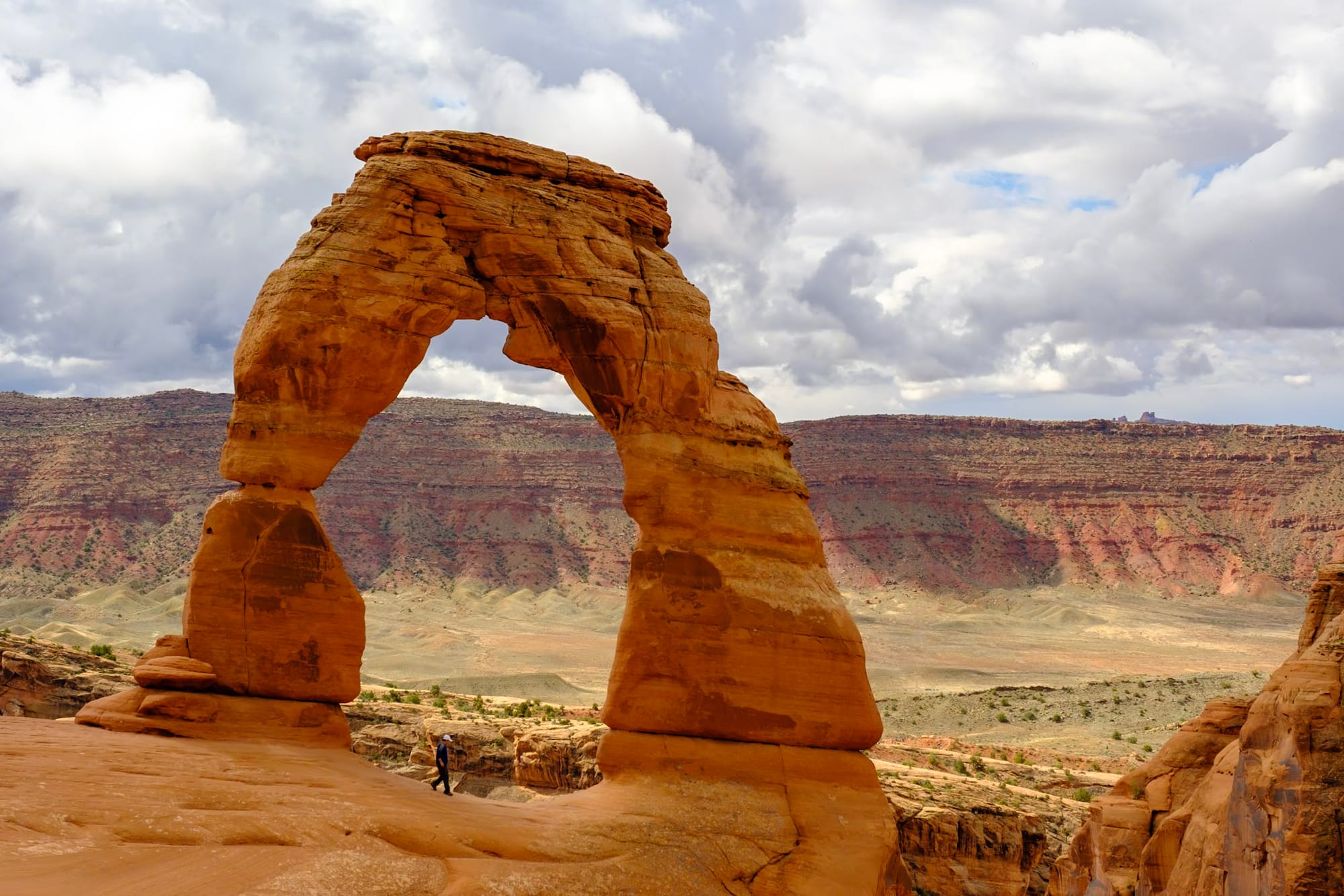
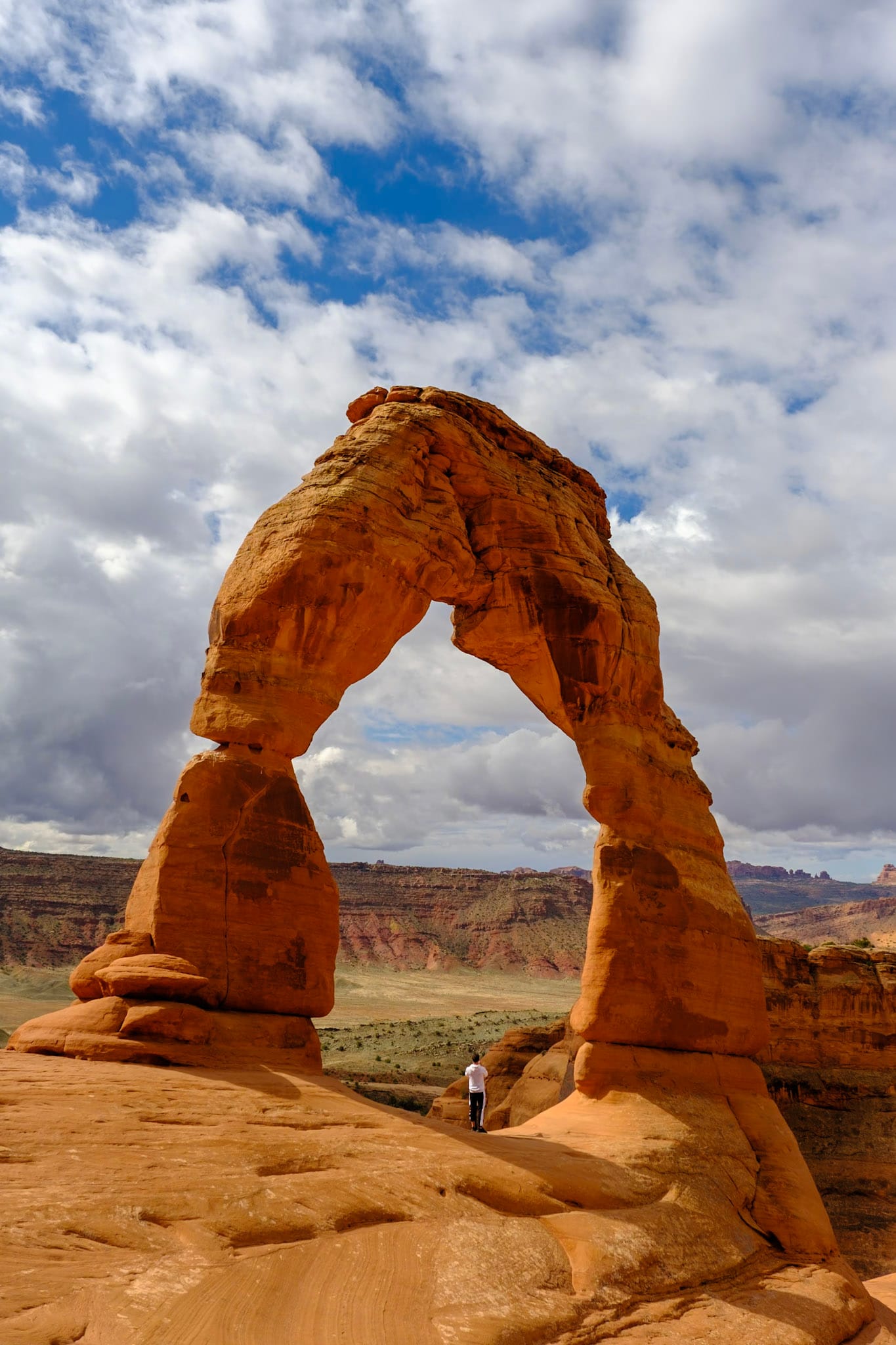
Joey and I waited to take our pic beneath the arch (it feels even bigger standing right beneath it, with the world dropping away on the other side) and hung out for a long time to just look at it. Then we headed back for the much easier climb down.
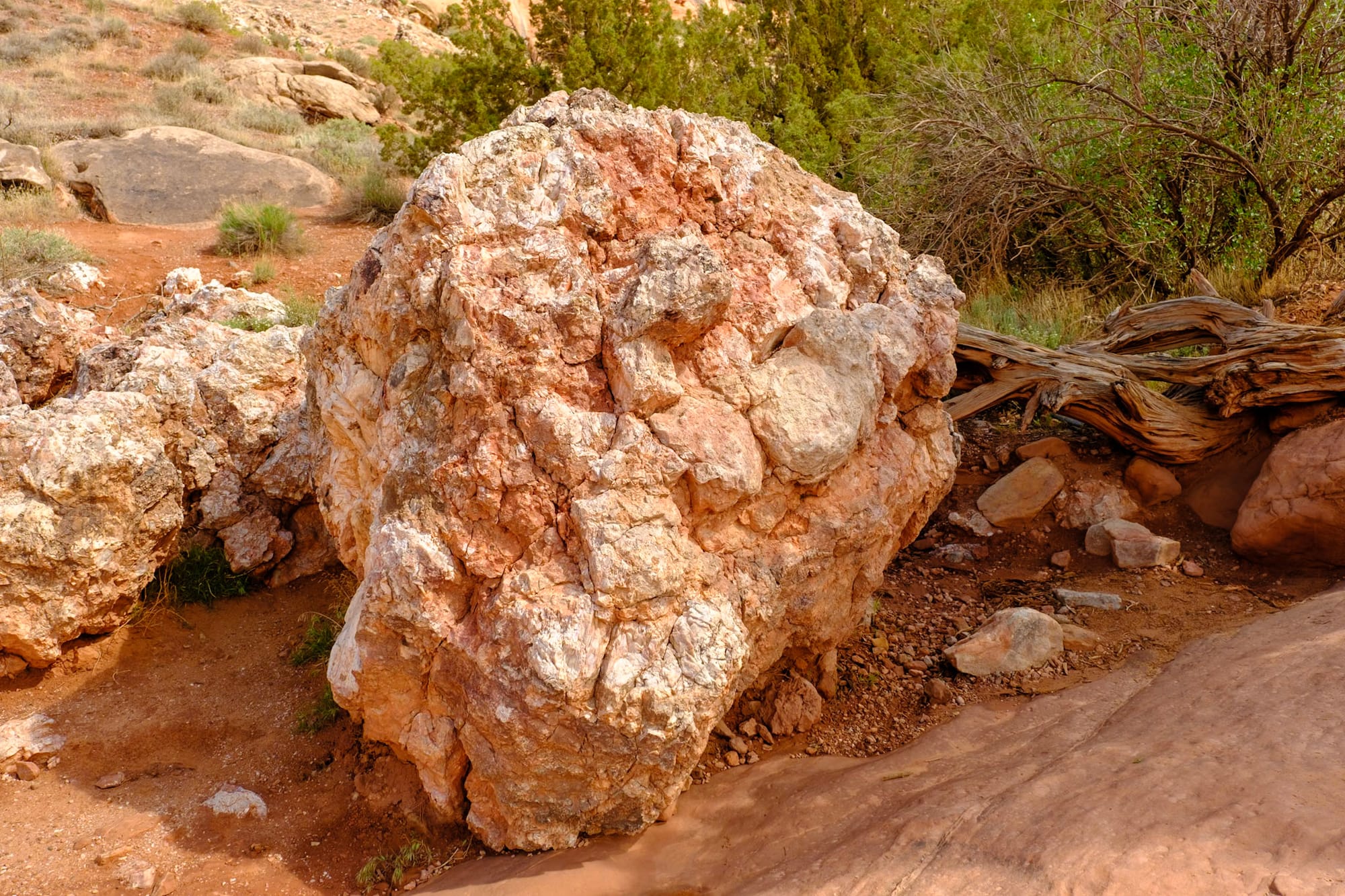
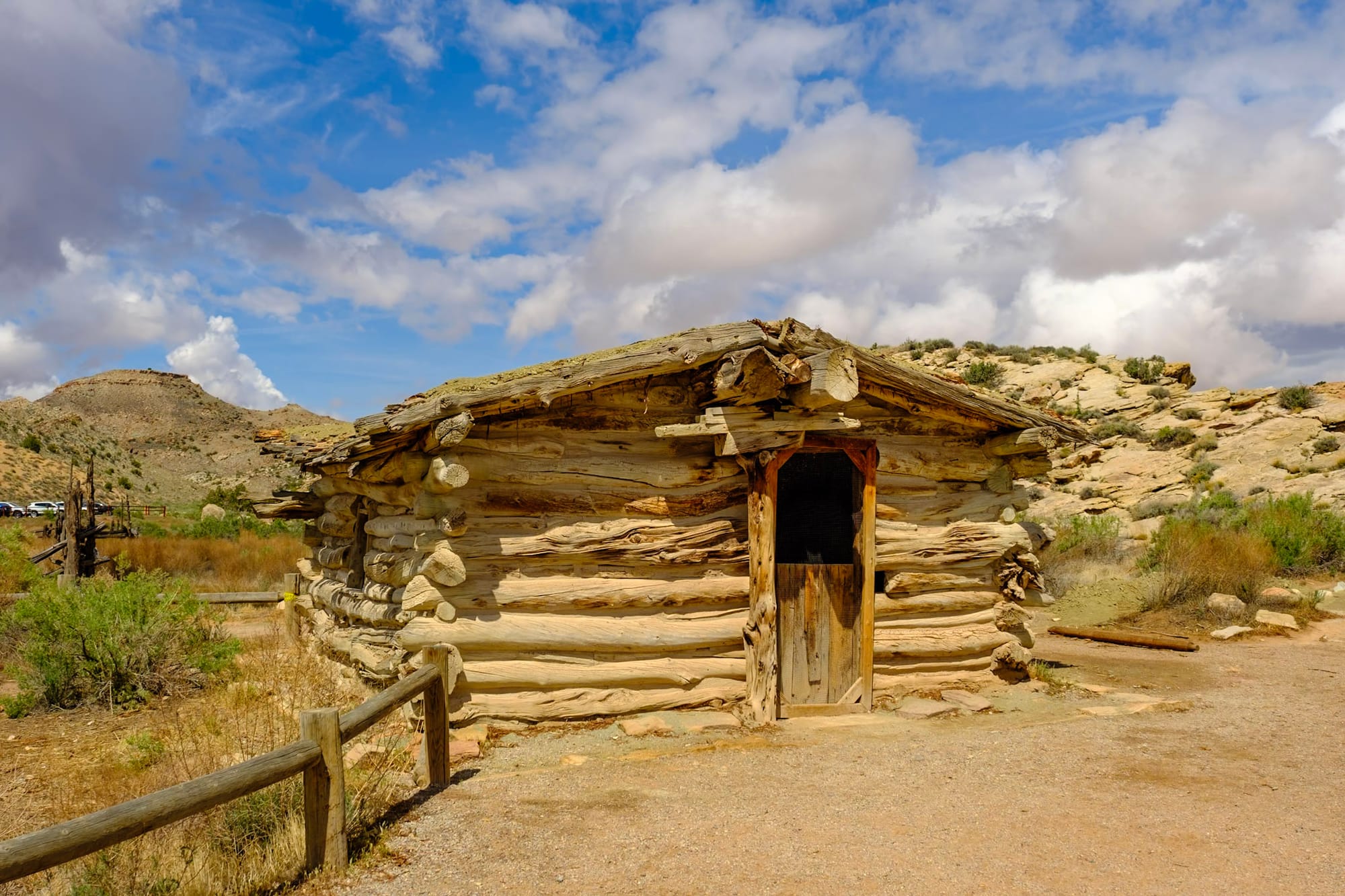
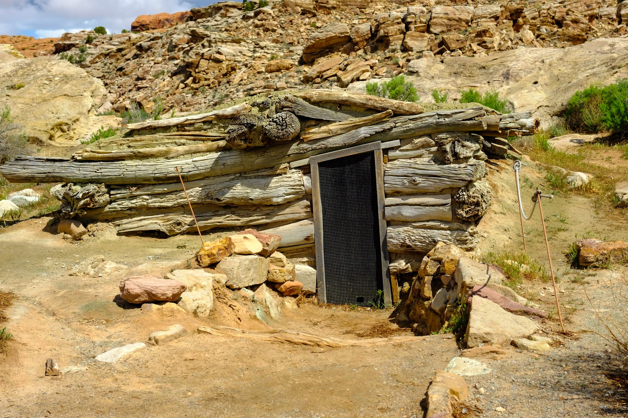
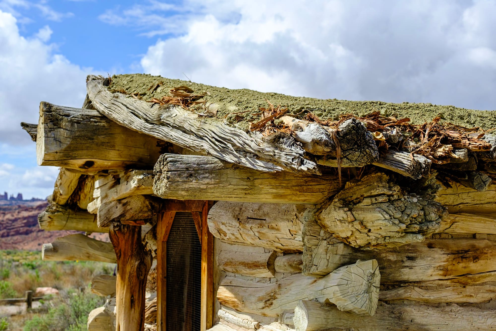
A cool rock and Wolfe Ranch remains near the trailhead
It was early afternoon when we were done, and we went back to the campground to relax. We spent the rest of the afternoon soaking in the warm sun (the weather cleared up), reading and relaxing and doing nothing by the river. I ran into town to get chicken shawarma pitas from Sultan Mediterranean, which were delicious and totally hit the spot after a day of hiking and being outside.
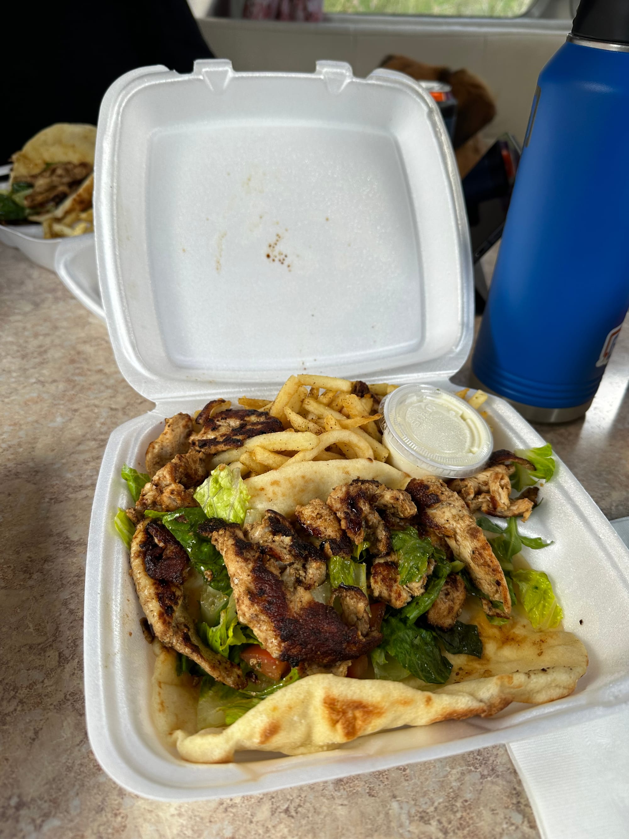

Delicious Mediterranean food, beer at the grocery store I got a kick out of (#Utah), and Hollie enjoying the river views.
Aaaaand that's about it for our time exploring the Mighty Five! On Monday morning, our last day in Moab, we worked from the coffee shop again and then left in the afternoon to drive up to Salt Lake City. We were on our final push north for the season – more on that next time!
Member discussion