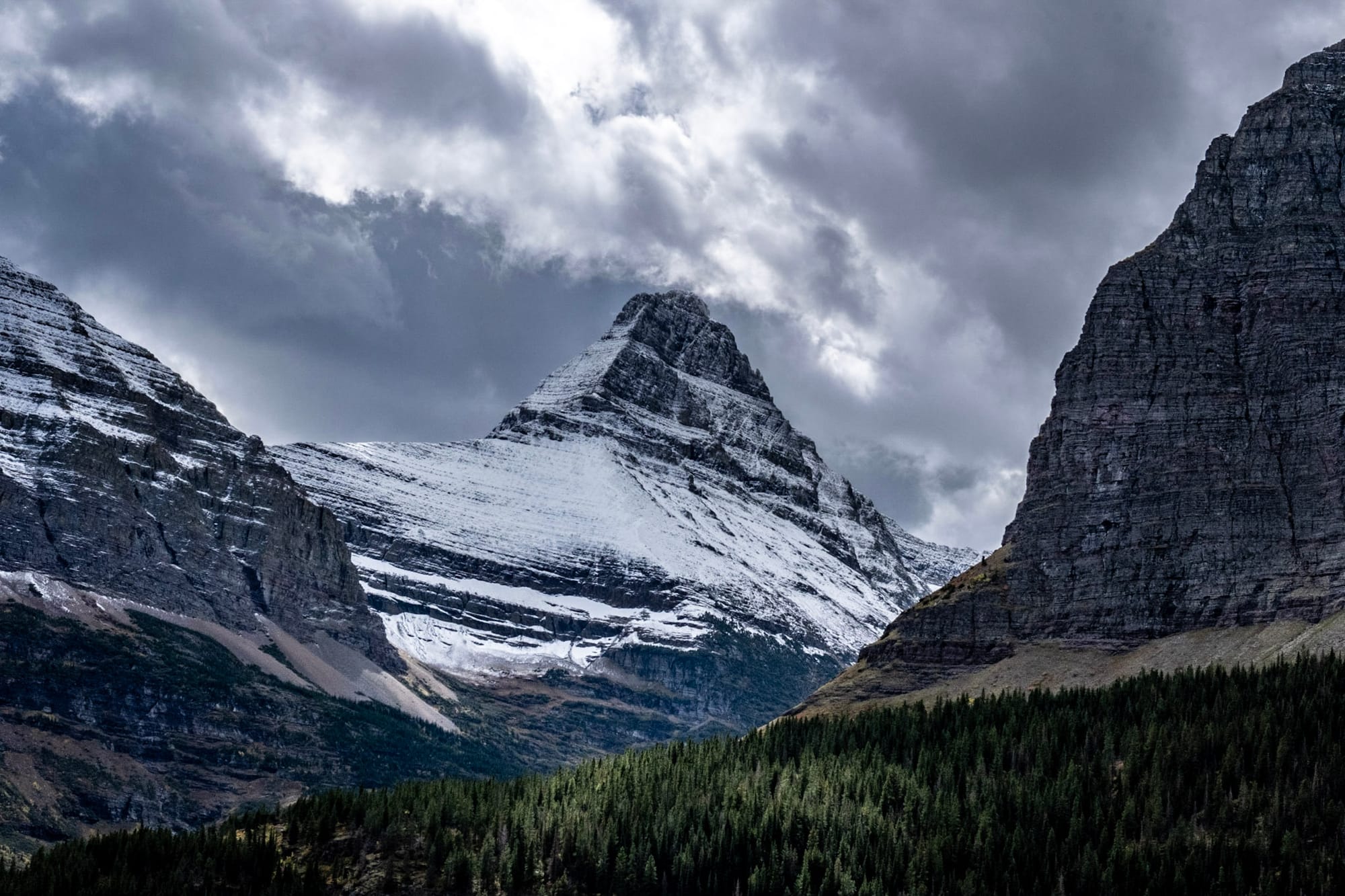
Backbone of the World: Glacier National Park
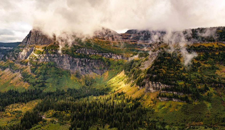
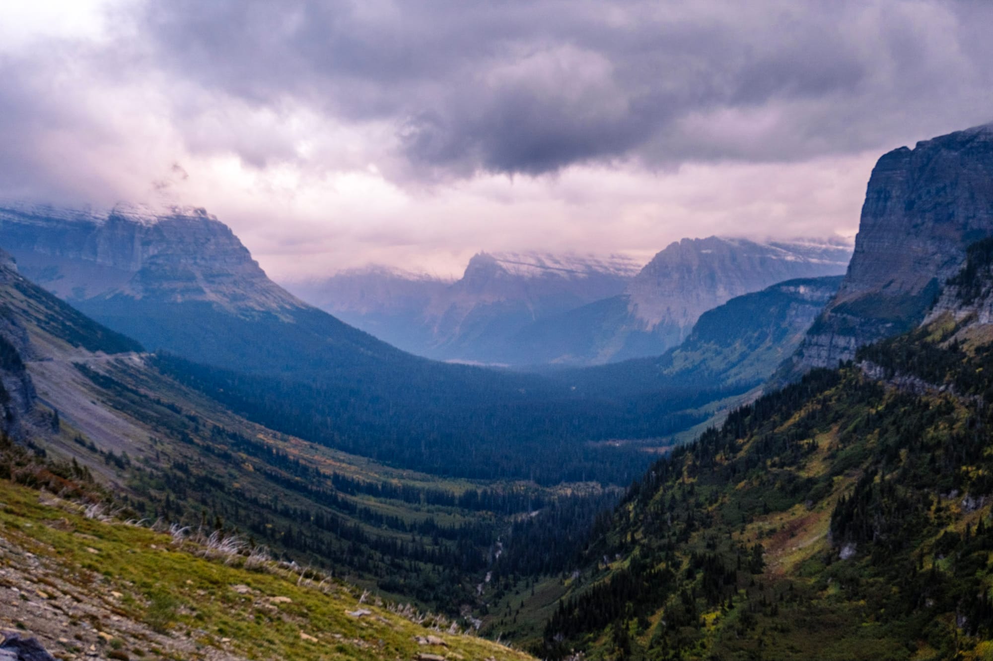
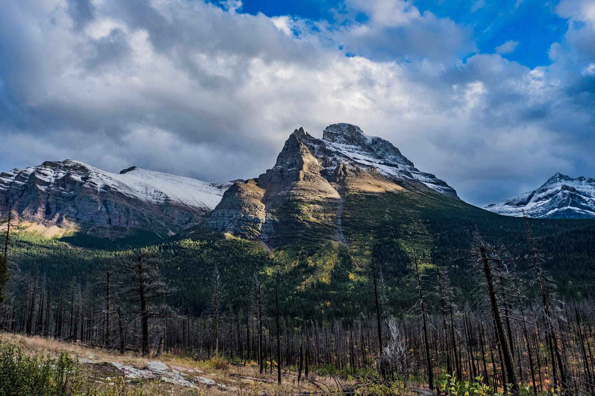
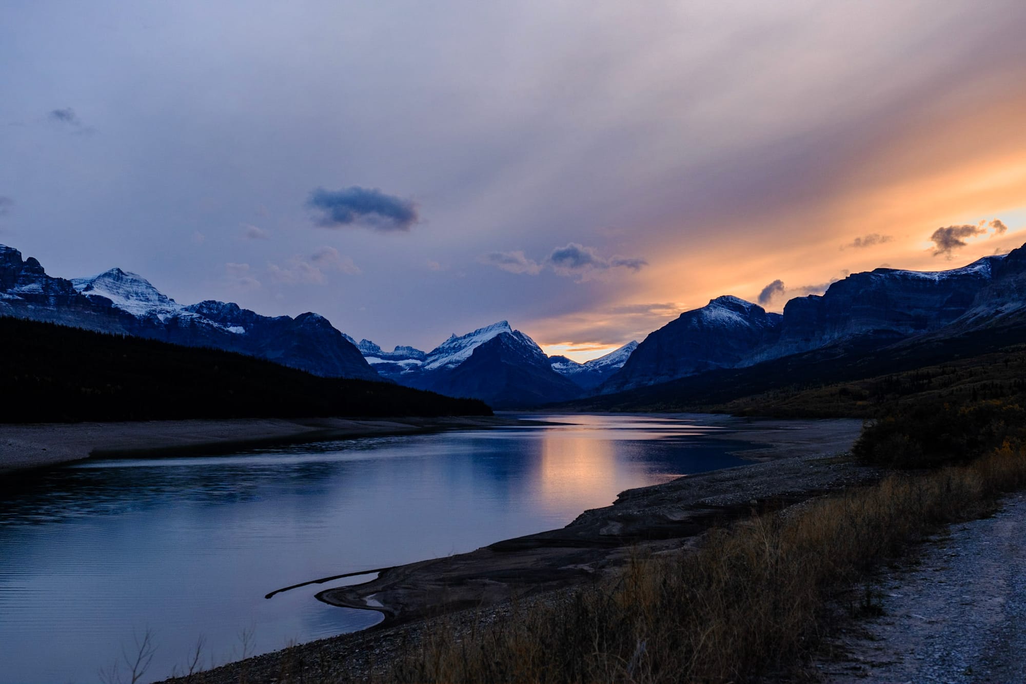
Glacier, we miss you. The last big destination on our RV trip before heading back home, and although we didn't know it before, we saved the best for last. Glacier was the most stunningly beautiful place we've ever seen. Not to be dramatic (although Glacier is a dramatic place) but it was like heaven on earth. Even the gray, cold, windy weather we had for much of our time there couldn't hide it.
And it wasn't just the beauty that drew us in. It was the unique, remote location, so far up north. It was everything shutting down for the season around us, even though it was still September – the crowds thinning, the few restaurants and stores closing. It was seeing the snow start to fall in the higher elevations.
Glacier was the home of the Blackfeet Nation for thousands of years, who called it "the backbone of the world." We spent two weeks there and left for the long drive home to North Carolina on October 1. Pictures won't do it justice, but here we go!
Map & logistics
First, for anyone planning a trip to Glacier or just interested in learning more, here's a quick overview of how the park is laid out and some logistical notes! Otherwise, you can skip down to the next section. 😉
West Glacier: Where most people, including us, enter the park. The west side is the most accessible to bigger towns and has more tourism infrastructure (stores, restaurants, campgrounds, etc) so it's the busier side.
Going-to-the-Sun Road: The main road (and basically the only road) through the main section of the park, and the #1 attraction at Glacier. It begins in West Glacier, runs for 50 miles through the mountains all the way to the east entrance in St Mary, and takes about 90 minutes to drive from one end to the other.
Vehicles longer than 21 feet aren't allowed on Going-to-the-Sun Road, so you can also take Route 2 to go around the mountains and get to the east side of the park.
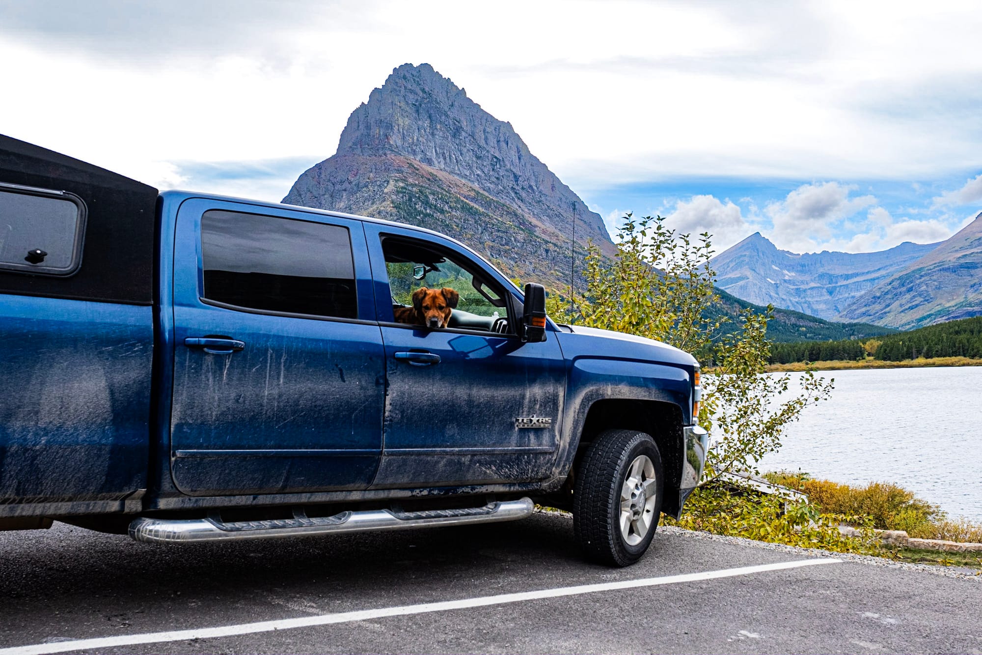
Logan's Pass: The highest point on Going-to-the-Sun Road at 6647 feet. There's a visitor center, bigger parking lot, and a few popular trailheads that begin here.
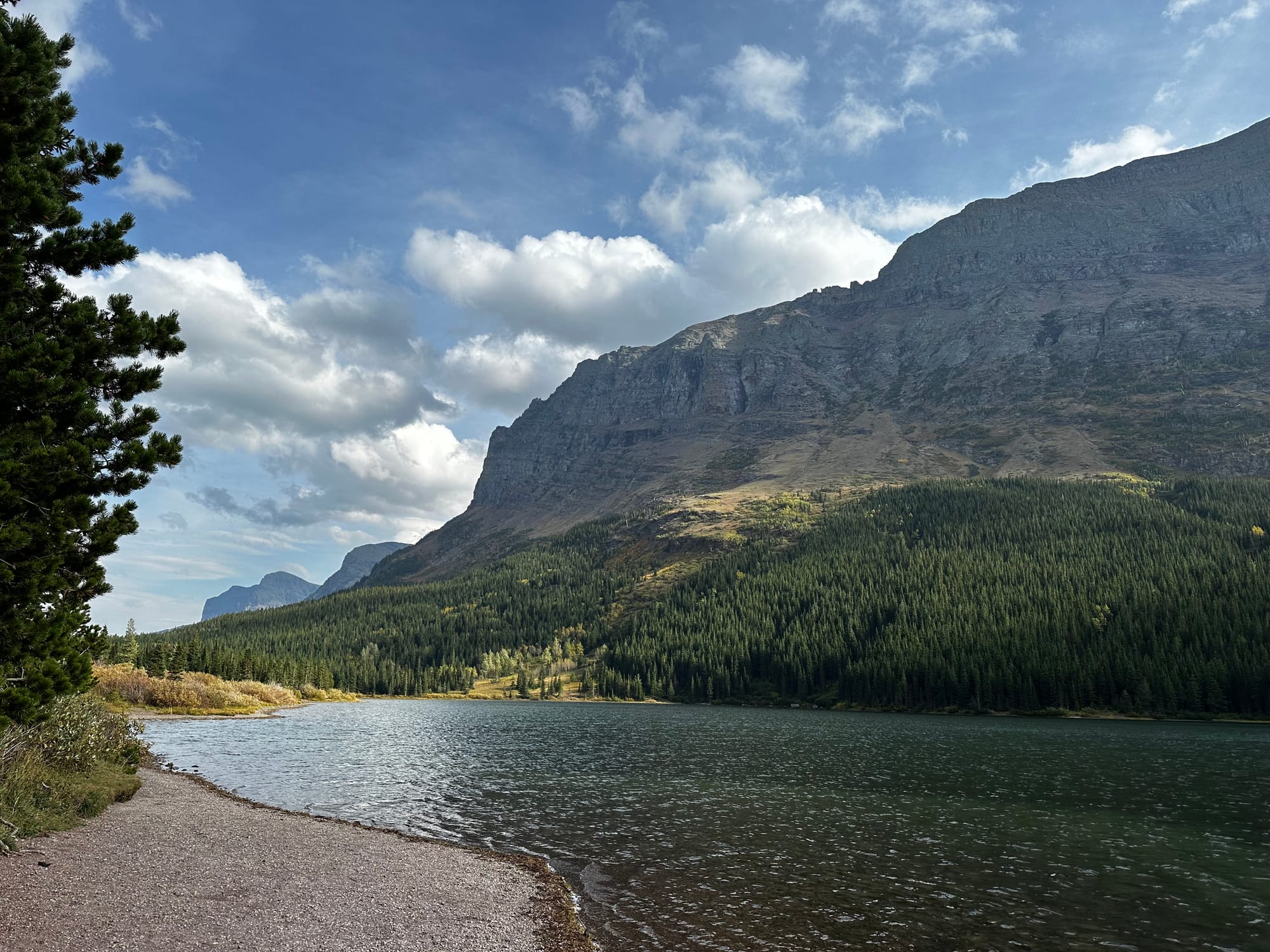
St Mary: The town on the east end of Going-to-the-Sun Road. There's a visitor center by the park entrance here, a hotel and casino, and a handful of campgrounds and small bars/restaurants. The east side is much more remote than the west side, and is on the Blackfeet Indian Reservation.
Then there are a few other sections of Glacier that you access from different roads:
North Fork/Polebridge: A remote area that you access by driving north from West Glacier. There's camping, hiking, and the completely off-grid town of Polebridge. We didn't go here, but definitely want to next time.
Two Medicine: An area on the east side, south of St Mary, near the community of East Glacier Park (we didn't go here either).
Many Glacier: Another area on the east side, north of St Mary. There's a hotel, campground, and several popular trailheads.
To the north, Glacier borders Canada. Waterton Lakes National Park is on the Canadian side; the two parks combined are an International Peace Park.
If you're planning a trip to Glacier, we'd recommend one of these options:
- Splitting your time between the east and west sides so you're not driving as much – it can take a couple hours to get from one side to the other, and in peak season, you have to get to the most popular places super early if you want parking. (Or you can take the free shuttle that runs on Going-to-the-Sun Road during peak season).
- Staying at one of the campgrounds inside Glacier National Park (there are a lot of options, but you need to make reservations early).
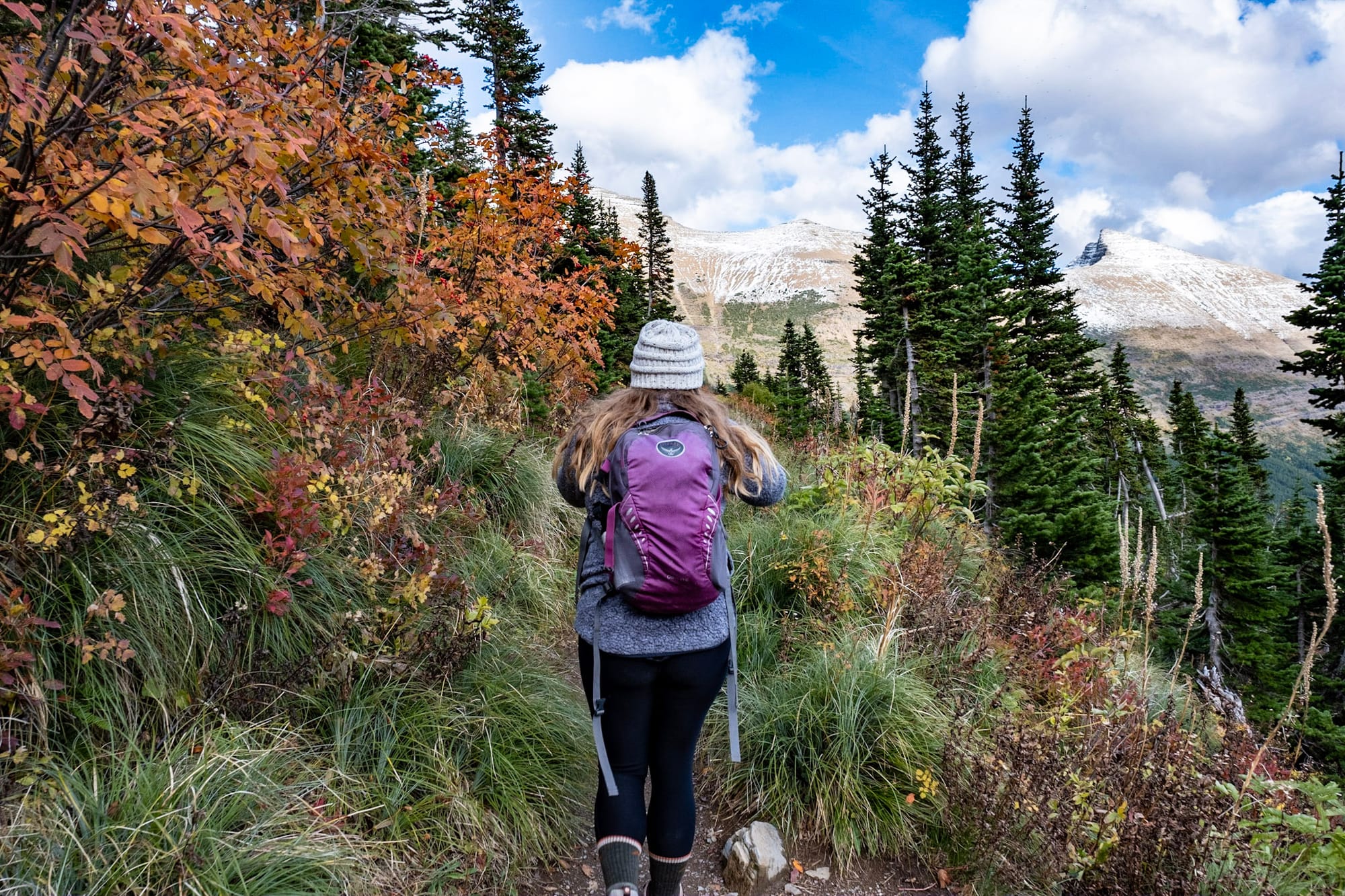
- Just staying on the east side. We liked the east side so much better than the west – it's closer to Logan's Pass and the most majestic Going-to-the-Sun Road views, Many Glacier, Two Medicine, and most of the best trails. It's also a whole different vibe from the west side, and feels more wild.
One last note on logistics and trip planning. Glacier is extremely popular and uses a reservation system during peak season to access Going-to-the-Sun Road and other high-traffic areas. We didn't have to worry about this since we went in late September, but if you're planning a summer trip, you can read about the requirements on the NPS website.
It was still a little busy when we visited Glacier, especially the first week, but not nearly as bad as it would be in July or August. I think that's a big reason why we loved our time there so much – going toward the end of the season.
For another resource, Exploring the National Parks with Dirt In My Shoes is a podcast we love, and they have great trip planning guides on their website as well.
West side
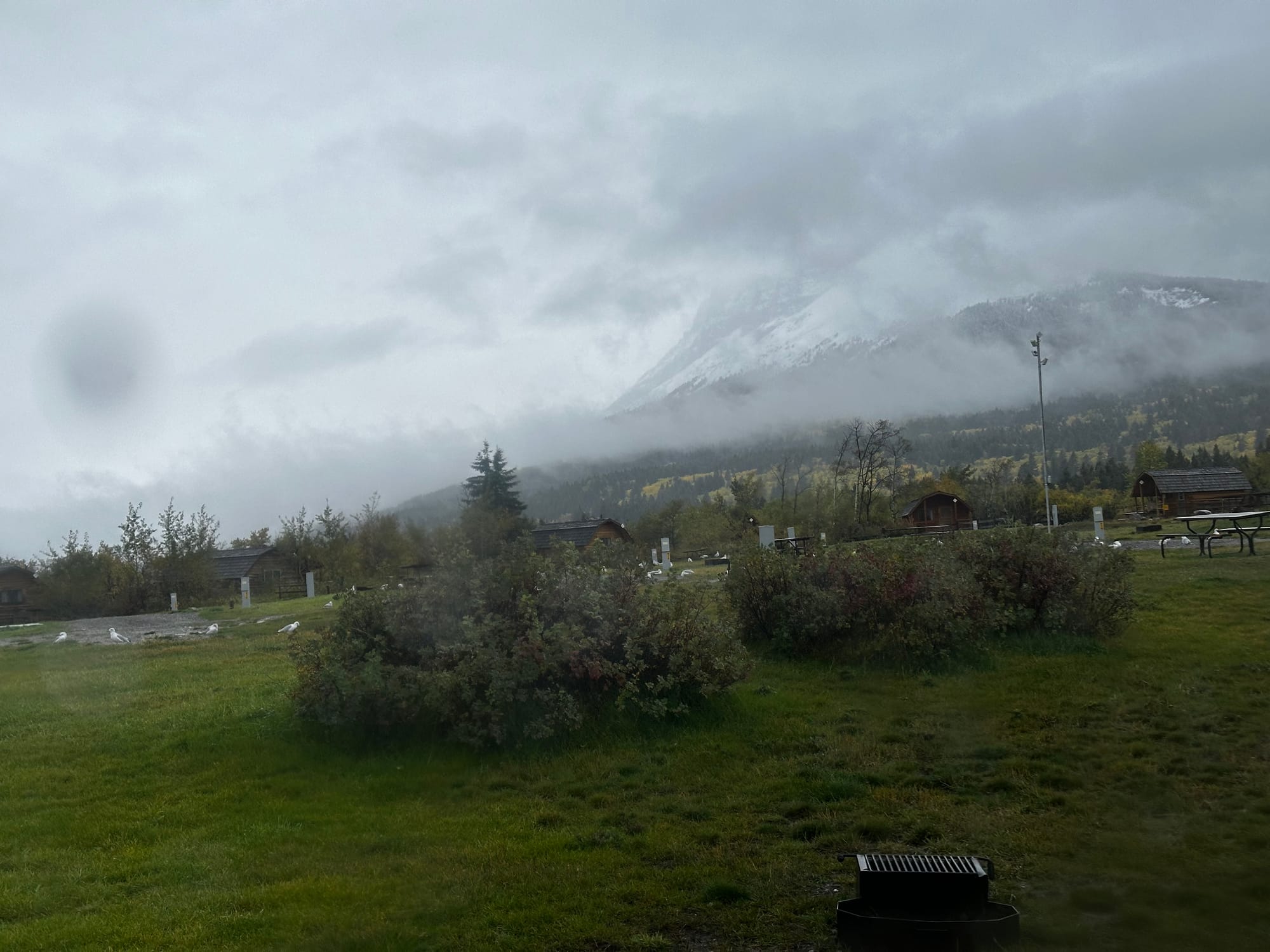
Originally we booked campgrounds for a week in Glacier: 4 nights on the west side, 3 nights on the east. On the west side, we stayed at Mountain Meadow RV Park just 10 minutes from the West Glacier entrance. This was a nice campground – the sites were kind of close together, but mostly surrounded by trees, so it was cozy-feeling. They had nice staff, a good camp store, showers, and electric & water hookups at our site.
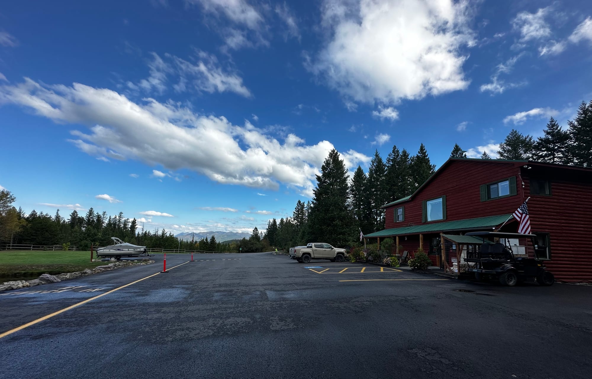
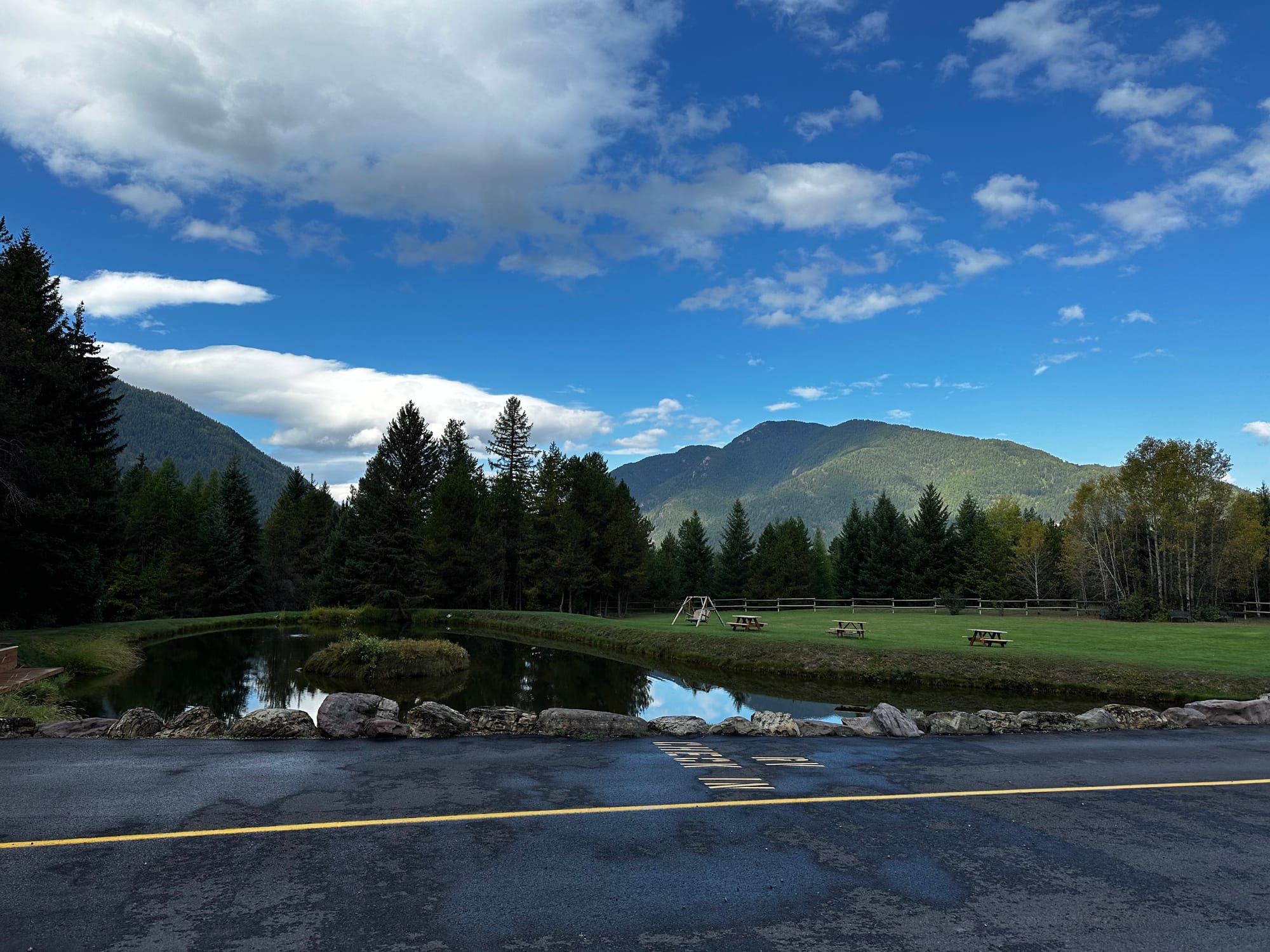
Mountain Meadow RV Park
We got there later in the day on Sunday, September 17. It was kind of a low-key week – since we had to work, we did our exploring in the late afternoons and evenings. The west side is at a lower elevation than the east, and even though it was overcast most days, it was pretty warm (50s/60s during the day). On this side, you're kind of below the mountains, down among the pine forests and lakes. It takes longer to get to Logan's Pass (the highest point on Going-to-the-Sun Road) from the west, so we saved that for the east side.
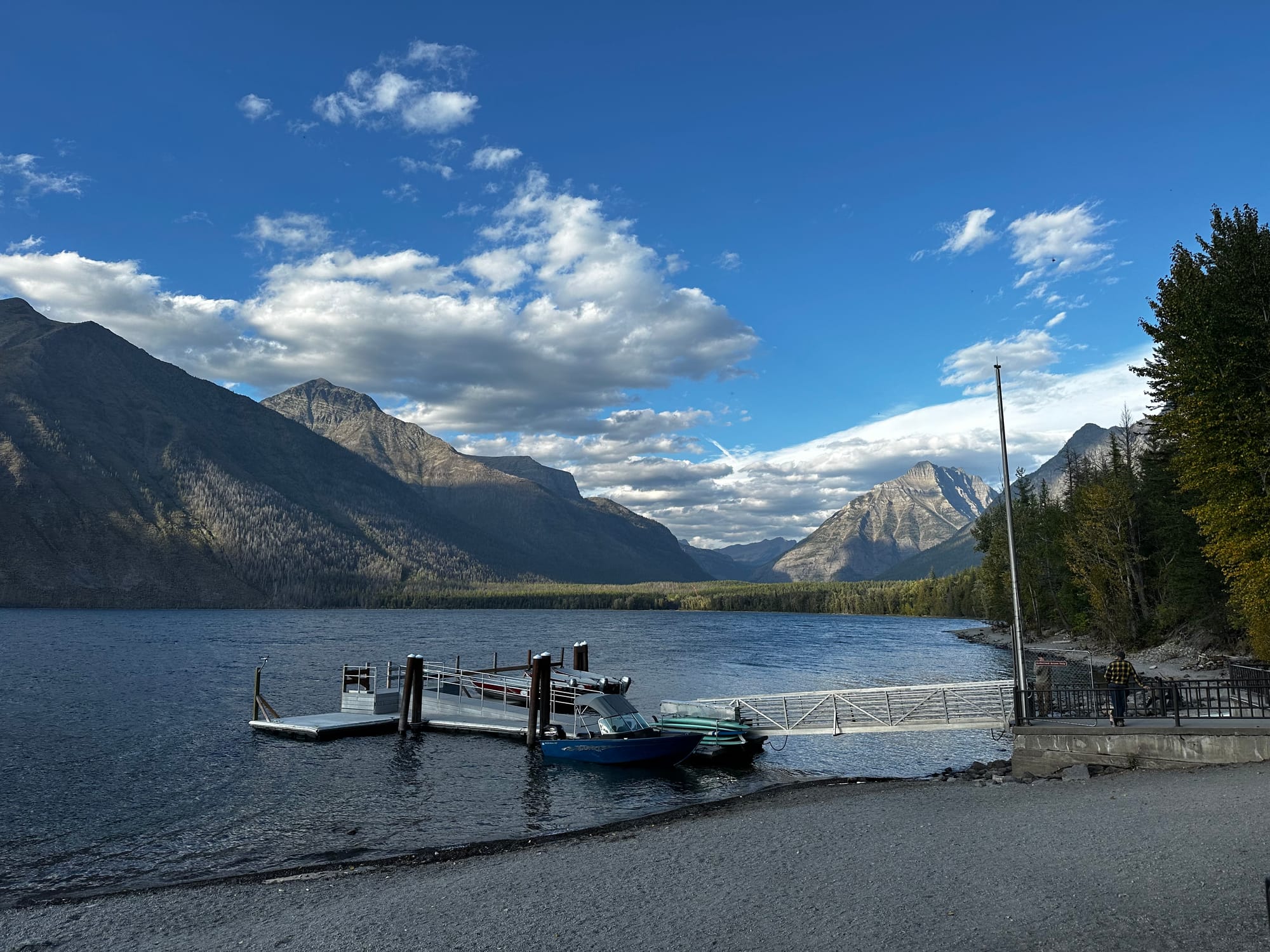
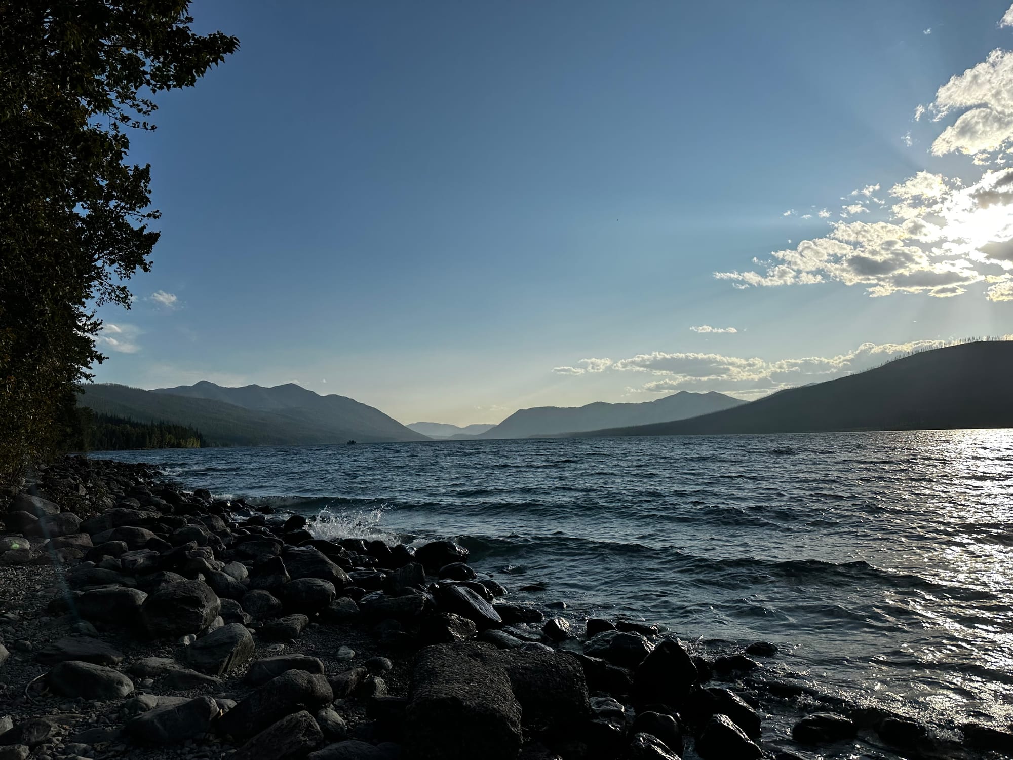
Lake McDonald
Instead, we spent time in the Lake McDonald area. When you drive into the park from West Glacier, you'll hit the Apgar visitor center and campground right away, which are on the southern end of the lake. Then you follow the road along the lakeshore for a while (it's 10 miles long and the biggest lake in the park) until you get to the Lake McDonald Lodge at the other end.
The lodge was gorgeous; it's an old Swiss-style lodge built in 1913. We went inside, and it had a cozy fireplace, unique lights, and a piano in the lobby. The back porch has rocking chairs overlooking the lake, and you can walk down onto the rocky shore. The lake was clear and beautiful with the mountains in the background.
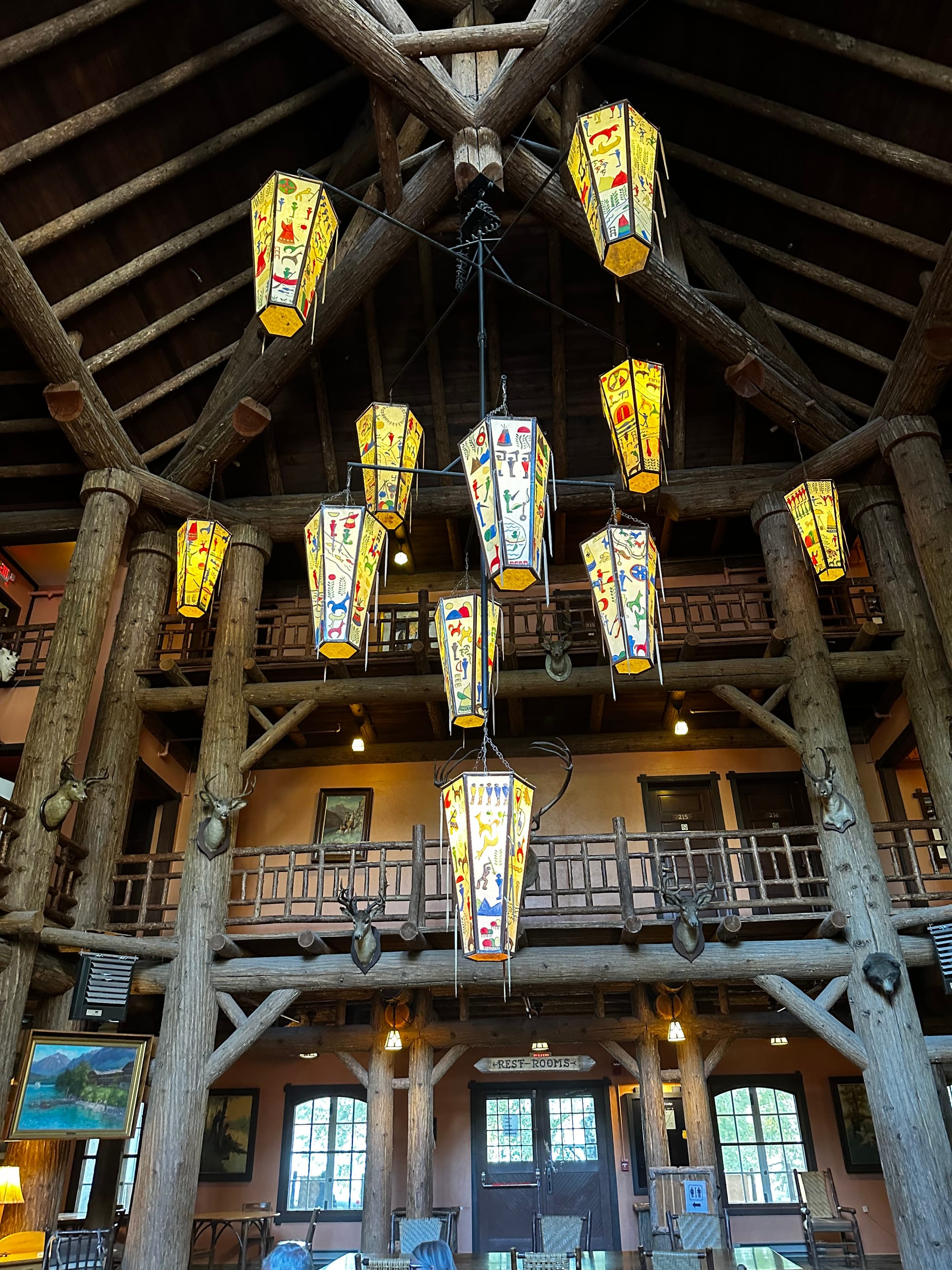
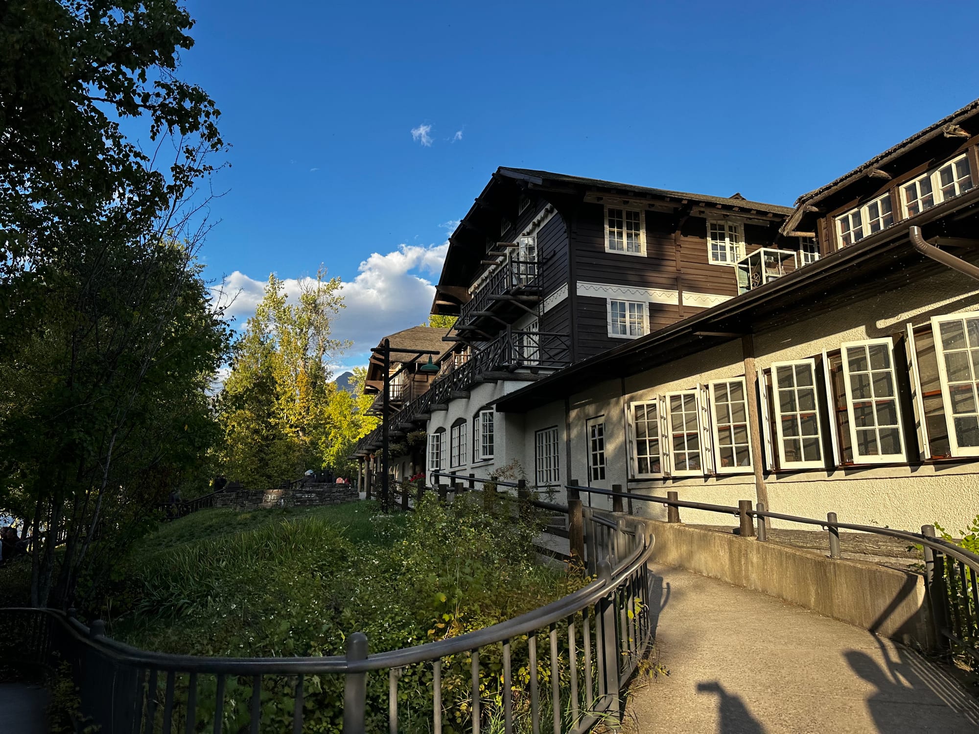
Lake McDonald & lodge
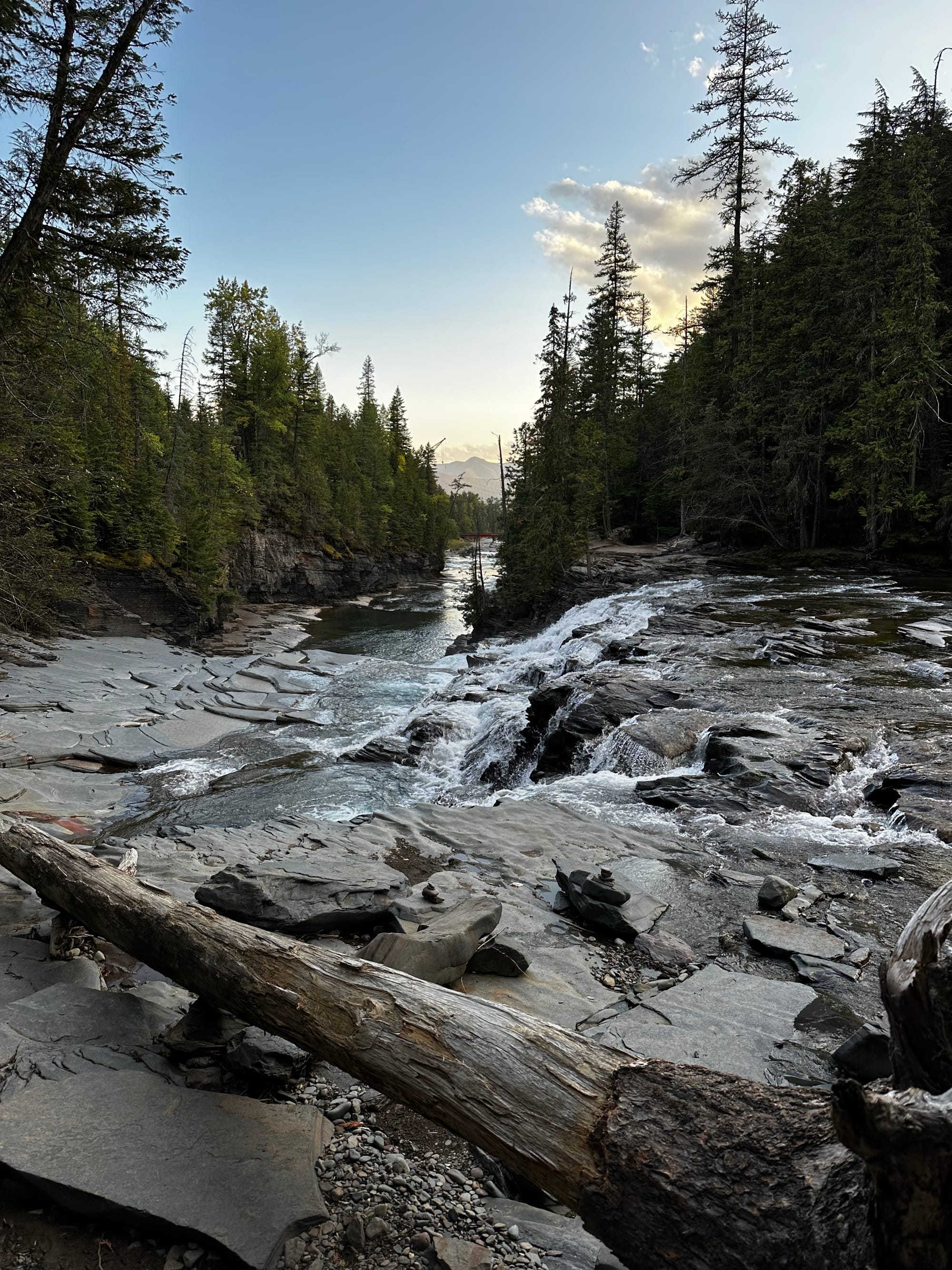
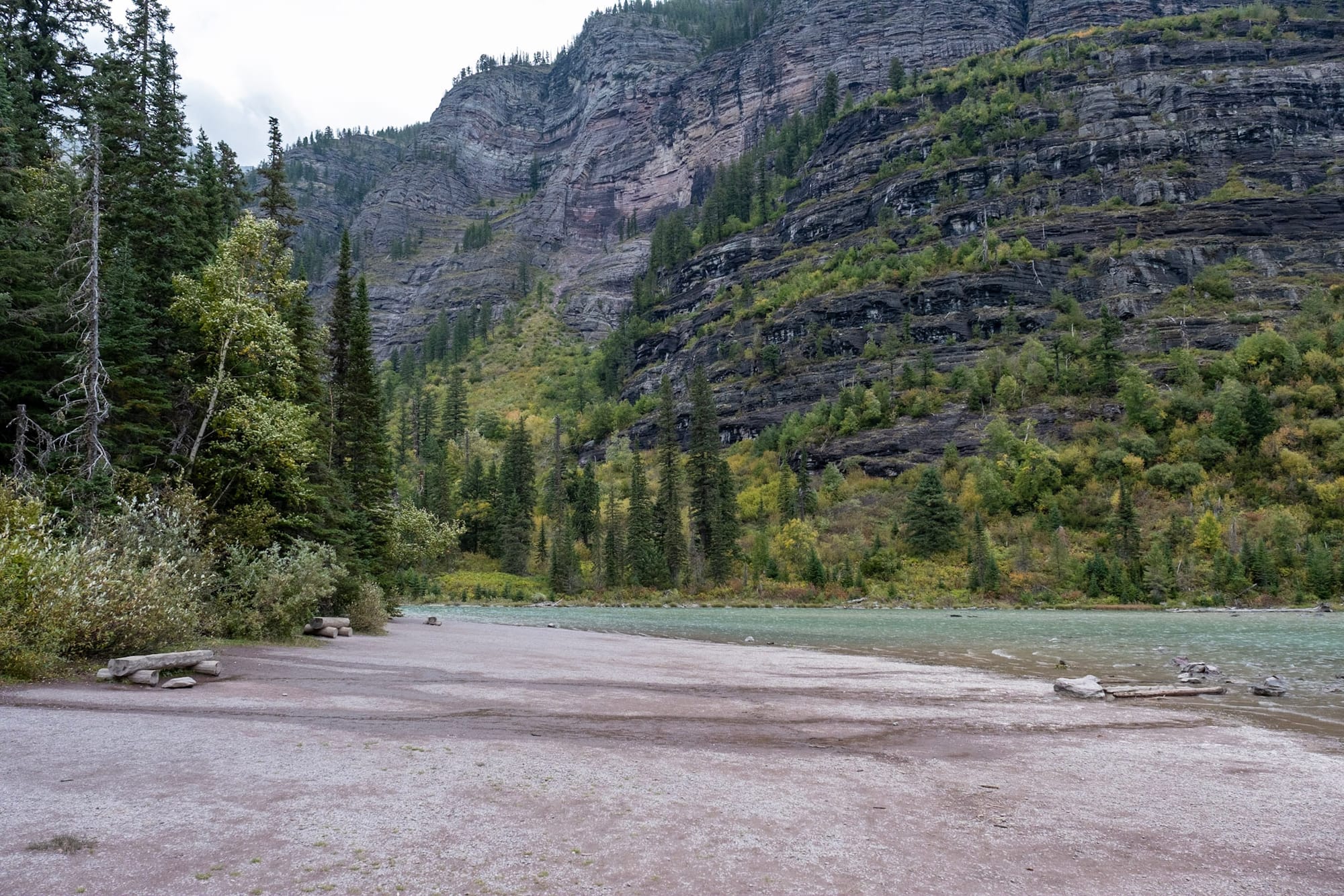
We kept driving on Going-to-the-Sun Road and found a pull-off for McDonald Falls. You can see the waterfall from above at the parking area (which is an okay view) but we noticed some flat rocks next to the falls and wondered if we could get down there. Sure enough, there was an unmarked trail through the woods nearby leading right down to the falls. This was such a cool, beautiful place to hang out at for a while during golden hour.
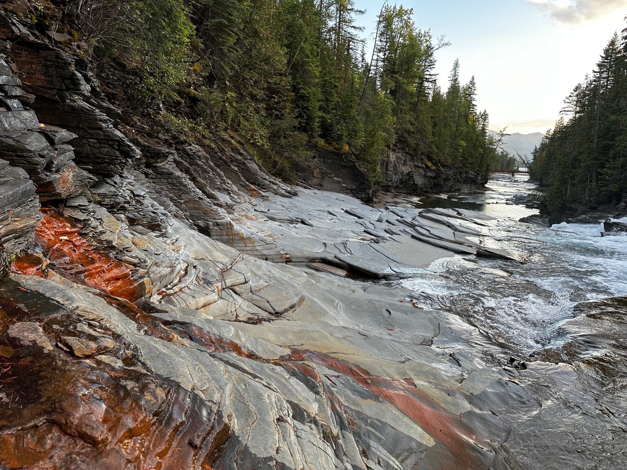
McDonald Falls
Trail of the Cedars / Avalanche Lake
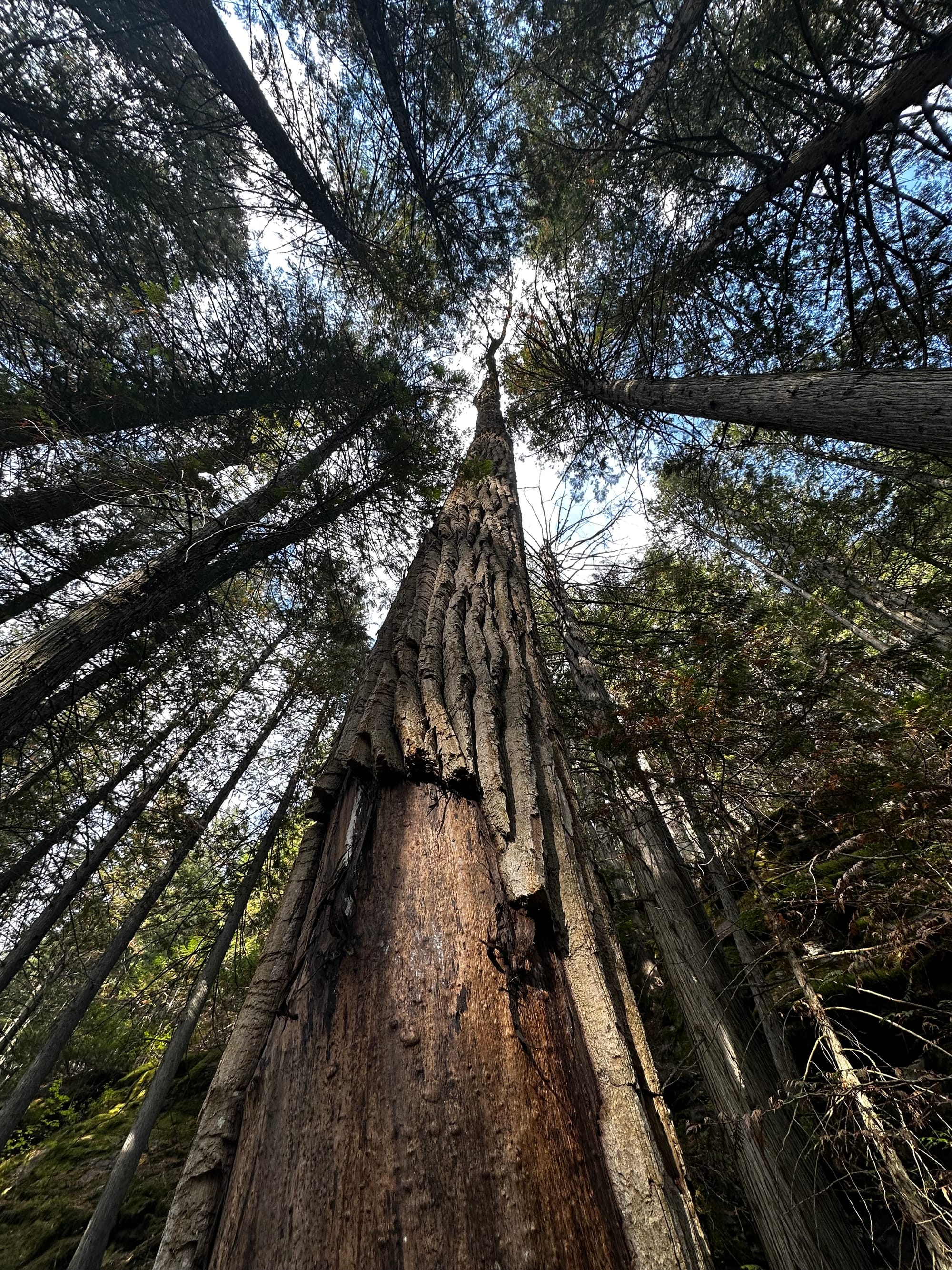
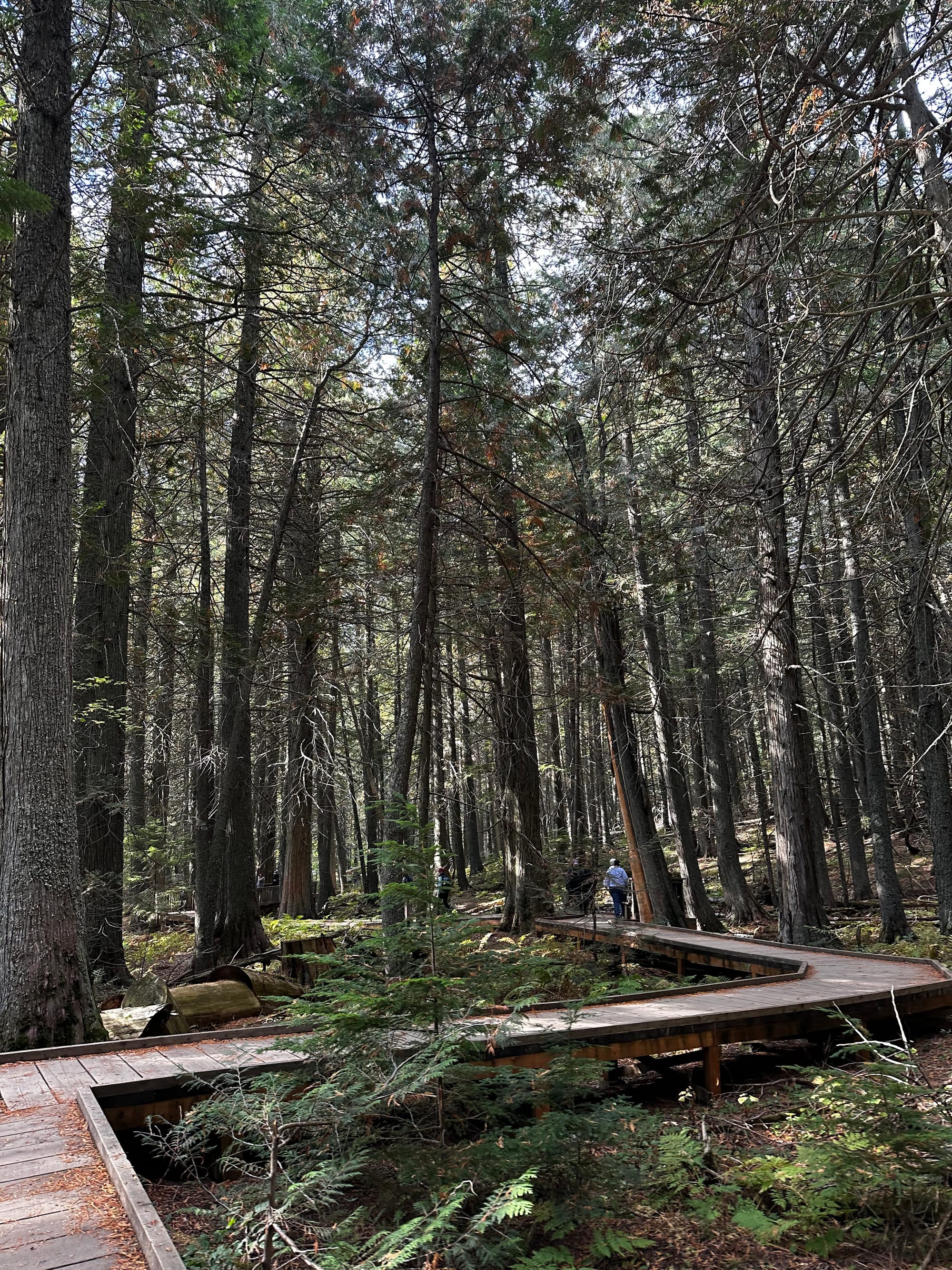
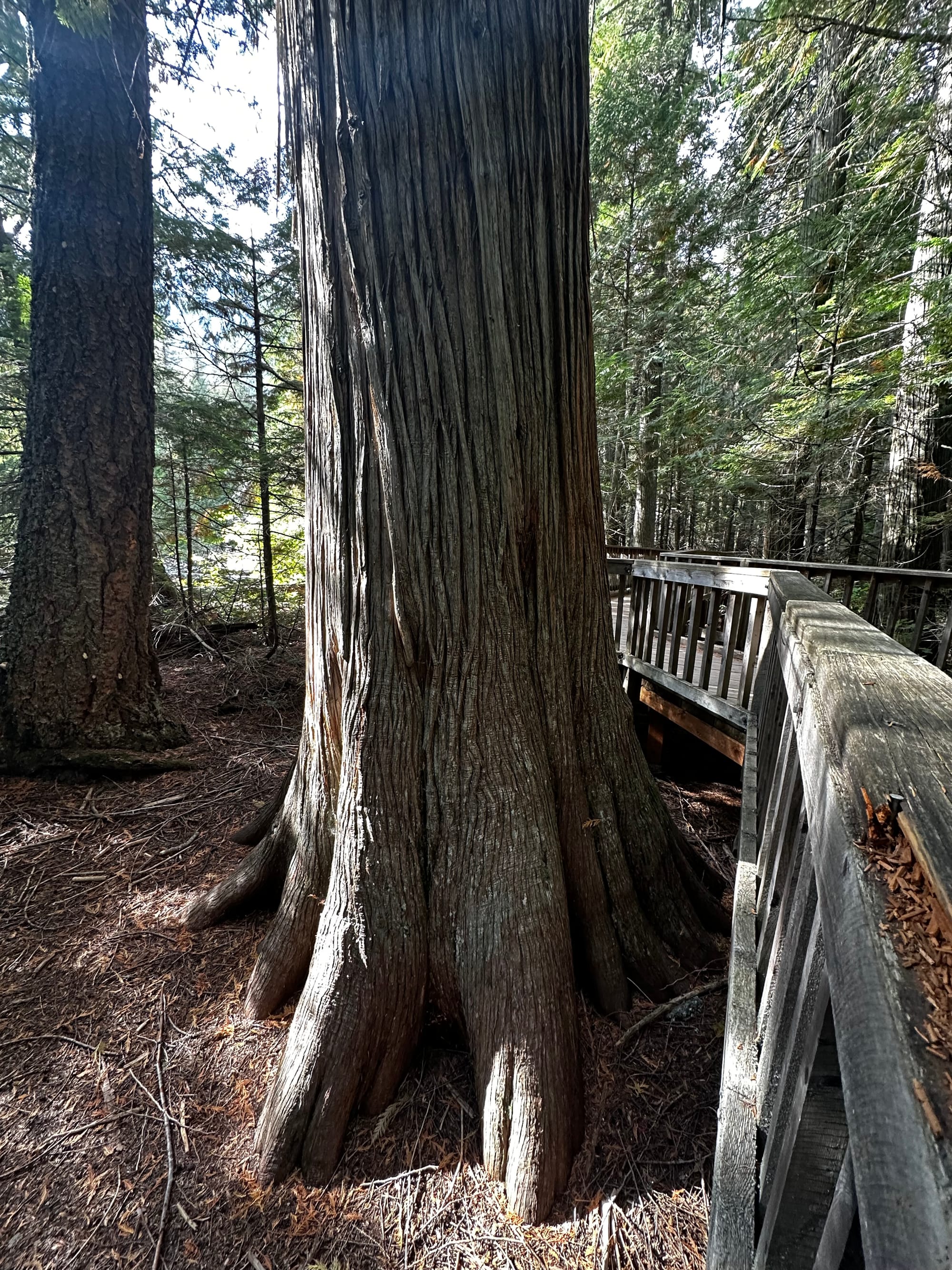
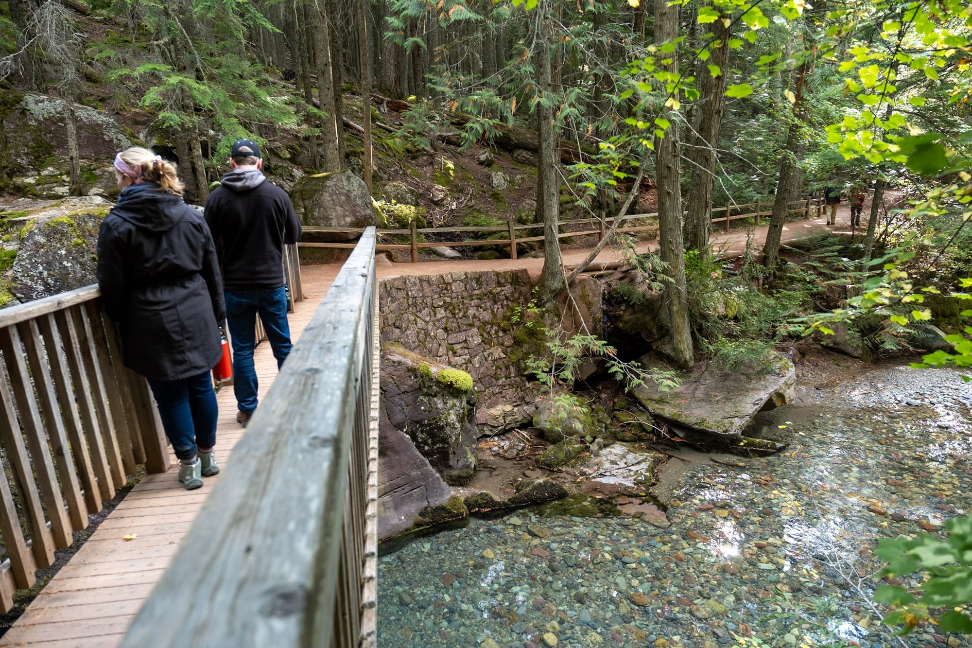
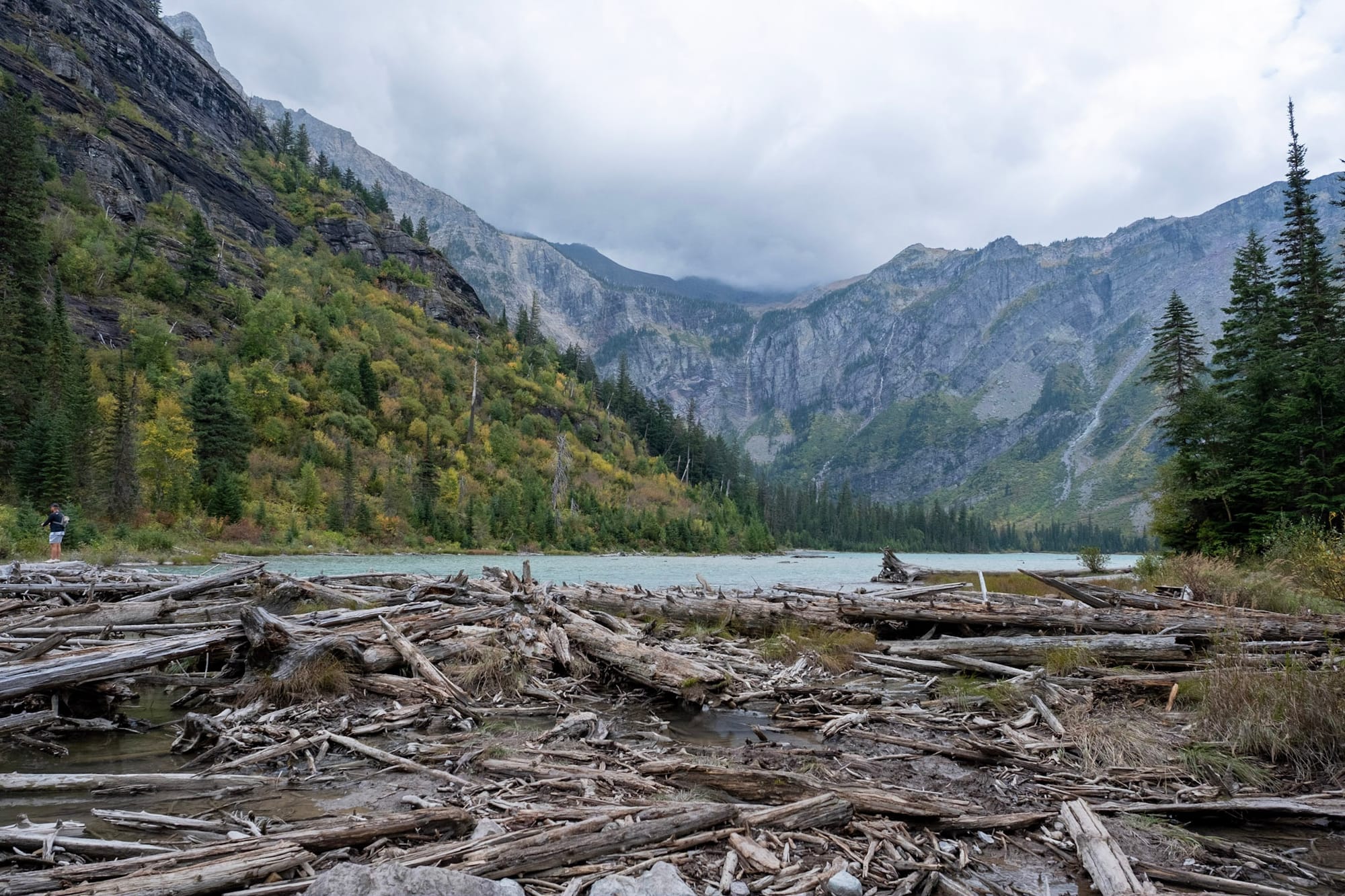
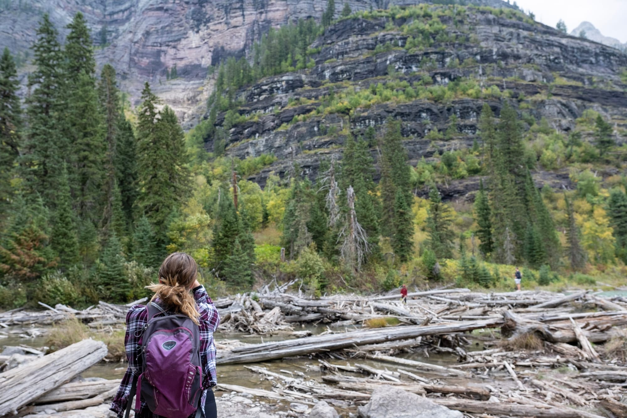
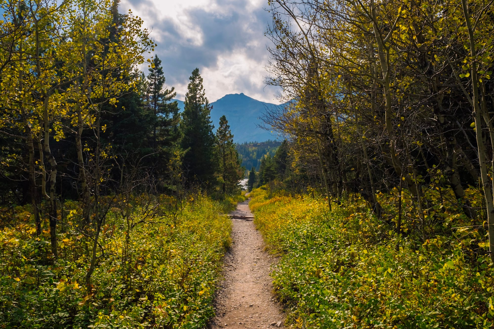
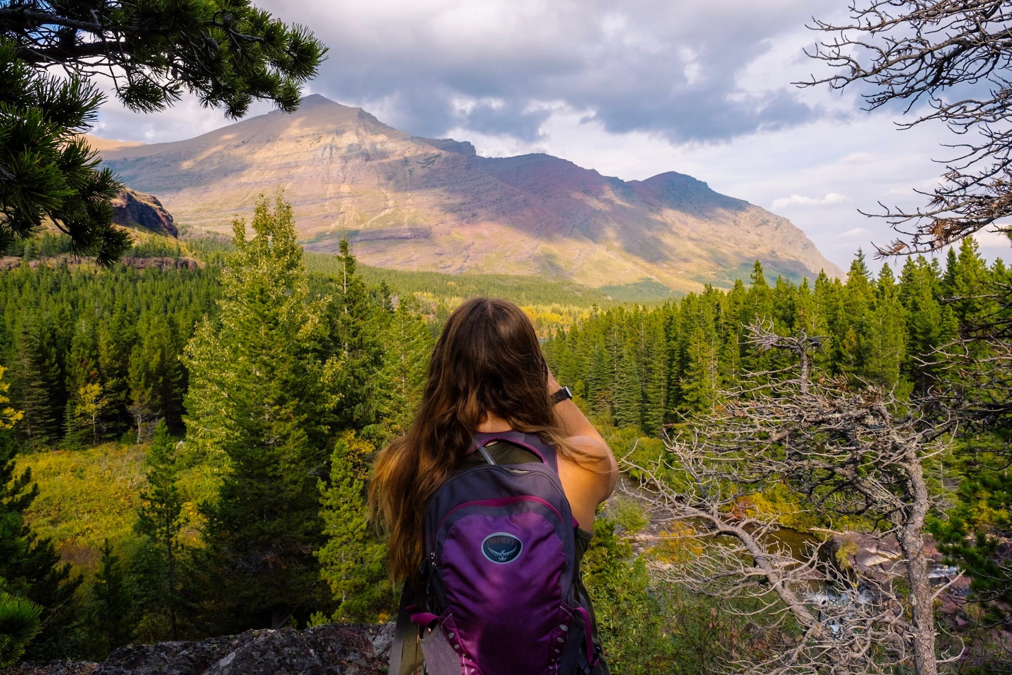
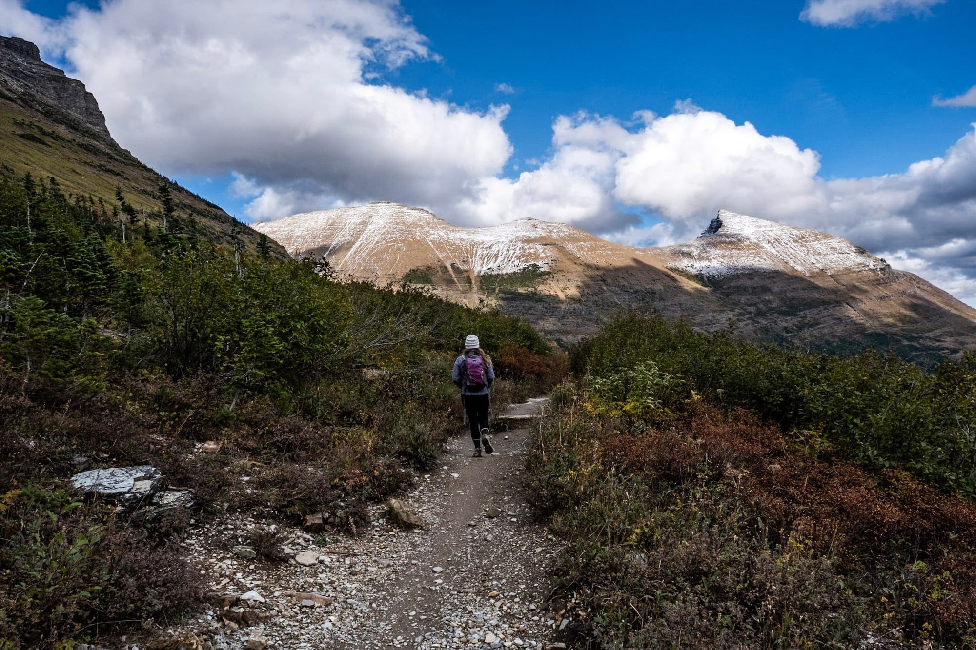
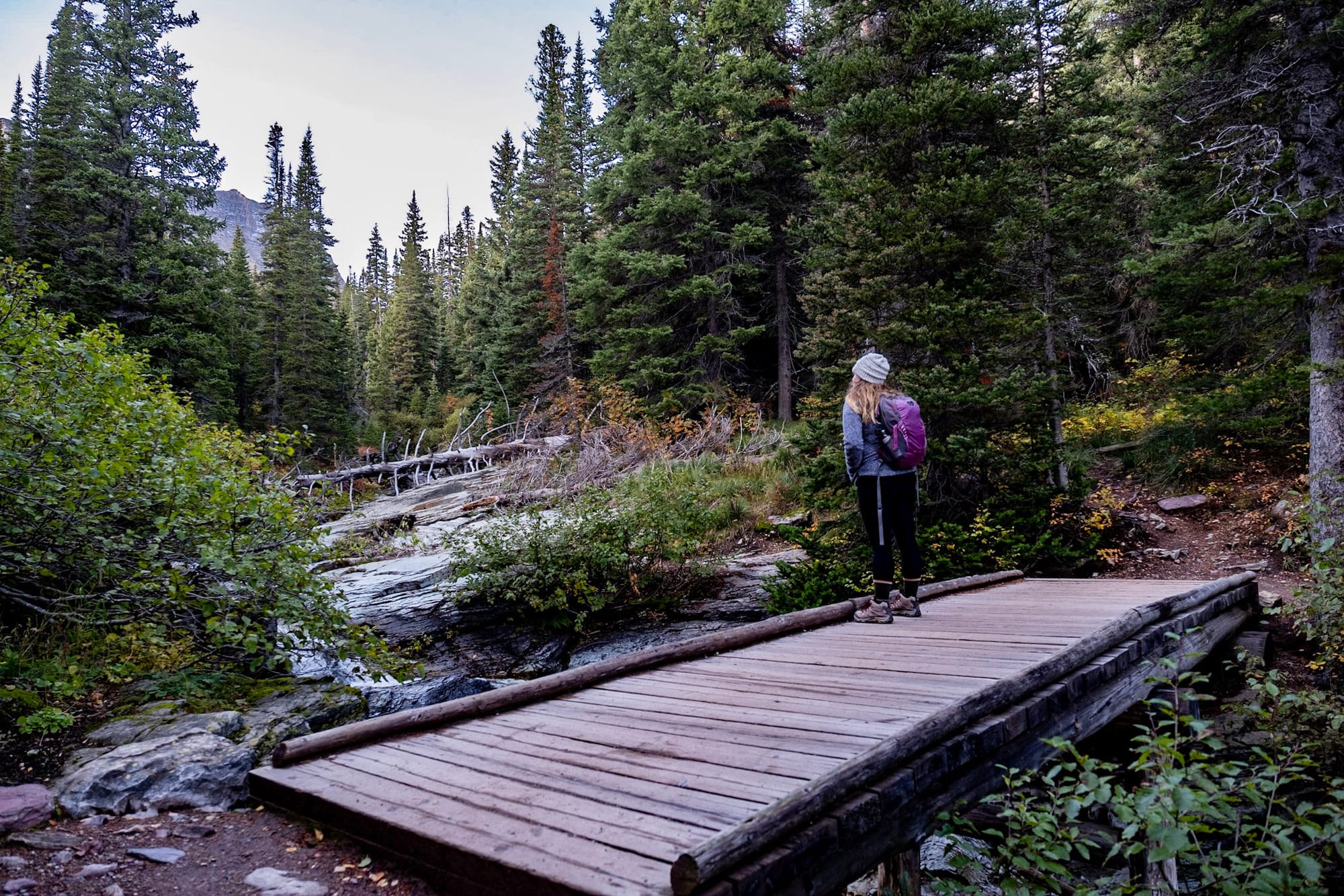
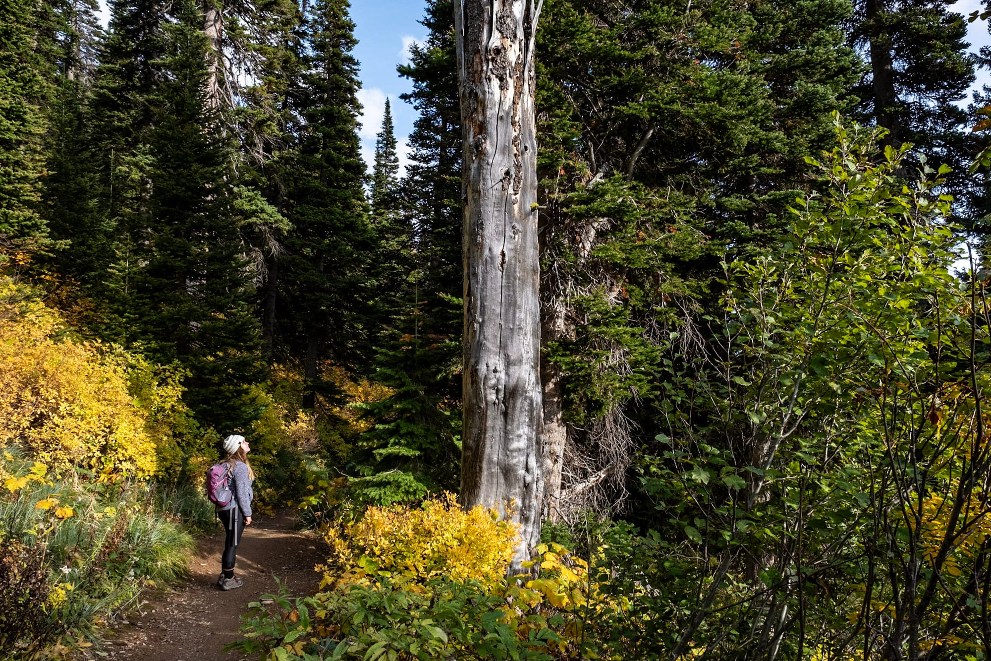
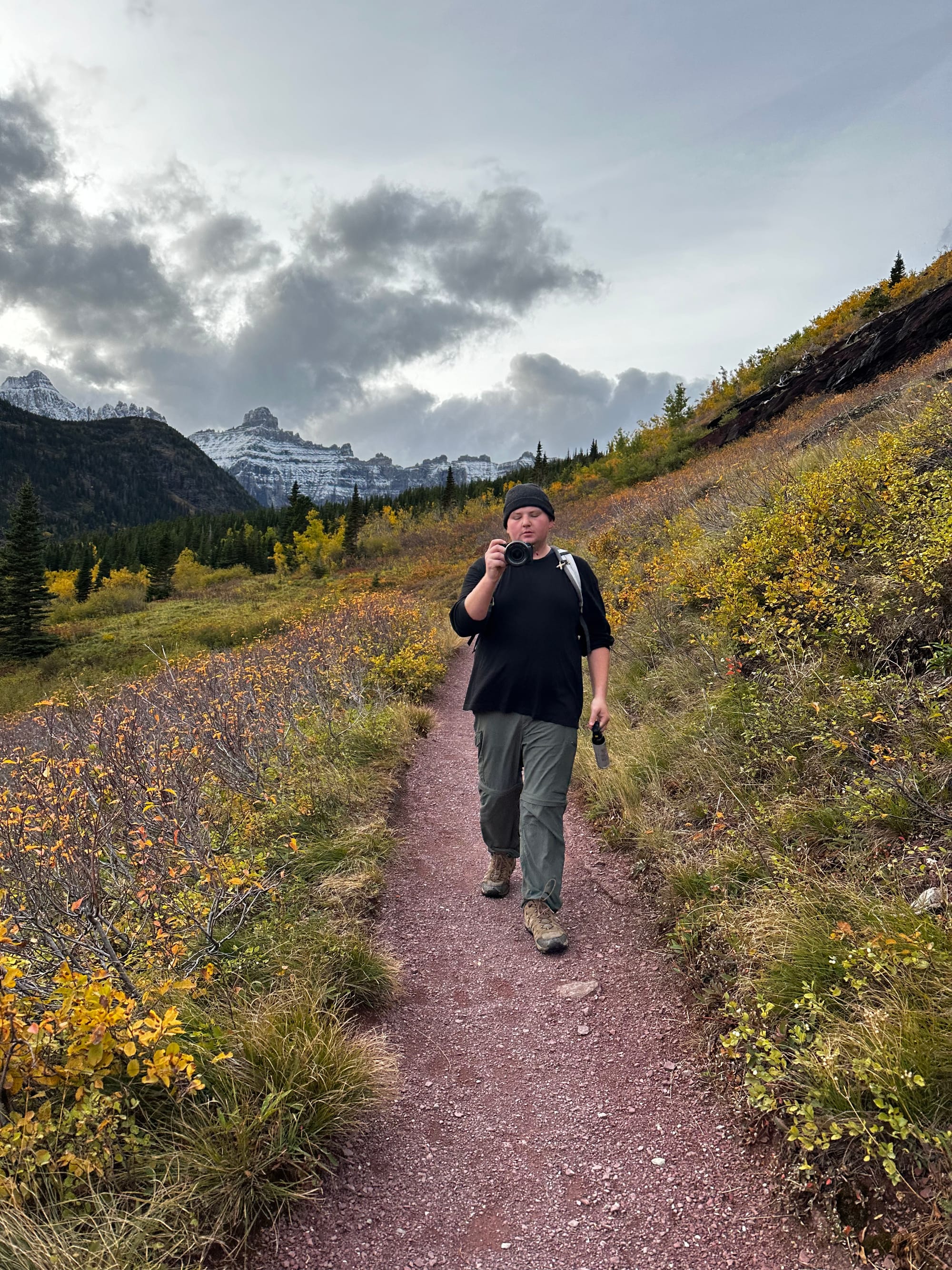
The best thing we did on the west side was hiking Trail of the Cedars and the Avalanche Lake Trail. It's a really popular hike for a good reason: not too long (about 5 miles total), not too hard, and gorgeous.
Trail of the Cedars is an easy nature trail: a flat wooden boardwalk winding through a boardwalk of huge, towering red cedars. These trees are mesmerizing.
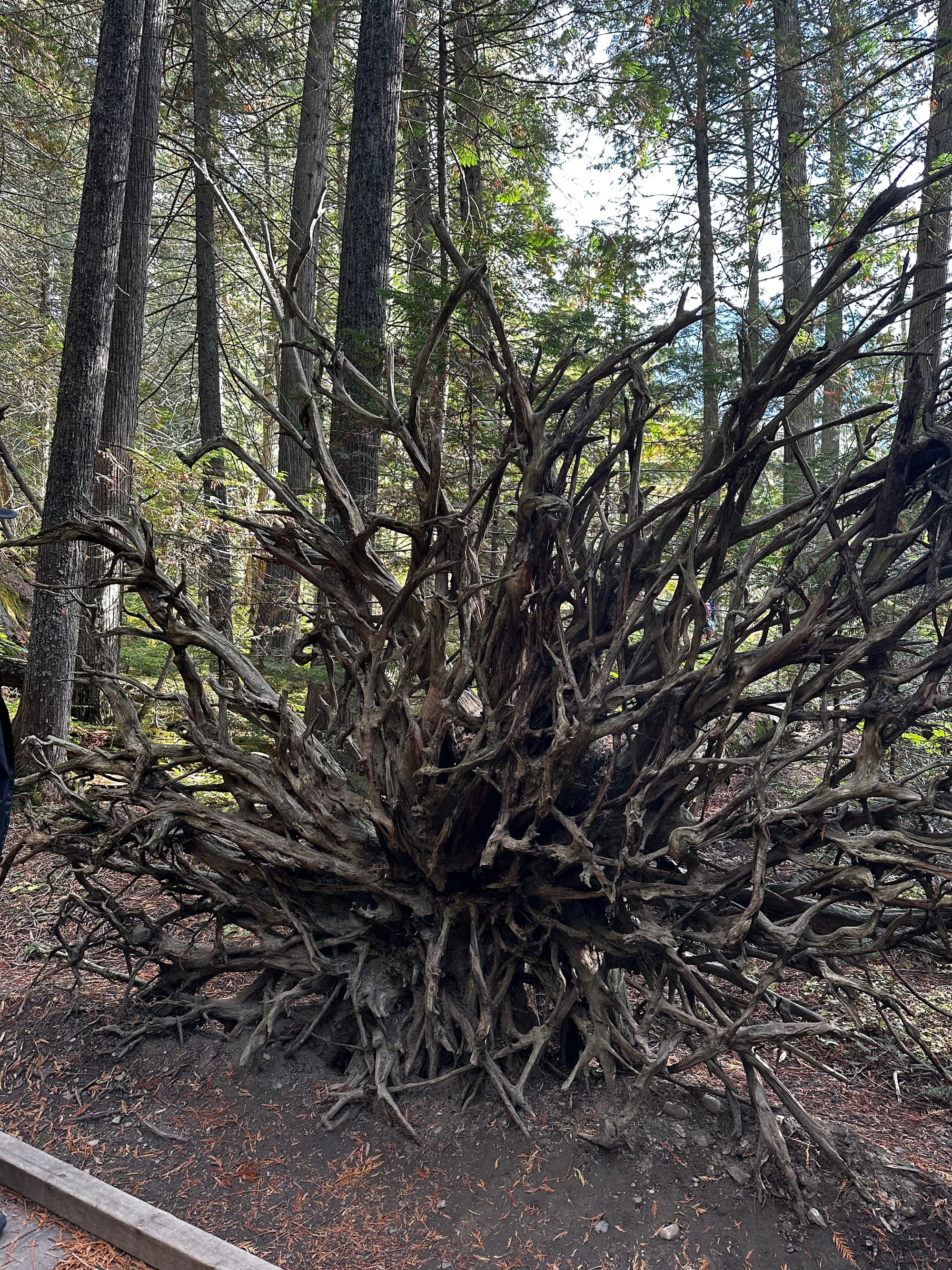
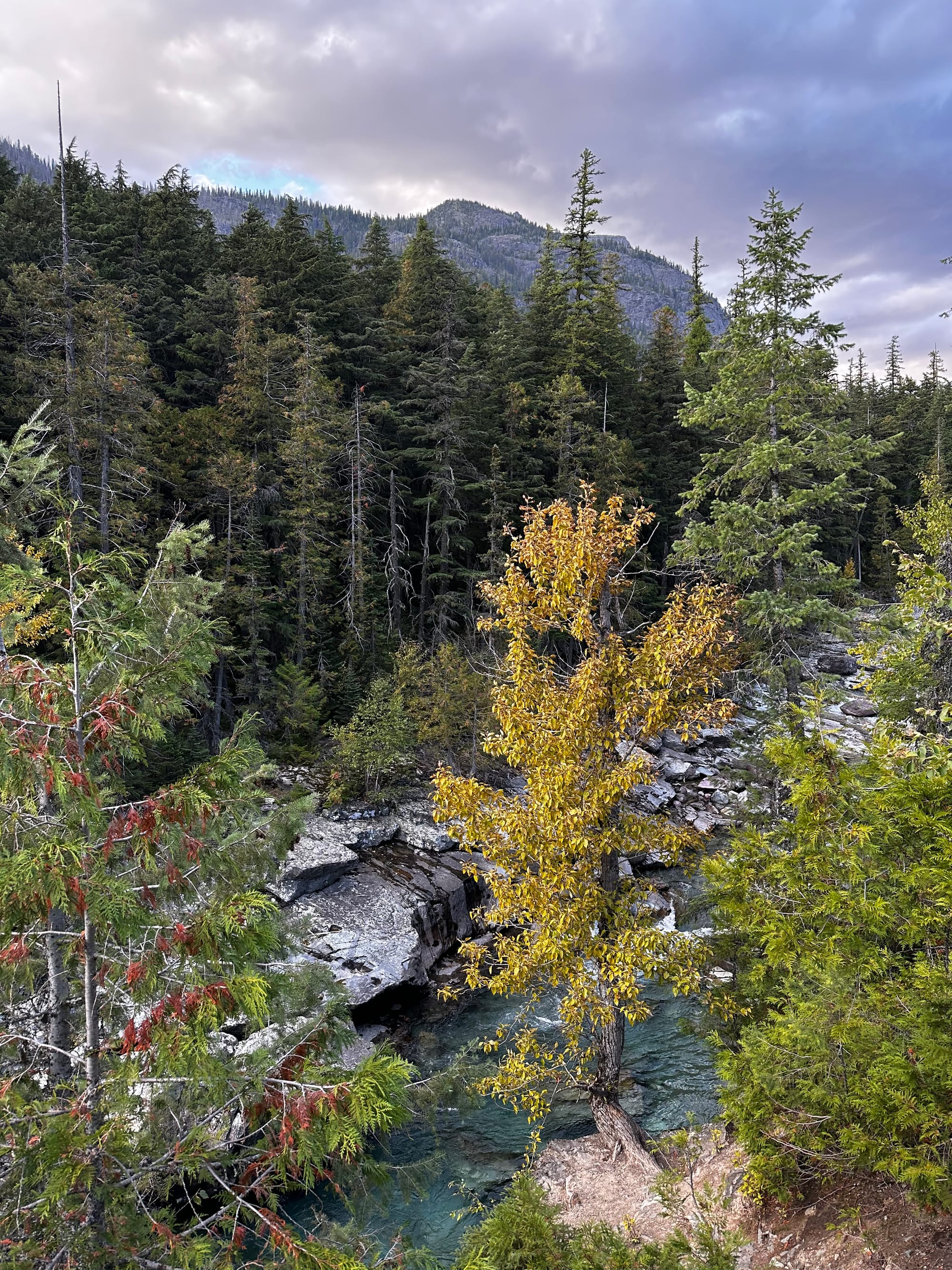
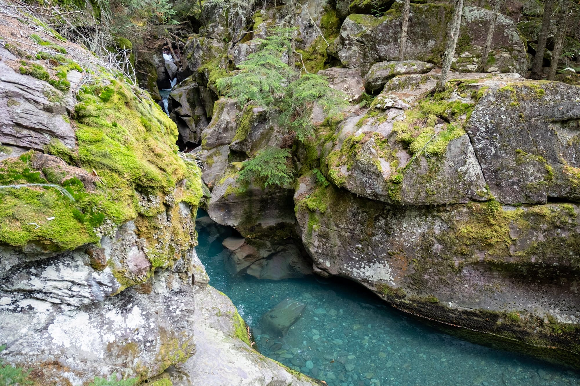
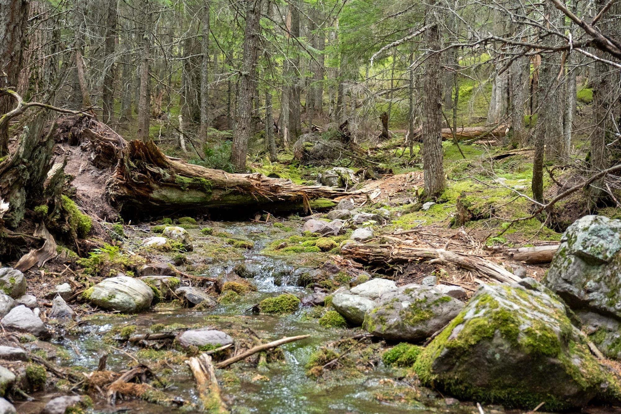
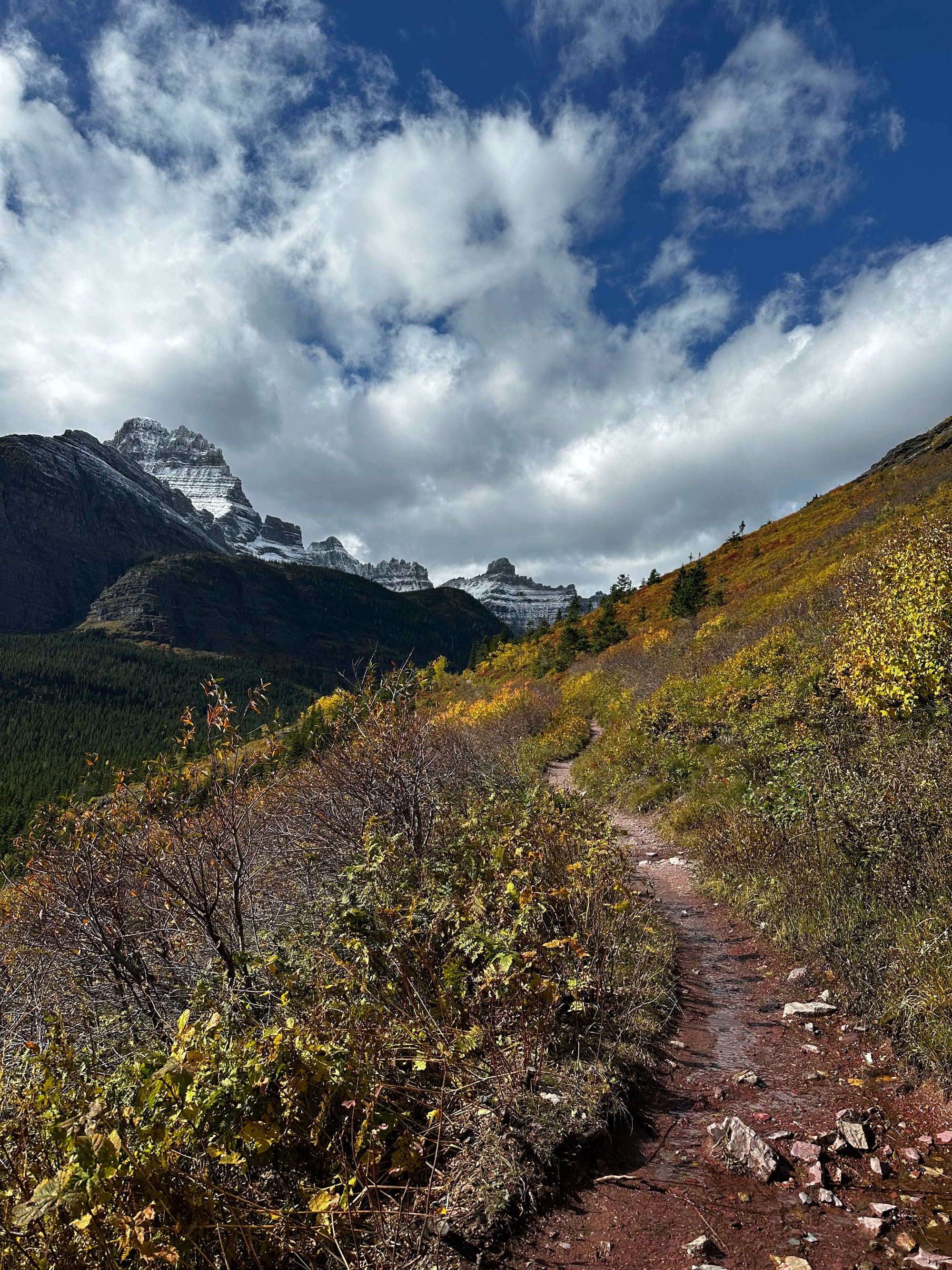
After about half a mile it connects with the Avalanche Lake trail; around there you get to a stream of clear, unnaturally bright blue water tumbling over colorful rocks. This whole area feels like a different world compared to other areas of the park – green and lush, sort of how I imagine the Pacific Northwest.
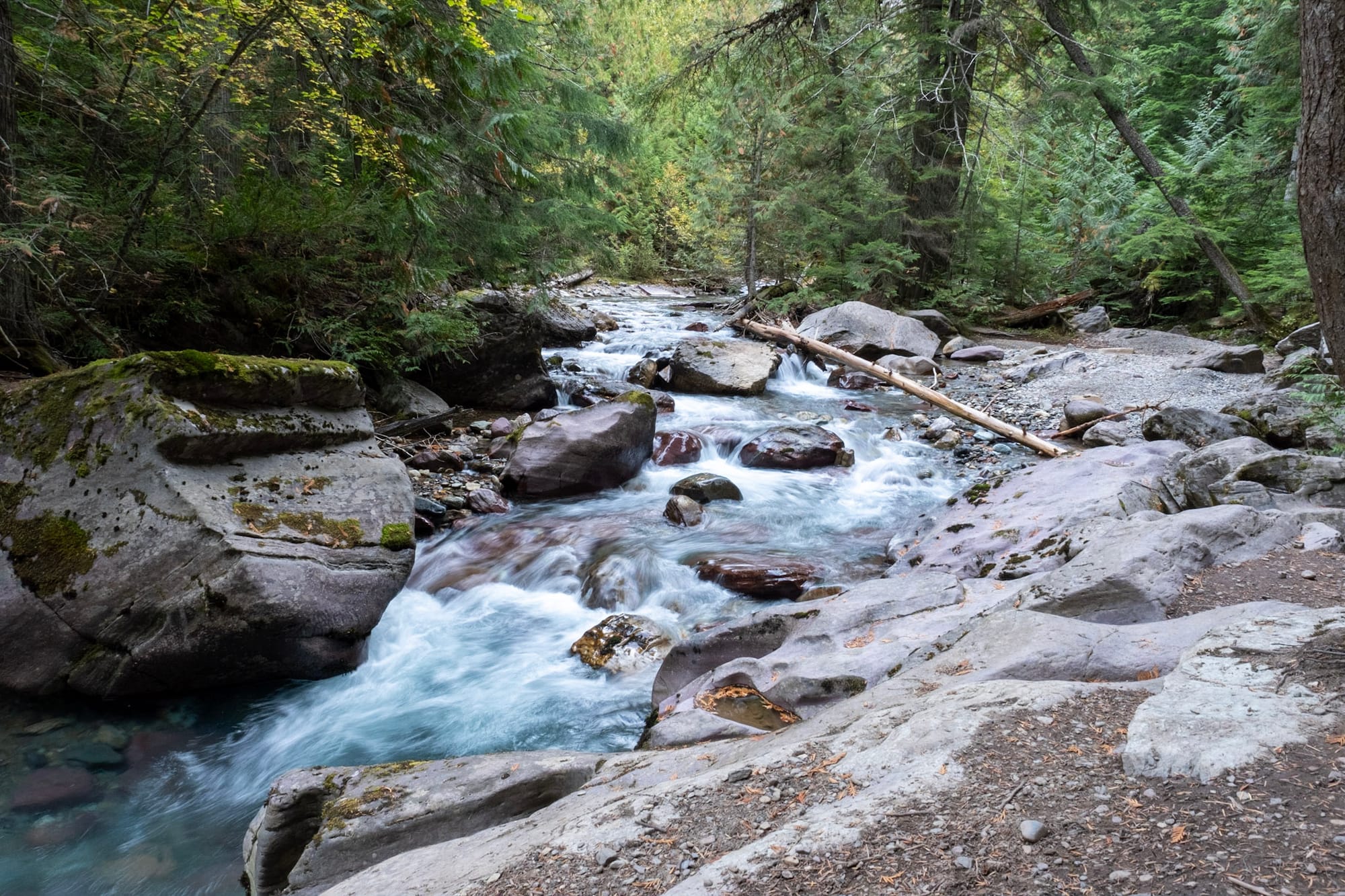
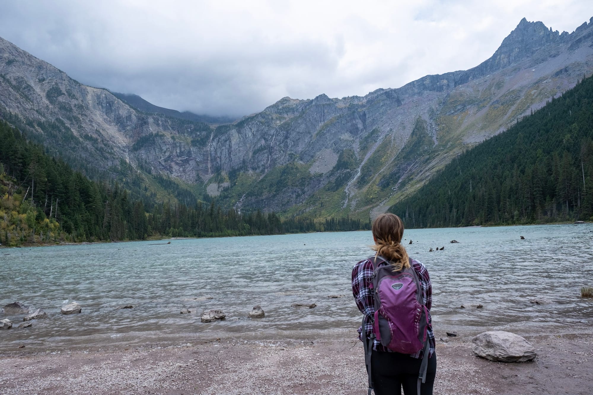
Then the trail climbs higher through more trees, following the stream, with occasional views of the mountains and valley along the way. Eventually, everything opens up to the view of Avalanche Lake.
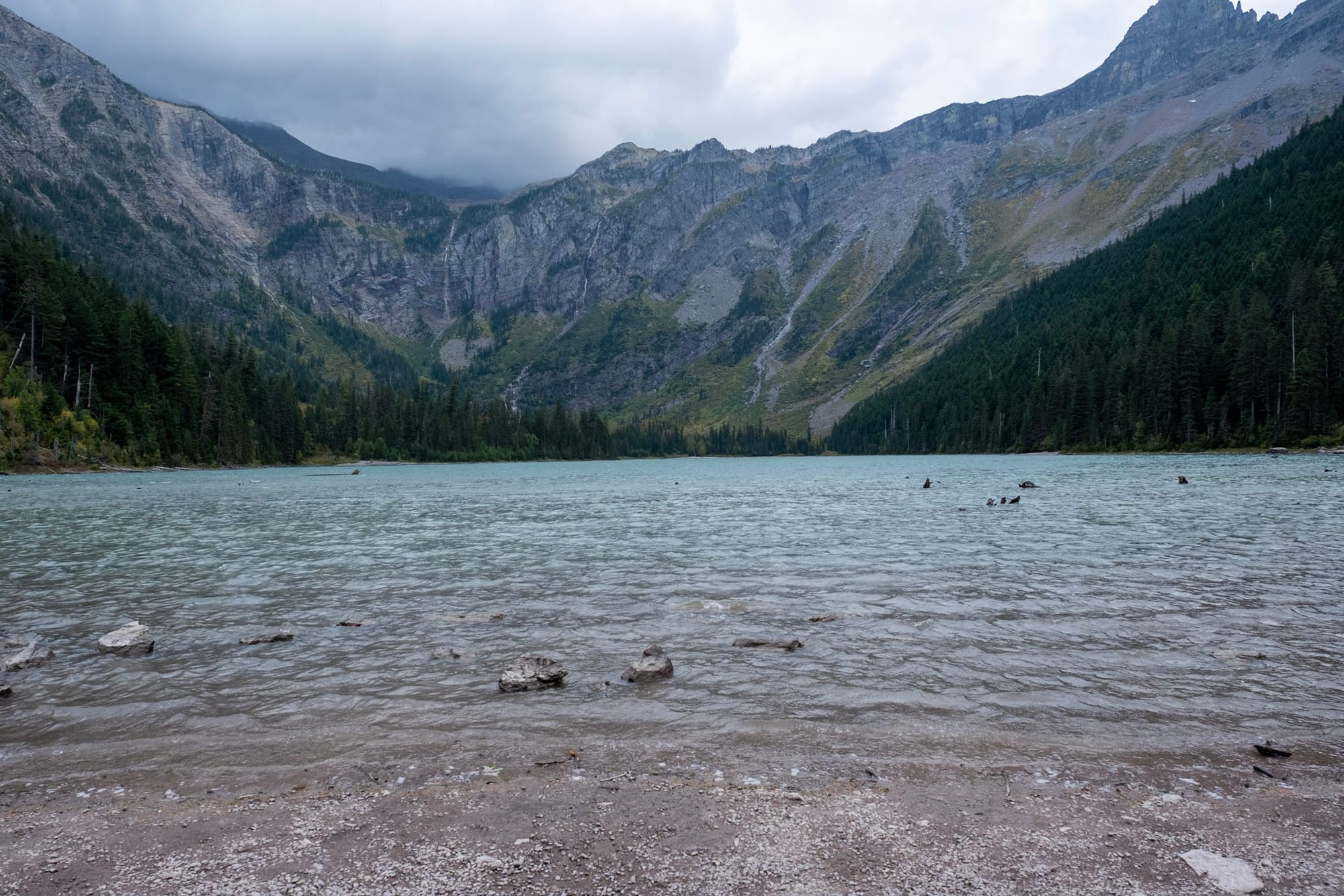
A lot of the lakes in Glacier are this clear, light blue color – not 100% sure why, but maybe because they're glacial lakes? Either way, they're so pretty. Avalanche Lake is set in a bowl with the mountains curving all around and skinny waterfalls flowing down into it.
It was windy, drizzly, and a lot colder up there than when we started. We stayed for a while to take in the view, and then started back down.
Definitely recommend checking out these trails if you're in Glacier – there are a lot of long hikes in the park, so this is a great shorter, easier option that still has awesome views!
East side
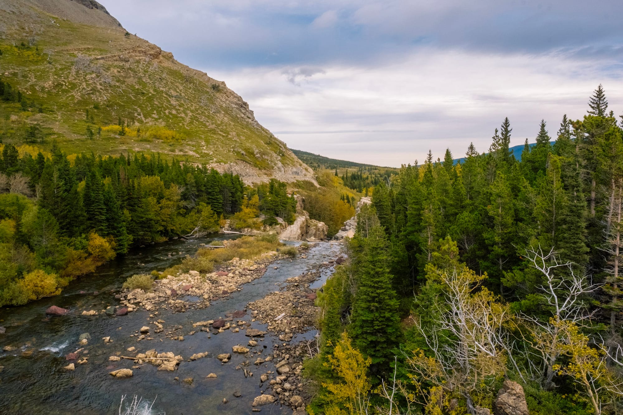
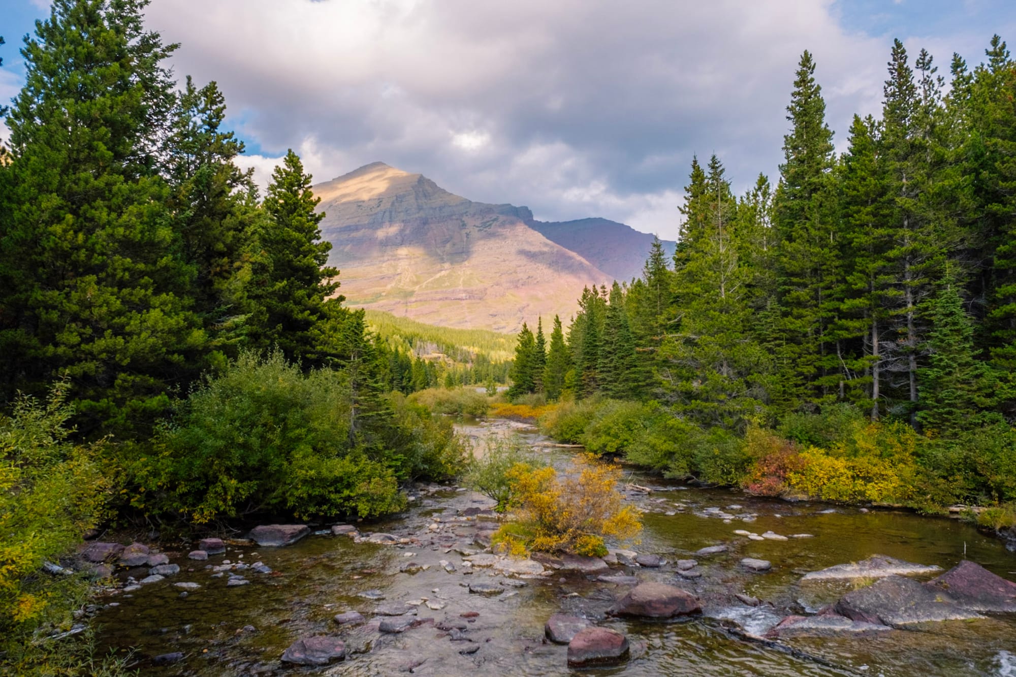
On Thursday, we left our campground and drove two hours to St Mary on the east side of Glacier. Since we had the Airstream, we took Route 2, which goes around the park to the south (long vehicles/RVs can't drive through the park on Going-to-the-Sun Road). It was a beautiful drive along the Middle Fork Flathead River with the mountains to the north. Train tracks followed the road for a lot of the drive – you can actually take an Amtrak train to Glacier!
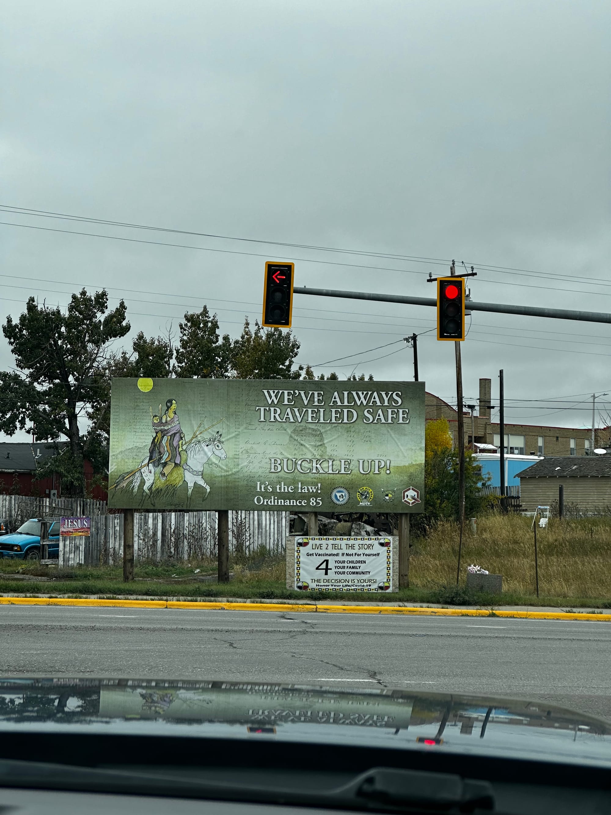
Eventually, we reached the community of East Glacier Park, and everything started to look different. Unlike the thick green forests to the west, the land on the east side of Glacier is mostly wide open rolling plains. The mountains in the park end abruptly, and then it's seemingly a lot of nothing to the east. (It's actually mostly the Blackfeet Indian Reservation). It's a lot more remote and wild west feeling.
After driving through East Glacier Park, the road wound up the hills to the town of Browning (the reservation headquarters) and then back down to St Mary. There were cows wandering all over the road on the way – it was funny but annoying trying to keep Hollie from seeing them and barking her head off (cows are her mortal enemies).
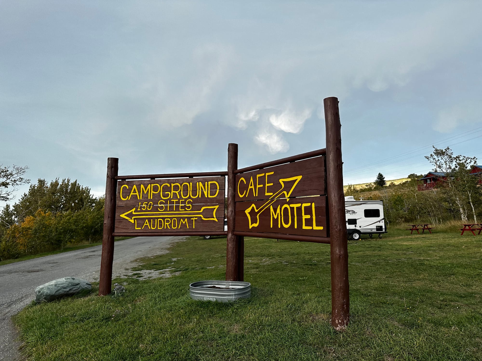
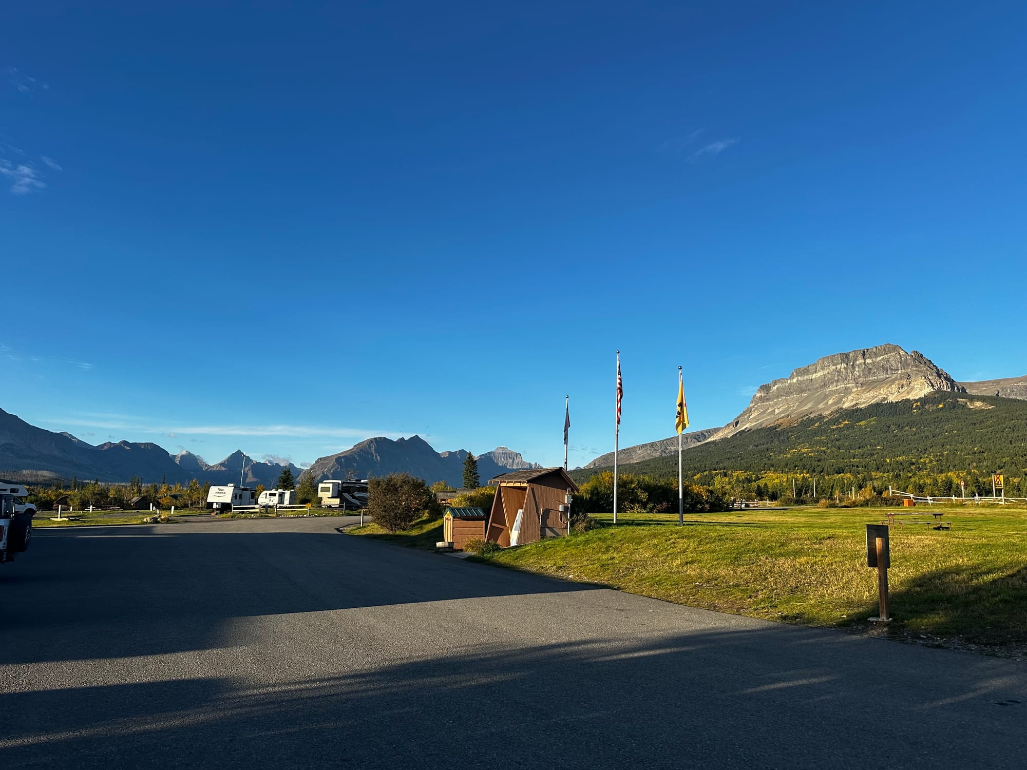
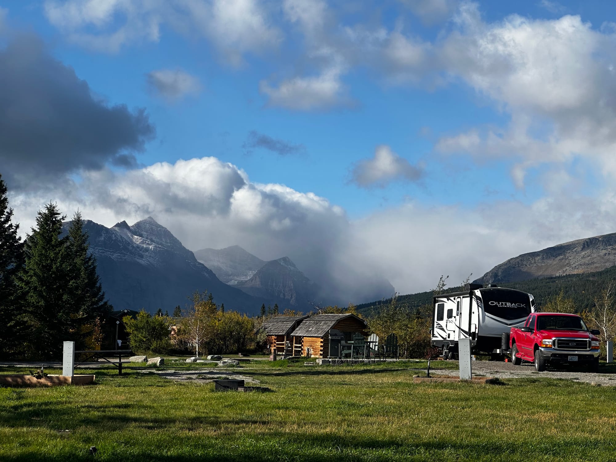
Johnson's of St Mary
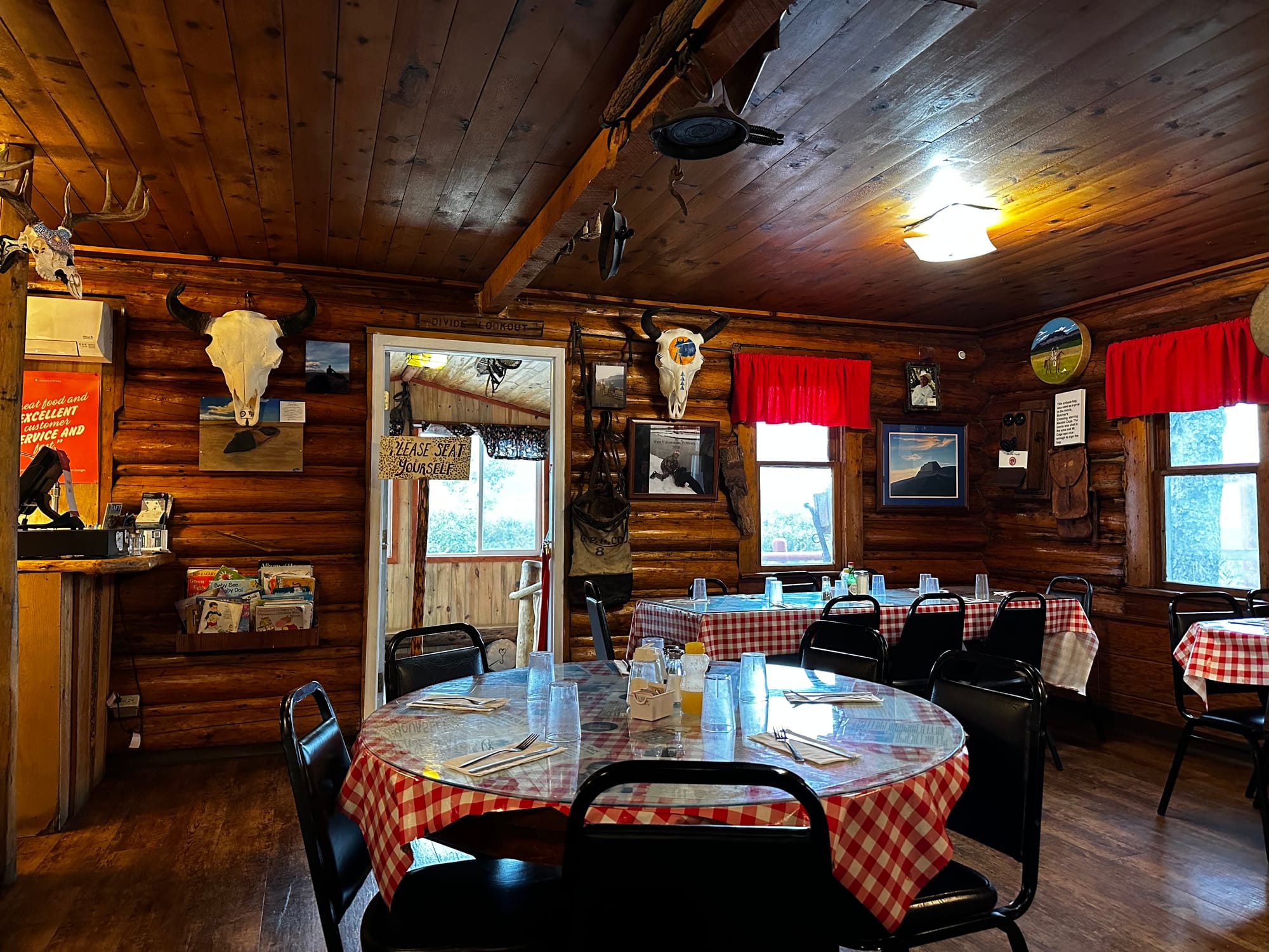
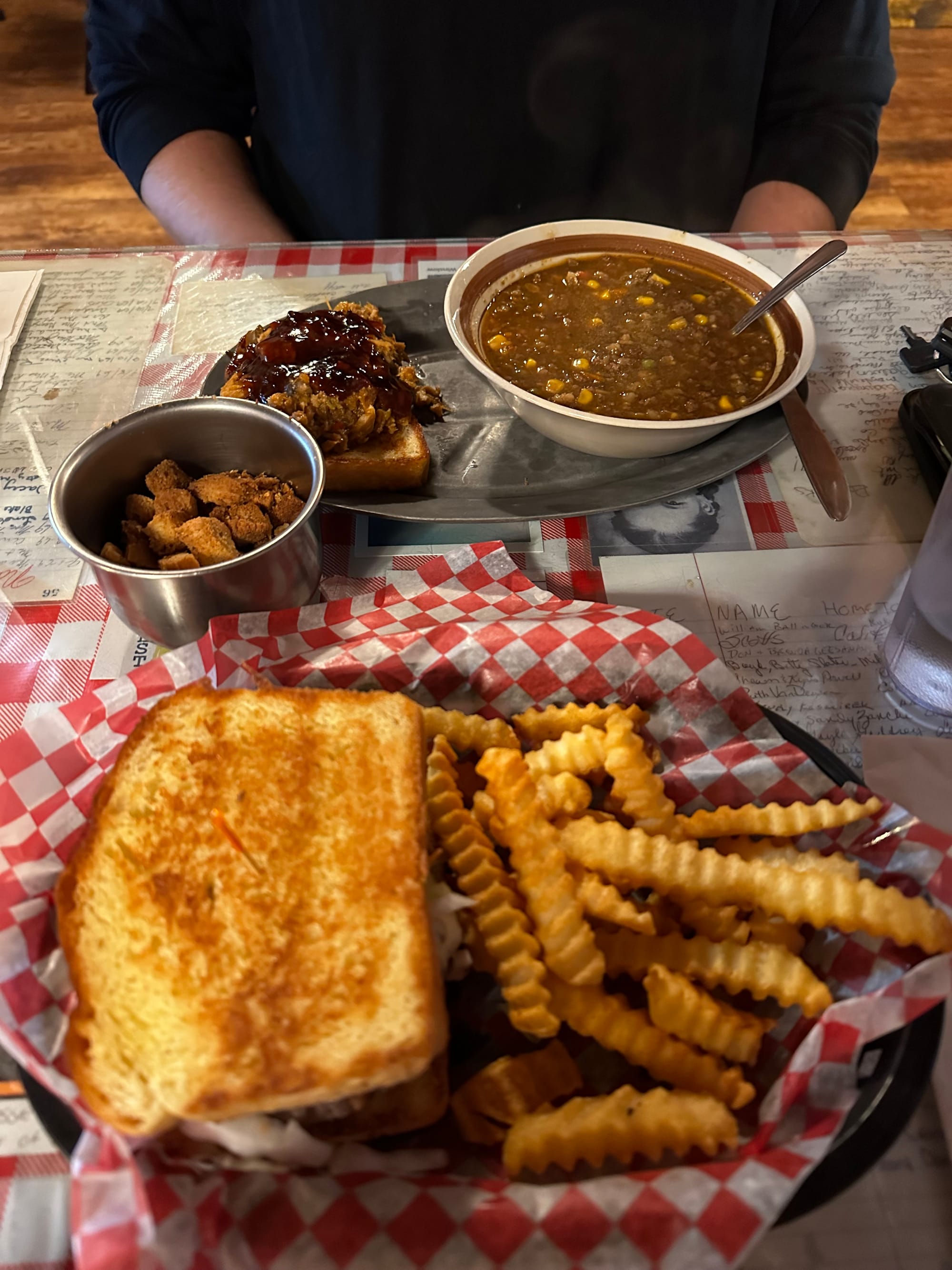
Our campground for the next few nights was Johnson's of St Mary. It's a family-run place that's been around since the 1950s with a campground, cabins, motel, and restaurant. The campground was pretty basic, but was a great base for exploring Glacier and had amazing views of the mountains and Lower St Mary Lake. But we were lucky to choose this place just because of the amazing Johnson's restaurant, which I'll talk about in a minute.
When we arrived, we were surprised at how much colder and windier this side of the park was. It was freezing (not literally, but felt like it). The campground office wasn't heated and we were way underdressed as we checked in and got set up. Luckily, Joey talked to someone who recommended eating at the Johnson's restaurant, so we dressed warmer and walked over there for lunch.
Johnson's Campground
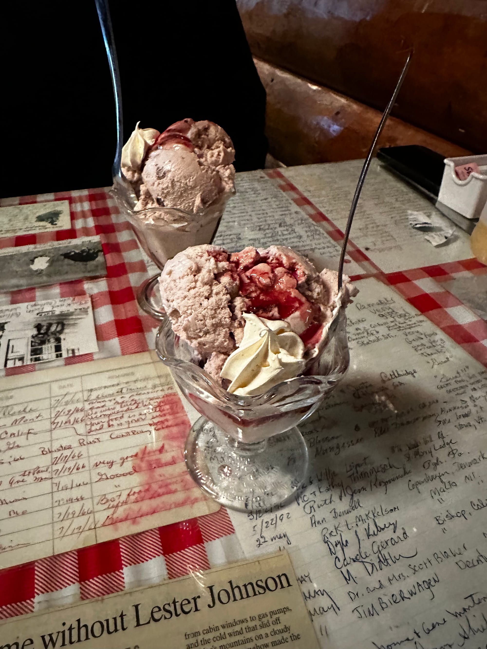
WE LOVED THIS PLACE. It's super cozy and homey inside, with all kinds of memorabilia from the family, visitors, and park over the years. They serve delicious, home-cooked meals – barbecue, chicken-fried steak, burgers and sandwiches, soup (the soup was the main event - it was different every day but so warming and delicious), huckleberry pie and ice cream. It was the kind of old-fashioned place where they emphasize "you get what you get, and you'll like what you get." Their menu included a long history of Johnson's and a funny, sarcastic FAQ section ("no, we've never seen the wind blow like this before.")
Johnson's was closing for the season on Sunday (the day we planned to leave) and they were trying to get rid of food. We went twice and it was delicious both times.
Johnson's Cafe ❤️
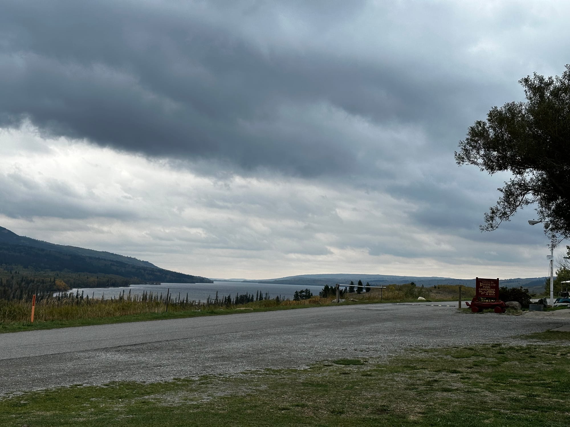
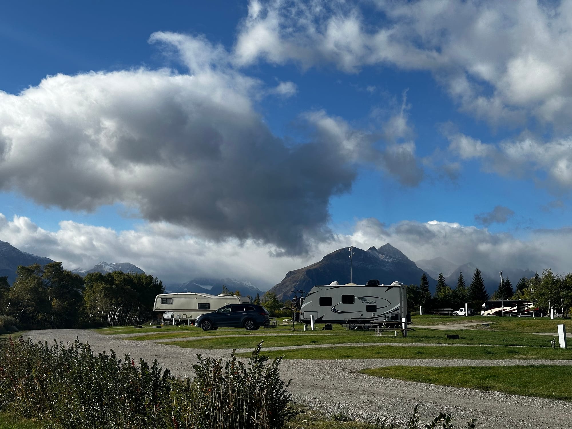
St Mary/East Glacier KOA
While I'm talking about campgrounds, I'll cover the other place we stayed on the east side. Almost right away, we knew we were going to want more time in Glacier – there was still a ton more to see and we only had a few days left! So we looked at other options since Johnson's was closing, and decided to move across the road to the St Mary/East Glacier KOA.
This was the first and only KOA we've stayed in so far. We usually try to avoid them because they're generally not our vibe – expensive, close-together sites, geared toward families with lots of amenities, etc. But we didn't have a ton of options in St Mary and actually ended up liking this KOA a lot (it was expensive, but that's to be expected so close to Glacier).
It wasn't busy since the season was winding down, and we only had close neighbors for part of the time (and it didn't really matter since we were either working or exploring). The staff and camp store were both super nice. There was a pool and hot tub (the hot tub would've felt PERFECT, but we didn't end up using it for whatever reason), a dog park, and walking trails to the lake. And like Johnson's, it had stunning mountain views and was just a few minutes away from the eastern park entrance.
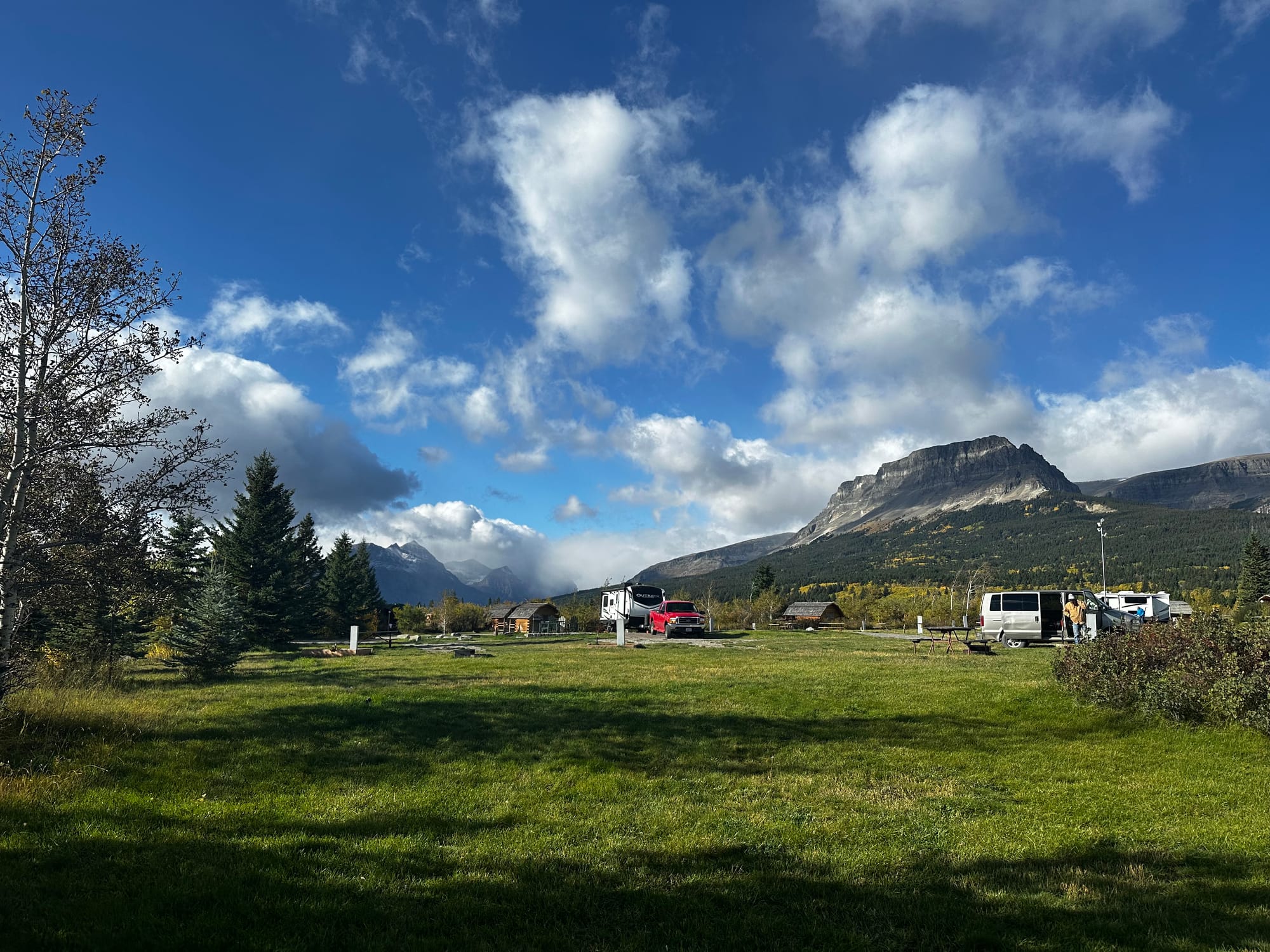
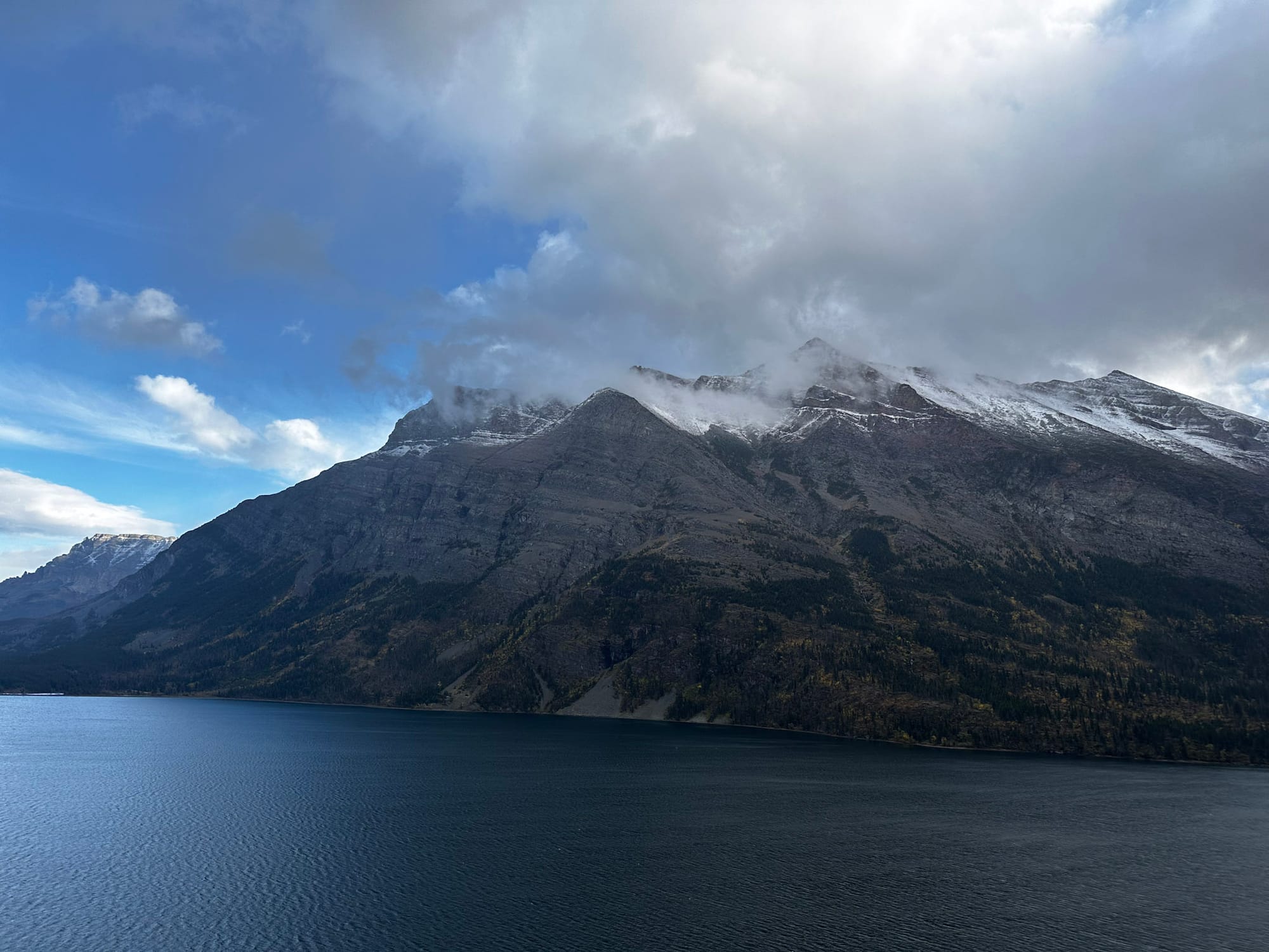
Views from the KOA, watching the clouds roll in over the mountains
We booked our KOA site for a week, leaving on October 1, when they also closed down for the season.
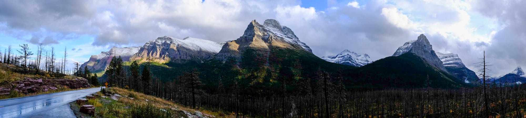
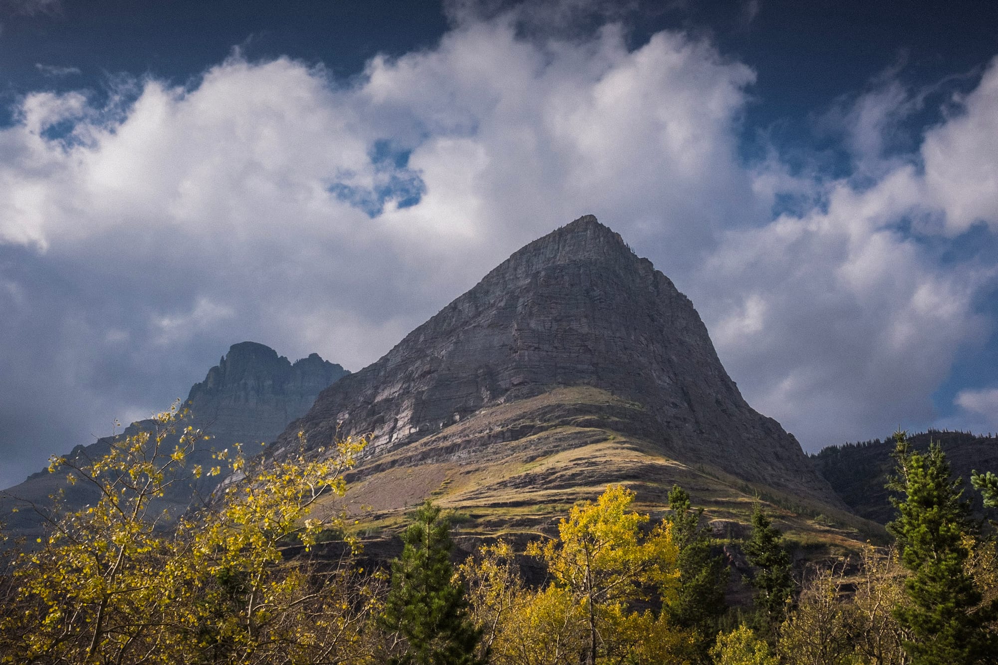
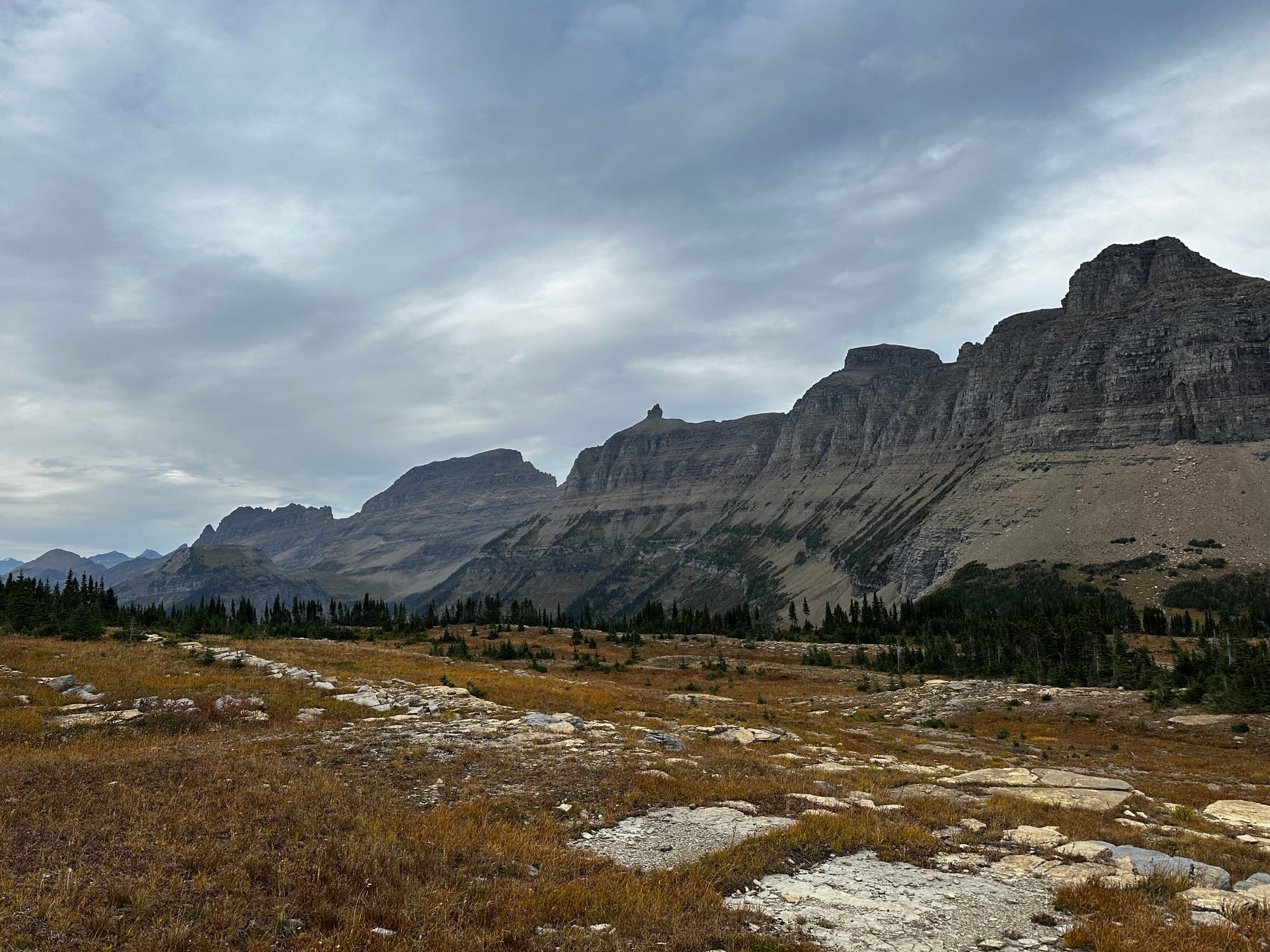
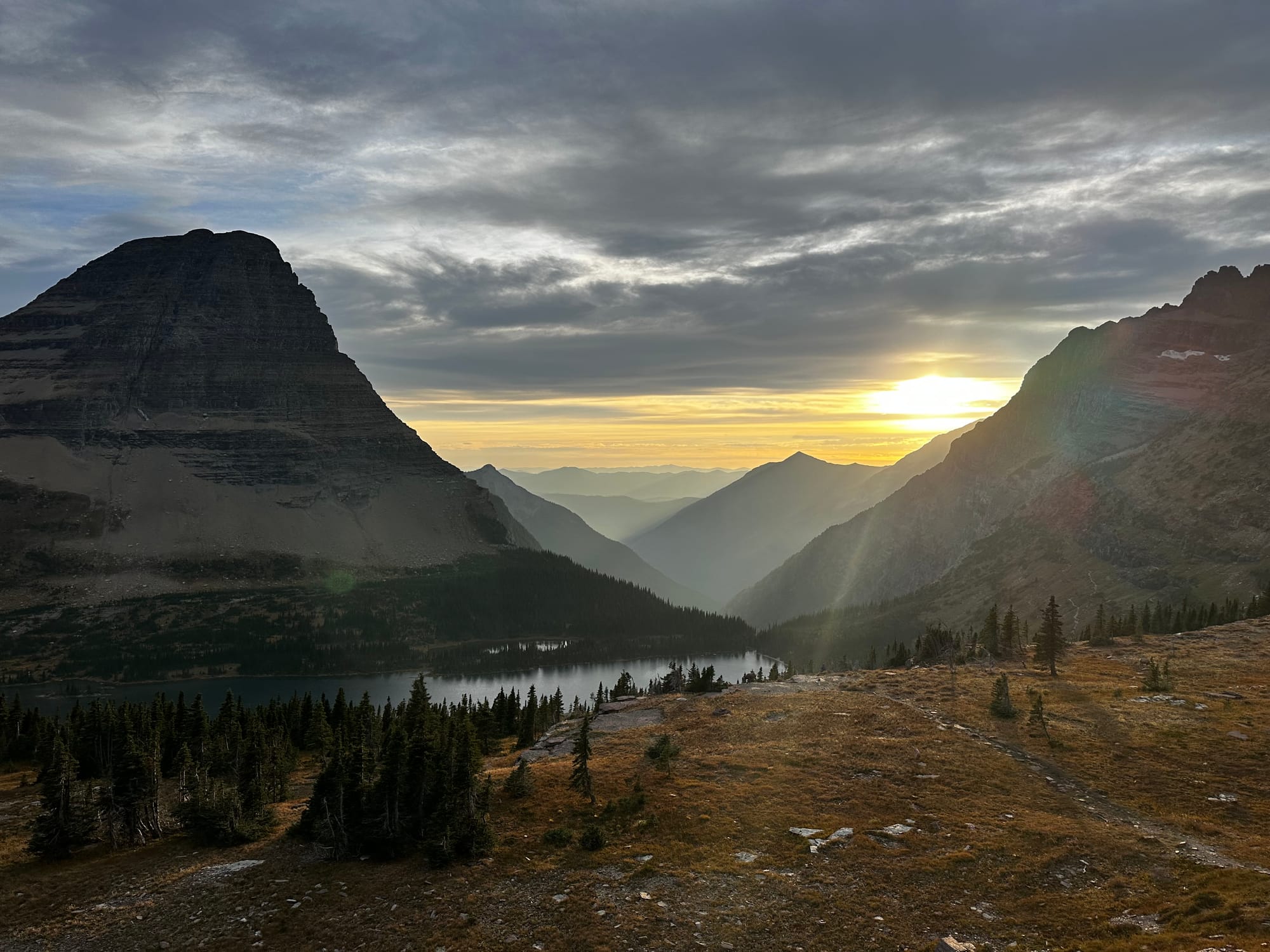
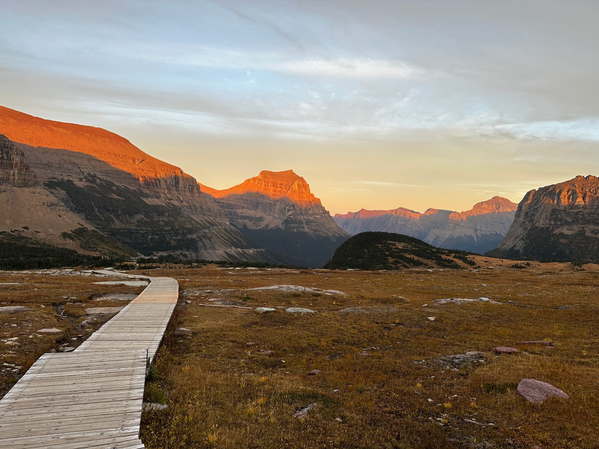
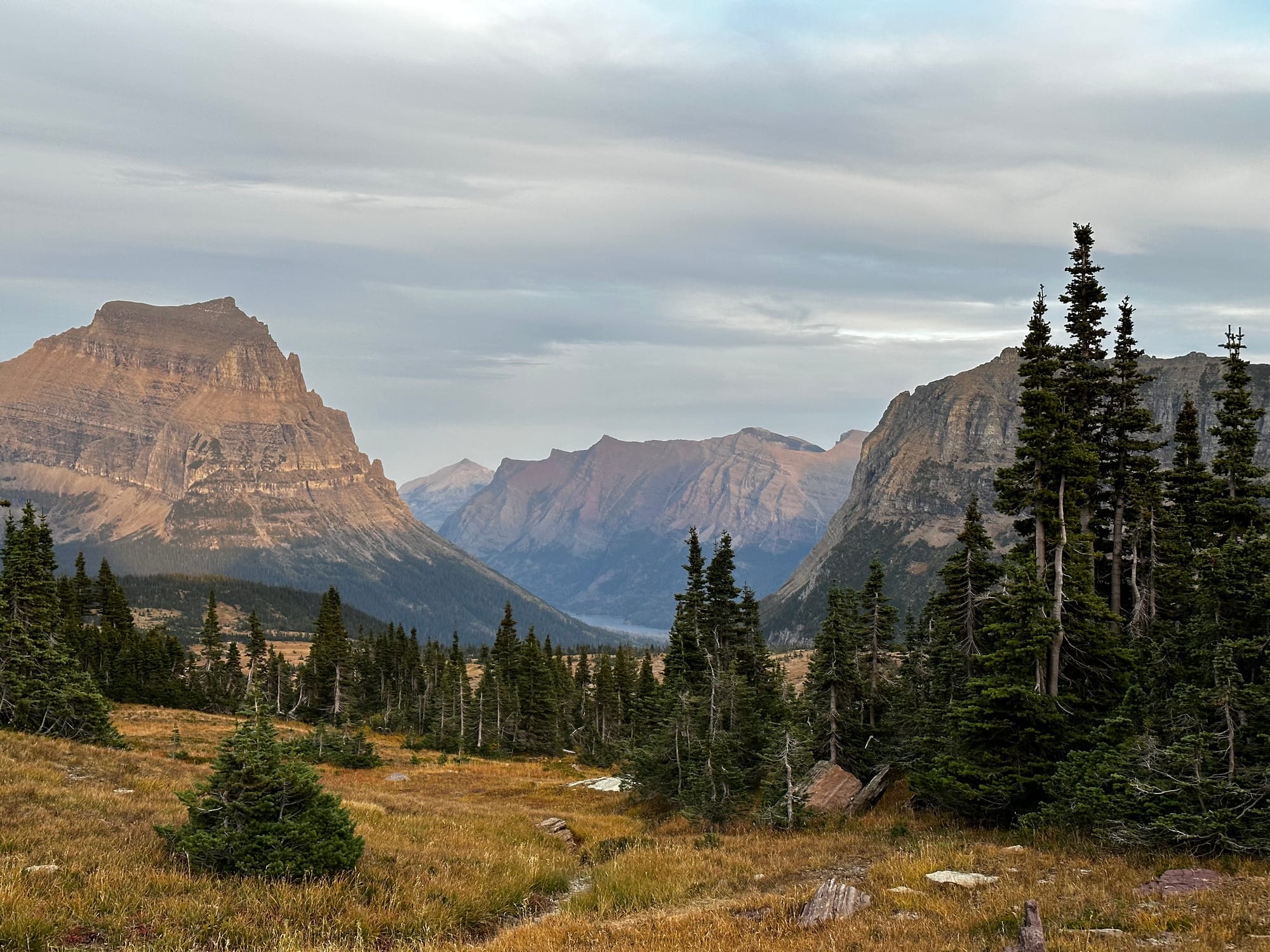
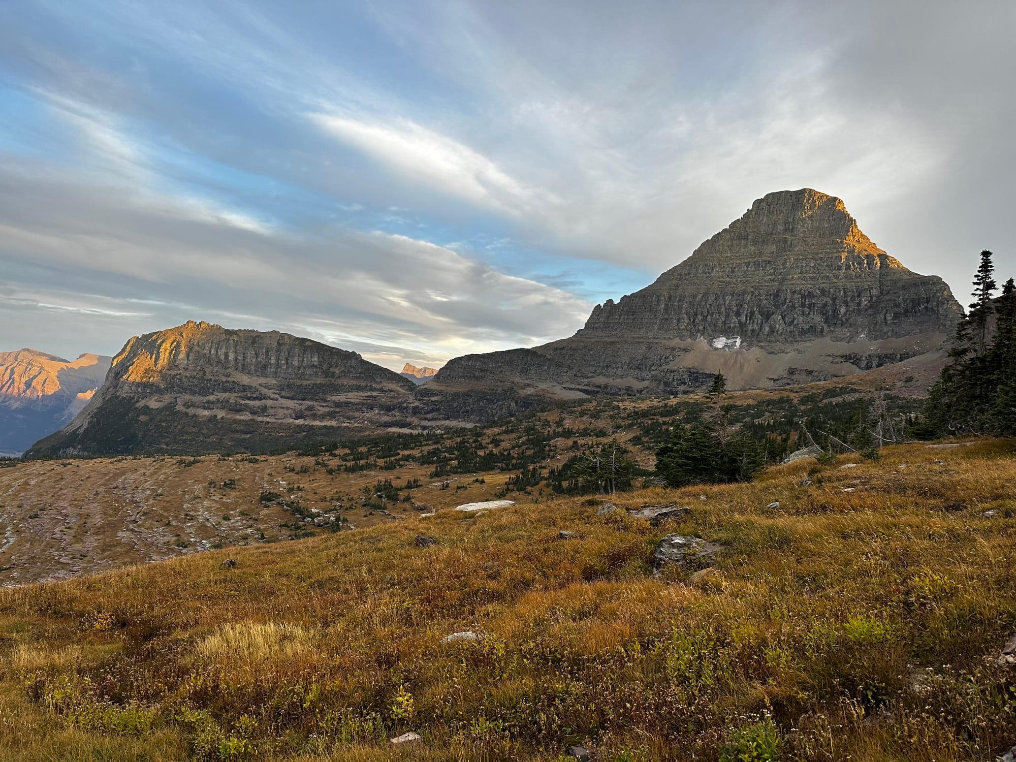
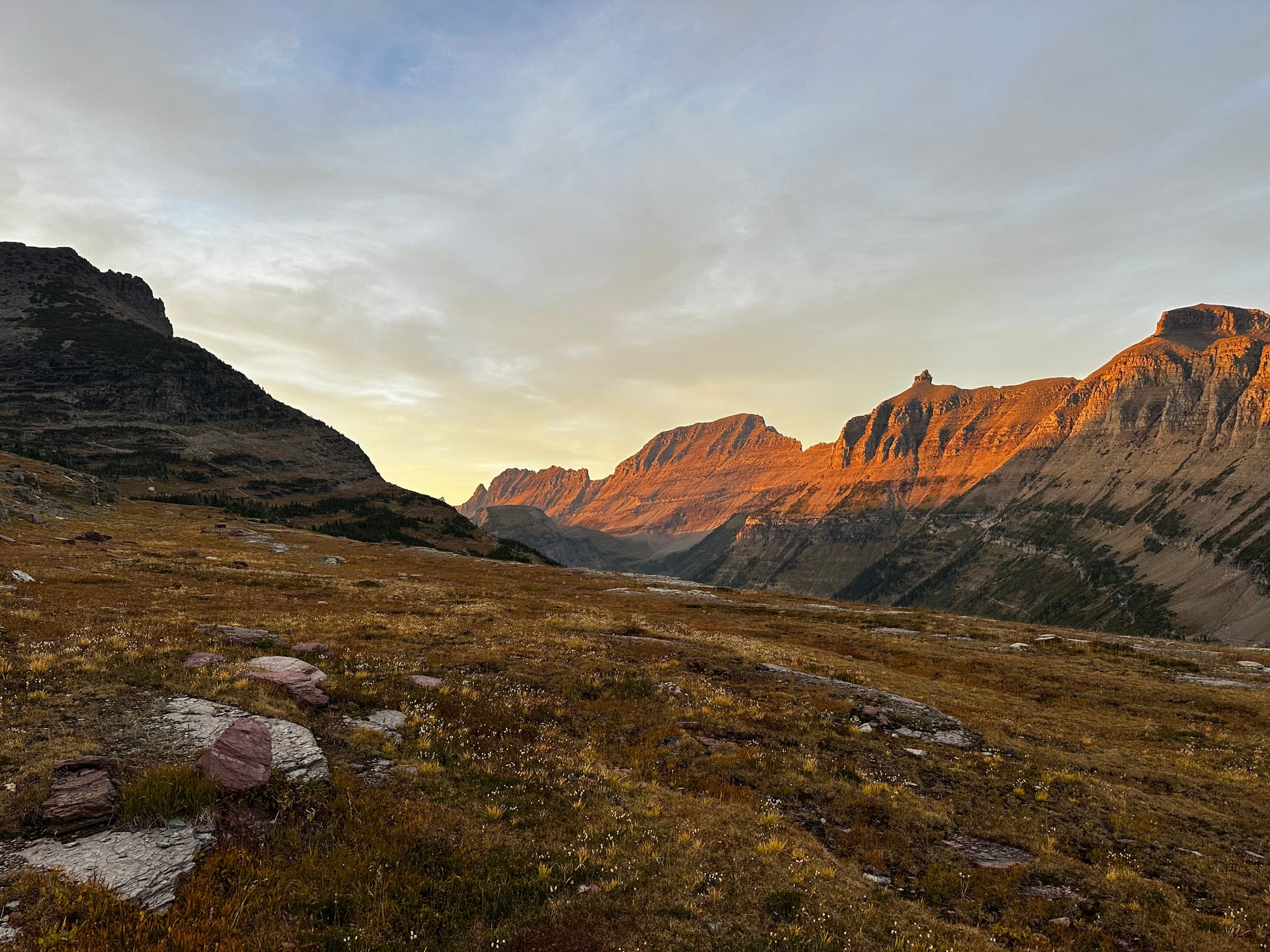
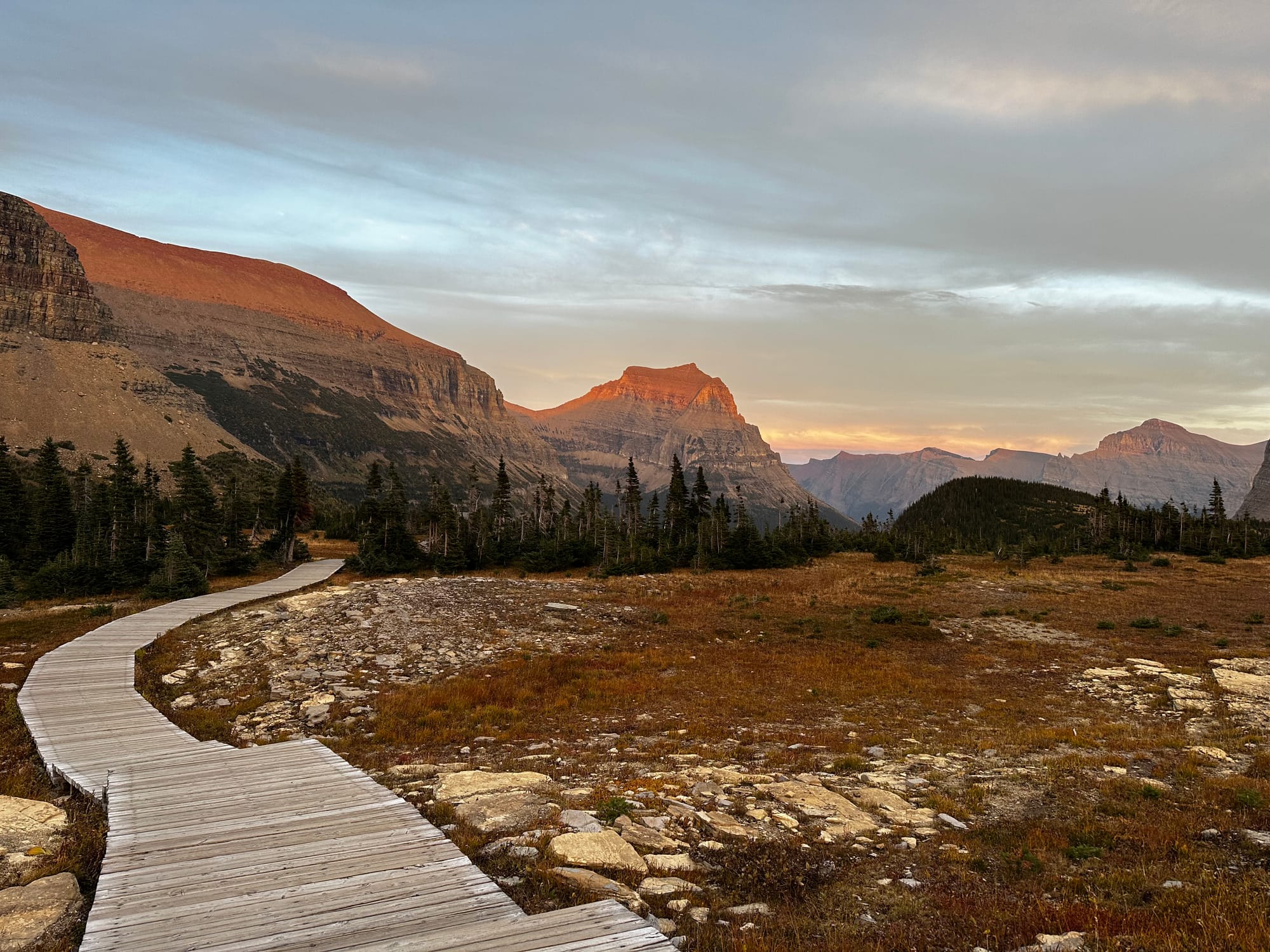
Going-to-the-Sun Road
Finally, we drove all of Going-to-the-Sun Road: the main event in Glacier!
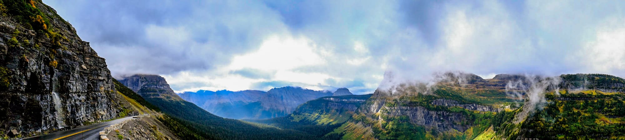
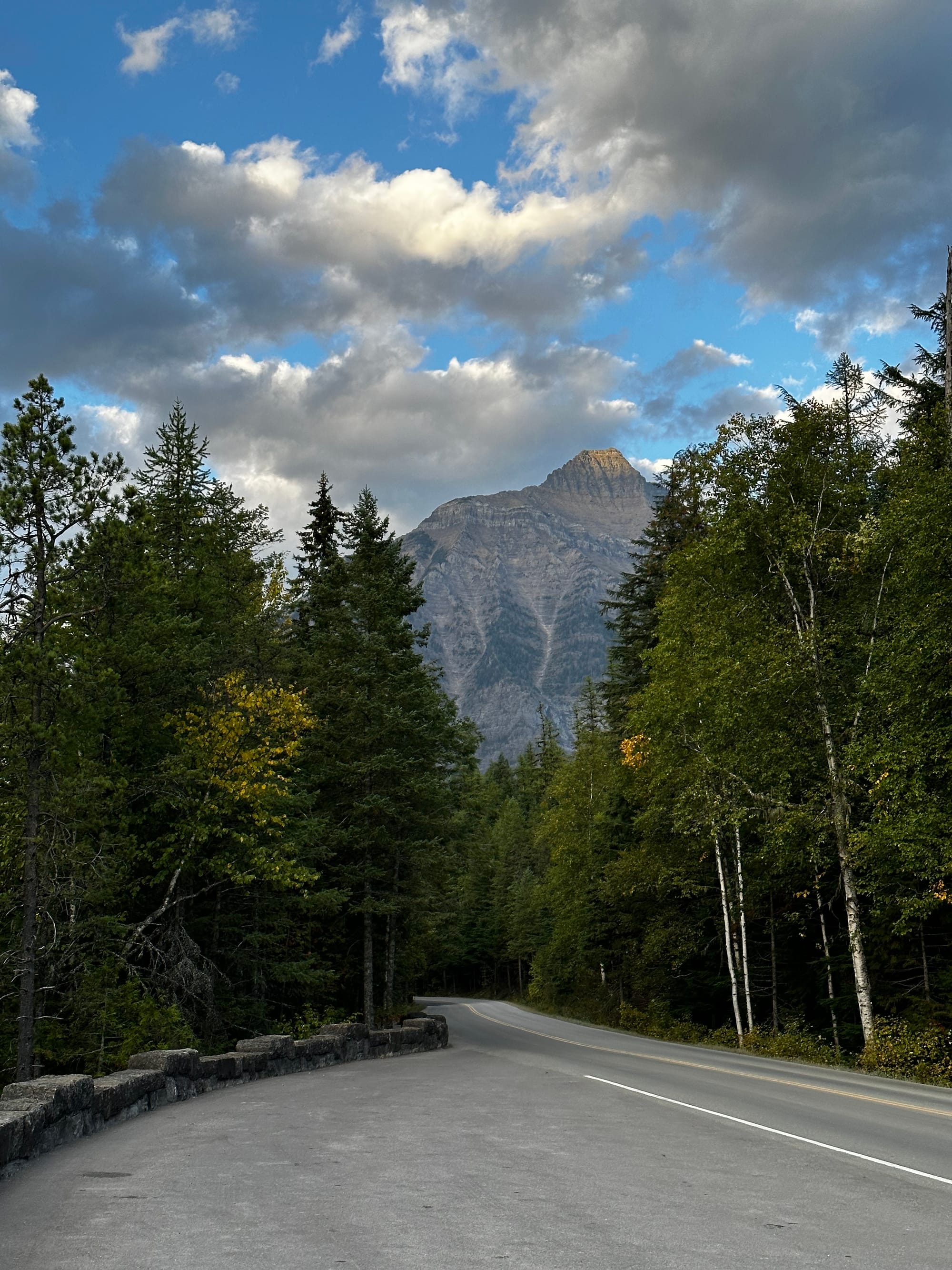
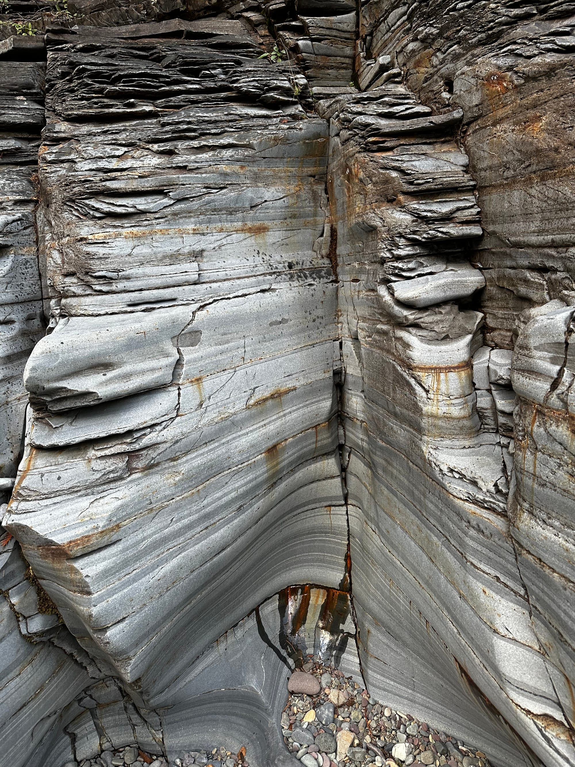
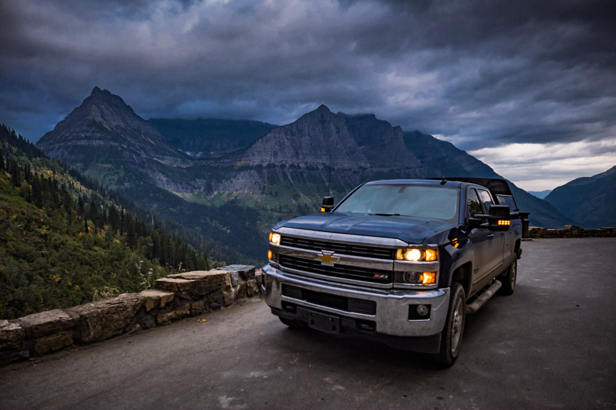
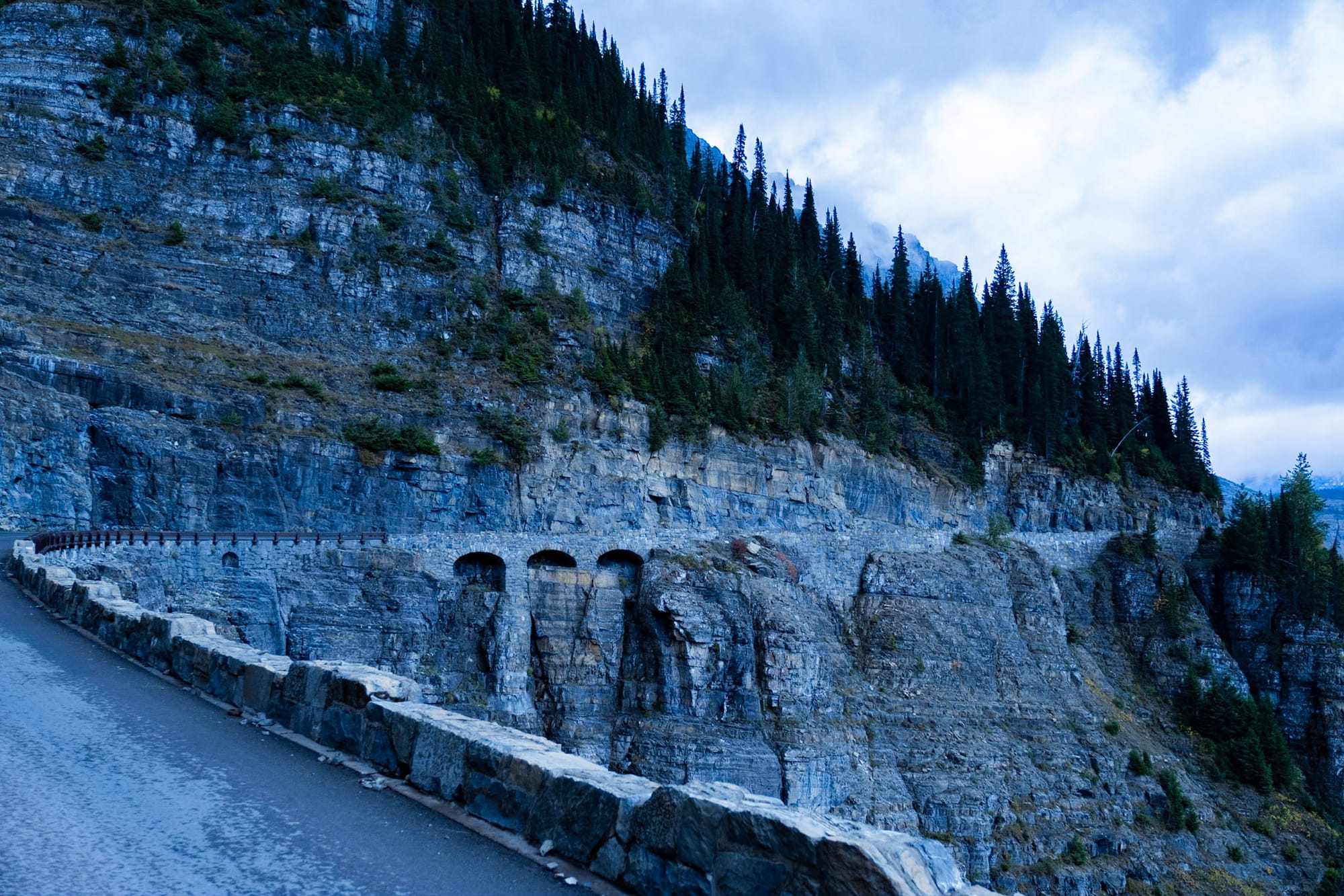
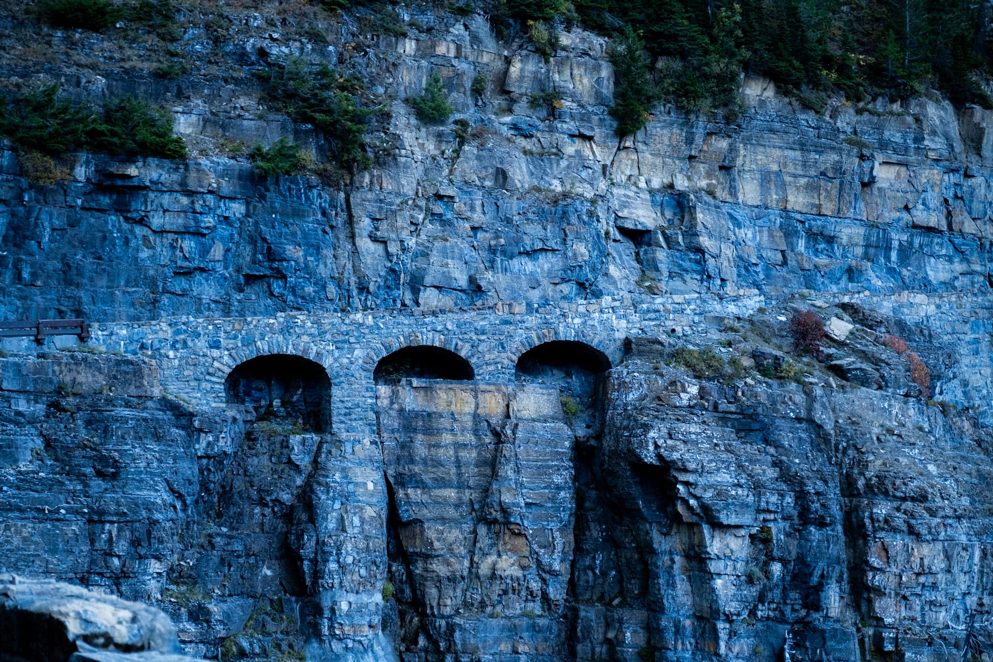
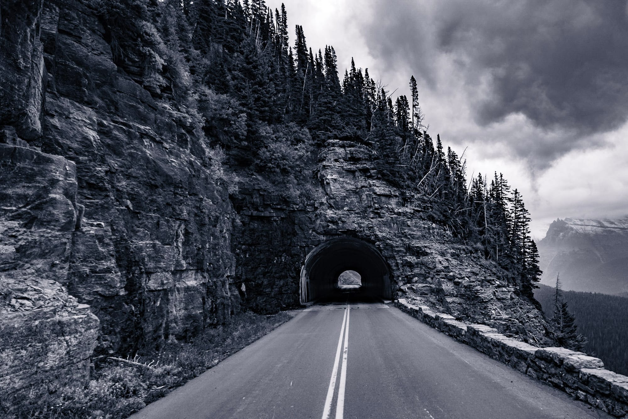
The road was finished in 1933 and is a major engineering feat. It has only one switchback; instead of twisting back and forth while climbing, it follows along the mountain walls. This results in limited impact to the area, panoramic views, and steep drop-offs from the side of the road. It's slightly nerve-racking at points – there's a reason there's a vehicle size limit. Our truck barely made the cut. One stretch of the road in particular is pretty narrow, with a rock wall right outside your window and cars squeezing by on the other side.
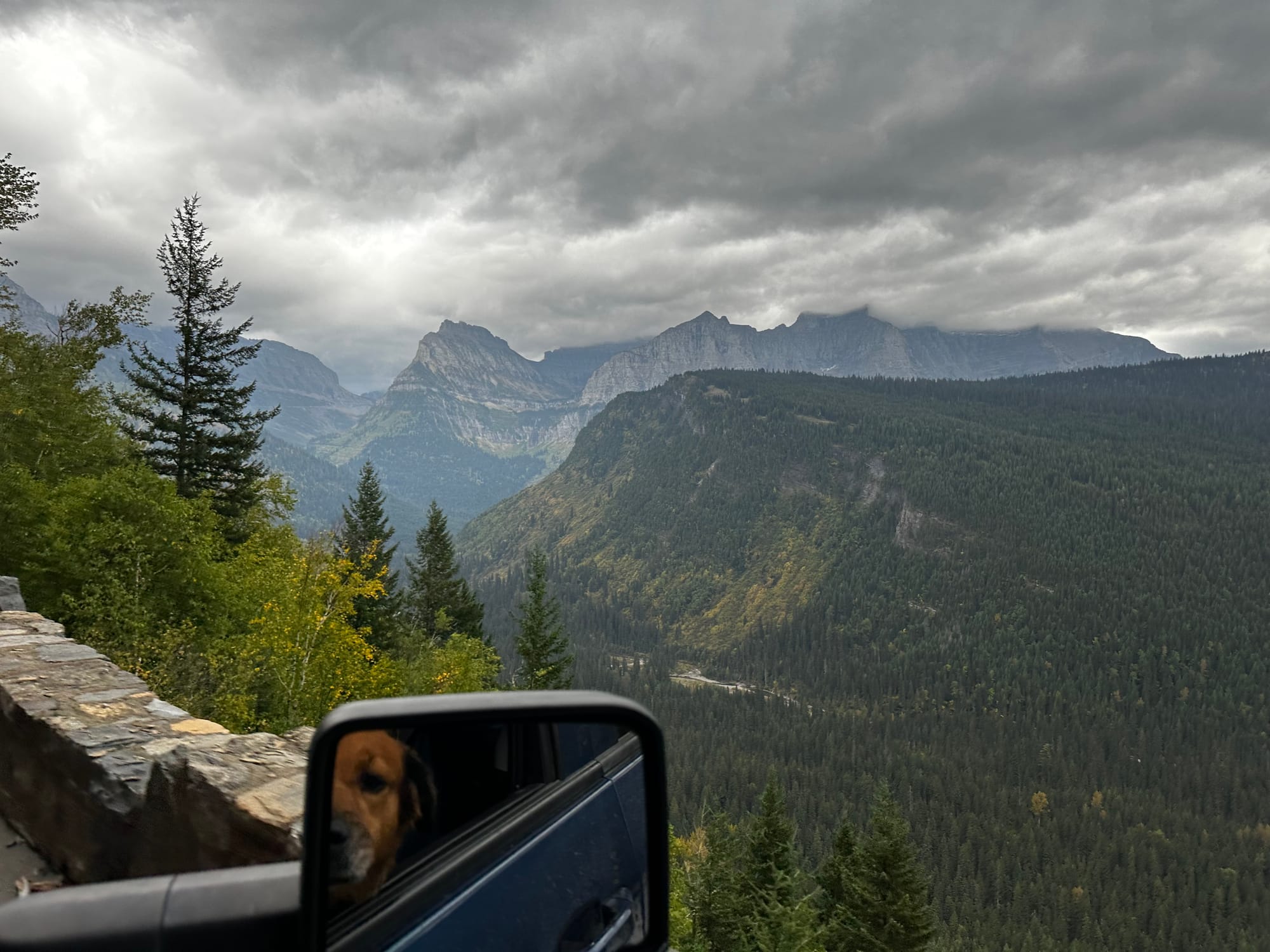
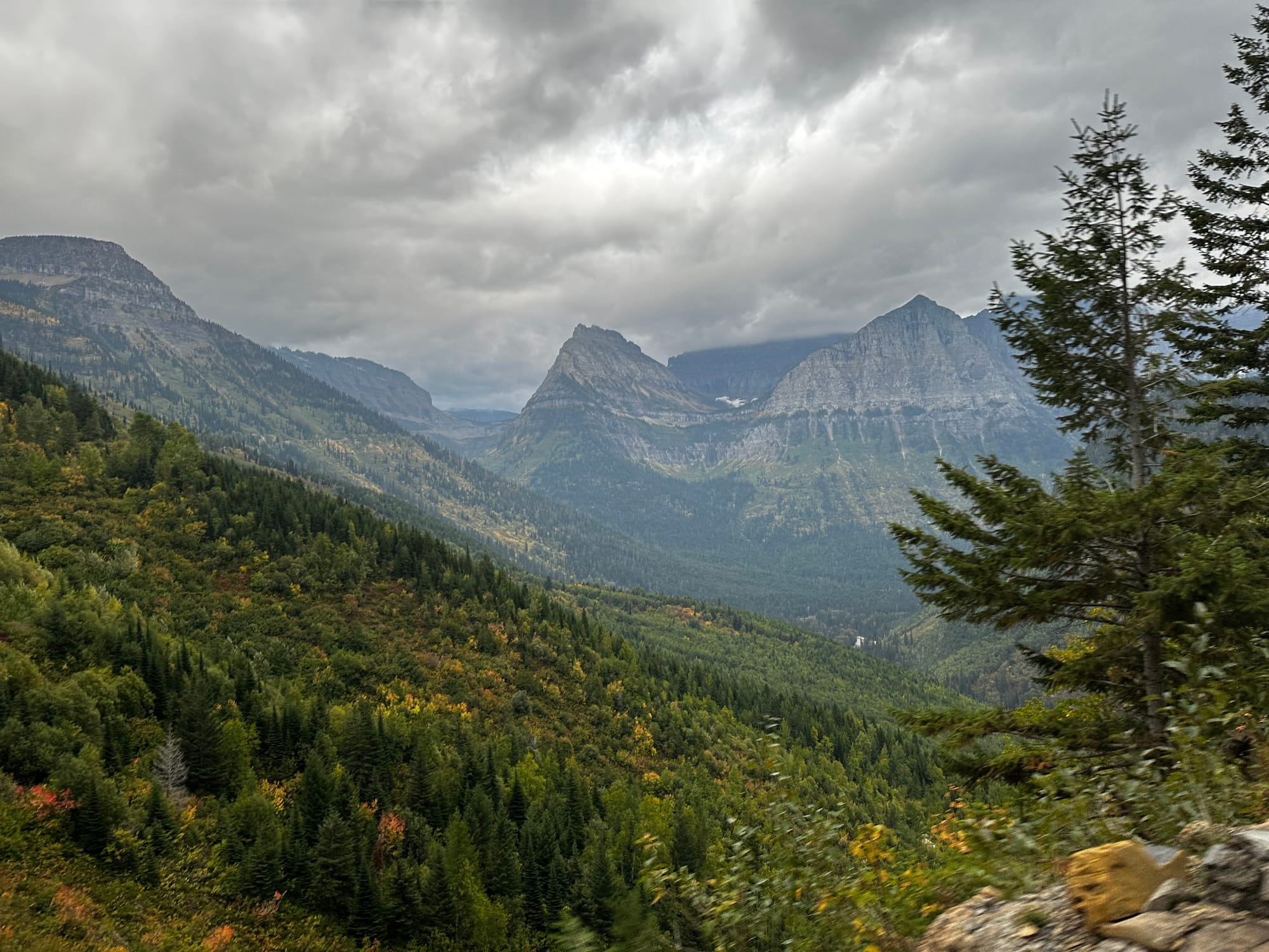
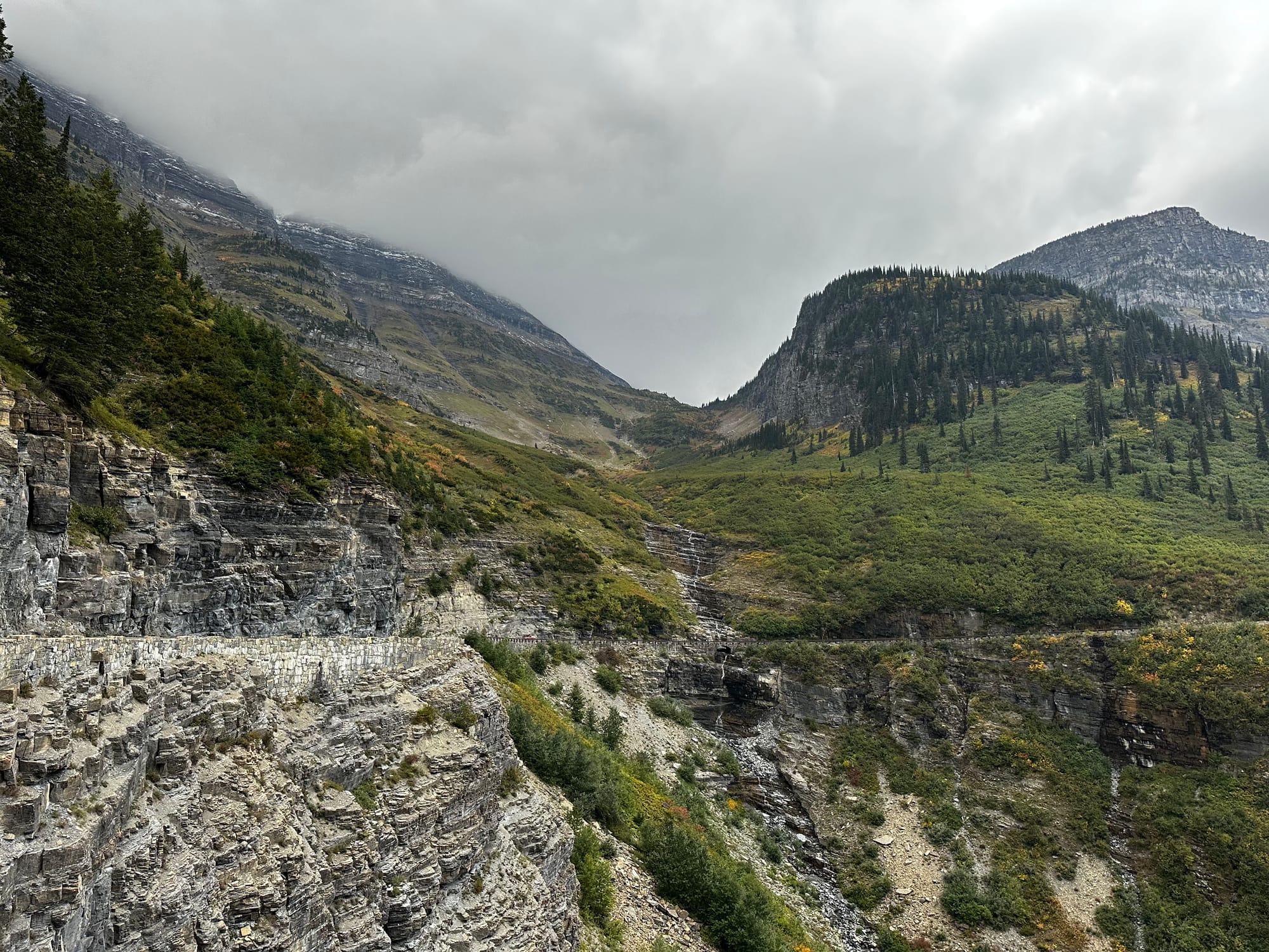
But the views are CRAZY on Going-to-the-Sun Road. It's the most stunning scenic drive, one where you have to stop at almost every pull-off to soak it in. The valley dropping out below and the mountains all around almost don't seem real.
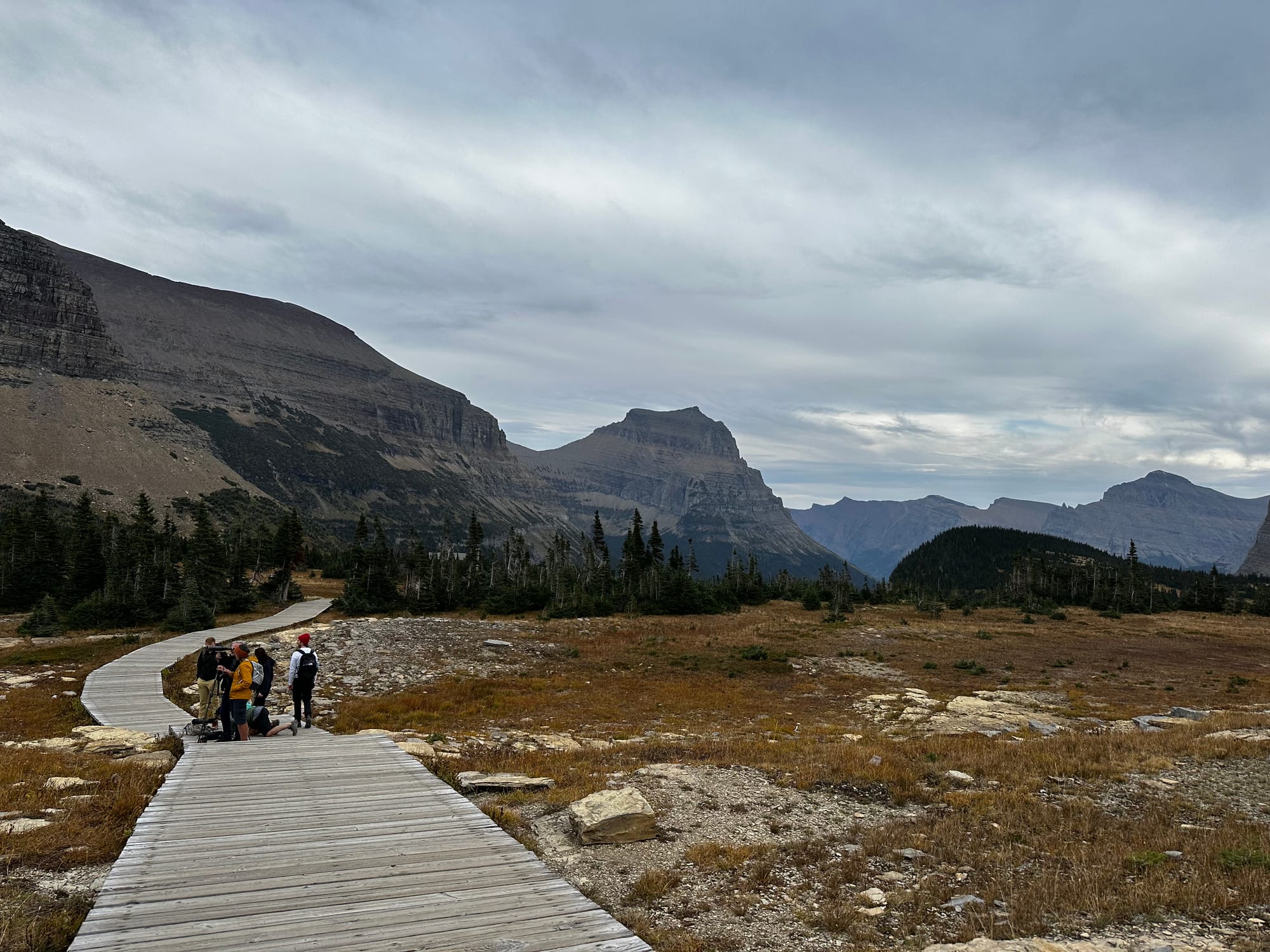
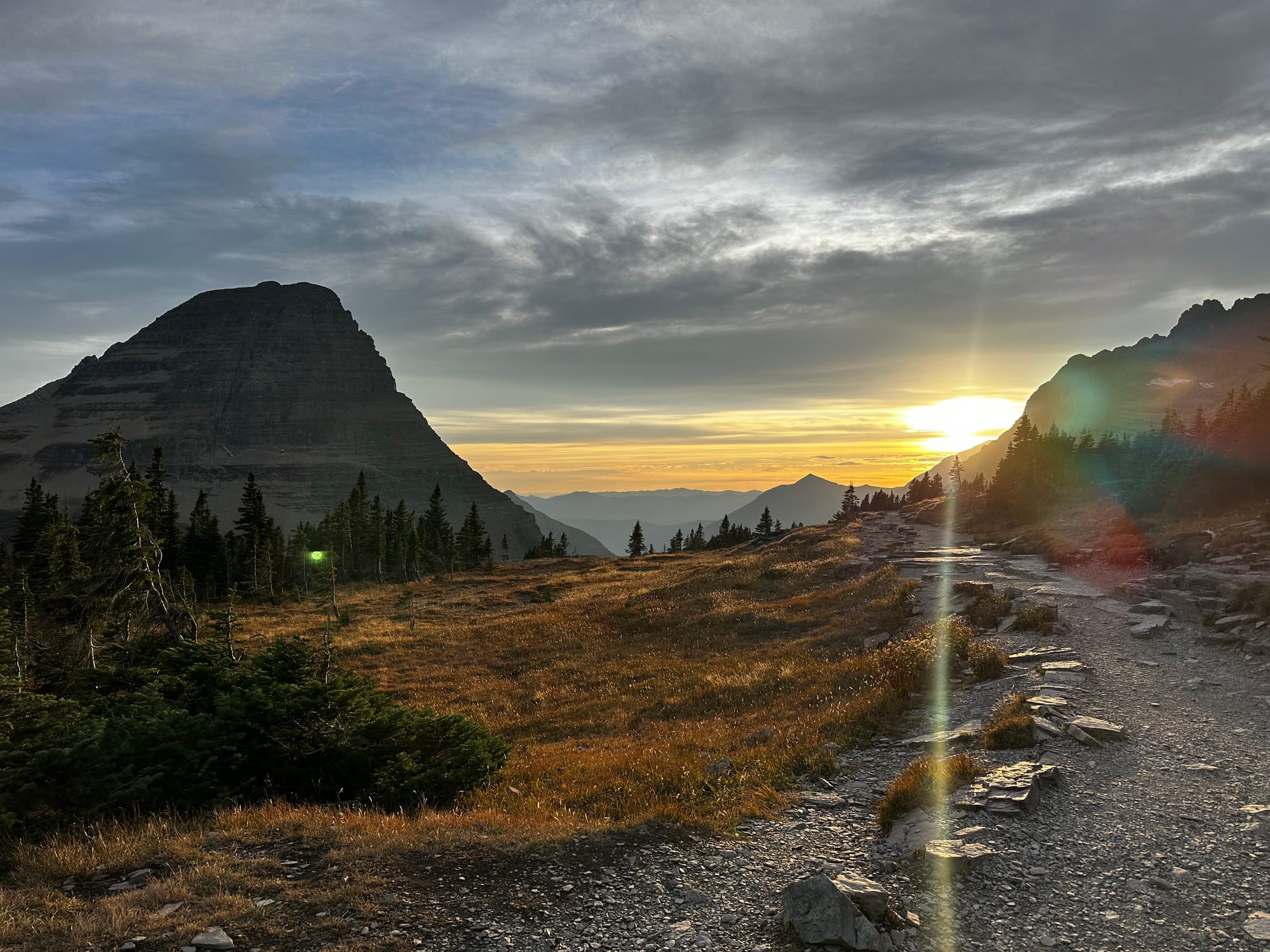
Logan's Pass is the highest point on the road. There's a visitor center and a bigger parking lot, and a couple of the most popular trailheads (the Highline Trail and Hidden Lake) start here – so it's busy, even late in the season. We tried stopping at Logan's Pass a couple times before we were finally able to get parking. If you go in the summer, take the shuttle or get there super early (or later in the evening!)
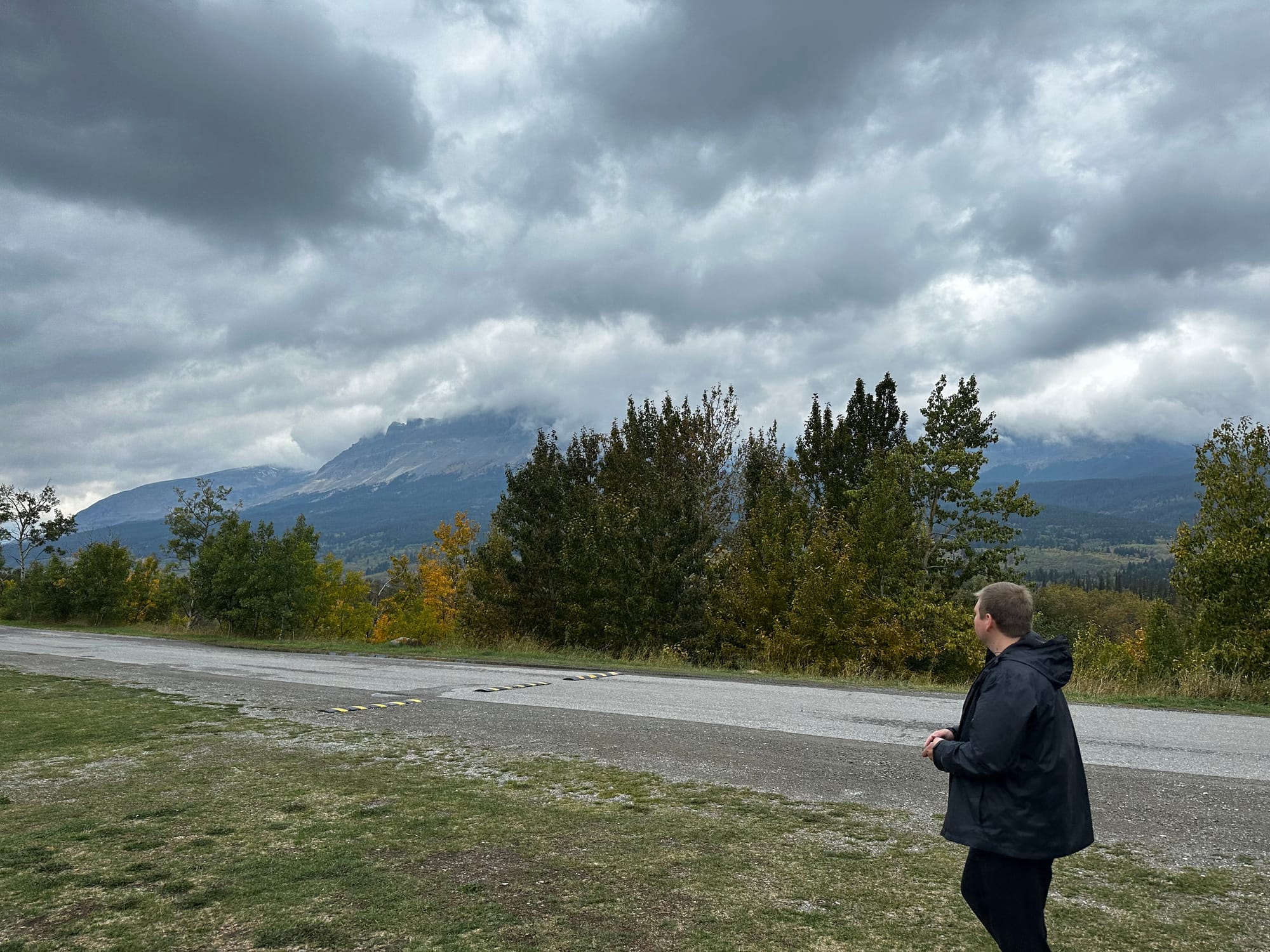
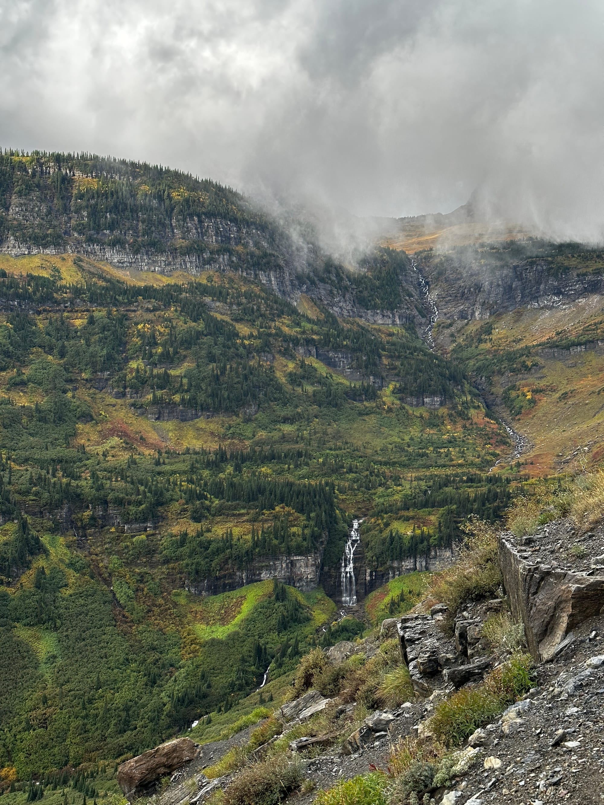
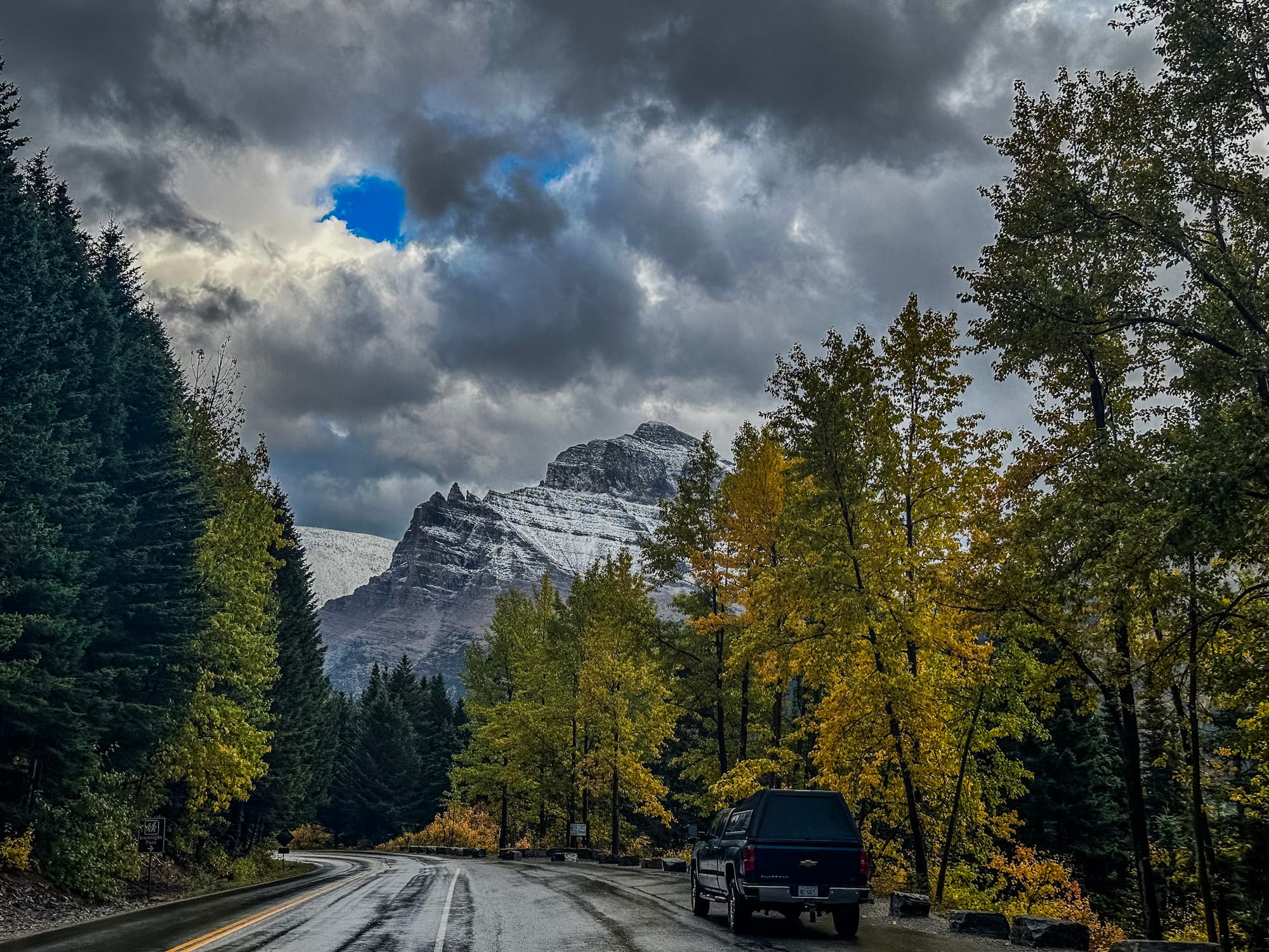
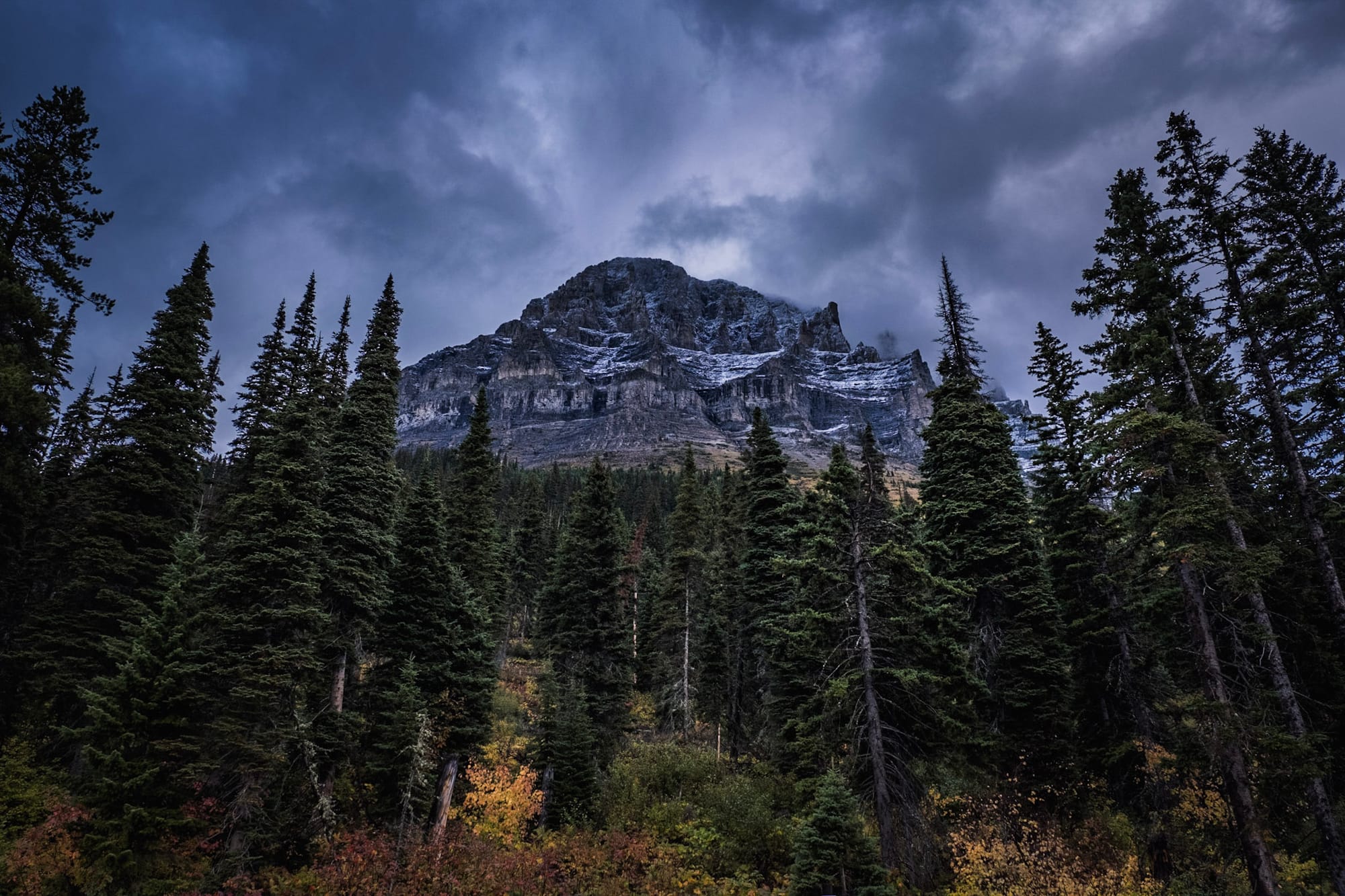
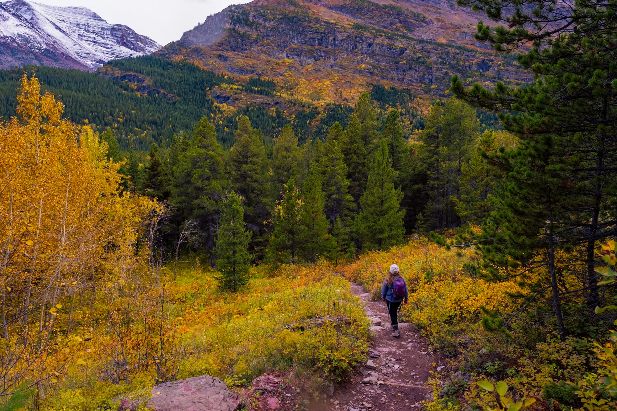
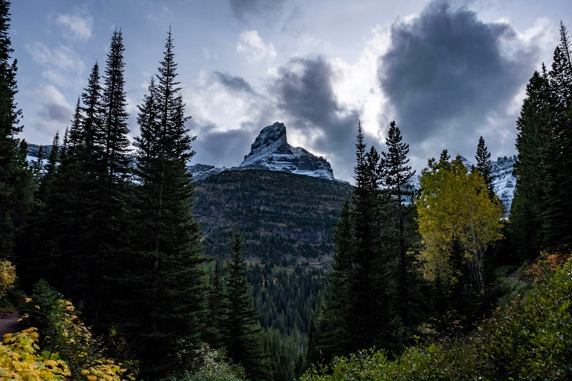
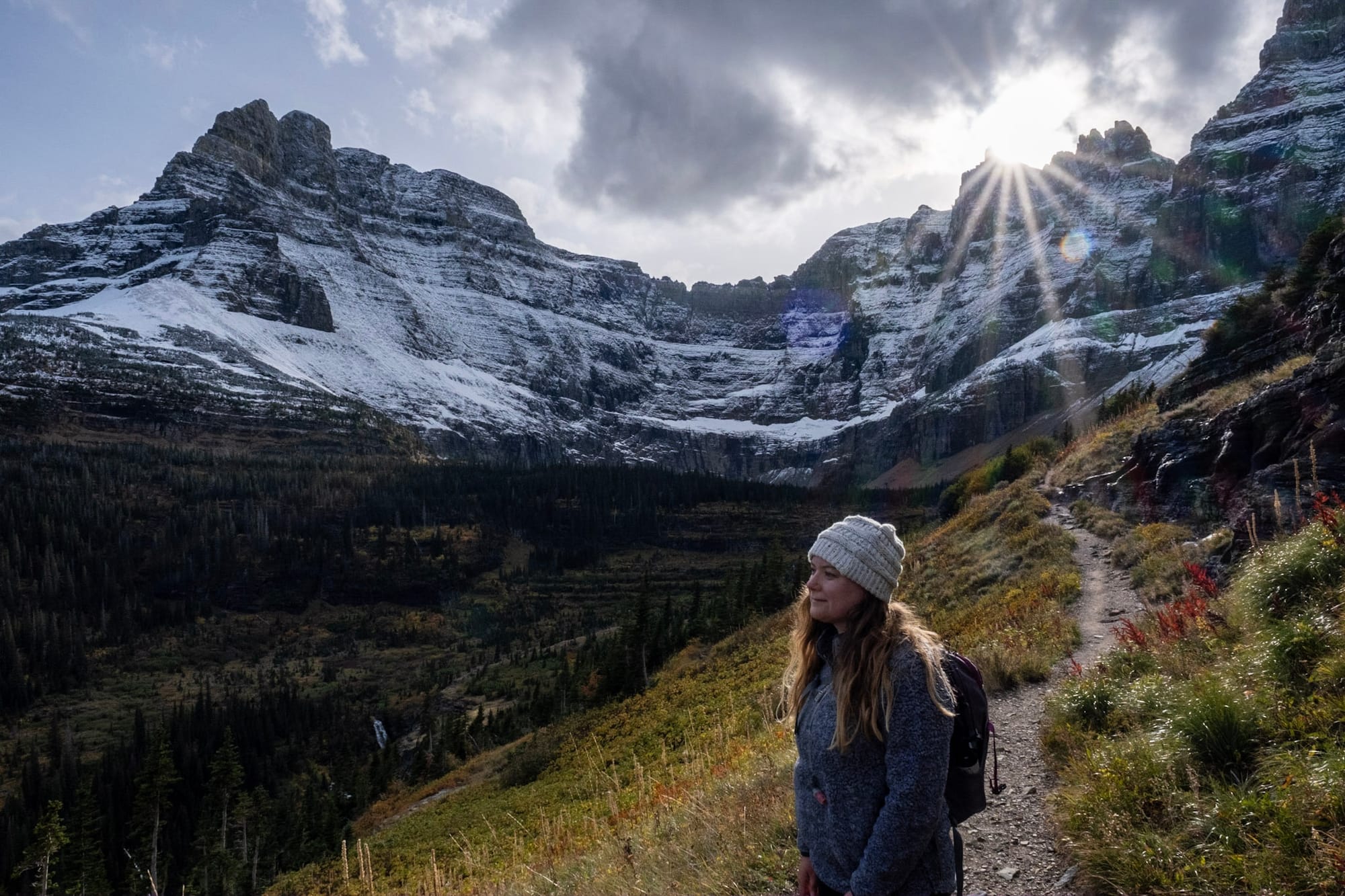
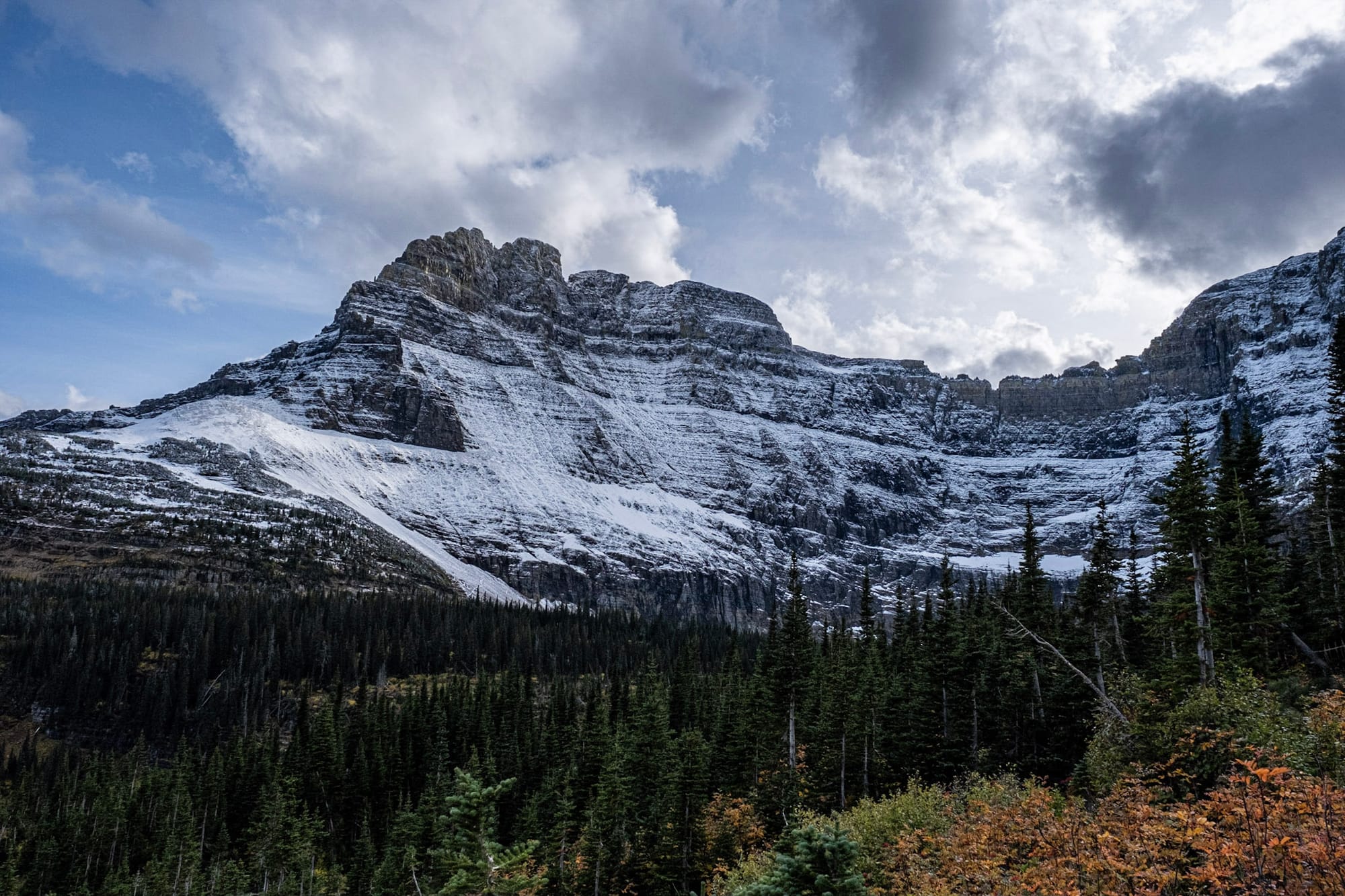
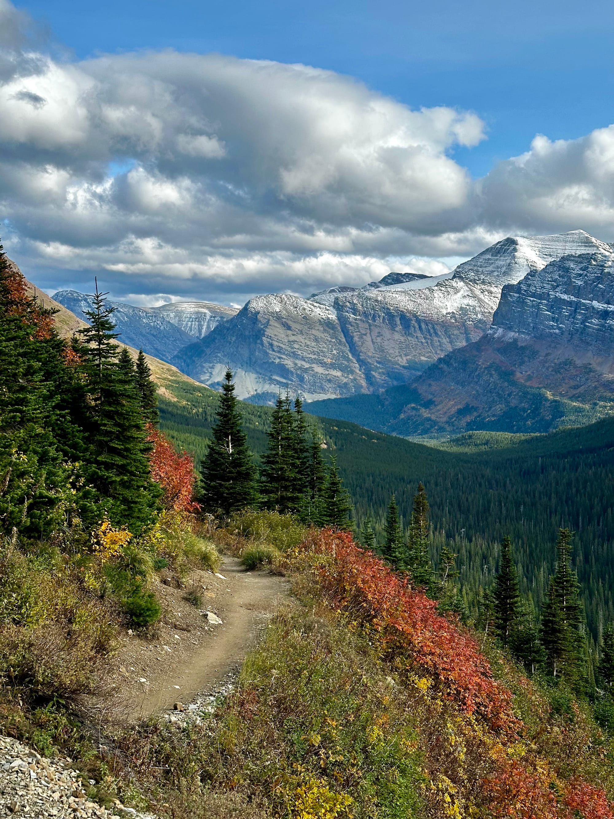
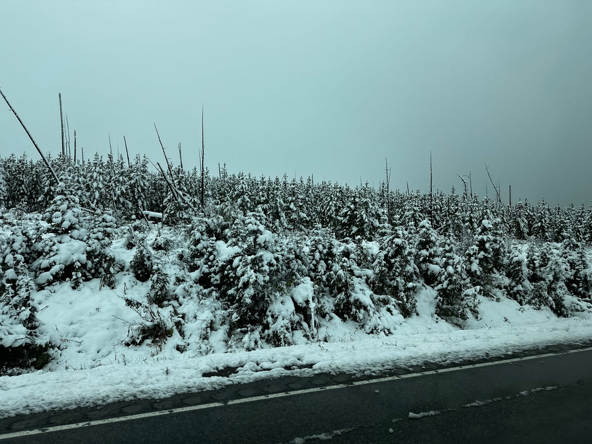
During our last week in Glacier, it started snowing up in the mountains. The highest section of Going-to-the-Sun Road actually closed down due to snow, which was sad, but we'd already driven it a few times at that point. And it was so beautiful seeing the snow against the fall colors.
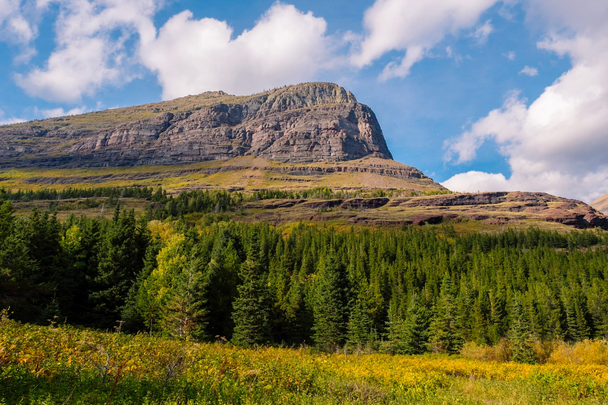
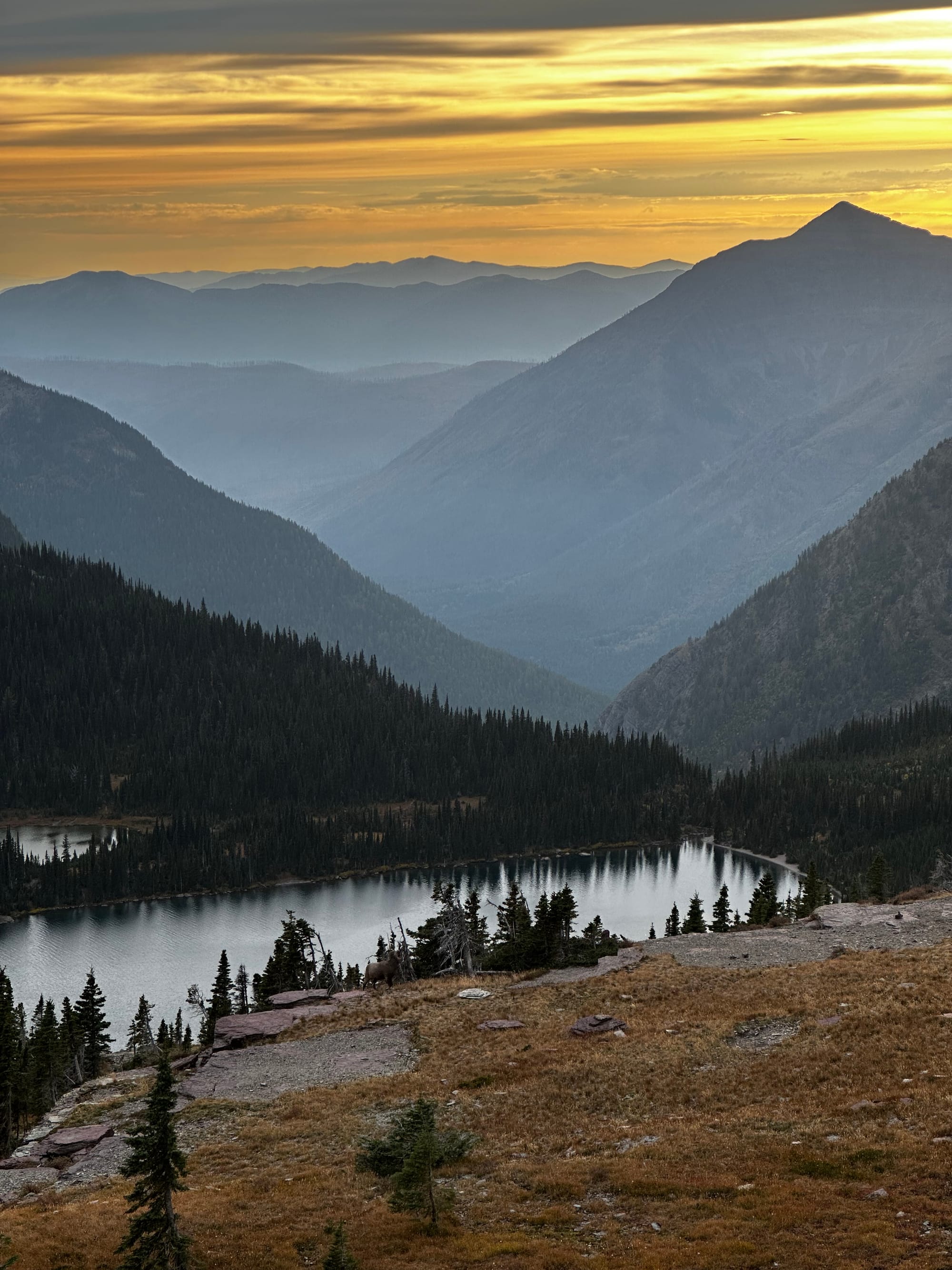
Many Glacier
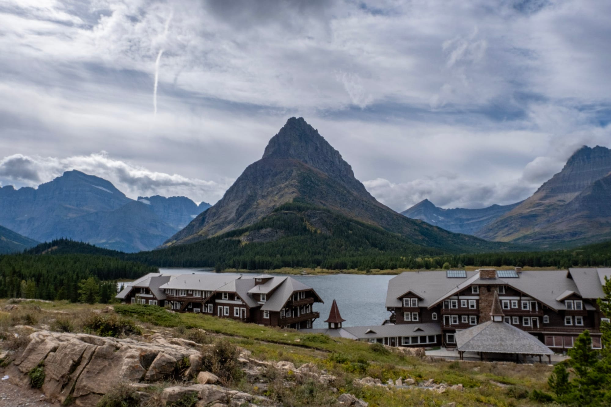
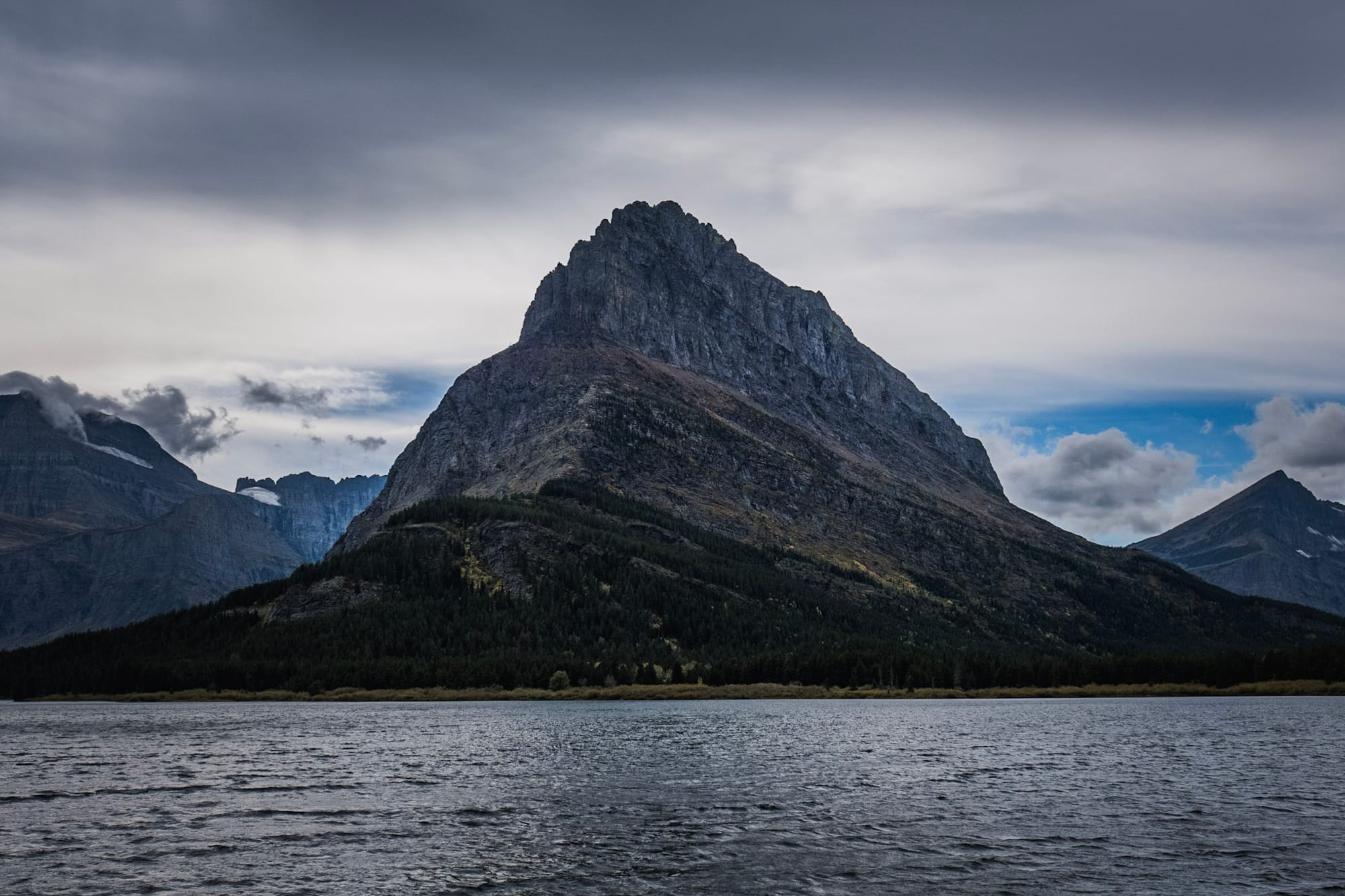
Many Glacier is a separate area of the park on the east side, about 30 minutes northwest of the main east entrance in St Mary. It feels remote – no cell service (like many areas in Glacier) and much of the drive there is on a long gravel road – but it's a popular place to visit. Going-to-the-Sun Road and the main park is stunning, but Many Glacier is equally beautiful; we fell in love with it. It's a small area to drive through, but has a hotel, campground, ranger station, and is the starting point for a lot of great hiking trails.
The Many Glacier Hotel is another old, beautiful Swiss-style lodge on the shore of Swiftcurrent Lake. It was closed for the season, so we parked in the mostly empty lot and walked around to take in the views. It was very peaceful and beautiful (I'm over-using the word "beautiful" in this blog). We could definitely picture living in Many Glacier for a season.
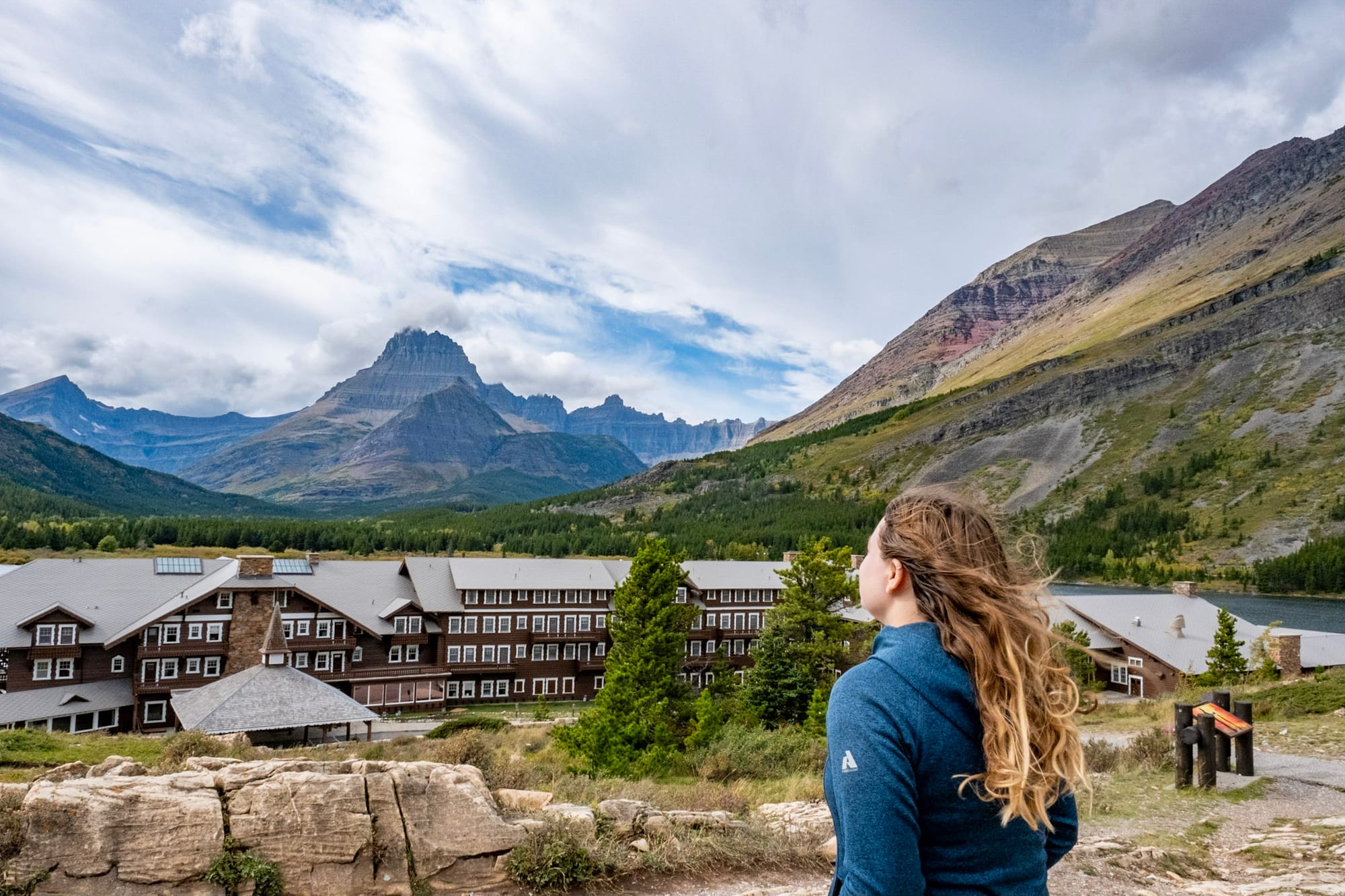
Many Glacier Hotel area
More hiking!
Glacier has some amazing hiking with over 700 miles of trails, which we only did a fraction of. There are a lot of long hikes that take several hours (or days if you make it a backpacking trip) but also a good amount of shorter ones that give you a nice taste of different areas of the park.
Like everywhere we've been, I have a list of things to do the next time we visit, including:
- The famous Highline Trail, which starts at Logan's Pass. I really wanted to do at least part of this one, but sadly, Going-to-the-Sun Road closed for snow before we had the chance. But it looks super cool; the first part of the trail is narrow and exposed as it follows along the side of the mountain.
- The Grinnell Glacier trail, a very popular long hike starting in Many Glacier. In between working, bad weather, and doing a lot of short hikes and other sightseeing, we ended up with only one day left to do a long hike, and we chose a different one.
- So many other trails!! A lot of the long ones look gorgeous, and it would be so fun to backpack and camp out in the mountains.
Here's a quick look at the trails we did hike!
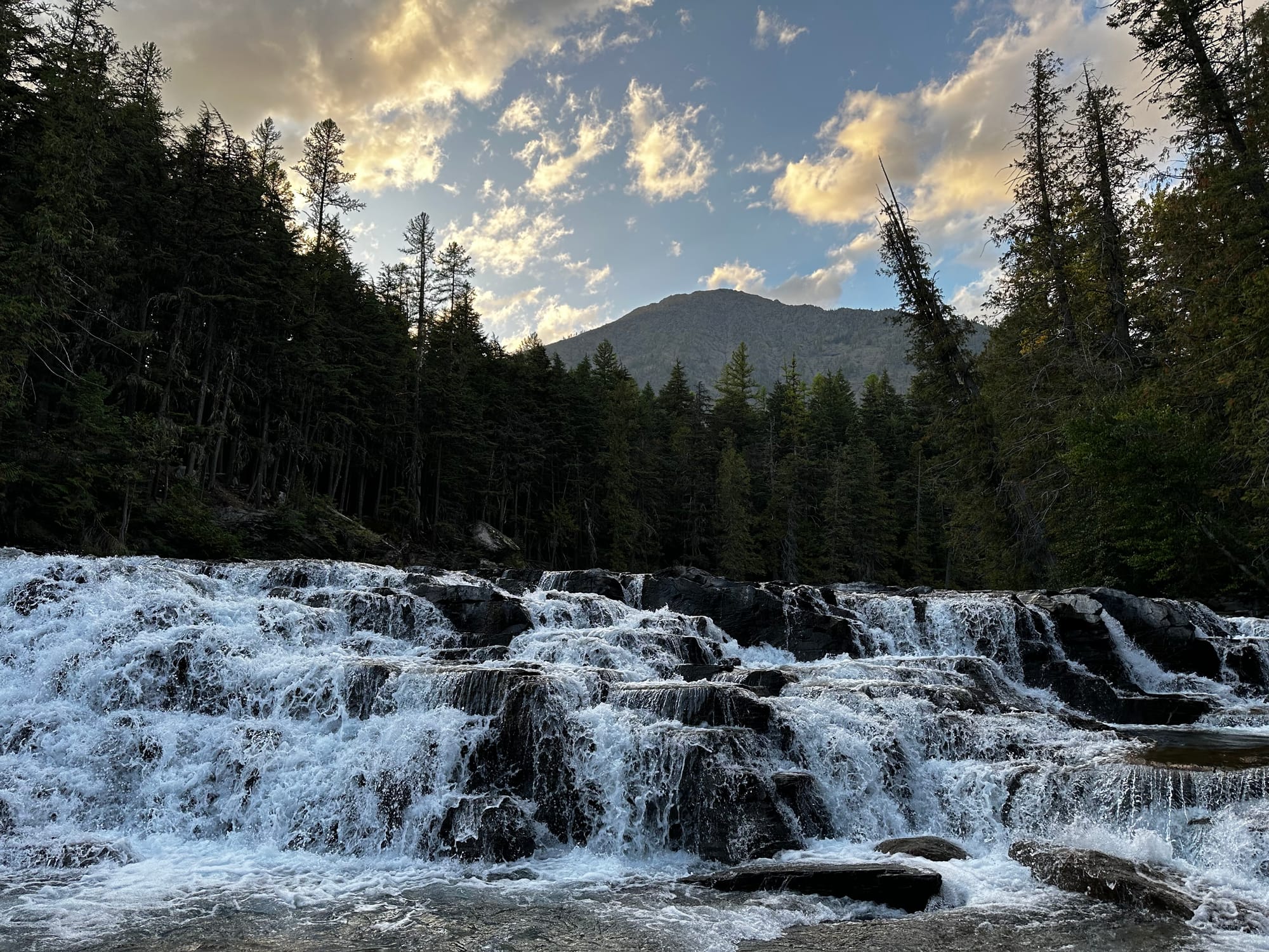
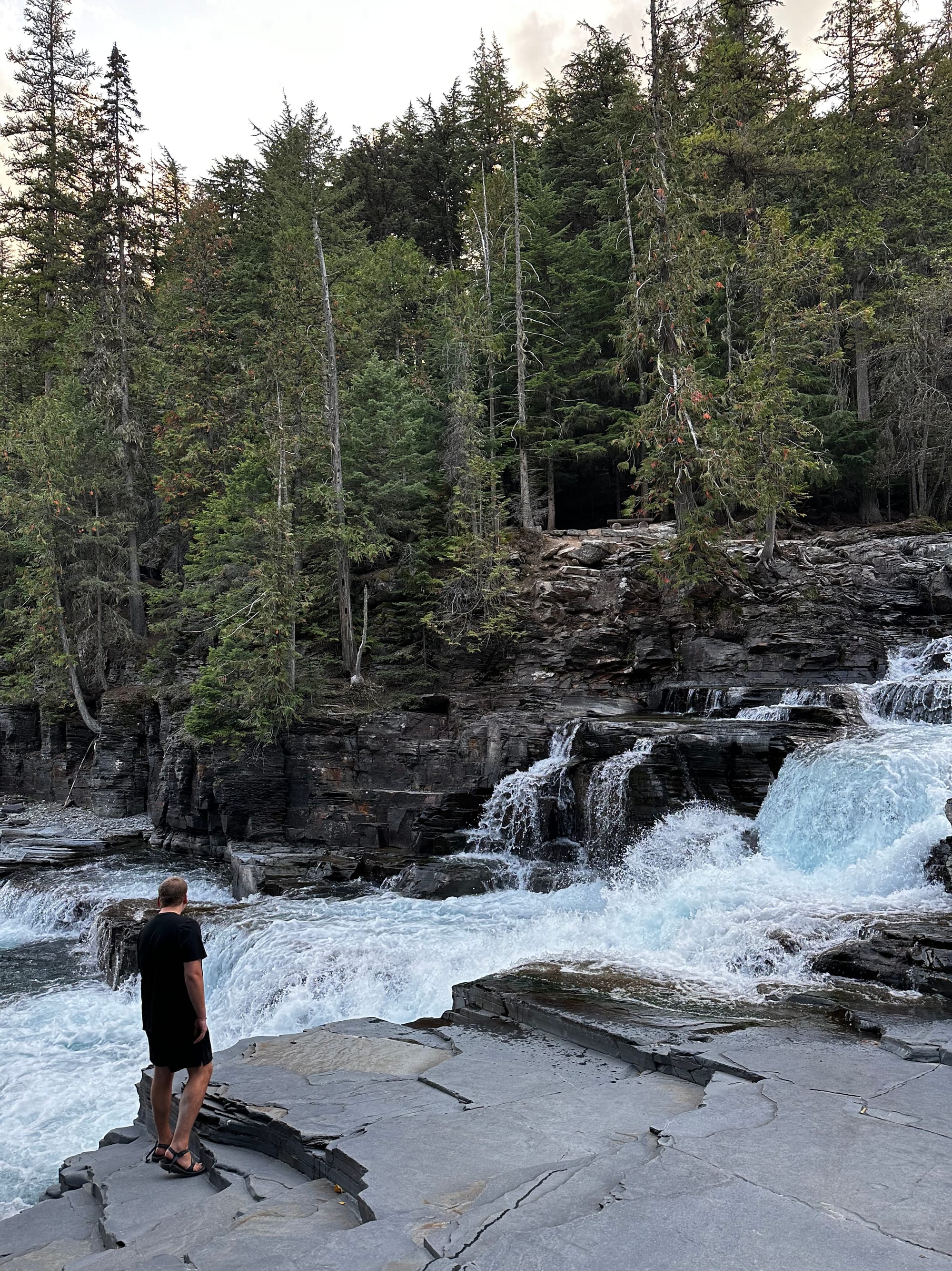
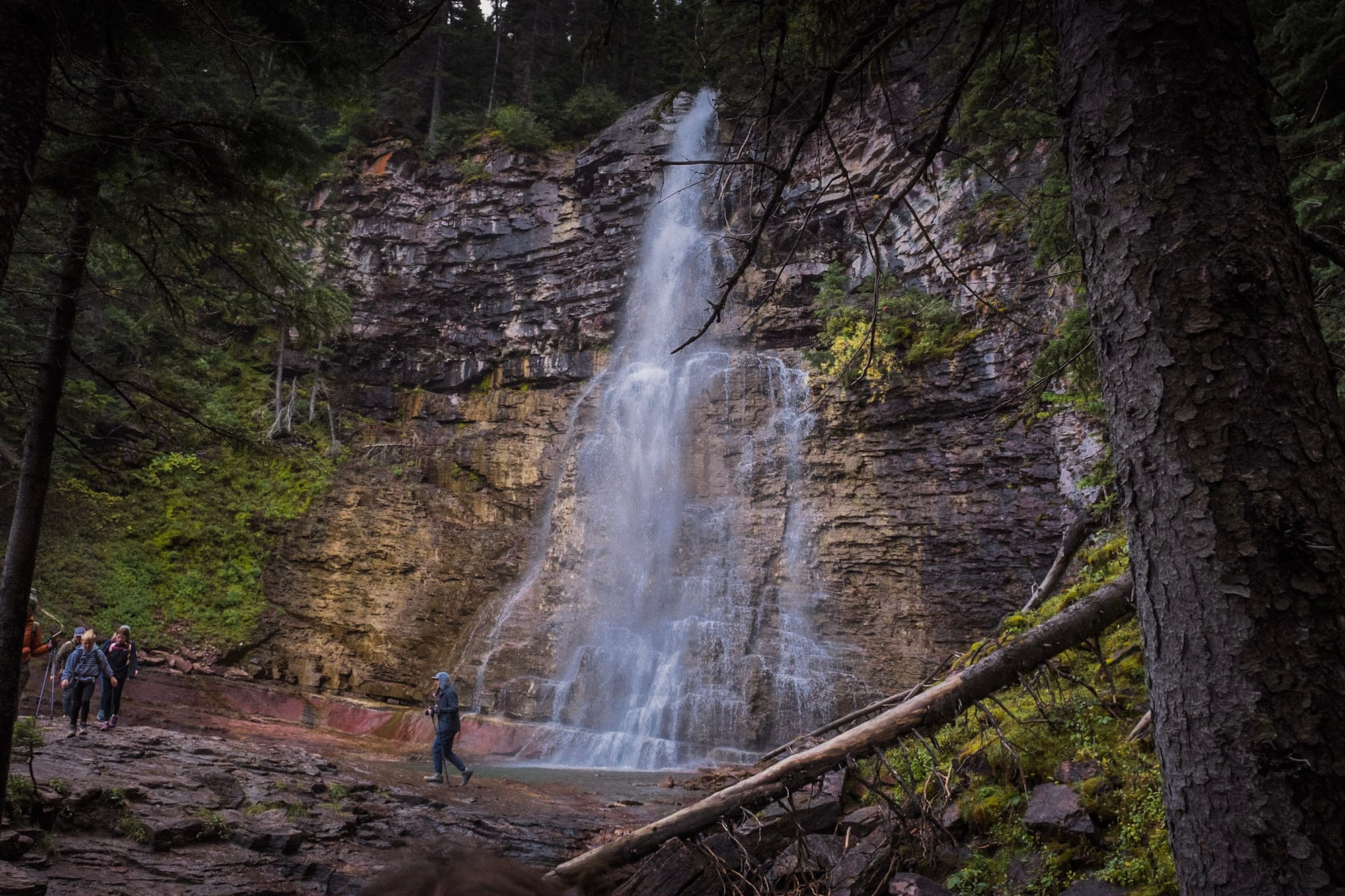
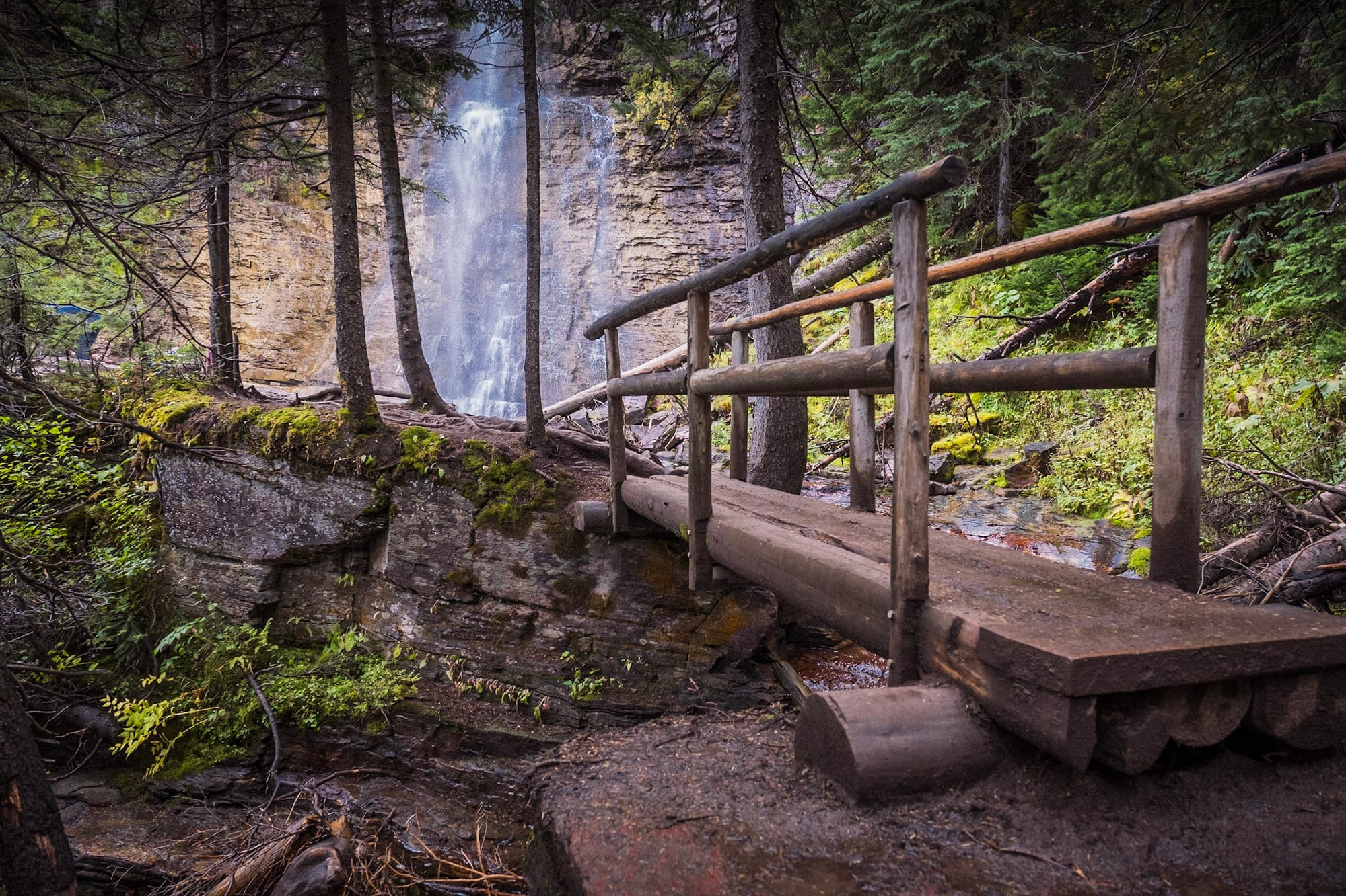
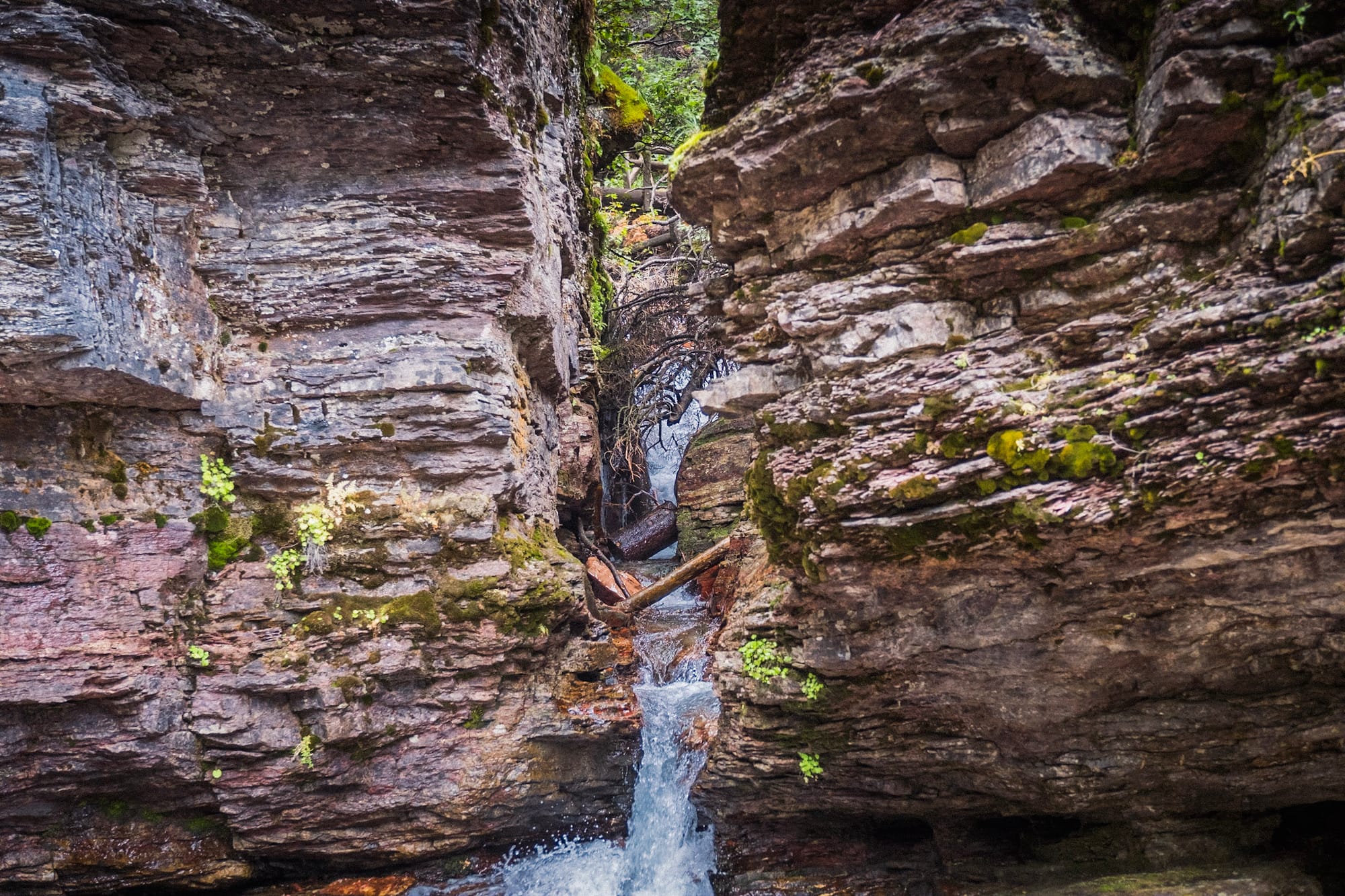
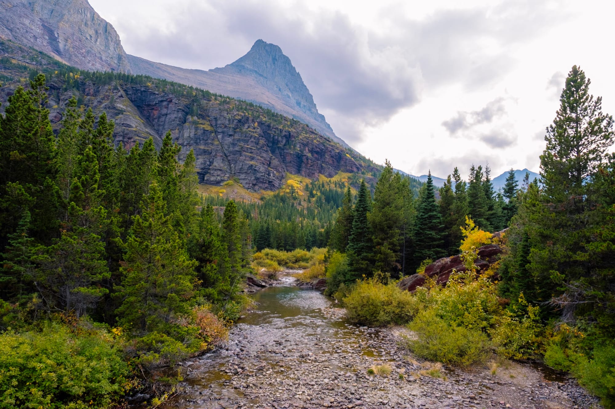
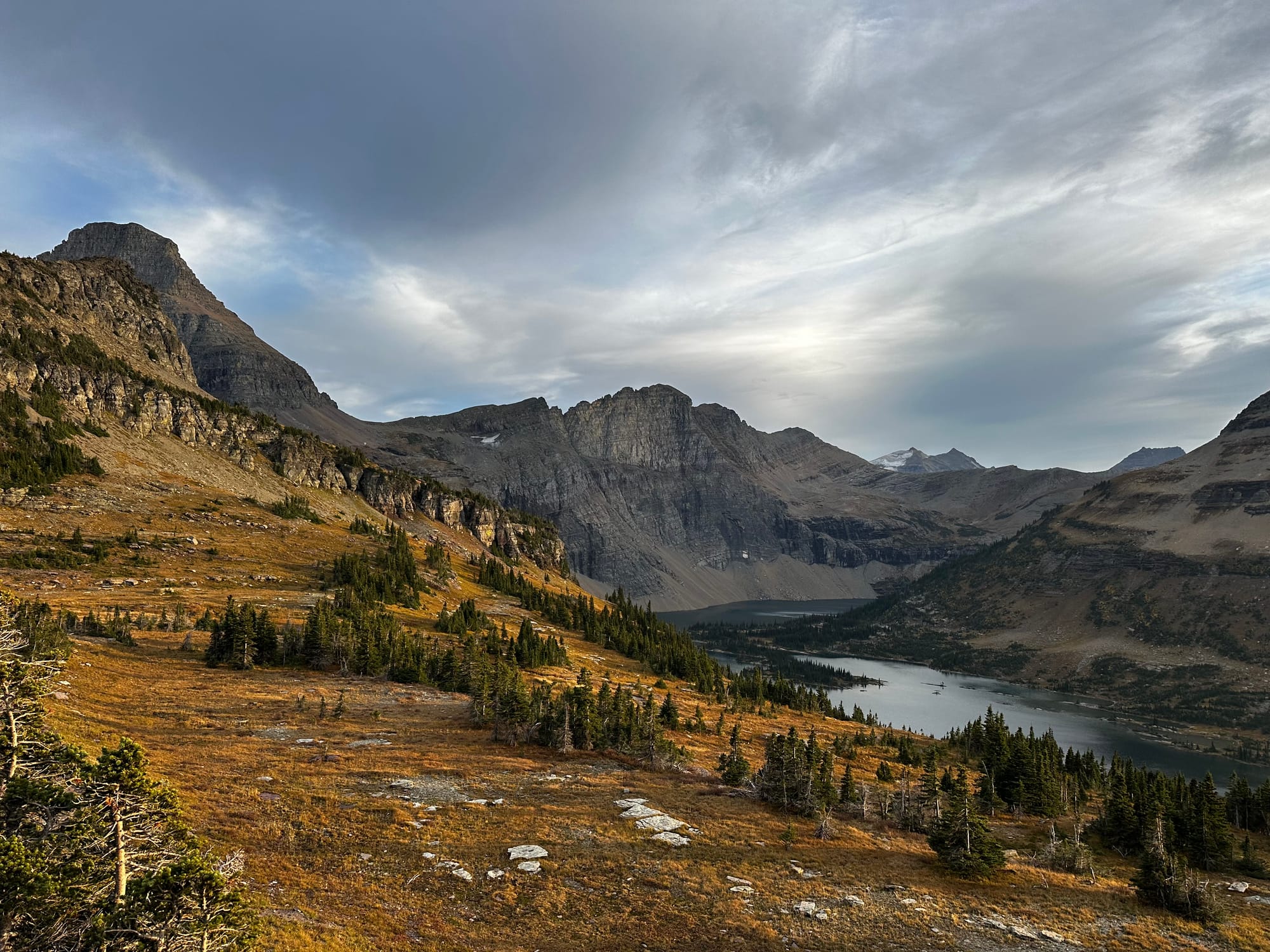
St Mary & Virginia Falls
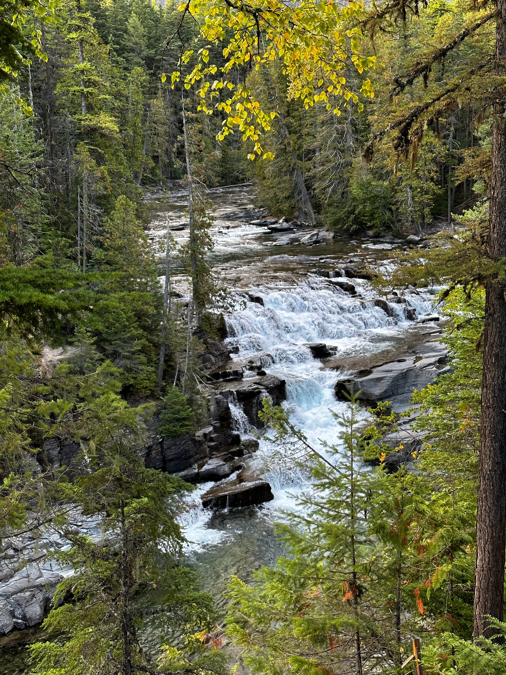
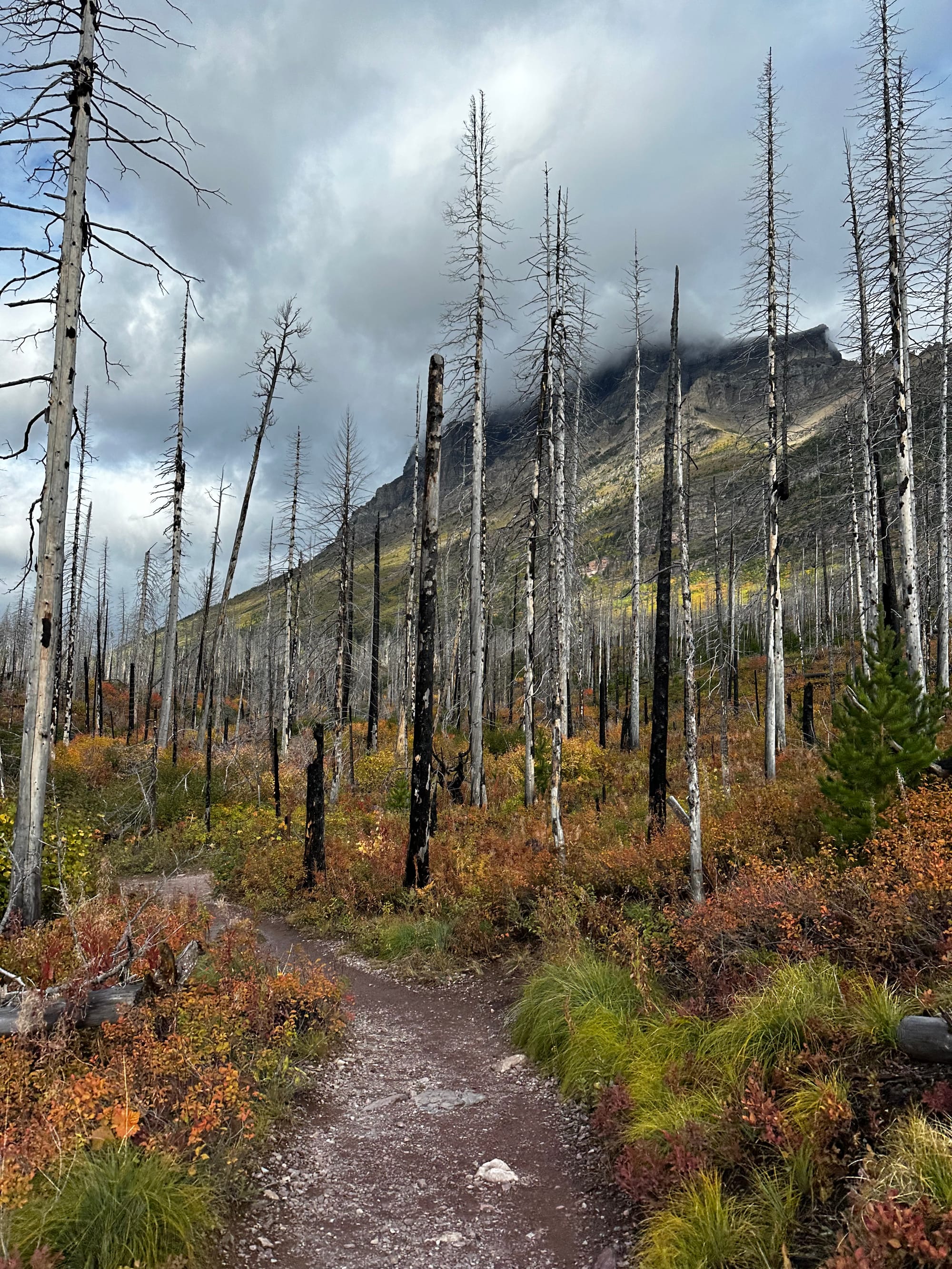
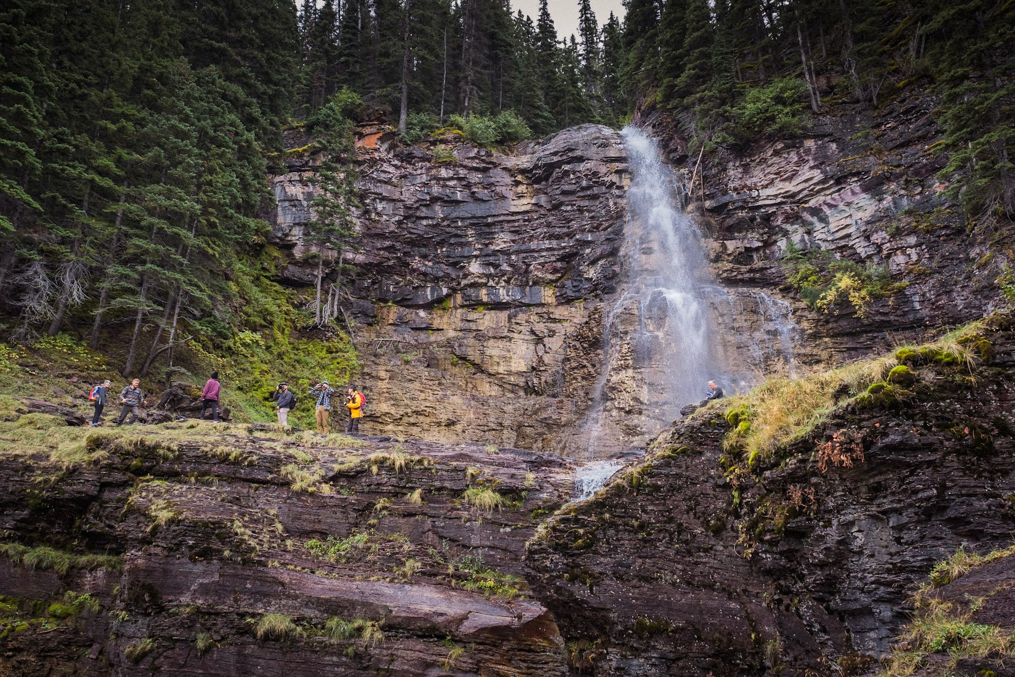
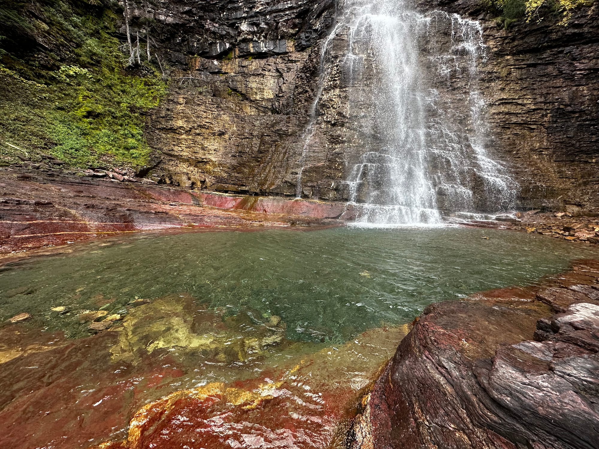
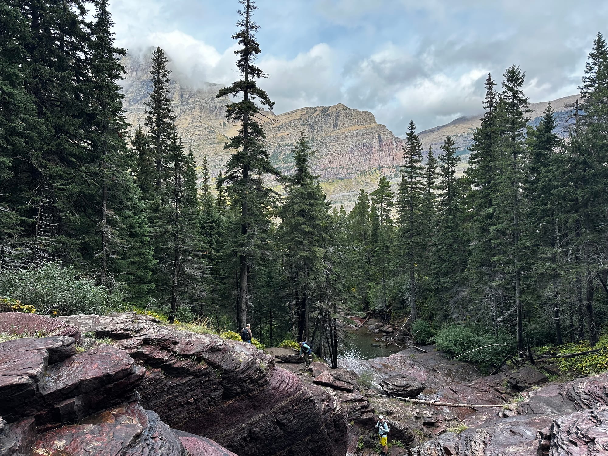
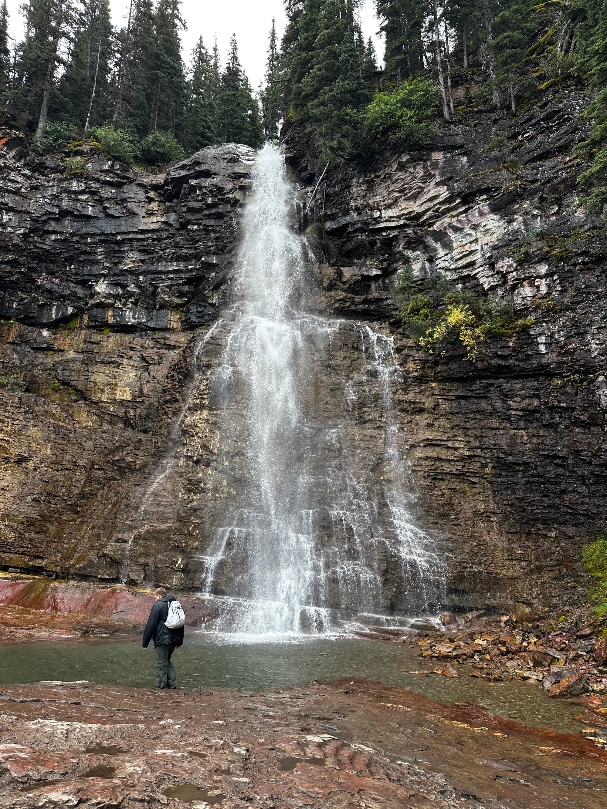
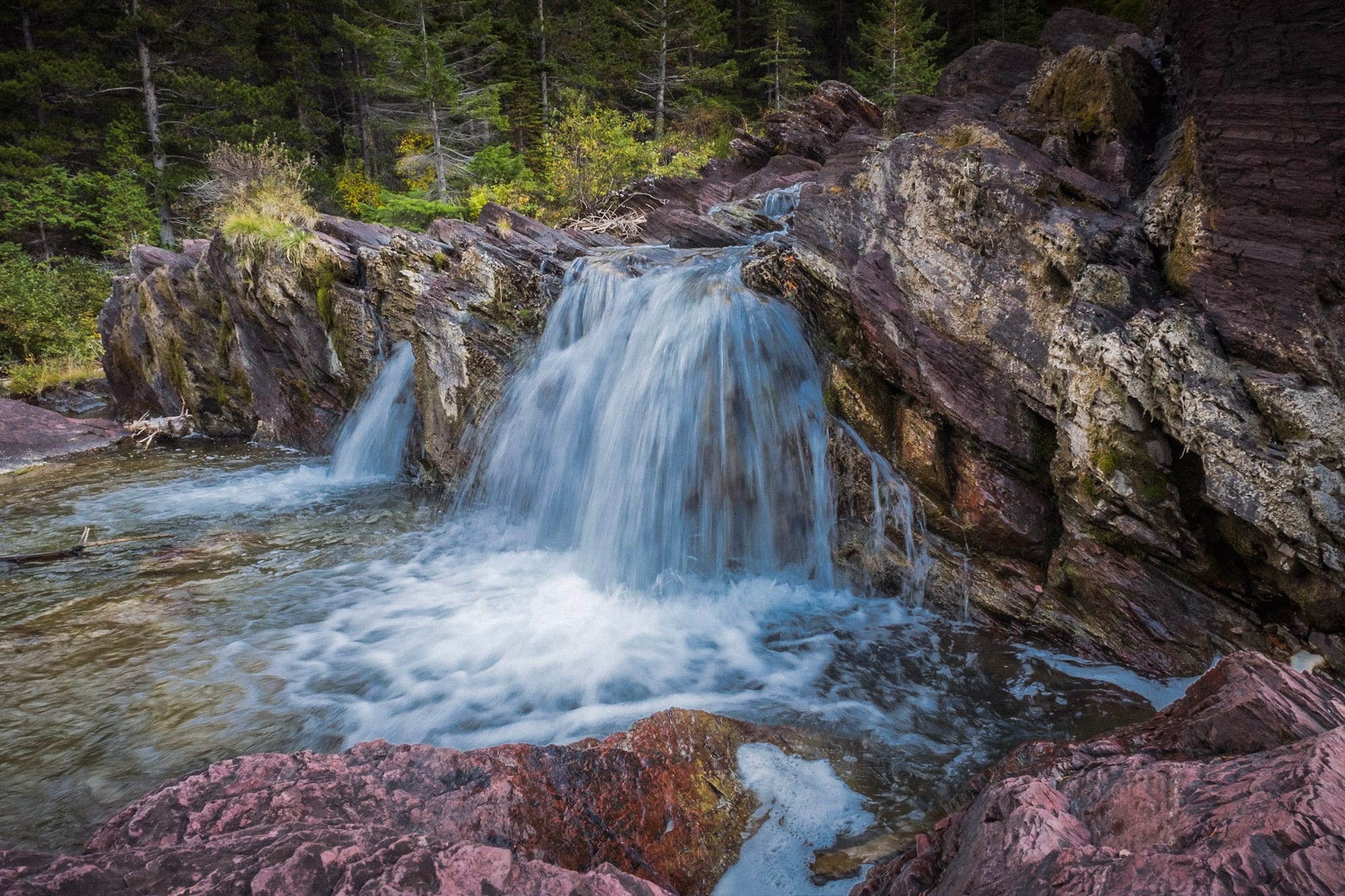
This was an easy hike that was almost 4 miles total, close to the east park entrance. From the parking area, we hiked downhill through some burned forests before reaching the river and the first waterfall, St Mary Falls. It was a small but pretty waterfall; the water was a vivid deep blue.
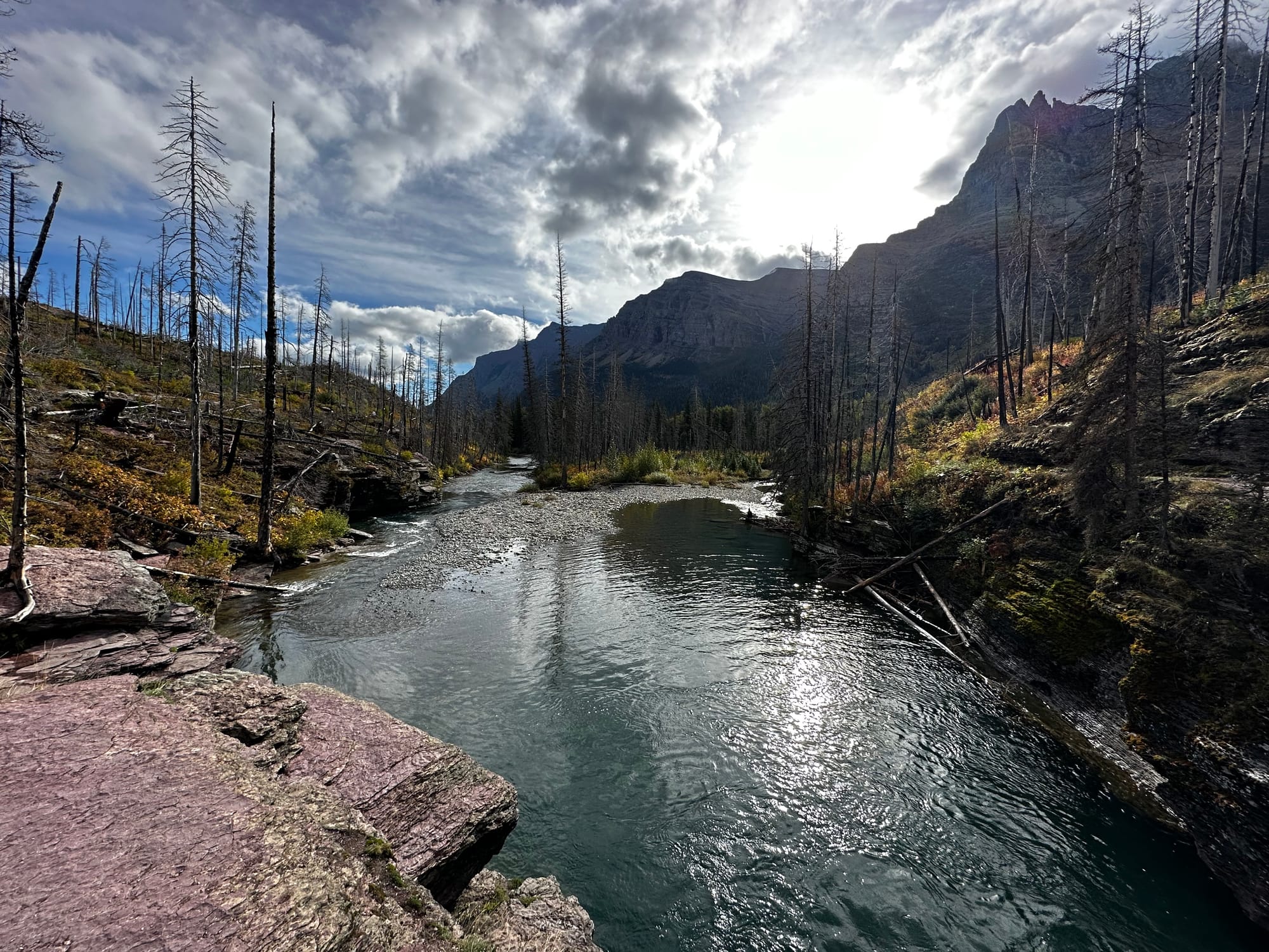
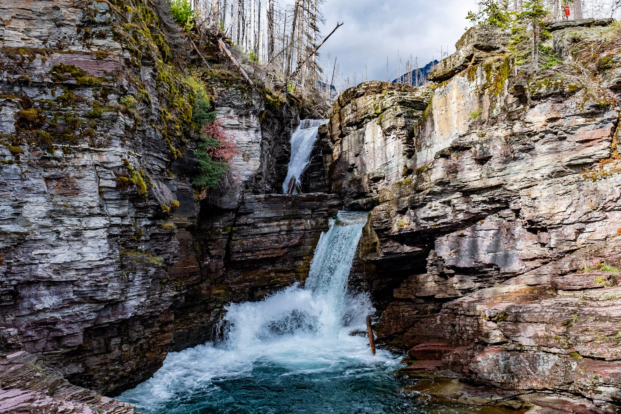
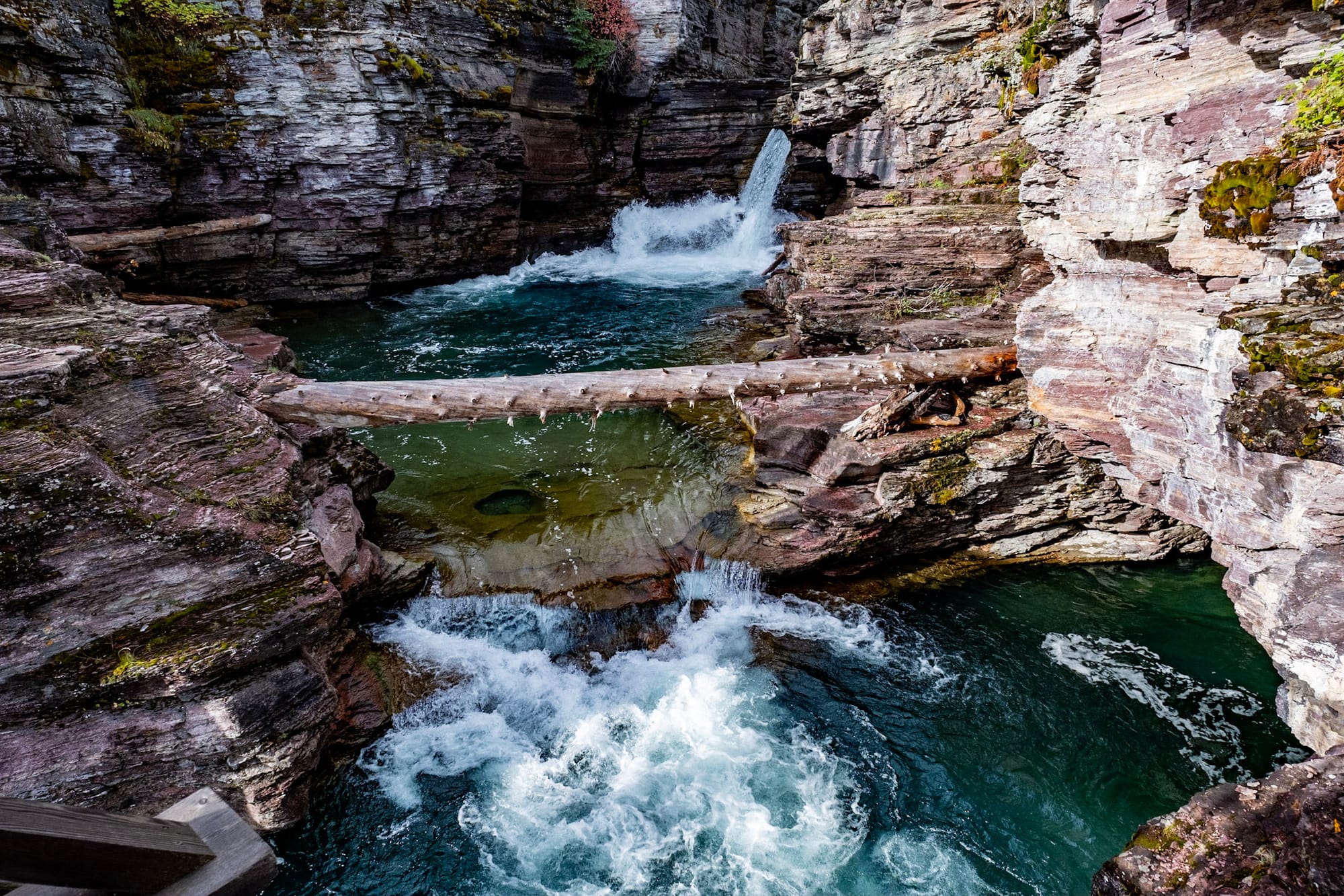
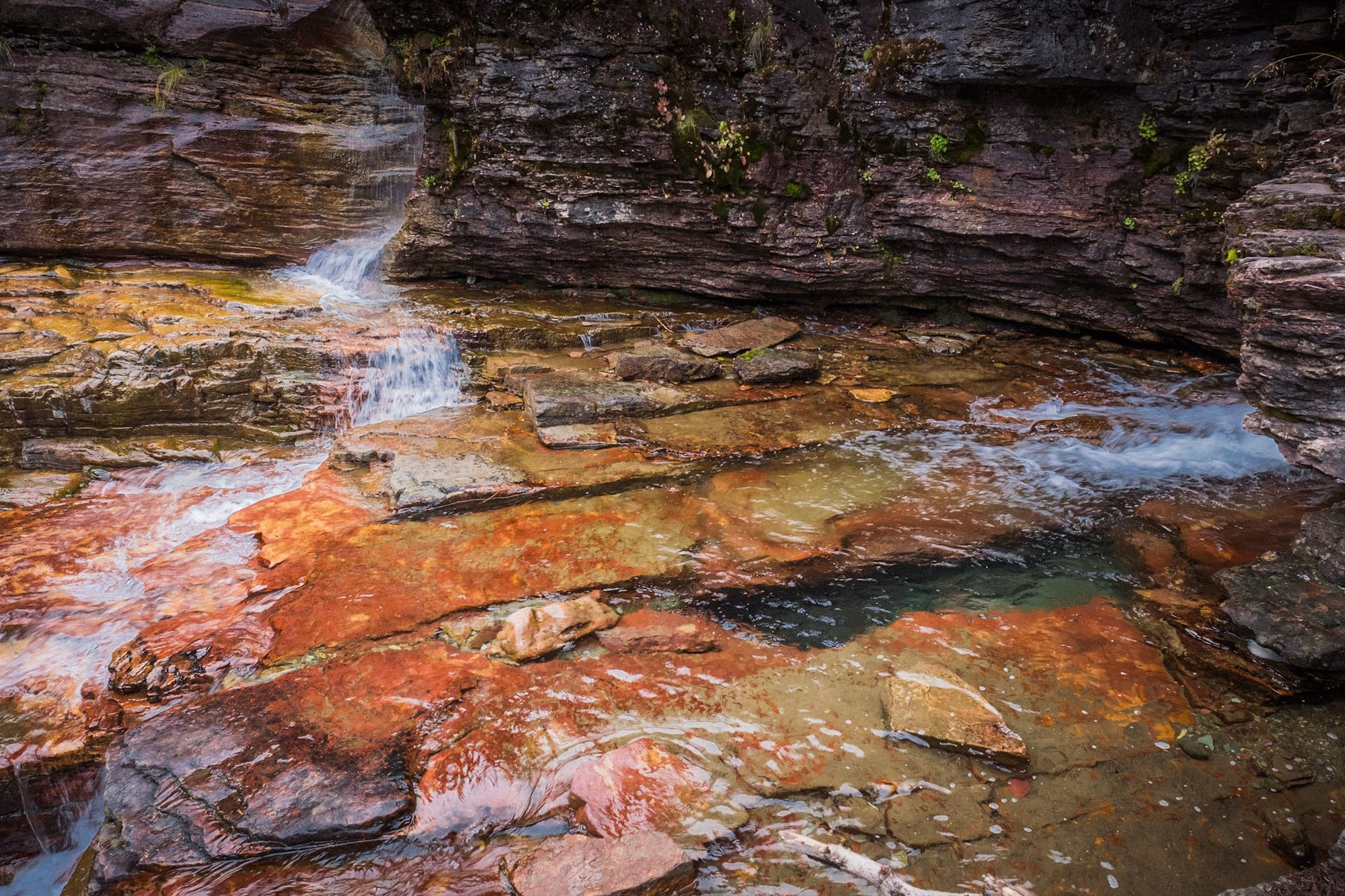
Then the trail climbed back up through the forest (with nice mountain views behind us) following the stream until Virginia Falls emerged. This waterfall is much taller and gorgeous, with bright red and orange rocks in the pool below.
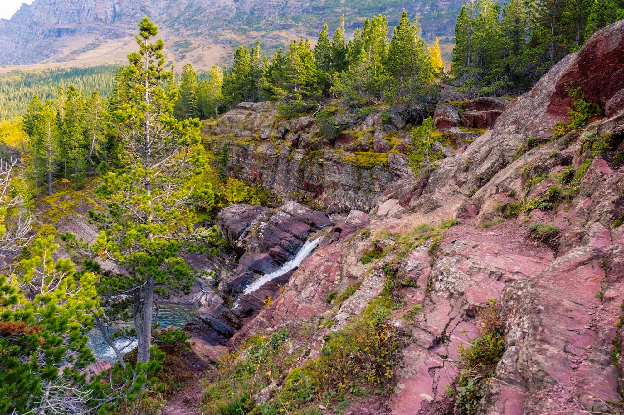
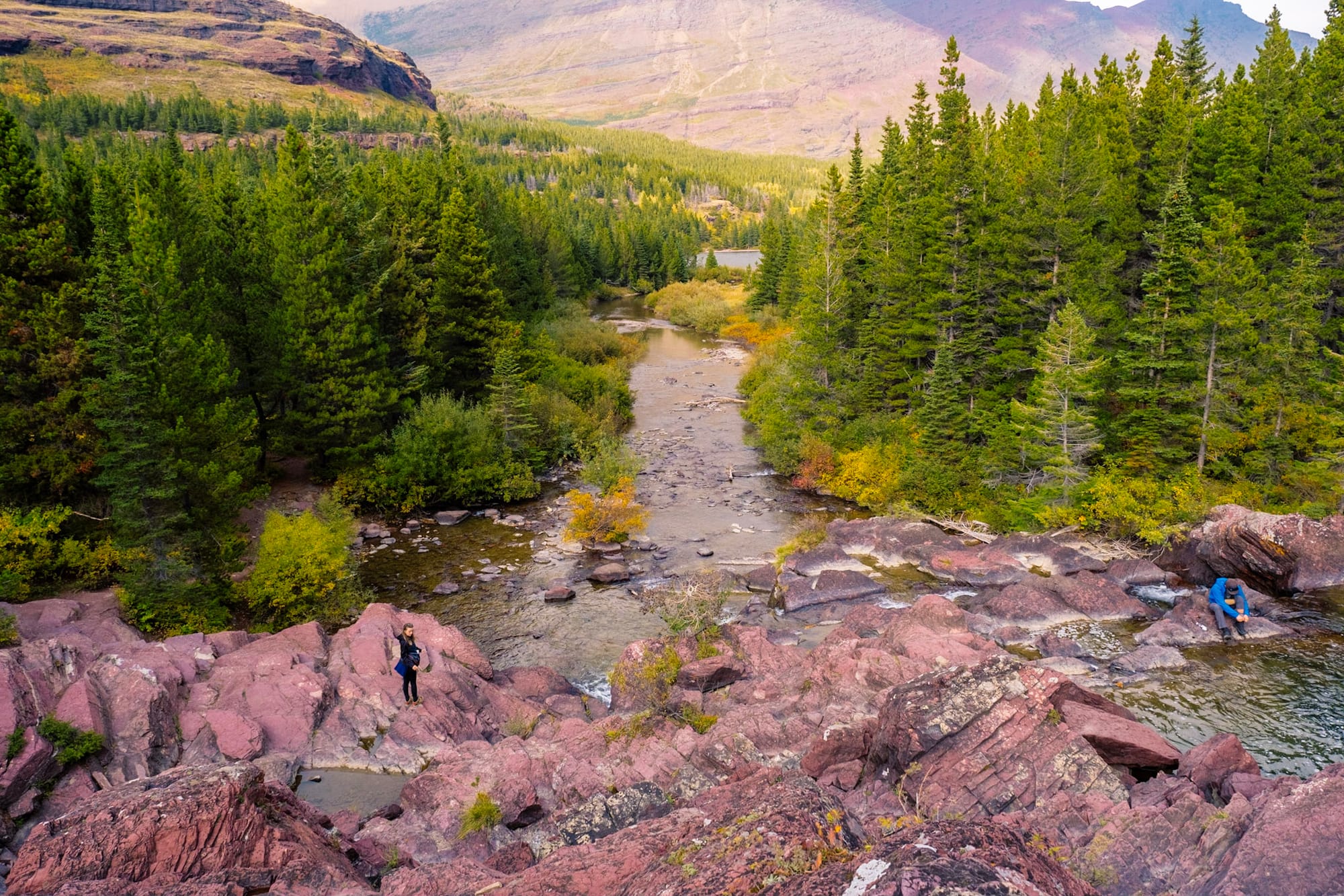
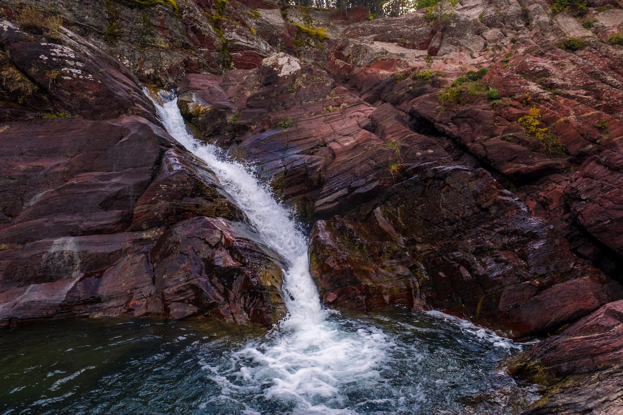
Redrock Falls
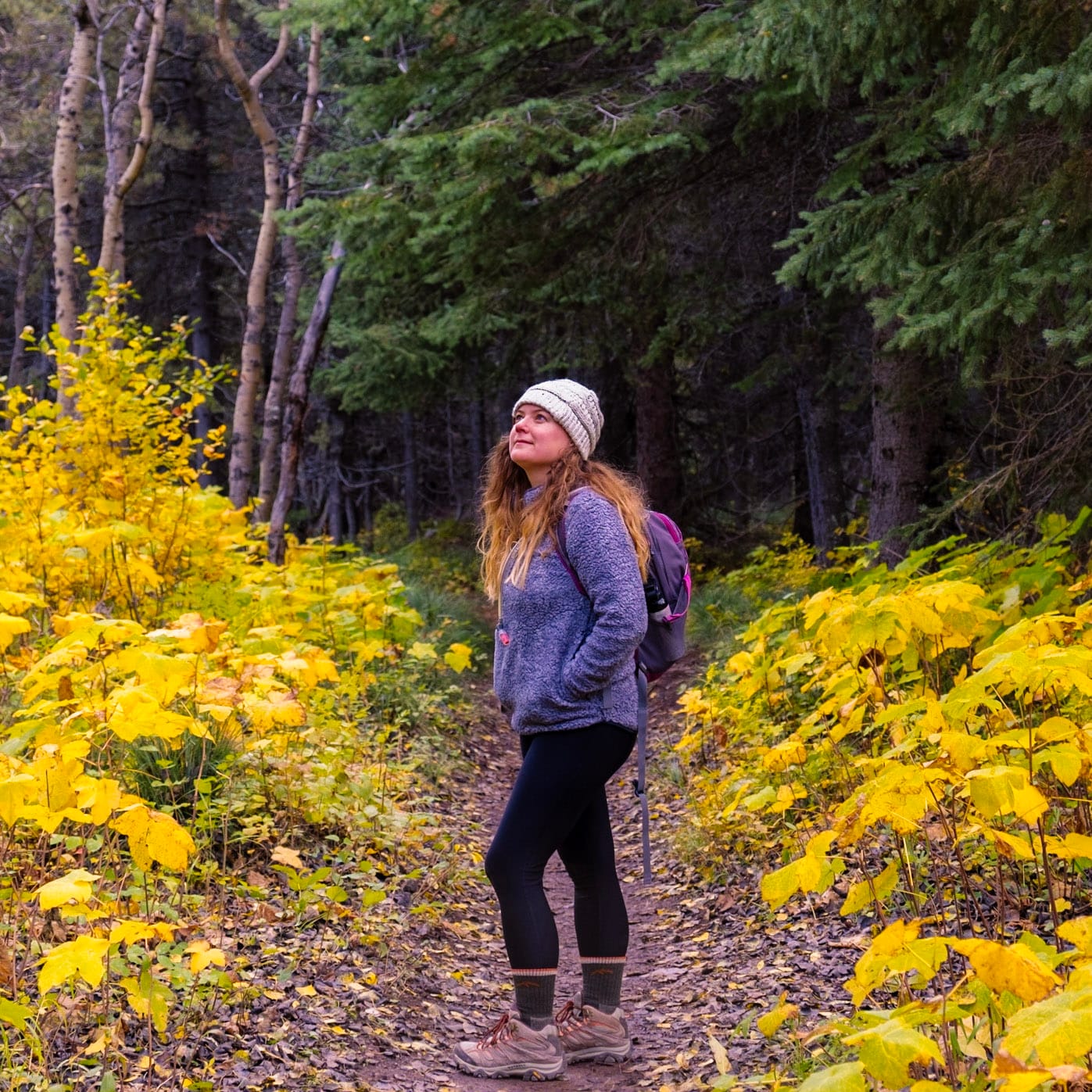
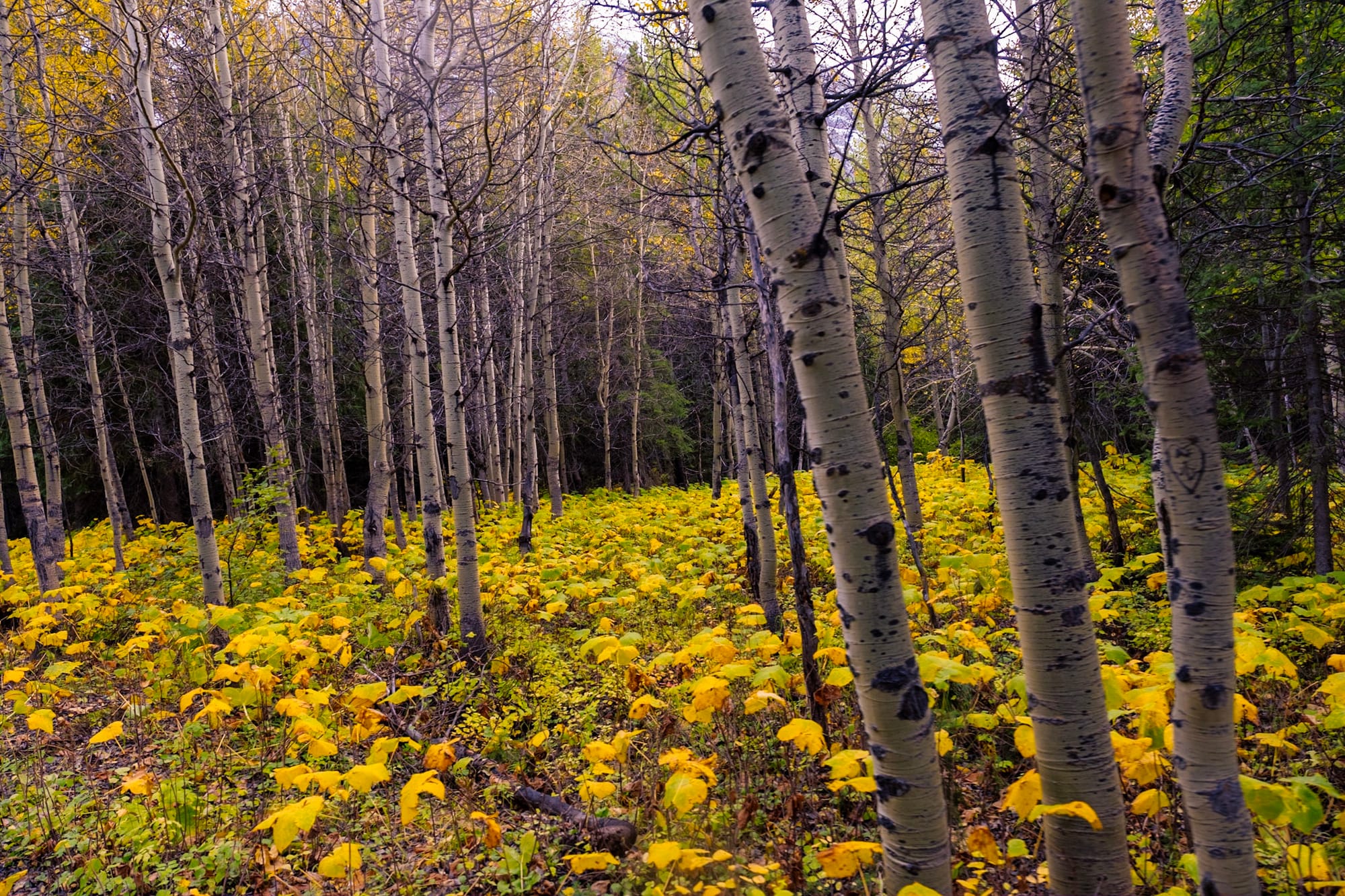
This hike starts in Many Glacier and is part of the longer Swiftcurrent Pass trail. We hiked it to Redrock Falls, roughly 3.5 miles roundtrip. It was a warm, sunny day. The trail is easy but the views, like everywhere in Glacier, are beautiful in every direction. It winds through the woods (which were full of bright yellow aspens) and passes Fishercap Lake and Redrock Lake. We saw a moose in one of the lakes on the way back, but it was pretty far away.
Our destination, Redrock Falls, cascades over layers of red rocks (obviously) which we climbed up to get a better view of the Many Glacier mountains surrounding us.
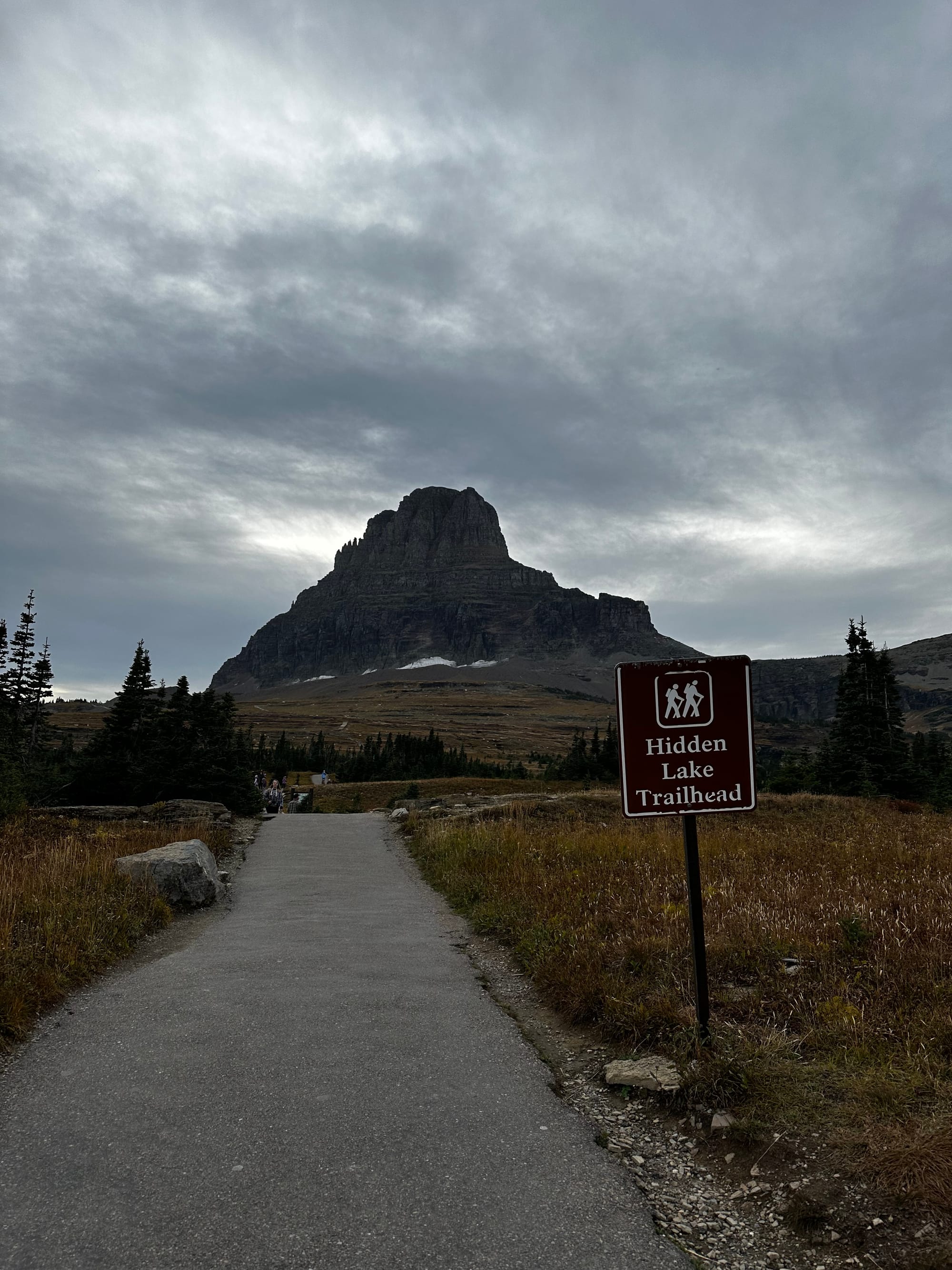
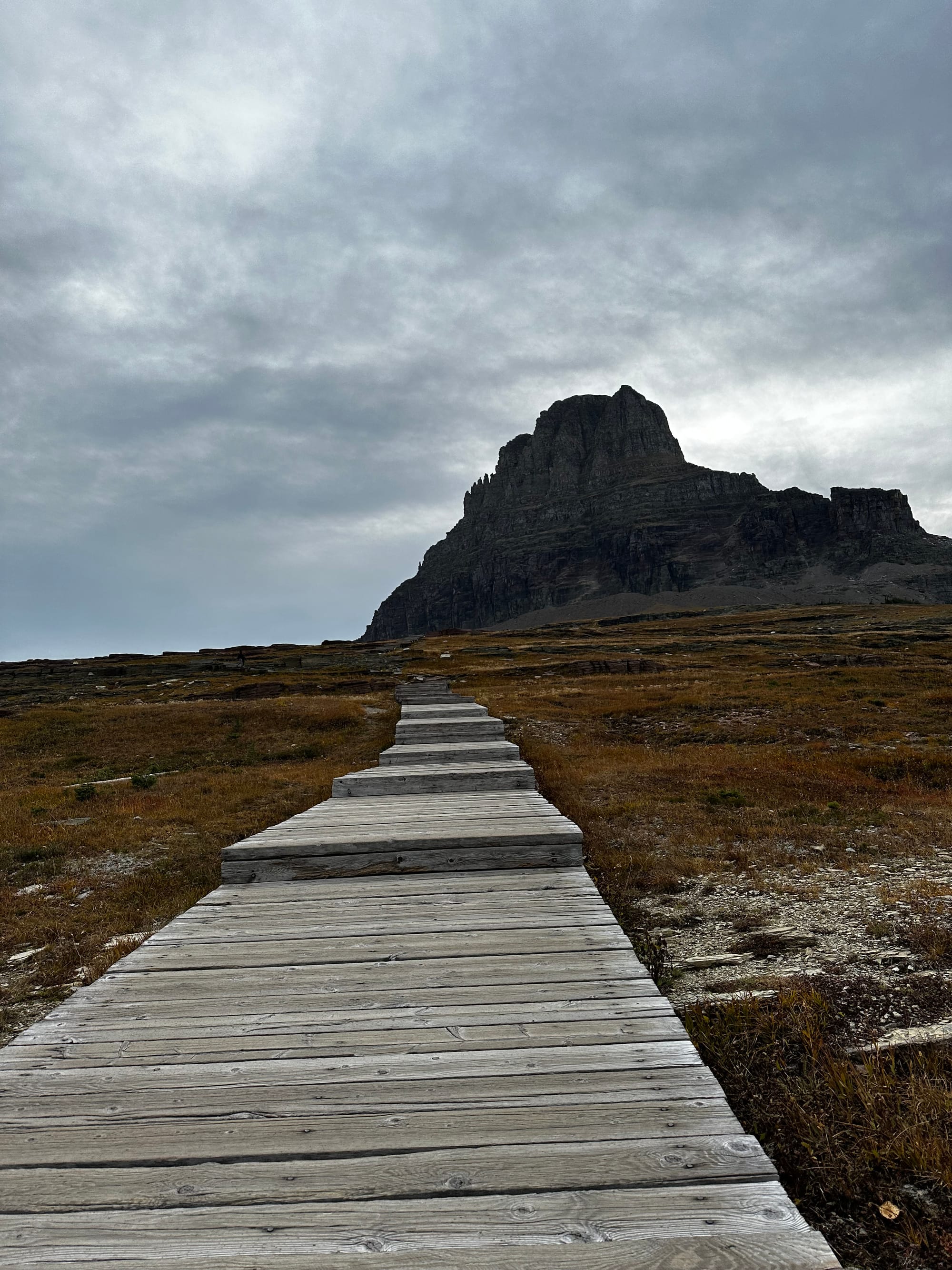
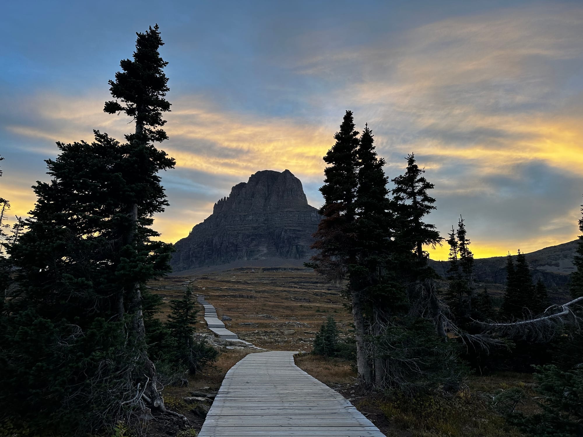
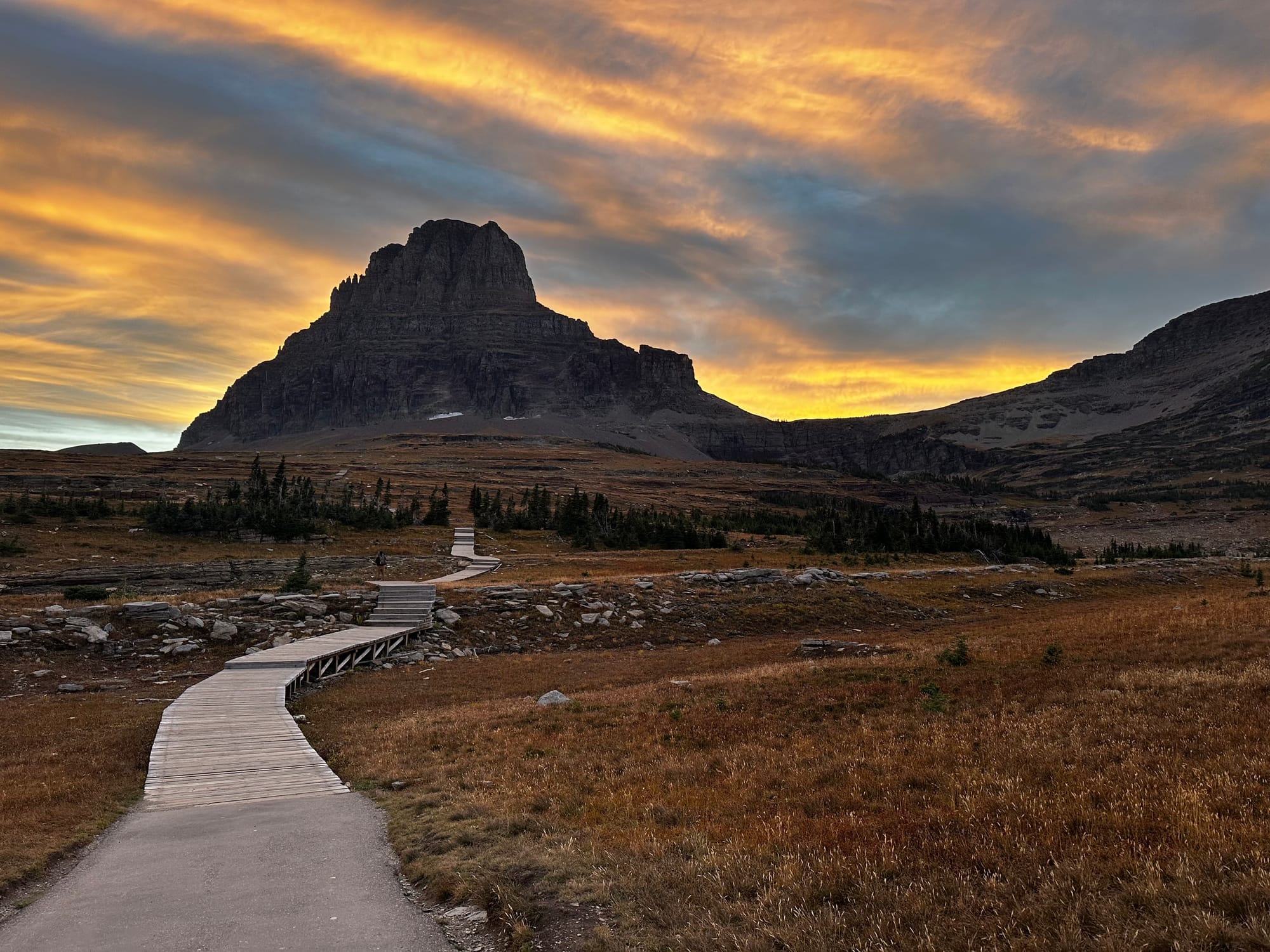
Hidden Lake Trail
I hiked this one by myself after work one evening, and although it started out gray and cloudy, the timing ended up being absolutely perfect with the sunset.
The trail starts at Logan's Pass and is 2.6 miles roundtrip to the Hidden Lake Overlook (which I did) or 5.2 miles roundtrip if you go all the way down to the lake. Most of the hike to the overlook is on boardwalk that climbs up a hill behind the visitor's center, with Clements Mountain looming at the top. It's wide open and exposed, and it was cold!
After close to a mile you reach the top, then it's a short walk next to the mountain to the overlook. It was an AMAZING view from here. Looking down, you see Hidden Lake with Bearhat Mountain behind it. The sun was setting and a couple of bighorn sheep were hanging out on the ridge below. The wind was cold, but I hung out for a while taking it all in.
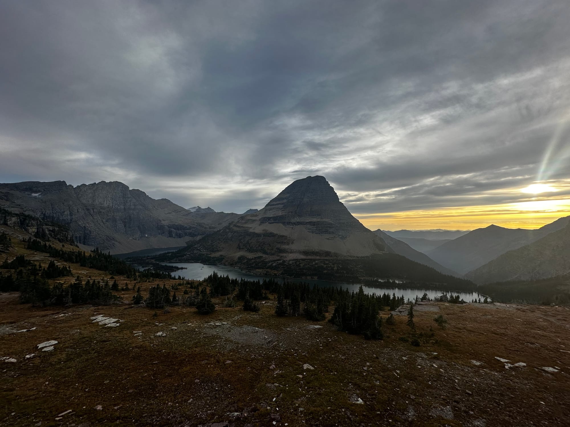
The views were even better on the way back, looking down on the mountains glowing pink from the sunset and the bright golden hour sky. It was very quiet and peaceful. I was stopping every few feet to take photos and just stand in awe.
This is a really popular hike, and since it's shorter, it's a great one to do first thing in the morning or in the evening when the lighting is better (and it's less busy).
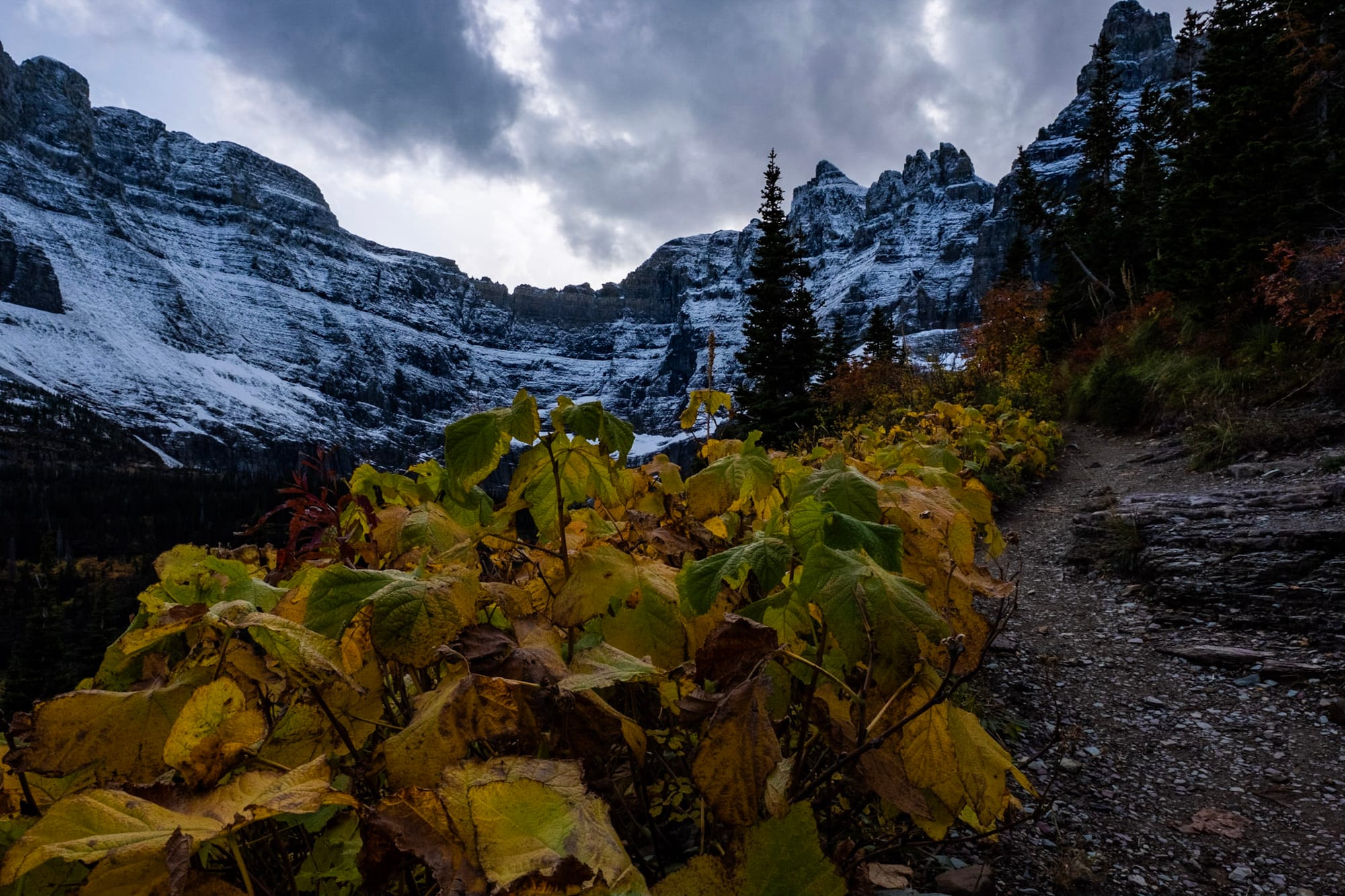
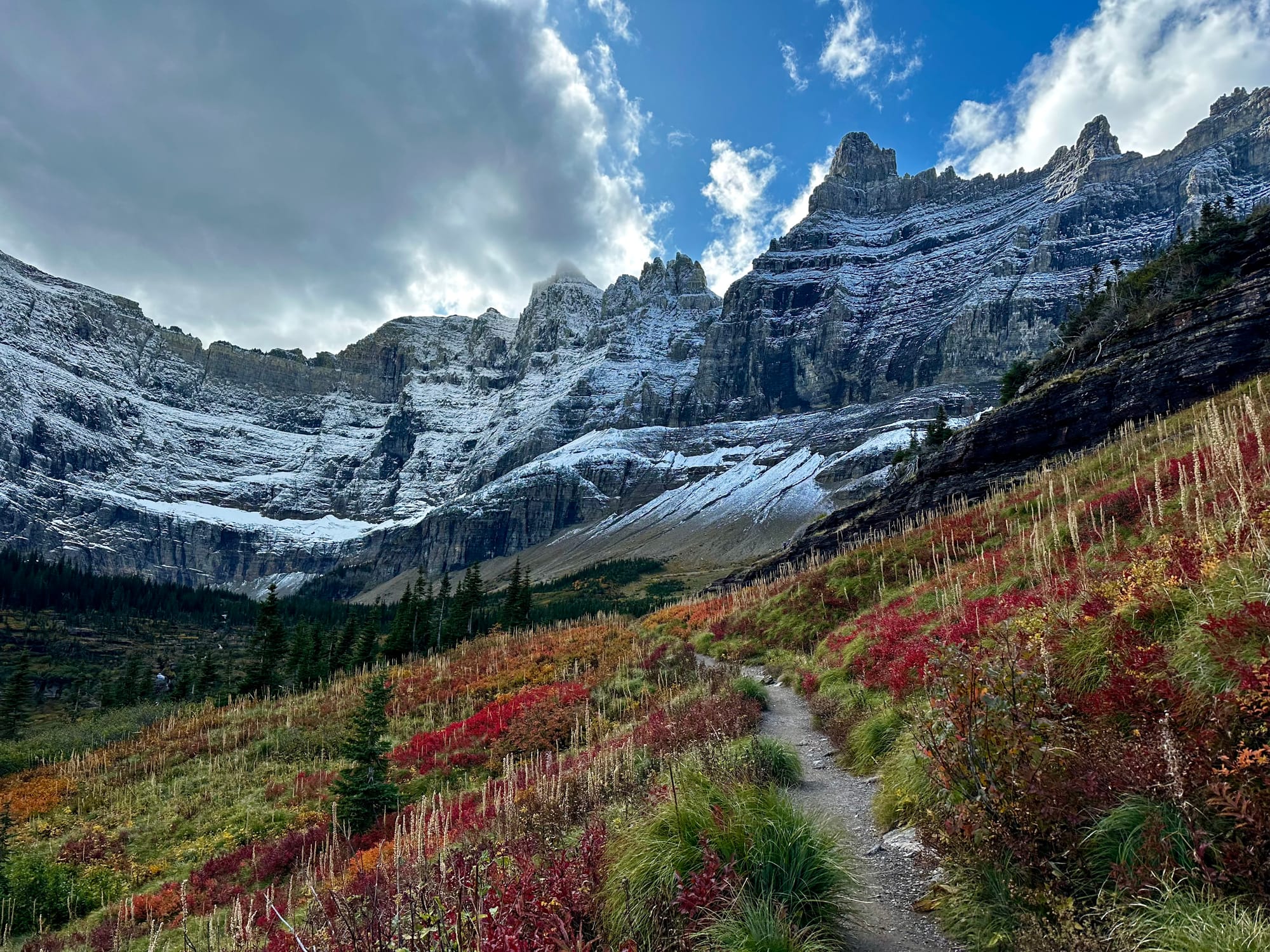
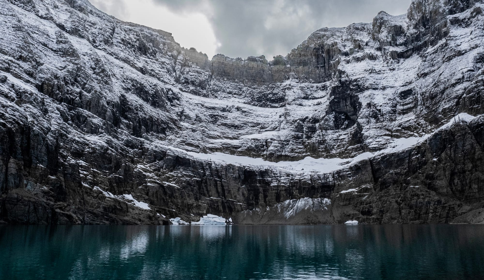
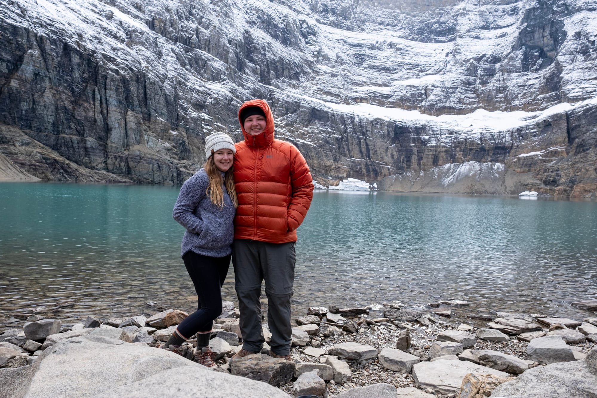
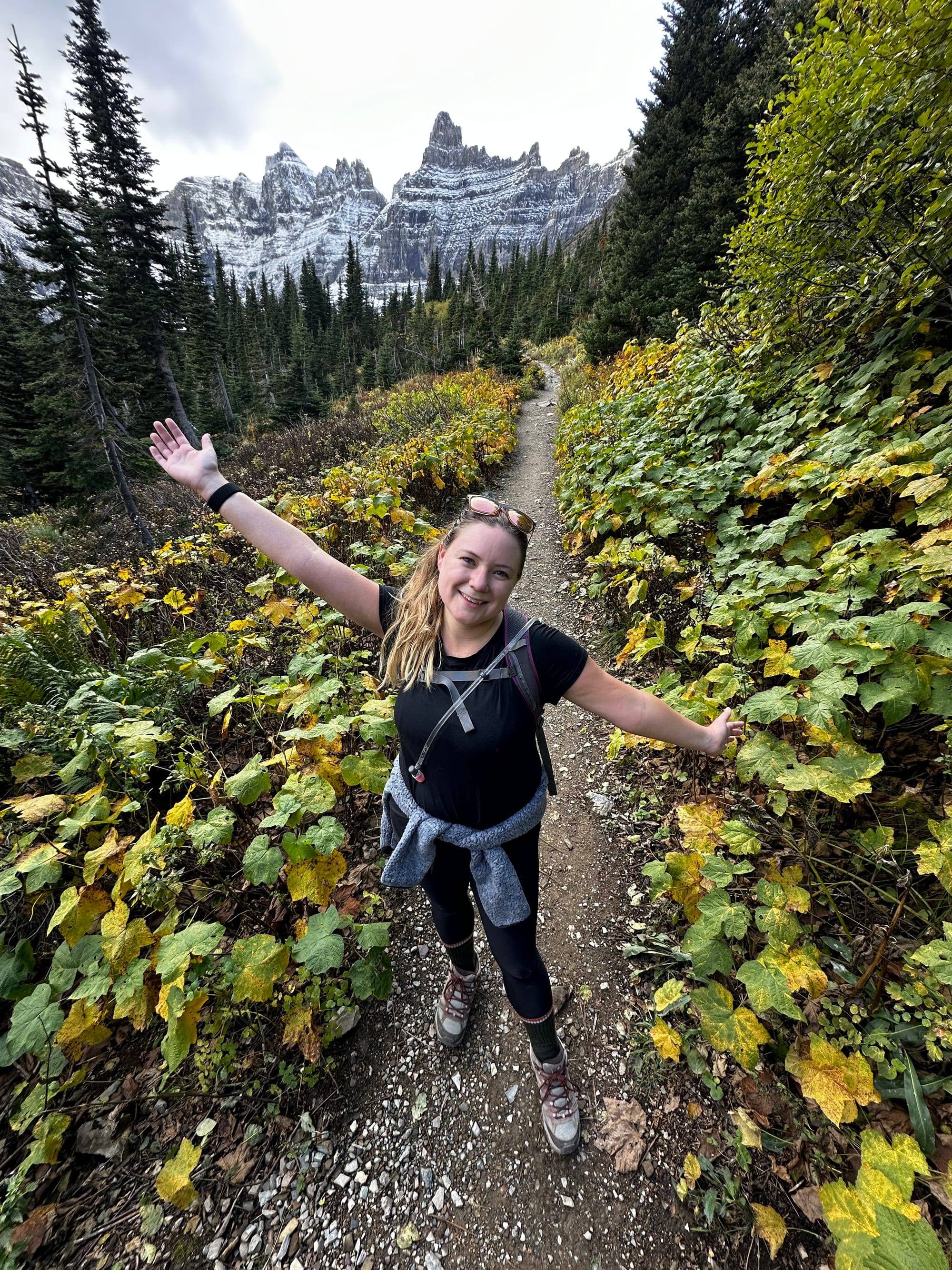
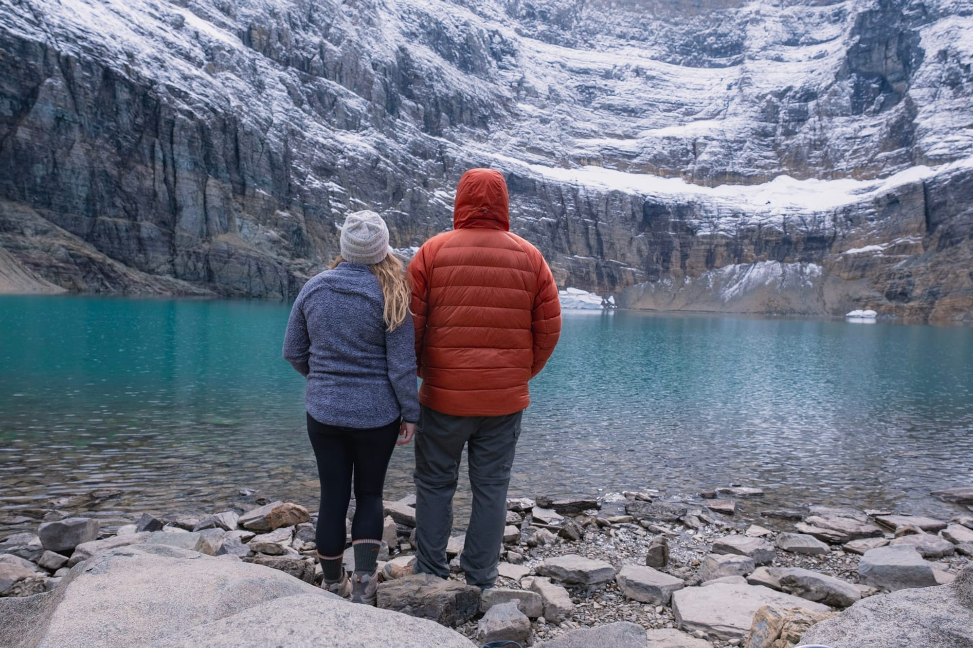
Iceberg Lake
Finally, the highlight of our time in Glacier – Iceberg Lake! We hiked it on our second to last full day in the park, taking advantage of a warm Friday afternoon when the weather finally cleared up after days of cold, windy, drizzly weather.
The Iceberg Lake Trail starts in Many Glacier. It's 10 miles long roundtrip, but besides the length it's not too hard – it starts off steep for the first half mile or so, but then it's a gentler, mostly gradual uphill the rest of the way.
The views on this trail are spectacular the entire time. For the first part, you're in the open, hiking along the side of the mountains, looking out over the valley and the other peaks all around. Toward the middle, the trail enters a darker forest and crosses a stream that tumbles over a cliff, a tall waterfall in the woods.
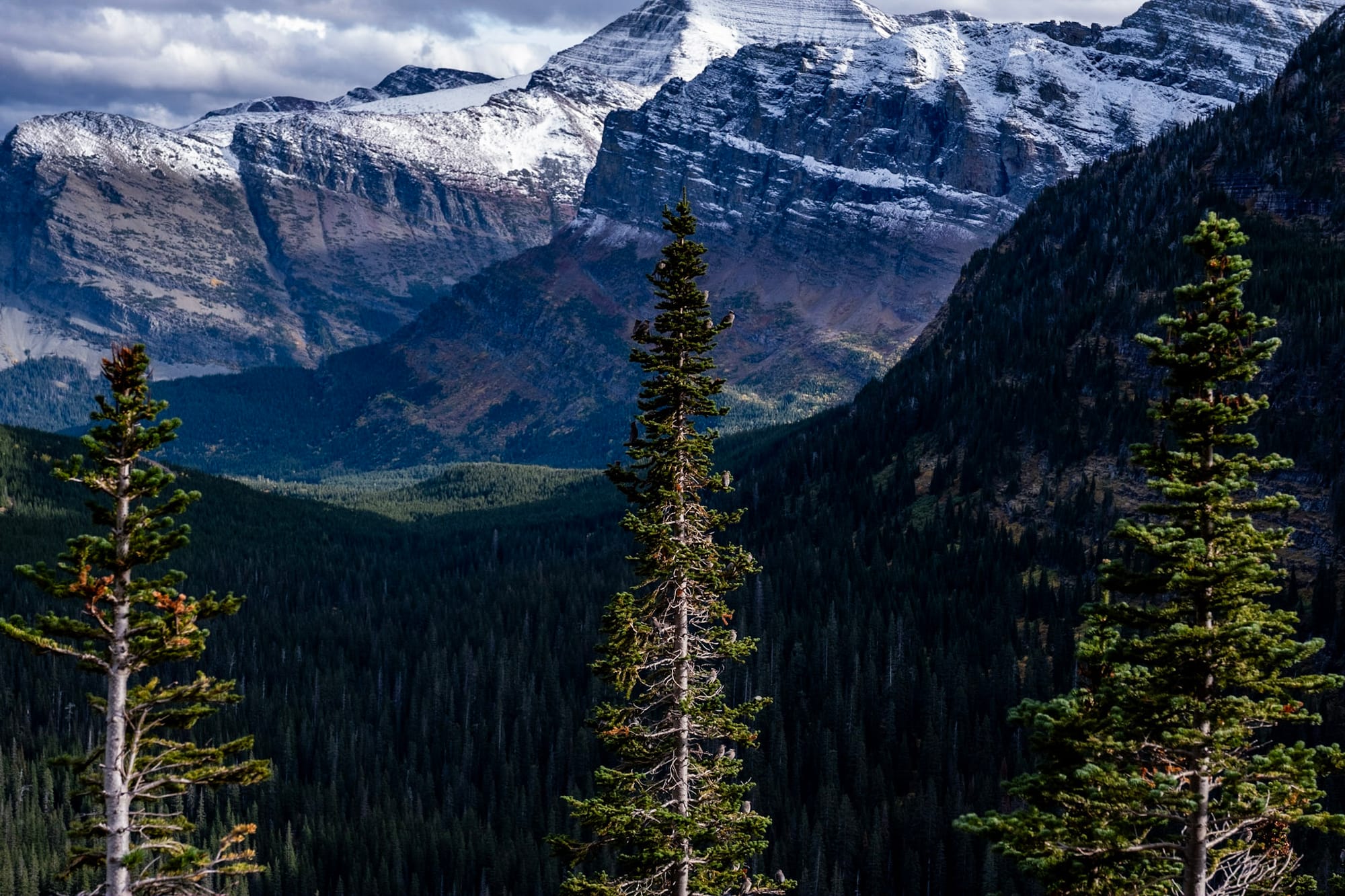
Then the trail emerges into the open again, with more incredible views. You're high above the valley below. The dark pine trees, light green grasses, and bright red and orange plants were a beautiful contrast with the dark gray, snow-covered mountain wall we were heading towards. It was getting closer and closer – our destination, Iceberg Lake, was just below the wall.
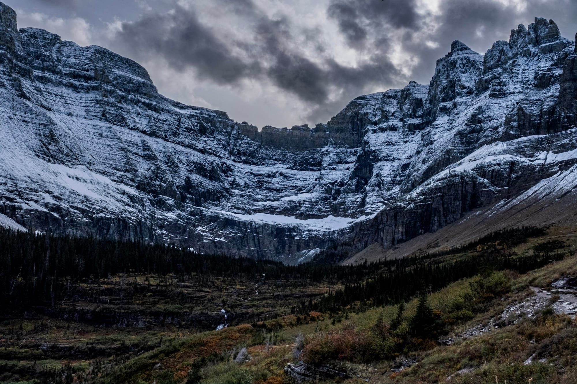
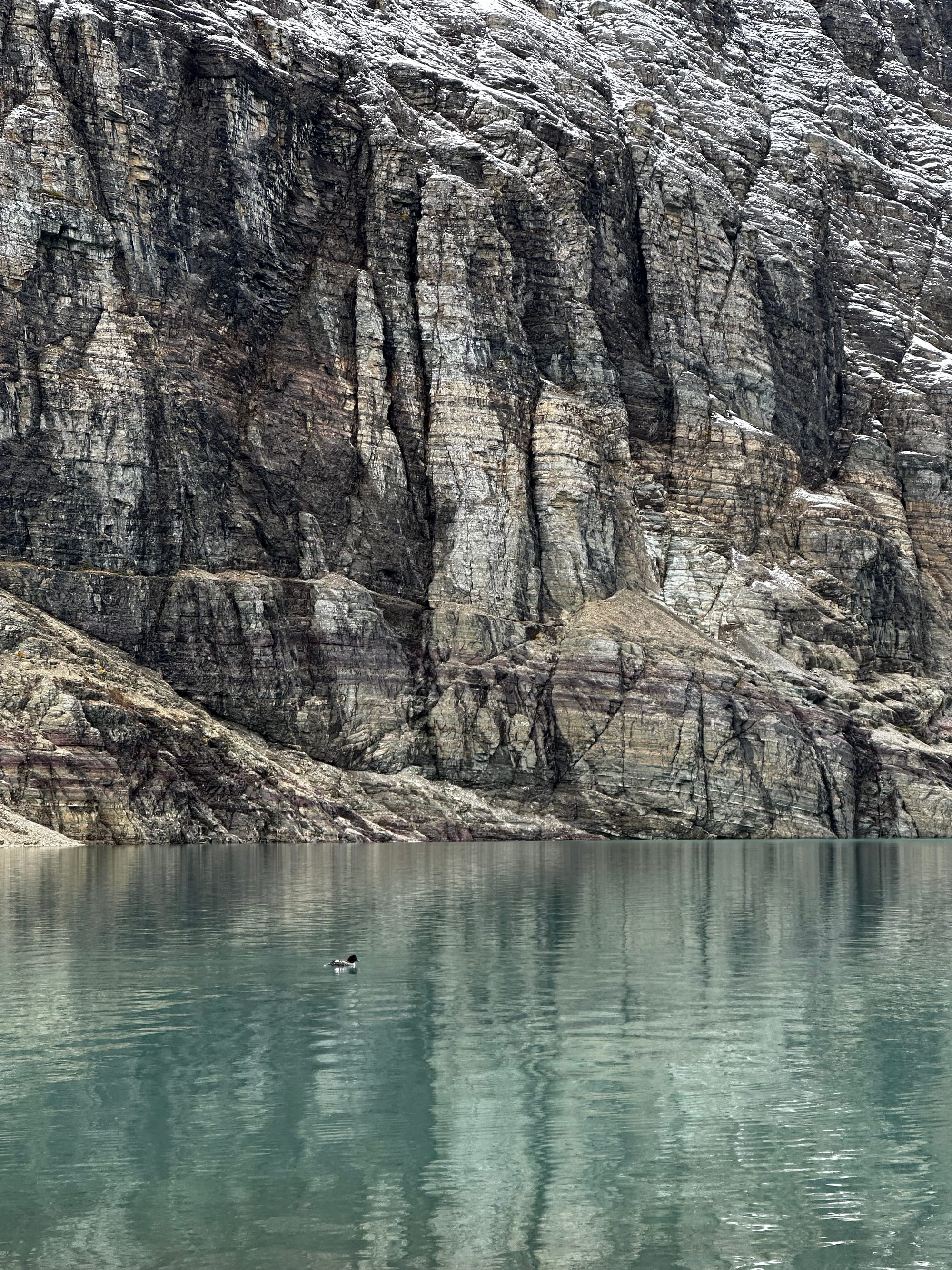
Finally, we arrived at the lake. The views along the way had already made the hike totally worth it, but Iceberg Lake is a perfect destination. It's icy blue, surrounded by the curving snowy mountain wall. There were only a few other hikers at the lake with us, so it was peaceful and quiet (and cold).
After resting at the lake a while, we started hiking back, soaking in the views from the other direction. It was starting to get late, and we didn't pass anyone else on the trail. The quiet was nice, but also a little nerve-wracking – we kept expecting to see a grizzly bear every time we turned a corner. Joey kept the bear spray in his hand the whole way back. Luckily, we didn't need it.
Words and photos can't describe just how stunning this trail was. I can't wait to hike it again someday.
As we drove out of Many Glacier, we stopped to watch the sunset over the lake. Then we left to reward ourselves with pizza.
Life in Glacier
We already can't wait to go back to Glacier National Park. I know it's crazy busy during the summer, and probably a big reason we loved it so much was witnessing the crowds thinning, the snow falling, and everything starting to shut down for the season. But it was just a really cool experience, especially on the east side with its remoteness, limited infrastructure, and stunning scenery.
A few other unique things about life in Glacier:
- Groceries and gas were SUPER expensive on the east side – like $5/gallon at the station just outside the park entrance. And the tiny grocery/convenience store in St Mary was crazy expensive as well (not to mention running out of food since they were about to close for the season). We drove 30 minutes to Browning for cheaper gas and groceries, but it was still pricy.
- Speaking of Browning, MT... it's the headquarters and main town of the Blackfeet Indian Reservation. Joey went grocery shopping there one day, and witnessed two interesting things: 1) the countless stray dogs running around town (and waiting around outside the grocery store for food) and 2) being cut off in traffic by someone driving a truck to herd horses across the road. Very wild west!
- There are only a few restaurant options in St Mary, and the only one open by the time we left was Kip's. It's a small bar that looks like someone's cabin basement – wood interior, old pool table, northern dive bar feel. We loved it. They actually had great pizza and good drink deals. It always had a mix of locals and hikers hanging out.
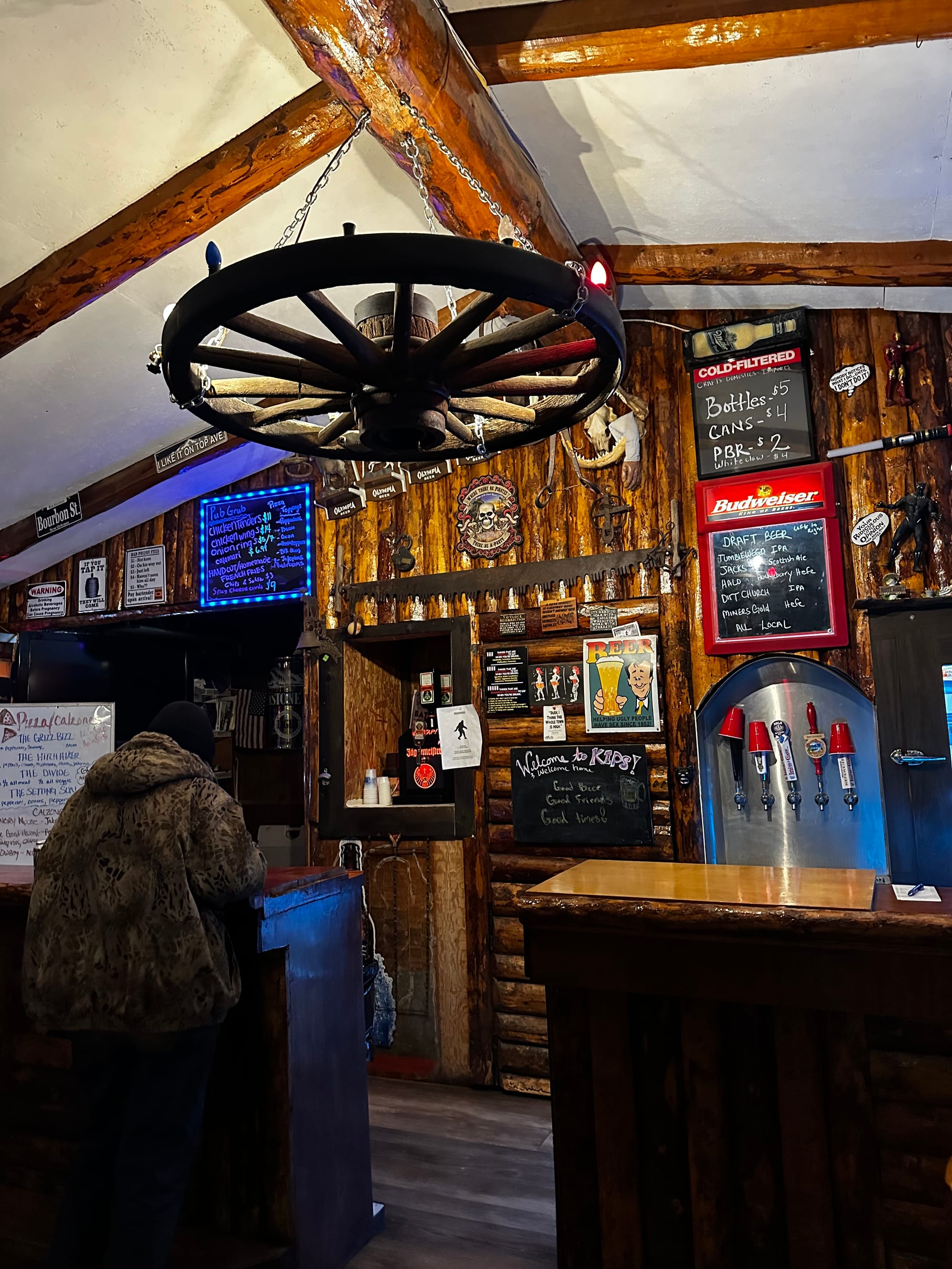
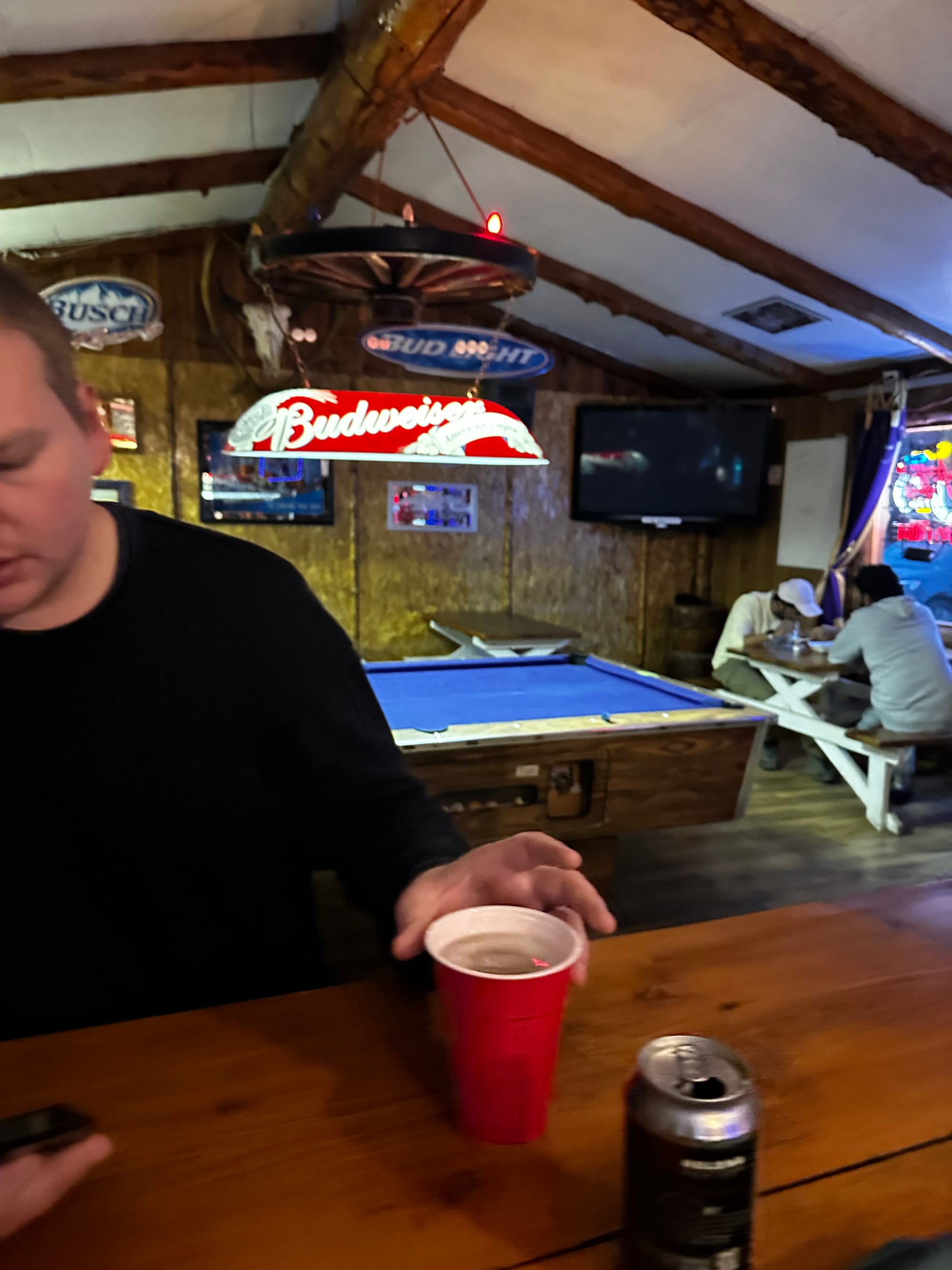
Kip's Bar
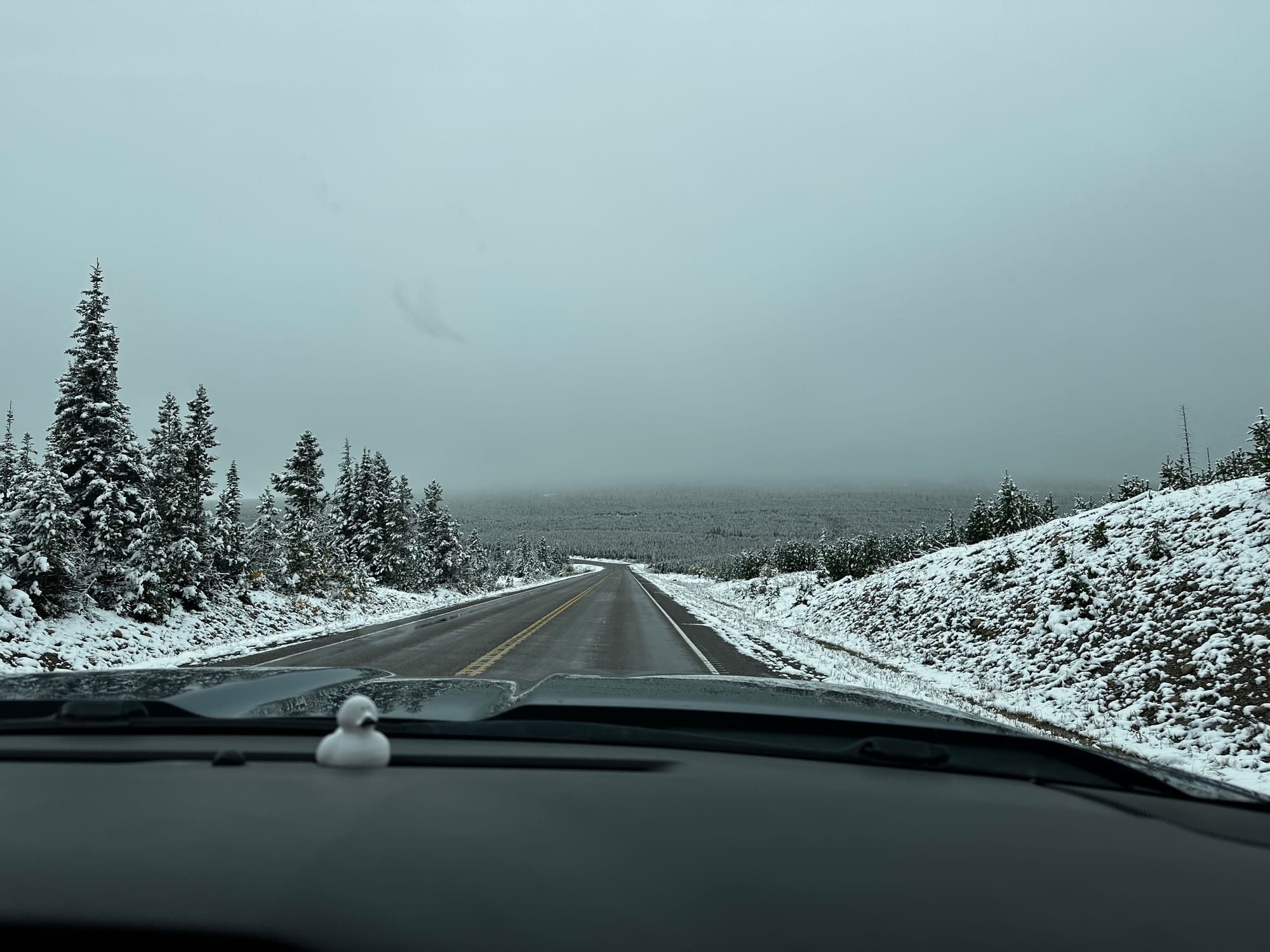
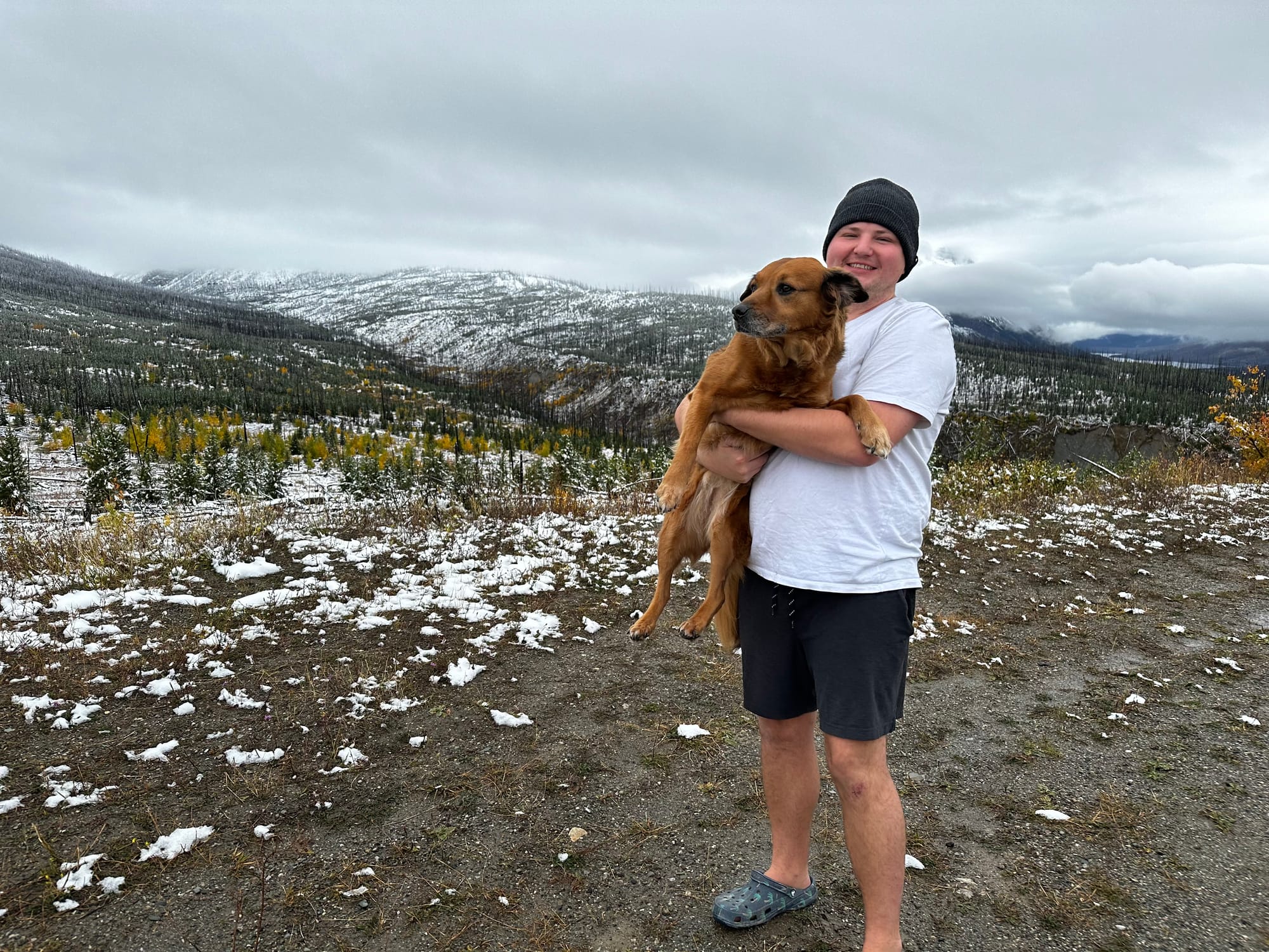
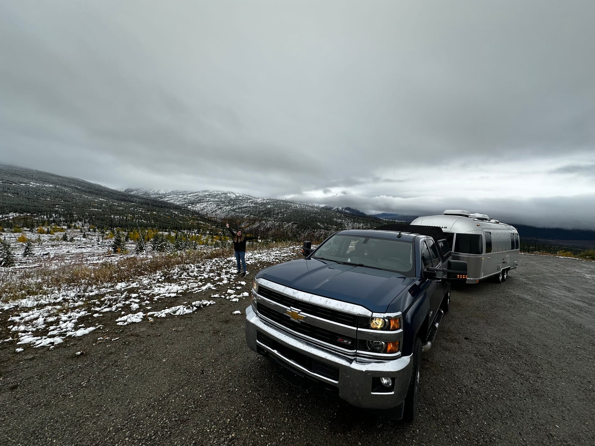
On October 1, our campground closed. We refilled our propane, packed up, and left Glacier to start the long drive home to North Carolina. As we drove up into the hills around the park, we entered a winter wonderland. We pulled off on the side of the road to admire the snow and take in the mountain view one last time.
That's pretty much a wrap on round 1 of our RV travels! After Glacier, we drove almost 2,000 miles in one week, crossing the country and stopping in random places (and revisiting a couple) in Montana, Devils Tower, Badlands, Iowa, and Missouri along the way. Then we camped at a state park outside Nashville for a few days before finishing the drive to NC. I might do another short post soon about this long road trip home.
We've been in North Carolina since late October, enjoying the holidays with family and friends, and are getting ready to hit the road again in a couple weeks!
Thanks for following along as always. 2023 was a huge adventure that we'll never forget, and we can't wait to see what this year brings.
Member discussion